The first weekend of October drops us our next long weekend, thanks to extra days of leave purchased from work, falling neatly between my late Summer and end of season breaks, which had been intended to be a few days to relax and stroll a bit, but turned into a four day spell of activity when I found a steam rail tour for the Thursday, the last of the West Coast Railways season, which travelled up the Settle & Carlisle line and neatly dovetailed with the occasion of my Mum's 81st birthday, which allowed me to fulfil a promise that I made the previous year to take her out for a steam train ride for her 80th, so I've got her company for the period, with us taking each other out to celebrate our birthdays. Riding out from Wakefield Westgate, it's not needing a early start despite the descent of Autumn, though our travel window does tighten somewhat thanks to the service running out of York some 45 minutes late, at 10.25am bringing us our rake of vintage BR Mark 1 coaches and topped 'n' tailed diesels that will take us to Leeds for a reversal and then a merry pound up the Aire Valley to gain our steam traction from Hellifield to take us non-stop over the watershed and up the Long Drag of Northern England's premier scenic line, which we haven't seen in far too long, up the Ribble Valley and among the Three Peaks, to Dentdale, over Ais Gill summit and on down the Eden Valley. Somehow, all the time lost early is regained as we reach Carlisle, at 2.15pm, where we can find that it's been the line-appropriate LMS Jubilee 45627 Sierra Leone hauling us (actually 45699 Galatea in disguise, and oddly wearing the number of 45662 Alberta on its cab sides), and there's locomotive manoeuvres to be watched at both ends of the break, which is otherwise only long enough for a stroll from the Citadel to Tullie House museum and back, where we can have brews and cake, and purchase that Hadrian's Wall Path t-shirt that I've been promising myself since failing to find one in 2014. Departing at 4.30pm, with the daylight still strong and the changeable and rather poor weather not really spoiling the trip we re-ride the path homewards, breaking for water and photographs at Appleby before lamenting the lack of audible chuffing from the locomotive and clickety-clacking of the rails as we ascend to Ais Gill again, gradually losing the landscape in the gloom as we come down the Ribble valley and finally finding ourselves in darkness as engines are swapped again at Hellifield, a long break that coincides usefully with teatime, before we run back to homewards in a surprisingly familiar 1980s train fashion, with the jaunt concluding at 9.15pm, a round trip of nearly 11 hours that we both enjoyed immensely, thankfully.
Sunday, 8 October 2023
Morley to Bretton Park 07/10/23
Sunday, 9 October 2022
Cross Gates to Ossett 08/10/22
Return from Down Country with my brain and legs ready to get back into the walking routine, having spent the midweek celebrating My Mum's 80th birthday by organizing an afternoon tea for her church fellowship on the day itself, no small task as it required two days of labour and another of rest before we headed back Up Country with Mum being particularly pleased with how it all unfolded for her, and with that done we can get back into the walking year, still having to work around train strikes which limits my options again, and as we've done the best park walks in Wakefield district, staying much closer to home seem the best option. So we're walking in Leeds again as my ancient Explorer 289 comes out for probably its last hurrah, bussing ourselves out on the #40 to the east of the city to alight at 9.05am on the A6120 opposite the Cross Gates shopping centre and the railway station where we can start our tilt to the southwest, under unseasonably bright skies, with a pronounced autumnal chill in the air as our path takes us away down Green Lane and Cross Green Lane through the suburban quarter of semis to meet the Victorian townlets that grew beyond the city back in the day, meeting the terraces and town houses of Gravelythorpe on the way up past the Leodis inn, and onwards Chapel Street and the transition into Halton. Beyond said chapel, and the Dial House, the prettiest in this corner, we meet the Halton High Street, all of a 1980s redevelopment style that we're thankfully not doing any more, strung along the Selby Road, which we cross to head south, down Irwin Approach behind Lidl and alongside the local recreation grounds to meet Temple Newsam Road, leading us down through the suburbia and into the spread of Temple Newsam park, with our park walk arriving at the start of the day rather than the end, shadowing the perimeter of the golf course and sticking to the shaded pavement below the canopy of autumnal leaves as we are led up to the eastward turn and the reveal of the view back across south Leeds (one of the few places where Morley can be placed in the landscape at a significant remove). Press uphill on a familiar route past the running track and on to the Sycamore Walk to pass through the shade towards the heart of the park, arriving to the north of the Jacobean house complex and meeting the track that leads us down between the stables block and the Home farm, observing just how many folk seem to be out early to make the best of this sunny Autumn morning, and find a park run going on along the track on the fringe of the east lawn, which we'll not tangle with as we press east still, down the side of Mather Wood to the revelation of the wild woods on the rise beyond, where we have a single focused target, to be found beyond the fall of the beck that feeds the Menagerie Ponds.
Monday, 3 October 2022
South Elmsall to Nostell Priory 01/10/22
My September Nine Day Weekend finally arrives, too late for Summer Jollies and not featuring any Autumn Jollies as midweek is going to be spent with My Mum, to celebrate her 80th birthday, and thus we're left with only the weekends to use as we push for 1,000km in 2022, with our organisation being disrupted further by having renewed strikes on the railways, postponed after the death of HMQE2 and now restored to keep us inside West Yorkshire, which isn't a huge problem as I've had a couple of bus-able plans on my slate for months now, with the idea of walking in the park maintained as we seek out another one deep in the heart of Wakefield district. Thus we ride out on the #425 and #496 to South Elmsall, alighting at the bus stand at 9.45am, after a journey that was almost twice the duration of one on rails (no thanks to Arriva for misplacing a service along the way) and the bright morning sunshine that we had for most of the journey looks like it's not going to endure as we head out, over the railway station and up High Street, with the rain coming on sharply as we hide in the bus shelter by the United Service Club for several minutes, letting it pass before we continue on up Hacking Hill to the estate at the top of the town before Field Lane leads us out above the old quarry remnants and into the landscape dominated by the Next distribution depots. It's a development that's still growing, placing a new facility on the south side of the lane with its own linking bridge overhead, to be regarded with a certain kind of awe at it sheer extent across the plots ahead of the A638, where we land by Cherry Tree farm and the H&BR Wath branch, where our easterly push, away from our apparent destination continues, across the Doncaster Road and onto the dirt track of Coal Pit Lane as the early gloom starts to lift, dropping a rainbow above the Upton Becaon / Walton Wood / Barnsdale ridge as we press on toward the earthworks around the lost Waterfield farm. We can place ourselves on the very edge of Doncaster borough, west of the A1 and Skelbrooke village before we turn north, onto the Wakefield Way route as it strikes along the muddy field boundary down to the sewage farm , where the path up to the cottage by the remains of the H&BR South Yorkshire Junction branch is overgrown and damp, reminding me of just how little interaction I've had with horrible paths across this year, a theme which reoccurs once we've met the driveway and taken the most direct path north, a field walk and green passage that's enough to make me want keep to pavements from now on, which we can do once we've landed on Sleep Hill Lane and drawn ourselves out to and across the A6201 Wrangbrook Lane.
Sunday, 4 September 2022
Bentley to Wombwell 03/09/22
It's worth a brief reflection to note that August Bank Holiday weekend has never been that rewarding in terms of my walking career, having only brought multiple days of exercise in three of my past seasons, probably becasue I've been keeping the powder dry for my week of Late Summer Jollies at the start of September, which we won't be enjoying this year because of how I've arranged my leave with regards other things going on, and thus we approach the End of Summer with only a long weekend booked in its place, where we might have hoped to have travelled away before my plans rearranged themselves. Instead we are still pulling walks off the normal slate, and finding that today we will be doing something very rare indeed, which is travelling between two places which have arrived on my radar within a calendar year, which will also not pass through any part of the walking bubble that had been previously established across the last decade, which has not been done (outside of holiday trips) since 2015, which has me realizing just how tethered we have gotten to the Field of Walking Experience that we had inflated over my first four years on the trails. So everything we see today will be exclusive to the season of 2022, as we resume our east-west passages across South Yorkshire, alighting at Bentley at 9am, deep within greater Doncaster and setting a course southwesterly down Watch House Lane between the terraces and the spread of suburbia that hasn't claimed the extensive allotment gardens, ahead of the rise over the old H&BR - GCR joint line, the contemporary Trans Pennine Trail, and thence down among the semis to the passage over the A638 York Road, immediately getting us back to crossing this year's trail as we land outside the York Bar WMC, just downwind on the old Roman Road path. Cusworth Lane leads us on, among the suburban spread, where Dillicarr House is the only residence of a particular vintage, with the Mallard inn (hopefully named for one of the city's most notable products) sitting opposite, beyond which we detour slightly into Cusworth village, where most of the local rural flavour can be found, around the British Orthodox church and the way into the public park in the grounds of Cusworth Hall, just another noble pile to add to the number in this quarter, where we are led through the woods and up to the end of the driveway by the gatehouse, trying to not get tangled up with the participants in the local park run before we alight on the roads once again, at Back Lane.
Sunday, 21 August 2022
Hemsworth to Bretton Park 20/08/22
The last two rounds of train strikes thankfully didn't effect our walking plans as Northern Trains weren't involved on either of them, leaving us to come and go as we had intended but for this day we have a general stoppage which means we are going to have to delay our planned late season residency in South Yorkshire and instead pull something off the end of season list instead, feeling fortunate that we do have full bus services available across Wakefield district thanks to the end of the beef at Arriva, ensuring that we can take a couple of rides south on the #427 and #496 to give us than chance to go for a Summer afternoon walk in the park in the late stretch of the day's passage. It's to Hemsworth we ride, to alight at the bus stand that could be easily mistaken for part of the Tesco superstore at 9.10am, just a few steps away from the library and the tangle of the roads in the middle of town at Cross Hill, where we pick the fifth and final of them for our westbound path, joining the Barnsley Road as it pushes out via the urban borough of West End, with its pair of Working Men's clubs giving the sort you'd anticipate as we pass the midway point on the old turnpike between Pontefract and Barnsley, and depart the suburban ribbon of the town as we elevate out past the Vissitt Cottage bar and hotel. The fields around Vissitt Manor give us the looks east towrds the fall toward the Don, but we are upper Dearne bound from here on in as we join Robin Lane, passing the suburban ribbon as we have the Enley Moor masts landing on our horizon, following west to meet the Holgate Almshouses, which are a fine bit of late Gothickery that you really can't get a good angle on from the road, which gives better sight toward distant Barnsley as we progress, shadowing the fall of Frickley Beck and the H&BR mainline beyond Brierly tunnel as we are drawn into the village enclave above Hiendley Common, distinct with its estate house and terraces from its near neighbour to the north, but apparently unnamed.
Sunday, 7 August 2022
Knottingley to Bentley 06/08/22
After returning to work for a week of cross-site activity between the hospitals, and suffering a horrible bout with an upset stomach along the way, we return to the trail come the weekend, hopeful that we have better luck with the trains and weather than we had last weekend, and that a rapid turn on the ground might be had after a month of dawdling, and despite there being half the number of services passing through Morley today, the extended trip to the northeastern corner of the 2022 walking field can let us have a half-hour turn-around at Castleford to see how the station's redevelopment works are progressing. Thence we can alight at Knottingley after 9.30am, as we set a course to the south and east, rising to the Station Hotel and the A645 to remind ourselves that there's a lot more to this town than is recalled, with most of it lying to the east of the station, as we work a way with Headlands Road and Spawd Bone Lane around two sides of the railway triangle with the former motive power depot in its middle, also passing below the chimneys of the Ardagh glass works and noting the adjacent Reiki practitioner and Guns & Pawn store as being the strangest of neighbours before making our fifth railway transit via the England Lane level crossing. This returns us to the Weeland Road by the Stoelze Flacconage glass works and the CT Transport depot before we start our southbound turn by joining the Womersley Road, taking us over the Askern branch again by the Winston inn, for our sixth passage of the local railway lines before heading on out past the town cemetery with its obvious pair of mortuary chapels, and through the suburban enclave that grew on the quarried pits that must have brought the glass industry to the area, where one aggregate supplier still operates, ahead of the turn by Park Balk farm, where we shift into the countryside. We are initially shadowing the southerly track of the railway, and then the eastwards push of the M62 as we pace among the fields and find ourselves on the low bluff of King's Standard Hill, revealing the vast flatlands between the lower Aire and Don in the east, tracing the any pylons across the fields towards Drax Power Station, while noting that the last remains of Eggborough have now vanished completely, demolished two weeks ago, with the massive spoil tip, or landfill, on Gale Common rising unnaturally ahead as we come around to pass over the motorway.
Monday, 25 July 2022
South Elmsall to Conisbrough 23/07/22
As Saturday rolls up, the heatwave conditions already seem like a distant memory as the 39C peak experienced in Leeds on Tuesday (on Britain's hottest day on record), has since seen a welcome regression to the mean as temperatures dropped by 20C to get us back into a much more manageable walking climate, so we can thankfully progress without having a repeat of the Summer of 2018, and instead experience something like the same week of last year, where mid-July spiked hot before slumping into a really rather mediocre second half, as low cloud and chilly rain washed all the way across the Summer holidays. We have a nicely large time window for the plans for today, with a good cluster of points of interest at the end of the trip, really not all that far away in the Don Valley as we alight at South Elmsall a little after 8.50am, finding the day a little brighter than projected as we rise to High Street and drop down to the junction by the bus stand and the end of the main shopping street, hanging a left onto the B6422 and following the Doncaster Road as it leads off to the southeast, passing St Mary's church and out through the surprisingly narrow suburban band at Common End, soon landing in the shadow of Frickley Colliery park as we enter the countryside, not that we get much sight of its spoil tip's heights as it hides behind a bank of trees. Passing over Frickley Beck takes us out of West Yorkshire after less than a mile, entering Doncaster borough and losing the footway as Elmsall Lane moves on to pass through the embankment of the H&BR Wath branch, where we cross the Wakefield Way route and note the house of Moorhouse & South station, before the road starts its rise across Moorhouse Common, where more cyclists seem to be out than drivers as it presses uphill, revealing the local reverse horizon, with the Next depot and quarry marking its eastern edge as we push up past the woodlands of the Ashes and take a turn with the lane across the hill crest to show up the western horizon.This would guide the eye towards the distant Dearne Valley views, if it wasn't for the haze, and instead we have to look down towards the landscape of Frickley Park, which occasionally reveals itself beyond the thick hedges and wheat fields, mostly being obscured by Hooton Pagnell wood before the Hall is revealed briefly, as we land in Hooton Pagnell village, perched on the edge of this minor upland and bringing the picturesqueness along with the views, still maintaining its vintage rural flavour and some of those hints of a Cotswolds style as the cottages and farmsteads hang on around the market cross and All Saints church on its bluff, which are passed as we come below Hooton Hall, with its imposing gatehouse and high walls.
Sunday, 17 July 2022
Moorthorpe to Mexborough 16/07/22
For the third time this year, we're due another burst of heatwave conditions, and once again, they're not due to coincide with the weekend, which is just as well as we could be looking at a temperature spike in the vicinity of 38C at the start of next week, which is far beyond anything I can recall having experienced in this country (or indeed ever, as 35C in Heidelburg, Germany in 1990 is still the startling peak that I remember), and as 30+C over the summer of 2018 proved to be challenging for the seasonal walking experience, contentment can be found that we might still be able to dress normally and not be too anxious when Saturday projects a mere 25C maximum. So no early start is needed as we travel south again, getting ever closer to the established borders of our walking field for our jump off, alighting at Moorthorpe at 9.25am and admiring the under-employed station buildings and negotiating the footbridges to get to the B6422 Barnsley Road, where we strike east towards South Elmsall, passing the cemetery, St Joseph's church and the Kung Fu school, before we strike south between the terraces of Wesley Street, and then elevate ourselves up the side of the playing fields beyond Langthwaite Lane, to meet Westfield Lane by the bowling greens and the Frickley Colliery Welfare cricket club. Tracking south through this elevated urban extension of the three towns mash up, we pass the Junction Inn and follow the lane to its end, where new urban growth has filled up all the vacnat plots north of the Frickley Colliery Country park, where we enter via its original road entrance, tracing the rough track through where the pit head once stood, now utterly obscured by long grass, and our wandering detour to elongate the route starts as we join the long straight and hard path that reaches uphill to the northeast, describing the coal seams as they pass below us, if I'm interpreting them correctly. It's a good space for the locals to exercise as we are led up to the summit of the park, at the top of the old spoil tip, now identifiable with the seven grassy mounds atop it, which we'll pass around with the track as we look over Frickley Athletic FC's ground and over the South Elmsall and Upton villages, with water tower and mast beyond, as we ll as looking to the eastern horizon that we don't know as we come around to the south side, presenting the south-eastern horizon that's we've grown to know over the last month, before we head downhill on the rough, steep track to seek the way out south bound, beyond the wild ponds and the switching-back path.
Sunday, 19 June 2022
Featherstone to Goldthorpe 18/06/22
After three days of heatwave conditions, or more realistically three days of temperatures in excess of 20C for the first time this year, we look forward to Summer as we sit just shy of the top of the year, but predictably enough, the heat and sunshine cannot last into the weekend, and we're looking at a potentially tight weather window to pace against to fit with our tight time window that's dictated by our choice of start point and destination, which looks like it might be the theme as the High Season progresses, so we're going to have to keep the pace up today if we don't want a long wait to get home. Arrive at Featherstone at 10am, on the first train that doesn't take the long way round, to strike out route south down Station Lane, past the Railway Hotel and the mildly bustling main street, taking us down to the A645 Wakefield & Pontefract Road, which is crossed between the town council offices and the Lidl store, joining Girnhill Lane as it takes us south through the terraces into the suburban band of the town beyond the WMC and community gardens, an area that seems to have swollen with Lego houses below the lane's sudden eastbound turn, which leads to the rough track at the town's edge. This leads us to the field path that we traced back in 2014, joining it as it heads arrow-straight southwest through the wheatfields on a clear route over to the rougher and partially concealed tracks that take us down to the passages over the upper reaches of Went Beck, feeling happy that there's a dog walker to follow as we track around the edge of a plantation that's grown a lot over the last 8 years as we are led to the hamlet of West Hardwick, where the main farmstead and associated cottages are passed around as we get onto New Road as it leads southeast for a bit to put us onto the permissive path that leads towards Nostell Priory. Southwest-bound again we ahead below the plots of South Ings Fields, shadowing Hardwick Beck as it flows away from the estate, as the Pump Lane track directs us towards the eastern perimeter wall, where the National Trust site could be entered, it appears, but we're staying outside it, trying to find a path in Engine Wood that might not actually exist before picking up the Engine Lane track as it leads down to the Nostell East Vista, where a wide open space leads the eye west to the Palladian Nostell Priory house, with grazing cattle in the fields to the east, and a staring bench is provided for elevenses, as it is feel like that time of day already.
Wednesday, 20 April 2022
Outwood to Fitzwilliam 18/04/22
The three day walking burn across the long Easter weekend is a rarer beast than might have been expected, as this turns out to be only the second time that I've actually completed one, the first time since 2019, and it's a good feeling to have as we keep the legs going in an intense burst so that we might keep the mileage up while other April Saturdays are lost due to the need for necessary socialising, and thus we head into the last trip from greater Wakefield to the local railway stations that I've never finished a trip out to, dawdling our way down to Outwood on a train that feels like its getting held at every signal. Alight at 9.40am, with not too many original footfalls to be made across the first hour or so as we seek the railway paths again, starting out via Lingwell Gate Lane and Potovens Lane as they lead among the suburbia of Outwood and Lofthouse Gate to the obvious hump in the latter where it passed over the Methley Joint Line, before seeking the path behind the back gardens to pick it up in the cutting that leads up to Leeds Road, as well as the section beyond the A61 that has now got its cycleway in situ, both of which weren't traced when we came this way in 2014, extending the accessible route as it presses on east towards Castleford. We'll take a right turn at Anaheim Drive to head south-east as we join the Nagger Lines, the old narrow-gauge railway that serviced Lofthouse Colliery, which now forms another local path behind the suburban gardens of Outwood and Stanley, which seems well used by local exercisers as it pushes us down to Rooks Nest Road and the packet of enduring green fields beyond as we come down to Lime Pit Lane, where the rails are still embedded in the tarmac, and acafe has developed in Spa Fold farm, with a hard path leading us on along the edge of the green before we cross the A642 Aberford Road. It's quite a descent to get to the low section, entering the fields around the meandering river Calder, which hides from view as we pass by Smalley Bight farm, as we look back to the terraces on the road into Wakefield and the treetops of the Stanley Marsh nature reserve beyond them, pondering how many times we've already paced these paths on our travels as we come down towards Stanley Ferry, at least carrying a better understanding of the industrial landscape of the area than we did during my novice days on the trail, acknowledging the Victoria colliery site to our right before we emerge onto Ferry Lane.
Saturday, 16 April 2022
Sandal to Glasshoughton 15/04/22
Having taken a weekend out to visit My Good Friends in Calderdale, and to get in my first night out on the town since the Covid Pandemic started, in Manchester, we can return to the trail feeling socially recharged, which is just as well as the long Easter Weekend is next on the slate, right at the cusp of the year starting to be warmer, and we’ve gotten a trio of routes to cram into the four days, from starting points around greater Wakefield aimed at railway stations that have yet to act as finish lines on my travels, and that’s what we have in mind as we ride out in the Good Friday sunshine. Alight at Sandal & Agbrigg station at 9.40am, and our route starts southeast, through the car park on the western side of it, to find the cycleway that follows the former railway spur that linked the GNR-GCR main line to the North Midland main line off to the south, rising over what feel like a mile against an already sharp natural gradient, to drop us down below one of the many Oakenshaw junctions at the northern edge of Walton village, which we turn away from to follow Oakenshaw Lane north, to soon see an Azuma making shot work of the ascent on its London-bound passage south. Passing north we can look to Wakefield on the horizon, and find a pony loose in the road before we choose to make a brief detour to trace the Barnsley Canal’s section that we didn’t examine in 2015, the channel that meanders north towards Agbrigg, still in water and reedy, forming its own sort of nature reserve with a developing right of way along the tow path, followed as far as the channel remains up to the allotments before overgrowth stops progress and we are compelled to go back the way we came, listening to the sound of the diesel trains making slow progress south on the railway. Back on the lane we spy the viaduct on the canal, and befriend the horses in the fields of Oakenshaw farm as we pass around it, to pass over more railway lines, the Crofton line and the spur to the North Midland line, which seems to be theme in this district as branches and links abound, before we are angled around to meet Heath Common and the A638 Doncaster Road, both of which are passed over, the former on an isolated stretch of former road among the rough grass and gorse bushes, and below the horses grazing the pasture to the south, with the remains of Heath Old Hall on the immediate horizon.
Friday, 28 May 2021
Bronte Way #3: Wycoller to Gawthorpe Hall 27/05/21
 |
| Long Distance Trail means Selfies! #3 at Wycoller Country Park |
Two rest days are taken from the trail in the midweek period of 2021's Spring Jollies at Home, to allow time for other activities like shopping, spring cleaning and generally getting our house in order before The Way is rejoined at its most awkward extremity, but not putting Mum too far out of the way on another day out for her while performing Parental Taxi duties, dropping us off at 9.50am under much brighter conditions than we saw three days back above Wycoller's valley, at the country Park's Haworth Road car park, where we can both regard The Atom in a much more positive light than we did on Monday, as sunshine really elevates the views from the Panopticon. Looking forward to a whole day of walking into the previously unknown in Lancashire, our first in a long while, The Way needs to be returned to by the descending path down to the hamlet, giving us restored views over Pendle Hill and its borough downstream as we return to Wycoller Hall's ruins where we can poke around the remains of this late 16th century hall, dismantled in the early 19th century, meaning we have the same sort of edifice to regard as Charlotte Bronte supposedly did, as we wander among its rooms and around to the aisled barn, and that's going to be about it for the Bronte connections as The Way seems to have fallen like the Hadrian's Wall Path, having crammed most of its points of interest into its middle portion. We'll need to trip around the hamlet before we go, tracing the track to its northwestern end by Lowlands Farm, and the pricey new cottages that have been added in here, then coming back up the main street, crossing over the beck as we go and quietly marveling at how expensive and Cotswolds-ish it all feels, ahead of us meeting the Packhorse and Clapper bridges again and heading on upstream along the metaled path on the southern bank, through some willow tunnels and across a small wetland reserve as the settlement falls away behind us.
Sunday, 23 May 2021
Bronte Way #1: Birstall to Thornton 22/05/21
 |
| Long Distance Trail means Selfies! #1 at Oakwell Hall. |
Sunday, 4 April 2021
Dewsbury & D.R.C. Walk #1: Dewsbury to Birstall 02/04/21
 |
| Long Distance Trail means Selfies! #1 at Dewsbury Minster |
With the 'Stay Local' lockdown restriction ending on 29th March, we are now officially released to cautiously approach the idea of walking further away from home again in 2021, and with a promising-looking long Easter weekend coming up, it's the perfect time to pull the Dewsbury & District Ramblers Centenary Walk off the To-Do list, as I've had the route guide on my shelf for years and it sat as a plausible fall-back route for last Summer until I decided to go full bore into the Pennines, so its moment is now, easily dividing into three legs that are only modestly long, and with none more than a straightforward ride away from Morley either. Good Friday morning thus has us up, but not with the lark, to ride a still under-populated TPE service down to Dewbury station, to alight at 10.05am, and making our way to the start line via the western side of the town, across the A638 Ring Road and down Wellington Street, by the Dewsbury Reporter flatiron building and the Elim Chapel, across Daisy Hill and down Southgate to the bus station on South Street, before spilling out of Church Street and across the A638 again to the official beginning of the trail at Dewsbury Minster, the ancient church of this parish. Away we go then, anti-clockwise on the trail, along the side of the ring road, eastwards below the looming Town Hall, past the Sports Centre, Job Centre and Bingo Hall complex, and the Matalan dominated retail park, all located on the former goods yards of the L&YR and the GNR, all completely scrubbed from the landscape aside from the name of Railway Street bisecting the two sites, as we rise up to cross the foot of Wakefield Road and carry on up the side of Old Bank Road to trace the Kirklees Way route on paths seen seven seasons ago. Up the toe of this hill we travel, along the wooded Hollinroyd Road, above the terraces of Eastborough before Sugar Lane drops us onto the A653 Leeds Road by the Crown Inn, with the way leading us on into Caulms Wood park, where we infamously lost the trail in 2014, but this time we are prepped, and find the correct route from the main path across this lofty green space over the town, as we meet the circular arboreal feature at its heart where we are led up into the eponymous woodland.
Sunday, 7 March 2021
Wilton & Oakwell Hall Parks Circuit 06/03/21
 |
| 2021-22 finally gives us the chance to really fill in the blanks in my walking calendar! |
It hasn't been extensively trumpeted on my blog, but one quiet fascination that I've developed over the walking seasons has been watching the sequence of available Saturdays shifting around as I've travelled, and as entering the tenth year of my career, we finally land ourselves on the seventh, and final, schedule of dates that have not been traced thanks to the movement of the Leap Years, and from now until the end of February 2022 we are going to have the chance to fill in a lot of the blanks in my calendar, to see if we can walk on all 285 days in what I've deemed to be my walking year before I turn 50 at the end of Season 13! So, with that thought in mind, we open out March, without it's business feeling too serious as we are still compelled to keep things local through the enduring lockdown conditions, heading out with the intent for more local park walking, over the border in Kirklees district, as we start out from Morley Hole at 10.10am, and immediately finding that the amount of local trails blazed is really starting to run me short of original routes to illuminate as we are compelled to set off up the A643 Bruntcliffe Lane, among the estates and industry, cemetery and school, in order to travel to the southwest. Crest to the south side of the Aire-Calder ridge beyond Bruntcliffe Crossroads, and note that over the last nine years we have been witness to the decline, closure and finally demolition of the Shoulder of Mutton inn, which has now been replaced by a vacant lot in the heart of its urban hamlet at the town's fringe, which peters out as we cross over the M62 and aim ourselves down Howden Clough Road between the pair of rural outlying terraces, seeking the one local path that seems to have escaped my feet so far. We may have come up this way in 2012, at the conclusion of my Leeds Country Way circuit, on the trail out of Birkby Brow Wood, and paced across these open fields last year, but the long wandering driveway to Schole Croft farm across this lofty, and still rural, plateau had escaped my passage until now, directing us toward the decline of Scotchman Lane, with the Gawthorpe and Ossett towers directly ahead of us, at the edge of the long Kirklees horizon to the southwest, sadly shrouded by much cloud, though the pervasive gloom of the morning does look like it might break.
Tuesday, 27 October 2020
Hebden Bridge to Halifax 25/10/20
It's probably been observed here before, but when the clocks change, it's possible to trick yourself into an early start on Sunday morning as your body is yet to re-tune itself to the hour gained with the resumption of GMT, and this is particularly useful when your Saturday washes out and a much, much brighter day is projected to follow it, so getting ahead of the limited services to Calderdale means that you can be alighting the 9.20am train at Hebden Bridge without having broken you weekend sleep patterns, and all sorts of prepared for a turn along the north side of the Calder valley for a change. What you aren't ready for is the hiss of rain that passes over as you start out, weather that ought to be expected at this time of year, in this location but still catches you out as you pick an alternate route out to the A646 Burnley Road, via Mayroyd Lane and Crow Nest bridge over the Calder and up through the yard of reclaimed stone to still pass over the Rochdale Canal on the Station Road bridge, ahead of rising past the smart terraces and villas at the Machpelah corner and elevating with the A6033 Commercial Road. We've a lot of climbing to do to get onto our high downstream route, and thus we join Birchcliffe Road as it presses forcefully uphill, through an accumulation of proud terraces that still have me wondering just how this town grew around the merging rivers and up the steep valley sides in the 19th century, as we head up past the Stubbings school and up to the apex corner, then passing the hostel and school in th old Baptist chapel and rising sharply on as the weather blows itself out and sunshine pours in over the lower wooded reaches of Hebden Water, with St Thomas the Apostle's tower in Heptonstall rising above it. We rise with Wadsworth Lane to what feels like the top of the town, only to find a block of council houses on the high apron of fields above it, as if there wasn't anywhere else to place them, which we rise on past, with the valley view expanding behind us in the sunshine, revealing the path to the south that we took down into the town a few weeks back, as we also cross our last previous path in the vicinity, blazed in 2013 and revealing that the north side of Calderdale is still wanting for attention, even now. Shift away from having the sunshine directly in our eyes and roll uphill among the farmsteads that occupy the lane below the high road and the moorland apron, a cluster that seems to be growing into another suburban sort of hamlet, which I'm calling Wadsworth Lanes, high over the valley, from where we can look up the valley of Hebden Water to the north to spy the Old Town Mill on its high perch, while also rising high enough to spy all the wooded branches of the Calder splitting off the valley below and to look across to Stoodley Pike rising above the moorland brow to the south, revealing why people might want to reside up here, despite the practical inconveniences.
Sunday, 5 July 2020
Morley Far North Circuit 04/07/20
Wednesday, 22 May 2019
The Long Walk to Leicester #4 - Bamford to Rowsley 20/05/19
 |
Long Distance Trek means Selfies!
#4 at Bamford
|
Sunday, 21 April 2019
The Long Walk to Leicester #2: Horbury Bridge to Penistone 20/04/19
and Watermeadows Park.
 |
Long Distance Trek means Selfies!
#2 at Horbury Bridge
|
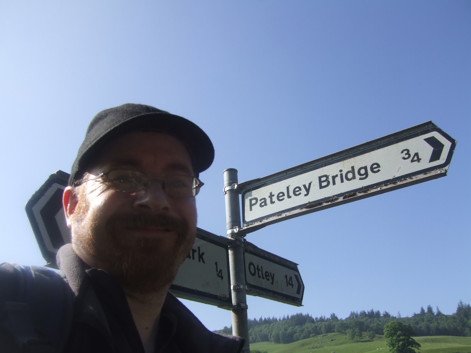
Sunday, 28 May 2017
Nidderdale Way #4 - Bewerley to Ripley 26/05/17
The Holme, Swarcliff, Birstwith, Hampsthwaite, and Clint.
 |
| Long Distance Trail means Selfies! #4 at Turner Bridge, Bewerley. |