Cadeby Tunnel, Cadeby Cliff, Kingswood, Conisbrough Castle, and Burcroft. As Saturday rolls up, the heatwave conditions already seem like a distant memory as the 39C peak experienced in Leeds on Tuesday (on Britain's hottest day on record), has since seen a welcome regression to the mean as temperatures dropped by 20C to get us back into a much more manageable walking climate, so we can thankfully progress without having a repeat of the Summer of 2018, and instead experience something like the same week of last year, where mid-July spiked hot before slumping into a really rather mediocre second half, as low cloud and chilly rain washed all the way across the Summer holidays. We have a nicely large time window for the plans for today, with a good cluster of points of interest at the end of the trip, really not all that far away in the Don Valley as we alight at South Elmsall a little after 8.50am, finding the day a little brighter than projected as we rise to High Street and drop down to the junction by the bus stand and the end of the main shopping street, hanging a left onto the B6422 and following the Doncaster Road as it leads off to the southeast, passing St Mary's church and out through the surprisingly narrow suburban band at Common End, soon landing in the shadow of Frickley Colliery park as we enter the countryside, not that we get much sight of its spoil tip's heights as it hides behind a bank of trees. Passing over Frickley Beck takes us out of West Yorkshire after less than a mile, entering Doncaster borough and losing the footway as Elmsall Lane moves on to pass through the embankment of the H&BR Wath branch, where we cross the Wakefield Way route and note the house of Moorhouse & South station, before the road starts its rise across Moorhouse Common, where more cyclists seem to be out than drivers as it presses uphill, revealing the local reverse horizon, with the Next depot and quarry marking its eastern edge as we push up past the woodlands of the Ashes and take a turn with the lane across the hill crest to show up the western horizon.This would guide the eye towards the distant Dearne Valley views, if it wasn't for the haze, and instead we have to look down towards the landscape of Frickley Park, which occasionally reveals itself beyond the thick hedges and wheat fields, mostly being obscured by Hooton Pagnell wood before the Hall is revealed briefly, as we land in Hooton Pagnell village, perched on the edge of this minor upland and bringing the picturesqueness along with the views, still maintaining its vintage rural flavour and some of those hints of a Cotswolds style as the cottages and farmsteads hang on around the market cross and All Saints church on its bluff, which are passed as we come below Hooton Hall, with its imposing gatehouse and high walls.
 |
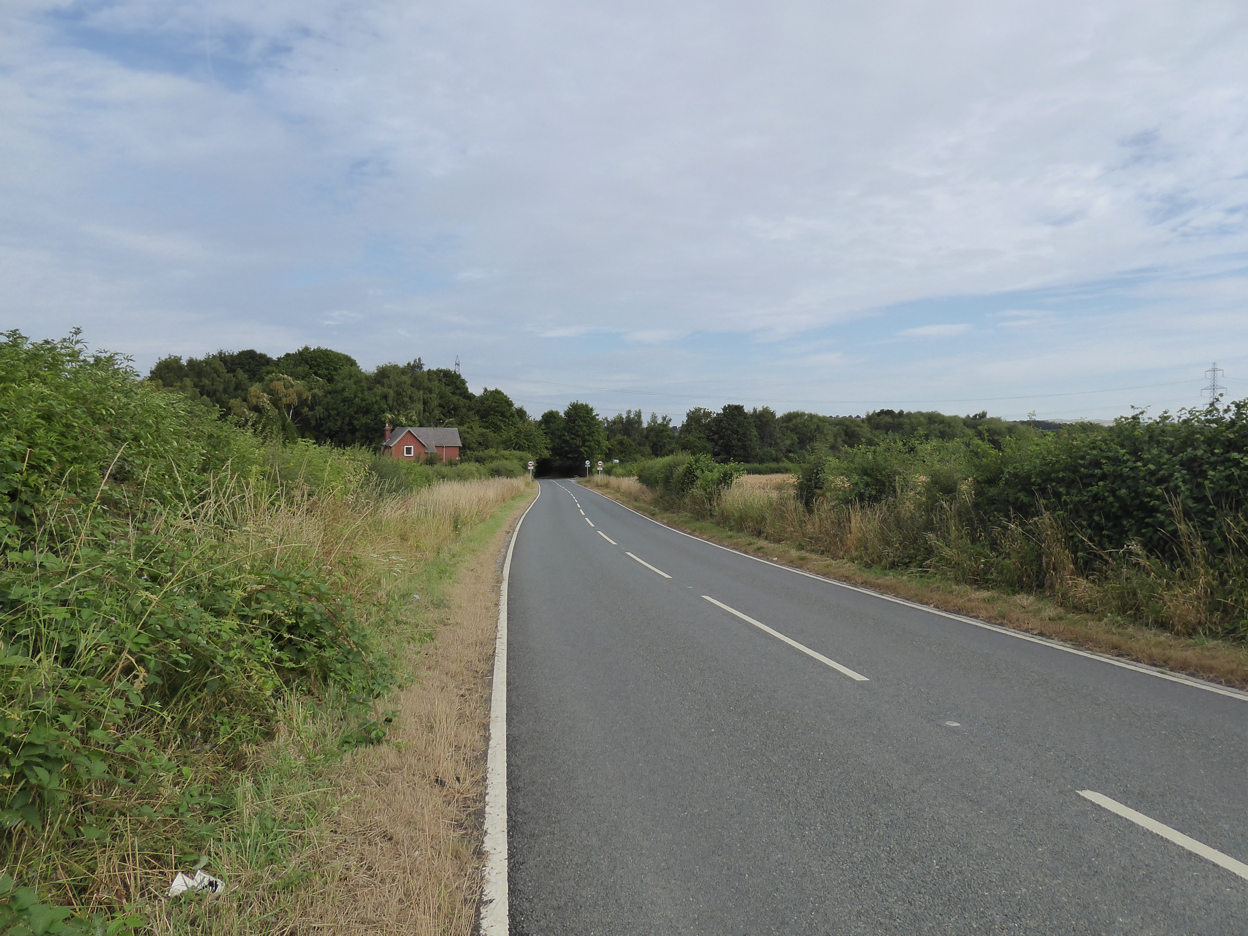
| Doncaster Road, South Elmsall. |
 |
| Frickley Beck, and Frickley Colliery Park. |
 |
| Moorhouse & South Elmsall station, on the H&BR. |
 |
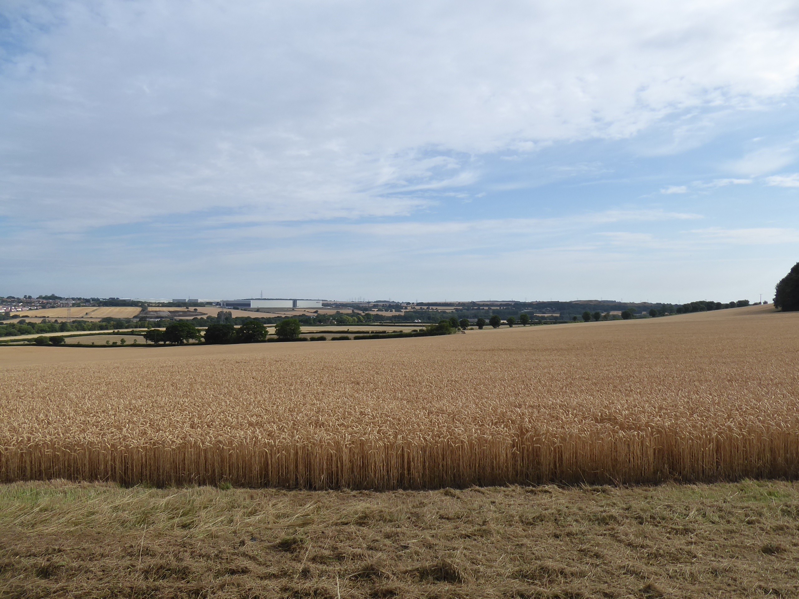
| The eastern view, from Moorhouse Common. |
 |
| The Dearne Valley horizon, beyond Hooton Pagnell woods. |
 |
| Hooton Pagnell village. |
We hang a left turn beyond, on the corner by the cricket field, passing into the relatively level upland, where the streams flow easterly toward the Don, following Butt Lane as it drifts down toward the groove formed by the beck flowing away from Bilham Park, another estate that has somehow endured among the coalfields, where unpacking the landscape becomes difficult as there are many plantations up here that aren't marked on the map and we press east away from the direct routes south towards Hickleton to meet the Bilham Row terrace concealed in the woods at the top of the latter of these lanes where we finally land upon the Explorer 279 sheet of 2003 vintage, after merely grazing its lower plate last weekend. Passing between the rise of Norman Hill and the wooded mass of Cliff Quarry brings us down to meet Brodsworth Lane, and the strung out ribbon of houses and farm settlements associated to Brodworth Hall, hidden away on the wooded rise to the south, getting the feeling that this is a bit of model sort of village, relocated away from its historic parish church as we find ourselves a bench for early elevenses, as the day can't seem to decide if it wants to be hot and bright or not, before moving away from the northern estate entrance towards the five lanes junction where we'll be departing from the B6422 route. The estate houses on this corner give credence to my impression, and also make us feel like we might be touching the outermost suburban reaches of Doncaster as we turn south onto Church Lane, with the press keeping us on the eastern perimeter of Brodsworth Hall, its parklands and house concealed by a continuous wall of trees and hedges as we pass its main public entrance, with interest drifting instead to the landscaped spoil tip of the former Brodsworth colliery in the east, once the largest in the county and now a community woodland to neighbouring Adwick le Street, looming large over the undulating and recently harvested wheatfields.
 |
| Hooton Pagnell cricket club. |
 |
| Bilham Park. |
 |
| Bilham Row, Street Lane. |
 |
| Estate cottages, Brodsworth. |
 |
| More Estate cottages, Brodsworth five lane ends. |
 |
| Brodsworth Colliery spoil tips. |
The horizon down the corridor of hedges lining the lane directs the eye towards the spire of the parish church at Marr, almost holding our attention for half a mile plus as we drive on south across this modestly high flatland, remembering to look back at the end of the hedges to get a clear sight of Brodsworth Hall before we enter this hamlet with St Helen's seeming a bit too large for it, meeting the A635 Barnsley Road as it brings on the heavy traffic and taking a few paces west along its pavement to pass Manor farm, which looks like it has a Roman colonnade facing the main road, pacing along to the corner by the Marr Lodge steak house. Turn south onto Blacksmith's Lane as it presses back into the fields, with wheat abounding as we carry on, with only Melton Wood and the Marr wind farm lying ahead as we find ourselves in a landscape almost bereft of visual context, pushing us along somewhere east of where we were last weekend, but getting no clue as to the location of Hickleton as we eschew the bridleway into the woods and stay on the road to test our resolve against the traffic, among the golden crops as we pass below the quartet of turbines, flanking the road in pairs and whirring constantly in the cool breeze. It's a properly long drag across this upland on the wonderfully named Hangman Stone Lane, which we carry on towards the southwest edge of, rising slightly to give us some sights on the northeastern horizon, picking out the other local wind farm near Hampole and also having Eggborough and Drax power stations rising on the distant Aire horizon, illustrating just how far east we've drifted, and also spying the glass works at Long Sandal, way downstream on the Don before we crest and split off the road just before it dives off the south side of the upland, joining the bridleway south and staying high up, thus depriving us of views towards the fall of the merging Dearne and Don valleys.
 |
| Brodsworth Hall. |
 |
| Manor Farm colonnade, Marr. |
 |
| Melton Wood. |
 |
| Marr Wind farm. |
 |
| Turbine action. |
 |
| More Turbine action. |
Grey haze lingers on the western horizon as we drift across the open fields of Ox Pasture, taking us west of Melton Wood and on towards a slurry tank at the track's angle from where we press west, to finally gets hint of Doncaster on the eastern horizon, as it's the only settlement in the locality to accommodate any tower blocks, which rise above the decline of the upland horizon, with the only distinctive feature to me being the tower of the Minster church, which loiters in our periphery as we turn south again, drawn towards High Melton, which has sat to the south of us, below the tower of its parish church, since we joined this path. Land by weather-boarded council houses and follow the rough track of the lane as it slips between various vintages of cottages to land on the Doncaster Road in the village across from the gates to Melton Hall, once used as a college but now up for developmental sale, and as we pass east we find a convenient bench by the village hall to take lunch, before pressing on along the tree-lined lane to pass the Red House and its farm, and finding that the church is well hidden from view now that we're close to it, not appearing as we pop out beyond the village and turn south again onto Cadeby Lane, with the long feature boulevard of trees reaching up from Melton Park. The pleasing warmth and brightness of the morning has passed as we travel south, with gloom and dampness being carried in the air as we move on among more flat fields, gradually approaching the Don Valley as it cuts through to the south, its presence being felt as a water tower lingers on the horizon and we approach Cadeby (not the Leicestershire one where the Rev. Teddy Boston ran a light railway in the garden of his vicarage), strung along both sides of its lane, which we'll bisect after the long half mile over the high fields towards it, joining the rural suburban cluster as we pass along Garden Lane, which then settles into the last elevated, and high-hedged, passage to the south.
 |
| Ox Pasture, and distant High Melton. |
 |
| Ox Pasture, Melton Wood and distant Doncaster. |
 |
| Doncaster Road, High Melton. |
 |
| Melton Park arbour boulevard. |
 |
| Cadeby Lane. |
 |
| Garden Lane, Cadeby. |
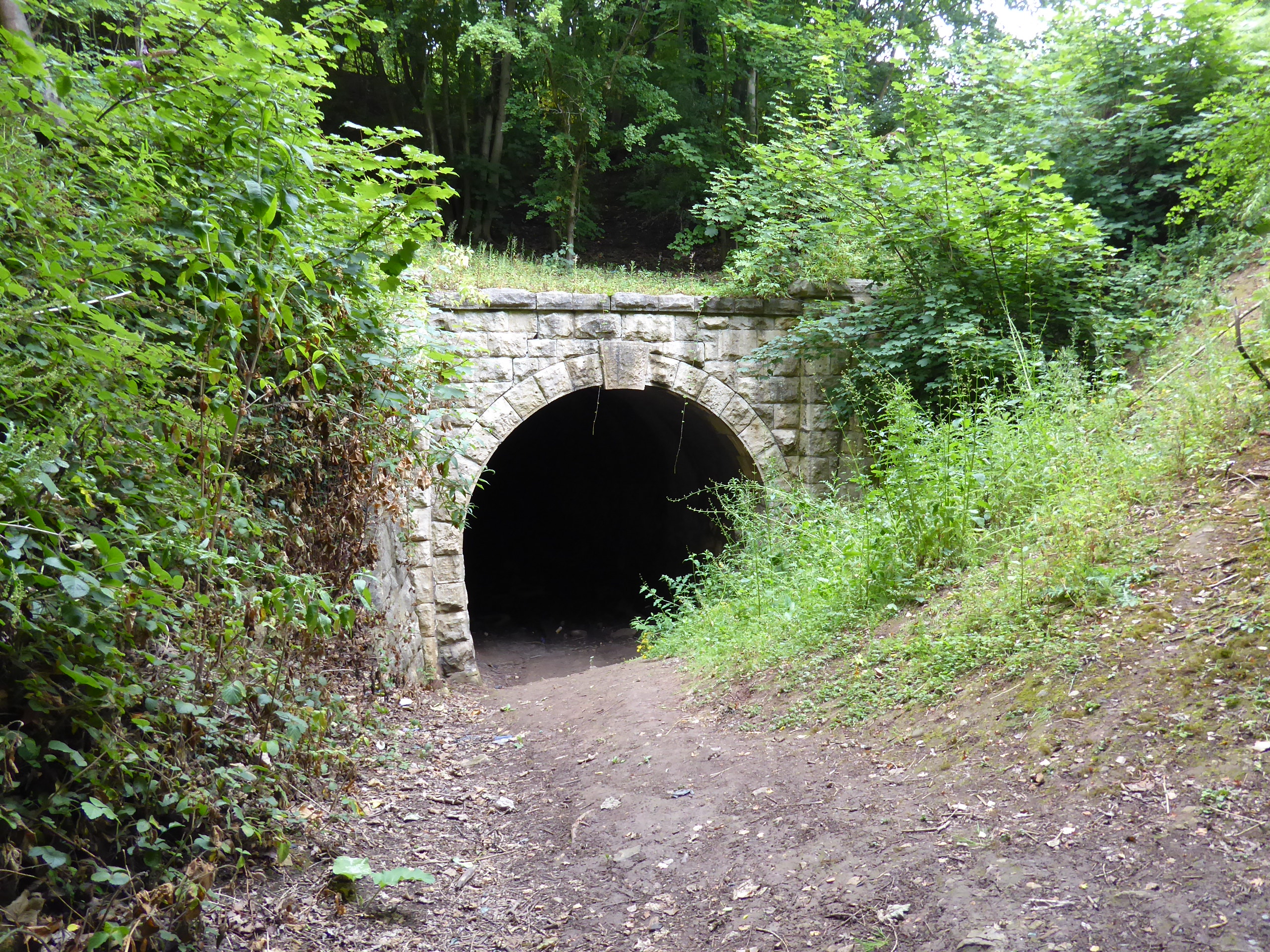
The narrow lane has roadworks going on down much of its length, when I'd anticipated the noise was coming from the nearby quarry, and those works have to be avoided as we arrive above the steep drop of the Don valley side, taking a turn on the decline eastwards as it reveals the view across to Conisborough castle, perched on the south side, and still some way off as we've gotten a whole bunch to see down here, as we pass down to a path crossroads, happy that we've done the homework before coming out here as our map marks none of these tracks adequately as we pass the quarry entrance and push downhill eastwards. The active railway passes under our feet as we head down towards the river bank, with a mass of engineering bricks soon arriving ahead of us, forming the 14 arched span of Conisbrough viaduct, constructed in 1909 and one of the last of its kind, looming massive over the wooded valley cleft as it once carried the Dearne Valley Line across the Don, crossed by an iron girder span high enough to accommodate masted sailing vessels, and altogether one of the best features in the county, with the Trans Pennine Trail paths abounding to offer multiples of views to its immaculately crafted north side, though damp gloom and tree growth do much to spoil the sightlines that I seek. Double back to the cross roads to push west, soon disappearing into the trees to find another railway feature, the single bore of Cadeby Tunnel, on the H&BR South Yorkshire Junction line which tapped the local coal mines, curving away to the north and plausibly accessible if you have the appropriate gear (which I don't), but another fascinating reminder of how heavy industry once maintained three railways on this valley side, which we'll progress along, on the alignment of the DVR line, under the Constitution Hill footbridge and below the edge of Cadeby Cliff, perched above the woodlands that have grown on the site of Cadeby Main Colliery, itself somehow crammed onto the northern riverbank.
 |
| Road up on Garden Lane. |
 |
| Conisbrough Castle appears across the Don Valley. |
 |
| Conisbrough Viaduct. |
 |
| The Don Span, Conisbrough Viaduct. |
 |
| The best general view obtained beyond the trees. |
 |
| Cadeby Tunnel on the H&BR South Yorkshire Junction branch. |
 |
| The Dearne Valley line, below Cadeby Cliff. |
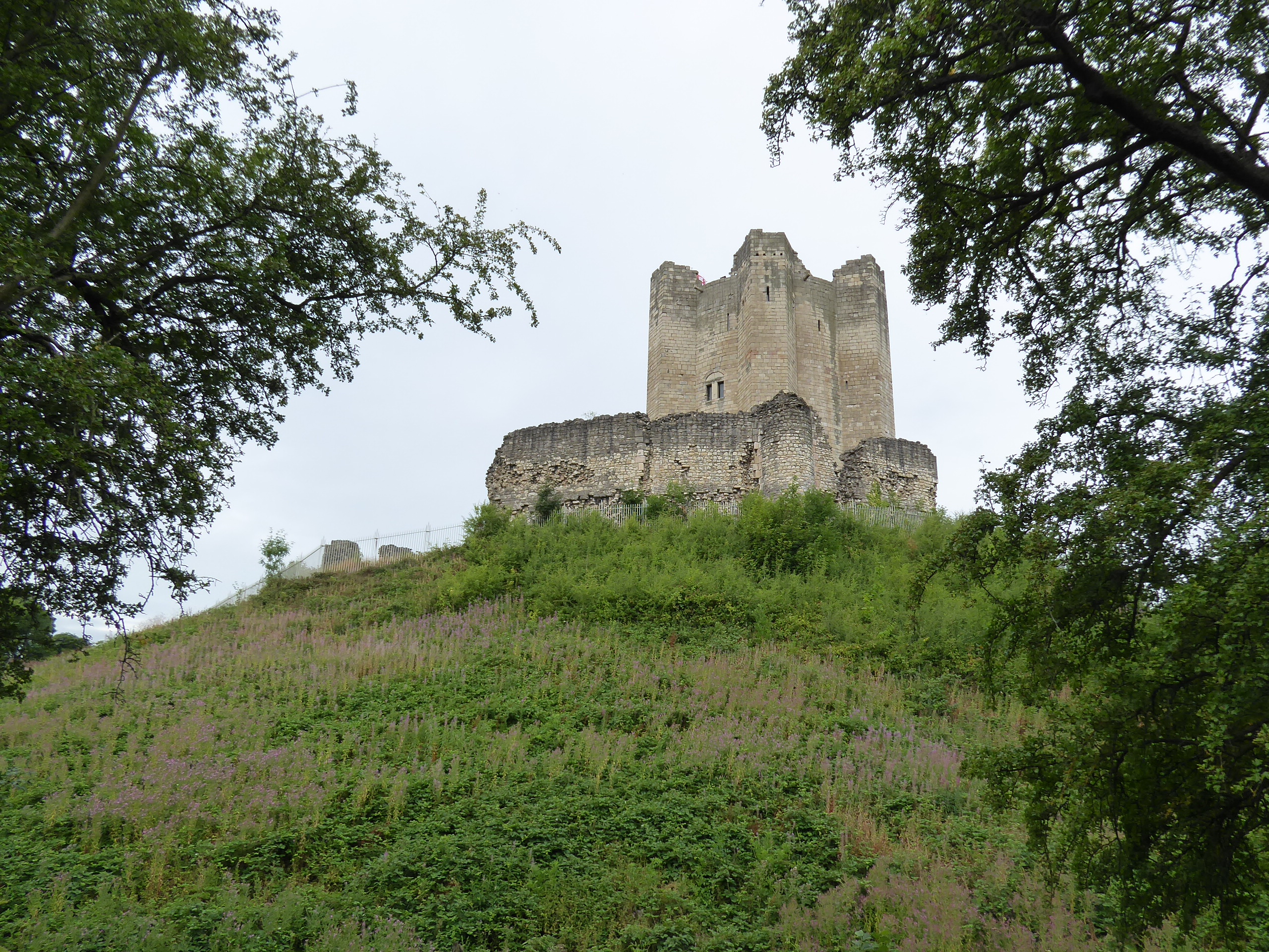
We drop down from the trackbed and hairpin back eastwards, to tangle with the Trans Pennine Trail again as it passes behind the Kingswood outdoor activities centre, a holiday camp of sorts on the site of the Doncaster Earth Centre, which ironically failed to promote the concept of sustainable development in the wake of the millennium, and is passed around to come down to the permissive path over the river Don via its access bridge, landing us just north of Conisbrough station and in time for the train an hour ahead of our scheduled finish, not ending the day as we have another target to meet, so the footbridge is passed over to ascend Station Road to the crossing of the A6023 Low Road. We ascend the road beyond toward Conisbrough on its hillside, with our focus beyond the turn of Dale Road being Conisbrough Castle, which emerges into view atop its motte and bailey, its circular and buttressed Norman keep looming large over the ruined walls of its outer bailey, an imposing and romantic ruin that inspired Sir Walter Scott when writing Ivanhoe, and still enduring as a modest tourist trap, which we only have time to take a circuit around, via the woods on its northern side and around to the bailey ditch on its south, before completing the path around via Castle Hill, making note to return here on a bright winter's day to get the best possible sights of this one too. Ferry Lane drops us back down to Low Road by the terraces of Burcroft, and we walk on down Riverside Close to meet the hard riverside path beyond, to pace upstream on the Don's bank, behind the riverfront developments and above the concealed angling stands, not getting the full riverside experience before we meet the active railway bridge, with its massive iron piers and girders passing overhead and offering a quiet spot for local teens to enjoy some alone time, which we pass away from to return to the A6023 and down to Conisbrough station, another proud edifice of MS&LR vintage, concluding at 3.00pm at the end of a very slow trip, but still well ahead of the next party express train ride.
 |
| Kingswood, the former Earth Centre. |
 |
| Conisbrough Station. |
 |
| Conisbrough Castle from Dale Road. |
 |
| Conisbrough Castle from the bailey ditch. |
 |
| Conicbrough Castle from Castle Hill. |
 |
| Low Road, Burcroft. |
 |
| The Railway Bridge on the Don. |
5,000 Miles Cumulative Total: 5687 miles
2022 Total: 402.3 miles
Up Country Total: 5,210.3 miles
Solo Total: 5355.4 miles
5,000 in my 40s Total: 4280.8 miles
Next Up: The Went valley and a longer delve to the South-East.


No comments:
Post a Comment