14.9 miles, via West Hardwick, Nostell Priory, Wragby, Horncastle Hill, Ryhill, Havercroft,
South Hiendley, Frickley Bridge, Brierley, Windmill Hill, Grimethorpe, New Park Spring
woods, Little Park woods, Great Houghton, Sand Hill, Billingley, and Highgate.
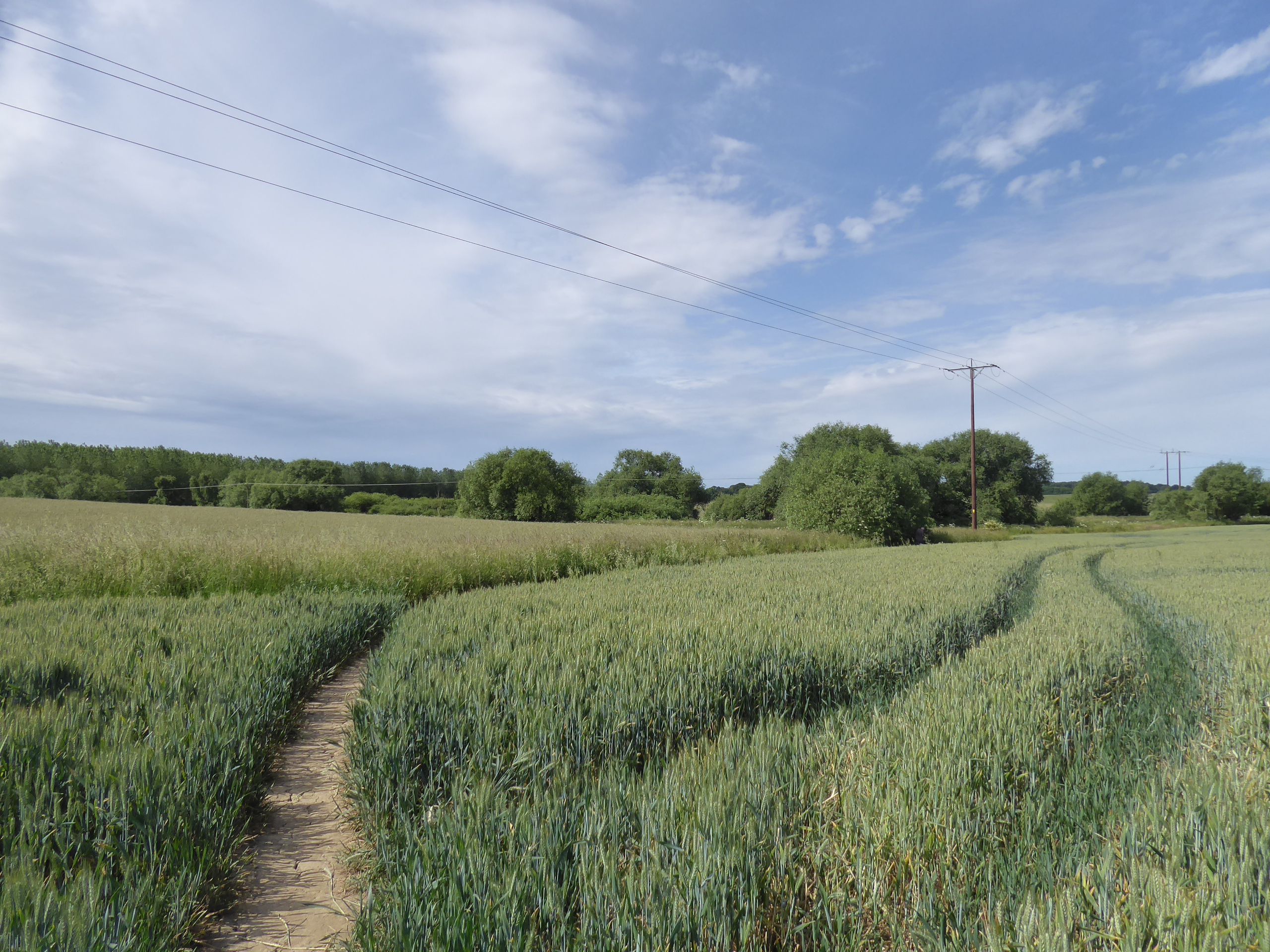
After three days of heatwave conditions, or more realistically three days of temperatures in excess of 20C for the first time this year, we look forward to Summer as we sit just shy of the top of the year, but predictably enough, the heat and sunshine cannot last into the weekend, and we're looking at a potentially tight weather window to pace against to fit with our tight time window that's dictated by our choice of start point and destination, which looks like it might be the theme as the High Season progresses, so we're going to have to keep the pace up today if we don't want a long wait to get home. Arrive at Featherstone at 10am, on the first train that doesn't take the long way round, to strike out route south down Station Lane, past the Railway Hotel and the mildly bustling main street, taking us down to the A645 Wakefield & Pontefract Road, which is crossed between the town council offices and the Lidl store, joining Girnhill Lane as it takes us south through the terraces into the suburban band of the town beyond the WMC and community gardens, an area that seems to have swollen with Lego houses below the lane's sudden eastbound turn, which leads to the rough track at the town's edge. This leads us to the field path that we traced back in 2014, joining it as it heads arrow-straight southwest through the wheatfields on a clear route over to the rougher and partially concealed tracks that take us down to the passages over the upper reaches of Went Beck, feeling happy that there's a dog walker to follow as we track around the edge of a plantation that's grown a lot over the last 8 years as we are led to the hamlet of West Hardwick, where the main farmstead and associated cottages are passed around as we get onto New Road as it leads southeast for a bit to put us onto the permissive path that leads towards Nostell Priory. Southwest-bound again we ahead below the plots of South Ings Fields, shadowing Hardwick Beck as it flows away from the estate, as the Pump Lane track directs us towards the eastern perimeter wall, where the National Trust site could be entered, it appears, but we're staying outside it, trying to find a path in Engine Wood that might not actually exist before picking up the Engine Lane track as it leads down to the Nostell East Vista, where a wide open space leads the eye west to the Palladian Nostell Priory house, with grazing cattle in the fields to the east, and a staring bench is provided for elevenses, as it is feel like that time of day already.
 |
| Station Road, Featherstone. |
 |
| Girnhill Lane, Featherstone. |
 |
| Field walking across the Went valley. |
 |
| West Hardwick. |
 |
| Pump Lane and Engine Wood. |
 |
| The East Vista, Nostell Priory. |
We resume along the curved track that shadows the ha-ha ditch, and rises along the resuming perimeter wall towards Wragby village, but find the access gate firmly padlocked shut, which means this path might not be as permissive as I'd thought it was, though a clamber gets us over to this quaint corner on the Doncaster Road, where the A638 is followed to the disused Wragby lodges and our turn onto Garmil Lane between St Oswald's cricket club and the sites of the Wakefield Independent School, joining Swine Lane by the Preparatory department in the old village school, by the very modest village hall. We are led past the Ibstock Brick & Tile plant, still scarring the local landscape with quarrying, and out footway-ed passage ends as we rise to cross the Leeds - Doncaster line, above the site of Nostell station, before we rise on around the elevated top of Horncastle Hill, with its farmstead and water tower prominent, and settle into the landscape of green fields and trees that conceal so much of the industrial activity that used to take place in these parts, and a keen historical eye is needed to recognize that some of these plantations actually conceal old railway lines, like the Barnsley Coal Railway off the the north, and the Dearne Valley Railway, as it pushes itself across our track. Nostell Lane rises us up southbound towards Ryhill village, which reveals that it is indeed on a hill as we look over the rooftops of the suburban accretions towards Anglers Country Park, before we drift into the village heart by the modestly scaled St James’s church, turning onto School Lane and wandering among its kinks and strangely located roundabout before we meet Mill Lane by the Methodist chapel, which leads us past the village shops and down the unusually wide boulevard of terraces on the way across to meeting the B6428 at Havercroft Green, where a bench offers itself for a lunchtime stop, already.
 |
| Wragby village. |
 |
| The old village school, Nostell. |
 |
| Nostell station terrace. |
 |
| Lost railways on the landscape, Swine Lane. |
 |
| Nostell Lane, Ryhill. |
 |
| Mill Lane, Ryhill. |
Brier Lane gets us going southeastwards, taking us through the oldest portion of Havercroft village, the scattering of farmsteads around the infilled cutting of the former Dearne Valley line, which again cuts across our route, and our views of the environs of Barnsley start to appear as we find ourselves above the watershed again, meeting the tramway that once rose up across the landscape from Monckton Main colliery as the lane drags us over the hillside above Felkirk school, while also spying surprising buses in the local traffic, from Barnsley borough as there are no Arriva services running locally thanks to strike action. Next village down is South Hiendley, which the Wakefield Way wandered us around back in 2015, and it seems that its contemporary main road doesn’t correspond with its old one as leads down from the old ‘Upper’ village, with George Street still providing some interest as we pass down to the Kirkgate corner and by the Sun inn, before landing among more familiar paths beyond the memorial garden and old chapel on Main Street, where the way brought us down across the High and Low commons, and Brierley Road pushes us uphill to the crest of the rise ahead of the drop down to Frickley Bridge. Our path from seven years back meets one from two weeks ago as we pass over the former H&BR mainline and into Barnsley borough, and it’s then uphill again on familiar pavements to meet Brierley village again, keeping things different by the A628 by walking to the corner by the former Three Horseshoes inn, so that we might walk along the full length of church street this time, and see the sights in reverse order, from the Methodist chapel, past the Hall, parish church and village club, before we put a name to the battlemented Langley House and split onto a new South Yorkshire path with Brierley Road as it declines downhill, below last week’s high route across the rising fields.
 |
| The Dearne Valley Line, Havercroft. |
 |
| The tramway to Monckton Main, Brier Lane. |
 |
| George Street, South Hiendley. |
 |
| Hiendley Low Common. |
 |
| Frickley Bridge. |
 |
| The Three Horseshoes (former), Cross Hill, Brierley. |
 |
| St Paul's church, Brierley. |
 |
| Brierley Road, leading to Grimethorpe. |
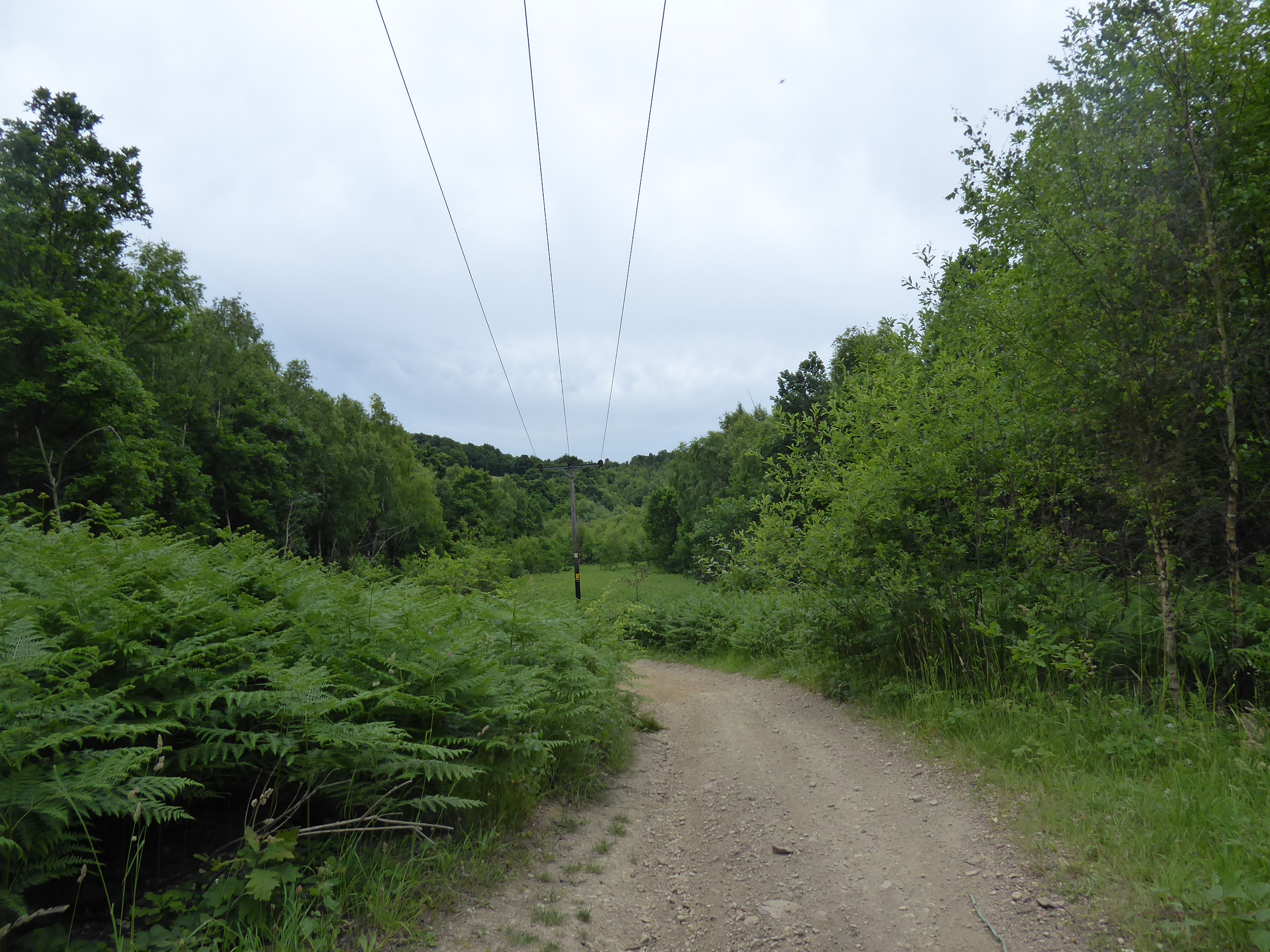
This drop to the Dearne side of the valley brings us into Grimethorpe village at Windmill Hill, a settlement that’s synonymous with the south Yorkshire coalfields, with an apt name that actually predates it, which you could be forgiven for thinking is entirely dated to the colliery’s mid 20th century heyday as council estates fill the local landscape, almost concealing the old Grimethorpe hall and the Manor farm, ahead of the run up past the WMC, St Luke’s church and the playing fields, to meet the high viewpoint north by the Red Rum inn, where despite the post-industrial depression, recent residential development has swelled the village further. Cemetery Road leads us out of the south end of the village, past the graveyard and onto a bridleway that suggests a lane lost to time, rapidly dipping into New Park Spring woods above the colliery site and a brickworks claypit, and finding the locale popular with dirt-bikers, who rip it up in a nearby enclosure as we descend on the heavily rutted track, hoping that we aren’t going to get tangled up with any speeding motorcyclists as we keep the dead-reckoning going beneath the foliage, bottoming out where a beck flows west and rising on south to take a left on the only clear fork in the mostly straight track, to elevate us through some shaded quarry remnants. Emerge to find ourselves perched above the Dearne valley again, despite the river’s relative proximity, above the (former) trio of wind turbines and the ASOS depot on the site of Great Houghton colliery, with Park Lane leading us around above Little Park Wood and in towards the route down Hargate Hill that we blasted last weekend, landing on the hard pavement at the west end of Great Houghton village, because that’s the way my recent routes are plotting, having finally erased the odd northward indentation into my Field of Walking Experience’s southern boundary, and now replaced it with a southerly protuberance as we pace the High Street again under much gloomier skies than last week's.
 |
| The Grimethorpe Colliery Memorial, Windmill Hill. |
 |
| Brierley Road, Grimethorpe. |
 |
| Cemetery Road, and the Red Rum, Grimethorpe. |
 |
| New Park Springs Woods. |
 |
| Ascending Park Lane, by the quarry. |
 |
| The wind turbines by the Dearne Valley side. |
 |
| Park Lane and the cemetery, Great Houghton. |
We’ll briefly pass up Chapel Street to take a closer look at the church of St Michael & All Angels, formerly the chapel to the lost Old Hall and curiosity to take in ahead of stopping for late lunch at the same bench that we used last week, checking my time window to see that I’ve got 80 minutes to do the last hour, resuming our route along the B6273 among the redbrick houses to the corner by the Welfare Hall and then striking off down the Rotherham Road through the terraced district of Sand Hill, with the Sandhill Tavern, the other pub in the village, in amongst it, ahead of a level passage over the former Dearne Valley railway line, all gussied up with bridleway access. Our route rises beyond, to show us passing to the southwest of Thurnscoe, visible across the fields, splitting off the B-road by a microwave mast at the crest and joining the West Kirk Road as it projects us on to a view over the Dearne valley, above Darfield and looking towards the Dove valley in the west, ahead of us gaining a footway again to lead us into the village of Billingley, completely rural in aspect despite the location among all the coal mining and doing most of its business with equestrianism and Christmas tree farming to go along with the picturesqueness on its bluff, which the Billingley Green Lane will soon take us down from towards the A635. Join the main Barnsley - Doncaster to send us east along the broad footway, taking us down to the passage over Thurnscoe / Carr Dike as it flows Dearne-bound, and rise through the open fields to come up to the traffic island by the bypass road and Aldi store at the western end of Goldthorpe, which we’ll approach along Barnsley Road, past the suburban growth and the terraces of Highgate, but not getting a feel for the size and true nature of the village beyond the WMC, as the railway line soon slips below the main road before we’ve reached its heart, and thus we’re done at another new destination at 3.25pm, having maintained a feverish pace to land before the day’s threat of rain arrives.
 |
| St Michael & All Angels, Great Houghton. |
 |
| The terraces of Sand Hill. |
 |
| The mast on the West Kirk Road corner. |
 |
| The Memorial Garden, Billingley. |
 |
| The A635 leading to Billingley Bridge. |
 |
The Highgate terraces, Goldthorpe.
|
5,000 Miles Cumulative Total: 5612.9 miles
2022 Total: 328.2 miles
Up Country Total: 5,136.2 miles
Solo Total: 5281.3 miles
5,000 in my 40s Total: 4206.7 miles
Next Up: How does the Walking Year work around a National Trains Strike?
and a Bus Strike across Wakefield District?


No comments:
Post a Comment