16 miles, via Bendles, Park Balk, King's Standard Hill, Cridling Stubbs, Spring Lodge,
Womersley, Grove Bridge, Stubbs Bridge. Tanpit Bridge, Low Field, Norton, Askern,
Sutton, Burghwallis Common, Owston, Owston Common, Carcroft Common,
Bentley Moor, Toll Bar, and Wrostholme.
After returning to work for a week of cross-site activity between the hospitals, and suffering a horrible bout with an upset stomach along the way, we return to the trail come the weekend, hopeful that we have better luck with the trains and weather than we had last weekend, and that a rapid turn on the ground might be had after a month of dawdling, and despite there being half the number of services passing through Morley today, the extended trip to the northeastern corner of the 2022 walking field can let us have a half-hour turn-around at Castleford to see how the station's redevelopment works are progressing. Thence we can alight at Knottingley after 9.30am, as we set a course to the south and east, rising to the Station Hotel and the A645 to remind ourselves that there's a lot more to this town than is recalled, with most of it lying to the east of the station, as we work a way with Headlands Road and Spawd Bone Lane around two sides of the railway triangle with the former motive power depot in its middle, also passing below the chimneys of the Ardagh glass works and noting the adjacent Reiki practitioner and Guns & Pawn store as being the strangest of neighbours before making our fifth railway transit via the England Lane level crossing. This returns us to the Weeland Road by the Stoelze Flacconage glass works and the CT Transport depot before we start our southbound turn by joining the Womersley Road, taking us over the Askern branch again by the Winston inn, for our sixth passage of the local railway lines before heading on out past the town cemetery with its obvious pair of mortuary chapels, and through the suburban enclave that grew on the quarried pits that must have brought the glass industry to the area, where one aggregate supplier still operates, ahead of the turn by Park Balk farm, where we shift into the countryside. We are initially shadowing the southerly track of the railway, and then the eastwards push of the M62 as we pace among the fields and find ourselves on the low bluff of King's Standard Hill, revealing the vast flatlands between the lower Aire and Don in the east, tracing the any pylons across the fields towards Drax Power Station, while noting that the last remains of Eggborough have now vanished completely, demolished two weeks ago, with the massive spoil tip, or landfill, on Gale Common rising unnaturally ahead as we come around to pass over the motorway.
 |
| Knottingley MPD (former), with MGR. |
 |
| The England Lane crossing and footbridge, Knottingley. |
 |
| The terraced top of Womersley Road, Knottingley. |
 |
| The suburban bottom of Womersley Road, Knottingley. |
 |
| The pylons leading to Drax, but not Eggborough. |
 |
| The M62 and the Gale Common 'hill'. |
Entering North Yorkshire, the lane kinks a bit and passes among some quarry remnants as Far Park farm passes through our local lens and we come down to meet the crossroads at the west of Cridling Stubbs, which just sits off our path as we carry on, having refreshed our views of the east which we took in two months ago, and strike into the unknown as we carry on south, taking us past Spring Lodge farm and it associated cottages before we pass over the Askern line at Springlodge crossing for the last time, and carry on among the quarry remnants at North Field, noting the presence of a former railway spur passing below our feet. A footway arrives beyond the first cottage on the lane, keeping us out of the traffic's way as we pass among several flooded quarry pits, with one enduring as a swimming lake though none are particularly visible through the trees as we head south towards Womersley village, the presence of which has been long hinted by the spire rising into the local horizon, landing at the end of Northfield Lane and finding more of that rubble and red tile construction that is spread across this locality encompassing the old farmsteads and newer builds around the whitewashed old schoolhouse. The long wall of Womersley Park seems to occupy the entire south side of the Main Street, only getting interrupted by the placement of the parish church of St Martin and its vicarage, as well as the park house itself, revealing that this is a further extension of the stately estates to the east and south of West Yorkshire, with the wall resuming as we come down by the more varied suburban band along Park Lane, where a bus stop on the Station Road corner provides an early lunch break spot, before we process onwards, past Home Farm and down the parkland's perimeter, where no views west are gained beyond the thick hedge of trees, on our way southwards down Churchfield Lane.
 |
| Cridling Stubbs. |
 |
| Springlodge crossing, on the Askern Line. |
 |
| Between the hidden ponds, Northfield Lane. |
 |
| Main Street, Womersley. |
 |
| St Martin's church,.Womersley. |
 |
| Churchfield Lane between Womersley Park and the Askern Line. |
Still shadowing the Askern line, a field distant to the east, we come in sight of last week's path once we've passed onto the un-named lane that splits off, giving us a southwesterly look towards Little Smeaton and the low range of hills that the river Went penetrated, while the eastern horizon offers no real sight across the flatlands as plantations cover it wholly, a mile or so away, meaning the fall of the lowermost Aire and Don aren't traceable beyond as we come past the old Womersley Grove and Forlorn Hope farms, with Grove bridge crossing the eastward falling Birka Drain between them. A landscape interruption comes as the road rises among these low fields, to pass over Stubbs Bridge, passing over the lost H&BR mainline while forming a minor irritation to those who have to maintain it while it passes over a void, beyond which we come down to the switches of lanes that lead into the extremely modest hamlet of Walden Stubbs, just to the east of the railway line and our ongoing route, with Tanpit Lane being joined to take us past the cross stump by the last of its local corners, by Wentbank farm, which naturally leads us to passage over the Went itself, actually looking like a proper river at Tanpit bridge. The south bank greets our entry into South Yorkshire and Doncaster borough, with our southbound passage taking us onto the rough track of Stubbs Lane, away from the site of Norton Priory to the west and down past the sewage farm and equestrian fields that sit to the north of Norton village, where our early day phase ends and part two starts to get a lot more urban as Station Road is met to lead us east, among its cottages, terraces and suburban houses, as we progress on towards the railway again, meeting the old station house just ahead of the level crossing, where we turn south onto New Road, among the suburban developments and mining terraces.
 |
| The view towards Little Smeaton. |
 |
| Forlon Hope (or Little Grove) farm. |
 |
| Stubbs Bridge, on the H&BR mainline. |
 |
| Stump Cross, Walden Stubbs. |
 |
| Stubbs Lane, approaching Norton. |
 |
| Station Road, Norton. |
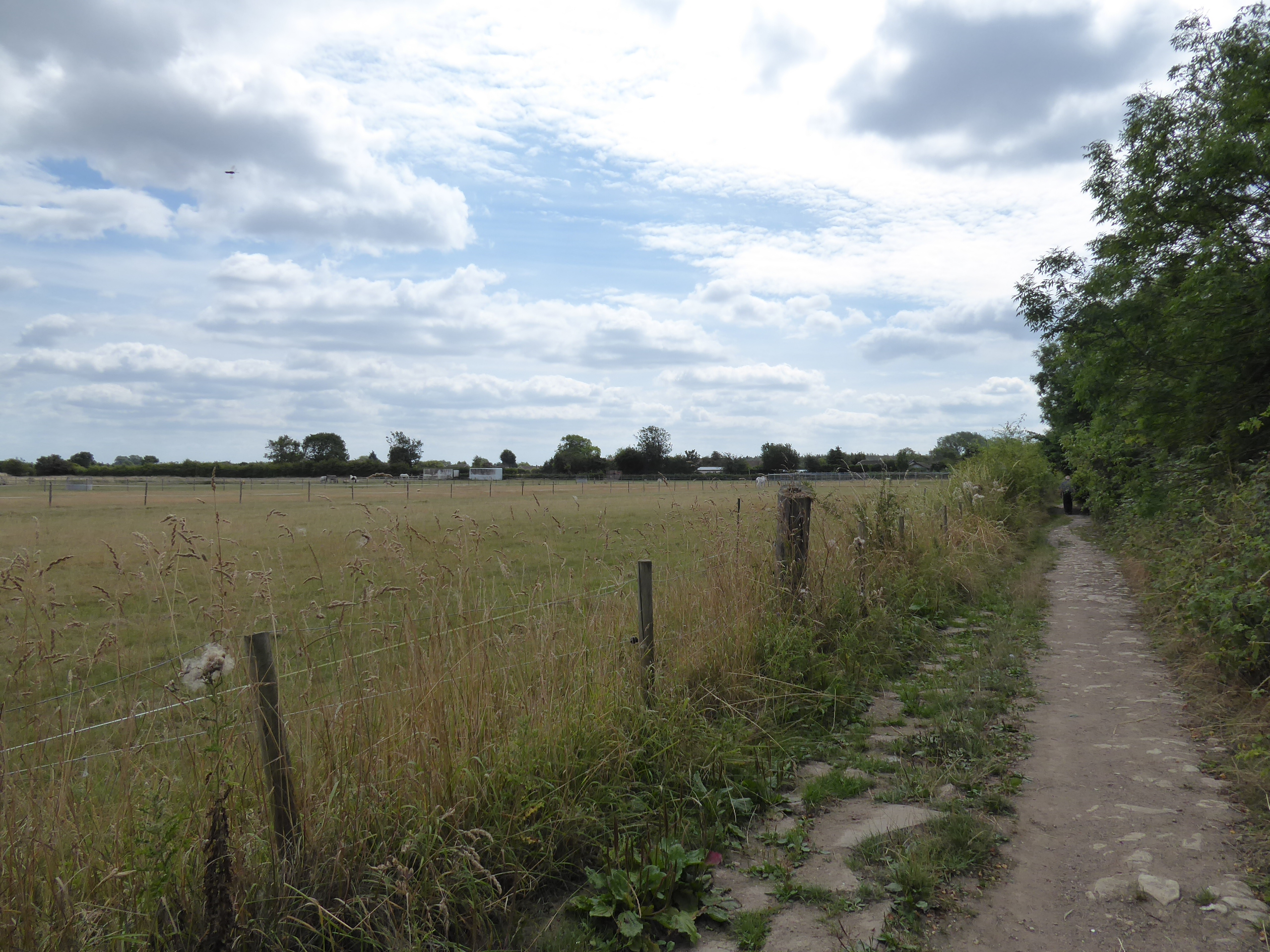
We're seeking the footpath that traces the eastern boundary of the woodland park that has reclaimed the site of the spoil tips and coalite plant that grew to the north of Askern Main colliery, and that's easy enough to do in theory but on the ground it's easier to get tangled up in the post industrial dirt tracks through the trees and drift away from our last phase of shadowing the railway, having to make a course correction or two which drops us onto shaded tracks below the elevated dome of spoil and lead ourselves south atop a concealed and shaded embankment that drops us out onto Campsall Road, just north of Askern village. We drop down to meet the High Street by the Co-op store and St Peter's church, and join the pavement of the A19 as it leads us south, through the centre of this 19th century spa that became a 20th century colliery village, which explains the contrast between the shopping parades and the ornamental Askern Lake at the village heart, below the looming water tower by the colliery pit head and across from the White Hart and Crown Inn taverns, and the reach of the council houses and industrial estates that sit to the south, where we quit the most direct route south to join Sutton Road, mainly because the A19 isn't the sort of road that you want to challenge when it lacks a footway. Askern is thus departed by the Spa Academy and the caravan site that looks like it's been used for special forces training, as fields are passed through on the way along to Sutton village, another rural enclave that contrasts heavily with the post industrial landscape to the north of it, its rubble 'n' tile farmsteads and cottages being admired as we pass southwesterly, coming down to the corner by the Anne Arms inn, and then switch to a southeasterly tack to lead us back towards the Selby & Doncaster turnpike, seeing little of Burghwallis common among the dense cover of hedges and trees before we come down to the small urban enclave by the Owston inn, on the A19 corner.
 |
| The New Lane track, Askern Main. |
 |
| The concealed embankment, Askern Main. |
 |
| Askern High Street, and Lake. |
 |
| Sutton Road, Askern. |
 |
| Sutton Road, Sutton. |
 |
| The Owston inn, by the Doncaster & Selby turnpike. |
Take a right turn by Askern Lodge, away from the trunk road, and head down Stockbridge Lane, which feels a lot more like a driveway as it leads us towards Owston village, off the beaten track and sharing a name with a Leicestershire settlement, I might note, with All Saints church sitting at its eastern edge and feeling rather too large for it, where we'll tour around and break for a second lunch, doing a time check and realizing that we're good to keep within a tight time window, before we head off onto the footpath that leads across the rather underpopulated golf course on the grounds of the Owston Hall Hotel and Spa. Meeting the driveway midway across can send us out via the Owston Lodge entrance, heading southwest as we follow Owston Lane down between East and West farms, which are geographically the wrong way round, landing us on the B1220 Askern Road, just west of the A19 again, but we turn away from it for a third time as we instead move southwest to drift in towards last week's route, which has sat a mile or so to the west of us for much of the last couple of hours, drawing us over towards Carcroft again, visible across the fields to the west and passing north of the Croft Farm landfill on Owston Common and the Bullcroft Colliery spoil tip site, which appears to have been recently landscaped into an unnatural hilltop. Beyond Well Dike we find ourselves landing among the industrial units and terraces ahaed of the crossroads at the top of Station Road, where we again turn to approach Adwick station, only a road's width away from last week's pavement as we pass over the Adwick - Stainforth Line again, but this time turn onto Bentley Moor Road as it leads among more light industry, heading southeast again as it rises to pass over the embankments of Old Ea Beck and then carrying on among the open flat fields, between the Don Valley Model Flying Club and Uncle Eddie's Motocross park, which is making all the noise as we progress on to the red route to the finish line.
 |
| All Saints church, Owston. |
 |
| Owston Hall and Park. |
 |
| East Farm, Owston Lane. |
 |
| Croft Farm landfill, Owston Common. |
 |
| The Adwick - Stainforth Line, Carcroft Common. |
 |
| Bentley Moor Lane. |
Meet the A19 and rejoin its side to head south, and even though it still lacks a footway as it crosses Bentley Moor, it's dead straight and has a wide verge for the half mile that we have to pace alongside it, with barely a pantechnicon in sight as we come down the Doncaster Road to meet the top end of Toll Bar, a satellite settlement that's grown to the north of the greater city beyond, initially to serve Bentley Colliery which sat to its east, where its toll bar still sits on the corner of Prospect Road among the terraces beyond the local primary school, as the sole pre-20th century feature within it, between the kinks on the Askern Road. The turnpike rises beyond to pass over the Trans Pennine Trail on the lost H&BR - GCR joint line, also passing around the western edge of the colliery site as we arrive above Bentley, getting direct sight to Doncaster Minster as we pass into the greater city proper, with the terraces and estates having grown up the length of the A19 with the arrival of heavy industry, to now form a suburb that has completely consumed the hamlet of Wrostholme, where one rural vantage building endures ahead of the Aldi store, beyond which the channel of Mill Dike joins the roadside, flowing down the perimeter of Bentley Park, the pavilion of which looms large opposite the Baptist chapel. Bentley proper lies beyond, but we turn off the A19 before we meet its High Street, with Cooke Street leading us past its old village school and the Bay Horse inn on the run down to the level crossing at the northern throat of Bentley station, which could have proved to be an obstacle if we'd cut our timing fine as our Leeds-bound platform lies beyond it, but we've maintained a fierce pace for the first time in a month in order to land at our penultimate new destination for the year at 3.15pm, which give us a quarter hour to finish lunch, stretch the calves and Azuma-spot before we ride the train away.
 |
| Pacing the A19 Doncaster Road, to Toll Bar. |
 |
| The toll bar, Askern Road, Toll Bar. |
 |
| The passage over the TPT, and the direct sight line to Doncaster Minster. |
 |
| Askern Road, Wrostholme / Bentley. |
 |
| Bentley Park Pavilion. |
 |
The Bay Horse, Cooke Street, Bentley.
~~~ |
 |
| Azuma-spotting at Bentley station. |
5,000 Miles Cumulative Total: 5721.8 miles
2022 Total: 433.1 miles
Up Country Total: 5,241.1 miles
Solo Total: 5386.2 miles
5,000 in my 40s Total: 4311.6 miles
Next Up: Aiming ourselves along the old roads towards Yorkshire's newest City


No comments:
Post a Comment