 |
| Blogging with a View, in Scarborough. |
Showing posts with label Spring Jollies. Show all posts
Showing posts with label Spring Jollies. Show all posts
Saturday, 27 May 2023
Rumination: Spring Jollies & Planet Spotting
Thursday, 25 May 2023
The Cinder Track #2 - Ravenscar to Whitby 24/05/23
11.9 miles, via Ravenscar Brickworks, Peak Alum Quarry, Brow Alum Quarry, Stoupe Brow,
Howdale Wood, Allison Head Wood, Fyling Old Hall, Ramsdale Beck, Fyling Thorpe,
Robin Hood's Bay, Bay Ness, Rain Dale, Hawsker Bottoms, Hawsker, Stainsacre,
Cock Mill Wood, Larpool Wood, Larpool Viaduct, and Prospect Hill.
NB: Historical Reminiscences are in Italics.
 |
| Long Distance Trail Means Selfies! #2 at Ravenscar |
Monday, 22 May 2023
The Cinder Track #1 - Scarborough to Ravenscar 21/05/23
10.7 miles, via Falgrave, Woodlands, Gallows Field, Newby, Scalby, Burniston, Cloughton,
Newlands Dale, Hayburn Wyke, Staintondale, and Bent Rigg.
 |
| Long Distance Trail means Selfies! #1 at Scarborough |
Thursday, 26 May 2022
Mary Towneley Loop #3 - Holme Chapel to Sandbed 25/05/22
14.4 miles, on the Pennine Bridleway, via Green Clough, Long Causeway, Sheddon Clough,
Cant Clough Reservoir, Worthsthorne Quarries, Hurstwood Reservoir, Smallshaw Clough,
Rams Clough, Gorple Gate, Gorple Stones, Clough Head, Widdop Reservoir, Clough Foot,
Lower Gorple Reservoir, Reaps Coppy, Reaps Level, Edge Lane, Land Bridge,
Strines Clough, Brown Hill, New Delight, Bow Lane, Blackshaw Head (Cally Hall),
Marsh Lane, Naze, Cowbridge Wood, and Jumble Hole.
 |
| Long Distance Trail means Selfies! #3 at Holme Chapel |
Tuesday, 24 May 2022
Mary Towneley Loop #2 - Broadley to Holme Chapel 23/05/22
14.8 miles, on the Pennine Bridleway, via Healey Dell, Spring Mill reservoir, Broadley Fold & Prickshaw, Rooley Moor (Bottom of Rooley Moor, Warm Slack Hill, Pike Brow, Top of Pike,
Bagden Hillocks, Hamer Hill, Top of Leach) Cragg Quarry, Black Hill, Cowpe Bottom,
Hugh Mill, Waterfoot, Booth Fold, Edgeside, Shaw Clough, Lumb, Peers Clough, Red Moss,
Bent Hill Rough, Deerplay Moor, Easden Clough, Stone House Fold, and Holme Station.
 |
| Long Distance Trail means Selfies! #2 at Broadley |
Sunday, 22 May 2022
Mary Towneley Loop #1 - Sandbed to Broadley 21/05/22
15.8 miles, on the Pennine Bridleway, via Callis Bridge, Callis Wood, Edge End Plantation,
Rough Head, London Road, Mankinholes, Lumbutts, Hey head Green, Rake End,
Salter Rake Gate, North Hollingworth, Bottomley, Summit Tunnel, Reddyshore Scout,
Owler Clough, Higher Calderbrook, Grimes, Turn Slack Clough, High Lee Slack,
Hills Clough, Watergrove Reservoir, Higher Slack Brook, Long Shoot Clough, Brown Hill,
Lobden golf course, Rushy Hill, Hopwood Hall, and Hindle Pastures.
Late May means Spring Jollies time, and my first opportunity to get away from home at this time of year since 2019, and as we don’t have an obvious holiday locale that fits in with the year’s field of interest, and thusly we look to what we’d been hoping to do before a global pandemic got in the way, and that’s why we’re setting course for Calderdale with the plan we hatched for Spring 2020 (also carried in Summer 2021, but then put on reserve again, because reasons), namely the Mary Towneley Loop on the Pennine Bridleway, 47 miles over the fields, moors and valleys of the three river catchments on the West Yorkshire - Lancashire border. Taking a cottage with My Mum on the hillside above the A646 Halifax Road puts us in a good location for the initial start line, where the parental taxi won’t be needed as we’re only a few bus stops west of Sandbed, where the #590 service can be ridden for a 9.15am start, at the point where the Pennine Way and Bridleway tangle up passing across the valley, and we immediately strike south at Callis Bridge, passing over the river Calder and the Rochdale canal, and hit the rising path that leads up to Callis Wood, giving us a fine view over Charelstown before we disappear into the trees, switching back with the hard track and also wandering off of it as we elevate. Before we can reach the high apron of fields above the valley, we drop down to pass over Beaumont Clough bridge and then rise along the perimeter of Edge End plantation to reach the track that leads across the open plots of Rough Head, directing us towards Stoodley Pike on its high perch, while Blackshaw Head and Heptonstall appear on our reverse horizon, and the bridleway endeavours to keep us low-ish as we come around to Kinshaw Lane, taking us by Swillington farm and onto the passage of London Road, 100m below the high monument.
 |
| Long Distance Trail means Selfies! #1 at Sandbed. |
Friday, 28 May 2021
Bronte Way #3: Wycoller to Gawthorpe Hall 27/05/21
15.8 miles, via Turnhole Clough, Saucer Hill Clough, Boulsworth Dyke, Will Moor,
Thursden Wood, Thursden Brook, Park Wood, Pike Lowe, Holden Clough,
Swinden Reservoirs, Lee Green Reservoir, Swinden Water, Houghton Hagg Wood,
Brun Valley Country Park, Bank Hall Park, Leeds & Liverpool Canal (Burnley),
Reedley, New in Pendle bridge, Spurn Clough, Moor Isles Clough, Pendle Hall bridge,
Ightenhill, Habergham, and Pit Plantation.
 |
| Long Distance Trail means Selfies! #3 at Wycoller Country Park |
Two rest days are taken from the trail in the midweek period of 2021's Spring Jollies at Home, to allow time for other activities like shopping, spring cleaning and generally getting our house in order before The Way is rejoined at its most awkward extremity, but not putting Mum too far out of the way on another day out for her while performing Parental Taxi duties, dropping us off at 9.50am under much brighter conditions than we saw three days back above Wycoller's valley, at the country Park's Haworth Road car park, where we can both regard The Atom in a much more positive light than we did on Monday, as sunshine really elevates the views from the Panopticon. Looking forward to a whole day of walking into the previously unknown in Lancashire, our first in a long while, The Way needs to be returned to by the descending path down to the hamlet, giving us restored views over Pendle Hill and its borough downstream as we return to Wycoller Hall's ruins where we can poke around the remains of this late 16th century hall, dismantled in the early 19th century, meaning we have the same sort of edifice to regard as Charlotte Bronte supposedly did, as we wander among its rooms and around to the aisled barn, and that's going to be about it for the Bronte connections as The Way seems to have fallen like the Hadrian's Wall Path, having crammed most of its points of interest into its middle portion. We'll need to trip around the hamlet before we go, tracing the track to its northwestern end by Lowlands Farm, and the pricey new cottages that have been added in here, then coming back up the main street, crossing over the beck as we go and quietly marveling at how expensive and Cotswolds-ish it all feels, ahead of us meeting the Packhorse and Clapper bridges again and heading on upstream along the metaled path on the southern bank, through some willow tunnels and across a small wetland reserve as the settlement falls away behind us.
Tuesday, 25 May 2021
Bronte Way #2: Thornton to Wycoller 24/05/21
16 miles, via Thornton Cemetery, Well Heads, Denholme Clough, Black Edge, Thornton Moor,
Stony Hill Clough, Leeming Reservoir, Back Leeming, Oxenhope (Lower Town),
Old Oxenhope hall, Haworth, Penistone Hill, The Slack, Bronte Bridge, The Height,
Buckley Green, Ponden Reservoir & Hall, Whitestone Clough, Silver Hill Bank, Jarnel,
Watersheddles Reservoir, Cross Bent, Smithy Clough, and The Atom.
 |
| Long Distance Trail means Selfies! #2 at Bronte House, Thornton. |
For leg #2 of this trip across a Chunk of West Yorkshire's literary history, I've got my Parental Taxi in attendance, so there's no need to make the frustratingly long bus ride via Bradford Interchange to get out to Thornton, as Mum can drive me out here, getting in behind the rush hour traffic, and not putting her out of her way at all as she can continue on to visit friends of hers in Skipton without having to put much more than a dozen miles on the round trip from Morley along the way of acting as my shuttle, like she would normally have done if we were having normal Spring Jollies. So alight on Thornton Road at 9.45am, and scurry back up Ball Street to mick up the trail once again at the Bronte House, where Rev. Bronte recalled as having spent the happiest years of his life (mainly because all the members of his family were alive whilst residing there), before we set off with the trail up Market Street, taking in more of this pleasingly rural vintage village, as we roll up to the Black Horse inn on the West Lane corner and rise up to meet the suburban spread of the village above, taking us past the Thornton Mill redevelopment and up to the chapel and Sunday school on the James Street Corner. Cross here and rise to the path on Reservoir View, the last terrace in the village at this altitude, and enter the equestrian fields and meadow beyond, perched up the valley side above the tapering west end of the village, affording come fine views up and down the valley, as well as to Thornton viaduct as it descibes it less than straightforwards passage up from the south, before we enter Thornton cemetery and trace its wide promenade path across its width, between the raked terraces of graves up and down the hillside. A rough track and field path guide us on, from Bottom of the Row farm, and up to Close Head farm, as we look down to the passge of Well Heads tunnel, its portal hidden in the wooded pit below, and still no closer to being revived than int was in 2013, and we'll start on that year's route again as we rise up to Well Heads hamlet, with its stone terraces stretching down from the White Horse inn, atop the rather blasted feeling ridge that rises between Thornton's valley and the next one over to the north.
Sunday, 23 May 2021
Bronte Way #1: Birstall to Thornton 22/05/21
15.8 miles, via Nova, Oakwell Hall, Gomersal, Little Gomersal, Rawfolds, Hightown,
Upper House, Sepulchre Hill, Hartshead, Willow Valley Golf Course, Ox Pit, Birkhouse,
Bailiff Bridge, Norwood Green, North Wood, Shelf Hall, Coal Pits Hill, Low House,
Clayton Heights, Sheep Hill, Clayton, Fall Bottom, and Thornton Hall.
 |
| Long Distance Trail means Selfies! #1 at Oakwell Hall. |
Saturday, 25 May 2019
The Long Walk to Leicester #5 - Rowsley to Belper 23/05/19
17.3 miles, via Northwood, Churchtown, Darley Bridge, Oker, Matlock, High Tor,
Matlock Bath, Cromford, the Cromford Canal, High Peak Junction, Robin Hood,
Whatstandwell, Ambergate, and Scotches (plus the Derwent Valley Heritage Trail Leg #3).
 |
Long Distance Trek
means Selfies!
#5 at Rowsley
|
Take two days out from the trail to allow the legs a rest and to blog to my hearts content in the down time, and also to do holiday stuff, because I'm on holiday, which has Tuesday spent riding the train at Peak Rail, because it's not a trip away without visiting a preserved line (which would make Dad happy, for sure) and then Wednesday is spent getting in the industrial heritage in at Cromford Mills, where the concept of factory manufacture took off in the late 18th century. With holiday whims satisfied, we can thus get back in the walking saddle on Thursday, knowing that another 17+ mile day lies ahead, with weather that promises a lot of sunshine and heat, in complete contrast to the already distant feeling trip over the Dark Peak only five days back, taking off in the Parental Taxi with a bag full of food and liquids that I know I'm going to need for a jump off at the Grouse & Claret in Rowsley at 9.05am. We're right by the side of the A6, which as we know is one of Leicester's main roads and could rightly be followed for the remainder of my Long Walk, but we know there wouldn't be as much fun in that, and the Derwent Valley Heritage Way will offer a much more peaceful take as it ventures down Old Station Close, to the sight of the second and longest enduring of Rowsley's stations, lost under industrial units since its 1968 closure, and we could walk the cycle path on the railway formation south from here, but the way wants us to venture into the beech woodlands by the side of the river, and so that's the way we head. A nice and shaded start to the day, feeling that it's much longer walk down to the newer Peak Rail station than it felt when we drove down there, and only slight landscape hints are felt during our passage, and oddly, we miss seeing the confluence of the River Wye as it flows in from the west, and it's odd that such a major branch of the Derwent could arrive invisibly, especially as I knew that I was looking for it.
Wednesday, 22 May 2019
The Long Walk to Leicester #4 - Bamford to Rowsley 20/05/19
14.4 miles, via Shatton bridge, Goose Nest wood, Leadmill bridge, Coppice wood,
Grindleford bridge, Horse Hay coppice, Froggatt wood, Frogatt, Calver, Bubnell, Baslow,
Chatsworth Park, and Calton Lees (plus the Derwent Valley Heritage Trail Leg #2).
 |
Long Distance Trek means Selfies!
#4 at Bamford
|
Sunday makes for a nicely chilled out day away as we spend it settling into our rather curious cottage in Winster, one which has two double bedrooms, a dining room that seats six, but a living room with only space for two armchairs, so it'll be fine for Mum and myself to fill for the week, and the village itself has a tonne of charm, with many stone cottages crammed together on its hillside, largely borne of the lead mining industry and sat around the National Trust's very first property, the 15th century Market Hall. Thus relaxed, we are ready to go again on Monday as the weather showed a marked spike in improvement, tootling our way back up to the Hope and Derwent Valleys to resume the trail, not getting out quite as early as I'd would have liked, due to Mum accidentally breaking our cottage's shower, and me managing somehow to successfully fix it, landing us at Bamford station for a 9.30am start, hopeful that I haven't seen too much of today's passage already on our way back. Anyway, I can guarantee that this will be a much shorter and gentler trip than Saturday's escapade, as we make our way back over retraced steps over Mytham Bridge and past the Hope Valley Garden centre to resume the Derwent Valley Heritage Way, at Shatton bridge, leading into the dead-end village of Shatton and taking us over the lowest crossing of the River Noe, the main watercourse of the Hope Valley itself, which flows to our left as we pass around an equestrian paddock as we make for the Derwent's bank. Where the Noe converges with the Derwent is where the latter becomes considerable, as both drain an extensive area of moorland, and thus we have a large channel to follow as we join the undulating an occasionally high bank of the river, skirting along the edge of the broad pasture below the rises of Offerton Moor to the south, following it around Kentney barn before we get a reveal of the local Dark Peak company behind us, with Lose Hill and Win Hill flanking Crookstone Moor, the eastern edge of the Kinder Scout plateau. Bamford Edge also muscles into the view as we press on, but there's not so much to see going forwards as the bank gets tight and undulating until we get a reveal of the hillsides above Hathersage, a proud Derbyshire village that looks like it will remain completely unseen from this trail, hidden away on the north-eastern bank, with only signage indicating its presence somewhere beyond the coverage of trees and the string of stepping stones.
Sunday, 19 May 2019
The Long Walk to Leicester #3 - Penistone to Bamford 18/05/19
17.5 miles, via Cubley, Sheephouse Height, Midhopestones, Ewden, Smallfield,
Bradfield Dale, Bole Edge Plantation, Strines, Moscar, Ladybower Reservoir,
and the Thornhill Trail (plus the Derwent Valley Heritage Trail Leg #1).
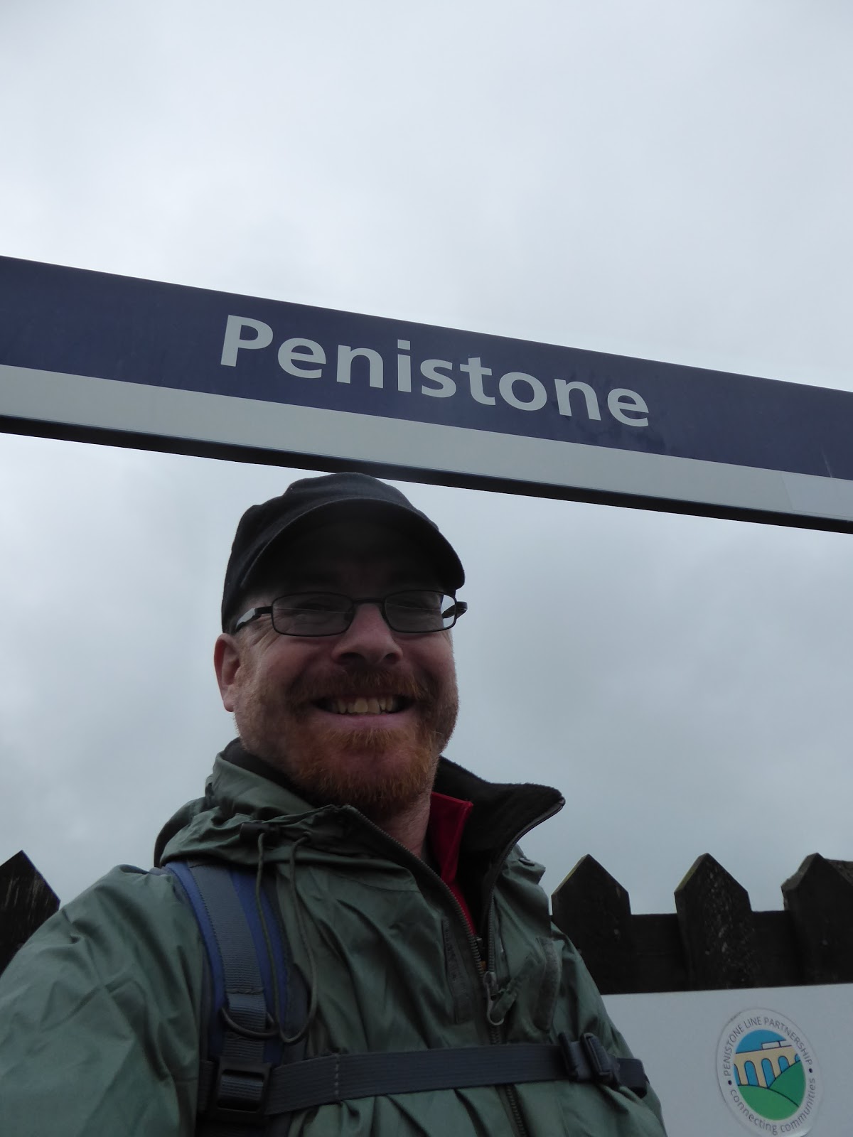 |
Long Distance Trek
means Selfies!
#3 at Penistone.
|
It's a weird feeling to organise a holiday for the family without having Dad around to enjoy it too, but after his passing getting away for a week was one of the first thoughts for the future that Mum and I shared, and with a legacy having come my way, affording a few weeks away over the coming years shouldn't dent my finances at all, and as Mum has gotten her driving confidence going again, added to getting herself a sat-nav app, her being my taxi for a week of walking across Derbyshire should be as straightforward as is possible. Getting going is the first order of business then, leaving Morley at ouch o'clock in the morning, and leaving Mum as custodian of my flat and the baggage as I make for the trail that will link my local wandering fields to the Midlands, which probably aren't as far away as my brain would think, riding the rails and cursing this month of May that still hasn't brought any consistently decent weather, arriving at Penistone for an 8.45am jump-off, under gloomy skies and clouds that look like they could threaten rain at a moments notice. We thus start our resuming path into the unknown by slipping onto the Trans Pennine Trail path which heads south of the station and reveals the platforms of the former MS&LR Woodhead route, which were coated in trees when we visited in 2014 and haven't seen a regular passenger service since 1970, and we then slip down Eastfield Avenue to make our way through the town, rising among the terraces on Church Street to pass around the other side of the parish church of St John the Baptist. Land on the High Street opposite the pubs and the Co-op, and am struck that folks seem to already be out in force despite the early hour and we press on south as the stone houses slip from townhouse style to a scale more modest, and occasionally rural before the lane takes a dip and slips solidly into suburbia, gaining the name of Mortimer Road as it goes. The rise away from the Don valley resumes as we climb towards the bottom end of town, and there's more to Penistone than you'd expect clearly, meeting the council estate at Cubley, right about where the Barnsley district bus terminates and we start to slip into the countryside, past the Cubley Hall hotel and pub, and into the elevated fields that lie beyond, shrouded in an uninviting grey haze, which sadly gives us little by way of gaining a contextual view into the landscape around-abouts.
Saturday, 26 May 2018
Leicestershire Round #3 - Somerby to Hallaton 24/05/18
12.7 miles, via Owston (& the Woods), Withcote Hall, Launde Abbey, Ridlington Ridge,
Belton in Rutland, and Allexton.
 |
| Long Distance Trail means selfies! #3 at the Stilton Cheese inn, Somerby. |
You will know that it's not my nature to walk on consecutive days, but my rescheduling of my walking days has given me opportunity to get in a third day when I'd only intended to walk two, though the Friday weather looking like hot garbage means that I have to get out on Thursday morning, not quite with the lark like the preceding trips, but early enough to tend to the pressure blister that I've developed on my right sole, so padding is applied and we return to High Leicestershire with the feeling that could get painful. So on the my third leg of the Round and the guide's fourth as the parental Taxi drops me off at the Stilton Cheese inn in Somerby at 9.05am with village looking a lot less bright beneath overcast skies and it's off down Manor Lane on a southwards track, with foot injury in tow as we pass the Manor Farm and note the new build houses that perfectly complement their surroundings before we push out into the countryside, fully intent on passing this way again. There's a pretty heavy mist hanging over the eastern county, and once we hit the edge of the high plateau that's home to both Somerby and Burrough, there's not much of a view to see, so the path descends one of the many stream grooves down the hillside, away from another large dairy herd, and on up another landscape rise where there's a staring bench on the field boundary, from where there isn't much of a view in the direction of Tilton on the Hill. Then on, down past plantation that isn't on the map or in the guide book, to meet the stream crossing by a very old sign pointing to the "Leic's Round", and join Newbold Road, which is rising hard surface that takes us uphill towards Owston, which was once home to a monastic foundation, since vanished but living on in the name of The Priory house, next to St Andrews church, with the rest of the small village strung out along the Main Street. Pass the village pump, nicely preserved and on to the cluster of very rustic farmsteads at the bottom, and then on to the farm track that leads on towards Owston Woods, concluding by a large open field with many cows in it, and with the way out not visible, so that doesn't make for the easiest going as I start to feel like I'm going on one leg. I pass through untroubledthough, and the ancient woods spread out ahead, a couple of fields distant, but there's a lot of grass to cover to get there, downhill and uphill with little other landscape context to see aside from Owston Wood Road as we approach.
Friday, 25 May 2018
Leicestershire Round #2 - Rearsby to Somerby 23/05/18
15 miles, via Thrussington Mill, Hoby, Rotherby (sorta), Frisby on the Wreake, Gaddesby (sorta), Ashby Folville (sorta), Thorpe Satchville, Burrough Hill, and Dalby Hills.
No walking opportunities for Monday or Tuesday, as I'm more useful to aid My Parents on a trip to the hearing aid clinic on one day, and to accompany them to the church lunch club on the other, though the heat and sunshine seem to have retreated once Wednesday comes around, but the cue to get back onto the trail comes once time is freed up again, through the part of the Leicestershire countryside that feels most familiar to me. So my leg #2 starts, aiming at taking in the remainder of the guide's second and all of the third as I strike into the East of the county from Rearsby village, starting out from by the Packhorse bridge of 1711 as the Parental Taxi drops me off at 8.15am, under glum skies with a sharp wind blowing from the northeast, and the path leads us over the bridge, past Manor farm and up to the Church of St Michael & All Angels, and deciding that I'm feeling under-dressed as I sneak the paths from the suburban enclave of Church Leys and down past the Sisters of St Joseph of Peace convent. The waterproof is donned as a windcheater as we meet Station Road, and I'll wander slightly from the Round path to see the still-considerable remains of Rearsby Station, where the Cross-Country services now run over the level crossing without stopping, and only the mildest of trespasses is needed to get back on the right track, meeting the Round path by the foot-crossing for a field walk in the direction of the River Wreake, well away from the large dairy herd in the fields below Thrussington. Hit the riverbank after passing over three plots, finding the channel can look more like a stagnant ditch in places, but find it looking more active as we approach Thrussington Mill, where a canal-style bridge takes us over the channel of the river and the remains of a lock chamber, evidence of the Melton Mowbray Navigation, which canalised the Wreake from 1797 to 1877, noted before we pass the mill itself, firmly in the grip of a makeover to make it more like its neighbour downstream. From the driveway, it's back to field walking, through bouth cultivated fields and rough pasture, heading upstream and not really getting any aspect that would suggest we are at the bottom of a river valley, and also feeling no joy towards the wind as it keeps the early going cool, as we come up to Lodge Farm, and its enclosure of Christmas trees, which I always seem to forget have to be grown anew every year.
 |
| Long Distance Trail means Selfies! #2 at Rearsby Packhorse Bridge. |
Monday, 21 May 2018
Leicestershire Round #1 - Newtown Linford to Rearsby 20/05/18
14.7 miles, via Bradgate Park, Woodhouse Eaves, Swithland Reservoir, Mountsorrel,
Cossington, and Ratcliffe College.
Spring Jollies time, and the days of getting away to a fresh trail in the countryside are sadly done, as My Dad is no longer able to travel as he continues to struggle with the onset of Parkinsons Disease, and thus my holiday breaks this year will be spent in The Old Country to lend him some extra company and to be an extra pair of hands and ears around the house for My Mum, a sequence that will finally give me an opportunity to tilt at the Leicestershire Round. Devised by the county's Footpath Association in 1987 and standing at 100 miles long, it will be the longest trail that I have attempted so far, and its circuit is relatively accessible from our base in Humberstone, though the guide's division of the route into ten legs seems a bit modest, so I boldly figure that it can be easily done in seven, and that's the plan that I have in mind as the Parental Taxi drives me out to Newtown Linford for a very early start on Sunday morning, planned as such so that I might be of maximum use to My Parents on my non walking days. Pass through Newton Linford village to get dropped off at just after 8.15am in the Bradgate Park car park, and we are certainly not the earliest starters out here as joggers and folks gathering for the Emergency Services day already crowd the tarmac, and as we have no distinctive route marker to indicate the Round's start line, I'll set out from the main gate to head on into the park itself, along the side of the stream that flow eastwards, in the shadow of tall trees and outcrops of granite. Immediately get entertainment from the herd of juvenile Red Deer, retreating across the track and stream from the main park into the deer enclosure as we march on towards Bradgate house, the home of Lady Jane Grey, and the Earls of Stamford, and notable as one of the oldest all-brick stately homes in the country, now ruined but preserved along with the rest of the park for the people of Leicestershire in 1928, thanks to the generosity of Charles Bennion of British Shoe co. Naturally the route takes us uphill immediately from here, up past Bowling Green Spinney and through the recumbent herds of Fallow Deer to rise to Charnwood Forest's most notable hill, where the Old John Tower sits atop it, not the sort of climb the body wants as the heat of the day comes on already, but it's alway good to be up on this granite top to take in the view around the county from 212m up, even if there's way too much morning haze to see much all that clearly in these conditions.
 |
| Long Distance Trail means Selfies! #1 at Bradgate Park, Newtown Linford |
Sunday, 28 May 2017
Nidderdale Way #4 - Bewerley to Ripley 26/05/17
13.4 miles, via Nought Moor, Guise Cliff, Heyshaw, Dacre Banks, Darley (station),
The Holme, Swarcliff, Birstwith, Hampsthwaite, and Clint.
There's not going to be a third rest day on this trail, as four days of walking doesn't fit well into seven when two are needed for travelling, and it would be impolite to leave my parents at a loose end so I could finish this on my preferred day of Saturday, and so leg #4 follows immediately and despite plotting so the two shortest days come at the end, I'm still going to nab a lift in the Parental Taxi to the Turner Bridge junction, as I'm in no mood to do an extra half mile on a day that promises to be even hotter than the one that preceded it. So off we go, from south of Bewerley to start the concluding stretch of the Nidderdale Way at 9:05am, so early that the morning haze hangs heavily over the valley, and the opening footfalls have us starting out up Nought Bank Road, soon avoiding its sharp twists and ascents by heading into the fields for a more direct route uphill that soon gets the knees and lungs feeling that this final day isn't going to be much easier that others. Pass into the woods that fringe this high hillside, still panting and straining, up to the rough field above, with the path passing an ice house that seems too far removed from anywhere to be useful, crossing the bank road to meet the rise up onto the high moor, with the route guide telling us to look out for the local rock formations as we go, but none would get close to rivalling Brimham Rocks for detail, despite the Crocodile Rock having an accurate name and the Pulpit and Giant's Chair having hugeness. The focal point interest has to be Yorke's Folly, a pair of columns suggestive of ruined abbey, built during an agricultural depression in the late 18th century as a method of keeping local workers employed, now sitting high and sentinel-like above Pateley Bridge to give anyone ascending the hillside an obvious destination on the edge of Nought Moor, interestingly the exact same upland that has Simon's Seat and Barden Fell at its opposite side above Wharfedale, a splendid and desolate space that brings peace and remoteness to this transition away from Upper Nidderdale.
The Holme, Swarcliff, Birstwith, Hampsthwaite, and Clint.
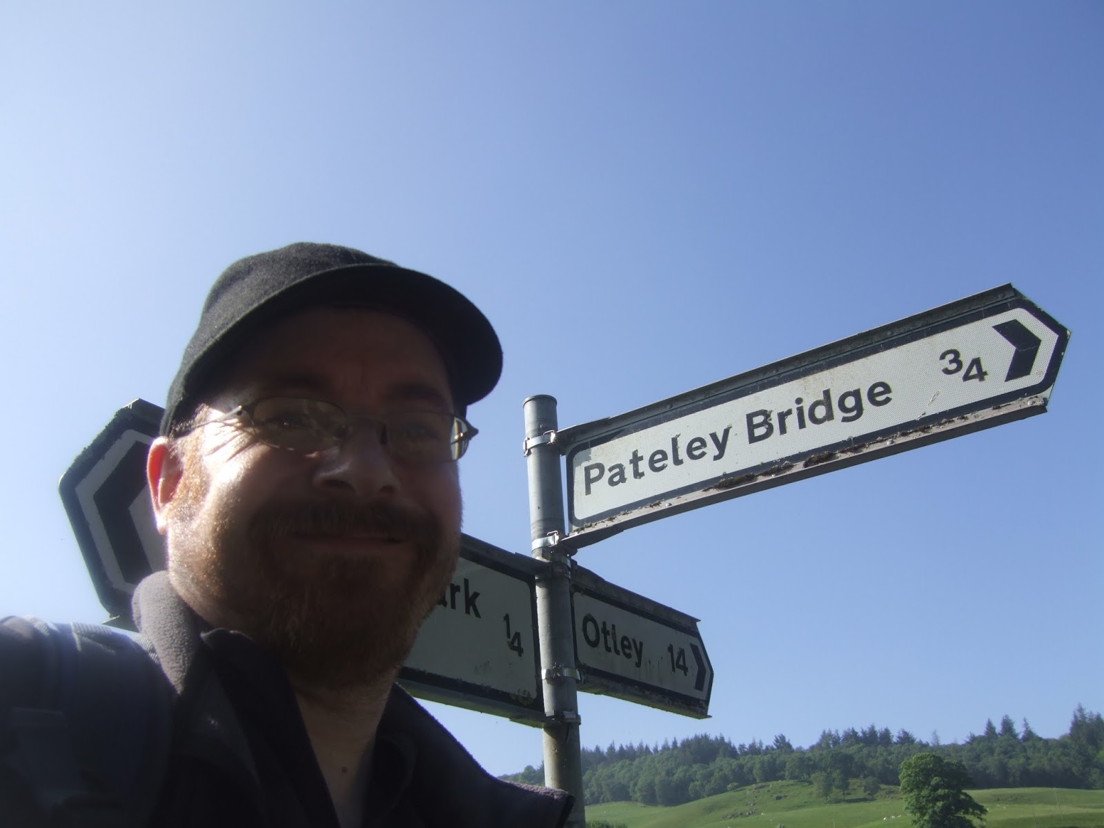 |
| Long Distance Trail means Selfies! #4 at Turner Bridge, Bewerley. |
Saturday, 27 May 2017
Nidderdale Way #3 - Middlesmoor to Bewerley 25/05/17
11.7 miles, via How Stean Gorge, Studfold, West House, Ramsgill, Gouthwaite Reservoir,
Heathfield, Ashfold Side Beck, Prosperous Mill, Brandstone Beck, and Ladies Riggs.
Second rest day is used for that expressed purpose, rest, doing nothing more strenuous than taking a drive out to Brimham Rocks, and to get in ice cream at Birchfield Farm, plus there's also laundry to do, by hand, as we may live in an age of free Wi-Fi but we're not going to pay £6 per load to get our clothes refreshed, so as leg #3 comes around, we're ready as the hot days start to pile up in a way that seem most unseasonal. The Parental Taxi is booked for an early start to drop us in Middlesmoor, the remotest parish in Nidderdale, resuming The Way from the car park above the village, at 9.40am, having encouraged My Mum to get out of the car to photograph the view to the south that she wouldn't have seen otherwise, and thus we resume wandering down though a village that seems far bigger than it needs to be at this remove from civilisation. Maybe all these cottages and farmsteads clustered together so that the citizens of Stonebeck Up parish could gather for solidarity and security in a blasted landscape, having a pub, the Crown, and a church, St Chad's, that seem outsized for a corner so remote, a fine place to visit or to summer in, but not a place to dwell in the rotten quarter of the year when the ridiculously steep road needs to be traversed for access. Onwards then, as the day's peak temperature seems to already be coming on with hours of the morning still to come, enjoying the cooling breeze as a field walk takes us away from the high moors and down in the direction of the hamlet of Stean, not quite getting there as our walk is set to pass over and largely alongside the cleft of How Stean Gorge, where the beck has gouged through the surface gritstone to the limestone below to shape a sculpted channel in the fashion of The Strid, albeit much longer. It's not easy to photograph from the lane, as Spring foliage keeps it well covered, and the visitor centre is closed for repairs that involve a very large crane that must have required fun and games to get it here, passing on the meet Studfold Farm, which has been made over as a campsite and activity centre styled to educate and entertain young kids about the realities of country life.
Heathfield, Ashfold Side Beck, Prosperous Mill, Brandstone Beck, and Ladies Riggs.
 |
| Long Distance Trail means Selfies! #3 at Middlesmoor. |
Wednesday, 24 May 2017
Nidderdale Way #2 - Pateley Bridge to Middlesmoor 23/05/17
14.9 miles, via Wath, Gouthwaite reservoir, Bouthwaite, Lofthouse, Limley, The Edge,
Woo Gill, Scar House reservoir, and In Moor.
First rest day of our jollies is used for just that, rest, with no more strenuous activities going on than getting supplies in from the Dales Market store at Bridgehouse Gate, or getting an afternoon brew in the Pancake House in Pateley Bridge, so when the big day on the trail, comes up I feel about as fully charged up as possible, and apt to get some of this slightly excessive holiday diet burned off, and there isn't even great need to hurry as the start line is only a five minute drive distant. So onwards on a northward track for the day, departing from the Nidderdale Way sign at the bottom of Pateley Bridge's High Street at 9.25am, and approaching the River Nidd up close for the first time, and finding that Pateley's bridge is impossible to photograph satisfactorily from either side, turning to Mill Lane and wander past the flood walls (thinking that you rarely hear about this river inundating anywhere), passing behind the gardens of The Sidings and finally making our acquaintance with the riverbank, already looking idyllic in the sunshine. To mix in with our river walking, we also get some railway walking to do, as our path follow the low embankment of the Nidd Valley Light Railway, built in 1903 as a narrow gauge line to facilitate the construction of the reservoirs up the valley by the Bradford Corporation Waterworks, and converted to standard gauge in 1907, transporting men and machinery until closure in 1936 with the completion of the works, having never made as a viable regular line. It gives us a good firm path to follow away from Pateley Bridge, soon retreating into the landscape, with no good sight of the Scott Gate Ash quarries or their incline up the hillside gained as we push on following the riverbank and the river's quiet murmuring, getting very few looks to beyond the south bank, shrouded in trees and continuing on the railway alignment as it drifts from the riverside to offer a substantial retaining wall in the woods between Low Green house, pressing on through the fields of pasture and sheep, far below the high north side of the dale.
Woo Gill, Scar House reservoir, and In Moor.
 |
| Long Distance Trail means Selfies! #2 at Pateley Bridge. |
Monday, 22 May 2017
Nidderdale Way #1 - Ripley to Pateley Bridge 21/05/17
14.2 miles, via Cayton, Shaw Mills, Woodfield Mill, Brimham Lodge, Brimham Moor,
Smelthouses, White Houses, Blazefield, and Knott.
'One does not simply walk into Nidderdale.' I remarked a few years back, rather dryly, and that still seems to be the case in 2017, as Spring Jollies roll around again, and I have to rely on the Parental taxi to drive me out to this most hidden of Yorkshire's dales, not much above an hour's ride away from home but a real challenge to access on foot or by public transport. So here we set ourselves up at Bewerley Hall farm, in Barn Owl Cottage, just across the river Nidd from Pateley Bridge, a nicely spacious let that might be comfortable for us all, especially for My Dad as his mobility issues have not improved over the last year, with the next Long Distance Trail on the slate, selected as it is the closest available path to home, straightforwardly do-able without requiring My Mum to put in hours of driving on my behalf. After bedding in on Saturday, our trail can get going from Ripley, at the easternmost extremity of the trail, and only a few miles distant from Harrogate to remind us that we really aren't all that far from home, getting dropped off among a tonne of visitors arriving for an equestrian event in the castle grounds, at a rather early hour on a Sunday Morning. Pick up the path at 9.55am by the Medieval cross in the village square, which with the castle and church, is one of the few ancient survivals in a village that was completely rebuilt in the early 19th century by the Lords of the Manor, the Ingilbys, after the fashion of an Alsatian village, apparently, complete with an Hotel de Ville, and thus looking like a slightly more Gothic variant on Harewood to my eyes. Main Street leads us to the B6165, telling us that its less than 10 miles to Pateley Bridge from the A61 roundabout, but naturally this trail will be finding us more miles to do as we soon head off into a bucolic landscape along Birthwaite Lane, rising past the farm and barn that share its name, before moving onto a rougher track that follows the field edge and offers faint glimpses across the Vale of York before slipping in to the woods above Cayton Gill.
Smelthouses, White Houses, Blazefield, and Knott.
 |
| Long Distance Trail means Selfies! #1 at The Market Cross, Ripley. |
Saturday, 28 May 2016
Yorkshire Wolds Way #3 - Londesborough to Fridaythorpe 26/05/16
14.2 miles, via Nunburnholme, Warren Dale, Sylvan Dale, Nettle Dale, Pasture Dale, Huggate, Horse Dale & Holm Dale.
Wednesday brings the rain, as is predictable for May, and a rest day is spent with limited activity, like hitting the Woodmansey garden centre for many, many cups of tea, and taking a ride into Beverley to check out the new Flemingate shopping centre and to get in a cut price meal in Prezzo. Rest is good when faced with the glum day that follows, with no chance of the sunshine enjoyed on the first two days, and so the will is stiffened and a determined attitude is donned for a 9.30am start in Londesborough, picking up the path outside All Saints church once again, and determining this estate village as notably desirable in a brick built and Arts & Crafts sort of way, before pressing off north-ish along a lane which seems to lack a name and carries us to the very lowest edge of the Wolds Terrain. Naturally, with limited elevation and grey skies, it's here we find an interpretative board, to point out the sights of Vale of York which are largely hidden by the low-hanging cloud, only Church Hill at Holme on Spalding Moor is identifiable. It's an altogether inauspicious start to the days trail, with only Cleaving Coombe illustrating the scenery you'd expect of the Wolds, and once the next lane has been met and the yard of Partridge Hall has been traversed, we hit a field walk around the low edge of Burnby Wold and the long grass gives the trews a heavy soaking, meaning that spirits start to dip as we meet the rough growth and sketchy path down towards Nunburnholme. It's a village with a stream, and nuns, if the name is to be believed, but we won't be seeing much more of it than a few houses and the quaint church of St James (complete with organ rehearsal!) before landing on another field walk, with more long grass getting me we right up to my thighs, and spirits aren't good as we note that we have dropped well below the expected altitudes of the Wolds and the coming paths are going to feature a lot more uphill trekking.
 |
| National Trail means Selfies! #3 at Londesborough |
Subscribe to:
Posts (Atom)