12.4 miles, via Westfield, Frickley Colliery Park, Frickley (Park & Hall),
Thurnscoe East, Phoenix Park, Hickleton, Barnbrough Park, Barnbrough,
Harlington, Adwick bridge, Adwick upon Dearne, and Dolcliff Common.
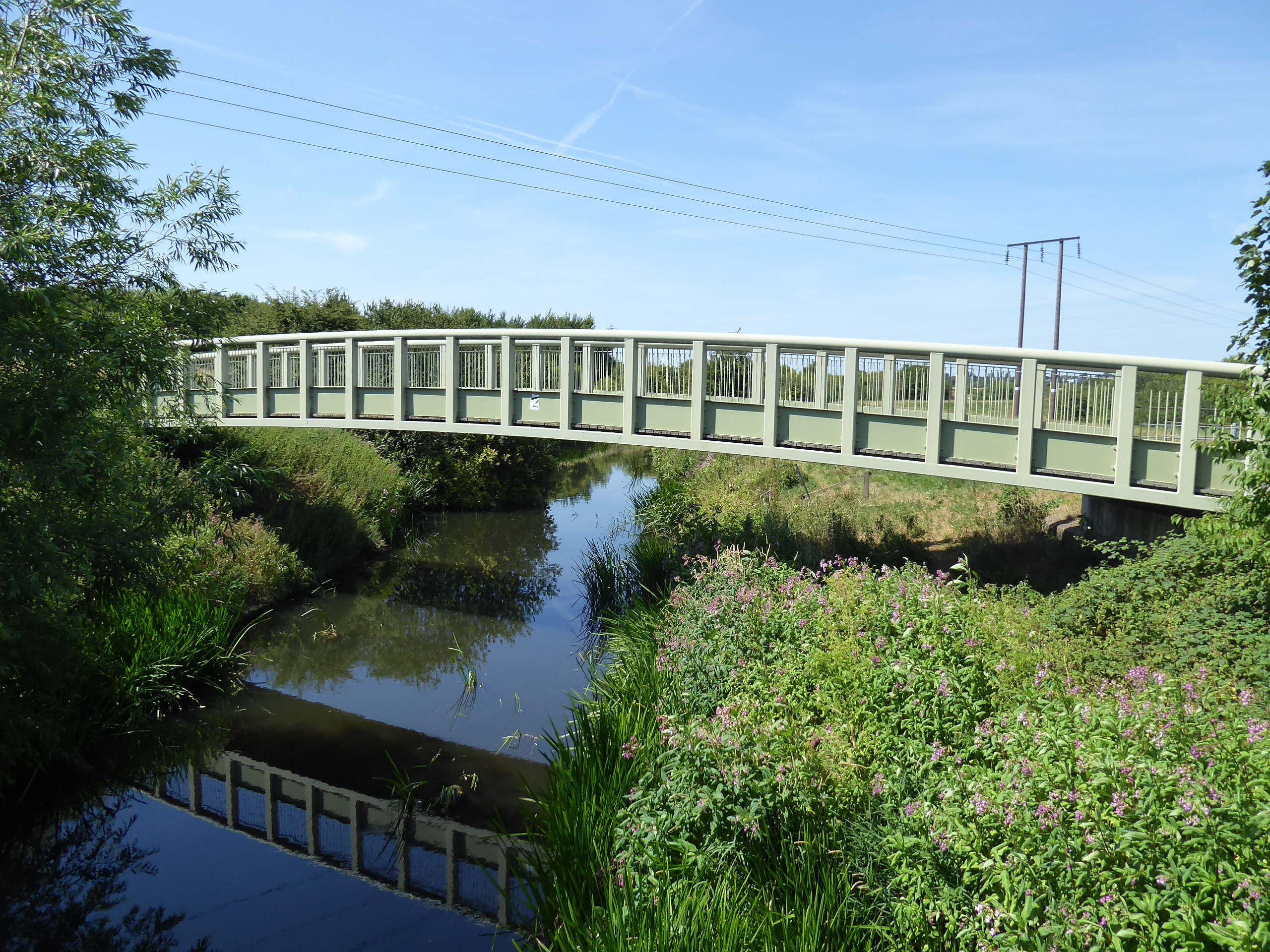
For the third time this year, we're due another burst of heatwave conditions, and once again, they're not due to coincide with the weekend, which is just as well as we could be looking at a temperature spike in the vicinity of 38C at the start of next week, which is far beyond anything I can recall having experienced in this country (or indeed ever, as 35C in Heidelburg, Germany in 1990 is still the startling peak that I remember), and as 30+C over the summer of 2018 proved to be challenging for the seasonal walking experience, contentment can be found that we might still be able to dress normally and not be too anxious when Saturday projects a mere 25C maximum. So no early start is needed as we travel south again, getting ever closer to the established borders of our walking field for our jump off, alighting at Moorthorpe at 9.25am and admiring the under-employed station buildings and negotiating the footbridges to get to the B6422 Barnsley Road, where we strike east towards South Elmsall, passing the cemetery, St Joseph's church and the Kung Fu school, before we strike south between the terraces of Wesley Street, and then elevate ourselves up the side of the playing fields beyond Langthwaite Lane, to meet Westfield Lane by the bowling greens and the Frickley Colliery Welfare cricket club. Tracking south through this elevated urban extension of the three towns mash up, we pass the Junction Inn and follow the lane to its end, where new urban growth has filled up all the vacnat plots north of the Frickley Colliery Country park, where we enter via its original road entrance, tracing the rough track through where the pit head once stood, now utterly obscured by long grass, and our wandering detour to elongate the route starts as we join the long straight and hard path that reaches uphill to the northeast, describing the coal seams as they pass below us, if I'm interpreting them correctly. It's a good space for the locals to exercise as we are led up to the summit of the park, at the top of the old spoil tip, now identifiable with the seven grassy mounds atop it, which we'll pass around with the track as we look over Frickley Athletic FC's ground and over the South Elmsall and Upton villages, with water tower and mast beyond, as we ll as looking to the eastern horizon that we don't know as we come around to the south side, presenting the south-eastern horizon that's we've grown to know over the last month, before we head downhill on the rough, steep track to seek the way out south bound, beyond the wild ponds and the switching-back path.
 |
| Moorthorpe station in the Summer sunshine. |
 |
| Wesley Street, Moorthorpe. |
 |
| The Junction inn, Westfield Lane. |
 |
| The bottom of the long path, Frickley Colliery Country Park. |
 |
| The top of the long path, Frickley Colliery Country Park. |
|
 |
| The mounds atop the spoil tip, Frickley Colliery Country Park. |
|
 |
| The descending path, Frickley Colliery Country Park | .
| |
The Frickley Lane bridleway is found beyond the end of the old railway spur off the H&BR Wath Branch, and the Wakefield Way route, sending us back into the unknown as we trace the long farm track south, passing into South Yorkshire and Doncaster borough and getting some very welcome shade on the eastern side as we go, passing among the wheat fields and hedges to meet Frickley Park beyond the Park Cottages, with the track hardening as we observe its old hall and farm lying to the east and its new Hall being found ahead, passing between it and the stables block (and walled garden) and through the woods towards Frickley farm, while wondering if the scattered hamlet of Frickley is really a place at all. The bridleway route south pulls us off the tarmac to get us field walking, tracing the boundaries as we shadow the Swinton & Knottingley line at a field's distance to the west of us, tucking it into our walking field as we come down across Church Field Lane, the way to nearby Clayton, and then start taking more interest in the eastern landscape as we press on, noting All Saints Frickley in its isolated location and looking up to the wooded nab of Watchley Crags above the golden fields as we ponder how much of this we might venture toward in the remainder of this year, also spying Hooton Hall while a familiar water tower and mast arrive back on the northern horizon as we rise. Arriving north of Thurnscoe, we find a landscape of old tracks among the fields criss-crossing the landscape on the top edge of the Dearne valley watershed, with Stodfold Lane, Street Balk and Chapel Lane having their rough passages trod between their wild hedges before we meet the infilled passage of the H&BR Wath branch, shadowing the extant railway and the western edge of the Thurnscoe East council estates, which we'll enter rather then press south though the long, dry grass, to enter Barnsley borough again and find pavements under our feet as we press on down Briton Street and Deightonby Street.
 |
| Finding the shade on Frickley Lane. |
 |
| Frickley Park and Hall. |
 |
| Field Walking by the railway. |
 |
| Watchley Crags. |
 |
| Street Balk lane. |
 |
| Deightonby Street, Thurnscoe East. |
Windsor Street projects us out of the estate and onto Station Road, just east of the present Thurnscoe station, but across the B6411 we can find the Station House nursery and the site of the H&BR Hickleton & Thurnscoe station which served the villages in the early 20th century, which is passed through as we come down to Barrowfield Road, where lines into Hickleton Colliery once led, while beyond we can find Phoenix Park, which occupies the site of the tips to the south of it, with a field of sculptures and perambulation paths being passed through at the western end, before we rise to a view up the Dearne valley, beyond Goldthorpe's rooftops. Joining the hourglass shaped path among the landscaped woodlands above, we need the find the sole sheltered bench for lunch and watering, as well as changing hats so that we might not bake in the afternoon heat, before we make our way eastwards across the top of Phoenix Park, as the wide boulevards offer no shade at all, and a way to the summit needs my newer E278 map to guide me, finding the toposcope with only the southeastern vista being visible among the trees, as well as sneaking Barnsley briefly into the western distance before we are drawn downhill towards the northeastern corner of the park, sharply downhill, without shade here either, despite the trees. Land on the B6411 Lidget Lane, and back in Doncaster borough, by the junction of Chapel Lane, showing that we've enjoyed a bunch of digressions to take in Phoenix Park as the time window for the day easily allowed for it, pressing east still as we rise among the fields, acknowledging that combine harvesting is already going on as we press uphill towards Hickleton village, which arrives almost as suddenly as the A635 Doncaster Road does by the revived stump cross, built in yellow sandstone and looking like something right out of the Costwolds, and it's fascinating to note how the South Yorkshire coalfields dwelt adjacent to country villages that have retained their idyllic aspects against the odds.
 |
| Hickleton & Thurnscoe H&BR ststion site. |
 |
| Phoenix Park, on the Hickleton Colliery spoil heap. |
 |
| The hourglass path, Phoenix Park. |
 |
| The upstream Dearne valley view, Phoenix Park. |
 |
| Phoenix Park, from Lidget Lane |
 |
| Doncaster Road, Hickleton. |
We pass into the churchyard of St Wilfred's, noting the memento mori of human skulls in the lychgate and admiring the level of decoration on the exterior before we pass out onto Hickleton Lane, landing between another village cross and the gatehouse of Hickleton Hall, which is itself encountered as the road south passes through the ha-ha ditch, so as to not interrupt the east vista, which is revealed to look towards Doncaster and the eastern flatlands as we spy it beyond Lawn Wood and the Bothy cottages, before we pass through the woodlands that bound the eastern edge of Barnburgh Park, which may or may not be an entirely separate estate from its neighbour. The full bore of the day's heat comes on as we drop back into the passage across the Dearne valley, approaching the village of Barnburgh, and finding that it has benches in the pinfold with a view as we land at its suburban top, where we can pause to refuel and ponder just how hard the heat is working on me after so many cooler days on the trail, before we head off again, feeling steeled as we pass down to the rural vintage end of the High Street and come down to the tangle of the converging local lanes, by the Coach & Horses inn and across from St Peter's church, towering above the crossroads. Passing the church fete in full swing, we follow Church Lane as it leads us down to Hollowgate, through the suburban enclaves that have merged Barnburgh with it neighbour of Harlington, which isn't really seen as it has back gardens only facing the lane, while my attention is drawn to the passage of the Dearne Valley Railway line across it, as well as finding the winding wheel memorial to Barnbrough Colliery, which once sat to the west, ahead of the level equestrian fields and the passage down to the river Dearne, bounded by high flood embankments and offering a safer passage away from the road and Adwick Bridge, if we'd known about the Trans Pennine Trail route, or the Adwick Washland RSPB site.
 |
| Hickleton Hall, and the Ha-Ha ditch. |
 |
| Barnburgh Park woods, Hickleton |
 |
| The pinfold with a view, Hickleton Road, Barnburgh. |
 |
| St Peter's church, Barnburgh. |
 |
| Harlington's back gardens, Hollowgate. |
 |
| The River Dearne at Adwick bridge. |
Pacing the tarmac was what we chose though, and it will have to suffice as we press across the valley floor, along Harlington Lane and along the periphery of the reclaimed colliery tips on Bolton and Adwick common, before we rise up to meet Adwick upon Dearne, a very modest village that seems to have very little of vintage beyond the Manvers Arms and the War Memorial, while the turn up Crow Tree lane reveals it isn't very extensive either, and we are soon onto the Adwick Road which runs above the valley, offering a view back towards the parklands that we traversed about, as well as towards Goldthorpe, before the hawthorn hedges return to spoil the aspect. We are now on the approach to Mexborough, soon found beyond the parched-looking fields, with the views over the Dearne valley resuming over the community allotments, and suburbia arriving on the western roadside before we come down the surprisingly extensive site of the Montagu Hospital, which reveals that I have no real knowledge of the vintage or extent of this town, sitting that bit too far outside my regular travelling radar, which reaches off to the east down every street end passed as we traverse over the subtlest of hilltops on the old Dolcliffe Common, before declining down past the Co-op store to meet the island by the police station on the A6023 Doncaster Road. We'll slip off the town bypass as it passes below Bank Street, which perches itself above the River Don and leads us towards the Mexborough main street, which seems very quiet for a Saturday afternoon, though most of the business seems to be going on in The Pocket sports bar, as well the Montagu Arms and the Old Market Hall taverns, where we turn down to cross over the Greens Way road and down Station Road, over the Don Navigation channel and past the static caravan park, to meet Mexborough station, undoubtedly the best appointed small town station to be found in the county, with it main buildings fully intact despite the modest service and usage on the Sheffield - Doncaster line where we wrap the day at 2.45pm.
 |
| The Manvers Arms, and the War Memorial, Adwick upon Dearne. |
 |
| The reverse horizon, from Crow Tree Lane. |
 |
| Montagu Hospital, Adwick Road, Mexbrough. |
 |
The Dolcliff Common Co-op, Adwick Road.
|
 |
| Bank Street - High Street, Mexborough. |
 |
Mexborough Station in the Summer Sunshine.
~~~ |
 |
| Finally landing on the banks of the River Don. |
As we're ultimately 35 minutes ahead of the train's arrival, a cool waiting room is most welcome after a long, slow day on the trail, where we might actually chill down before we go on a short venture to stand on the banks of the River Don, a gnat's crotchet away to the south, before the party express arrives to take us Doncaster bound, through the landscape that the Summer walking season for 2022 will hopefully be delving into further, spotting us four future destinations along the way of the first two legs homeward (with a rare express train ride along the way) while realizing we're deep into the unknown in this southeastern quarter.
5,000 Miles Cumulative Total: 5673 miles
2022 Total: 388.3 miles
Up Country Total: 5,196.3 miles
Solo Total: 5341.4 miles
5,000 in my 40s Total: 4266.8 miles
Next Up: A big Viaduct, and a Castle, on the downstream Don Valley horizon.


No comments:
Post a Comment