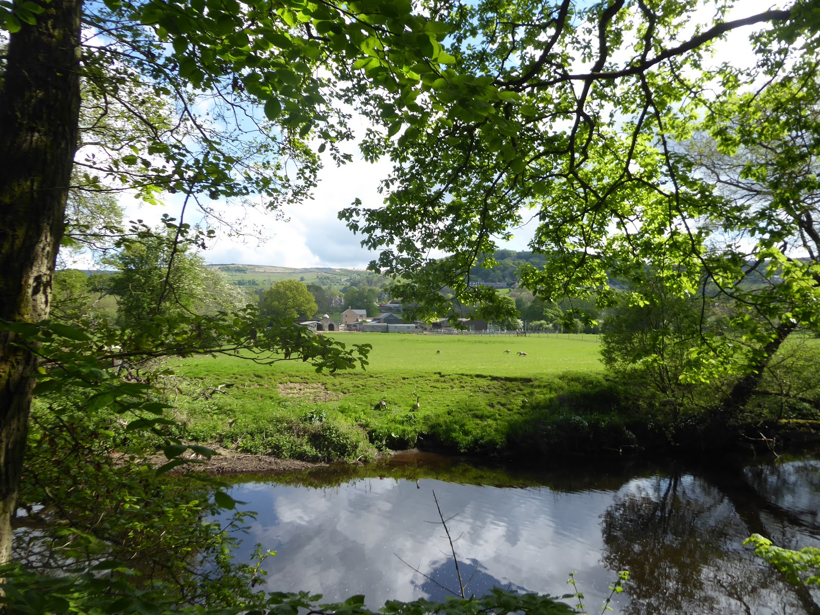
Sunday makes for a nicely chilled out day away as we spend it settling into our rather curious cottage in Winster, one which has two double bedrooms, a dining room that seats six, but a living room with only space for two armchairs, so it'll be fine for Mum and myself to fill for the week, and the village itself has a tonne of charm, with many stone cottages crammed together on its hillside, largely borne of the lead mining industry and sat around the National Trust's very first property, the 15th century Market Hall. Thus relaxed, we are ready to go again on Monday as the weather showed a marked spike in improvement, tootling our way back up to the Hope and Derwent Valleys to resume the trail, not getting out quite as early as I'd would have liked, due to Mum accidentally breaking our cottage's shower, and me managing somehow to successfully fix it, landing us at Bamford station for a 9.30am start, hopeful that I haven't seen too much of today's passage already on our way back. Anyway, I can guarantee that this will be a much shorter and gentler trip than Saturday's escapade, as we make our way back over retraced steps over Mytham Bridge and past the Hope Valley Garden centre to resume the Derwent Valley Heritage Way, at Shatton bridge, leading into the dead-end village of Shatton and taking us over the lowest crossing of the River Noe, the main watercourse of the Hope Valley itself, which flows to our left as we pass around an equestrian paddock as we make for the Derwent's bank. Where the Noe converges with the Derwent is where the latter becomes considerable, as both drain an extensive area of moorland, and thus we have a large channel to follow as we join the undulating an occasionally high bank of the river, skirting along the edge of the broad pasture below the rises of Offerton Moor to the south, following it around Kentney barn before we get a reveal of the local Dark Peak company behind us, with Lose Hill and Win Hill flanking Crookstone Moor, the eastern edge of the Kinder Scout plateau. Bamford Edge also muscles into the view as we press on, but there's not so much to see going forwards as the bank gets tight and undulating until we get a reveal of the hillsides above Hathersage, a proud Derbyshire village that looks like it will remain completely unseen from this trail, hidden away on the north-eastern bank, with only signage indicating its presence somewhere beyond the coverage of trees and the string of stepping stones.
 |
| Shatton Bridge, on the Noe. |
 |
| Lose Hill, Crookstone Moor and Win Hill, with Kentney Barn. |
 |
| The Hathersage Stepping Stones, on the Derwent. |
We're definitely making a transition out of the Dark Peak landscape as we go down here, as the last moors of dull coloured grasses pass behind us to be replaced by more verdant colours and thick woodlands on the rising hills, but I'm no wiser as to where the White Peak starts in this quarter as the hilltops still show up Gritstone crags and heather moors, sights which are lost as we pass through the trees of Goose Nest wood, where we have a thick bank of bluebells on the slope above and a carpet of wild garlic on the slope below. Hints of Hathersage have been had on a few angles once we come upon the pasture again, but we'll not get any closer than Leadmill Bridge, not too far down the B6001 from David Mellor's cutlery factory, and that's be our first crossing of the Derwent as we shift onto the eastern bank, which slips us away from the river slightly, on the track past Leach House farm and the local waterworks, slipping us below the high embankment of the Hope Valley line as the river and the way take a definitively southward shift. We thus move into a narrower valley space, with the hard track enduring all the way to Harper Lees house, where we join the pasture walk again, down to the riverside below the looming slopes of Gorsey Bank and Fallcliff Woods on the high banksides, before we disappear beneath the cover of Coppice wood, where relief from the heat of the day is most welcome before we return to the open pasture below Upper and Lower Padley, with the mass of Froggatt Edge rising ahead of us. Ploughing on among the greenery means we have to stay alert for the views and remembering to look up and back at the crags prominent above this eastern bank of Gritstone, noting the mass of Millstone Edge behind us and crag above Hay Wood ahead, something to distract us as the way moves from the river bank to head towards the B6521 in a roughly straight line, landing us upon it downhill from the Padleys and across the river from Grindleford (which is incidentally nowhere near its railway station), whose bridge we well see but not cross, next to its toll bar cottage.
 |
| The Derwent in the proximity of Hathersage. |
 |
| Leadmill Bridge. |
 |
| The way down to Coppice Wood. |
 |
| Froggatt Edge on the horizon. |
 |
| Toll Bar Cottage, Grindleford bridge. |
Thus we briefly touch an urban-ish landscape before returning to the pasture, pressing away from the riverside once more, through fields managed as a reserve for ground nesting birds before we enter the National Trust's Horse Hay Coppice and Froggatt Woods, where there's only the most notional border between them, but we get some cooled down solitude away from the river for the necessary consumption of elevenses, which is really an early lunch, before we gain a flagged path amongst the boulders and bluebells on the woodland floor. We also discover the most delightful little water hole along the way, pooled on the stream that flows though the woods, and find we've gained some height above the river once we emerge from under the green canopy, some 30m above the river, which afford us views towards Stoke Woods and feels like a lot of height gain on a trip that's notionally all downhill, as we're deposited among the sheep pastures once again, gradually following the track as it settles into an established path, Spooner Lane. It gradually gains integrity as it leads towards Froggatt, landing us in this village which looks for all the world like a Peak District idyll, marking our first significant stretch of civilised contact since we set out today, and it looks like I've got it to myself as we pass in front of the parade of cottages down to the corner of Hollowgate by the particularly austere Wesleyan chapel, and on past the Home farm down to Froggatt bridge, which we'll pass over to attain the western bank of the Derwent. Pause under the tree cover to admire its pair of asymmetric arches, before setting off again, finding that the river has become unusually placid and broad at this juncture, and the level going means we can move on at a pace as the fields on the western banks rise in a riot of pasture colour, another reason to be happy to be out travelling at this point in the season, before we shift into a wilder bit of managed wetland, where we have to deviate some from the riverbank to cross Stoke Brook. We then come upon the A625 crossing New Bridge, where we cross the roads but not the river, having gained a direct look up to the crags on Curbar edge, high over the east bank, and as we join the hard track beyond the explanation for the stillness of the river is revealed as we align alongside a goit channel and the Derwent spills heavily over Calver Weir, and it's also worth noting the flock of sheep and lambs having a happy old gambol in the narrow sliver of fields between the two water courses, as we pass by.
 |
| Froggatt Wood. |
 |
| Across the Derwent to Stoke Wood. |
 |
The Wesleyan Chapel, Froggatt.
|
 |
| Froggatt Bridge. |
 |
| New Bridge. |
Sticking by the millrace is easy to do when the correct path moves away from it and we have to make an emergency course correction to avoid wandering through the oncoming caravan site, cutting over the field to the gate that leads through the yard of Stocking Farm, which is notable for its curved end wall on the house and the barn that has spent part of its life doubling as a non-Conformist chapel. Ahead should loom Calver Mills, the furthest upstream of the 18th century mills that were developed to harness the power of the River Derwent, but the vast cotton mill of 1804 is obscured by trees and hedges, and is virtually invisible from all angles as we land in Calver, and even an off route sneak over Calver bridge to the Curbar side of the river doesn't reveal this now contemporary apartment complex in full, with only one edge or its highest storeys visible. There will be more mills in this trail's future, but for now we'll pass out of the North, as we pass under the A623, the road that I marked as the divide that separates it from the Midlands, and I'll consider it the same way now, as we still sit on a latitude north of Chesterfield, and thus Calver passes behind us, having seen little more than a couple of streets of it, taking the path behind some back gardens before we land in sheep pasture again, tracking south as the high wooded bank looms ahead. This eventually squeezes the path into a narrow corner, and we slip into the cover of St Mary's woods, and as the apron of pasture returns at the riverside, we stay at a remove from it, which gives us enough of an angle to look up to the Curbar and Baslow edges, showing their rough Gritstone crags above the valley while I ponder our supposed proximity to Limestone country, gradually working our way back into the fields before striking off to meet Bubnell Lane. This starts us on our longest sustained road walk of the day, rising through Townend Wood and above the course of the river, heading on amongst what feels like the outer suburban edge of Baslow, which starts to expand on the opposite bank, but according to the map, this settlement claims its own identity, and I'm inclined to agree with that assessment as we pass Bubnell Farm, Bubnell Grange and Bubnell Hall on the declining lane, above the long weir on the Derwent that roars away merrily an really has you pondering the wisdom of waterfront living.
 |
| Stocking Farm. |
 |
| Calver Mill, hiding in plain sight. |
 |
| St Mary's wood. |
 |
| Curbar and Baslow Edges |
 |
| The cottages at Bubnell Hall. |
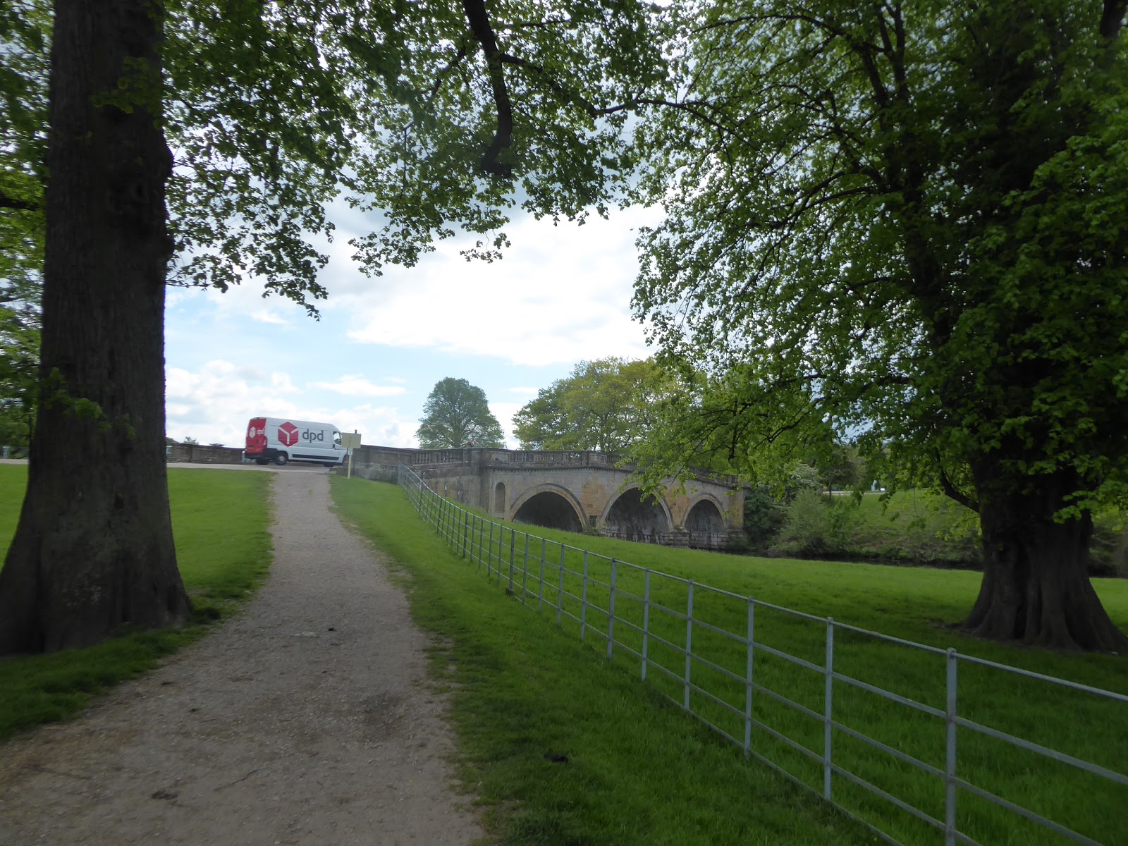
Baslow arrives as we enter its Bridge End via is 17th century bridge, complete with guard hut for the barring of undesirables from the village, landing in the oldest corner of the settlement by its Co-op and galleries, making it feel altogether upscale as we seek a spot for lunch, down by the riverside with the ducks and a fine views of the bridge for company, where an update can be shared with Mum before we make the final two hour push on the day. On to the main road, the southbound A623, taking us past St Anne's church with its 'Victoria 1897' jubilee clock, before we split up School Lane which takes us past the Wesleyan chapel and the village school up to Over End, where the old cottages have piled up to make it look like the modern holiday house corner, and we then pass around the Prince of Wales green to descend Eaton Hill, where suburbia than you could never hope to afford has bloomed, largely on the former site of a Hydro. Land in Nether End, by the Italian Restaurant, and cross the A619 Cock Hill by the village hall and green, noting the establishments up and down the lane that illustrate that Baslow knows which side its bread is buttered on, the Cavendish Hotel and the Devonshire Arms, as this village prospers squarely on its proximity to the Chatsworth Park estate, seat of the Duchy of Devonshire. It's parklands lay ahead, the track towards it lying a little way along Church Lane and over Bar Brook, which takes us past the farmstead and cottage in the estate colours (BR Blue, again) before we meet the Cannon Gate, which allows disabled access into the park while still keeping deer within the wall, and there's a lot of history to unpack in these grounds, the home of the Cavendish family since the middle of the 16th century and to the Dukes of Devonshire since the end of the 17th. The parklands that we pass though were largely laid out at the behest of the 4th Duke in the mid 18th century, under the supervision of the pioneering landscape architect Capability Brown, and the deer still roam wild here, keeping the low branches of the trees neatly trimmed, while a notable remnant of the Elizabethan and pre-Ducal estate can be seen standing sentinel above the wooded hillside to the east, the observatory tower know as The Stand.
 |
| Baslow Bridge. |
 |
| Over End, Baslow. |
 |
| Nether End, Baslow. |
 |
| Chatsworth Park. |
The path runs us up to the White Lodge, the gatehouse to the estates nurseries, now utilised as a campsite, where Joseph Paxton had his house when he served as the 6th Duke's gardener and pioneered the construction of iron-framed greenhouses and other Victorian landscape designs, and as move on past the cricket field, we get sight of Chatsworth House itself, developed by the 1st, 4th and 6th Dukes, one of the grandest in the country, where the residential English Baroque style was developed by William Talman and Thomas Archer, before gaining 19th century Italianate additions designed by Jeffry Wyatville, while out on the front lawn, the recent horse-trialling event is packing up, demonstrating the work of the 11th Duke in opening up the noble estate for public use in the 20th century. We meet Queen Mary's Bower, and then Paine's Bridge, which takes the west driveway over the Derwent, and the path forwards is blocked by the next event setting up, the RHS show which occupies all of the level west bank, which keeps us high on the driveway to look beyond the trees to the 1st Duke's baroque gardens, complete with picturesque cascade to the south of the house, and to see the supremely high Emperor Fountain, installed by the 6th Duke to impress Tsar Nicholas I of Russia, who never visited to see it. Beyond the flower show set-up our interests become altogether more mundane as we lack an obvious clear path forward, as the right of way doesn't follow and existing path, and so we have to head on in a vaguely downstream direction, wondering if the grooves on the ground, the rights of way on the map and directions in the guide book actually align with each other, and thus we do our best to not startle the recumbent sheep as the route by the weirs, the dip of a small stream and the ruins of a corn mill are sought before we land on the B6012 by the estate's gates and cattle grid. We exit after two miles of traversal and the trail leads us to the Calton Lees car park, beyond the estate boundary, where the guide's instructions on how to pass though it are vague, but we do need to take a look at the monument to the 11th Duke, who opened up the estate to the public (and whose praises I have sung at Bolton Abbey already), installed on the occasion of his 2004 death by the tenant farmers with gratitude, before we join the lane that takes us behind Chatsworth's garden centre and on to the hamlet of Calton Lees itself.
 |
| The White Lodge, and Nursery, Chatsworth Park. |
 |
| Chatsworth House and the dismantling horse show. |
 |
| Paine's Bridge, Chatsworth Park. |
 |
| Chatsworth House and the assembling flower show. |
 |
| The Downstream Derwent, Chatsworth Park. |
 |
| The Cornmill, Chatsworth Park. |
This is a most pleasant little cluster of cottages and farmsteads, clearly still tied to the neighbouring estate judging by their colour scheme, perched at a remove from the river in the lower stretch of a steeply-sided side valley, where a holiday home away from it all would be most desirable, aside from the high cost that would contribute to the £4M cost of running the Chatsworth estate. Meet a field walk that ascends us to a view downstream, and over towards Beeley, secluded away in its own spot on the far side of the Derwent, with it's eponymous moor sitting above it, surely the furthest south of the Gritstone band that stretches down from the Dark Peak, and then we head downhill, around the corner of Lindup Wood, which fills up all of the high western bank of the river. We return to riverside pasture for three large fields, where cows graze, and I had thought we might find sheep in all the inhabited plots though today, but the cattle here are as docile as they come and are not perturbed at all by any one in their fields, which is just as well as there's nowhere to hide on the long way down to the toe of Bank wood, which stretches down to the riverside. We gain a track a little way beyond the trees, which will lead us on to the day's finish line, and its been extensively fouled by herding bovines, so it's all a bit stinky in the afternoon heat as we press down towards Rowsley, where we spy St Catherine's church before we pass under Rowlsey Viaduct, where the MR's line from Matlock to Buxton swung over the Derwent to enter the Wye valley, on its way towards Bakewell and the Monsal Trail, the last of the Trans Pennine routes we'll see on our trip Down Country and thence we enter the village along Church Lane, with the wooded cap of Peak Tor ahead of us. Join the A6's pavement to pass the Peacock Inn, and carry on over the Derwent ourselves, where we exit the Peak District National Park, and pass into regular Derbyshire despite there being another day of dynamic landscape to come, ending the day's trip by the former Rowsley Station hotel, the unpronounceable Grouse and Claret, at 3.25pm, before seeking out Mum in charge of the parental taxi, parked at the Peak Shopping Village on the original station site (of three!), where we might seek a well-earned brew at the Italian café, and maybe a bargain at Mountain Warehouse or Regatta Outdoors.
 |
| Calton Lees. |
 |
| The Pasture below Lindup Wood. |
 |
| Bank Wood. |
 |
| Rowsley Viaduct. |
 |
| Rowsley Old Station. |
5,000 Miles Cumulative Total: 3854.8 miles
2019 Total: 204.4 miles
Up Country Total: 3455.1 miles (only 7.8 miles Up Country)
Solo Total: 3564.3 miles
Miles in My 40s: 2448.6 miles
Next Up: Onwards through the dramatic valley where Modern Industry was born.


No comments:
Post a Comment