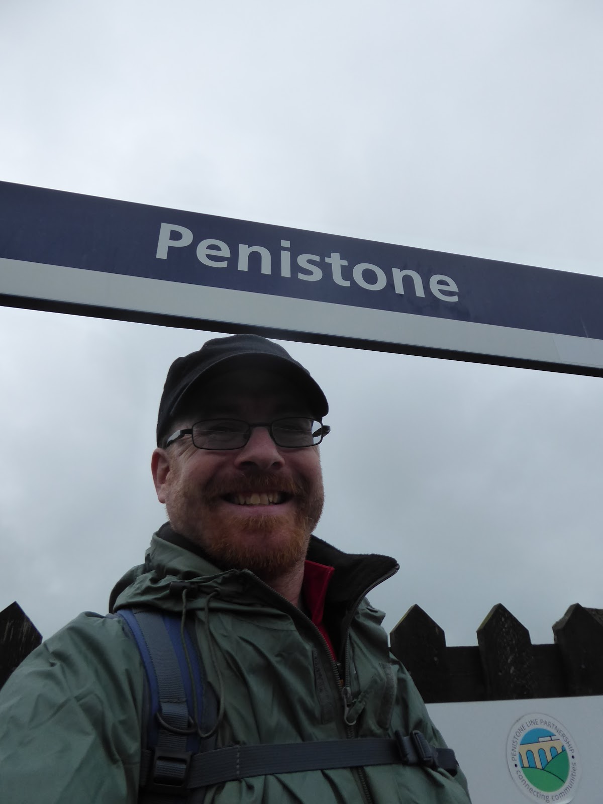
It's a weird feeling to organise a holiday for the family without having Dad around to enjoy it too, but after his passing getting away for a week was one of the first thoughts for the future that Mum and I shared, and with a legacy having come my way, affording a few weeks away over the coming years shouldn't dent my finances at all, and as Mum has gotten her driving confidence going again, added to getting herself a sat-nav app, her being my taxi for a week of walking across Derbyshire should be as straightforward as is possible. Getting going is the first order of business then, leaving Morley at ouch o'clock in the morning, and leaving Mum as custodian of my flat and the baggage as I make for the trail that will link my local wandering fields to the Midlands, which probably aren't as far away as my brain would think, riding the rails and cursing this month of May that still hasn't brought any consistently decent weather, arriving at Penistone for an 8.45am jump-off, under gloomy skies and clouds that look like they could threaten rain at a moments notice. We thus start our resuming path into the unknown by slipping onto the Trans Pennine Trail path which heads south of the station and reveals the platforms of the former MS&LR Woodhead route, which were coated in trees when we visited in 2014 and haven't seen a regular passenger service since 1970, and we then slip down Eastfield Avenue to make our way through the town, rising among the terraces on Church Street to pass around the other side of the parish church of St John the Baptist. Land on the High Street opposite the pubs and the Co-op, and am struck that folks seem to already be out in force despite the early hour and we press on south as the stone houses slip from townhouse style to a scale more modest, and occasionally rural before the lane takes a dip and slips solidly into suburbia, gaining the name of Mortimer Road as it goes. The rise away from the Don valley resumes as we climb towards the bottom end of town, and there's more to Penistone than you'd expect clearly, meeting the council estate at Cubley, right about where the Barnsley district bus terminates and we start to slip into the countryside, past the Cubley Hall hotel and pub, and into the elevated fields that lie beyond, shrouded in an uninviting grey haze, which sadly gives us little by way of gaining a contextual view into the landscape around-abouts.
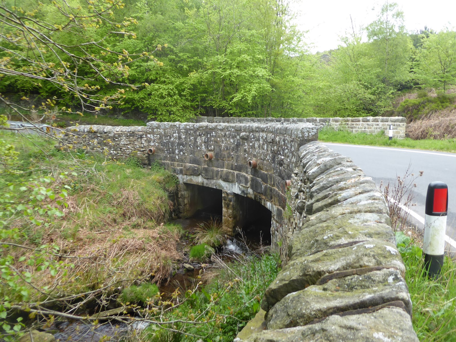
I can be sure the views over the descending Don to the east are fine when the weather is that much brighter, but for now we'll have to steel ourselves against the hiss of fine rain, as the clouds sit barely above the hilltop ridge that we will be traversing, passing through the copse which conceals Cliff House farm, with its yard secreted in a quarry, and snare a view west to Hartcliffe Tower on its prominent hillside, rising with the lane to High Moor altitude, over 300m up, catching sight of the Whitley Heights windfarm before the rain starts to harden. Past the high land and Cranberry Farm, we meet the road crest on Sheephouse Height, where the low portions of the Emley Moor masts peek through the gloom on the northern horizon, as we depart the immediate catchment of the Don as we slip into the next valley down, that of the Little Don or Porter, where we can look east to see the town of Stocksbridge, sitting at a remove form our trail, while we take a westerly tack around the high plantation and past Sheephouse Farm, on the long descent down into the valley, one noted for its reservoirs that we can't see from here. The Dark Peak lies beyond, barely apparent beyond the walls of grey cloud, which has me very glad that I chose this route ahead of the high path over Cut Gate to travel to the Derwent valley, as we pace on down the steep lane, gaining some tree cover as the rain eases off, sliding down past a goat farm to the valley floor, where we pass under the railway line that was built in 1898 to supply materials during the construction of Langsett reservoir, upstream to the west. We then land on A628 in Midhopestones the only notable village that we'll see during the seven hours out from Penistone, which is a very loose association of houses and farmsteads stretching up Mortimer Road, which we follow having passed over the Little Don or Porter and failed to get any view at all to Underbank Reservoir, despite its close proximity rising past Ye Olde Mustard Pot inn, which is currently not in business, rising to meet signage that indicates the way forward to Strines and the Derwent Valley, both many miles ahead of here, which couples well to the fact that we're only three miles out so far, meaning it's going to be one of those walking day.
 |
| Ascending to Sheephouse Height |
 |
| Descending to the Little Don or Porter valley. |
 |
| Mortimer Road, Midhopestones. |
We've now entered Sheffield district too as the ascent away is the first hard test on the lungs and legs, getting 50+m up past Hill House farm as the rain eases off completely, and the going then feels a bit more favourable as we hit a level stretch on towards the moorland edge, winding our way among a few plantations before meeting the continuing rise at the edge of Barnside Moor, where the views down and back are expansive with the crest of Whitwell Moor ahead to the east, and the cloud shrouded Woodhead moors on the western horizons. Past the Wind Hill Lane corner, we enter the Peak District National Park, on the fringe of the Dark Peak's distinct lack of actual peaks, but the promise of enhanced vistas comes with it, as we rise up to Thorpe's brow for our reveal over the Ewden Valley, cresting at 340m up and immediately getting a view down to Broomhead reservoir, largely concealed by the density of trees around it, while the wooded clough of the river forms a ribbon across the centre of the view, coming down from the heather moors to the west, a vista that makes me certain that this was the right way to travel. Our steep and rapid decent takes us through the very loose association of farmsteads that supposedly forms Ewden, passing Cottage and Garlic house farms up close to the roadside (which are surely a proper challenge to dwell in, meeting the first of many cyclists as the road slip steeply down towards the river, hair-pinning sharply as we go down below the foliage before switching back at the bottom where we cross Ewden bridge. A steep ascent follows, against the traffic for maximum security, regaining the height lost over a couple of hundred metres before settling onto a gentler rise, where we get sight of a much more silvery view of Broomhead reservoir, and then pass around the boundary wall of Broomhead park, where the hall hides somewhere behind the walled garden and a bank of trees that eventually conceals all views east, leaving us with little to see as the rising dome of Broomhead Moor to the west offers us nothing.
 |
| Ascending to Barnside Moor. |
 |
| Descending to Ewden. |
 |
| Ewden Bridge. |
 |
| Broomhead Moor. |
Mortimer Road keeps us high, on the moorland edge, which means I can't quite tag Wigtwizzle hamlet onto my walking field, but staying high eventually rewards us with a broader view down the valley of Ewden Beck, and the look ahead reveals a moorland landscape on the east side of the road that looks like it has been heavily worked over in its distant history, covered in mounds that are suggestive of ancient mining, which animates the mind as we elevate towards the next ridge passage, hopeful that the returning drizzle is just a passing shower. Approaching the crest we get our probably last look to the Emley Moor masts, five ridges distant across the Don and Dearne valleys, which means we aren't that local to home anymore as our route meets the edge of the upper branches of the Loxley Valley, where an ancient earthwork, the Tor Dike, sits to divide the watersheds between ancient tribes, and the expanse of the Bradfield Moors fill the western view, the rivers flowing down towards Sheffield and our first proper Peak District edge lands on our southern horizon, which is surely Stanage Edge, sitting sentinel above the Derwent Valley, where we are still headed, once we've broken for elevenses. The route won't be straight forward though, even though we remain on Mortimer Road, as the northern branch of the river has to be traversed and that means dropping down from moorland altitude again, around the fields of the Mortimer House shooting lodge, and down into Agden Wood on a friendlier pitch than the previous ones, though it's quite a long wander to the passage over Agden Dike via the bridge that is too tightly angled to accommodate long trucks, and then the re-ascent follows, and we know that drill by now. Land on the high road, which gives us a view downstream to Agden and Damflask reservoirs, beyond which the city of Sheffield can be sensed down the narrowing valley, though it's a view that's regularly concealed by trees, with the rising moorland of Emlin hill again offering no vistas to speak of, and so we start to feel like it's a bit of a trudge, before we get an interruption for a wooded passage over Emlin Dike, a pretty intermediate stream that doesn't require a crazy descent to get to it.
 |
| Broomhead Reservoir. |
 |
| Tor Dike. |
 |
| Agden Bridge. |
 |
| Agden and Damflask reservoirs. |
So remain high, as we move into the western branch of the river, which calls itself Bradfield Dale, which soon reveals the reservoirs that sit at its base, with the more distant Strines appearing ahead of the downstream Dale Dike, and we follow the road as it hangs above this latter expanse of water, noting the utterly derelict Thornseat shooting lodge above the lane, still commanding a view and only landing in my eyeline as we looked towards the bank of bluebells that sit in front of it. We pass by the dam below before the water surface view vanishes as we pass into Bole Edge Plantaion, which robs us of all contextual views as the trees take over, and it's all private woodland too, so there's nary a trail amidst it to attract the passers-by, just a few tracks to distant cottages among the conifers above the road, and the deciduous trees below it, before we meet the path to the local paintballing facility, the second such one that we've met this year. Before we get into the descent down to Strines Beck, we do get a dynamic landscape reveal though, arriving above Strines Reservoir, which sits below the bare moorland side of Sugworth Edge, on which the folly tower of the neighbouring Sugworth Hall sits, providing a view that deserves a nicer day to observe it, which slips from view as we descend again. This will be the last descent of the day as we cross these many branches of the Don, heading down under the cover of trees on another long angle off our main trajectory to actually make two stream crossing, passing over a clutch of converging becks before we meet the main course of Strines Beck, on maybe the tightest bridge passage of them all, and then we rise again, and I'm glad that's the last of them as I'm frankly done with all the drops and climbs that have come along today's route along Mortimer Road. At the top of the climb out of the clough, we meet an actual settlement, if a cottage, a farmstead and a pub really constitute such a thing, but Strines has the most buildings we've seen at the roadside since we passed through Midhopestones some 4 hours back, and the extensive yard of the Strines Inn will provide us with a spot to stop for lunch and to get the measurement on our progress so far, and as the hillsides above the Derwent start to feel close, the realisation that we could still be three hours out from the end means that there's still no time to waste.
 |
| Dale Dike reservoir. |
 |
| Bole Edge plantation. |
 |
| Strines Bridge. |
 |
| The Strines Inn. |
At least the threat of rain has passed by now, with all the cloud sitting well above the hillsides, and so waterproofs are shed as we set out from the busy car park by the pub to resume the walk on the road, as it attaches itself to the edge of Strines Moor and heads up towards the outer edge of the Don watershed, a gently rising haul that lands Stanage Edge on our forward horizon as we follow a long and angled path, high above Strines reservoir. As the road haul might be dull, the evolving view down is a good one, as the arrangement of the water and the tower above shift around, with Sugworth Hall sitting amidst it all, surely more substantial than another shooting lodge in this landscape that has shockingly little rural activity going on in it, with very few sheep roaming the moors to our west. At least from this moorland edge, we finally get a Dark Peak vista that seems worthy of our proximity, as a look to the north-west shows up the view for a couple of miles, as far as Back Tor, the sentinel outcrop above the middle portion of the Upper Derwent, while the look back beyond Bole Edge teases the path we've already taken, not that it's too easy to unpick, and as our time in the Don valleys concludes we can look to the future of spending time in and around Sheffield to absorb this South Yorkshire landscape further. As we run up to Mosscar, another invisible hamlet, the lane crests at the day's summit, 354m up, and thus we end not just the Derwent valley, but also Derbyshire, where all of the next three legs of my trip to Leicester will fall, as Stanage Edge now dominates the forward horizon, easily close enough to walk onto from here, though our path will finally take us off Mortimer Road, which feels wrong as we are within a half mile of its end, but practical matter rule my head as I have no intention at all of joining the descending and footway-free A57. So we moorland walk instead, joining the grassy track that leads down towards Mosscar House farm, and also lands Bamford Edge and Win Hill on the horizon, a proper peak in the Peak District at last, and something we have clearly seen when visiting the Hope Valley, which seems tantalising close from the high aspect up here as Lose Hill and Mam Tor appear to peek over the western horizon, momentarily.
 |
| Strines Reservoir. |
 |
| The Dark Peak Vista, with Back Tor. |
 |
| Stanage Edge. |
 |
| Descending to Mosscar House Farm. |
As we pass through the farmyard, I get a text from Mum, saying she's due to set out from Morley with here sat-nav set for Bamford, and thus I'm against the clock now, feeling a slight disappointment that we haven't our usual update chats along the way, as I've mostly been in a mobile signal grey area for the bulk of the day, and thus we press down towards the Derwent Valley, shadowing the A57 at a remove and dropping low enough to lose views over the Dark Peak fringe to the crags on Derwent Edge. Stanage Edge is still to our south as we head towards Win Hill, meeting quite the oddest and most incomprehensible boundary marker by where the track is crudely interrupted by a wall, and we continue on by the lay-by on the A57, under the shadow of the lower moorside of Hordron Edge, just upstream on Ladybower Brook from Cutthroat bridge, and as we approach the interceding Highshaw Clough, our path degenerates suddenly, and we need to take careful steps down to cross the stream, and then scramble some over gritstone boulders to resume our path. Back on an easy going track, we start to sense the presence of the walkers and riders in the Derwent Valley, enjoying this route above the twisting and narrow A57 as is drops down below us, carrying on among the heather and bracken, which still lies dead and dried up from last year with the new growth still barely apparent, before we run into a small nature reserve beyond Nether Brook, where the banks of trees shield us from the traffic noise below. It's a peaceful way to finally slip into the visual company of the Derwent Valley, with Ladybower Reservoir peeking into the landscape below the wooded flanks of Win Hill, which has gained a wisp of grey cloud above its top that has it looking like Cotopaxi, the Ecuadorian volcano of note, and that evolving view west will keep us company as we descend among the trees to finally land by the A57, which has had all the twists and turns in it despite this eastern half of it not being the Snake Pass.
 |
| Cutthroat Bridge on the A57. |
 |
| The Derwent Moors. |
 |
| Win Hill and the Ladybower reservoir reveal. |
This drops us by the Ladybower Inn, where a positive throng resides after a dozen miles on one of the rarest road walks of my career so far, where pausing for a brew could tempt, but pressing on is key, as we slip down by the side of the eastern lagoon of Ladybower reservoir before shifting onto the A6013 which passes over it on the viaduct that can't be viewed satisfactorily from any angle, where we can look over the vast surface of the reservoir to it surrounding hills and the remnants of Ashopton village that still cling to its northern shore. We pace on, past the fisheries and its pontoons, from where we get the best view of Crook Hill and the A57 viaduct, before abandoning the shoreline to head into the Hazeldene car park, not a path you'd choose as its surrounding trees shield the views, but because this is where we can start the Derwent Valley Heritage Way, making it's belated arrival on the day's schedule at 2.50pm. The 55 miles of this trail will take us all the way to the River Trent and the Leicestershire border, but for now we start out by the public conveniences, heading south down a wooded path, lined be many bluebells, which doesn't offer much by way of views thanks to the growth of the foliage, until we've arrived above the Ladybower Dam, which we find the steps down to, where we can read the 1945 monument to its construction, and that of the other reservoirs in the Upper Derwent, which is placed by the roadside. The trail then leads over the dam, a vast earthwork that fills the whole valley, a much more utilitarian structure than those at Howden and Derwent, but one with a grace in its simplicity, embellished by the stonework of its valve towers and the gaping chasms of its runoff chutes, and it's a good place to gain contextual views too, as we sit below both Bamford Edge and the flanks of Win Hill, while looking downstream towards Shatton Moor, which we've also seen up close from the Hope Valley during 2016's visit.
 |
| The Ladybower Inn. |
 |
| Ladybower Reservoir. |
 |
| Ladybower Dam |
 |
| The Waterworks and the view to Shatton Moor. |
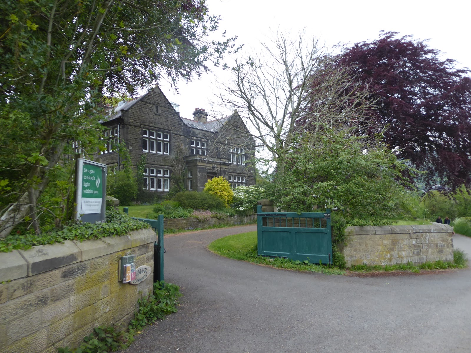
On the west bank, we join the lane that descends by the side of the dam, above the rather modest waterworks, down to meet the Thornhill Trail, the remnants of the railway that was built at the turn of the 20th century to aid the construction of the upper reservoirs (when it was an easier option than trying the use the roads) and this will lead us down to the bottom of the upper valley, as it settles into a wooded cutting or terrace that sits on the rising bank, offering views over to the sharp crags of Bamford Edge, but no obvious proximity to Yorkshire Bridge, the model village constructed to replace those lost below Ladybower Reservoir. Bamford village lies down the valley, but on the eastern side of it, so we'll get few up close views as we move on to pass over Carr Lane and around the village of Thornhill, which is well concealed somewhere up the western bank, getting sight towards St John's church and Bamford Mills below as the edge above retreats up the valley, and the railway line has given us quite the gentlest of descents to enjoy as its short mileage runs out by the former Water Board house that is now a Quaker Community facility. A field walk follows to pass under the MR's Hope Valley line, our fourth Trans Pennine line on the trail, where local trains pass in both directions making me glad that I've not been aiming to catch either of them today, and run down past the Hope Valley garden centre edge to meet the A6187 Hope Road and leave the Heritage Way to make for Bamford station, joining the borough as we pass over the Derwent via Mytham Bridge. It's only a short walk from there to the A6013 Station Road, where we can drop ourselves onto the platform for a 3.55pm finish, showing that the Hope Valley is almost viably local to West Yorkshire for walking purposes, and finding my Parental Taxi waiting for me, where Mum can also tell tales of Mortimer Road after her sat-nav sent her over it too, before we set off south for our week's base in Winster.


No comments:
Post a Comment