14.4 miles, on the Pennine Bridleway, via Green Clough, Long Causeway, Sheddon Clough,
Cant Clough Reservoir, Worthsthorne Quarries, Hurstwood Reservoir, Smallshaw Clough,
Rams Clough, Gorple Gate, Gorple Stones, Clough Head, Widdop Reservoir, Clough Foot,
Lower Gorple Reservoir, Reaps Coppy, Reaps Level, Edge Lane, Land Bridge,
Strines Clough, Brown Hill, New Delight, Bow Lane, Blackshaw Head (Cally Hall),
Marsh Lane, Naze, Cowbridge Wood, and Jumble Hole.
 |
Long Distance Trail
means Selfies!
#3 at Holme Chapel |
When we travelled out to Calderdale, we brough with us a weather projection that suggested we ought to be having a decent spell in the mid-week, but as the days have borne on, we have gotten much less encouraging forecasts, so that it comes to pass that we have to choose the lesser of two poor days when the third leg comes around, despite having started out with as much flexibility as we thought we could provide, and thus we ride out on Wednesday, a day earlier than intended, wrapped up in all my available waterproofs as the Parental Taxi drops me off at Holme Chapel, en route to Mum’s get together with her Skipton friends at Boundary Mill, Colne. It’s 10.10am when we start up, an hour later than usual in the hope of getting in behind the weather, which is still sending in a persistent drizzle as we rise away from the A646, armed with my trusty indestructible Fuji camera (as my new Lumix isn't getting ruined this early in its lifetime) as we shift up Green Lane, not getting any views of the Calder valley and the scars on its south side as a damp haze bleaches out everything, with a sharp wind blowing in behind us as we rise on a familiar sort of 150m pull, passing up above Green Clough, quitting the old lane and striking across the field paths to encounter workmen digging up the old surface. They’ve certainly got a lovely sort of day for tearing up the turf and laying hard core in its place, just as I have for passing among them, pondering how well my boots might hold up against this damp turf as we come up level with the Coal Clough windfarm, which the clouds appear to be rising above as we take the horse-friendly detour path that avoids a testing passage along the Long Causeway road at the clough head, touching the first of many routes from last year ahead of us striking onto the moors below the obscured Hameldon Ridge, but soon drifting downhill again, into some welcome vegetation around the Sheddon Clough Limestone Hushings.
 |
| Ascending Green Lane. |
 |
| New Bridleway being laid out, Green Clough. |
 |
| Long Causeway, and Coal Clough windfarm. |
 |
| Vegetation on the moors, Sheddon Clough. |
This landscape of grassy lumps is the ancient industrial spoil remnants of Quicklime production, now forming a bizarre, and extensive, which stretches down the side of its eponymous stream, where sheep roam freely and colour is provided by rhododendron bushes, planted in a campaign of historical prettification, and It's noticeable that the rain has stopped as we pass over the beck and rise north, with the sou’wester having blown out the worst of itself, not that we are free of damp haze that hangs in the west, obscuring much of a look towards Burnley down the Brun catchment, or releasing Pendle from the pall that hangs over it. We’re not getting wetter though, and that counts as we tramp over to Cant Clough reservoir, spied from above last year, where we can look up across the water to the Hare Stones and the top of the Hameldon ridge, and down to the heavy terraced embankmenting the secures the dam that we are passing across, before we rise beyond, into more industrial scarring, the equally vast fields of spoil of the Worsthorne quarries, that reach up the hillside to the west of Hurstwood reservoir, which sits in the next valley branch below us, not possessing quite the drama of it companion to the south, but baring its own scars as a suitable terrain for mountain biking. Meeting the shore of the reservoir, we shift upstream on its western side, still below the quarrying spoil heaps as we head up towards its feeder stream, Smallshaw Clough, which we pass alongside before rising up to meet Gorple Road, the rough Trans-Pennine route that modernity didn’t claim, as it strikes eastwards across Worsthorne Moor, giving us some crisply defined horizon edges over the Lancashire Calder valley as we press away from Burnley district, and mot getting a good scope on where we are among these rolling hills of moorland grasses until we meet the division point on the Pennine Bridleway.
 |
| Sheddon Clough Limestone Hushings. |
 |
| The view to Burnley and Pendle Hill, down the Brun valley. |
 |
| Cant Clough Reservoir, and the Hare Stones |
 |
| The Worsthorne Quarry remnants. |
 |
| Hurstwood Reservoir. |
 |
| Gorple Road, over Worsthorne Moor. |
That route, northbound over the moors to Black Clough and far beyond will have to wait for another day, as we’re getting back to the leeward side of the Pennines by pressing east on the long slow press uphill, watching the Lancashire horizon in the west retreat as the cloud draws in behind us, still not getting a clear fix on where we are as all the moorland crinkles to the south could present the Hameldon ridge on our sight line from this rise on a straight and unchanging pitch, and it’s only when we drop to pass over Rams Clough and rise beyond do we get the mental sorting out we need. That places us relative to the upland trail we made last year when we spot the Coal Clough windfarm to the south of it, and the Hare Stones on the rising col below, as two more pitches uphill drag us up to Gorple Gate, with the wind battering us hard as we transition back into West Yorkshire, tracing the path below the rising mass of the Gorple Stones and getting a heavy dosage of 2021’s landscape as we press on above Gorple Upper reservoir and the lost farmstead above its northern shore as we press on to the Clough Head ridge, with the boldly shaped rock formations on its western face. Take another beating from the channelled winds on that crest too, taking in the eastern horizon of moorlands above Hebden Bridge before we quit this high ground as the trail starts its long and steep downhill wander into the natural amphitheatre of craggy tops and sloping plots that surround Widdop reservoir, a long descent that doesn’t seem any shorter for having experienced half of it before, and the stern breeze follows us all the way down, with the water’s surface reflecting the slate grey skies that still scud overhead, as we seek a lunch spot, found by a dry drainage channel, where we can pause, hopeful that the day’s harshest conditions are in our wake.
 |
| The ongoing climb of Gorple Road. |
 |
| The Hameldon ridge, and the Hare Stones, above Rams Clough. |
 |
| Gorple Stones, and Company. |
 |
| The Rocks on the Clough Head Ridge. |
 |
| Descending the Clough Head path to Widdop Reservoir. |
 |
| Widdop Reservoir and Grey Stone Hill. |
Feeling bold, we put the Fuji away and retrieve the Lumix from my bag, and set off along the southern shore of the reservoir, passing below the plantation and the looming rock formations at Cludders Slack, finding that they look rather more imposing when observed from the far side of the valley, and we’ll also observe the slightly Egyptois valve tower before we pass across the dam, exposing ourself to the full force of the wind that has blighted today far more than the rain did before we join the side of Ridehalgh Road by the tubular metal gate that is getting played by the breeze like an aeolian harp. That’s a third route from 2021 tangled with as we meet the apex of the loop, before pace downstream alongside the deep cleft of Graining Water, letting the dam and the setting of the reservoir pass behind us as we descend into some relative calm, meeting actual traffic for the first time in three hours as we head down to Clough Foot and the first house that we’ve seen in as long, almost touching the northbound Pennine Way before we slip onto the reservoir access road that leads over the stream and up the far side of its deep channel, angling us away from Well Holes house and the Packhorse Inn on the main road, and returning us to solitude on the way around the moorland nab. The sweep of this lane directs us around to Gorple Lower Reservoir, to pass over its dam at the start of our definitively inbound leg, getting another profoundly cold blast of wind from the west and the reservoir’s surf gets up, taking us over the fall of Reaps Water below it as we feel ever closer to our familarest corners of Calderdale, coming around by the reservoir cottages on the southern side, and then rising again, on the shared Pennine Way path over Reaps Coppy, giving us a good look back to where we went over the top earlier today, and meeting the remains of Reaps farm lost among the moorland as we go.
 |
| Cludders Slack, above Widdop reservoir. |
 |
| Downstream on Graining Water from Widdop dam. |
 |
| Ridehalgh Road, above Graining Water. |
 |
| Graining Water and the Packhorse inn. |
 |
| Lower Gorple reservoir dam. |
 |
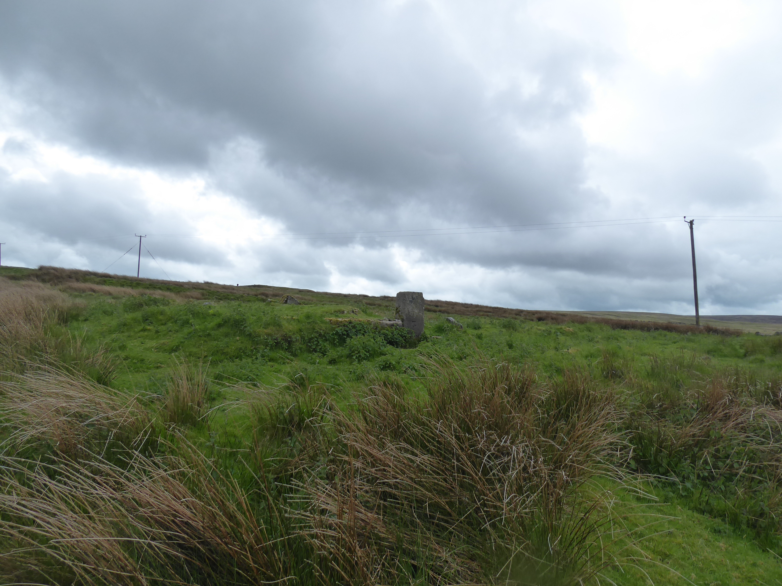
| Reaps farm remnants, Reaps Coppy. |
As the Way departs east, the Bridleway continues south, ensuring things are kept interesting for those who’d ride rather than walk, meeting roaming cows on the access land below Reaps Level, taking us pretty stiffly up to the third summit of the day, not quite topping 400m this time but marking a pretty dramatic transition as we pass around the western end of Standing Stone Hill, as the expanses of Heptonstall moor, and the fingers of the valley up to Walshaw Dean and Greave Clough in the north pass, and the Colden valley appears ahead of us, extensively farmed and welcoming us with an actual sunburst. It’s a nice spot to pause and water, at the top of Edge Lane, looking downstream across the fields in this relatively verdant valley, with the darkening moors up to Black Hameldon behind us, setting off southeastwards to immediately find a fixer-upper opportunity at Lane Side, and plenty of farming happening at Everhill Shaw before getting the feeling that many of the other cottages along here have become rural retreats, thanks to the passage of the domestic weaving industries and the need for farm labour, noting the change of road quality as New Edge as the high route keeps on to Long Tail. A sudden and dynamic hairpin turn sends us southwest and downhill as the narrow School Land Lane thrusts us past its eponymous farmstead and all the way to the valley floor, where Colden Water is crossed via Land Bridge, just upstream of the Lands farm gardens, where a riot of floral colour has been introduced to the landscape, contained by a large bank of tree from the elements, which we pass in the shade of as the last cloudburst of the day blasts past, yet another corner where we passed last year (which also conceals a lost mill’s chimney), before we press uphill in the deep groove of Sunderland Lane, as I start to feel tired of the Bridleway’s interesting digressions, especially its many uphills.
 |
| The climb over Reaps Level. |
 |
| The upper Colden Valley, below Black Hameldon. |
 |
| Everhill Shaw, below Edge Lane. |
 |
| Edge Lane above School Land Lane. |
 |
| Land farm gardens. |
 |
| The ascent of Sunderland Lane. |
Check in with Mum as her day out concludes, and it feels like I ought to have only about 90 minutes to go to the end of the day, as we’re passing above Field Head farm and looking downstream to the reveal of Heptonstall on its perch at the valley foot, overshadowed by the hills above Hebden Bridge, through this odd southeasterly digression does continue, hanging on the edge of the marginal fields as it drops down into Strines Clough, and then rises stiffly up to the top corner of this digression, landing by the eponymous farmstead, where the route guide has to be actually referred to as the layout has been completely changed around. Proof that five nights of sleeping on the route description has proved worthwhile, and the way forwards down Brown Hill Lane is as direct and obvious as you could need after that, shadowing down the side of Brown Hill, heading directly east and downstream, noting what looks like an oil derrick in the yard of the farm about halfway down, descending to the hairpin corner of the road between Colden and Blackshaw Head, dropping down with New Shaw Lane, past the rows of cottages, to meet the seventh and final trek path from last year, as we come down above the New Delight inn and Jack Bridge . It would be very easy to keep on down to Hebden Bridge from here, via the straight run of Hudson Mill Road, hanging above the deepening Colden Clough, but the loop has one last nasty trick, pulling straight uphill from Shaw Bottom on a narrow track that doesn't seem to be suitable for use by more than one traveller, certainly with anyone climbing slowly and descending rapidly on the steep, rough surface, getting some brightly lit meadow action at the crest before meeting the outer eastern reach of Blackshaw Head at Cally Hall terrace, returning Calderdale to our forward horizon, in the vicinity of Stoodley Pike again after teasing the horizon across the days.
 |
| Looking down the Colden valley to Heptonstall. |
 |
| Ascending about Strines Clough. |
 |
| Brown Hill Lane and Brown Hill. |
 |
| New Shaw Lane above Colden. |
 |
| The steep ascent out of the Colden Valley. |
 |
| Cally Hall terrace, et al, Blackshaw Head. |
It ought to be downhill all the way from here, following the farm track of Marsh Lane as it offers views west up Hippins Clough, and advertising Chisley Stones atop Staups Moor as an alternative to the wide spread of the southern face of the valley, also showing up Bridestones Moor and Pole Hill before we head down on the hard track to Dew scout and slip down the path featured on the guide book cover, ahead of the roughening paths that lead down to Naze and the former chapel site above High Underbank, then joining the long twisting path that leads down below Cowbridge Wood. In the shade above Jumble Hole Clough, the remains of three lost mills can be found, gradually returning to nature in the woods above the heavily managed stream, before the mostly intact Underbank works is found outside the tree cover, finally down at the valley floor with the lane beyond leading us under the bridge of the main line up Calderdale, returning us to the side of the A646 Halifax Road by the Sand Bed and Wood Villas terraces, and taking the horse friendly path behind the trees downstream to seal the Mary Townley Loop at 4.40pm, across the way from Callis Bridge. All done in the time window as planned, with the Parental Taxi ready to collect me after Mum had a day out only 20 minutes longer than mine (though finding that Sandbed is twice as many bus stops down the road than expected did cause a few issues), and we need to high-tail it back to base at Beeton Cottage as straightening ourselves out and refreshening is in order for an imminent dinner date with My Good Friends in Calderdale, at the Old Gate in Hebden Bridge, and after 46 miles put down over five days, you couldn’t say I haven’t earned some sociable beveraging and a steak, to put a capper on a very nice and relaxed week away, despite all the activity.
 |
| Looking west up Hippins Clough. |
 |
| Descending back into Calderdale. |
 |
| Mill remnants, Jumble Hole Clough |
 |
Sandbed terrace, Halifax Road.
~~~ |
 |
Long Distance Trail means Selfies!
#4 back at Sandbed.
~~~ |
 |
A well-earned Steak Dinner at the Old Gate,
with Mum and My Good Friends in Calderdale. |
5,000 Miles Cumulative Total: 5540.4 miles
2022 Total: 255.7 miles
Up Country Total: 5,063.7 miles
Solo Total: 5208.8 miles
5,000 in my 40s Total: 4134.2 miles
Next Up: Seeking out the one unseen Railway Station inside my Walking Bubble.


No comments:
Post a Comment