14.8 miles, on the Pennine Bridleway, via Healey Dell, Spring Mill reservoir, Broadley Fold & Prickshaw, Rooley Moor (Bottom of Rooley Moor, Warm Slack Hill, Pike Brow, Top of Pike,
Bagden Hillocks, Hamer Hill, Top of Leach) Cragg Quarry, Black Hill, Cowpe Bottom,
Hugh Mill, Waterfoot, Booth Fold, Edgeside, Shaw Clough, Lumb, Peers Clough, Red Moss,
Bent Hill Rough, Deerplay Moor, Easden Clough, Stone House Fold, and Holme Station.
 |
Long Distance Trail
means Selfies!
#2 at Broadley |
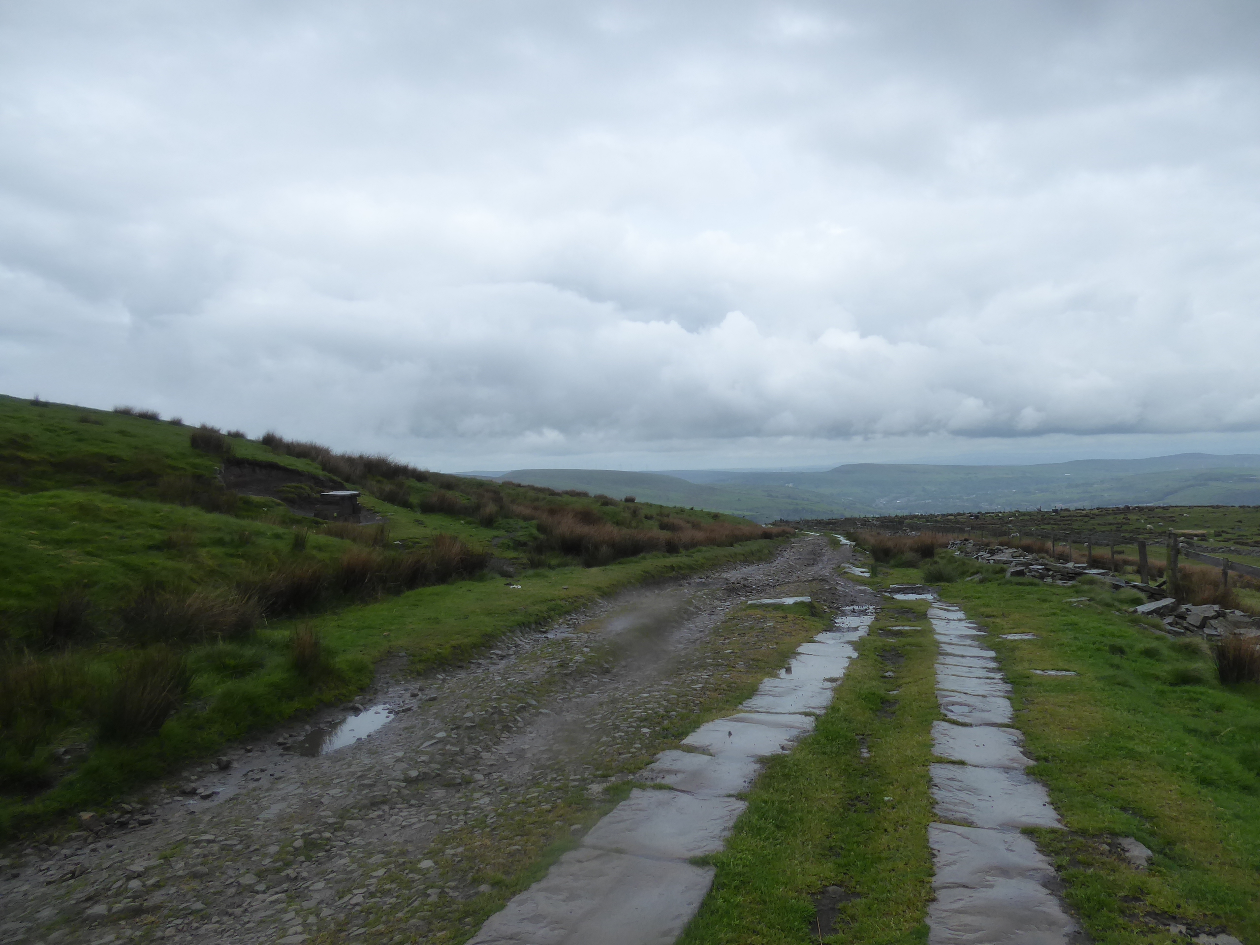
Having had the main excursion of our Sunday rest day be a jaunt over to Ramsbottom to have a Sunday dinner date with My Sister and My Nieces at the Eagle & Child, when the time comes to approach the second leg of the Mary Townley Loop, My Mum has gotten much more comfortable with the tootle over the high road into Rossendale, making the main concern for Monday morning being getting around the rush hour, and school run, traffic in Todmorden, as we need to get a good start on the day as we could be facing down a tight weather window, as we’re deeply uncertain about what the capricious local weather could bring. As it is, we alight at 9.15am again, by the sandwich stand in Broadley, and set off purposefully down into Healey Dell nature reserve to meet the upstream path alongside the river Spodden taking us as far as the bridle bridge before joining the downstream path on part of the lost L&YR Rochdale – Bacup line, which is paced until we’re split off up by the beck and tramway that once led to Spring Mill, now lost to suburban redevelopment at the south end of Whitworth, but still naming the adjacent reservoir, which looms over the valley as we start the press up it west side. Gloom already hangs in the air as we slip back into Rochdale district and come up though the farm hamlets of Broadley Fold and Prickshaw, close enough together to not really warrant separate identities, with Knacks Lane drawing us up among further farmsteads, pressing southward before a sharp turn takes us into the quarry delves as the Bottom of Rooley Moor, directing us towards the nab end of the moorland at Hunger Hill before another sharp right turn pushes us onto the old road over Rooley Moor, where our long ascent northwesterly begins in earnest, with the tower blocks of Rochdale town centre directly behind us.
 |
| The former Rochdale - Bacup line, in the Spodden Valley. |
 |
| Spring Mill Reservoir Dam. |
 |
| The Quarry Delves at Bottom of Rooley Moor. |
 |
| Rochdale from Rooley Moor Road. |
Signage indicates that it should take an hour to get to the top, and in the initial going we have a rough surface to pace at a decently strenuous pitch, rising in such a way that gives no indication of the elevation to come, while also shutting off the views to east and west as we press up Warm Slack Hill, and not doing much to enhance the Greater Manchester horizon that revealed itself over our previous trip either, at least until we meet Pike Brow and the Spodden Valley opens up to the east, giving us a look across the terrain that we paced around on our way to get here. At Top of Pike, we meet a hillcrest, just below 400m altitude, and the way ahead is revealed, undulating and rising at a friendlier pitch, while also opening up a view to the windfarm above Knowl Moor, the most obvious top on this upland’s southern face, while also revealing that we are not digging deep into the moorland as the valley containing the Greenbooth and Naden reservoirs opens up to the southwest, which might dissolve the feeling of isolation if it wasn’t for the track improving to one of well-packed setts, which the cobble thieves haven't yet gotten to, and the site of the old, and remote, Moorcock Inn being located below Bagden Hillocks. The changing perspective over the windfarm on the adjacent moorland rib can hold the attention for a while as we press up the last phase of the ascent, as Manchester retreats into the gloomy haze behind us, while an eye has to be kept on the weather coming in from the west as even a low percentage chance of precipitation in these parts, and at altitude, could still bring on sudden rainfall, and that’s what happens as we crest over to the eastern side of the moor, coming down for barely longer than it takes to get waterproofed up as Bacup and the northeastern corner of Rossendale are revealed below.
 |
| Rooley Moor Road rising to Top of Pike. |
 |
| The view over Pike Brow to the Spodden Valley. |
 |
| The windfarm around Knowl Hill, above the Naden Brook valley. |
 |
| The site of the Moorcock Inn, Bagden Hillocks. |
 |
| Rooley Moor Road, on Hamer Hill. |
 |
| The turn towards Top of Leach. |
The timing to the top proved to be correct though, passing about 20m below the 474m summit at Top of Leach, and the Rossendale Way’s foundation memorial being met as Boulsworth Hill and the Hameldon ridge arrive behind the haze ahead, and Pendle Hill and Longridge Fell arrive far behind the northwestern corner of Rossendale as Rooley Moor Road dives down into the valley below and we keep on with the high path of grooved slabs that runs above the steepling drop down to Cowpe reservoir and its eponymous village, right in the heart of the river Irwell’s highest reaches. We carry on, drawn in among the disturbances in the landscape created by the vast extent of Cragg Quarry, abandoned to all but bridleway users and mountain bikers these days, and a strange sense of isolation can be had we pace on among the worked-out rock faces and the vast amounts of spoil tipped out in finger shaped formations across the moorside, with some tramway remnants to be found too (to be explored on a future occasion), spread all the way to the renewed descent at Black Hill, where West Pennines features are revealed, as we spy Darwen Tower, Holcombe Moor, Winter Hill and Ramsbottom Peel Tower in short order. So, we’re still not that far from somewhere familiar, and as the prominent Cowpe Lowe top rises ahead, we need to quit the moorland and head down into the valley, shedding the altitude rapidly as we drop down on a grassy farm track and getting a decent review of the northern face of Rossendale as we descend, looking across Waterfoot and Newchurch as we trace our path to come, while shifting around enough to feel like we’re passing directly below the high edge that we just traced, and having trees return to the landscape ahead of breaking for lunch on the switchback by Tippett Farm.
 |
| The Rossendale Way tablet, Rooley Moor Road. |
 |
| Cragg High Level Tank, and Cowpe Reservoir. |
 |
| Among the Rock Faces and Spoil Tips of Cragg Quarry. |
 |
| Tramway Remnants, Cragg Quarry. |
 |
| Cowpe Lowe, and Black Hill. |
 |
| Newchurch and Waterfoot in the heart of Rossendale. |
There’s still some more turns to make before we land back in civilization though, tracing the rough track and farm access road down before we can come down to the bottom of Cowpe Road, below the ribbon of terraces and houses that once reached up to the mill site, now redeveloped, up the valley, and after all that time on the moors, it’s not much fun to walk on the roads again, which seems to be the thought process of the bridleway plotters too, as they switch is off the main road between the lost industrial site at Lumb Hole Mill and the partially enduring ones at Hugh Mill. We bottom out in the valley as we pass over the river Irwell, more famous as Manchester’s main watercourse, and our way takes us around the coal yard that endures on the site of Waterfoot station on the former L&YR Ramsbottom – Bacup line, passing up to the side of the A681 Bacup Road (just west of the restored tunnels that require a closer look), and once over the Pegasus crossing, we’re back heading uphill again, rising with the terraces of Townshend Street and Millar Barn Lane, past the Rawtenstall & Bacup grammar school, and emerging between the Jolly Sailor and Ye Olde Boot & Shoe inn at Booth Fold. Crossing Booth Road has us passing over the Irish Sea Trek route of 2015, and thus encompasses all of southeastern Rossendale into my Field of Walking experience, swelling my bubble considerably before we pass up Todd Carr Road and Prospect Street, sticking to the pavements as I forget that we are on a bridleway route and should be detouring onto the dirt track on the perimeter of Edgeside park as we rise uphill, before we hit the final rise out of the Irwell valley to land on Edgeside Road, which leads us up the edge of the Whitewell valley.
 |
| Cowpe village, from above, |
 |
| The River Irwell at Waterfoot. |
 |
| Bacup Road and the Waterfoot Tunnels. |
 |
| The Jolly Sailor, and Ye Olde Tuck Shop, Booth Fold. |
 |
| The Bridleway in Edgeside Park. |
 |
| Edgeside Lane, Edgeside. |
Heading north, we pass beyond the urban limit of all the settlements crammed into the deep cleft of Rossendale, dropping with the lanes among the woodlands that fill the side valley at Shaw Clough, and then rise beyond its farmsteads and cottages, following the rising track up to the Hollins farms and then joining the rough path beyond, placing us in the fields above the sprawl of Whitewell Bottom in the valley and restoring some of the isolation felt on the moors, even though this is a much more managed landscape, as we pass over the fall of Brock Clough and don’t see another farm until Shatlock Cote. The bridleway path at least directs us well through the yards we meet, not getting us lost at Thorn House, even if the path of Pinch clough lane doesn’t seem suitable for horses or cyclists as it perches itself above the fall of the river valley, and its main road, before leading us to better surfaces, down from the Salisbury farms and into village of Lumb, where Whitewell Beck is crossed to get a closer look at St Michael’s church and its former schoolhouse, putting us by the side of the B6238 Burnley Road a corner too early as we briefly misplace the Loop route, so we break for second lunch in the village’s Millennium Green. Check in with My Mum to give her a speculative ETA and then the push can start to the final stretch out of Rossendale, with Peers Clough Road directing us out towards the marginal fields on the west side of the Whitewell Valley, and not giving us much by way of named landscape features to trace a route amongst, with only Lane Side farm being a feature on the densely hedged road, before we fall into some deep and ancient grooves in the landscape, pondering if we are indeed being led to a Peers Clough, which might name the falling streams that we pace abouts, as we press north, above Water and Grove Weir farm.
 |
| Above Shaw Clough, looking down the Whitewell Valley. |
 |
| Lumb Lane, heading north and upstream. |
 |
| The tight path to Lumb, above Burnley Road. |
 |
| St Micheal's church, Lumb. |
 |
| Peers Clough Lane, leading who knows where? |
 |
| Among the falling streams of Peers Clough, maybe? |
We at least get a distinct location as we pass up between the Near and Far Pasture farms, and the surprising amount of landscape scouring that’s gone on among them, while we have to give ourselves a bit of a landscape crash course as we rise up to the moorland fringe, as we’re still short of things in the locality to identify, pausing by the feeder channel to the nearby reservoir to don waterproofs as the wind distinctly darkens, before we are elevated up to the path along the edge of Red Moss, where we can look back to spy the Ramsbottom Peel tower again, as we as spotting the many mast on Hameldon Hill, at the borough’s northwestern corner. We also tramp alongside the Dunnockshaw Community Woodland, with the moorland top of White Hill rising ahead of us, before we take a sharp turn downhill, to cross the B6238 Burnley Road, getting the view over Clough Bottom reservoir as we go, before following the horse-friendly path that keeps us away from the combining traffic with the A671 which has the minor drawback of sending us on a bit of a detour, directing us east towards Deerplay Hill, the westernmost promontory of Thievely Pike, while also giving us a review of central Rossendale from this northern fringe. The plots of Bent Hill Rough also take us across the springing points of the young Whitewell Beck before we finally make our turn over the Rochdale & Burnley Road, and double back on ourselves across the open plots of Deerplay Moor, with the darkening sky suggesting the imminence of the rainstorm that never quite arrives, as we’re led to the top of Easden Clough, where the A671 makes its dramatic drop into the Lancashire Calder valley, and we keep to the eastern side, away from the hilltop landfill, and trace the path that follows the driveway across to Cow Side farm until we are detoured along the grassy path around it, giving our first views towards Burnley.
 |
| Rising over the reservoir drain, towards Red Moss. |
 |
| Red Moss and White Hill. |
 |
| Clough Bottom Reservoir, and the view south. |
 |
| Deerplay Hill, from the Horse-Friendly path. |
 |
| Ominoous Skies above Deerplay Moor, and the descent to come. |
 |
| Easden Clough, and the descent to Cliviger parish. |
The descent really gets going as we hit the track down to Stone House Cote, with both Pendle Hill and Boulsworth Hill rising ahead to punctuate the horizon, where we soon find ourselves above the grassy field path which has the Mary Towneley Memorial, with the creation of the Loop in 2002 being the lasting testament to the lady of Towneley Hall who promoted the creation of the Pennine Bridleway, who sadly pre-deceased its opening, from where we drop down into the scattered parish of Cliviger, getting a good look across so much of the terrain, both urban and wild, that we visited last year. At the farm cluster of Stone House Fold, we bottom out and start the final easterly press, following the undulating track as it offers sight of our finish line, with the Coal Clough windfarm above, and also come down by the railway past Scout Farm, just as the Preston-bound oil train powers downhill from the Copy Pit Summit, continuing to trace the tracks as we are brought down to the site of Holme station, long lost for obvious reasons, with the access road across the valley leading us to the merger of the Black Clough stream with the young Lancashire Calder, and then it’s up the lane to Holme Chapel itself. Emerging onto the A646, across from the village schools, we cross to put another seal on the expanded Field of Walking Experience, now encompassing all of northeastern Rossendale into my bubble too, and once the Memorial Garden and the church of St John the Divine have been regarded again, we can cross to the Ram Inn, to wrap the day at 3.35pm, just as the Parental Taxi service arrives, only right on cue thanks to Mum having to tussle with the roadworks in Todmorden, another service for which I’m hugely grateful (not that the duration or cost of a ride on the #592 bus back to West Yorkshire could be considered that onerous).
 |
| The Mary Towneley Memorial. |
 |
| Stone House Fold, below Easden Clough. |
 |
| Oil Train action on the Copy Pit line. |
 |
| The Calder bridge, Holme Station Road. |
 |
| The village school, and St John the Divine, Holme Chapel. |
5,000 Miles Cumulative Total: 5526 miles
2022 Total: 241.3 miles
Up Country Total: 5,049.3 miles
Solo Total: 5194.4 miles
5,000 in my 40s Total: 4119.8 miles
Next Up: Third & Final Leg, Digging Deep into Last Year's Walking Field.


No comments:
Post a Comment