Take two days out from the trail to allow the legs a rest and to blog to my hearts content in the down time, and also to do holiday stuff, because I'm on holiday, which has Tuesday spent riding the train at Peak Rail, because it's not a trip away without visiting a preserved line (which would make Dad happy, for sure) and then Wednesday is spent getting in the industrial heritage in at Cromford Mills, where the concept of factory manufacture took off in the late 18th century. With holiday whims satisfied, we can thus get back in the walking saddle on Thursday, knowing that another 17+ mile day lies ahead, with weather that promises a lot of sunshine and heat, in complete contrast to the already distant feeling trip over the Dark Peak only five days back, taking off in the Parental Taxi with a bag full of food and liquids that I know I'm going to need for a jump off at the Grouse & Claret in Rowsley at 9.05am. We're right by the side of the A6, which as we know is one of Leicester's main roads and could rightly be followed for the remainder of my Long Walk, but we know there wouldn't be as much fun in that, and the Derwent Valley Heritage Way will offer a much more peaceful take as it ventures down Old Station Close, to the sight of the second and longest enduring of Rowsley's stations, lost under industrial units since its 1968 closure, and we could walk the cycle path on the railway formation south from here, but the way wants us to venture into the beech woodlands by the side of the river, and so that's the way we head. A nice and shaded start to the day, feeling that it's much longer walk down to the newer Peak Rail station than it felt when we drove down there, and only slight landscape hints are felt during our passage, and oddly, we miss seeing the confluence of the River Wye as it flows in from the west, and it's odd that such a major branch of the Derwent could arrive invisibly, especially as I knew that I was looking for it.
 |
| The Grouse & Claret, the old Station Hotel, Rowsley. |
 |
Missing the Wye-Derwent Confluence, somehow.
|
 |
| Peak Rail's Rowsley South station complex, Northtown. |
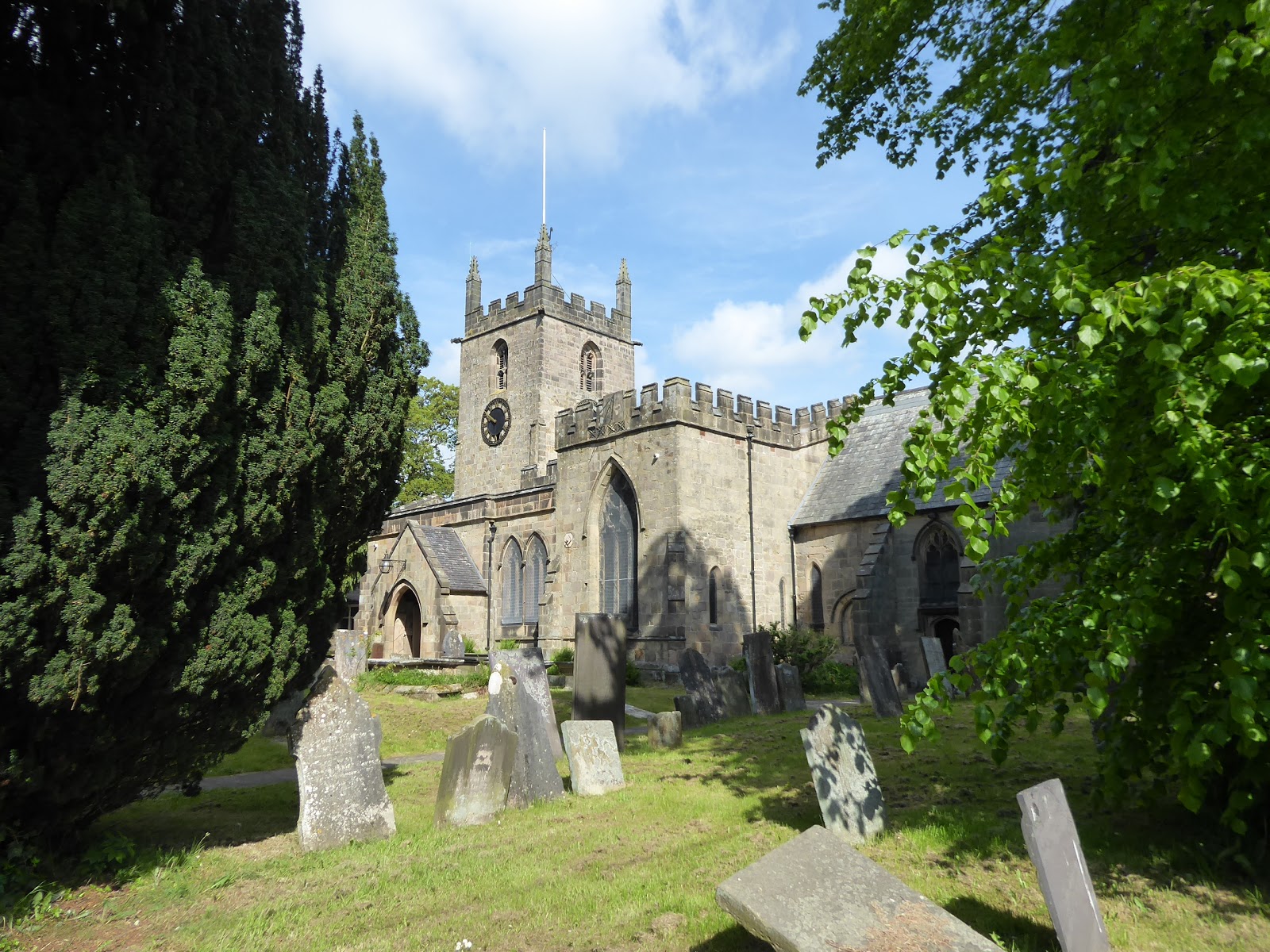
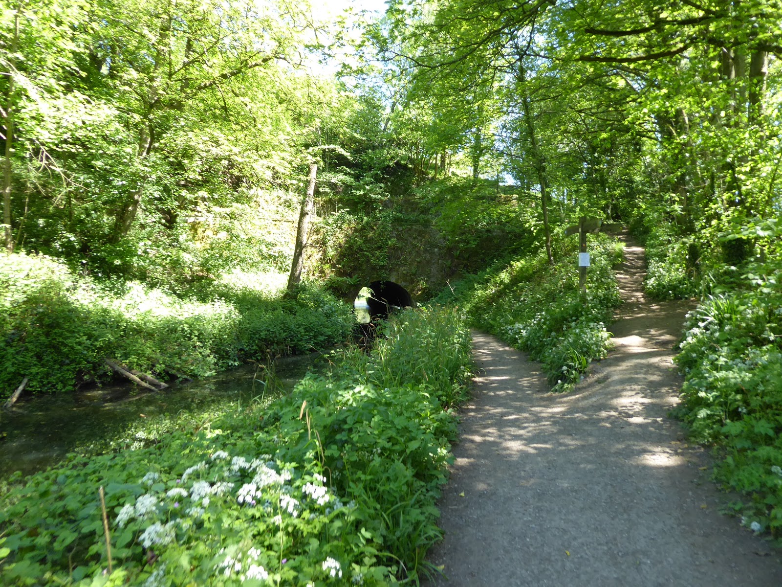
The only interruption to the wooded path is a deep, stone-lined culvert that we are forced to pass around before we get emptied out onto the lane at the north end of Peak Rail's Rowsley South station and yard, which is actually in Northwood, an entirely separate settlement from the surprisingly small village up the valley, and here the way takes the track and field path around the yard, where no trains are running today, aside from NCB 72 having a light steam, and views to the rolling stock are mostly hidden by trees and hedges, with only a Class 37 and a Class 46 spottable from this path. Open fields give us a bit of space to locate ourselves as the Derwent Valley remains wide, north of Matlock, with Stanton Moor and its wooded sides rising to the west, the equally wooded Darley Hillside elevating to the west, with Masson Hill on the distant horizon to the south, and passing a lone barn we get a hard track to follow down to Abbey farm, which is all sorts of busy at this early house, with the path leading is past its bold house and collection of attractively shaped trees into Churchtown. This is really just a piece of Darley Dale, but sits at a rural remove from it, home to a school and St Helen's church, and a few country cottages, but its soon in our wake as we hit the field path again, across the rough plot full of docile cows and on across the well-mown fields that sit above Darley Dale's cricket field, which we pass around to land on the B5057, a road we've tootled up a few times already on our travels from our base in Winster. So the way down to Darley Bridge is familiar already, with the Square & Compass in being rendered even more distinctive with the sign of its roof that can be seen from space, and here we pass over the Derwent, but don't join the startling road uphill and instead join the quiet lane that lead towards Oker, or Oaker as the signs would have it, hugging the riverbank as far as the village's outer edge with the looming rise of Oaker hill ahead of us. The lane gets super rural as it loses it containing hedges and gains a grassy stripe down its centre, which could have you fooled that you as on a farm track, but it rises away from the river to meet the farmstead concealed in the woods, we find bungalows and cottages at a seeming remove from the regular world, revealing Oker has a presence that you wouldn't expect, though this too is left behind quickly as the path strikes into the fields again, with Matlock on our future horizon.
 |
| Field Walking by Abbey Farm barn. |
 |
| St Helen's church, Churchtown. |
 |
| The Square & Compass, Darley Bridge. |
 |
| Aston Lane getting super-rural. |
 |
| Oker (or Oaker) hamlet. |
Not that we shall see too much of it from the riverside, as our track takes us alongside former workings of Cawdor Quarrry, with their works buildings lying derelict and surely earmarked for a future residential or commercial redevelopment, their boundary traced until we slip into a wooded glade by the side of the Derwent, on a path that look like it could crumble into the river at a moment's warning, as it leads us towards the town, which is virtually hidden from view below the canopy of leaves. Pass under the Derwent Bridge that carries Peak Rail's metals over the river, and find the A6 on the far side if it, but we stay contained away as we pass the former Matlock Riverside station, a rare disused station on a preserved line, and under the bridge that takes the A6 Derwent Way relief road overhead, meeting local walkers on the green path before we are compelled to join Matlock properly, emerging just down from the railway station and upstream from Derwent Bridge. The town stretches down the A6 Dale Road to the south, and spreads extensively to the east, and we'll cross over the old bridge that is really far too narrow for contemporary traffic, but we'll not probe much further into its Victorian landscape, home to Derbyshire County Council, as the way directs us into Hall Leys park, the urban green space to the town that really does try to offer everything, from formal gardens and playing fields to bowling green, boating lake and miniature train rides within its modest space. We then land in the oldest corner of town, but depart is quickly via Knowlestone Gardens, passing over Bentley Beck by its flood gate and pumping station(!?) as we meet the path at the riverside by the steepling high cliffs of Pic Tor as the Derwent enters the dramatically narrow valley that stretches south to Cromford, and the limestone rockfaces that tower over the path look only suitable for climbing, so it's a bit of a surprise to find the guide book's suggestion that the viewpoint at the top could be visited. I've got a lot of miles to go though, so I'll err on that idea, renewing my reputation as someone who shirks a climb, by staying low and taking the path that passes twice below the railway line down the valley, as I steel myself for the ascent to High Tor, which starts under the tree cover but beyond the rising switchback we land into the full glare of the sunshine, below the suburban elevation of Starkholmes, so the hard work of the climb seems ever so slightly unnecessary.
 |
| Cawdor Quarry's derelict plant. |
 |
| Peak Rail's bridge on the Derwent. |
 |
| Matlock Town Centre, from Derwent Bridge. |
 |
| The Limestone Cliffs of Pic Tor. |
 |
| The way to the High Tor grounds. |
Above here sits Riber Castle, the 1862 house of the local industrialist John Smedley, a site that has been infamous for its state of almost continuous dereliction, so it's a bit of a surprise to find that it has been completely residentially redeveloped in the last decade, returning some purpose to its imposing site above the valley, which has now formed a deep gorge to our west, with a viewpoint to get the precipitous sights downwards, though the expansive view to Matlock emerging behind us is just as inspiring to my eyes. The sharp, elevated edge of High Tor looms ahead, more than 100m above the valley floor, and we'll rise to it to take first lunch, looking across the valley to the Heights of Abraham, and the cable cars that take the visitors to this park atop Masson Hill, while a wary look down is also in order to see the spread of Matlock Dale, and a look north gives a last look to the distant gritstone moors far up the Derwent Valley, the last lingering suggestion of the North country to be seen on this trail. The route down head us into tree cover, and the signage gives little indication of the correct route as steep paths take a whole variety of routes downhill, and this the way down needs to be picked out carefully, losing all that height gained below the canopy of branches, and somehow landing ourselves by the cable car station at the first try, where we'll detour briefly for action photography above the valley before we strike south towards Matlock Bath station. Over the Derwent we head again, to arrive in Matlock Bath by the Midland hotel, where we join the pavement of the A6 North Parade as it sweeps along the riverfront of this small town, completely distinct from its neighbour to the north, where a spa developed and boomed in the 19th century, and now enduring as a tourist hotspot in the region, presenting a boldly Victorian face, as we head down past the parades of shops that flank the former non-conformist chapel, opposite the 1897 Jubilee Bridge, and upstream from the townhouses that appear to pile up on the high valley side. South Parade is a slightly different proposition, composed of white-washed buildings so thick with amusement arcades, gift shops and fish restaurants that you could believe that you are actually at the seaside, which could have you believing that resorts end up being the same regardless of their location, and the fact this is solely a tourist town is confirmed as the road rises past the Grand Pavilion, above the Derwent Gardens, and below Holy Trinity church.
 |
| Matlock from High Tor. |
 |
| Matlock Bath, from High Tor. |
 |
| The Heights of Abraham cable cars, above the Derwent. |
 |
| North Parade, Matlock Bath. |
 |
| South Parade, Matlock Bath. |
Things get a bit greener, and the cliffs around-abouts a bit more pronounced as we carry on south on the A6 Derby Road, but past the New Bath Hotel and the Old Schoolhouse terrace, we get the looming bulk of Masson Mills ahead, the first in the sequence of the Derwent Valley mills UNESCO World Heritage Site, where Richard Arkwright established his first mill to be powered by the river in 1783, developing a massively influential design and practice in the process, on a site that endured in continuous industrial use until 1991. The 1911 extension is now home to the shopping village, where we just visited, and this this massively imposing edifice in red brick is already logged in the memory banks, to be admired as it recedes from view beyond the broad sweep of the river as we head south, below the steeply wooded bank of Harp Wood, before we spilt off the path just shy of Cromford village to take the shaded old road route along the river facing side of Scarthin Bank. This track gives us a view across the river to Willersley Castle, an imposing pile that was built as Richard Arkwright's house but not completed until after his death in 1792, before running us down to St Helen's church, another late 18th century edifice, in red sandstone, south of the famous Cromford Mills that the way has actually taken up past without taking an up-close look, which seems like a mistake, so you'll forgive me a waffle as I emphasise their historical importance. The first mill established here in 1771, using Arkwright's water frame, revolutionised the manufacture of cotton yarn, ending it as a cottage industry, and it was also the first successful factory design to prosper anywhere in the world, and influencing and redirecting the patterns of industry and working practices that we have all inherited since, from the contracted employment and working week, to terraced housing and labour laws, it all started right here in the Derwent Valley. Beyond Mill Lane, we meet the wharf of the Cromford Canal, which was 14 miles long when engineered by Thomas Jessop and Benjamin Outram and opened in 1794, built to supply materials and coal to the booming Derwent Valley mills and to export goods to the wider canal network in the days when it was easier to build a unique transport facility rather than use the pre-turnpike roads, where the surviving wharf buildings create another little historical tourist centre and a boat ride can be had, if so wished, along a portion of the surviving six miles of canal, which was isolated by subsidence in 1900, and closed in 1944.
 |
| The 1783 Mill, Masson Mills. |
 |
| The Derwent above Cromford. |
 |
| Willersley Castle. |
 |
| Arkwright's Cromford Mills, the World's first factory complex (22/05 visit). |
 |
| The Cromford Canal wharf. |
The towpath takes the way forwards, and it seems to be the tourist red-route as I tag onto the back of a relative caravan of walkers as we push back into the greenery of the valley, with the canal settled into a long and level pound at the 84m contour, passing above the first stretch of level fields encountered since arriving in Matlock, which are naturally home to the local cricket and rugby clubs, and as we pass Bridge 1, the suburban edge of Cromford on the A6 high above our path passes and we slip back into a rural landscape again. The shady stretch of the canal comes up close to the railway, where anticipation of a passing train is strong, though none passes as we do, and a progress update is passed to Mum around notional lunchtime, passing around the back of the Cromford Garden Centre as we go, where they definitely have a concrete stegosaurus in their yard, and heading deep into the surrounding greenery until we emerge into the pong created by the downstream sewage works. Ahead lies High Peak Junction, where the workshops of the Cromford & High Peak Railway endure, where the Cromford Incline can be observed heading out of the valley to the west, part of the seemingly insane scheme, hatched in the 1820s (and engineered again by Outram, Jessop & Son), of opening up the markets in northwest by transporting goods on a rope and horse powered line over the White Peak to the Peak Forest canal, some 33 miles distant, conceived when railways were still a novelty and one which amazingly endured until 1967, with steam power having replaced horses on the higher sections. It's the High Peak Trail these days, but those 17+ miles will have to wait for another day as we follow the lowest stretch of it down to the Wharf Shed, a modestly sized transport hub, where we meet the navigable limit of the canal, opposite the Leawood Pumping House, and the way carries on over the aqueduct that takes us over the Derwent, making a decisive shift onto the north side of the valley as we enter the Derwentside nature reserve, where the watered canal now forms a miles long pond. It's all much quieter down here, as we've passed the limit of regular tourist interest, and as the valley narrows between Lea Wood and Birch Wood on the high banks, we get a view forwards to Crich Stand, the monument to the Sherwood Foresters regiment that sits high above a quarried out rock face, while the feeling of our four transport arteries down the valley starting to tangle up is felt, with the noises of the river and A6 road being heard close by, and with us passing over the portal of Leawood tunnel on another aqueduct as we press south.
 |
| Bridge 1, the Cromford Canal. |
 |
| High Peak Junction. |
 |
| Wharf Shed, Leawood Pumping Station, and the Derwent Aqueduct. |
 |
| The Railway Aqueduct and Lea Wood Tunnel. |
The green coverage increases as we carry on, with the scent of cow parsley betting eye-wateringly thick at the canalside as no breeze penetrates the heat, and it's relief to meet Gregory Tunnel as it spears its way through the interceding bankside, which we pass through on the uneven flagstones, finding that it's just long enough for its darkness to be troublesome, not that there's any risk of us falling in the water as a rail contains us before we emerge again by a lagoon with a second view up to Crich Stand. Press on, enjoying the rural solitude, passing Leashaw Farm as the guide book tells us to look out for the idyllic hamlet of Robin Hood, which goes unmarked on all maps and can be found on the west bank as we meet the next section of woodland, compromised of several stone and redbrick cottages arranged on the declining hillside with gardens and feature gazebos around them, like a much more modest version of Portmeirion. It certainly earns the idyllic tag that the guide gives it, hidden by the shade of Oxhay Wood, which we pass through before the miles of solitude and greenery briefly end as the canal path passes under the Main Road bridge, landing us in Whatstandwell, which I've never been certain how to exactly pronounce, and I'm not really sure that it's an actual place at all, despite it having a railway station on and a bridge on the Derwent, as it might just be an eccentric outlier to Crich village up the hillside. We break for second lunch here, getting ourselves a smidgen behind schedule as the weather makes it finally necessary for me to carry three bottles of liquid, before moving away passing the tunnel and station that feature on the railway that is separated from us by only a wall, with the valley narrowing markedly between the vast wooded banks of Crich Chase and Shining Cliff woods, and you can feel the arteries of the valley being pressed together, all in visible proximity until you land that view where the canal, the railway, the road and the river can all be seen within a single eyeline view. Mum will tell you that this is one of the best drives anywhere in the East Midlands and it's certainly a special corner of Derbyshire despite being miles beyond the Peak District's boundary, a space to absorb as we retreat again below tree cover, as the canal starts to feel extremely overgrown and the only landscape feature to snare beyond the woodland views is the short tunnel on the railway line where a service lane from the Alderwasley mills used to rise from the riverside up to a goods yard and canal wharf.
 |
| Gregory Tunnel. |
 |
| Robin Hood hamlet. |
 |
| The Main Road bridge etc, Whatstandwell. |
 |
The Cromford Canal, the Derwent Valley Line,
the A6 and the River Derwent in a Single Image.
|
 |
| By the Alderwasley Mill wharf and yard. |
The canal moves away from the railway and road as it strikes its abbreviated path eastwards towards its terminus at Langley Mill, and we've only got two more bridges, a trio of cottages and one exceptionally well-made garden to pass before we slip off the canal path, with the mast on the hill above Thackers Chase and Ambergate village ahead of us, and the revival of this waterway in it's entirety, including the pioneering Butterley Tunnel would certainly be a heritage project for the ages, but probably one beyond the ability and financial reach of even the most ambitious restorationists. We descend Chase Road to meet the A6 again, as it lands on the last, or first, few metres of Matlock Road, taking us down among the semis to pass over the River Amber, that is an actual river that names the Amber Valley district, and down to pass below the high bridges that carry the railway lines overhead, where one of only three of Britain's triangular railway stations once dwelt, since reduced to a single platform on the Derwent Valley line. We also wander past the Hurt Arms inn, which seems to be short of a letter S in its name, and press on down around the cricket field before we split off by St Anne's church to head down Holly Lane, and not follow the A6 or the Midland Mainline on towards our destination, and this takes us over to the west bank of the Derwent, which has felt rather absent from our trail for the last seven miles or so, on a properly long bridge as the river gains the flow of the Amber, it's third major tributary since we started out on its path. We'll not take the official path rout up through The Birches and instead favour the lane rising steeply past Woodbine cottage in the hope that a downstream view might reveal my favourite view from the train at a greater elevation, where the A6 sweeps south from the river with the houses of Ambergate raked up the hillside above, and the view is grand, but not quite the same, as we observe a much more rural landscape from the top of the 40m push that I wasn't anticipating this late in the day. Pressing along Whitewells Lane, we can start to feel like we've travelled a long way from home, as the trains roll up and down the valley on the line between Sheffield and London, and the division of the Midland Railway's enduring lines into the Derwent and Amber valleys is plainly obvious as we process our way past Lawn farm and Dairy Wood seeking the off-road route that will take us towards today's finish line, which we find in a cattle field, but these lower Derwent Valley cows are docile in this heat too.
 |
| Poysers Bridge, our last call on the Cromford Canal. |
 |
| The Ripley Road Bridge, Ambergate. |
 |
| The Confluence of the Derwent and the Amber. |
 |
| Ambergate from Whitewells Lane. |
 |
| The Downstream Derwent from Whitewells Lane. |
So it's downhill almost as sharply as we ascended, field walking around the edge of Yewtree Wood to meet the driveway to Lawn Cottage, which lead us on to Wyver Lane that will lead us on to Belper, while still having some points of interest to reveal along the way, like the early 19th century firing range in the shadow of Coppice Woods, where the private militia raised by Strutt's Mills used to practice, to fight off the potential threats posed by the Luddites and the French in the febrile era of the Napoleonic Wars. The lane keeps us nicely shaded as the sunshine beats down on the meadows, before we run up on the edge of the Wyver Lane Nature Reserve, which surrounds Belper Lake, a prime spot for birdwatching and another property managed by the Derbyshire Wildlife Trust, who seem to have maintained every bit of waterway and woodland that we have passed in the miles down from Cromford, and so praise is due for their preservative work amongst all the enduring prettiness. Shade resumes on the later portions of the lane as we advance close to both the river and the railway as three transport passages still make their way down the Derwent Valley, still tangling with each other too as the run down to the suburban edge of Belper, among the stone cottages of Scotches which sit across from Belper Riverside Gardens and the exceptionally placid Derwent, which could easily be mistaken for a boating lake, and despite its proximity, the vast 1913 East Mill hides from clear view beyond the riverside allotments. Meet Belper Lane and the A517 Ashbourne Road, and get a fine view of the river weirs and Belper Mills complex from the Calder's Corner gardens, before we cross the Derwent on Belper Bridge to get a proper look at the site where Jedediah Strutt, Richard Arkwright's monied partner and inventor of the Derby Rib, established his cotton mills in 1778, the first to be powered by the Derwent itself, where the oldest surviving portion is William Strutt's North Mill of 1804. It has a revolutionary fireproof design constructed with an iron frame and no wood, and could be consider the progenitor of modern building techniques, from which tower blocks and skyscrapers ultimately grew, and it was also from here that Samuel Slater took (or illegally exported) the cotton mill system's latest designs and innovations to the USA in 1789, to fire the Industrial Revolution in the Americas, both reasons why this town is also part of the Derwent Valley Mills World Heritage Site, with the surviving complex to be photographed extensively and wildly admired as we move down to the A6 Bridge Street.
 |
| The Wyver Lane Firing Range. |
 |
| The Wyver Lane Nature Reserve. |
 |
| Wyver Lane, Scotches. |
 |
| The Derwent Weirs, Belper Bridge. |
 |
| The East and North Mills, Belper. |
Belper's influence in changing the face of the world can also be seen as the way takes us past Christ Church, and Low Row primary school, both Strutt establishments, and up Low Row itself, where both sides of the lane are covered with some of the first industrial terraces in the world, built to house mill workers and still occupied today, built out of the Strutt's paternalistic desire to provide for those whom they employed (confirming my belief that it was Whigism and Non-Conformism that fired most of the social innovation that this country witnessed in the 18th and 19th centuries). I'd never have had Belper as a town to investigate if in search of industrial heritage, so my choice of route has been great for gaining insight, and we'll probably need to visit again to see more of it when not on the Heritage Way, which will lead us through the shifts of urban landscape on Green Lane as we pass the spired Congregational church and seek the path down to the well contained railway station secreted away at the bottom of Albert Street. Land above the deep cutting that gouges its way through the town to close the trip and my holiday trail at 4.20pm, only a 40 minute train ride away from Leicester, and in a different world from the corner of South Yorkshire from where we started out, thrilled with how well this break away has worked out as we head into the Field Lane Car Park to see where Mum has parked the Parental Taxi. ~~~ Of Course, the Holiday isn't quite done there, as we use Friday for a chilled day of rest for the most part, before we return to North Mill, Belper, to get ourselves a history lesson in the birth of both the cotton industry and the industrial town, before returning to Rowsley for a steak dinner at the Grouse & Claret, and then after we've packed ourselves up and vacated Christmas Cottage in Winster, we can spend a big chunk of Saturday at the Crich Tramway Village. It's my first return visit since I went with Dad and My Sister in 1981/2 (?), and Mum's first as she missed that trip as it coincided with her very first meeting for the URC synod, so it's a memory trip for the both of us, especially as we are both seeking out Leicester Tram #76 while we're there, before we head away, with my journey home starting from Alfreton, of all places, after snagging a £9 ticket homewards. We're both hugely satisfied with our break, and sure I missed Dad's presence a tonne, but Mum and I made the most of each other's company for the week, and Mum is already thinking about the next trip away as she's totally game for it, but that's for next year, as this trail will be picked up again in September, after we've all had a family get-together to celebrate what would have been Dad's 78th birthday in July, hopefully.
 |
| Long Row, Belper. |
 |
| Field Row, Belper. |
~~~
 |
Let's toast a successful holiday,
and the progress of The Long Walk!
|
5,000 Miles Cumulative Total: 3872.1 miles
2019 Total: 221.7 miles
Up Country Total: 3455.1 miles
Solo Total: 3581.6 miles
Miles in My 40s: 2465.9 miles
Next Up: Back Up Country for a Bank Holiday Monday Stroll in Kirklees, again.


No comments:
Post a Comment