17.2 miles, via Coalpit Field, Sharlston Common, Crofton, New Crofton, Santingley Grange,
Wintersett, Ferry Top, Wintersett Reservoir, Ryhill Pits, West Fields, Hodroyd colliery,
Wester Cliff, Sandy Bridge, Shafton, Shafton Two Gates, Upper Cudworth, Cudworth,
Cudworth Common, Storrs Wood, Crooke House, Edderthorpe, Darfield, Mill Houses,
Quarry Hills, Marles Bridge, and Bolton Ings.
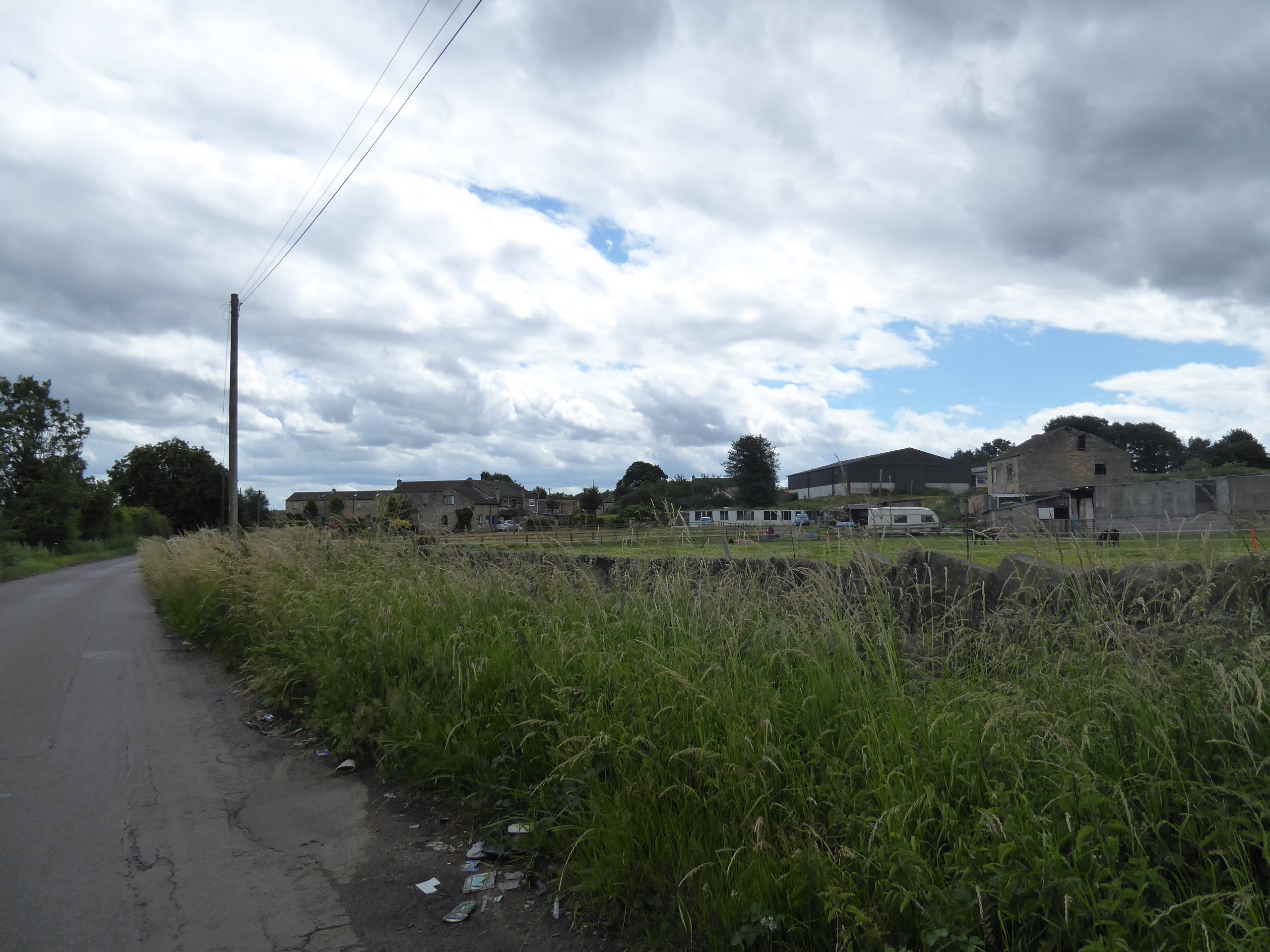
After our rail strike imposed interlude, we can get back to our questing into South Yorkshire as July rocks up, and today's start line requires quite the most ridiculous train ride to get to it, not just necessitating an early start on the ground to give me the best possible time window for, but also requiring an even earlier departure from home as there isn't a direct service to be had until much later, making this the third time this year that I've been compelled to travel the long way round when using services on the Wakey-Knotty line, and I'm sure it won't be the last either, so that we might alight at 8.55am at Streethouse. Starting out westwards along High Street, it's worth noting that Wakefield district appears to have got its bus services back as the #148 trucks past as we observe that the settlement beyond the level crossing is certainly the more substantial of the halves, taking us past its estate and primary school as we are led past the old Station Hotel, for the lost Sharlston station and over the top of the railwat triangle that once led into New Sharlston colliery, now landscaped away in the fields to the north as we pace on as the lane passes among the Coalpit Fields to the turn onto the track of Hammer Lane, that set us off south, taking us over the railway line that we didn't travel in on. Sharlston Common village lies beyond, with its suburban acquisitions reaching past its village school, which is passed around as we seek the route through the estate houses, along Jubilee and Northfield Road to find the way onto the A645 Weeland Road across from St Luke's church, where we continue southwest to the road division by the Spring Green Nurseries garden centre, and take the old Pontefract Road down its leafy passage toward the general spread of Crofton village, not on the most direct possible route considering our destination, but taking in lanes otherwise unpaced as we come down to the Church View terrace and war memorial on the Doncaster Road. Cross the A638 by the Cock & Crown inn and follow Cock Lane downhill as it passes around the western edge of the grounds of the lost Crofton Hall, now mostly buried beneath the suburbia that has swollen this satellite beyond greater Wakefield, with our route turning southeast as we join Harrison Road, passing the Shay Lane primary school and rising uphill to take us to a short detour up to All Saints church before joining the High Street, where the Crofton Old Hall hides behind the Crofton Academy, and the Royal Oak inn provides a faux half timbered contrast the rest of the main street shops, before we come up past the infant school and Sainsbury's store, ahead of the Hare Park Lane corner.
 |
| High Street, Streethouse. |
 |
| Hammer Lane. |
 |
| Jubilee Road, Sharlston Common. |
 |
| Pontefract Road, Crofton. |
 |
| All Saints Crofton, with Stocks. |
 |
| High Street - Hare Park Lane, Crofton. |
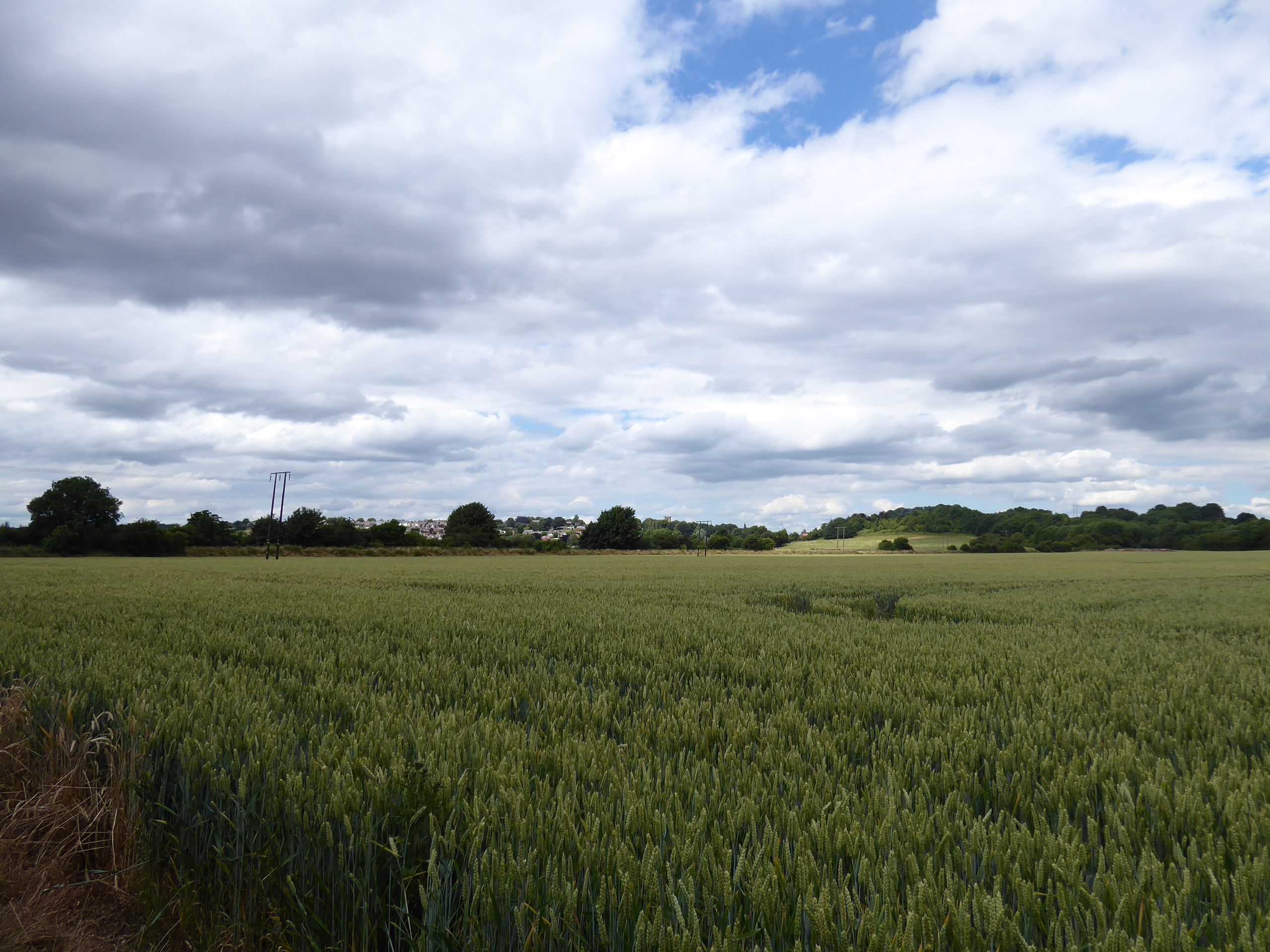
This is where trails brought us before, rising up past the local library, the village garage and the refitting Goose & Cowslip inn, as we transition into New Crofton, with its estates that grew in the last century to service the nearby collieries, with Santingley Lane leading us past the Winding Wheel memorial and the old tavern on the corner before we meet the route of the previous route out of Streethouse, taking us into the countryside as the summer sunshine makes the first of many breakthroughs, passing us over the railway line to Doncaster and on past a farm enclosure populated with donkeys and llamas before passing over the former Dearne Valley line as it passes below us and we carry on onto a new lane through the goldening wheat fields. Wave at the #196 bus as it passes, as it gave us our very first experience of this landscape as we track south, shadowing the edge of Anglers Country Park as we come down the twisting lane, passing Santingley Grange farm on the most pronounced corner before we trek on, with the gloom returning in an enduring pattern as we come around towards Wintersett village, we where started the Wakefield Way trek in the shadow of Pear Tree farm many seasons back, and we'll match those footfalls for a while as we pass through this most modest of hamlets along Ferry Top Lane, still showing little by way of suburban swelling as we come down past the Angler Retreat Inn and our uphill press on a new route on the lane up to the hillcrest at Ferry Top itself. Wintersett reservoir loiters in the landscape ahead, but it hides well behind hedges and tree as we come down to the causeway that passes over its eastern extremity, and is only really visible through the access points for anglers, keeping in close contact with the shore as we pass up and down and up again on the way into the ancient woodlands at Ryhill Pits, where bellpit remnants are surely in evidence below the undergrowth, before we scratch the edge of Ryhill village, almost next to its station site on the old GCR line, and onto Station Road by the still patriotically dressed cottages.
 |
| Winding wheel and former pub, New Crofton. |
 |
| Santingley Lane, and the golden fields of summer. |
 |
| Santingley Grange farm. |
 |
| The Anglers Retreat, Wintersett. |
 |
| Wintersett Reservoir. |
 |
| Ryhill Pits wood. |
Ryhill Pits Lane wanders into the fields, kinda southwesterly, and could takes us onto a lengthy detour off piste via Cold Hiendley, so to get back onto a southerly take we join the field path that leads south though the waist high wheat, bisecting the path of the Barnsley Coal Railway on its embankment before tangling for a few steps with the passage of the Royston - Ryhill colliery tramway, which isn't quite enough to qualify as a railway walk for today, before we're directed onto another groove through the wheat to reach the Ten Lands - Church Lane junction, with the latter getting us back on a hard surface on the way down to the B6428 crossing, where a road closure on our route is imminent as of Monday. We're lucky to not have to find a detour here, as we continue to hammer at a rate, passing a cottage on one of the Hodroyd colliery pit heads, and also over the coal tramway that we've noted from above and below on our recent local trails, before our southeasterly drift takes us in sight of St Peter's Felkirk off to the east, and the remains of Monckton Main colliery in the west, with the massive spoil tip that has been rehabilitated as Rabbit Ings country park lying ahead, as we approach it from a third different angle without entering to trace its lofty paths, but do note the bridge over nothing at its northeast corner, which marks the entry point to Barnsley borough. Sandybridge Lane drops down to its namesake stream (flowing Dearne-ward after so long on the water-shedding hills of the Calder catchment) and bridge, passing over the H&BR mainline route as we go, before we make the rise up into Shafton village, almost immediately landing us on its considerable village green, which we trace the western edge of, by the Singing Man inn, seeking a lunch break spot after almost three hours of continuous going, before we track up Dog Hill to meet the expanded 20th century half of the village, where terraces, council houses and semis landed along the High Street with the expansion of industrial activity in the area, towards the primary school and Shafton Two Gates.
 |
| Field walking through the Barnsley Coal Railway. |
 |
| Tangling with the B6428 again. |
 |
| St Peter's Felkirk, just off our trail. |
 |
| Rabbit Ings and Monckton Main, just off our trail. |
 |
| Shafton Green. |
 |
| High Street, Shafton. |
Hang a southwesterly right turn at the Barnsley & Pontefract Road junction, taking us past the Fox & Hounds inn and putting us on the same route that we took out from Streethouse in 2015 for the third time today as we pass down to the A628 as bypasses Shafton and Cudworth, staying with the main road as we get our first good view of the fall of the downstream Dearne valley, and carry on among the long terraced fronts of Upper Cudworth, where three settlements have merged into one over the years, matching the southbound route of seven seasons back all the way down to the main village heart by the old school, cinema and the Victoria inn. Split off with Snydale Road, heading us directly south and keeping us at a remove from greater Barnsley as we pass the Dorothy Hyman stadium and sports centre, and the views across the side valley to the east which reveals where our passages on the high ridge and in the vicinity of Brierley and Grimethorpe previously took us, as we find Cudworth keeping on stretching south down the Darfield Road, past the Pinfold Hotel and Birkwood school and on down through the council estates at Cudworth Common, beyond which the view opens out east across the fields of wheat and barley to the reclaimed hills that were once the spoil tips of Grimethorpe colliery. Southeastward country road walking takes over as we join Storrs Mill Road, taking us past its eponymous terrace and farm on the downhill drag that takes us into Storrs Wood where we pass over another bridge over nothing, and then the River Dearne in short order, sharing the latter's bridge with the former North Midland mainline before we rise with the south/west bank to pass over it, and then the GCR's Houghton colliery branch in its rock cutting before we run on, with thick hedges containing the narrow lane and denying us regular views towards the wind turbines around the ASOS depot on the far bank.
 |
| Pontefract Road, Upper Cudworth. |
 |
| Barnsley Road, Cudworth. |
 |
| The Dorothy Hyman Sports Centre. |
 |
| Cudworth Common, and the reclaimed spoil tips. |
 |
| Storrs Mill farm. |
 |
| The river Dearne at Storrs Mill bridge. |
 |
| Railway remnants concealed in Storrs Wood. |
It's not a hugely fun road to walk, too narrow for the quantity, and speed, of the traffic on it, with many blind and awkward kinks along the way of its path through the tiny farm hamlet of Crooke House and the slightly larger one at Edderthorpe, while the hedges deny contextual views as we sidle down south between the paths we blazed to both the east and west, rising on for a distance that feels longer than that plotted on the map ahead of the green tube of trees that finally leads us back to a footway at the Highfield end of Darfield, the relatively small section of the village that has settled around the cemetery on the north side of the Doncaster Road. Benches are found by the side of the A635, ideal for second lunch break and refuelling against a day that has hit its most overcast and chilly phase, before we press on along the main road, leaving the main bulk of Darfield village to the south for another day as we are drawn down past the lodge house and high walls of Middlewood Hall, secreted away on its bluff above the Dearne, which is met beyond the Bridge Inn, returning us to its west/north bank via Darfield bridge, ahead of the neighbouring settlement of Mill Houses, which we'll barely touch before we split south onto Cliff Road to shadow the riverside. Passing with the lane downstream, we meet some very prefab-looking council houses, and as the road progresses down what appears to be a dead-end, we meet a selection of villas at Quarry Hills which seem quite incongruously located, just downwind of Darfield railway station and the dug-out Cat Hill tunnel which passed behind them, while our path leads us onto the riverside meadows beyond the sewage farm, where an angler seems to occupy every open spot on the riverside as we wend a way down to Broomhill Road, the old lane in this quarter that was replaced by the construction of the A6195 (which we could have traced down from Shafton).
 |
| Wind Turbines and ASOS depot, Houghton colliery. |
 |
| Edderthorpe hamlet. |
 |
| Highfield, Darfield. |
 |
| Middlewood Hall Lodge, and the Doncaster Road. |
 |
| Prefab housing, Mill Houses / Quarry Hill |
 |
| Riverside walking and Broomhill Road. |
At Marle's Bridge, we take a left to continue following the Dearne as it flows east, getting as good a location as we can find hereabouts to scope our location with regards Darfield and Cat Hill, to the southeast of Barnsley, which we'll be turning away from as we pass under the aforementioned A6195 before it sets its course above the Dove valley, with the paths beyond getting that bit wilder as the river moves away in a straight line, redirected by the construction of the North Midland main line, now bisecting the Old Moor and Bolton Ings wetland reserves, with our track taking us across the old railway, and Ings Dike on its far side as we seek the path east. It's an easy find, and easy to negotiate as it's dead straight, but it's following the edge of a hillside constructed of mining spoil, and the track is deeply rutted as if no work was done after the last heavy plant left at the end of reclamation work, and it's clearly popular with dirt bikers too, with every footfall risking an ankle injury across the worst parts, while also being swelteringly hot thanks to the seasonal vegetation cover and offering no views around except directly ahead and behind, so great relief follows with it wandering northeast-ish to meet the harder track of Ingsfield Lane to take us towards Bolton upon Dearne, found beyond the H&BR Wath branch remnant (last encountered in 2015 at Frickley colliery). Back on pavements, we sail on between the council houses on the hillsdie slope, with all the north-side, south-facing ones being the best quality to go with their views, which persist up to the top of Dearne Road and joining the High Street, where the village can present a substantial rural sort of front that predates the arrival of the coal industry, which we'll walk among to the church of St Andrew the Apostle and the old Co-op store on the side of Angel Road, which is crossed to lead to Station Road and Bolton upon Dearne station, as modestly scaled and styled as its neighbours to the north, but the only one the three with historic roots deeper than the 1980s, where we rock up at 3.20pm, 20 minutes ahead of schedule over the 17+ miles thanks to the intense pace that we somehow maintained all day.
 |
| Darfield and cat Hill in the Dearne valley landscape. |
 |
| The Dearne Valley Parkway, over the River Dearne. |
 |
| The long path, Bolton Ings. |
 |
| The transition path to Ingsfield Road, Bolton Ings. |
 |
| Ingsfield Road, Bolton upon Dearne. |
 |
| St Andrew the Apostle, Bolton upon Dearne. |
5,000 Miles Cumulative Total: 5646.6 miles
2022 Total: 361.9 miles
Up Country Total: 5,169.9 miles
Solo Total: 5315 miles
5,000 in my 40s Total: 4240.4 miles
Next Up: The way to the River Don lies beyond...


No comments:
Post a Comment