15 miles, via Padfield, Runal Intake, Devil's Elbow, Torside Crossing, Torside Reservoir,
Crowden Great Brook Clough, Laddow Rocks, Grains Moss, Dun Hill, Black Hill,
Black Dike Head, Good Bent, Dean Clough, Wessenden Head, Hey Cote Hill,
Hey Brinks, Rigg Shaw, Rams Clough, Binns and Bank Bottom.
After my Summer Jollies, it seemed wise to take a weekend off, as I'd been going at it on the trail for every weekend since the middle of April, and once back in work we experienced the most horrifying temperature spike, pushing temperatures up past 30C, which were then followed by the most dramatic shift downwards as the last weekend of July came around, more than 12C cooler and with both days blighted with rain that fell for many hours, scuppering any plans for getting out regardless of how modestly they might have been scaled. As it happened, we probably wouldn't have gotten out as it was, as an impromptu drinks get together was had on the Friday evening of the 26th July with my good friends IH & AK as we needed to have one last turn around with M&SW before they move away to Edinburgh at the end of August, which was a nice break from routine and had me snoozing off the booze for much of Saturday as the rain pelted down in a way that seemed entirely inappropriate. As M&S had scheduled up a final session for the next Saturday along, being available for that would be appropriate having enjoyed 23+ years of friendship with them, but a return ticket to Hadfield was starting to burn a hole in my pocket, with the August weather looking just a weird as July's, getting in my statement walk of the year, the one with West Yorkshire's actual summit in it, had to take priority, involving a 2+ hour trip out to the part of Derbyshire that isn't threatened with being underwater after a week of storms, a journey that would be so much easier if we could get the TPEs to stop at Guide Bridge and not have to make the connection at Manchester Piccadilly. So alight at 9.40am, feeling that it's slightly odd that it should be here, about as far south as is possible, that I have chosen to make my contact point on the west side of the Pennine divide, admiring the once mainline station that now sits at the lonely end of its branch line, starting out be retracing steps to the Trans Pennine Trail, admiring the views over the suburban rooftops to the moors to the north of Longdendale before passing under the old Woodhead Line at Platt Street bridge. This leads us into Padfield, among the old terraces and newer arrivals that have clustered around the largely still industrial site of Hadfield Mill, rising with the long uphill terraces of Post Street, which seem to be the way of such things on the west side of the Pennines, heading up past the former Wesleyan Chapel to meet the old rural village on Padfield Main Road, around the Peels Arms inn and displaying a whole wad of rural charm on the lane up to the Whitehouse Farm B&B.
 |
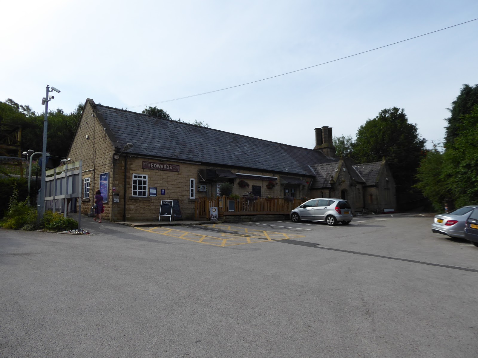
| Hadfield station. |
 |
| Post Street and Platt Street, Padfield. |
Arriving above the village, past the last house situated in a quarry, we find ourselves to the south of both our previous paths through Longdendale, and much higher up the valley side, which gives us a wholly fresh perspective on the valley, as Hadfield sits low down behind us, with the Tintwistle Moor and Rakes Moss rising above it to the northeast, with Peaknaze Moor rising ahead of us on the south side, as we elevate up between the high cistern chambers of the Runal Intake reservoirs, to get the sneaked looks to the suggestion of Greater Manchester's presense beyond the valley of the Etherow. Land on the B6105 Woodhead Road, which is one of those roads for the motoring connoisseur, it seems, as it settles onto the high valley side, giving us a look to the Peak District fringe and modest hills around Glossop before we set off into the valley with purpose, with Bottoms Reservoir revealing itself in our wake, and Valehouse and Rhodeswood Reservoirs soon becoming apparent at the valley floor, below their heavy fringe of forestry cover on the north bank, whenever it feels safe to walk on the wrong side of the road, which is quite often as we approach the hairpin into the cleft of Ogden Clough, which even old maps call the Devil's Elbow. The water run off in the stream sounds pretty fierce after the rains of last week, though today is already starting to feel sunnier and warmer than had been projected, which isn't going to get complaints from me until we've travelled far enough without of shade, as we manoeuvre around below the high moorland top of Nell's Pike with the sharp outcrops of Bramah Edge looming large above its own conifer plantations, while our continued elevation give us looks towards the high Loftend quarries and the Sykes Moor end of Bleaklow before we start to descend, passing the Old House B&B, before getting full sight of Torside Dam and the approaching line of trees that once concealed the railway and now houses the Longdendale Trail, as we come down below Reaps farm and the huge and looming cleft of Torside clough and we come down to Torside Crossing. It would be easy to follow the cyclepath eastwards on towards Penistone from here, but we have to join the Pennine Way to head north, finding it heading down towards Torside Dam, below the pylons and electricity cables that progress up the valley, and out over the top of the embankment to the north side, getting a fine view of the upper stretch of the valley across the waters of the reservoir, with the Shining Clough end of Bleaklow hanging high over it before coming around to meet the heavily flowing channel of the River Etherow running noisily into the spillway and overflowing into Rhodeswood reservoir below.
 |
| Peaknaze Moor, and the Runal Intake reservoirs. |
 |
| Yateholme and Rhodeswood reservoirs, below Rakes Moss. |
 |
| The Devil's Elbow, and Ogden Clough. |
 |
| Torside Crossing. |
 |
| Torside Reservoir, and the flank of Bleaklow. |
A bench near the Torside reservoir house provides a convenient spot for elevenses, and the water goes down easily after less than an hour and a half of trekking which immediately gets me anxious that I might run low on the most exposed trip of the year, but such worries are put aside as we follow the Pennine way through the trees on the north bank, shading us well as we pass below the hamlet of Hollins, mere metres away on the road above a ribbon of fields, with the rough edge of the Rakes Moss moor above, while our interest is drawn to the Torside crossing houses on the south bank. Rise with the path to make our crossing of the A628 by Highstones Lodge, and having crossed through our narrow field of walking experience in Longdendale, we set off with the rising track of the Pennine Way along the valley's pre-turnpike road to set a new western border onto it, passing uphill in a deep groove that opens out to give a view over to the dramatically large Torside Clough, while directing us forwards toward Crowden, with the quarried out hillside above and our eyes travelling upstream beyond Woodhead dam, to follow the turnpike and the salt road as they make their way onto the hills on the South Yorkshire border. Altogether a grand vista to take in, but the time to head north and off-road comes as the Pennine Way splits off through the rising fields to start the long 300m of ascent towards Black Hill, which we can get no sense of the presence of from here as we head over the field crest to enter Crowden Great Brook clough, with its sides rising 200+m above the floor, and the tongue of Bareholme Moss filling out its middle, separating it from the Little Brook branch to the east, and we progress on the rough track through the bracken, rising gradually below the rocky edges of Black Tor above to our left. The way ahead is visible though, rising 200m to the top of Laddow Rocks and the drama of the setting is enhanced as we pass out of the sea of bracken onto a heather lined run, with the heat of the sun coming on stronger as we meet the stream that splits the path below Rakes Rocks, where great care is needed to cross before we hit the hard rise beyond, steeply ascending on a rock path among the bracken, with the sound of waterfalls flowing down from the moorland springs above on the high edge that wears scars of recent landslips. Easing off to a level section at 320m up for a while, the drama of the upper valley unfolds further, showing up the sharp pinnacle of Castles rock, above the valley's narrowest point, far above where we are now, and the hope of keeping a pace with the other walkers heading up the trail is shed, as a half dozen people burn me off on the rise up to Oakenclough Brook, where a watering break is needed with some urgency as we come over the 400m contour.
 |
| Torside reservoir and the Crossing Houses. |
 |
| Hey Edge, Woodhead dam, and upper Longdendale. |
 |
| The turn into Crowden Brooks clough. |
 |
| Ascending Crowden Great Brook Clough |
 |
| Laddow Rocks, and Castles rock. |
Refreshed and with the heart rate down, we push onto the final stretch of the climb, now high enough up to get some vertiginous views back to see the bulk of Bleaklow sealing off the valley's passage behind us, and the channel of Crowden Great Brook settles into a deep groove at the valley floor, while the path we ascend varies in quality wildly, some times paved, sometimes rough and rocky, and occasionally wandering far too close to the edge as we rise to come above Laddow Rocks, still ascending as the cliff face falls away below us, not a good place to be if you don't have ahead for heights. At 500m up, a view can finally be grasped of Black Hill, rising modestly above the the moors of Roundhill Moss to the northeast, with the Holme Moss mast elevating to give us some useful local context, while we pass the path junction that splits off towards Mossley in the Tame Valley and the sheer drops of the gullies on Laddow Rocks drop away with regularity, and despite not getting close to the 540+m moorland top on this side, we get better illustration of height from looking back at the rock pillars that hang onto the valley side. We can also get elevated views from here, up to the Woodhead Pass, across the entirety of the Bleaklow Plateau and southwest to what must surely be the Cheshire Peak District, with Shining Tor in there somewhere, which makes that corner of the world feel that bit closer after our jaunt that way last year, before we turn attention forwards again and the path starts to make its way downhill, which is frustrating after all that ascending, noting that the Castles rocks don't rise nearly as boldly when seen up close. So downhill we go, away from the moorland edges of the Broadslates and much closer to the influence of Crowden Great brook, which forms a much gentler channel as we run into the moorland heart, meeting a couple of horribly steep drops to stream crossings before we finally run out into level terrain, where the heat feels much greater than that which was projected for the day, and we break for lunch by the stream, just behind the folks who overtook me. Then on, into the heart of the moorland, ringed by a local horizon despite being at some altitude, following the beck carefully as the path crosses it, or its interceding streams, as we press on into Grains Moss, with the rising track towards Black Hill still evident among the moorland grass, while I feel the mild elation of a grand old day to be out here as this is a landscape from which no joy could be extracted on a greyer or wetter day, even with the flagged path ensuring that we won't get lost in this scarily featureless landscape.
 |
| Looking back above Oakenclough Beck. |
 |
| The reveal of Black Hill above Crowden Great Brook. |
 |
| Looking back from Laddow Rocks. |
 |
| Black Hill, Holme Moss, and Castles rock. |
 |
| Crowden Great Brook flows off Grains Moss. |
We start the climb away from the clough that has brought us this way so far, meeting a moorland fence and stile, which divides this open access land, which would restrict free roaming potential, even if the way so far hasn't offered a single place for a transitory path at any point in the last couple of hours, and as the climb starts though the long browning grass of Dun Hill starts, we anticipate the reveal of our distant surroundings as we elevate ourselves up towards the 500m contour again. The view expands across the 520m elevation, returning the Dark Peak and Cheshire Hills of the Peak District to the southwest, and adding some Lancashire hills to the northwest, with the fringe of Rossendale and Winter Hill both describing familiar shapes at quite and extreme remove, and as we follow the path onto increasingly agitated turf cover on the summit cap of Black Hill., we get views up the spine of the Pennines, towards Boulsworth Hill and Pendle Hill at an equally great distance away, before we land among the folds of dark peat that cover our day's summit at over 570m up. It gives us an almost alien landscape at the hilltop, one which has been somewhat restored with a new regrowth of turf from its days of exposed and soot-blackened peat, not that its couldn't be unchallenging now with suggestions of bogginess and dank pools of water all around as we come up to the summit trig pillar at the Soldier's Lump, at 582m up, the highest point in West Yorkshire, which we finally meet after so many miles, and once the highest point in Cheshire, which seems like the historic county might have gotten lost if you're only familiar with its post 1974 boundaries. It's a fine panorama to take in too, as the eastern horizon is revealed, looking over the Holme Valley and Huddersfield, to the distant fringe of the Wolds, with too much haze to reveal much detail beyond Emley Moor mast and the Aire Valley power stations, and the only poor view is to the south east, where the elevated bulk of Holme Moss offers no view to the Upper Don valley and the stomping grounds of the early High Season, but we can enjoy being on a three-way watershed while we're up here too, as waters flow from here to the Holme and Etherow, and also the Tame, into Greater Manchester. Stomp on, over the English Watershed and among this elevated flatland going over to the West Yorkshire side, pacing a long way before we come up above Issue Clough to look down into the Holme Valley proper, and pause for late lunch completion at Black Dike Head, where we can look through binoculars to distant Leeds in the north east, and more locally towards the West Nab end of Meltham Moor (which has none of its familiar profile from up here), and north towards the Colne Valley as we sit and rest by the last guide cairn on the declining path.
 |
| The flagged path up Dun Hill to Black Hill. |
 |
| The 'Cheshire' watershed, and the remote Lancashire horizon. |
 |
| The 582m trig pillar at Soldier's Lump, Black Hill. |
 |
| The southeast view to Holme Moss, Black Hill. |
 |
| Issue Clough and the Holme Valley, from Black Dike Head. |
It ought to be two hours to the finish line from here, perceivable below the angled shape of Pule Hill above Marsden, beyond the Wessenden valley, which we have a lot of moorland to cross to get too as we start off downhill, finding that there's no one at all on this side of the hill, having met around two dozen traveling in both directions on the Derbyshire side, which confirms my belief further that the South Pennines is an under appreciated bit of terrain, which spreads ahead of us as we shed height on the flagged path that has superseded the peaty grooves of the old Pennine Way. Signage indicates a detour to take if waterflow in the forthcoming cloughs is too intense for crossings, directing us over to the relatively nearby Kirklees Way path but we'll retain today's boldness and continue on over the moorland of Good Bent as we shed 150m of altitude and land in a sea of purpling heather before we have to descend into Dean Clough, down steep steps that deflect us away from the apparent straight line up to the A635. Fortunately, it's not a treacherous crossing, despite the churning that comes on after last week's rain, though the climb up the north side isn't friendly when you want to be on a downhill all the way dash, and once we've risen high enough to gain a good hillside profile behind us on Black Hill - Holme Moss, we've got another descent to do to cross Reap Hill clough, beyond which another 50m of height has to be regained to meet the trunk route that links the Holme and Tame valleys, where the famous snack van no longer resides in its layby sadly. The moorland grass paths to Wessenden Head have gone it seems, and the Pennine Way angles over to meet the Kirklees Way route by Wessenden Head Road, sealing a new border as we start to retrace steps from 2014 as we come around above the valley head, taking in our last views back to the Black Hill massif before we set off downhill on that route that I know is going to be further than anticipated, hammering the dirt track down to Wessenden Head reservoir. Company returns to the tracks down here, as people enjoy the afternoon sunshine on the trek up from the Colne Valley below, which teases ahead of us as we come down by the spill channel of the upper reservoir and angle down towards Wessenden reservoir with the flow of Wessenden Brook, but following a five years old route to the finish line doesn't appeal, and an elevated alternative path appears ahead as we come around the corner Leyzing Clough enters the valley, keeping to a consistent height of about 360m, which we ought to follow for the benefit of a fresh perspective on familiar terrain.
 |
| Crossing Good Bent, with West Nab on the Horizon. |
 |
| Dean Clough. |
 |
| Reap Hill Clough. |
 |
| Holme Moss and Black Hill from the A635. |
 |
| Wessenden Head Dam. |
So this vaguely marked map track is joined, and immediately appeals as it carries us above the ocean of bracken that surrounds Wessenden reservoir, carrying us around the western slopes of Meltham Moor, which are marked with names on the OS map, like Hey Cote Hill, to the southern side of the Sike Cloughs, which show marked signs of water management even at this altitude, and on to the Hey Brinks hillside beyond, where we can watch the Pennine way peel out of the valley to the west as we carry on around above the vast water surface below. Come around again for the Butterley reservoir reveal, above Marsden, and appearing well ahead of Blakeley reservoir much further upstream, enjoying the wildness of the terrain before we settle onto the grassy path that follows the catchwater drain that runs all the way around the Deer Hill slopes with regularly placed bridges crossing it to allow animal access to the fields of Rigg Shaw above, which all adds another layer of interest to the landscape before we meet the runoff channels and sluices above Rams Clough. The proximity to the finish line is felt, but we are going to be too high up to get down if we don't start descending soon, and we're not on the markded paths either, and so a roughly stepped route has to be taken to get us down the access land exit by the viewpoint and turning circle on the dead end of Binn Lane, which we follow by the farmsteads that cling to the 300m contour before twisting our way down through the fields above Butterley reservoir, and across from the cricket fields, dropping out by its dam, back on the Kirklees Way route. Binn Road is thus followed down past the Bank Bottom Mills, with the local terraces giving us some of that angled downhill flavour that I ascribed solely to the western side of the Pennines, leading us down to the Mount Road crossing and on down Fall Lane between the Marsden Mill site and the Marsden FC pitch that is being maintained by grazing sheep, before we pass under the A62 bridges that angles the turnpike over Wessenden Brook, as we land among the cottages at the end of Towngate. The two hour run to the train has proved beyond my hurry up it seems, and so we idle our way past St Bartholomew's parish church, and over the River Colne by the ancient Packhorse bridge upstream from Station Road, which we join as the wave of drinkers and revellers arrive in town off the latest westbound train, a scrum I'll happily leave to their devices in my wake as my day wraps up beyond the canal at the railway station at 4.55pm, too late for the train but in good time for the #185 bus, which can send us in the direction of Leeds with enough evening left to join M&S's farewell session and to demonstrate well why boozing after a day's walking really isn't a good idea, even when it's totally socially appropriate.
 |
| Wessenden Reservoir. |
 |
| Blakeley and Butterley reservoirs, with Pule Hill. |
 |
| The Deer Hill conduit at Rams Clough. |
 |
| The high farmsteads of Binns. |
 |
| The contrasting terraces of Bank Bottom, Marsden. |
 |
| The Packhorse Bridge on the Colne, Marsden. |
5,000 Miles Cumulative Total: 4047 miles
2019 Total: 396.6 miles
Up Country Total: 3630 miles
Solo Total: 3732.8 miles
Miles in My 40s: 2640.8 miles
Next Up: Staying in the Colne Valley, now that we've arrived in it.


No comments:
Post a Comment