Yateholme reservoir, Holme Woods, and Gill Hey.
 |
Long Distance Trail means Selfies!
#1 at Berry Brow. |
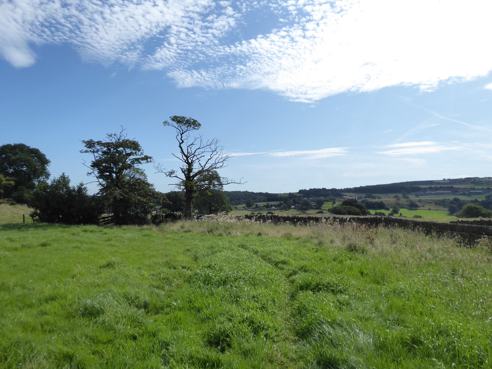
It seems that my cursing of this Summer's weather has brought us an exceptionally warm August Bank Holiday weekend, and I'm not going to complain when I've got 24+ miles of walking on the Holme Valley Circular to come, but it's a frustrating contrast to the conditions that I got this time last year when any sunshine on the peaks of Upper Wharfedale would have been appreciated, but we'll take it when it's here even if an early start will need to be in order as the outbound leg of this trip has shown up to be a much longer route than I had anticipated. It seems that the Holme Valley circular is the forgotten route of Kirklees district as no route guide is in print and there's not a single sign or waymarker for it anywhere on the ground, with only the OS map showing up its route on the OL288 plate, and that will have to be our sole navigator as we ride out to Berry Brow station, on the edge of greater Huddersfield and amazingly still not the last station to be visited on the Penistone line, where we alight at 8.20am, surely ahead of all but the most dedicated dog walkers of the borough. So away into the morning haze, and on down Birch Road past the school at this smart outer perimeter of town, with out first destination of the day silhouetted by the low sun, as our trail takes us over Bridge Street and then up Lady House Lane, with its stepped terraces and improbably located suburban outliers along its steep uphill drag, where we soon split off for a field walk, through the damp long grass. We are getting fine views westwards, though, across the wooded cleft of the upper Holme Valley towards Meltham Moor to the fringes of the Colne Valley to the north, and they are views that expand impressively as we gain altitude, up the side of Cold Hill, though the path route is vague as we scratch our way up to the track at the top, which takes us through the cluster of farmsteads at its crest, with a direct line ahead towards Castle Hill. A rougher track ascends us up to Ashes Lane, where small farmsteads cling to the high ridge edge which we have to look down from, towards the spread of Huddersfield below which feels a lot less alien than it did five years back, but still not quite familiar enough, which positively basks in the morning sunshine nonetheless, as does the view to the southwest and the upper Holme Valley, where so many miles will be put down further into this trip.
 |
| Berry Brow, and the way to Castle Hill. |
 |
| The lower Holme Valley, and Scapegoat Hill, from Cold Hill. |
 |
| Castle Hill from Ashes Lane. |
Focus needs to turn towards Castle Hill as it looms massively ahead of us, which can be accessed straightforwardly from the stepped path up from Lumb Lane, landing us on its rampart below the Victoria tower, pacing around its embankments and ditches that somehow feel much more ancient to my eyes than they did in 2014, taking in the view north that also makes a lot more sense when attached to the experience gained over the subsequent walking years, before heading south between the enclosures that occupy the plateau of this vast oval hillfort. I'm far from alone up here, exactly as predicted, and thus the solitude of the Circular path must be sought by descending the access road on the southern side and seeking the path that splits off onto a shady and angled descent behind Castle Hill Side farm, roughly descending us through the late Summer undergrowth before we spill out into the meadows below, which occupy the green valley that spreads to the south, a space shockingly empty of contemporary growth, and still full of active agriculture judging by the haymaking going on in the steep fields. It's grassy walking all the way down towards the farmsteads of The Lumb, and even these paths aren't quiet as the bank holiday dog walkers trace the paths that lead into Molly Carr wood, where the valley bottoms out with a passage over Lumb Dike under the shade of and then ascends the fields on the other side, but only briefly enough to get a contextual view towards Almondbury before entering the larger forest of Royd House wood. These are woodlands that feel ancient, largely thanks to the extensive presence of Beech trees and the lack of conifers, and our path never gets vague as it rises on through the crunchy carpet of beech nut husks, eventually emerging into steep fields that the sheep seem to be enjoying more than I do as we step purposefully uphill, gaining ourselves a nicely lit view back Castle Hill before we hit a better track furtehr up, which directs us up towards Fanley Tyas. There aren't going to be too many villages to visit along the Circular Path today, so we'll make the most of them while we can, even though this one hasn't really got going yet, so there'll be no pub crawl that starts at the Golden Cock on the Butts Road corner, and despite having not been out long, a rest already feels necessary, and the shady environs of St Lucius's churchyard will do nicely for that, certainly better than sitting in the direct sunlight by the War Memorial, as we've got a lot of walking south to come, as the route soon has us out into the fields of Farnley Moor where no shade is offered in the already rising heat of the day.
 |
| Huddersfield from Castle Hill. |
 |
| The way to Farnley Tyas with woodlands and haymaking. |
 |
| Lumb Dike and Molly Carr wood. |
 |
| Royd House wood. |
 |
| St Lucius's church, Farnley Tyas. |
These flat fields occupy the high bank between the Holme and the Shepley Dike (et al) valley, which gives us an eastwards look to a stretch of terrain that we have seen much of since the earlier going of this season, with the Emley Moor masts above it, and we keep on south, with no obvious distant horizon ahead as we trace the way though the fields toward Whinney Wood farm, where we cross Thurstonland Road and re-enter the fields beyond and finally rise towards a hill crest where the upper Holme Valley is revealed, from Cheese Nab around to Holme Moss. It's another viewpoint which someone has bagged for their wedding reception, judging by the marquee assemblage going on, and they're certainly due a good weekend for it, perched above the bank that we have to descend through the gorse bushes upon to get down to Hall Ing Lane, as we make our passage around Height Green farm and set sights towards Thurstonland village, which perches above its high bank on this valley side, with its spired parish church of St Thomas sat at a significant remove from the rest of it. This path at the valley side is one we've crossed before, on our first trip to Holmfirth, and the views down in that direction expand to encompass the whole valley as we pass over the point where Thurstonland tunnel passes below us, and successfully spotting its air shafts are almost a point of pride before we follow the rough walls into the village beyond, where the old farmstead seem to have had the executive do-over but the rustic character of it doesn't seem to have been lost at all. Land ourselves on the main road, just down from from the Rose & Crown inn and up from the Methodist Chapel, with the bank road looking like it makes really hard work of getting up the 100+m of ascent from the valley below, and we've go a hard ascent to follow on our path, up the boundaries of the ancient stripped fields to attain the top of Haw Cliff, the hillside beyond which looks distinct on this side of the valley thanks to the modestly scaled by still prominent pair of wind turbines at its crest, from where the Holme Valley expands mightily again, and we descend from its southern face even more sharply. We can look forwards to the high brow around the roughest part of the eastern valley side as we head down among the gorse and tufty grass with the New Mill dike branch of the river ahead of us, but we soon press east to land on Cold Hill Lane and meet the field walk away from the Biggin farms which almost feels like its removing us from the Holme Valley as we go, feeling the heat as the lower fields in theses parts are completely free of breezes.
 |
| The Shepley Dike valley, and Emley Moor, from Farnley Moor. |
 |
| The Holme Valley from Holme Moss to Meltham Moor from Heights Green. |
 |
| Thurstonland Village. |
 |
| The New Mills Dike branch, with Cheese Nab and Hades Plantation, from Haw Cliff. |
 |
| Cross-Countrying to Fulstone. |
The next village aim is for Fulstone, with the lack of decent waymarking on the Circular route making it harder to track towards than might be expected, and for a village that has its name on all the parish boundary markers ahead of some of the others in this quarter, it's not a big place at all, loosely associated over only two lanes and mostly occupying a footprint that hasn't enlarged much in the last century, it's all made over to look desirable for the modern resident, but feels like a hamlet with an ego thanks to its apparent lack of both church and school. Back into the field we go beyond, finding our uphill route back onto the high border of the valley, and that mean needing a map to route find to head up towards Ebson House farm, and for wits to be kept sharp as we have to head right through a cattle field, where they sound agitated by my presence but are thankfully effected enough by the heat to not get mobile, which is good as running uphill might have proved beyond me and as the wooded bank at the top is achieved, a rest for watering is in order. Head up through the trees and holly bushes to meet the Kirklees Way route, which we'll tangle with a quite a bit in the later portions of today, getting a fine view back over the path just traveled before we head over the cresting fields past the covered reservoir towards the A635 Penistone Road by the houses at Marsh Lane Top, and it would be easy to just retrace the steps of five years ago, but I'll mix up the route a bit to take us into the house cluster, which is barely a hamlet, at Gate Foot and work our way up to the high path via The Gully, a deep groove that has been made even rougher thanks to a pipe being laid up and then barely covered by a half-arsed resurfacing. That lands us on Hirst Lane again, but as we've attained moorland altitude for this first time on the Circular, it's worth following the shared route of the Kirklees Way again, as it carries on around Hirst Brow, at the western edge of this upland hillside that we've seen most of the rest of during the course of this season, largely because the views are enhanced by our improved landscape knowledge and by the fact that it's a lot nicer today that it was in September 2014. It's fine view to take in from Holme Moss round to Emley Moor, as the valley spoils us for viewpoints, adding Snowgate Head and New Mill to the valley below as we come around onto High Brow and then start the descent on the rougher path as attention is drawn to Scholes, Hepworth and the 400m ridge that encloses the southern side of the valley as we come down from the heights to meet Scar Hole Lane, in the shadow of Cheese Nab, one of those excellent cycling roads which really means everyone who rides up it does it really slowly.
 |
| Fulstone village. |
 |
| Reverse view to Fulstone, Haw Cliff and many cows. |
 |
| Gate Foot from The Gully. |
 |
| New Mill, etc, from High Brow. |
 |
| Meal Hill, Hepworth and the route to come. |
Slip down this absurdly steep lane, and fail to find the switchback path that supposedly takes the Circular path down to Meal Hill house, the one notable for its gazebo, ornamental lake and rock terrace, which we also encountered in 2014, so another variation on the route feels appropriate, heading down through the shade to meet the Meltham House terrace and then follow Tenter Hill down as it twists its way downhill to South View to give us the conviction that Jackson Bridge is a settlement entirely distinct from its uphill neighbours. Crossing the A616 Sheffield Road and heading along Chapel Bank gives us a good vantage point to look over its rooftops and high terraces, down in the valley below the Red Lion inn, and also providing an extensive look over the Dobroyd Mill site, which is very derelict and partially demolished, and due redemption within a year or two, which passes behind us as we come down to meet Hepworth Road and Butt Lane, which passes over the valley floor before pulling uphill sharply into the village beyond, passing the council estate and suburban growths that have attached themselves to it before we arrive in old Hepworth properly where we find the shaded bench at the bottom of Town Gate to take lunch before charging up for the final push of the day. To avoid last weeks path, we set off up Upper Gate to take in the back lane and the Kirklees Way route in reverse among the history of sheep farming and wool weaving happening in shuch close proximity, passing the Butcher's Arms again before we hit the Circular's official route into the fields to the south, which only last one field before I start seeking an alternative due to basking cows on the route in the nest plot up, which shifts us onto a track behind Hepworth's other suburban edge before we drop onto Far Lane. This alternate also offers us some tree cover for extra shade as we press on uphill past the Intake farms, and getting views back to the purple crowned banks of the valley to the east before we meet Cowcliff Hill Road and get back on track with the Circular as it comes around the top of Strines Clough and Dean Head Bank wood, passing Jordan Cottage and then slip off it again as it cross-countries its way away, and we stick with Strines Moor Road as it takes us below the embankment dam of Boshaw Whams reservoir. It's home to the Huddersfield Sailing Club, and despite its facilities with its prominent lookout tower, and seemingly favourable weather conditions, no one seems to be boating today, and so we see no action at the edge of moorland altitude and carry on to get the route back, found beyond the B6106 Penistone Road and off Daisy Lea Lane, where another cattle field has to be crossed, where the cows bellow noisily at their calves but all remain immobile due to the fierce heat of the afternoon.
 |
| The Meltham House terrace, Tenter Hill. |
 |
| Dobroyd Mills, Jackson Bridge. |
 |
| Upper Gate, Hepworth. |
 |
| Looking back to High Brow and Cheese Nab. |
 |
| The Huddersfield Sailing Club, Boshaw Whams reservoir. |
This lands us half way up Snittle Road, a notably unadopted lane which has the Hade Edge sports club and a mushroom farm at its lower end, and a long an grassy pull up through moorland fields in a dead straight line in its top half, giving us views over the ever-expanding Hade Edge village and over the Holme Valley in general, tagging this trail well for giving as many excellent vistas as possible, so if the shape of it all isn't burned into your mind's eye by the end of it, you'd have have been really failing to pay attention. Past the Snittlegate farms we land by the former Junction inn on the Dunford Road and shift west with Bare Bones road, named after the lost hamlet that once serviced the now-abandoned quarries on the edge of the moorlands that stretch from here over to the Don valley to the far south, that trackless quarter that will need a lot of imagination to explore, following the lane as it comes around to the apparently nameless plantation that covers a large chunk of the declining hillside, which we enter to gain shaded among the vast plots of managed conifers to gain shade from the heat. Descend with the lane, pondering its identity, getting the occasional sightline through a felled area to the far side of Hade Edge, and choosing to name it Hades plantation to go with the now ruined farm at its centre, next to where the management offices now reside, though the real fun comes once we need to make the traversal of Reynard Clough, which means a steep downhill on the access road, followed by an equally tough pull uphill in the far side, the sort of landscape experience you can have be seeing it up close. Beyond the plantation perimeter, we meet the fields of Copthurst Moor, and the path of the Kirklees Way, again, as it follows the track past Elysium farm, and then we swiftly abandon it again as the Circular carries on straight to the White Gate farm campsite, which is doing a roaring trade today, before we hit the track beyond that descends through the fields to the top of Dobb Dike clough, where I couldn't be sure that someone isn't herding cattle using a helicopter. This brings us above the main branch of the Holme proper, as we trace the paths and tracks along the edge of the clough, gradually rising us onto the route that will take us around Crow Hill, where the local cows will mostly idle and ruminate aside from the one that wants to stand sentry, and we can peer downstream to Holmfirth and Hinchcliffe Mill before we come around into the upper valley, and getting a much better view than the one we had five years ago, revealing Digley reservoir across the way and Holmebridge village and Brownhill reservoir below.
 |
| Snittle Road, and the Snittlegate farms. |
 |
| Hades Planataion. |
 |
| Reynard Clough. |
 |
| Copthurst Moor. |
 |
| Dobb Dike clough. |
 |
| Digley reservoir from Crow Hill. |
The Holme Moss - Black Hill massif rises ahead and Holme village appears across the valley, tantalizingly close, and as we come down through the moorland grasses to meet the Kirklees Way for the last time, we find we do have time for another detour, to see some features up close that we might have otherwise missed, switching onto the mountain biking appropriate track down through Ramsden wood to meet the well hidden dam of Riding Wood reservoir, which forms a peaceful idyll below the massively rising moorland cliffs of Ramsden Clough above, and offers a view down to Ramsden reservoir below. We then stick with Kiln Bent Road to bring us around by the embankment dams of Yateholme reservoir, which contain the vast cistern of water above us, one which looked so very tiny when viewed from 200+m above on the Holme Moss road, the surface of which we never get to see as it's obscured by the surrounding trees as we rise into the upper reaches of Netherley Clough, with Holme Moss still looking like an utterly impenetrable barrier of moorland beyond as we rise up the valley's head, possibly the uppermost crossing point on the river Holme. Here we swing around for the dash to the finish line, starting to feel the bus deadline tightening as Holme Woods Lane skirts its eponymous plantations, before the landscape opens out to reveal the royally purple fringe of Ramsden Edge high above to the east, and aiming our attention right downstream to the eastern end of the valley, where I'd hope the wedding reception on Farnley Moor's edge is now in full swing. We split off the lane rather than retrace steps down the A6024 via Lane hamlet, which takes us into the moorland fields of Netherley Brow, which mostly trace a wall line to keep open field navigation relatively straightforward, but I'd failed to anticipate the presence of Rake Dike in the landscape, and the steeply stepped descent down to the Gill Hey bridge at the base of its wooded chine comes as an unwelcome surprise, as does the sudden pull up the other side. Thankfully, we are close enough the finish line to not worry though, as the bus turning circle appears above and the path leads us up to the back gardens of Holme that have the best afternoon view to the moorland edge behind them, landing on Woodhead Road opposite the Fleece Inn where a shandy or three would be welcome if it wasn't so busy, like the whole village and more are out drinking, and the bus down the hill has already arrived so we hot foot it to the square at the bottom of Meal Hill Lane for a 3.30pm finish.
 |
| Holme Moss from Crow Hill. |
 |
| Riding Wood reservoir and Ramsden clough. |
 |
| Yateholme reservoir dam. |
 |
| Holme Woods. |
 |
| The way to Holme, with Rake Dike. |
 |
| The Fleece inn, Holme. |
That's only 5 minutes ahead of the #314 bus, which is a bit close for comfort, but feeling ready for the two hour trip homeward that is unfortunately inevitable when you are compelled to pick a remote destination like this one, though that's no real matter as we've already got two-thirds of the Circular down before we come back for the return leg's start on Monday, which promises to be easily as hot as this one, which might, hopefully, put memories of this deeply changeable month of Summer weather to bed forever?
5,000 Miles Cumulative Total: 4092.6 miles
2019 Total: 442.2 miles
Up Country Total: 3675.6 miles
Solo Total: 3778.4 miles
Miles in My 40s: 2686.4 miles
Next Up: August Bank Holiday Monday, and inbound on the Holme Valley Circular.


No comments:
Post a Comment