18.5 miles, via Turton Heights, Cheetham Close, Turton Tower, Jumbles reservoir,
Turton Bottoms, Edgworth, Wayoh reservoir, Entwhistle, Edge Fold, Cadshaw,
Darwen Moor, Darwen Tower, Earnsdale reservoir, Tockholes, Chapels, Stockclough,
Green Hills, Holly Tree, Cherry Tree, and Pleasington Fields.
 |
Long Distance Trail
means Selfies!
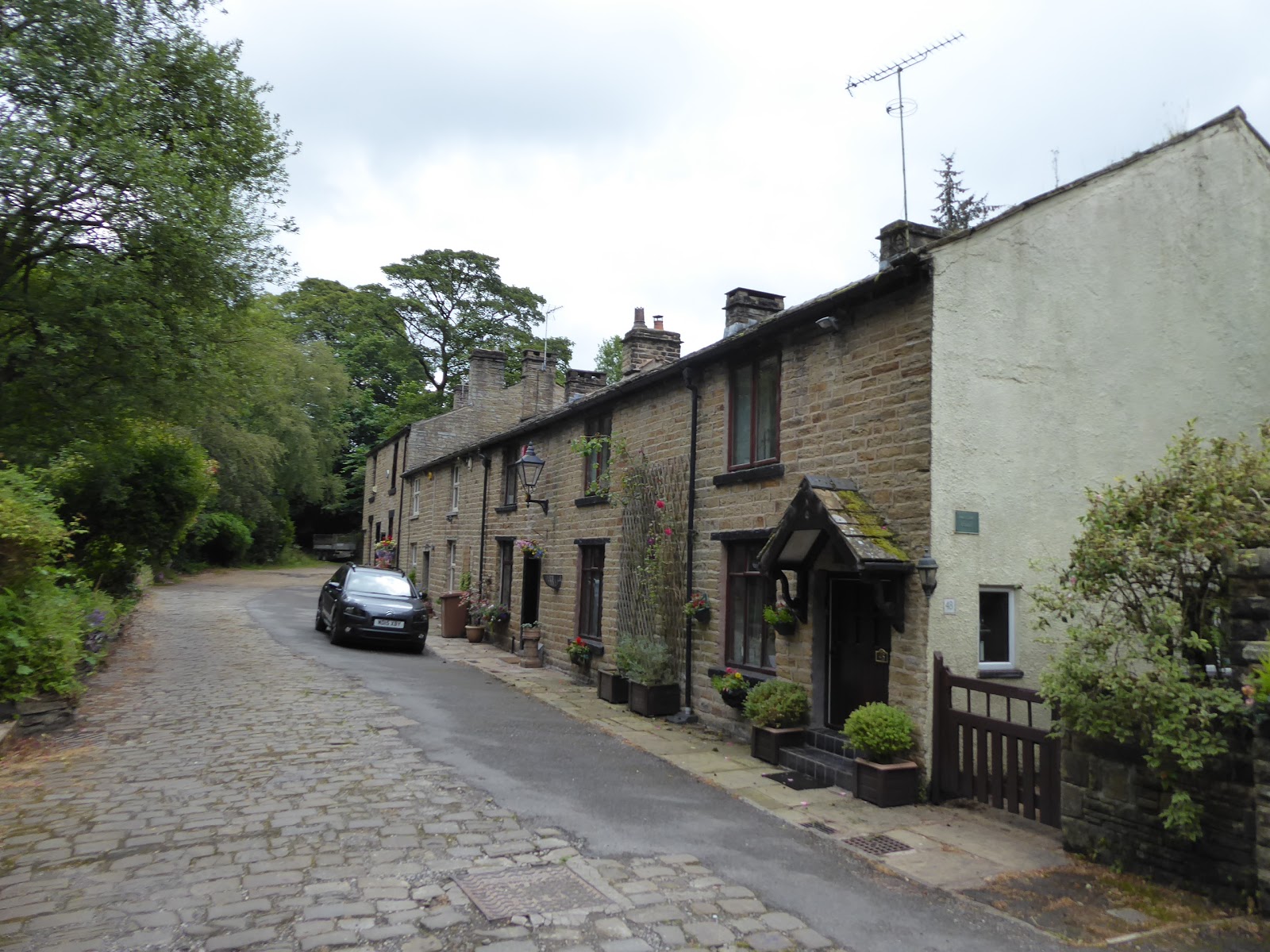
#2 at Dimple.
|
The way this week has scheduled, with our trip to the Land Registry falling on a Tuesday, and with us visitors not wishing to get in the way of My Sister's family's first weekend of the Summer holidays, we are thus compelled to walk on consecutive days so that we might get away on Friday, which forecasts as deeply mediocre, and leave myself enough weekend to blog properly and get the brain in order before I find out where I might be working next week (the last couple of weeks since supposedly transferring to St James's hospital have seen me bouncing all over the LTHT sites). So we rise early, which is absolutely necessary as this 32 mile trail hasn't conveniently divided into equal pieces, and so up the lane we two head from Egerton to Dimple for an 8.35am start, with both of us taking entirely different expectations of the weather to come on the day as we pass Ciao Baby and make our way further up the A666 Blackburn Road to pick up the Weavers Way as it takes us past Buffs farm and onto the fields to the north of it, aiming ourselves uphill to attain the top of Turton Heights, which isn't the most straightforward of aims as its over 100m up from the roadside within half a mile. The local cows in this field seem more curious than yesterday's as to our progress up through the long grass, but we've gotten enough of a head-start on them to get out of their enclosure and onto the steeply rising moorland path unscathed, with early sunshine coming on to tease us with warmth and illumination of the valley of Eagley Brook as we can almost see down to Bolton before we land on the moorland cap with a decent enough track, heading up to the crest to get a view over to the Bradshaw Brook side and on to the Holcombe Moor side and Ramsbottom Peel Tower. Unfortunately, the way forward on the crest toward the southern end at Cheetham Close follows a ditch through the knee length grass, which is firm enough to walk on, but the morning dew soaks into our trousers and waterlogs our boots before we get far past halfway along the top, where a fence and a wall block our path, and My Sister curses the route forcibly and states her intention to travel no further up here as we're forced to stop and wring out our socks, and ponder the wisdom in our choice of route, especially as a herd of cows sits at the summit beyond.
 |
| Buffs Farm. |
 |
| The best possible view of Bolton, from Turton Heights. |
 |
| As near as we're getting to Cheetham Close. |
So My Sister takes on the role of navigator as we reset our path, descending from the hillside via a circuitous route, one which we've surely paced in part before on our local travels, down to the lane that grazes the rough edge of this hillside among these marginal fields, where we stop to wring out socks again and pick the route for the day, eventually deciding to go against the feelings of defeatism and pick up the whole circuit of the Weavers Way as best we can, even if half the trip will be a directionless loop and My Sister will be going against a convergence of pains that she had tried her best to set aside. Onwards, then joining the loop of the Warpers Trail as it occupies most of the south eastern corner of the route, taking us initially on the long drag along the farm track lane that appears to only service Clough House farm as it traces its way back towards the point where we should have come down from Cheetham Close, and then drops us down a wooded groove to where we pass over the Bolton to Blackburn railway line on a markedly castellated bridge, which seems a bit like embellishment overkill until you recall that it sits on the estate of Turton Tower, the Tudor Manor and noble house of this area. Its current role is as a visitors attraction, and its signage is widespread in this quarter, though it sits too far from the lane to be well seen as we pass, landing in the extensive but vaguely defined district of Turton, which seems to encompass most of the valley at this end, and we set off into it past Tower farm and along the B6391 to meet the WWII era pillbox gun emplacement by the roadside, the true purpose of which can only be speculated upon as we join the field track that rises us over the fields to the east, passing a delightful natural pool at the crest before we descend into the trees that surround Jumbles reservoir. Easily the youngest of the cisterns that supply Bolton, we land at the footbridge at its narrow top end, its capacity mostly to the south of us, where the Horrobin Mills complex disappeared below its surface on completion in 1971, and we'll cross the eastern bank, where we pause again to give the socks a wring out before the path strikes north, past the flooded quarry workings at the tip of the reservoir and into the narrow and well concealed passage of Bradshaw Brook, another woodland glade with a river burbling its way through it, where the sunshine teases an appearance through the trees again.
 |
| The 'Turton' valley, with Holcombe Moor. |
 |
| Turton Tower. |
 |
| The Turton Pillbox. |
 |
| Jumbles Reservoir. |
We've done well for finding the hidden river valleys of the West Pennines on this trail, as our path snakes along the riverbank and under the shade of trees, while showing up the fragmentary remains of goit channels and sluices that once controlled the water flow over the weirs to service the mills downstream, which is a landscape usage that seems hard to imagine amongst the contemporary greenery but feels a bit more obvious as we approach Turton Bottoms, and the site of Vale Cotton mill, where the mill terrace still sits by the riverside in a suburban idyll. This all feels like a modern enclave of expensive little closes squeezed in the compact river valley, but illustrates well the lost history of the area, as the older cottages to be found down here are from the age of domestic weaving, and the upscale developments have grown on the sites of various later mills, which produced paper and bleach (both local specialities, it seems) as well as materials deep into the 20th century, where our path crosses the stream a couple of times before taking us into the site of Quarlton Paper Mills, of which just a sole chimney remains, among the houses you could never hope to afford. We rise out of the valley here, up some unfriendly steps and onto a field path, which takes us above the mill's reservoir, which still sits above the houses below, as we elevate up towards Meadow Crofts farm and start to acknowledge that the Weavers Way is having a bit of a wander as we rise high enough to still have Cheetham Close and Turton Heights in our immediate locality, with Edgeworth as our next village target on the western bank, which we'll come around to via the field path that leads into the woods where Quarlton Brook flows. Pass the overgrown reservoir with its still extent weir among the trees to find the rising path into the village, with the sounds of the primary school ringing in the air, landing behind The Barlow, the village institute of long standing, the recreation grounds of which we are compelled to pass through when the shorter route of the Way over to Bolton Road is found to be aggressively overgrown, and so we head south on a slight detour among its expensive suburbian terraces, descending towards the Wesleyan chapel, with the spire of St Anne's church in Chapletown sitting across the valley and inside the path's loop, meeting the Black Bull inn on the road corner.
 |
| Vale Mill terrace, Turton Bottoms. |
 |
| Weavers cottages, Turton Bottoms. |
 |
| Quarlton Mill chimney and concealed reservoir. |
 |
| The weir in the woods near Edgworth. |
 |
| The Black Bull inn, Edgworth, and 4,000 miles before I'm 45! |
The gravel path away from the road here leads us above the waterworks and dam of Wayoh Reservoir, where we can stop for elevenses after three hours of travel, with the way finally looking like it's going to set a course towards Blackburn, after too many early miles of not really getting going in any particular direction while My Sister can declare that she's already decided to not push on to the day's end, planning to bail out at the midway point before the convergence of pains she's enduring gets too much for her. So we press on to the rising path that leads to the reservoir's perimeter path, a track that was the very first that I walked with my Elder Niece in the spring of 2007, heading around the grasslands that have been grown on the Edgeworth Quarry sites, looking across the waters of this Y-shaped reservoir, with the moorland tops above it and with Armsgrove viaduct crossing its western branch, while our path takes us up the northern arm, past the Hob Lane embankment and up to its northern extremity, where a lot of imagination is needed to place the Know Mill print works in the landscape, all lost with the reservoir's enlargement in 1962, as we cross Broadstone Brook and seek the rising path away. This leads us uphill, to the lane on which the vaguely present village of Entwistle sits, not even marked on the OS map but still in possession of a station on the Bolton - Blackburn line, which is one of the few request stops on the railways, and also a popular pub, the Strawbury Duck, which you'll visit a good few times before you notice the apparent misspelling of its name, and from here we set off past New House farm and onto the well built track that will lead us off to the moors along Edge Lane, passing around Entwistle reservoir without getting sight of it. This is apparently a good cycling route, despite the rough and narrow section that passes than manicured lawns of one of the remote cottages at Edge Fold, which has a fine countryside view of the valley we've traversed, secluded away from nearby Bolton and Bury, and also the main farm looks like a promising fixer-upper too, with the track beyond elevating us out of the valley and directing us on towards the high end of Longworth Moor, with Winter Hill returning to the horizon as we wend our way over towards the A666, which is a longer trip than we both anticipate, among marginal fields with their lost farmsteads and false summits that seem a lot closer together when traversing this landscape on two wheels, as it would normally be travelled.
 |
| Wayoh Dam. |
 |
| The Hob Lane embankment, Wayoh Reservoir. |
 |
| The Strawbury Duck, Entwistle. |
 |
| Edge Fold and its inspiring view. |
 |
| Winter Hill and Longworth Moor on the horizon. |
The last crest brings us upon Cadshaw, one of only two hamlets of note on Blackburn Road between greater Bolton and Darwen, nestling in the depression between the moorland uplands of these parts, which is not much more than a farm and a former pub, and not an hour's walking distance out from where we set out this morning, but is large enough to have a layby where Dr G can park to pick up My Sister, and supply me with additional biscuits for the long solo push over Darwen Moor, with some four hours of the Weavers Way still ahead of us, and it's a shame we couldn't manage the whole trail together, but such is the way the world turns sometimes. We find the moorland track below Cadshaw farm, and press on to meet the path of the old pre-turnpike road as it passes the ruined Cadshaw Brow farm, where we stop for lunch, sheltered from the bite of the wind that is really taking grip now we are in a more exposed landscape, steeling ourselves with sugar in preparation for the trek along the track that will lead us above the cleft of Cadshaw Brook, which we had so much fun trying to find away across in 2015, following the Way as it elevates us on to the high brow to the north of it, tangling us up with the Tacklers Trail again among the many fields of sheep and a marginal landscape that used to have multiple farmsteads in it, which have now all been lost. Use of map and route guide is essential to find the way to the path at the western side of Darwen Moor, once above 300m, rising with a wall to a blind field summit (where moorland cows repose in quantity) and then descending to the corner of a plantation of conifers on the moorland edge which we pass through to finally meet the northbound path, which is much lower down than would be expected, landing among the long, reedy grass as we settle onto the western side, with the Jubilee tower on the northern end of the moor, and Darwen spread in the valley below, which we look over to the eastern horizon of the moorlands between Hoddlesden and Haslingden. It's a long haul, but level going, to bring us around to Lord's Hall, the prominently located house on the moorland fringe, thankfully not a hard path to trace as the song of the Curlew fills the air and the view over Darwen gets more detailed, with the chimney of India Mills rising prominently and the route of my 2015 Irish Sea trek becoming more obvious, as we pass above the Wet Head farms, and over the channels that drain the moorland around them, before we finally escape the rough path and land on the driveway of possibly the ultimate smart house in a deeply inconvenient location.
 |
| Cadshaw hamlet on Blackburn Road. |
 |
| Cadshaw Brow farm (former). |
 |
| Taking the high track onto Darwen Moor. |
 |
| The reveal of Darwen. |
 |
| Darwen Moor, and Lord's Hall. |
The tarmacked lane has to be descended, so that we might traverse our way across the deep gouge of Duckshaw Clough as its brook runs off the moorland edge, where the most accessible path to the heart of Darwen Moor rises, though we aren't going that way and instead find the sharply rising path away from the lane to keep us on the western fringe, giving us a good look back over the path just travelled and over the apparent valley to the east, even if its waters flow in both directions, south to the Irwell and north to the Ribble. Pendle Hill adds itself boldly to the horizon as we get all the moorland terrains of long grass and moorland trees, and bracken and heather as the path swing around the high edge above Darwen, rising on for a ways until the Jubilee Tower returns to the horizon, the most prominent point on the moor despite being far from the highest, and we start to feel much closer to the end of the day as the environs of Blackburn return to the landscape, beyond the passage of the M65, and good cheer finally arrives on the day as the sunshine finally starts to break apart the cloud cover that has hung heavy for so long on the day. My Mum calls so a progress report might be passed on, and despite all that has gone before I feel like we are only 15 minutes behind schedule as we reach the colourful stretch of moor that leads us over to the Jubilee Tower, which takes an age to arrive as moorland distances prove hard to measure, landing below the folly of 1897 as the exposed promontory gets buffeted by winds from the west, which means shelter has to be sought once we've done our circuit about it and the 372m trig pillar to relocate so much of what we've seen on the horizons of the West Pennines, before we look on to the north and east, to locate Todmorden moor's windfarm, and the shapes of Great Whernside and Buckden Pike at the absolute extremities. So the feeling of being not as far away as could be thought is felt again, tying this corner of Lancashire so much closer to Yorkshire than had been imagined and with Billinge Hill rising so much closer beyond Blackburn, it feels like it ought to be pretty plain sailing as the path downhill is joined, taking the obvious route that heads off the moor at a pace, down towards Sunnyhurst Wood, to the west of Darwen, which we take our last look towards as we descend, above the completely empty chamber of Sunnyhurst Hey reservoir, above the town.
 |
| Duckshaw Clough. |
 |
| The Western edge of Darwen Moor. |
 |
| Darwen revealed, again. |
 |
| The Jubilee Tower, Darwen, aka Darwen Tower. |
 |
| Descending from Darwen Moor toward Blackburn. |
Before we get down the full way, we split off on a slightly westwards tack, field walking over to the waterworks road that comes down from the empty cistern above, which we follow down to the Waterman's house by the side of the road, which we cross to join the lane down to Earnsdale Reservoir, and find a string of HGVs coming down this way, which you'd hope isn't still for the remedial work that was ongoing here in 2015, but is doesn't foul our path like it did then, which allows us passage over the dam, where we can take in the sharp end of Darwen Moor, and the cleft of Earnsdale that split it. We hit the northern side, and meet the route of the Irish Sea Trek, which we follow up the steep and wooded passage before we untangle ourselves from the Tacklers Trail as the route from 2015 pushes over the nearby Roddlesworth reservoirs, following the narrowest point on the Weavers Way, as we press north with the rising Trash Lane, among the well tended fields that apron the West Pennine moorlands, which still dominate the southwestern horizon, passing among farmsteads and county cottages that seem to have supplanted the ones from a century ago as Weasel Lane brings us about for a view over towards Preston and Fylde again, with Blackpool Tower looking more prominent this time, and with the Forest of Bowland marking a sharper northern horizon too. We soon land in Tockholes village, but only after a fashion as its many houses remain scattered among the elevated fields with no obvious nucleus, giving it the feel that it has maintained this fashion since the days of the domestic weaving industry, with very few new arrivals landing among the old cottages, and from our place on Tockholes Road, we arrive at a distance from the tow pubs that endure out here, and pass the old Sunday School and the back of Silk Hall farm as we seek the path that angles away downhill. Away from the elevated portion of the village we head, past the cattle that won't be roused and into the enclosures of sheep that are all too happy to get agitated, towards the separate enclave of Chapels, home to the village school and church, with its impressive lychgate and old schoolhouse with its exterior pulpit that looks very 17th century, while St Stephen's church itself is actually a modern structure, beyond the enduring ancient fragment of its gothic porch, which we'll pass around to meet the ongoing route beyond the smart little enclave of houses at Pickering Fold, developed on the old farm site.
 |
| Waterman's Cottage. |
 |
| Earnsdale reservoir, with Darwen tower and Earnsdale. |
 |
| The high path over Trash Lane - Weasel Lane. |
 |
| The old Sunday school, Tockholes. |
 |
| St Stephen's church and the Sunday school, Chapels. |
A field walk lies beyond, as we tangle up with the Reelers Trail again, tracing the boundaries as we work our way over towards the M65 again, with the hills from the early going of the first leg rising ahead of us, as the long loop of the Weavers Way comes into its late stages having hidden well from its western and southbound path for so much of its length, as we carry on though the grass to pass over Sheep Bridge brook in its wooded glade, before rising beyond to meet the edge of the motorway, which my map indicates is crossed on a diagonal path, but it's clear that we need to trace the narrow track at its perimeter to make a safe passage under it. This is done as we join the lane that leads down from Higher Whitehalgh farm, passing below the carriageways before we pass into the cover of Stockclough wood, which is home to the Blackburn Outdoor Airgun Club, and its idyllically sited firing range, which we pass on the rising lane, to find all kinds of snarling up of traffic as it tries to enter and exit Lower Whitehalgh farm, doing the school run from the Little Acorns nursery, and the route guide has to be consulted to not have us visit it and instead find the correct route along its old driveway. A field track beyond leads us towards Fowler Fold farm, but gets vague among some grassed over spoil heaps, and I'm not entirely certain that it was meant to deposit us in its yard and paddock, but there's no one about to correctly direct me as we get back on track down the driveway, with Hoghton Tower's hill on the western horizon, and the satellite village of Feniscowles sitting in the landscape ahead of us as we make our way over to Broken Stone Road, where we join the field path past Horden Farm, with its view towards Black Combe in distant Cumbria and the llamas and alpacas in its enclosure. Approaching suburban Blackburn, it seems to be growing beyond its mapped edge on Livesey Branch Road, sprawling up the fields and cutting off the path thanks to the building work going on, and the route diversion isn't obvious, with inadequate signage and a well concealed map not helping matters as we faff around for a while before picking up the route that angles us through the sheep fields and to the western corner of the Green Hills development, and behind the gardens of the semis on the A6062 before meeting the path again at the entrance lane, hopefully to be properly restored once this suburban enclave is completed, where we call Mum to tell her that my finish time is going to be somewhat later than planned.
 |
| Field Walking toward a familiar horizon. |
 |
| Meeting the M65 again. |
 |
| Stockclough Wood and the Airgun club. |
 |
| The westward horizon from Fowler Fold farm. |
 |
| The Green Hills development fouls our path. |
My intended finish time passes with more than a mile of the route still too go, feeling slightly puzzled that the distance down from Darwen Tower has proved to be much longer than expected, landing firmly in the late afternoon heat as we enter the outer edges of Blackburn, following the pavements as they lead us into the suburban Holy Tree estate, following the main drag of Pinewood around the many closes with an arboreal theme (the Vaughan Williams fan in me noting Linden Lea), for a distance that just keeps on going before we meet the alleyway and path that leads us to the passage over the Leeds & Liverpool canal at Livesey Hall bridge. Pass the pyramid-topped Livesey Library before we emerge onto Preston Old Road, and the features from yesterday's trip continue to reappear in short order as we pace the side of the A674 from the Feng Shui care home and into the district of Cherry Tree, finding another suburban path to walk along as the Weavers Way leads long The Crescent among pebble-dashed semis and bungalows developed on the site of Livesey Hall, from where a footbridge leads us over the Blackburn - Preston railway line. The guide's directions into Pleasington fields are vague and even the map route seems unhelpful, so the cyclepath that leads to Witton Park is joined to give us the best sense of direction, vanishing into the dense cover of trees before it wends its way downhill and into the open onto the common fields along the sides of Tower Road, where we could contemplate abandoning the official route for a rapid burn the finish line, until we see that we are upon the car park indicated by the route guide from where we can meet the path by the side of the River Darwen, again. So eastwards with the Beamers Trail along the riverside path, by the all weather playing fields and cut the last corner off the Weavers Way to enter Witton Park via the convenient footbridge to roll over to the close of the loop the trail by the Arena at 5.15pm, 45 minutes overschedule and feeling a lot of the discomfort that comes with having walked too many miles, but the Parental Taxi is there waiting for me, for which I'm wholly grateful, and thankfully, I'm not too late to adversely affect our plan to get the family out for a meal to celebrate Dad's birthday. So we head back to base with a completion of this plan that really has been on the schedule for far too long, and it's been hugely illuminating to see now that the landscape around has become so much more familiar, and even though My Sister didn't put down all of the miles of it down with me this time around, as of next year, I'm going to start persuading her that we need to do the Rossendale Way together, as Lancashire needs so much more walking investigation.
 |
| Pinewood, Holly Tree estate. |
 |
| The Crescent, Cherry Tree. |
 |
| Pleasington Fields |
 |
| Crossing the Darwen to enter Witton Park |
 |
Long Distance Trail means Selfies!
#3 at Witton Park.
|
5,000 Miles Cumulative Total: 4032 miles
2019 Total: 381.6 miles
Up Country Total: 3615 miles
Solo Total: 3717.8 miles (9.7 miles walked solo)
Miles in My 40s: 2625.8 miles
Next Up: West Yorkshire's Big Hill, is finally targeted, come rain or shine.


No comments:
Post a Comment