16.4 miles, from Tanshelf, via Friar Wood, Mill Hill, Hardwick Lane, East Hardwick,
Whitegate Hill, Badworth Hunt Kennel, Standing Flat Bridge, Thorpe Audlin,
Thorpe Grange, Walton Wood, Barnsdale, Barnsdale Bar, Skelbrooke, Harry Wood,
Hampole, Red House, Roman Ridge, Woodlands, Beck Hill, Hanging Wood, Highfields,
Scawsby, Lady Pitt's Bridge, St Mary's Bridge, North Bridge, and Frenchgate.
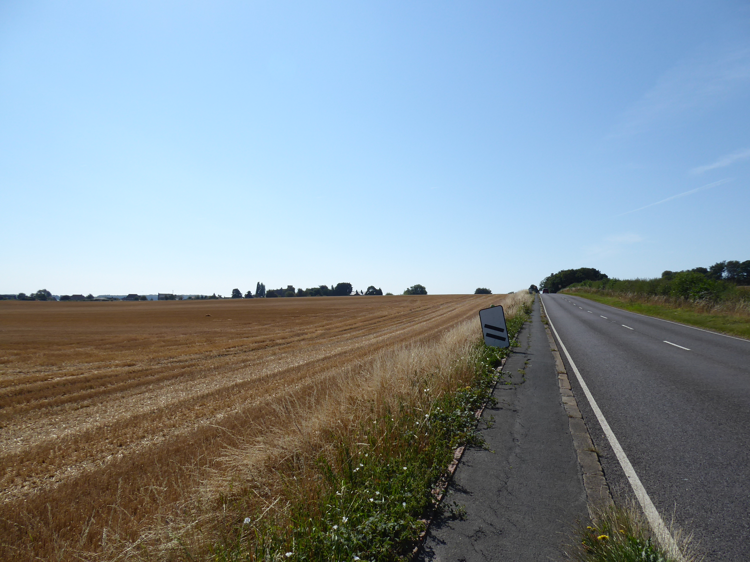
If there were ever a day that needed an 8am start it was this one, as Saturday has us settling into the fifth day of the mid-August heatwave, but such options aren't available to get us to the start line before the day's heat has started to kick in, as there's no early services to be had via Castleford thanks to engineering works (rather than strikes that Northern aren't being affected by), and bus services are no alternative when the need is to get going in a hurry, and thus the first ride to take us directly out to Tanshelf is two hours later than I'd have liked, returning us to Pontefract's other station nearly six months after I laid it down as one of this season's jump off points. Alight at 10.05 am, dressed in the summer get-up of light shirt and floppy hat, carrying much more liquid than food, and hoping that the day's trek, to the 12th and final new destination for the year will prove as unchallenging as I'd project as we rise to the side of the A639 Park, which will be our companion for a while as it leads us south past the western edge of Pontefract Town centre, uphill past the former Queen Hotel, and the Haribo factory, which looms large over its store at the end of Cornmarket and following Jubilee Way as it crests over the town's hilltop to descend down by the end of Ropergate and the Central Methodist church before we get into a tangle with the A645 Southgate, at the west end of Friar Wood gardens. Away from the Wakefield Road, we rise with Mill Hill, passing through a shaded groove in the landscape, concealing what appears to be caves in the rock faces amidst the landscape of villas as we pass south ito the suburban reach of the town beyond the Carleton Road crossing, and keeping on as we meet the division of the A628 Barnsley Road, hanging left as we meet the wide boulevard of the Hardwick Road as it pushes out of town, along the supposed alignment of the Roman Ermine Street, passing under the upper half of the Swinton & Knottingley railway line and into the fields beyond, into the Little Went Valley. The footway keeps us secure along the straight and quiet passage of the A639 as it passes among the fields, across the fall f the streams as we pass Haverlands farm, looking east to the rise of Went Hill and heading up the modest rise among the parched and recently harvested wheat fields in the full glare of the sun as we head along towards East Hardwick, the sole village of note along this stretch of the lane, which is probably why the traffic is so light, coming up the rise to pass the cottages and pump at the west end of Darrington Road, before we lose our pavement and have to brave the metalled road surface beyond, across the east end of Ackworth's Station Road and over the Wakefield Way route.
 |
| The Queen hotel (former), Park Lane, Pontefract. |
 |
| The tangle of the A645 and A639, Pontefract. |
 |
| The division of the Hardwick and Barnsley Roads, Pontefract. |
 |
| The Went valley, beyond the railway line, Hardwick Road. |
 |
| East Hardwick in the Went valley landscape. |
 |
| Darrington Road end and the pump, East Hardwick. |
We also rise with Whitegate Hill as it divides the branches of the Went Valley, not properly regarded when we traced the paths to the slight west of us in 2015, but actually looking like a proper valley as we crest over, with the Walton Wood - Upton Beacon ridge ahead, and the fall towards Wentbridge lying to the east as we approach the loose association of the hamlet that has settled around the Badsworth Hunt Kennels farmstead, which sits with its caravan parks ahead of the fall towards Standing Flat bridge, where we cross the Went proper and our path from two weeks ago, enjoying a brief interlude with a footway before the southward rise starts in earnest. Signs greet us as meeting Thorpe Audlin, which sits to the west of the main road, and its scatterings of farmsteads are acknowledged as we rise up across the B6474 by the Fox & Hounds inn, taking us outside of the Field of Walking Experience again as the Roman Ridge Road abandons any proximity to civilization on the plough uphill toward the southern crest of the Went Valley, with mast and water tower now rising on our southwestern horizon, as the steady rise drags us up towards Thorpe Grange, the one farmstead on the roadside, as we gain altitude to give us some surprisingly haze-free views back across Wakefield district, through the thick and uncut hedges. Past the driveway to Walton Wood farm, and its rather alleged airfield, we find the road pitch intensifyin as it leads us up to the eastern end of Walton Wood, giving us the sole stretch of sketchy passage as we pass the cottage on the crest and come around the reveal of the eastern horizon, with the A1 making iself apparent ahead of the fields we paced amongst over the last pair of weekends, with Drax power station standing sentinel over the flatlands of the merging Aire and Don valleys, with Goole being picked out some 20 miles away with an extreme telephoto view as we progress, not falling away downhill as the mast reappears on the western horizon, above Upton village.
 |
| The Went valley horizon, from Whitegate Hill. |
 |
| 'Badworth Hunt Kennels', Doncaster Road. |
 |
| The Fox & Hounds inn, Thorpe Audlin |
 |
| The Roman Road in full effect on the ridge climb. |
 |
| Walton Wood farm and mast, plus Upton Beacon. |
 |
| Drax Power Station and the eastern flatlands, beyond the ridge crest. |
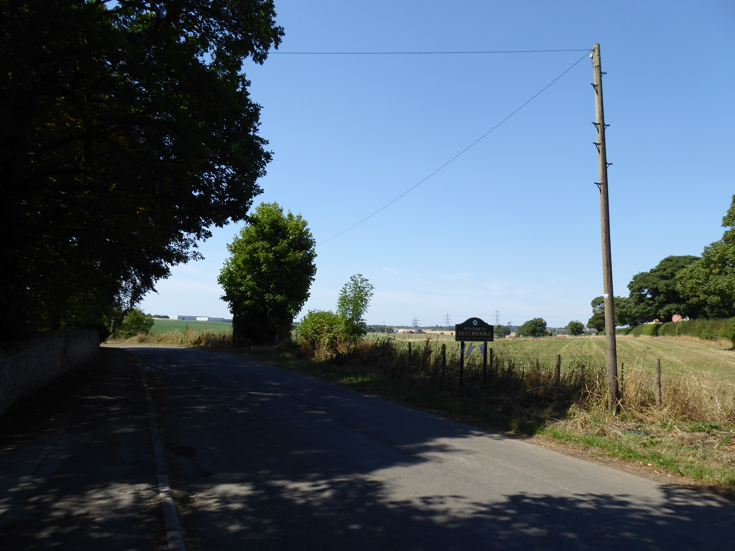
We pass above Barnsdale tunnel, through the woods that run along the length of its passage with the old H&BR mainline below, and also passing the Paddock caravan park as the southbound A1 draws in towards the A639 to the west of Cusworth Hill, with the combination of the two roads eventually arriving as we come down towards Wrangbrook Lane, as the Great North Road chooses to claim the Roman Ridge Road and thus our early phase of surprisingly secure road walking ends among the tangle of lanes at Barnsdale Bar, by the transport cafe and the lay-by that absolutely reeks of urine. Also depart West Yorkshire as we join the bridleway that shadows the A1, briefly pacing atop the ancient embankment before we are forced into the field of fodder crops to peel away from the road and descend some, whilst getting a renewed horizon that places us amongst the known landscape, looking directly ahead towards the Hampole and Marr wind farms, as well as the spread of Brodsworth Park, while the west reveals the depots to the east of South Elmsall, while the view to the southeast revels our relative proximity to our destination, at barely half way through the day. Alight onto Bannister Lane at the top edge of Skelbrooke village, where we pass around the cottages and the grounds of it hall and parkland (another one!), before taking the rough path that leads us to the heart of this would-be hamlet, which qualifies as a village thanks to the presence of St Michael & All Angels church, which provides necessary shade and a bench for our lunch break, before we strike on down Straight Lane, past the farm and trio of council houses before we turn onto the dirt track of Doncaster Lane, where we can look east towards Robin Hood's Well and Summer House farm on the eastern horizon.
 |
| Above Barnsdale Tunnel. |
 |
| Barnsdale Bar, where we quit the Roman Road. |
 |
| Field walking towards a familiar-ish horizon. |
 |
| Landing in Skelbrooke, actuall rather close to South Elmsall. |
 |
| St Michael & All Angels, Skelbrooke. |
 |
| The dirt track of Doncaster Lane. |
We pass east of reclaimed quarries, themselves east of the ones at South Elmsall, and also the H&BR South Yorkshire Junction branch which has apparently been erased from the landscape to the north, only to rather suddenly find it as we join the westward passage of a shaded track that reveals the partially infilled three-arched bridge and deep cutting that runs south, which we can't safely venture into, instead taking the turn beyond the artistically stacked stones and fairy houses in the glade that leads south through Harry Wood and onto the field path that leads down to Leys Lane, just west of the station cottages of Hampole Station.We cross over the bridge over the Leeds - Doncaster line, above the station site, noting the remains of the H&BR bridge too as we rise to the hamlet of Hampole, which feels barely apparent around it priory site and manor farm at the side of the A638, where the footway of the Doncaster Road is joined, propelling us east again, below the Hampole wind farm and along the noisy drag of the main road, where a lot of motorists seem to not want to drive all that sensibly as we rise uphill between the Hampole Grange farm and the old lime works, ahead of the entanglement with the A1. It's all change with the roads once we're across H&BR branch again, as the A1(M) quits the old roads to become motorway bypass around Doncaster, and the Great North Road itself splits off south of Skellow to make its own passage south by Adwick, which frees the Roman Ridge Road from the accretions of the modern transport network, and once it can be located beyond Junction 38, via a rough and concealed track below Red House farm, we can have it all to ourselves, getting a explanatory noticeboard giving us some local and ancient history by the crossing of Rockingham Way, by the traffic island with a globe on it, where shade need to be sought for watering ahead of the press through the day's peaking heat.
 |
| The three arched bridge on the H&BR branch, Harry Wood. |
 |
| Field walking with windfarm and lost railway on the horizon. |
 |
| Main Street, Hampole hamlet. |
 |
| Hampole windfarm from the A638 |
 |
| The concealed limeworks betwixt road and railway. |
 |
The A1 and the Great North Road untangling
themselves from the Roman Road, Red House. |
Thus the 30+C portion of the day will coincide with our entry into greater Doncaster, resuming our trek down the remains of Ermine Street as it passes through the wooded band between the Red House industrial park and the Woodlands housing estates, west of Adwick le Street, feeling a surprising remove from the urbanism as we go, only getting the proximity revealed occasionally, such as by the Fair View park, where someone has set the underground reservoir on fire, popping out across Ridge Balk Lane where three vintages of housing meet, or getting the reveal to the brick and spired All Saints church in the old portion of the council estate. The decent byway surface drops from its ancient embankment to pass below Beck Hill and its plantation, to meet the natural groove that was once formed by Langthwaite Dike, where access can be gained to the Brodsworth community woodlands, on the former colliery site seen from its far side a few weekends ago, where a railway branch also cuts in from the east, which is passed over as we rise through Hanging Woods, which elevates us to the level of the Highfields estate, another strip of council houses which has a block of ancient barns hidden behind them, beyond which we meet open fields, giving us an eastern horizon, where distant windfarms and the Goole docks can again be picked out, beyond the ends of the Aire and Don. Our modest elevation still finds us on a plateau of sorts, among the level fields around the urban cluster of Little Canada, and the suburb of Scawthorpe, with the old Great North Road not too far away to the east as we tramp on, meeting the few cyclist who are out to brave the heat as Green Lane is crossed and the increasing proximity of Doncaster is teased by the minster church tower rising ever closer on the horizon ahead, a view frequently obscured by the thick and overgrown hawthorn hedges, as the Roman Ridge road draws us into the newest city on the county, granted it elevated status in the Platinum Jubilee honours this year, finally met as we arrive behind the Greenwood estate and Rosedale Primary school.
 |
| The Roman Road in the woods behind Woodlands. |
 |
| Behind the back gardens of the Woodlands estate. |
 |
| Passing over the depression between Beck Hill and Hanging Wood. |
 |
| The ancient barns behind the Highfields estate. |
 |
| On the Roman Ridge behind Little Canada. |
 |
| Doncaster Minster teased on the horizon. |
The byway is maintained as we enter suburban Scawsby, across Stanley Road and on down behind the back gardens and garages to Alwyn Avenue and beyond, only settling into a multi use track beyond the builders yard and Scout hut, ending in the yard of a tyre garage and landing on the side of the A638 York Road by the Sun inn, just ahead the A635 Barnsley Road, where there's just enough shade to grab a watering break before we set a course toward the city centre, passing the York Bar WMC before finding that we don't have to have dual carriageway for the full trip townward, as we slip onto the adjacent suburban front and cycleways that take us over the Trans Pennine Trail on it railway path again. The roadside is resumed as we pass the extensive Danum retail park, before we are elevated over Lady Pitt's bridge, taking us over the rather modest Swaithe Beck, before an old portion of York Road is followed over a flood plain bridge that has no modern use as apartments block stand next to it, which leads to St Mary's roundabout, where the A19 and the Sprotborough Road get tangled in, along with the station avoiding railway line that passes overhead, and we pass between the car dealerships and the Three Horse Shoes inn to come over the river Don via St Mary's Bridge to meet the ancient end of Marshgate, the old road out of this side of town. The North Bridge road elevates us over the famous crossing that takes us over the Don Navigation and the railway station's northern throat, just up from the GNR's Doncaster Plant works, with the minster church of St George sitting to the north as we come down by the Frenchgate shopping centre, which can't be passed under with the A630 Trafford Way and thus we detour onto the High Street among a modest number of shoppers to loop around the centre, via St Sepulchre Gate and West Laithe Gate to arrive in front of Doncaster station, with its LNER vintage Art Deco buildings and recent campaign of prettification that's created a plaza outside it.
 |
| Roman Ridge behind the back gardens of Scawsby. |
 |
| York Bar, York Road, Doncaster. |
 |
| Lady Pitt's bridge, on Swaithe Beck, Doncaster. |
 |
| St Mary's bridge, on the Don, Doncaster. |
 |
| North Bridge, and the Minster church, Doncaster. |
 |
| Doncaster High Street. |
 |
| Doncaster Railway Station. |
We should also note the art installation of A3 nameplates outside, which I'd hope were all historic winner of the St Leger Stakes, before we pass inside to wrap the day at 4.10pm and make our way from the most 1930s of concourses straight to our train home, eschewing the chance for a prolonged train-spot, as there's a limited number of services on the rails today, and it's been a hectic sort of trip anyway, burning up a right old pace to get this one down on schedule, on the hottest walking day of the year too, and there will be plenty of opportunities for a revisit in a cooler climate, as after reaching a dozen new destinations across the county, we've already reached the end of that trajectory for 2022 (and in the middle of August!).
5,000 Miles Cumulative Total: 5738.2 miles
2022 Total: 449.5 miles
Up Country Total: 5,257.5 miles
Solo Total: 5402.6 miles
5,000 in my 40s Total: 4328 miles
Next Up: Walking in the Park so that another national train strike doesn't cramp my style...


No comments:
Post a Comment