19.3 miles, via Milford Hall, Monk Fryston, Hillam, Hillam Common, Birkin, Beal, Kellingley,
Stubbs Bridge, Cridling Stubbs, Darrington Quarries, Mid Yorkshire Golf Course, Darrington,
Westfield, Wenthill Plantation, Wentbridge, Broom Hill, Thorpe Audlin, Thorpe Gate,
Rogerthorpe Manor, Upton Beacon, Upton, and Minsthorpe.
The long Platinum Jubilee bank holiday weekend presents the perfect opportunity to do what suits me best, getting out of the house and taking a long walk, as street parties and the like to celebrate HMQ doing the same job for 70 years aren't my bag at all, and a decade on from trekking Rombalds Moor on the occassion of the Diamond Jubilee, we look to a much longer trip today, as we start our own campaign to walk for 70+ miles in the month of June, in a display of low-key patriotism, or merely making best use of the five walking days that have been made available. We immediately return to South Milford for our start line, with a time window entirely dictated by the rail services at either end, alighting at 9.20am under the sort of weather that I'd have liked to have seen more of on my Spring Jollies week, descending down to the Milford Road and striking south through the village along its main artery, mostly matching the path that we took when last passing this way, taking us over Mill Beck, of ford nomenclature, before Low Street leads past the Swan hotel and down between the old faces of the village and the suburban band beyond. Soon enough, we're into the fields, following the land as it leads us to the island on the A162 bypass road, which is crossed to pass Milford Hall, now fenced off from view and in residential hands, and to trace the footway-less side of Meadow lane as it passes the rail yards at Milford Junction and leads us away from the wrinkles that bound West Yorkshire and down to the way into Monk Fryston as Lumby Lane takes us over the railway and down to the A63 junction, to join the picturesque Main Street as it takes us among the colourfully dressed stone houses and across the way from the Crown Inn and St Wilfred's church. This is the corner of the village that we didn't see in 2015, and it's obviously its best face, and we join our route of seven years prior as we split off away from Monk Fryston Hall to join Lumby Hill as it rises slightly to take us past the old village school and on through the suburban band that has grown to join neighbouring Hillam to the greater settlement, noting a lot of sympathetically built houses in the local sandstone rubble vernacular as we come down to the green by the Cross Keys inn, before we start our new path by heading along Chapel Street, taking us past Hillam Hall and along the ribbon of development on the eastbound lane, where many dream houses have been built, it seems.
 |
| Mill Beck bridge and the Swan Hotel, South Milford. |
 |
| The South Milford - Sherburn in Elmet bypass. |
 |
| Lumby Lane, outside Monk Fryston. |
 |
| St Wilfred's church and The Crown inn, Monk Fryston. |
 |
| Lumby Hill and the Hillam - Monk Fryston border. |
 |
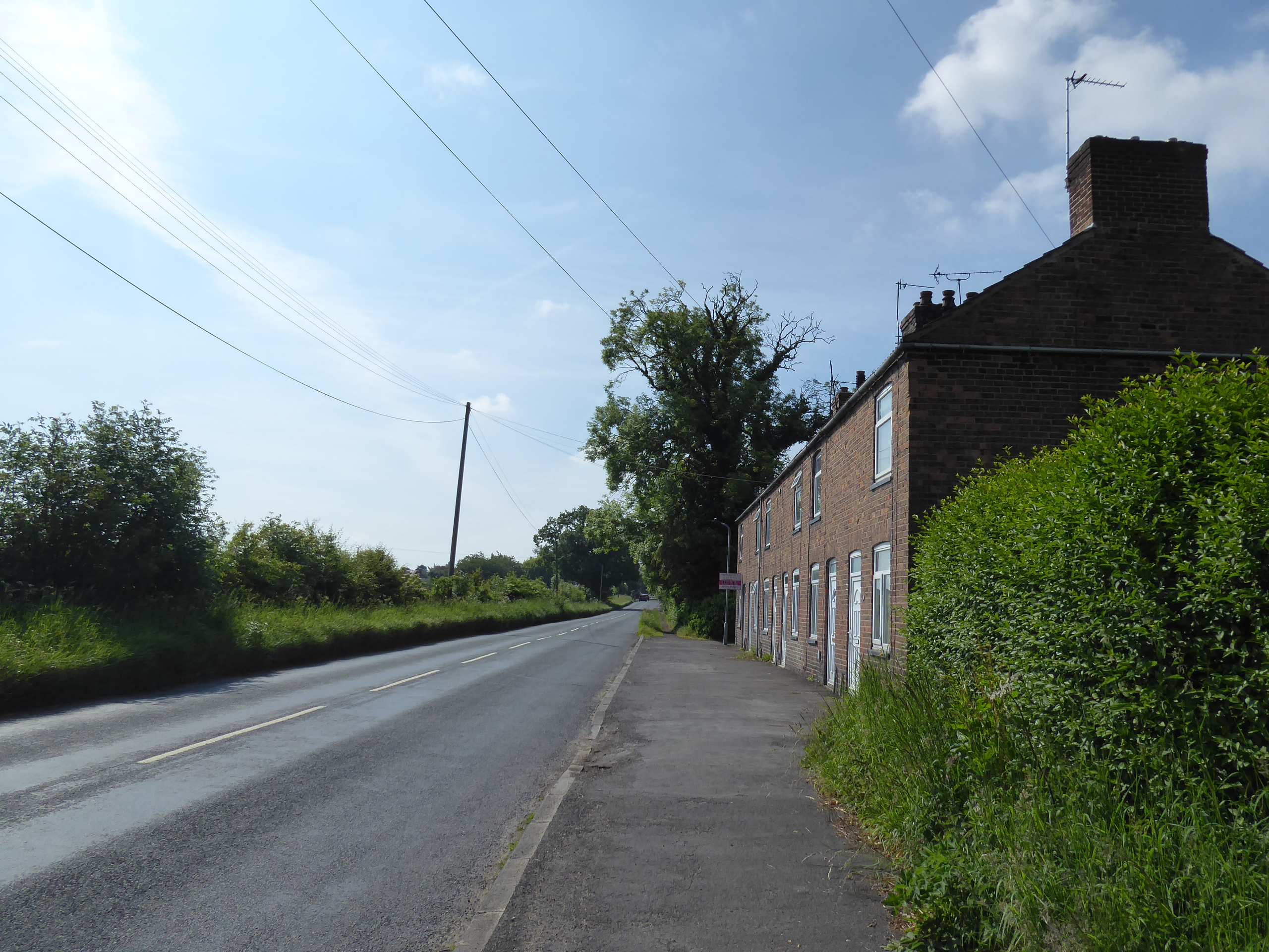
| The suburban spread on Hillam Common Lane. |
Hillam Common Lane takes the straight line path beyond, definitively directing us into the western reaches of the Selby Levels, and a wide flat horizon emerges to the east of us as we progress, picking out the few hillocks that rise to the northeast and tracng the lines of pylons that head out towards the remains of Eggborough power station in the distant east, finding myself regularly acknowledged by the passing cyclists and equestrians who've chosen this corner as their exercise terrain as we maintain a stead rate over to the house cluster at Hillam Common itself, an odd place to test out suburban living. A southbound turn comes as we join Roe Lane, taking us past the local Christmas tree farm as we continue among the level fields, spying the tall chimneys of the Ferry Bridge multifuel plants rise on the western horizon, while also spotting Drax power station emerging from behind Gateforth Wood in the east as we're drawn past the sheds on the Viner Station site, the only farm buldings on this lane, to have the powers stations become our travelling companions to our left as we carry on, taking more interest in the local wind turbines that would be normal (and also spying the Hook Moor windfarm in the far north), as we come down to pass the driveway to Northfield House farm. There's actual farming going on as we meet the first house above Birkin village, a tractor laying pipes in the potato fields, as it happens, before we head into the only notable settlement in this quarter, with suburban dwellings and a few council houses filling in the spaces between the equestrian stud and Manor Farm, before Main street is joined to take us past the old rectory and down to St Mary's church, perched on a minor bluff, and then on down Intake Lane, taking us over Old Eye beck and noting the vast embankments that have been constructed to contain any potential floodwaters that might rise in these lowlands.
 |
| Hillam Common Road, looking northeast. |
 |
| The odd residential corner of Hillam Common. |
 |
| Roe Lane, with Eggborough Power Station. |
 |
| Looking Southwest, beyond Northfield House farm. |
 |
| Birkin village, arriving in the landscape. |
 |
| St Mary's Birkin, with the Old Eye beck embankments. |
Open fields return to the landscape beyond, as we continue south, with view between the hedges and tree lines diminishing in number, with the power stations still sitting to our east, but glances to the west reveal the few high points in Knottingley, namely the chimneys of the glassworks, the riverside mill and the one tower block in the town, to be regarded as we come down towards the crossing on the River Aire, arriving rather suddenly as we come up over Beal Bridge, passing over the deep and wide channel on a structure that look like it could use some patching up before we land by the Kings Arms inn in Beal village, where a bench needs to be sought for my early lunch break. Once fed and watered, Craven Garth leads us from Marsh Lane to Main Street, among the council houses and matching more footfalls from 2015 as we come by the Jenny Wren inn, still a source of great amusement to me, before we move away from the suburban add-ons that have swelled this village, and join Common Lane as we push outside of the our Field of Walking Experience, to start this year's quest to swell its southeastern boundary, which will initially move Knottingley off its border, still visible through the hedges and across the fields, along with Ferrybridge, to our west as we press past the transport depot and grit store as the only features on this country lane, aside from our closest proximity to Eggborough power station in the east, as we come down to the side of the A645. We'll pace on the Weeland Road west to meet the edge of Kellingley village, turning south again onto Sudforth Lane to pass the council houses around The Oval, built to service the needs of the neighbouring colliery, the last deep pit in the county, with the site of which completely being obscured by banks of bushes and trees, earmarked for a redevelopment that doesn't seem to have gotten past the stage of 'pulverise everything', in marked contrast to the unnatural hill of uncertain provenance off to the south of us, to be regarded as we come down to pass over the Knottingley - Goole railway line, and the disused colliery spur adjacent to it.
 |
| The view to Knottingley from Intake Lane. |
 |
| Crossing the River Aire at Beal Bridge. |
 |
| Main Street, Beal, and the Jenny Wren. |
 |
| Eggborough and Drax power stations, from Common Lane. |
 |
| The Oval, Kellingley. |
 |
| The Gale Common hill, and the Stubbs Lane crossing. |
Beyond the field of solar panels. we rise to pass over Stubbs Bridge on the wide cut Knottingley & Goole canal, it's 20 mile eastward push still not falling onto my slate after all these years, before Beal Lane seems to want to direct us to the reclaimed hill on Gale Common, rising massively over the flatlands, while our first proper elevation comes as we are compelled to rise over the M62, giving us some height to survey the horizon to east and west before we pass down to meet Cobcroft Lane to start our westward push, right along the edge of the post industrial reclamation site and into the glare of the midday sun. The lane takes us past the Wonkey Donkey sanctuary, and the Manor Grange stud, across the way from Northfield House, and after so long among the level going, we start to feel some natural undulations beneath our feet as we come past the village of Cridling Stubbs, sitting just away from our passage on the road that seems to have been rebuilt to avoid it, as we continue to pass over the road down towards Womersley, but instead carry on to pass over the Knottingley - Doncaster railway line, notably used by only one passenger service, which we were only minutes away from seeing up close, with Stubbs Lane leading us into a landscape of trees and high hedges. It's not the best sort of place to be visualizing a new boundary route, getting no scope at all to our location as we come up by the Darrington Quarries with the idle machinery and oddly domestic office buildings, which explain the amounts of fine dirt that litter this quiet lane, which only features odd bursts of traffic, as we rise above the bridge that links the route between the main quarry chambers and push beyond to the sharp corner of Leys Lane, coming down from Knottingley, where a pair of turbines rise ahead to the south, and the Amazon depot by the A1 and M62 appears on the western horizon beyond the fields.
 |
| The Knottingley & Goole canal cut. |
 |
| The M62, looking west. |
 |
| The Wonkey Donkey Sanctuary, near Cridling Stubbs. |
 |
| Cridling Stubbs, almost hiding in the landscape. |
 |
| Darrington Quarries, Stubbs Lane. |
 |
| The wind turbines visible from Stubbs Lane. |
Our next sharp right turn takes us out of North Yorkshire, having been so close to the West Yorkshire boundary across the last hour, with the lane taking us through the woodlands that mostly conceal the Mid Yorkshire Golf Course, which is heard more than seen along our passage, which makes some twists and turns to pass through a dry river channel and a rock cutting before coming up by the club house, where we get a view towards the Walton Wood mast, giving us a view to our finish line across the renewed we dynamic landscape, before land at the side of the Old Great North Road, by the John Deere tractor garage. We pass south here, in the shadow of the modern A1 to pass under it with Estcourt Road, to enter Darrington, pausing by the Darrington Hotel for a second lunchbreak before we pass west along the main road, largely because the apparent direct route along the Old Great North Road and the A1 doesn't seem wildly sensible, instead passing above the remains of Darrington Hall and coming right up close to our original boundary as we trace a ways through the village, passing below St Luke's & All Saints church and the Spread Eagle inn as we transfer directly from the OS E290 map plate to the E279, on the only trajectory by which that would be possible. The southbound push is resumed as we the narrow and tightly hedged Westfield Lane, which elevates us onto the high field behind Went Hill, revealing our proximity to Pontefract when we can see north, with Fletchers Spring Covert sitting on the hillside edge to the west and the apparent crossing place on the A1 sitting next to the caravan park, despite the footbridge not having an ROW joining it at either end, to be regarded with curiosity amidst the diminishing sunshine, and when the thick evergreen hedges allow before we come down to the lane's end by the microwave mast at Wenthill Clump.
 |
| Leys Lane in the woods around the Mid Yorkshire golf course. |
 |
| The Mid Yorkshire Golf Course Club House, Leys Lane. |
 |
| The Estcourt Road bridge, carrying the A1. |
 |
| Estcourt Road, with the parish church, Darrington. |
 |
| Westfield Lane, betwixt Went Hill and the A1. |
 |
| Fletchers Spring Covert, Went Hill. |
We join the B6474 Old Great North Road as the modern A1 presses away to the southeast, heading directly south as we take our last looks towards Eggborough and Drax before we dive downhill into the wooded rock cutting that leads down through Wenthill Plantation, taking us down through the hillsdie edge as the road rolls down into Wentbridge village, which seems to be exclusively composed of villas in its setting around the river Went and its passage through the pronounced valley to the east, and we'll note the Wentbridge House hotel doing a roaring trade, ahead of passing over the reedy channel of the river, below the older village reach to the south. A downstream peer barely reveals the Romanesque church of St John before we press away with Wentbridge Lane southwestwards, maintaining an unexpected footway as we rise above the shallow Went valley, below Thorp Plantation, and looking north to the pronounced edge of Went Hill as we rise up to Broom Hill, getting some good contextual views over the half of Wakefield district that we've done little time in so far this year, as well as to Ackworth and Pontefract's hilltops, before we descend down to meet the A639 Doncaster Road by the Fox & Hounds inn, placing in sight of the distant Pennine horizon in the west. Thorpe Lane is met beyond, drifting us down into Thorpe Audlin, where a bench by the allotments in the village pinfold offers one last feeding and watering spot before we start the final push, south through the village of mostly suburban housing, where we pass back inside the Field of Walking Experience as the Wakefield Way route is crossed, meeting the few enduring farmsteads before we leave the village via the bridge over Barr's Drain and start on the gentle rise up to Thorpe Gate, where a close or two of council houses have been built, at a remove from both the old and new versions of the village, for some reason.
 |
| The Old Great North Road, digging through Wenthill Plantation. |
 |
| The Old Great North Road, Wentbridge. |
 |
| Wentbridge Lane, rising to Broom Hill. |
 |
| Went Hill, from Broom Hill. |
 |
| The village Pinfold, Thorpe Audlin. |
 |
| Thorpe Lane rising to Thorpe Gate. |
At Rogerthorpe Manor, developed as an hotel and wedding venue with an appropriate sort of setting, we depart the road to join the bridleway that will lead us over the day' summit, a complete change from what's come before, slamming the dirt path uphill through the green fields towards the water tower on Upton Beacon, itself a late arrival on the day's horizon, with the Walton Wood mast rising to the east, and Badsworth village sitting in a hollow to the west as we 50m of altitude to the total on a day that's barely seen as much over its preceding six hours as the district panorama opens out to the north and west. Join Field Lane beyond the farmstead at the crest and start the descent down through Upton village, which is mostly council estate and suburban encroachments at this high end, to be raced through on the way down to the Olde Shoppe and the Upton Arms on Common Lane, before realizing that we're still on the B6474 as New Lane brings us down to the traffic island where the H&BR line once passed, ad getting a bit confused as my old map doesn't show the A638 North Elmsall bypass tangling with our route before we get onto Minsthorpe Lane and find ourselves outside the urban landscape and overlooking a southern horizon that I do not recognize. Past the Dale Lane corner and the Barnsley Oak inn, Mill Lane gives little indication of having dropped us in Minsthorpe or South Elmsall for that matter as suburbia and the nearby industrial park do their best to hide from view, at least until the faux Mill House is passed and we are dragged over to High Street and the sudden downhill drop through the old village above the conglomeration of the three villages that grew with the mining industries, noting another old Magnet Ales sign on the old tavern halfway down, across from the spired Trinity Methodist church, before the arrival among the local travellers above South Elmsall station, where we wrap at 4.35pm, a mere four (4!) minutes ahead of the (hourly!) train ride home.
 |
| Rogerthorpe Manor, Hotel and Wedding Venue. |
 |
| The bridleway ascent to Upton Beacon. |
 |
| Field Lane, Upton. |
 |
| Tangling with the North Elmsall bypass. |
 |
| Mill House, Mill Lane, Minsthorpe. |
 |
| The Old Tavern, High Street, South Elmsall. |
Postscript: Honestly, I'm amazed that I made it in time, having maintained a decent clip over 19+ miles over seven walked hours, which would have been challenging rate even on a good day, though today we did it on two bad legs, having somehow strained a calf muscle in my 'good' left leg during the night, having been awoken by one of the worst pains that I've ever experienced, after my crooked leg had unconciously and suddenly tried to straighten itself, a nagging ache that still persists as we write this, to go with the wonky hip and knee on my right side that have needed the support and management through the season so far. Still standing, though, and walking and sitting too, for that matter, pretty certain that some decent limb and joint stretching will get things back in order soon enough, but I really hope that this isn't a harbinger of things to come, as the process of naturally aging, and running the risk of pressure blisters and the like, are already plenty to be dealing with as my walking career continues to unfold, and a lifetime of sudden aches and painkiller consumption in order to keep myself going is not something that I want to have in my future, no thank you very much.
5,000 Miles Cumulative Total: 5569.4 miles
2022 Total: 284.7 miles
Up Country Total: 5,092.7 miles
Solo Total: 5237.8 miles
5,000 in my 40s Total: 4163.2 miles
Next Up: Movement on the Southern boundary of the Field of Walking Experience.


No comments:
Post a Comment