12.6 miles, via Moorthorpe, South Kirkby, Brierley Gap, Brierley Common, Pudding Hill,
Brierley, Frickley Bridge, Brierley Junction, Hemp Dike, Sandy Bridge, Gander Hill,
North Field, Shaw Dike Bridge, Pools Bridge, Cronkhill Bridge, Carlton, Athersley
Memorial Park, Athersley North, Staincross station, Blacker, and Mapplewell.
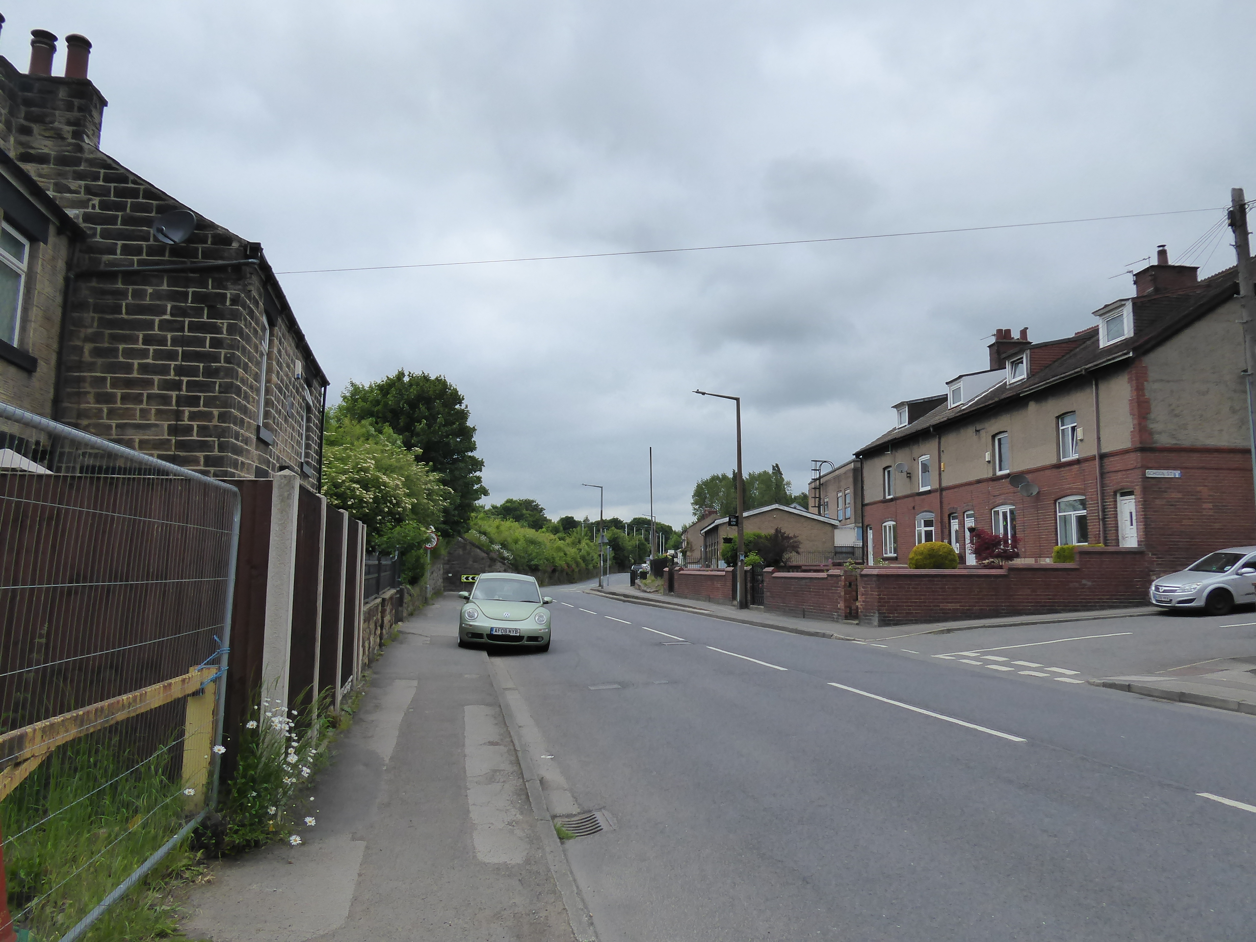
Having gotten down the long day on the trail for the start of the long Jubilee weekend, we now pull up a more modest distance for round two, a route that I've had plotted since 2015 and got left on the to-do list when unfortunate family circumstances overtook us, and it's just as well that I'm not looking to light up the trail with many miles, as I've got another pain to to add to that of my sore calf, and wonky hip and knee, and that's a blisterized right heel, caused by the apparent collapse of the support in my boot sole (after only a year of use!), which will need two layers of padding to make it walk-onable. We make our immediate return to South Elmsall then, alighting after 9.50am under very glum skies, with our route set to the west, rather than delving further to the southeast, taking us down past the bus interchange to join the B6422 Barnsley Road as it pushes us along the main shopping drag, predictably dressed in patriotic colours, as we match another old route from seven years back as it takes us through the first of the three villages that grew into a single town, having all the flavour of its post-mining status as we pass St Luke's church, the library, the old cinema and the Kung Fu school as we transition into Moorthorpe. Past St Joseph's RC church and the cemetery, we pass by Moorthorpe station on the line down to Sheffield, and keep to the previously seen roadsides as we soon enough enter South Kirkby, the largest of the three villages, as we pass the Barnsley Road recreation grounds and finally start on along a new pavement as the lane becomes White Apron Street, bringing a bit more vintage flavour to the environs as we are taken around All Saints church, and the Church House inn opposite, passing the police station and colliery memorial as we keep to the northernmost of the westbound route options, rising as the lane does up to Ball Park farm but not getting any real sense of where we are in this urban landscape. Quit the road towards Hensworth as we pass the Co-op store, and hit Holmsley Lane as it traces the northern edge of the South Kirkby Common estates, rising up beyond Hob House farm and finally giving us a vista to the north to regard, looking back to Upton Beacon and Walton Wood as the only distinctive parts on this horizon, which could easily draw attention away from the supposed Saxon vintage encampment in the now open fields to the south, before we head up past the Old Garden Centre (which is named as such), and on up to the corner by the old isolation hospital site, where the Wakefield Way route is met.
 |
| Barnsley Road, South Elmsall. |
 |
| St Joseph's RC church, Moorthorpe. |
 |
| All Saints church, South Kirkby. |
 |
| Ball Park Farm, White Apron Street. |
 |
| The view to Upton Beacon and Walton Wood, Holmsley Lane. |
 |
| The Saxon Encampment, beyond South Kirkby. |
That places Howell Wood in the hollow to the south of us, and at the Common Lane corner, we press outside of the Field of Walking Experience to start setting a new southern boundary as we head up past the Brierley Gap farmstead, mostly concealed by trees with a microwave mast contained therein, before we come down to a challenging passage over the B6273 Southmoor Road, entering South Yorkshire and heading on northwestwards between thick evergreen hedges over what was once the fields of Brierley Common before we pass the Burntwood Court hotel complex, on another isolation hospital site, and meet the outermost reaches of Brierley village. From up here we can finally orientate ourselves, looking towards Monk Bretton and Barnsley to the southwest across the undulations below Brierley Manor on it perch, before we come down to meet the village proper at Pudding Hill, with the rural and urban vintages piling up on each other as Common Lane comes down past the village res and to its end by the battlemented house on the Church Street corner where we make a sharp turn, but maintain our general trajectory, to rise past the Brierley Village Club, and on to meet the parish church of St Paul's, where shelter from the chill needs to be sought at early lunch time. Fortified, and glad that we didn't dress for June weather, we press on north-ish, past the Georgian pile of Brierley Hall and following the lane up to Pear Tree farm, where a footpath takes onto a shortcut that gives us a last look to high hill in the east, before we cross out over the A628 Barnsley Road and start on the descent down Frickley Bridge Road, dragging us down in the hollow formed by the westward flowing streams from South Hiendley and Hemsworth, with the old H&BR line coming down from Brierley tunnel advertising itself coming down from the east, a route traced with the Wakefield Way in 2015.
 |
| Brierley Gap farmstead and mast. |
 |
| Views denied on Brierley Common. |
 |
| The South Yorkshire horizon, beyond Brierley Manor. |
 |
| The battlemented house, Common Lane, Brierley. |
 |
| Brierley Hall, Church Street. |
 |
| Frickley Bridge Road. |
At Frickley Bridge, we join the old railway as it heads west, not on an ROW but on a well-trod path that shadows the cutting down to the Brierley Junction site, not looking like it ought to be approached up close as Hemp Dike appears to have taken up residence in it, but the westwards push has us seeking paths that look like they've been cut by many off-road bikes that come and go as the stream floods the trackbed in multiple places and some dead-reckoning in my route finding among the tree cover, and negotiation of the wetlands and a missing crossing point, test my resolve well on what felt like it ought to have been a relatively simple trespass. Still, a hard and clear surface is eventually found, below the farmsteads on the South Hiendley colliery site, and leading us over to the passage of the lost Dearne Valley Line, where we also travelled in 2015, putting us back inside our bubble as we join the field path that follows Hemp Dike downstream and leads over to the equestrian enclosure by Sandy Bridge, its eponymous lane being crossed to join a bridleway route with a better surface as the H&BR line gets the proper accessible treatment as it shades the southern side of Rabbit Ings country park, upon and above the alignment as it works its way around the natural rise of Gander Hill. The trees and greenery really conceal the industrial scarring that the land endured for over a century, with the Quiby Lane bridge being noted in the overgrowth before the line takes a southwards swing, passing where the junction for the branches to Monckton Main and Wharncliffe Woodmoor collieries reached away, into a now tree-clad landscape, which we trace south around the perimeter of the open plots of North Field, coming down past the site the H&BR yards, north of Cudworth, following the hard track all the way to Shaw Lane (not being tempted to follow the alignment into the nature reserve beyond).
 |
| The Hull & Barnsley line, above Brierley Junction. |
 |
| Hemp Dike is an obstacle on the H&BR line |
 |
| Hemp Dike is still an obstacle on the H&BR line. |
 |
| The relief of field walking, towards Sandy Bridge. |
 |
| The H&BR line gets the bridleway treatment. |
 |
| Quiby Lane bridge, and Rabbit Ings country park. |
 |
| The H&BR line leading to Shaw Lane. |
We almost immediately go back on ourselves from Shaw Dike Bridge, northwards on Boulder Bridge Lane as it leads among an industrial landscape of scrap metal processing, partially on the site of the H&BR's southern engine shed and thankfully inactive as we come up to Pools Bridge, where the westbound colliery spur passed under the North Midland mainline, with the bridleway leading into equestrian fields south of Royston, and shadowing the MR's line to Wharncliffe Woodmoor as it leads across to Cronkhill Bridge on the Barnsley Canal, where a break for late lunch is taken. The combined paths of the railway is then followed, riding up onto an embankment that places us back in the vicinity of greater Barnsley as we look over to Carlton and Royston on our passage to the B6132 Royston Lane, getting us back into the space we were in before our Spring Jollies, and passing around the back of the gardens of Carlton's suburban estates as they butt up to the old railway line that now handles hard surfaced path that leads around to the Athersley Memorial Park, once the home of the Wharncliffe Woodmoor collieries, one of the largest coal mining complexes in the county for almost a century until closure in 1966. Our path takes us below the landscaped hills of the former spoil tips, largely covered in forestry and wild grass, as we track west, above the angling lake and around the the playing fields on the side of the Athersley North estate, before we resume our railway trekking by finding the GCR's own branch into the colliery site, on a long curved sweep around the top of the council estate, which gives us a yielding soft surface to pace, and surprisingly provides an elevated view back over where we came from before passing around behind the back gardens and the still-smouldering remains of a few Jubilee bonfires.
 |
| Pools Bridge, NMR above, H&BR below. |
 |
| The Barnsley Canal, from Cronkhill Bridge. |
 |
| The Wharncliffe Woodmoor branch (MR/H&BR), south of Royston. |
 |
| The Wharncliffe Woodmoor branch (MR/H&BR), north of Carlton. |
 |
| Athersley Memorial park, on the Wharncliffe Woodmoor collieries site. |
 |
| The Wharncliffe Woodmoor branch (GCR), north of Athersley North. |
The late stages seem slow as my pace drops off, my blistered heel giving me grief as we meet the junction with the Barnsley Coal Railway and follow its dankly shaded (and still muddy and un-surfaced) passage down to the site of Staincross station and our rise up to the side of the A61 by the Eastfield Arms on the Bar Lane corner, with the latter lane, the B6131, being joined as we press on into Barnsley's elevated suburbia, with the Emley Moor masts ahead of us and noting just how much higher Staincross is up to the north as we drift downhill into the older landscape of Blacker, beyond the old town boundary. We're just as soon into Mapplewell and passing among the stores on the corner of the lanes where the A6428 intersects, which we cross as we note how patriotically dressed this corner of the greater town is, finding that we've got an uphill press to do beyond up Towngate, most unwelcome at this stage, past the Talbot inn and up to the King's Head before Darton Lane starts its dive down into the Dearne Valley, putting is in closer proximity to the town's high points that we saw hours previously, as we head past the Mapplewell & Staincross Village Hall complex and down past the long terraces to spy the best ghost sign in the area, midway down the lane's bypassed dogleg. The Whitley Common windfarms mark our horizon before the final dive down starts, losing views behind the trees of the North Gawber Colliery branch as it reaches up the northern valley side, eventually sinking down below the suburbia with as view as pass Darton Primary school and the old chapel at the top of Station Road, which leads us down beside the railway, and the many terraces on this side of the village, following the lane as it dives below the tracks and up to the side of the river Dearne at the north end of the village main street, where the turn onto Mill Lane is made toward the railway station, to conclude the day at 3.20pm.
 |
| The Barnsley Coal Railway, above Staincross station. |
 |
| Bar Lane descends to Blacker, Staincross rises above. |
 |
| Towngate, Mapplewell. |
 |
| The terraced descent of Darton Lane. |
 |
| The suburban descent of Dartone Lane. |
 |
| Station Road, Darton. |
Postscript: That's a late finish for the distance and terrain, though in good time for the train nonetheless (which can actually be caught this time around), but feeling like one push too many as my blistered heel continues to shout at me, as a brief look back reveals that we have done in excess of 87 miles over six excursions through the last 15 days, which feel like a bit much even when I'm at my most enthusiastic, and thus we ought to temper ourselves as we get back into Saturdays only wandering for the next seven weeks, and also look to a change to lighter footwear as it seems like I've killed these heavy boots already, which will probably do me a lot more damage if I continue to wear them while trekking the hard surfaces.
5,000 Miles Cumulative Total: 5582 miles
2022 Total: 297.3 miles
Up Country Total: 5,105.3 miles
Solo Total: 5250.4 miles
5,000 in my 40s Total: 4175.8 miles
Next Up: The quest for unseen South Yorkshire Railway Stations resumes!


No comments:
Post a Comment