The Holmes, Pride Park, Alvaston Park, Spondon weirs, Borrowash Bridge, and Ambaston.
 |
Long Distance Trek means Selfies!
#6 at Belper Station. |
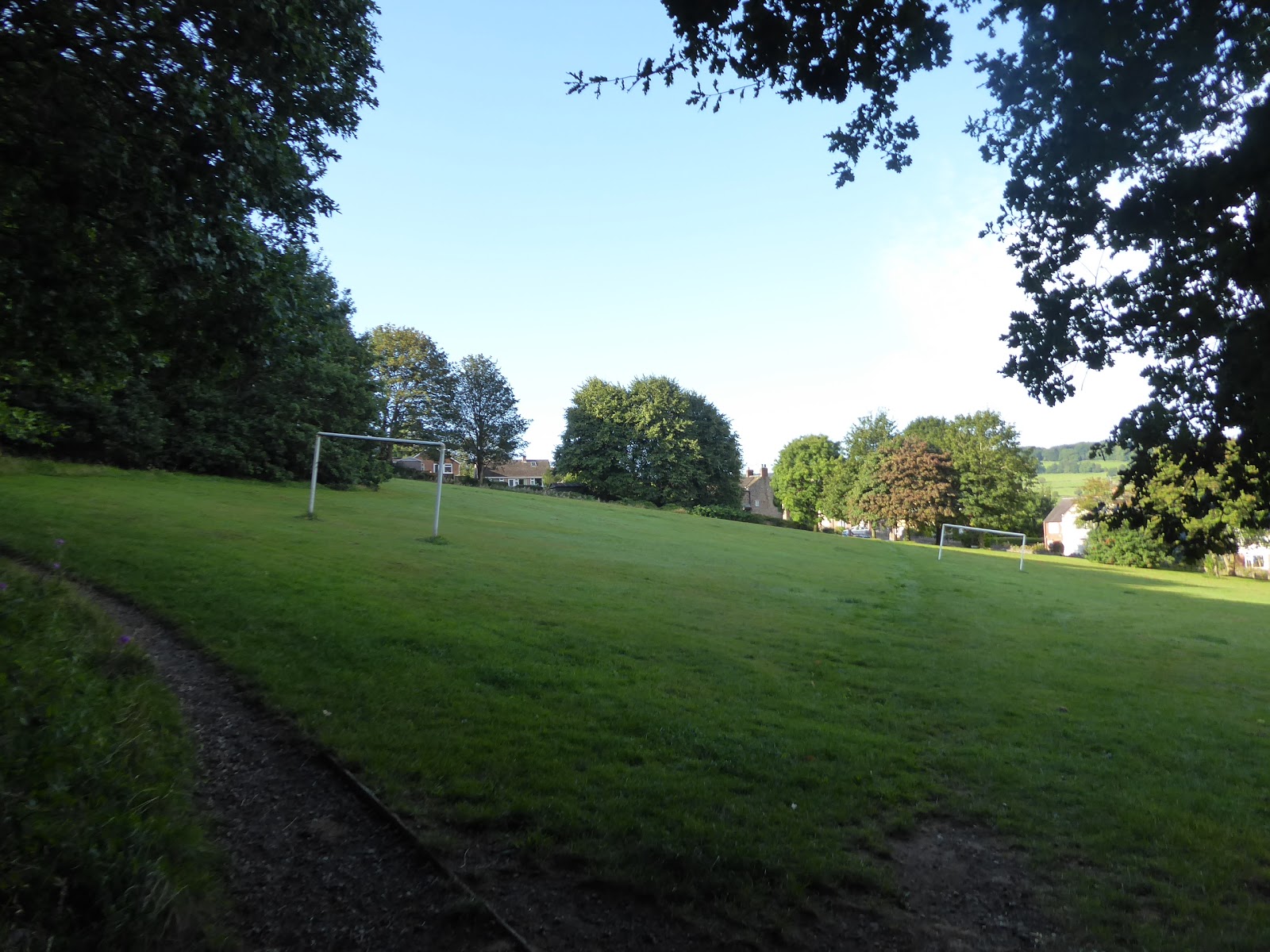
With the High Season of 2019 done, mostly successfully despite the wildly inconsistent weather, it's now time to get away from it all, at just about the best possible time, to head Down Country and get back onto the last legs of The Long Walk to Leicester, this year's crazy scheme that has actually slipped pretty far from my attention over the last three months, and now requires all my focus as I travel away to stay with Mum and utilise what is usually one of the best months of the late Summer for my jollies. Travelling on a Sunday had originally had me planning to ride out to Belper to resume the trail, and the Derwent Valley Heritage Way, by train, but a distinct lack of EMR services north from Leicester scuppered that plan and so Mum offered the Parental Taxi for my usage, despite her having to do an 80 mile round trip to get us underway, and that offer is taken up gratefully, taking a ride that visually stitches us up to the last leg as we get sight of East Mill before I get dropped off at the railway station to pick up where we left off in May, at a bright but chilly 8.35am, a good 90 minutes ahead of the rail alternative. We set off from the station up Albert Street to pick up the DVHW again on Green Lane, heading down it to meet King Street by the Memorial Gardens and the Ritz Cinema, with the town main shopping drag running down towards the A6, and we head up this road to the old Market Place at the top of the town, which feels eerily devoid of life at this early hour, before we head on into The Park, Belper's wild space where the morning exercisers can be found. Down we go through the rough field to cross Coppice Beck, and then rise across dewy grass and among trees to find the hilariously slanted football pitch, from whence we find the wooded path that takes us uphill, where a perch above the Derwent Valley is found, concealing the town rather successfully, before we slip behind and then among the houses of Cowhill, at its southern periphery, where we need to slip down among the older looking terraces of Holbrook Road before we can find the high path that will take us on down the valley, and away from the wrinkles of Derbyshire hills that have spread all the way down from the Peak District.
 |
| Belper Market Place. |
 |
| The Park, Belper. |
 |
| Holbrook Road, Cowhill. |
The rough track of Wildersley Road will take us forwards, arrow straight as the contours wander beneath it, heading past Rowland Hill farm and on to Wildersley farm, elevating us high enough above the Derwent Valley to be able to look back as far as Ambergate, across to what appears to be another rifle range target wall for the Strutt's Mill militia, and down towards what looks like a folly tower on a wooded hilltop which is actually the vent for Milford Tunnel (which we really ought to see up close as its portals of concentric arches of stone are some of the best in these lands). Off the track at it's end, we head into the fields, taking us behind a small wood and onto a brow path that is choked with late Summer growth, which would be challenging enough without the morning dampness that is still clinging to it, which makes for some trouser moistening going as we pass above Grange farm and the village of Milford, with its prominent mill chimney, one of the Derwent villages that we won't be seeing up close on this trip. Finally get a drier path as we land in the woodlands above Shaw Lane, which we cross before getting onto the paths beyond, which are no less weedy, but do take us off the brow and lead us into fields that serve the equestrian facilities around, undulating us southwards before we come upon the paddock above Makeney Old Hall, where we get onto the tarmac of Dark Lane and follow it down into Makeney hamlet, passing the immaculately dolled up Holly Bush inn, where the aromas of Sunday Dinner are already on the air at this early hour. It's a road walk beyond, taking us past the Makeney Hall hotel and among the lodges and cottages that must have once served its estate around the bottom of Red Lane, before we meet the Duffield Bank Road, below the high bank of woodlands that get us feeling chilly as the skies become a bit overcast and the shade robs us of any feeling of warmth as we look across the valley to Duffield village on the far side of the plains which surround the hidden river below, while we pass below Bank Wood house, and above Duffieldbank House, with numerous cottages at the roadside. Despite being in a landscape that I've traveled through many times, there hasn't been much to immediately recognise so far as we decline with the lane to touch the riverside at Duffield Bridge, passing the Bridge Inn, as the bells of St Alkmund's church ring the faithful to worship beyond the bank of trees, and even though we can only spy it spire and tower top from the low field path that we are now tracing, this is immediately notable as that church that seems surreally distant from its village, and isolated by the railway, when passed on the trains of the Midland Mainline.
 |
| The Milford Tunnel vent across the Derwent Valley. |
 |
| Milford village. |
 |
| The Holly Bush Inn, Makeney. |
 |
| Duffield Bank. |
 |
| Duffield Bridge. |
From our low path, we pass below the villas on Eaton Bank above, passing all the way around the wall at the bottom of Little Eaton house's plot before we pass above the perimeter wall that surrounded the site of the Peckwash paper mill, not one of the most significant among those of the Derwent Valley Mills World Heritage Site, but a nice looking on with its oldest parts enduring in residential use and with its chimney looming massively up from the path side, below the estate of what was surely the manager's house. Rise back to the road, and spy the train that we could have ridden to our start line trundling up the valley a solid 10 minutes late, so our chosen method of travel for the day is immediately shown to be a good one as we pass the parade of houses, including the one with a railway mural on the garage door, before we split off into the woods above, steeply rising to meet the quarrymen's path that leads us through the trees and over a narrow stone bridge that spans the mouth of the heavily overgrown Rigga Quarry. The track leads us out to Vicarage Lane which takes us along the suburban back lane into Little Eaton village, passing its Italianate namesake before we rise onto the path that takes us above the graveyard of the Parish Church, while failing to get sight of St Paul's itself, dropping us out at the old rural village - council estate boundary on The Town lane, where we have a sunny enough spot to break for elevenses on the outside the pharmacy and doctors' surgery. Then on down to Alfreton Road, crossing Bottle Brook and the former Midland Railway branch line that once served Denby colliery and Ripley, before we press south, away from the village school and past the Queen's Head and the village smithy, and its also worth noting the industrial estate that's home to Live Steam Models ltd, enduring in an old mill site at the heart of what was once a busy quarter of converging industrial uses, which featured an old tramway coming down from the north to meet the upper limit of the Derby Canal, which is now hidden away below the Outrams Wharf office park. Follow the cycle-way that traces the canal's remaining ditch at the roadside, past the Derby Garden Centre and meeting the A38 roundabout by the Starbucks that clearly used to be a Little Chef, splitting off to Ford Lane to pass the permanent caravan site and to fail to cross the railway via a foot crossing because it's been blocked off, and thus we have to pass over it via the steps my the A38, which seem a rather unnecessary deviation to make before we descend to the west side of mainline and pass under the trunk road, to meet the riverside plots beyond.
 |
| Peckwash Mill. |
 |
| Rigga Quarry Footbridge. |
 |
| The Town, Little Eaton. |
 |
| The Smithy, Alfreton Road. |
 |
| The Little Chef Starbucks by the A38. |
Our route guide offers a clearly defined path, but the reality of these fields is that there is no such indication beyond the first marker as we set off across the hard and impacted soil of what is apparently a commercial turf farm, ad once you get to the neatly trimmed and entirely flat fields of bowling green quality grass, it seems wrong to walk across it and a beeline is made for the dirt track that runs beside the Derwent, and we avoid taking the directed paths among the enclosed lumps that are supposedly air shafts, though what they used to serve is not readily apparent from any available source. Down here by the river, the feeling of Derby being nearby starts to come though as the Breadsall and Allestree suburbs can be felt at a remove on the rising sides of the valley, and as we entered the untended fields around the lakes of the Earl of Harrington's angling club, we get some industrial units filling out the valley floor ahead, but our route description gets vague and fails to match the map, so we seek the best available surface to pace, taking us past the canoe club on the far bank of the river and up to Haslams Lane, not on the right track but only one fields out from where we should have been. We land in Derby proper here, among the people attending the fields of Derby Rugby club, and those heading towards the parklands to the south, whom we join to pass through Darley Abbey Mills, the late 18th century Boar's Head cotton mills, that still endure in commercial use for light industry, gymnasia and leisure, forming a complex that is surely protected by its UNESCO status, which we pass though and admire before we make our only planned crossing of the Derwent on the DVHW via the toll bridge, where the fee taker isn't in attendance. Pause in the gardens opposite to take in the atmosphere as the river pours over the weirs below, and pass though the contemporaneous settlement of Darley Abbey, a delightful mix of buildings constructed to serve the mills, and to now form an idyll that barely suggests an industrial origin, among which the Abbey Inn forms the sole remaining section of the Augustinian abbey complex that still has its name attached to the settlement, which we continue to admire as we pull up New Road, away from the riverside. Into Darley Park we head from here, once the pleasure grounds of Darley Abbey House, of which only the stable block now endures, with the grounds now forming one of the city's definitive greens paces, which we'll be pacing through on the elevated paths southwards, while the main body of it is taken over for a concert by Sinfonia Viva later today, where the Saxophonix Ensemble can be heard rehearsing pop tunes in a Michael Nyman meets Marching Band style.
 |
| Commercial Turf Growing by the Derwent. |
 |
| The Earl of Harrington's Angling Club's Lake. |
 |
| Darley Abbey mills. |
 |
| The Abbey Inn, Darley Abbey. |
 |
| Darley Park. |
We meet the low path by the park's southern edge, by the Derwent Rowing Clubs HQ and boat house, leaving the crowds behind as the riverside path is sought, which takes us under the end of Handyside Bridge, one of the major enduring structures of the GNR's 1878 lines from Nottingham into Derby Friargate station, of which most of the local alignment has otherwise vanished since closure in 1967, now in use as a footbridge to access the apartment complexes that have developed on both sides of the river. The city feels like it has taken hold now along the sides of the Derwent, as we come upon St Mary's bridge, the first ancient crossing on the river since Duffield, which we pass under via wooden decking to see the chantry chapel that still resides at its west end, in a small plot next to the A601 Inner Ring road, over which the Jurys Inn hotel loom, and we have to peel from the riverside here, due to the extensive refitting works that have taken over the former Derby Industrial museum and the site of Lombe's Silk Mill of 1721, arguably the first successful manufactory of scale anywhere in the country, where the Italianate tower still rises over the riverside at the southern end of the World Heritage site that started way upstream at Cromford. Passing around its southern side we also find ourselves in the shadow of the cathedral church of All Saints, in the middle of its gardens, which makes me acknowledge the fact that despite being an East Midlands native, Derby beyond the environs of its railway station is not a city I know well, so it's useful to have a good sense of direction when the riverside path is blocked off on the west bank, forcing a detour to the east side via the Cathedral Green footbridge. This takes us through the Stuart Street apartments and office complex, before switching back again via Exeter Bridge on Derwent Street, the one with portraits of the city's historical notables on it abutments, to land in front of the Derby City Council offices and combined courts, opposite the steeped bank and shallow weir where the Canada geese settle, and we come around by the Riverlights Centre, where the works at the bank are revealed to be part of project to improve flood defences on the river, despite it having not suffered a catastrophic inundation since 1965. Meet the weir with the flow regulator tower and the fish ladder next to it, and pass under the A601 Inner Ring Road again, landing us in parkland that could have you believing that you are already out of the city, but we are actually in Bass' Recreation Grounds, also know as The Holmes, a bequest to the city by the eponymous brewer, which seems a bit under used for a warm Sunday lunch time, while giving us some greenery to enjoy as we pass through.
 |
| Handyside Bridge, on the former Friargate Line. |
 |
| St Mary's Bridge. |
 |
| The Silk Mill, Derby. |
 |
| The Derby River Gardens. |
 |
| Bass' Recreation Grounds, The Holmes. |
Depart the park via the bridge over the an old mill race and come up alongside the overpass of the A6 Pride Parkway, the first time we've come close to this road since setting out from Belper, and then meet the Derwent Bridge at the north end of Derby Station, just beyond the station throat which can be glimpsed below the roadway passing above, as can the access road (on the former alignment of the Derby canal) into the former Midland Railway works that used to extend to the east of the station, where Dad and I used to visit regularly on enthusiasts trips and open days in it last years when operated by BREL in the 1980s. It's all gone now, aside from the Roundhouse and a few workshops, redeveloped out of existence by Pride Park in the 1990, which now fills out the entire plot between the two railway crossings on the river, and will fill out the southern edge of our walk along the Way as it joins the National Cycle Network's NCR6 path as it hugs the bank of the river, along which we'll be travelling for a while, accompanied by the smell of balsam from the riverside plant life, as we seek a bench on which to take lunch. Find one beyond the back of the David Lloyd indoor tennis centre, where the city's industries are displayed upon then, and the progress on, certain that there ought to be a good sightline towards the Pride Park stadium beyond the surrounding commercial units, but it hides well for such a large structure, and we only get a really good look toward it once we've come past the Travelodge and are able to see down the open vista of Derwent Parade towards Derby County's home ground. Pass under the road bridge that links this development to the A52 on the much less occupied side of the river, and come behind the indoor trampoline park and DW Fitness gym (which confirm the district's definite sporting theme), hopeful that we'll get a good look at the Derby Arena and Velodrome, but it too lies well concealed from many angles and only briefly revealed at full height in all its yellow, silver and black colouring before the sole remaining rough plot in the development obscures it, retained on the site as a nature reserve. Pressing beyond the town, we pass under the Midland Mainline for the last time, as we head on south with the river, soon coming up behind Alvaston Park, which services the southern suburbs of the city with its ornamental lake, extensive playing fields and the largest BMX track that I've ever encountered outside of an event on TV, where several people are riding but seem reluctant to pelt around the track at speed or pull any sick stunts whilst I'm passing and ready with my camera.
 |
| The Derby Works / Derby Canal bridge, below Derby station. |
 |
| The feature benches by the Derwent, Pride Park. |
 |
| Pride Park stadium. |
 |
| The Derby Arena and Velodrome. |
 |
| Alvaston Park. |
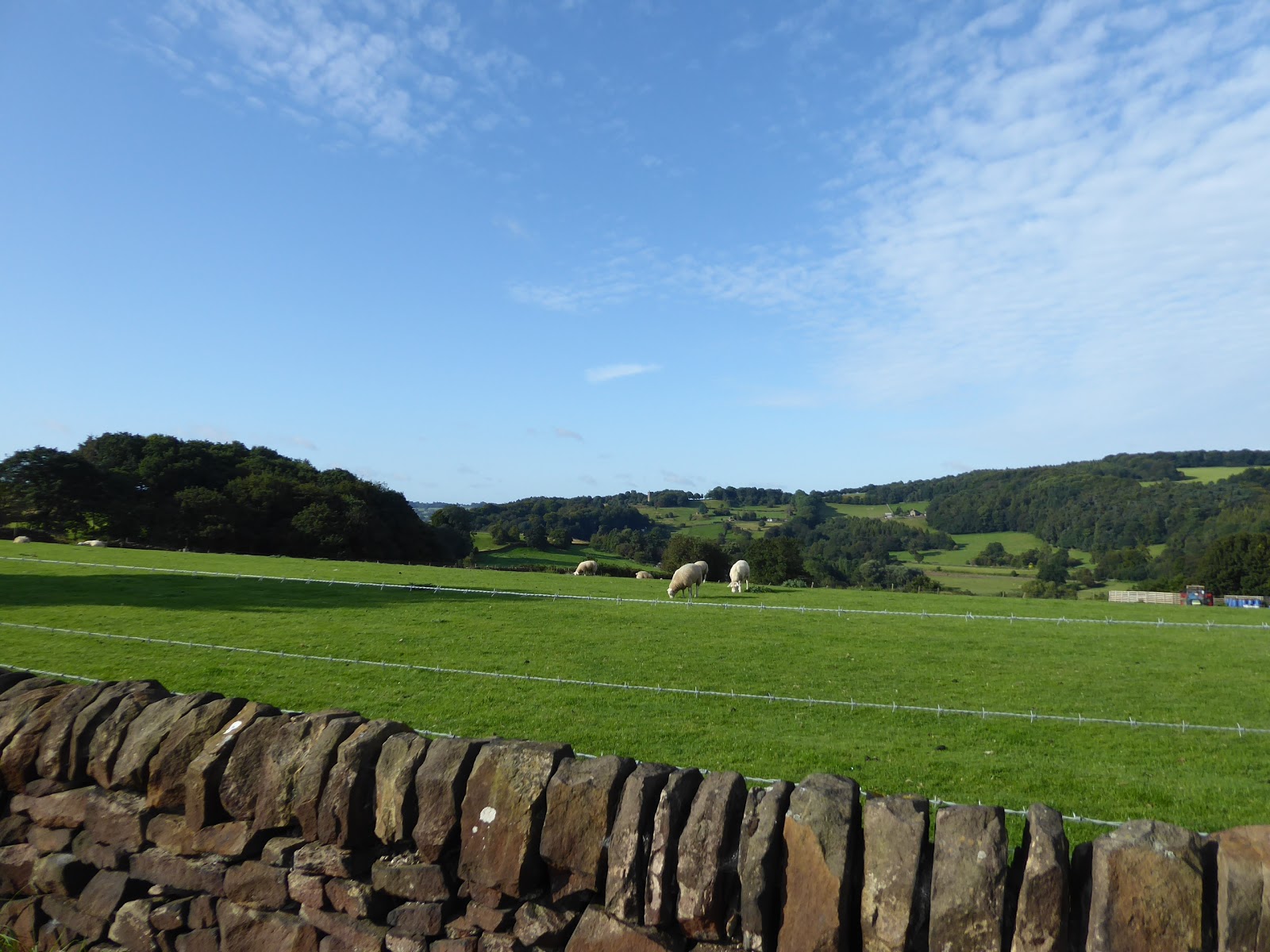
Passing under the A5111 Raynesway bridge, carrying the de facto Derby bypass to the east of the city, gives us the feeling that the city is now passing behind us, as the riverside starts to feel that bit wilder, despite the fact this there's a waste incinerator barely concealed beyond its bridge to the north bank and that this is a section where several meanders on the Derwent have been severed to help manage the flood risk on the river, with weirs established on the new channels, it's the fact that the tarmacked surface of the cycle path ends that makes it really feel like we are returning to the countryside. Carrying on along the path of impacted gravel, and the flatness of South Derbyshire really takes hold, having had several hours of city walking to distract us from it, passing alongside the riverside foliage and the thick hedges that conceal another burgeoning commercial development to the south of us on the former riverside pastures, soon coming up upon the Sponden sluices, another flood management feature, designed to redirect the river when its in spate, located just upstream from a bridge that isn't listed on my map or guide, which has no apparent traffic on it, but seems to be in place to feed the redevelopment of the British Celanese works site at Sponden on the far bank. Carrying on along the riverside, it starts to feel like we've been doing this for a while, despite keeping the walking pace up so that the finish time that I'd promised Mum that I'd achieve remains plausibly within reach, and the brief interruptions of cloud cover start to feel like blessed relief from the heat of the sun as we come up on the last and newest of the weirs on the river, forming a very graceful cascade at the start of the long straight channel that abbreviates the last major meander on this stretch of the river, which we follow as it passes to the north of the grounds of Elvaston Castle, a public park that is surely to Derby what Bradgate is to Leicester, somewhere that everyone has visited at some point, regardless of age or creed (also, it's name isn't variant spelling of its neighbour either, as they are distinctly separate places, as I've learned only today). Meeting an access bridge to the north bank, we pull away from the river channel to shadow the farm track out to the road, the B5010 Borrowash Lane, where we lose the NCR6 track after more than 4 miles, and move up to Borrowash Bridge, an impressive seven arched structure with extra width to accommodate flood waters below it, the last road crossing on the Derwent, which we stay to the south of as the way enters its final leg by dropping us onto the shallow levee through the neighbouring fields of sheep, who'll be our company now we are away from that of the cyclists.
 |
| The Raynesway bridge. |
 |
| Sponden sluices. |
 |
| Sponden Weir. |
 |
| Borrowash bridge. |
It's been a few hours since we were last walking on grass, quietly pacing the riverside without the presence of other people, passing a pipe bridge and watching the trains charge past on the mainline that runs really close to the north bank, and then we find the drawbacks of the path less travelled as we enter an overgrown section that gives the nettles and undergrowth a real opportunity to make your life a misery as our final footfalls are made along the riverbank before the DVHW peels away from it, only a few short miles from its mouth. So to field walking then, through enclosed meadows that show no recent signs of usage for anything, the kind of place that you could easily get lost in of it wasn't for the markers and trods clearly directing you over towards Ambaston, an expensive suburban enclave situated at the end of a long cul de sac, where developments have been dropped on the sites of old farmsteads, and a few older ones endure to ensure scenic appeal, though a couple of the new houses down here are really indicative of this being the sort of place you could only aspire to live if you had more money than sense. The open road awaits beyond, through the flat fields where there's little to see thanks to the high hedges of Hawthorn that rise along its length, only spying Ambaston Grange because it's the sole farm among these enclosures, only coming advertise there proximity to the county of my origin after a few twists as Ratcliffe on Soar power station is illuminated of to the east at the gateway to Leicestershire south of the River Trent (despite actually being located in Nottinghamshire, so shut up). Sight eventually draws us to Shardlow, the last village in Derbyshire, and sat on the old route of the A6, which we slip into via the suburban enclave around the village school on London Road, which we trace among its many characteristic pieces, passing both its pubs, The Dog & Duck and The Shakespeare inn, it's Manor house and Hall, and the ogee domed Indian restaurant in the shadow of the parish church of St James, all picturesque but barely illustrating its fascinating history. For Shardlow was also an inland port at the end of the 18th century, developed with the completion of the Trent & Mersey canal in 1777, which we meet at the eastern end of the village, beyond the Clock Warehouse, where the last mile of the Derwent Valley Heritage Way will join the towpath eastwards, but we'll just look at it from a short remove as we're at the end of today's leg of the Long Walk to Leicester, with the tiny-windowed and ghost-signed warehouses and the Very Nice House on the corner of Wilne Lane standing between me and my finish line at the Navigation Inn, where my Parental Taxi arrives just as I do at 3.30pm (which might just offset the whole hour I made My Mum wait at Witton Park back in July, maybe?).
 |
| Our last look at The River Derwent. |
 |
| Ambaston Village. |
 |
| Ambaston Grange. |
 |
| The Dog & Duck, Shardlow |
 |
| The Clock Warehouse, Shardlow. |
5,000 Miles Cumulative Total: 4118.7 miles
2019 Total: 468.3 miles
Up Country Total: 3684.3 miles
Solo Total: 3804.5 miles
Miles in My 40s: 2712.5 miles
Next Up: Entering Leicestershire and meeting my Down Country Field of Walking Experience.


No comments:
Post a Comment