Sutton Marina, Diamond Wood, Zouch, Normanton on Soar, and Bishop's Meadows.
 |
Long Distance Trek
means Selfies!
#7 at Shardlow |
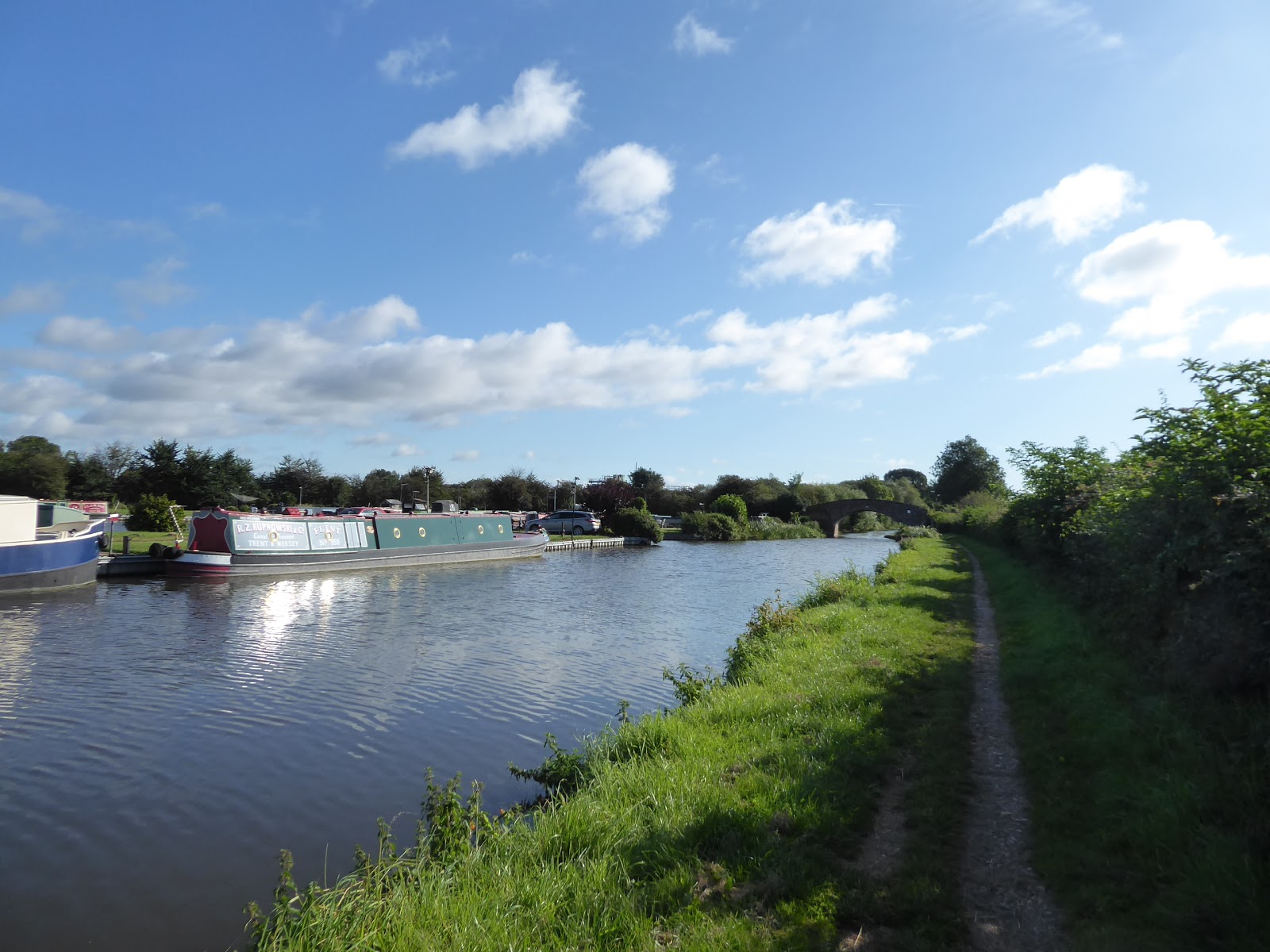
We get off to another early start as we head back to the bottom right corner of Derbyshire, with the Parental Taxi adding another 50+ miles to the 130+ miles that it put down on my behalf yesterday, which well illustrates My Mum's willingness to go above and beyond when it comes to accommodating my crazy walking schemes when she could have so easily cast me out to travel by train and the Skylink bus service, so the note of gratitude needs to be posted here, rather than buried in my later summation. We land at the Navigation Inn at Shardlow at 9.10am, so Mum can make a beeline homeward to do here thing with her Church Lunch Club, and so I can get on with the last mile or so of the Derwent Valley Heritage Way, which we meet when we return to the bridge of the Trent & Mersey canal and descend to its towpath, heading eastwards into the still intact landscape of wharves and warehouses at the heart of this late 18th century boom town, where goods travelling to and from the northwest would by stored and sorted before going on their new markets on the burgeoning canal network. It's a quiet idyll for leisure boating these days, making it hard to believe just how much industry would have gone on here in the 50+ years before the railways became the new transportation method of choice, it's now a place for waterfront living, and going back in time by visiting the watermen's inns such as the Malt Shovel or the New Inn, which we leave in our wake as we pass under Wilne Lane bridge, and we carry on pass the last few canalside cottages and the flood lock that protects the village from inundation, to meet Shardlow's extensive marinas. We can race the active boaters on the canal as we head east, along the long cut that passes Porter's Bridge, the very first on the canal as it makes its long way to Liverpool behind us, and the Derwent Mouth lock leading us out to the very end of the channel where it spills out into the River Trent, where the Derwent Mouth confluence can be observed from the remaining abutment of the original and now demolished Long Horse Bridge.
 |
| Shardlow Wharf, on the Trent & Mersey Canal. |
 |
| The Malt Shovel, and the New Inn, Shardlow. |
 |
| Shardlow Marina and Porter's bridge. |
 |
| Derwent Mouth and the end of the DVHW. |
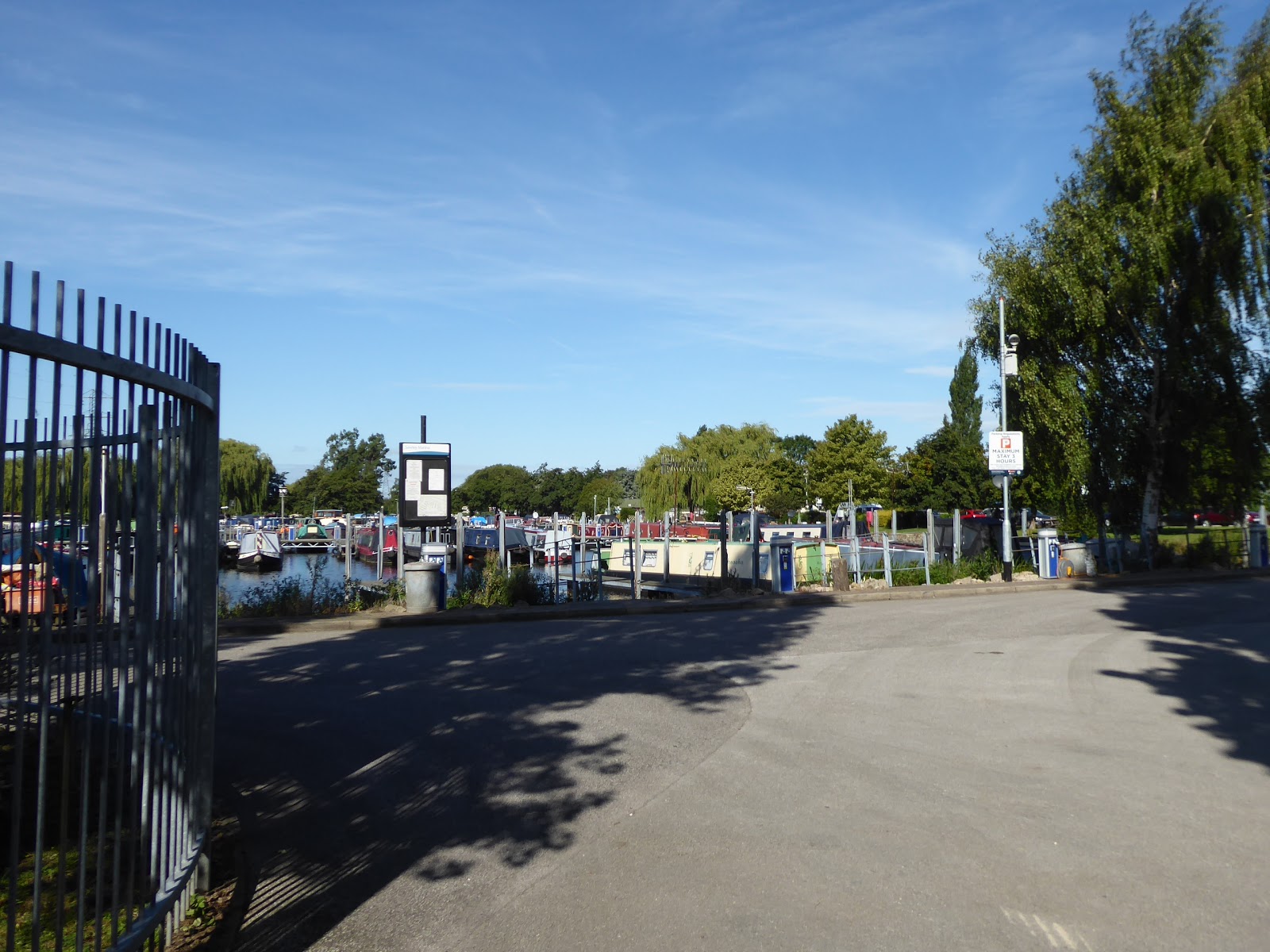
That's the end of the DVHW, and as we approach the new bridge off to the south, that feels like it ought to be the end of Derbyshire too as we cross the Trent to its south bank, but due to a strange boundary quirk, the flooded gravel pit and fishing lake on this side of the river isn't in Leicestershire like it really feels like it ought to be, the county of my origin being a plot further along from this point where the three major counties of the East Midlands appear to converge with their riverbanks. So we finally enter Leicestershire by the pipe bridge that seems rather over engineered, having trekked pretty much the full length of Derbyshire over five days of walking, and mark only our fourth county visited on The Long Walk pacing the bank of the Trent eastwards, and passing under the M1 bridge (marking our first contact with it on this trail, having otherwise seen it so often in Yorkshire), meeting the Sawley Cut, the short canal link to tie the many navigable waterways to this area together. Sawley village stands to the north of the river bridge, and we leave the towpath by the lock and canal bridge, to meet the B6540 Tamworth Road, passing the freight depot at the roadside and coming around to Warren Lane, which will sweep all the way around the boundary of Sawley Bridge marina, which is only visible from the access gates at either end, otherwise hiding its many boats from view with a parade of poplar trees and a thick bank of hawthorn hedge, before we follow the road on along a cross country trek. Passing under the freight line that directly links Nottingham to Burton on Trent, and see that there's no obvious route to the Soar Mouth to the north via Lockington Grounds, so visiting that corner of the county will have to wait as we pass over these level fields of recently harvested wheat with the sentinel cooling towers of Ratcliffe on Soar Power Station ahead to the east, and the flight path into East Midlands Airport coming over the slightly rising landscape to the south. As we tangle with the route of the Midshires Way, we hit the open fields to take off a significant road corner and find folk who like to uses these fields to exercise themselves and their dogs as we come over to meet Ratcliffe Lane and the most straightforward route to the riverside route that we'll be following to the heart of the county, watching the profile of the power station change before the lane degenerates to an overgrown bridleway, severed by the A453 Remembrance Way, which we don't quite meet as an unofficial, but nonetheless obvious path slips down to link us up with the River Soar Navigation route of the Grand Union Canal, at the bottom of the Ratcliffe Cut.
 |
| The new Long Horse Bridge, on the Trent. |
 |
| The Sawley Cut. |
 |
| Sawley Bridge marina. |
 |
| The flightpath into East Midlands airport. |
 |
| Ratcliffe on Soar power station. |
The grassy path of the canal, and riverside, will take us on southbound, under the bridge of the A453 and soon the the bank of the Soar as the river flows away from the navigation channel, with us having to remember to change our word usage as we carry on with it upstream after all those miles downstream with the Derwent, soon coming up across from Ratcliffe on Soar on the far bank with the spired Holy Trinity church and the manor farm featuring most prominently across the fields on the periphery of Nottinghamshire. Pacing on, the power station sits at our reverse horizon, and will dwell there for a while as we follow the riverbank, despite the right of way wanting to keep us away from it, with the village of Kegworth lying ahead, on its smallest of hills at a remove from the village, the spire of St Andrew's church being a familiar landmark to anyone whose regularly travelled the local portion of the A6 and its name synonymous with the plane crash on the M1 in 1988, a village we'll briefly touch on as we come up to its marina on the New Cut channel on the east side of the river. The act of following this takes us over the footbridge by the boat repair shed and takes us aross the Soar and into Nottinghamshire, which wasn't county that was intending to visit along the way of trip (and tags another county onto the lengthen list one ones walked in), taking us past the Kegworth New Lock and elevating us past the end of the Soar Bridge that would take us back into Leicestershire, but stay on within our neighbour as we pace its border, taking us around to Old Cut and the Old Lock, which actually only dates from the 1980s, replacing the vintage original. Pressing south we have a neatly contained path, separated from the fields by a ditch and a barrier as we come around the southern side of Kegworth village, where expensive houses have large riverfront gardens, with their setting only spoiled by the decelerating aircraft flying overhead on the approach to East Midlands Airport, and we also have another stretch of moorings to meet, strung up the riverside from the Otter Inn by the A6, one that doesn't have clear identity but I'll dub Sutton marina after the nearest available village. Sutton Bonington sits a way off to the east, home to a campus of the University of Nottingham and mostly otherwise concealed by banks of trees, with only spire and tower of St Michael's church rising above, and the long curve of the riverside feels exposed in the noonday sunshine as we carry on, feeling the need for lunch and wanting for shade, which is found at the apex where picnic benches are found at just the right point for us to have a cool off and feed up, near a river feature that the map dubs 'Devil's Elbow'.
 |
| Ratcliffe on Soar. |
 |
| Kegworth marina. |
 |
| The New Lock, Kegworth Old Cut. |
 |
| Sutton marina. |
 |
| Sutton Bonington, just beyond our trail. |
Push on, post refreshment, and our nicely contained path ends, sending us into the meadows at the riverside once again, but the cattle aren't roaming this far out and we've got a different location only a little further along in the shape of Diamond Wood, planted by the Woodland Trust in the Jubilee year of 2012, and maintained by the University of Nottingham, now forming a multi habitat forest for education and enjoyment, which adds some much needed variety to this riverbank, indeed more than could plausibly occur naturally. There's also power lines overhead and it's fun to see how the pylons have to be organised when they cross each others paths, as they rise above us and the flat landscape as we regain the riverbank on a shallow levee and wave to the passing boaters whom seem to out in greater force than you'd ever expect for this time of year, heading up and down stream as we leave Kegworth, Ratcliffe and Sutton Bonington in our wake as we come around the the Zouch Cut, taking another corner off the Soar as we meet it by its lock. Pace the channel up to the hamlet of sorts at its eastern end, seemingly unrelated to Ashby de la Zouch in the far northwest of Leicestershire, where the Rose & Crown must have once been the waterside inn of choice when a wharf grew here on the road to the nearby mill site, coming up to the A6006 by the flood lock and conclude our accidental visit to Nottinghamshire by slipping over the bridges over the weirs on the mill race and the Soar (which have a country cottage cluster on the island between them), as well as another flood management channel. Carrying on we pace the low bank on the Leicestershire side once more, noting that the far bank has various sheds that have been dolled up as summer houses along it, for those who might find conventional riverside living a bit too expensive, perhaps not in the securest location as the Soar's emergency boat moorings are directly opposite, just downstream from the Soar Boating Club on the far bank, on the top edge of Normanton on Soar, a village which well demonstrates the cost of living at the waterfront. There's not a single back garden along the whole riverside that doesn't look ferociously expensive, with moorings and even boathouses on all of them down to the spired St James's Church, and the chain ferry, which suddenly feel rather redolent of a lost age at the south end of the village, where the waterfront becomes chalets again and the open fields to the south start to draw attention to the wrinkle on the western horizon, the wrinkles of Charnwood Forest that give this county their most distinct natural profile, even if the modest hills within still fail to be easily identifiable, despite the many views we've had of them.
 |
| Diamond Wood, and pylons. |
 |
| The Zouch Cut. |
 |
| The Weir and Cottages, Zouch. |
 |
| The Soar Boating Club, Normanton on Soar. |
 |
| St James's church, and the chain ferry terminal, Normanton on Soar. |
The next town soon starts to loom beyond the fields and we join the path that drags us closest to the riverbank as we approach the pleasant green space by the Soar where anglers and leisure boaters get dangerously close to getting tangled up with each other as we pass, and come upon the start of the canal channel that splits off the Soar to head towards Loughborough, taking us along its tight and densely hedged off towpath, beyond which the Astra Zeneca factory looms large, one of the recognisable landscape features of the town to go with the Carillon and the University's Tower Halls. We enter Loughborough via the district of Bishops Meadows, which attaches its name to everything along this stretch of the canal, be it bridge, lock or moorings, all of which we pass as we come down to Bridge 41, where we get industrial units on one side or the other of the Belton Road West bridge, as well as an urban solar power plant and much more modestly scaled waterfront living where a conventional mid-sized run of semis offers a place to moor whatever size of boat you might afford. Pass Loughborough Lock, where more people than necessary seem to operating a single leisure barge, and thence under the A6004 Belton Road bridge, where we spot the obvious vintage inn and cottages that have endured while industry has come and gone from the canalside with new apartments developing opposite, and the run in to the town's wharf carries on straight ahead but we split off with the main cut to head to the day's finish line, behind the suburban gardens that come with a mooring opportunity as standard. This is certainly one of the more surprising desirable residential locations that has been found along the course of my travels, certainly adding value to some modestly scaled houses and apartments, which we follow around the the pub that is called The Boa or The Bat, depending in which end you are viewing it from, passing under the Meadow Lane bridge to spy the mill complex above the Nottingham Road bridge above, which marks the northern extent of my Down Country wanderings from a couple of years back. So as we ascend to the A60 and move towards the railway station, that means I now have ribbon of footfalls that links all of my 7+ walking odyssey around West Yorkshire to the vast majority of my youthful experience growing up in Leicestershire, which is mildly mind blowing, a day ahead of The Long Walk's completion, and with that we've got a now completed GCR bridge to look at before we wrap the day at Loughborough station at 2.20pm, and catching the train, and bus, back to base, while giving the Parental Taxi a well-earned rest, for a change, because she's really earned the break, hasn't she?
 |
| The division of the Soar and the Loughborough Cut. |
 |
| Bishop's Meadow Lock. |
 |
| Loughborough Lock. |
 |
| The 'Boa' Inn, and the Meadow Lane bridge. |
 |
| The GCR bridge at Loughborough station, we've been here before... |
5,000 Miles Cumulative Total: 4131.8 miles
2019 Total: 481.4 miles
Up Country Total: 3684.3 miles
Solo Total: 3817.6 miles
Miles in My 40s: 2725.6 miles
Next Up: The Last Leg of The Long Walk, returning us to the City of My Birth.


No comments:
Post a Comment