 |
Long Distance Trek means Selfies!
#7 at Loughborough station. |
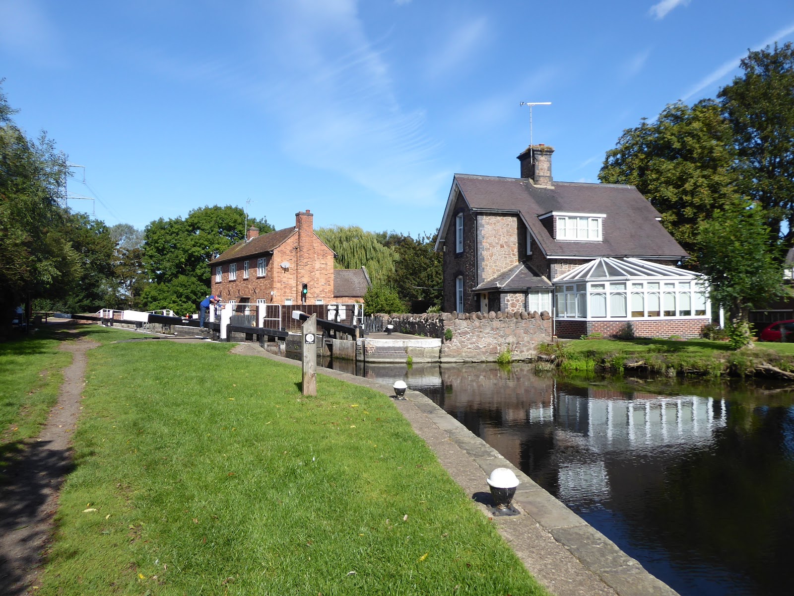
The Last Leg of the Long Walk comes around, the latest of my cross country schemes to come to fruition, feeling fortunate that the opening of the late season of 2019's walking has sent some rather good walking days our way so far, and there's not massive pressure to get out early again as the morning temperatures are markedly lower than the preceding couple of days, and anyway, the return rail ticket I bought to Loughborough if off-peak and thus not valid until after 9pm, so the Parental Taxi doesn't need to be ready for the crack of dawn to get me underway. So back to the point where my Up Country and Down Country trekking points finally touched, getting away from the railway station in the shadow of the Brush works at 9.40am, striking across the car parks to Nottingham Road, by the mill that is getting the upscale apartment treatment to descend beck to the towpath of the Loughborough Cut of the Grand Union Canal's Soar Navigation, coming down on the opposite side of it to the residential complex built around a former hosiery factory and passing under the Great Central Railway's canal bridge, their next fixer up job before they can start building their embankments to get to the bridge of the Midland Mainline. We strike southeast from here along the towpath, hemmed in by thick hedge and the town having grown to fill all the plots up to the west side of the canal, surrounding the once rural Little Moorland bridge, and looking like its probably ready to consume the factory site to the south of it, the one with large ghostly lettering along the length of its wall that resolutely refuse to resolve into any readable words, and beyond the town looks to have breached a path into the low fields of Loughborough Moors to the east as a new close or two have arrived on the far side of Moor Lane bridge. That's as far as this town's suburban splurge has grown, with the town ending by the boatyard of the Peter Le Marchand Trust, who run boating trips for the elderly and disabled and whose boats were spotted more than once along the path of the previous day on the trail, beyond which we enter the low fields once again, with only cows in the fields and the morning air still feeling chilly despite the sunshine, with all feeling peaceful beyond Miller's bridge, where there are only random boaters and solo dog walkers out on the canal with me.
 |
| The GCR's canal bridge, Loughborough. |
 |
| Loughborough expands around Little Moorland bridge. |
 |
| Millers Bridge in the peace of Loughborough Moor. |
We are pretty well contained by the landscape down here, not seeing much at all beyond the hedges and waterside plants that are at the absolute peak of their season, and so we listen for the sounds of passing trains being carried in the still air, noting the plantation of poplars that comes up by the canal bank and counting the bridges as we pass under them before the next feature comes around, which is the Pilling's Lock marina, a relative newcomer to this end of the Loughborough Cut as it isn't on my old E246 plate, but one that's packed to the gills at the southernmost end of this channel. It's natural that the next feature to come up is Pillings Lock itself, the flood barrier to this long cut, where we switch sides with the tow path, the many changeovers on the route having got me anxious enough to be annotating my maps beforehand when such a move has proved entirely unnecessary, coming down to the Soar's bank once more by the railway bridge that passes over it, where the EMR services thunder past as does an ROG train putting some brand new units through some shakedown testing. Pass the flood defence that is getting worked over on the far bank, and don't get tangled up with the politest and most considerate anglers that I've met on my travels, as we pace on past the meadows where Canada Geese reside in vast quantity, and large horses quietly graze, pacing the half mile or so down towards Barrow upon Soar at a pace that has it feeling a long way distant before we come upon some actually ancient cobbled towpath and around the kink in the river to the moorings below the hallow viaduct of the widened railway, where several boaters have started virtual squats below the arches, with one having been sealed with apparently every glass door and glazed panel that the owner could get his hands on. We come around to Barrow next, past the gardens of The Moorings Inn, by which a lone man punts like no one's watching, and we swap banks on the river via the Barrow Road bridge, where we touch the bottom end of the village's main street, downhill from the Bengal restaurant and the Soar Bridge in, with Proctor's Park Road leading us the short distance to Barrow Lock and the start of the Barrow Cut, which takes a long loop off the Soar. Beyond the Lock-keeper's cottage we enter a long green space that takes a while to get the moorings along the back gardens that you might have expected to find, eventually gaining that profile that you could never hope to afford before we pass under the Mill Lane bridge by the Navigation Inn and find our way around the yard of Barrow Boating, as the cut channel ends, without a flood lock but with extensive weirs that pour the downstream Soar away from the village.
 |
| Pilling's Lock marina. |
 |
| Pilling's Lock and the division of the canal and the Soar. |
 |
| The moorings below the railway viaduct, Barrow upon Soar. |
 |
| Barrow Lock. |
 |
| Mill Lane bridge and the Navigation inn, Barrow upon Soar. |
Beyond the largest of these, Welland Road on the far bank gives its suburban estate a riverside view to look over beyond their road, a variation from the norm of it sitting at the back gardens of smarter houses, a theme which soon resumes as we progress, only for it to get entertainingly chaotic when we meet the long back gardens of an old terrace, opposite the sole field of cattle along today's trail, who remain entirely recumbent as I pass by, as Barrow village passes, beyond the most impressively sized boathouse of all. Following the Soar down here does have us on a bit of an unnecessary loop, and it would be easy to cut off this corner, but we need to come past the Meadow Farm campsite and wharf, where I spent a miserable bank holiday weekend in 1984 camping with the 17th Leicester Boys Brigade company in 1984, and experience that put me off the idea of being in the great outdoors for decades, and frankly still maintains my lack of desire for spending nights under canvas, though fortunately the memories that endure are more hilarious than painful at 35 years remove. On along the riverbank, trying not to scare the local heron as we move through the open fields to come around under the A6 bypass road, beyond which the riverbank gets rough the skyline of Mountsorrel rises, the processing works attached to its quarries rising above the smart houses at the riverside, giving us our closest pass to the hills of Charnwood Forest as the path switches sides at the turnover bridge, by the most improvised looking marina that we've seen down this way. One riverside property has developed the largest back garden wharf that could possibly be created, giving a smart front to the Soar while otherwise surrounded by active industries, such as the quarry conveyor that still runs over the 1860 bridge of the Mountsorrel Railway, which still runs to the railhead and works by the Midland Mainline, looking much more graceful than its purpose demands, just a way downstream from Mountsorrel Lock and marina, where we tangle ourselves up with the Leicestershire Round as we come up by the Waterside Inn. So more familiar footfalls are thus retraced as we pass south, under the A6 again, and over the odd branch channel of the Soar as we watch the leisure boaters sailing north and pass among the twists of the river, which could easily have you feeling geographically lost if the tower of Sileby church regularly appearing across the fields as we come down to the Sileby Mill marina, where a boating community has definitely grown, to be observed from the opposite side of another turnover bridge, just down from the lock and weirs, where we will pause for lunch, feeling that the bright day is about to turn.
 |
| Waterfront Living in Barrow upon Soar. |
 |
| Meadow Farm marina and campsite. |
 |
| The modern A6 between Barrow and Mountsorrel. |
 |
| The Mountsorrel quarry conveyor bridge. |
 |
| The Soar's run off channel, below Mountsorrel. |
 |
| Sileby Mill and Marina. |
So it's bit cloudier and chillier as we press on, now inside the loop of the Leicestershire Round, which has us feeling close to home despite the distance to still walk, carrying on down the west bank along the side of the Mountsorrel and Rothley Marshes nature reserve, where the marginal fields have been allowed to grow wild, before we settle onto a much more wooded bank, still using St Mary's church tower as a guiding beacon, before we come up past the little island at the east bank with a cottage on it that can surely only be accessed by boat. The presence of industrial building beyond these banks along the A6 road is certainly well concealed by the woodlands, which end by the fields by Farnham Bridge farm, where the desire for waterfront living on the cheap has allowed some bold souls to combine sheds and caravans into riverside dwellings that probably haven't cost them ouchy pounds, creating a little and rather lovable blue collar marina, just downstream from where we cross the outspill of Rothley Brook, the watercourse seen all over Charnwood forest. The last stretch of walking on the Soar then comes into view, as we pace up towards the wharf and villa to the north of the Cossington Lane bridge, where we've also been before, starting our first Down Country river and canal walk back in 2014, though this time, I'll make a point of spying the Cossington Mill, which so notably escaped our view back then, before we step away from the riverside that has drawn us through so much of the county, hammering the lane west to pass under the A6 bypass bridge, again. Rise with the lane towards Rothley, one of those county villages that seems to have three entirely separate pieces, which we'll only be grazing the easternmost of as we land on the old Loughborough Road by the Miller & Carter Steakhouse in the old pub that I just cannot recall the name of, where we turn to the southbound stretch, where the suburbia of the Soar Valley villages seems to be still attempting to grow south to meet the upper edge of Leicester's conurbation, only a mile or two distant to the south. Push past the Woodcock Farm shop, and the nurseries on the northbound only stub of the road before it merges with the contemporary A6, which we choose to cross, at not inconsiderable risk, as pacing the dual carriageway to the city does not appeal, to seek the old pre-turnpike road that is now a rather forgotten bridleway, which skirts the Wanlip sewage farm, which has the wind turbine that's visible from miles around next to it, and we'll pace among the overgrowth that is bidding to be a picture of autumnal fruitfulness, among which an abandoned and burned out Audi sits, which has been there for a while judging by the grow of vegetation along the lane in both directions, not cared about by anyone, in this last major green space above the city.
 |
| The Soar by the Mountsorrel & Rothley Marshes nature reserve. |
 |
| Waterfront Living on the cheap at Farnham Bridge farm. |
 |
| Cossington Mill. |
 |
| The old A6 in suburban Rothley. |
 |
| The pre-turnpike path from Rothley to Wanlip. |
We emerge by the works entrance, and down Fillingate, which draws us on to pass under the A46 Leicester Western Bypass road, via a rather long twist that leads us into Wanlip village, where the old farmsteads sit opposite the large grazing fields of Highland cattle, and while suburbia seems to have arrived as would be expected along Rectory Road and Church Road, the footprint of the village hasn't enlarged massively, perhaps due to its proximity to the floodplains of the Soar, and we'll detour here to see the church of Our Lady and St Nicholas, as it's not going to get seen tucked away at the end of its lane otherwise. Return to the village heart and then strike for the city, down Wanlip Lane, through the very last fields that the ever expanding suburb of Birstall has failed to claim, just above its parish boundary, across from Watermead park and the Thurmaston superstores, and passing the Cedar Academy, before we burrow deep into the estate along the lane, getting urban very quickly but somehow still residing in the county and beyond the jurisdiction of the City council for reasons that seem inexplicable, as if the residents still think they live in a countryside parish. As well as sharing a name with a West Yorkshire town, it's notable for being a place that I've never had reason to pass through, as the A6 bypasses it and only a church Car Trek would have brought me here otherwise, and so it's old heart must be sought, beyond its commercial heart on the corner by the Earl of Stamford inn where the late 19th century cottages along Front Street sit around the ancient church of St James and the Old Plough inn, the obvious original watering hole for the village. There's also thatch and half-timbering to be found at the top of Church Hill before we land back on Birstall Road to resume the direct push towards town, to regain the face that I will always associate to Birstall, being that type of suburbia that's just that bit too ostentatious to be considered entirely tasteful, mostly perched on the rising plots above the Soar's floodplains, where the marginal fields and the Co-operative Sports club have endured while resisting the numerous attempts the residentially develop them. Thus we land on the Red Hill Circle roundabout, where the A6 arrives among the local roads and the A563 Ring Road sails overhead on its flyover bridge, and it's here that we finally land in the City of Leicester, more than a mile inside the urban area of the conurbation, and we've options of route to the city centre with both Abbey Road and Loughborough Road offering themselves as the direct paths, but despite erring onto the former of these, I'm still ready for a quieter route and thus split off by Belgrave St Peter's CofE school to get close to the River Soar once again.
 |
| Our Lady & St Nicholas's church, Wanlip. |
 |
| Leicester's urban spread limit at the top end of Birstall. |
 |
| St James the Great, in Birstall's ancient heart. |
 |
| The expensive suburban face of Birstall. |
 |
| The Red Hill Circle flyover and our arrival in the City of Leicester. |
It feels like my walking paths are naturally drawn towards the ancient Thurcaston Road bridge, having barely encountered it when growing up here, though we don't cross it and instead join the public parklands that stretch down the open riverside, taking the path into Ellis Meadows, where the city council have developed a park on cleared terrace plots, named after the notable local railwayman John Ellis and creating a green lung in the northern part of the city, where the end of the summer has workmen out with the heavy plant, baling the cut long grass for reuse. These are working men clearly unused to having amateur bloggers taking an interest in their work as they quiz my photography before I move on, regaining the Soar bank by the weirs at the top of Wolsey Island, right by the Abbey Meadows Pumping station, a real cathedral to the Victorian Steam Age, where the city's industrial museum still endures, with its beam engines within and steam excavator outside, it's a place where we went to every open day and steam fair when I was a boy. Right next door is the National Space Centre, a much later arrival that I made a point of visiting with Dad when it was new, and it's rocket tower forms a significant feature on the local horizon, like a giant, silvery chrysalis, upstream from the redeveloping industrial site on the island between the Soar and the Navigation channel, the revival of the Wolsey Island site having been long overdue to anyone who can recall the closure of the factories and council bus depot that occupied it many years back. The riverside path rises to cross Abbey Park Road, and to take us into Abbey Park, right up to the medieval walls of the precinct of St Mary's Abbey, which a largely conjectural layout of features within, famous as the last resting place of Cardinal Thomas Wolsey, Henry VIII's Lord Chancellor, who died here in 1530, a fine site to tease the mind of the inquisitive young folk when taking a break from whatever else the parklands offered, which we view today for the first time in far too long. Press on past the pavilion and the playgrounds on the west bank of the river before crossing the Soar at the park's south-eastern end, concluding the river walking that started at Ladybower Reservoir so many miles, back to pace by the all weather sports facilities by the side of the A6 St Margaret's Way, which leads us over the Grand Union Canal and into the industrial band that sits to the north of the city centre, where the disused hosiery factory site still await redemption, and St Margaret's church towers over the inner ring road, long removed from the residential Medieval city being located around it.
 |
| Ellis Meadows. |
 |
| Abbey Meadows Pumping Station. |
 |
| The National Space Centre. |
 |
| St Mary's Abbey remnants, Abbey Park. |
 |
| Onto the last leg along the A6, with St Margaret's church looming. |
Across the A594 Burley's Way we head, downstream from the bus station and up from the Highcross Centre, joining Church Gate between Matalan and the Blueprint nightclub (which will always be Krystal's Nite Spot to my mind, and never my choice of club,
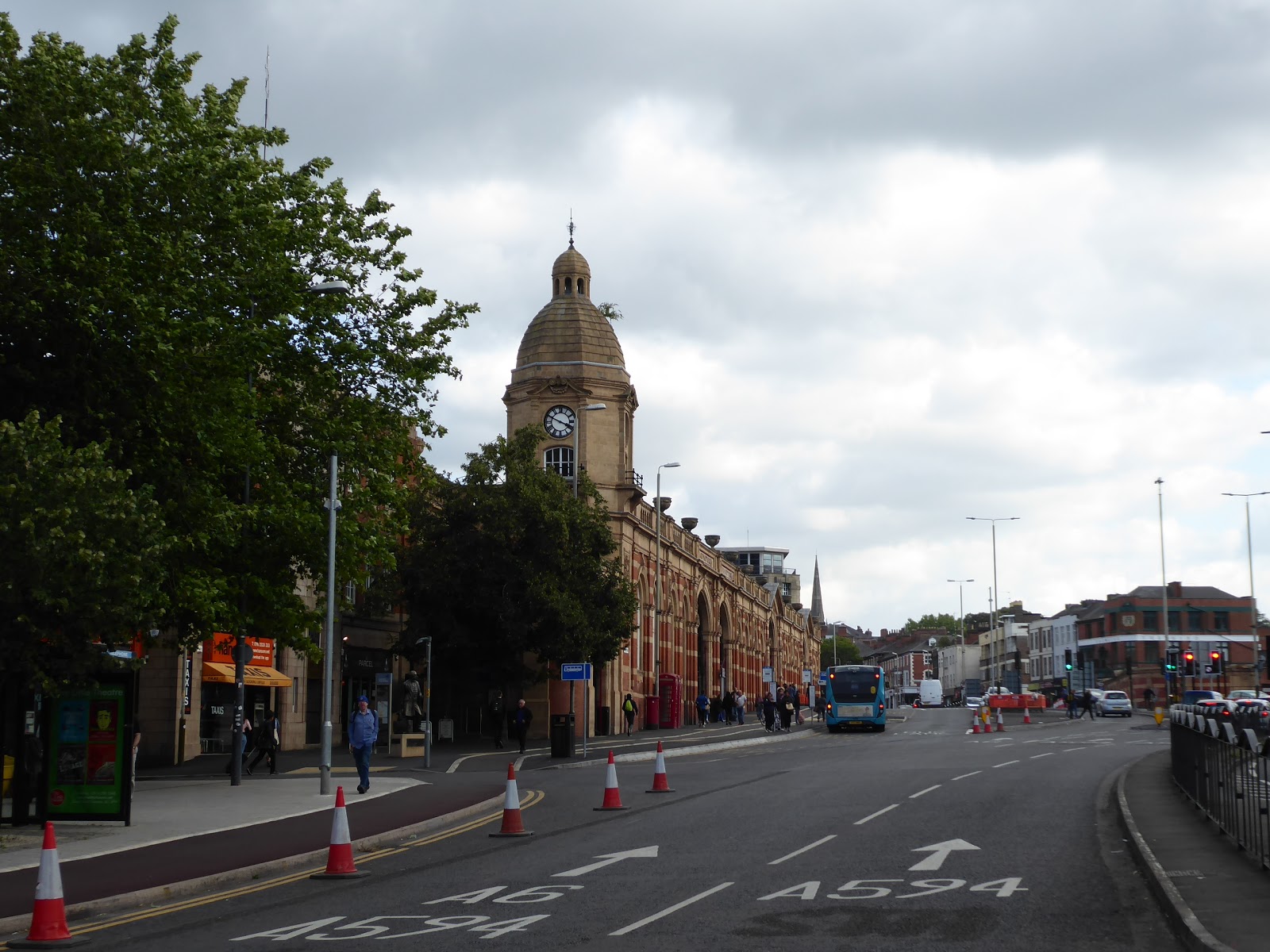
at all, I might add), and then following it in towards the city centre, it's narrow width and modest selection of stores and bars giving it the feeling of the least loved of all of Leicester's five major converging roads that lead into the Clock Tower square by the Haymarket Centre. We could end the trip here, by the memorial tower of 1868, at the very heart of the city, where the roads converge, including the Roman Fosse Way which came down Belgrave Gate to the western entrance of the forum of
Ratae Corieltauvorum at East Gate, and a turn towards my family home in Humberstone could be made down it's eponymous gate too, but we'll carry on south down Gallowtree Gate, the busiest of the city's drags, where Boots, WH Smith and M&S still endure despite the gravity of the city having shifted in the 21st century. The medieval city sits to the west of here, with the covered market and the Corn Exchange spied as we shift onto Horsefair Street, where the Town Hall of 1876 sits, a bold statement in the Queen Anne style, which I visited for the first time only this year when we had to register My Dad's death, and in tribute to him, and one of his best Dad Jokes, I'll trace a path along the side of the town hall square so that I can say 'I've walked down Every Street in Leicester!'. Return to my trajectory along Granby Street via Bishop Street, landing between the old Midland Bank and the city Post Office, neither of which are in use any more, but the frontage of the Turkey cafe opposite is still there, a vision in glazed tiles, as is the Grand Hotel just along the way, still in business against the odds as the rest of the street starts to feel down at heel, despite the infamously dubious King's Head pub having gone, and the Barley Mow having gotten a makeover (incidentally, it's worth noting that the Private Shop is still trading too). This passage brings us to the south end of the city centre, where we meet the A6 for the last time today, crossing London Road's tangle up with the Inner Ring Road to land in front of Leicester station, where the Midland Railway's colourful frontage of 1894 survived the redevelopments of the late 20th century, and from where Thomas Cook made his first excursions in 1841, the right sort of place to wrap my Long Walk of more than 100 miles Down Country at 3.50pm, where so many of my trips to the Old Country start and end these days, though those many journeys made in the past by rail, and road, now have a new parallel companion, one entirely composed of my footsteps.
 |
| Church Gate, the least loved of Leicester's thoroughfares? |
 |
| The Haymarket Memorial Clock Tower, at Leicester's City Heart. |
 |
| Gallowtree Gate. |
 |
| Leicester Town Hall and its square, from Every Street. |
 |
| The Grand Hotel, Granby Street. |
 |
| Leicester Station, London Road. |
~~~
 |
Long Distance Trek means Selfies!
#9 & final at Leicester Station. |
5,000 Miles Cumulative Total: 4147.3 miles
2019 Total: 496.9 miles
Up Country Total: 3684.3 miles
Solo Total: 3833.1 miles
Miles in My 40s: 2741.1 miles
Next Up: Back Up Country for a Stroll and a Train Ride to end my Summer Jollies.


No comments:
Post a Comment