14.9 miles, via Billinge Hill, Yellow Hills, Close farm, Hoghton Bottoms, The Horr,
Causeway wood, Sun Mill, Stanworth wood, Red Lea, Abbey Village, Rake Brook reservoir,
Roddlesworth reservoirs, Tockholes plantations, Hollinshead Hall, Pasture Houses Hey,
Longworth Moor, and Delph Brook plantations.
 |
Long Distance Trail means Selfies!
#1 at Witton Park.
|
Anyone who's been following my walking career across 7+ years and two blogs will be aware that walking the Witton Weavers Way has been planned for in every walking season I have done, but has never gotten onto the schedule as circumstances have always found me doing something else when I've travelled to the West Pennines to visit My Sister and her family, so as the eighth season presses on to my Summer Jollies, we find good reason to get it off the schedule as My Mum needs to come up country as we three all need to be in one place to get some business sorted with HM Land Registry. That's all sorted at the Fylde office on Tuesday morning, which hopefully resolves all the remaining issues with regards our inheritance of Dad's estate, and then we can shift focus onto tackling this 32 mile circular trail that supposedly celebrates the pre-industrial heritage of this corner of Lancashire, that is actually Blackburn with Darwen's major trail, as Bolton district doesn't actually have one, which My Sister and I will be able to take on while enjoying the flexibility of having two other adults around while My Nieces go through the motions of their last week of school. So onwards, getting driven up from Egerton to Witton Park on the western side of Blackburn in the Parental Taxi, for a start at 9.15am, in alien walking territory but in a corner that's still plenty familiar as this former country estate that has been Blackburn's municipal park since 1946 has been a regular stomping ground for My Sister's family, and the route, starting off past the arena and athletics track, up to the old pavilion and into Big Cover Wood traces the route of the first walk that I ever took with my Younger Niece, in the late summer of 2008. The rising track is just as testing for the early going as it was then, and I always seem to pant harder when in company, as I'm compelled to walk at someone else's pace, rising to the open fields that give us a look over the southern portion of Blackburn, with Ewood Park stadium obvious, and back to the northern flank of the West Pennine Moors, which this trail will take a while to get to as it loops northwards for a while, pressing uphill past Higher Garden Plantation to the limit of the parkland at Under Billinge Lane and joins the path across the slanted plots on which the woodlands of Billinge Hill stand, though we won't be seeking the summit path this time, but instead hang close to its western perimeter on the sharply rising and sometimes obscure track to seek the route westwards.
 |
| Witton Park. |
 |
| West Blackburn and Darwen Moor from above Big Cover Wood. |
 |
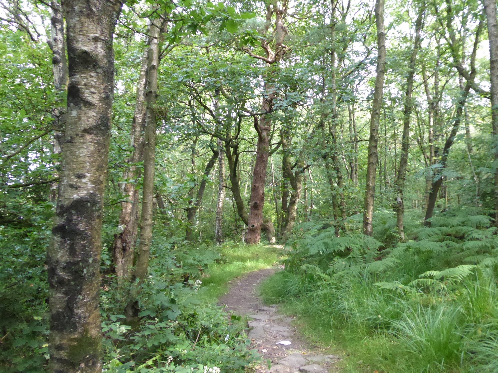
| Billinge Hill woods. |
We emerge into the grassy fields above the Clog & Billycock, our favoured smart eatery in this corner of the world, and rise some more to the ridge top of the so-called Yellow Hills, where our morning horizon expands to enhance the view to the south and gives us a look north to the environs of the Ribble Valley, across to Longridge fell and the Forest of Bowland, while ahead lies Preston, with Deepdale stadium sticking out prominently, and with our height gain we also need to peer across the Fylde peninsula to espy Blackpool Tower on the remotes horizon. It's here, above the disused quarry workings that I can mark 4,000 miles on the tally since 2012 (and before I'm 45, to boot) and under our feet we can meet the Alfred Wainwright memorial, from where his beloved Lakeland fells might be seen a on very clear day (providing a reminder to all that he was a Blackburn native before he moved to Kendal and became the started the pictorial guides that became his legacy), and from here we move off the best local viewpoint and get the trail going once more, descending above another abandoned quarry and into its apron of woods, beyond which we field walk and My Sister has to contend with her entirely rational fear of cows as we press on through their enclosure. We are still getting no closer to the west Pennines as the farm tracks lead us to Billinge End Road and on through the long grass to Close farm, on the last elevated bluff on this ridge, from where we descend through more pasture to enter a wooded clough that branches off the River Darwen, the local river that flows all round these parts while mostly hiding from view, which it does along here as we trace a path along the high edge of its wooded passage, with its watery passage clearly audible from above and only getting sight of it as we descend to its bank level by the Scouts hut that really looks like it was built by enthusiastic children. My Sister has to admit that this is corner of the locality that she hasn't visited in all the years she'd lived in these parts, so its a new adventure for us both as we tramp the path over to Lower Park farm, and the cottage cluster that once sat around its now absent cotton mill, which gives the first flavour of the trail's purpose, while we seek the main route of the Weavers Way over the river Darwen, and leave the circular route of the Beamers trail, one of four such loops that render this whole track rather complicated to read on the map, but we're onto roads now, finally settling onto a southbound tack as we meet the hamlet of Hoghton Bottoms.
 |
The view to Preston and Fylde from Yellow Hills
(and the vicinity of 4,000 miles before I'm 45 too!). |
 |
| Close Farm. |
 |
| The Woodlands above the River Darwen. |
 |
| The River Darwen. |
 |
| Lower Mill cottages, Hoghton Bottoms. |
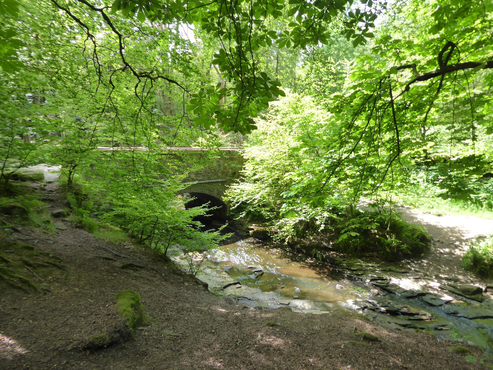
Some of the cottages in the ribbon along Valley Road and Viaduct Road have the bucolic and ancient flavour of the domestic weaving industry, but many other look like the product of the desire for suburban living in the countryside, while past Vale House farm we find the still intact site of Higher Mill, which is modestly scaled with its terrace and offices in full contemporary residence mode, with the river passing through a deep cleft beyond, which provides much more immediate interest to our geographers' brains. The gorge we pass through is known as The Horrs, and the Blackburn to Preston railway passes right over it on the 30+m high Hoghton Tower viaduct, which hides well beyond the canopy of Summer foliage, while the River Darwen churns over the rapids below the weir that fed the goit to the Hoghton Bottoms mills, with our passage carrying along the bank which feels like a sea of natural greenery until it's pointed out that the plants are Knotweed, Giant Hogweed and Himalayan Balsam, all of which are invasive species. We continue with the river as its valley widens out, and My Sister points out the exposed sand and mud to the sides, which are incredibly recent additions to the landscape, being post-glacial deposits of no more than 20,000 years vintage, which gives a new angle to view geological time that we normally view in millions of years as we tramp the riverside pasture and seek the path that leads up through Causeway Wood, taking us away from the river channel and then angling us uphill rather vaguely towards Hillock Farm with only a chimney that I cannot see on the horizon to guide us. We land on a farm track that brings us down to the A674 Preston Old Road, just beyond the edge of suburban Blackburn, where a pair of long terraces angle down the roadside towards the entrance to the Sun paper mill, where our path leads enters the site to find that it has been wholly demolished, and then rises to pass around the almost equally absent Star mill beyond, to find the channel of the Leeds & Liverpool canal, which needs walking on the Lancashire side, which we cross and then plough uphill towards Stanworth farm, finally regaining some altitude on the day again, before the path route gets blocked by the M65, which we are compelled to detour under at the western end of the vast concrete and steel viaduct that elevates it over the deep and wooded channel of the River Roddlesworth.
 |
| Higher Mills, and cottages, Hoghton Bottoms. |
 |
| The River Darwen in The Horr. |
 |
| Exposed Post-Glacial Sand by the Darwen. |
 |
| The Sun and Star Mills terrace by Preston Old Road. |
 |
| The Leeds & Liverpool Canal near Sun Mill. |
 |
| The M65 bridge over the River Roddlesworth. |
Now sharing the path of the Reelers Trail, the second loop on the Weavers Way, we hang on the upper edge of Stanworth wood as we pace the sides of the rising fields, trying to not startle the sheep before we get a indication to head into the woodlands and trace the steeply descending path down to the riverside, one which is so sharply angled that it needs a grab rail to steady you on the way down to the footbridges that leads us over to the eastern bank, where the route then heads straight up the field on the other side, across a steepling enclosure that has been carved up by cattle and dried rock solid. That's possibly the hardest climb of the day, one to test the knees and hips, taking us up to some level going beyond, over the field on the western side of the lost railway line between Blackburn and Chorley, a portion to the south of here which we've seen before, now concealed from the knowledge of most for more than 50 years, and the path beyond leads over to Bradley farm, through which the path seems to hide from immediate view, but passes too close from its uncontained slurry pit for our liking, and on through its yard where its dogs will come out to greet us. It's track leads us forwards, among the fields of sheep, where the potency of the local ram just has to observed, and despite travelling with guide book, map, GPS app and local knowledge, we both somehow miss the path turn as it departs the field track and thus we end up at Red Lea farm unintentionally, where the RoWs converge nonetheless at this made over house with its small holding of goats, donkeys and emus, but the way on the ground is utterly hidden, so we'll walk down their definitively not a footpath driveway to get back on track at Red Lea wood just to spite them. So through the trees and over the alleged river channel, to emerge by Benson's farm and follow the driveway out to the A675, taking us behind the long terraces of Abbey Village, which arrived out here to service Abbey mill, which also post-dates the historical remit of the Weavers Way, but provides an historic point of interest regardless, where suburban living in the country now rule supreme, and with about half the day's distance done, it feels like the right time to break for a cheeky lemonade at the Hare & Hounds inn at the top of the village, where we've already walked from on our travels, and My Sister's local knowledge becomes much more focussed to direct us the rest of the way.
 |
| Descending to cross the River Roddlesworth. |
 |
| The Lost L&YR Blackburn to Chorley Line, near Bradley farm. |
 |
| Red Lea farm (officially off track here). |
 |
| The long terraces of Abbey Village, from behind. |
Having watered, we slip back away from Bolton Road and head back into the river valley, getting the feeling that we've been wandering along the edge of Chorley district along much of the western side of the Weavers Way through the morning, entering the landscape of reservoirs on the western side of the West Pennines which were built to service the needs of the City of Liverpool in the 19th century, and we head over the angled dam of Rake Brook reservoir, with the last of the middle day's chilly winds blowing over as we pass around to the waterworks house and down to the footbridge over the runoff channel, though fording it would have been just as easy as it looks like its been dry for a while. Rise up to meet the dam of Lower Roddlesworth reservoir, a particularly picturesque spot with Darwen Tower rising with its moorland promontory above the heel of the reservoir, where we brought Elder Niece for a picture session on the weekend of My Parents' 40th wedding anniversary in the late summer of 2007, following the track over the dam to take up residency on the northern bank, among the trees and away from the shore line, where we lose the Reelers Trail and follow the path that My Sister's family has ridden plenty, and tangle up with the route of the Irish Sea Trek of 2015 as it leads down to the dam of Upper Roddlesworth reservoir. The Weavers Way doesn't actually come down to the shoreline, but I make a case for walking it while we can, and it's a pleasing little diversion to take so we can pace by the silvery surface for a while before we get back on track properly along with the path of the Tacklers Trail, or that's the theory at least, as instinct to follow the bridleway has us missing the Weavers Way as it splits off to the heel of the reservoir and thus we press on into the plantations on a higher track than intended, but no matter really as we're headed in the correct direction. The Tockholes plantations, all three of them, have filled the upper reaches of the river valley, providing a continuous ascent of around 100m and giving you the feeling of being remote from civilisation when the accompanying roads are not for away on either side, and we get sunshine re-emerging into the day where the canopy thins or the path enters an open stretch, before we drop to meet the pre-turnpike road as it comes down from the west to cross the stream at Halliwell Fold bridge, and join its path as Mill Lane heads up the eastern bank.
 |
| Rake Brook reservoir. |
 |
| Lower Roddlesworth reservoir. |
 |
| Upper Roddlesworth reservoir. |
 |
| Halliwell Fold Bridge. |
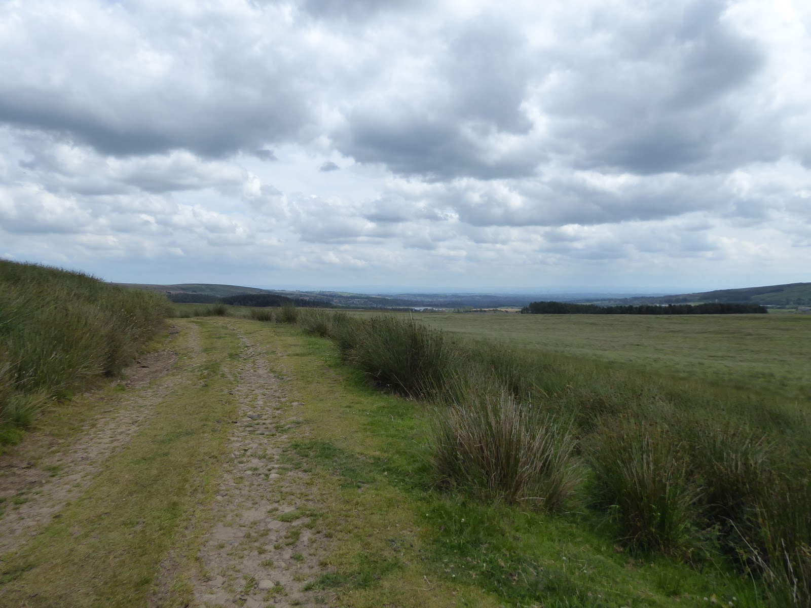
Aside from a few gateposts, there's little to see of the rural landscape that lived up here before being erased by more than a century of tree growth, gradually working our way from the river channel that deserves a last look or two back before we plough on to the path crest at Slipper Lowe, where a farm once crown the hilltop, and then we have to descend, which is offensive after all that climbing to come down to the site of Hollinhead Hall, where substantial remnants of the farmhouse, barn and stables block peek up through the long grass where the path finally emerges from the woods. There's still some ascent to come to get to Tockholes Road via the edge of Thorny Bank Plantation, as we start to enter that amphitheatre of wild moors that fill the landscape to the north-west of Bolton, with the western flank rising as we do, with the Great Hill - Spitlers Edge ridge (which we've walked over) close by and the mast clad top of Winter Hill (which we've also walked over) beyond it, meeting the road and then venturing onto the elevated stretch of permissive bridleway because it offers a staring bench where we can make our sole lunch break, where my cheese sandwich is consumed with so much joy. It's moorland walk in a relatively straight line for most of the remainder of the day, and we probably don't need a map of any kind to get to the finish line, and thus we head for the path from this corner of Darwen Moor that looks wholly unfamiliar from how it did when we came out here with Elder Niece for some sledging action in the snowy days after Christmas of 2014, avoiding the moorland ponies and entangling ourselves from the Tacklers Trail whilst joining the rough track that leads up to Lower Pasture Barn farm, the only house we'll be seeing up close between Rake Brook and the day's end. It's been nicely smartened but lacks a grand view, as the moorland mass to the west and north offers no view at all, and it's too far away to look to Belmont Reservoir, so it's as isolated as you could want to feel when only a half mile from the nearest A-road, deep in the moorland grasses of Pasture House Hey, which we continue on through as we come up above Belmont reservoir, which sits at the high limit of the catchment of the Irwell, after so many miles of being in that of the Ribble, actually supplying water to Bolton and providing a sailing club at another unexpected corner of the Pennines with Winter Hill as its dramatic backdrop.
 |
| Tockholes #3 Plantation. |
 |
| Hollinshead Hall ruins. |
 |
| Great Hill from the Darwen Moor fringe. |
 |
| Lower Pasture Barn farm, Pasture House Hey. |
 |
| Belmont Reservoir and Winter Hill. |
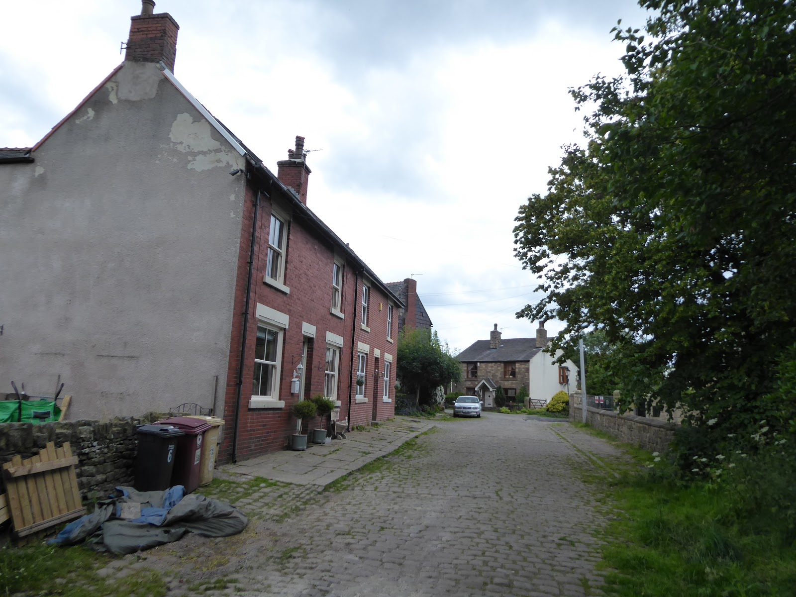
We set course for home as the path comes out on the rolling track above the Higher and Lower Pasture farms, in the declining fields that stretch down to the reservoir shore, cresting as we land on the edge of Longworth Moor, across from Belmont village and offering a view downstream to the huge open plain in which Manchester sits, its many tall towers rising less than 20 miles away through the haze, with the apron of the western edge of the Peak District beyond it, which I was out amongst only a few days previously, and we can feel even closer to the finish line as Delph reservoir and the uplands of Turton Heights and Cheetham Close come up on our immediate horizon. A look back across the moor reveals that its herd of awkward cows, noted for their ability to block the path, are keeping their distance from the track today, and as we hit the downhill haul, I note that despite all my visits to this corner of the county, I'd managed to forget that Springs and Dingle reservoirs sat in the shadow of Winter Hill, a sure consequence of having not walked out this way since 2015, and the gradual decline of the track seems to be giving My Sister no joy at all, as her cyclists legs seem to favour uphill paths more and the angle seems to be giving her hip grief as we come down by the edge of Stone Bank Plantation. Not much further to go on tiring limbs as we land on the roads that circuit around Delph reservoir, which will hide from view behind the Delph plantations as we take the bridleway that passes about it, descending steeply down to cross the beck that feeds it, and then rising on the switchback path to carry on among the trees that have been extensively felled and replanted on this side, emerging into the fields of Buffs farm, where the same herd of cows has lived for more than 15 years, according to my Sister, and after all the dwelling-free miles since Abbey Village we then look to concluding the day at Dimple. It's not a name anyone local uses, according to My Sister, but it's an old hamlet only a half mile north of Egerton, and by extension greater Bolton (which we've seen very little of on today's path), which used to sit on the pre-turnpike road that has since been superseded by the A666, and has had a bit of a desirability makeover in recent years, with one house even featuring on Grand Designs, and here by the edge of Blackburn Road, we'll stop today's trailblazing by the Italian restaurant in the old pub, Ciao Baby (or 'Chow, Baby!' as it always sounds to me) at 3.30pm, just shy of half way round and close enough to base to not need a ride home.
 |
| Looking beyond Bolton to Manchester and the Peak District |
 |
| Stone Bank Plantation from Longworth Moor. |
 |
| Delph Brook plantations. |
 |
| Dimple hamlet. |
5,000 Miles Cumulative Total: 4013.5 miles
2019 Total: 363.1 miles
Up Country Total: 3596.5 miles
Solo Total: 3708.1 miles
Miles in My 40s: 2607.3 miles
Next Up: Back the Way We Just Came, by a (much) Longer Ways Around.


No comments:
Post a Comment