13.8 miles, via Hinchcliffe Mill, Holmbridge, Holme, Lane, Holme Moss,
Heyden Brook valley, Heyden Bridge, Woodhead Reservoir, Crowden,
Torside Reservoir, Hollins, Rhodes Wood, Valehouse Wood, and Tintwistle.
After six weeks of pushing the boundary of my Field of Walking Experience southwards, and using the High Season weekend to probe the upper reaches of the Don Valley, like I'd promised to do, it's time to shift focus and start to looking westwards, so that I might start pressing westwards, so that we might properly investigate the Holme valley while Summer is still in business and can get in the long days of travelling before the days shorten too much, and having made such a big noise about all my approaches toward western Kirklees, my first day of travelling from within it will actually be striking for a finish line far beyond it. An early start is essential, predictably enough, but not just because of the length of the trip, but also because I'm NIW for the week and My Mum is travelling up so we might get some issues with regards my legacy and inheritance sorted out, and so it's away on the earliest of plausible trains and then off on the nearest available bus to land in Holmfirth for an 8.50am jump off, which comes after the necessary use of public conveniences as there are not going to be many places for comfort breaks on today's trip. July ought to be bringing the joy of the season, but the projections for the day have gradually rendered it mediocre, with little chance of sunshine in the day's first half, and thus we're off under gloomy skies, but wholly tolerable warmth, as we note Holmfirth's memorial pillar to the Treaty of Amiens of 1802, a rather premature monument to peace with Revolutionary France when 12 years of the Napoleonic Wars would start only 14 months later, placed opposite the bus stands that have been the focus of all our visits so far, before we make for the opposite bank of the Holme, which takes us up the politely dressed shopping parades of Victoria Street. Even before regular opening hours, the town feel busier than it ought to be, and thus the people need to be shed from our path as we strike westwards on Huddersfield Road, the other main street so far unseen in this town, as it leads past Holmfirth's market and mill, to the division point of the A635 - A6024 where the choice of moorland routes needs to be made, and admiring the landscape of weavers cottages and modest factories that still look the part of a town that originally thrived because of the domestic production of woollen goods, rather than heavy industry.
 |
| The Peace of 1802 monument, Holmfirth. |
 |
| Huddersfield Road, Holmfirth. |
Much can be made of the bucolic charm and picturesqueness of the town, making it understandable that it virtually became a living film set and the tourist still come here despite the TV series that made it famous having finished a good few years back, but as we hit the rising road towards the now visible and looming Holme Moss, we find sight of the mills that harnessed the River Holme above the town, where Lower Mill endures in part as a residential complex, but no fragments of Prickleden and Dyson's mills, or the Victoria Iron Works remain, aside from their names attaching themselves to residential complexes along the suburban edge of town. Further up, Spring Lane mill has gone, but Riverside mill remains as part of the Holmfirth auction market, and the largest mill complex up the valley, Bottoms mill, remains intact and still wholly industrial, sat among fields and below the rising bank of Malkin House wood and its vast mill pond, with its sentinel chimney standing high over the valley that has now opened out to give us a clear route upstream, through miles of apparent greenery, which soon retreat from the roadside as we run up into Hinchcliffe Mill, the first independent village beyond the town. Industry thrived here too, with both its mills still partially intact on either side of the ribbon of tall terraces that stretch along the Woodhead Road-side, around the Stumble Inn and the ivy clad Corn Loft guest house, with the older portion of cottages down Old Lane looking like something right out of Last of the Summer Wine, and there's more of the tall terraces at the top of the village by the old Methodist chapel, showing up and excellent economy of land use and the contemporary fortitude of those who'd enjoy rural living in homes with three flights of stairs. We then run immediately into Holmbridge, which I'd have fancied was the name of the whole settlement up here, but definitely seems to be it's lesser portion at the rural fringe, where the terraces diminish and the suburban ribbon thins down to the viable plots at the valley side, and we come down past the Pickled Pheasant inn and St David's church and cross the Holme Bridge, passing the last pair of upstream mill sites, Holmbridge and Clarence, before we lose the footway on the A6024 and begin the steep ascent along the lane up Holme Bank, at the side of the subsidiary branch of the main river, the apparently nameless one with all the reservoirs in it.
 |
| Victoria Mill bridge, on the Holme. |
 |
| Bottoms Mill. |
 |
| Hinchcliffe Mill. |
 |
| St David's Holmbridge. |
Green company takes over as we rise on towards Holme, feeling thankful that this is one of the county's quietest A-roads, where traffic only seems to come this way if it actually wants to, and half of it seems to be on two wheels, brought here for the challenge or the dramatic setting rather than its use as a trunk route, and we carry on past the Wheat Close terrace at the foot of Brownhill reservoir and then press on up to the village, which is as far as a bus can viably travel, where the castellated Holme House farm stands sentinel at its eastern end. Despite some suburban encroachment having come this way, right at the edge of moorland altitude, it still feels like a proper rural village, all stone cottages clustered around its green as if keeping close for warmth, where the Fleece inn could happily offer a cuppa on this July day that is resolutely not warming through, and it also stand across the Kirklees Way route, which means as we press beyond it, past the bus turning circle, we are out into the unknown, extending the western boundary of the Field of Walking Experience. The ascent to Holme Moss is now the target of the day, 200+m further up, but we've not travelled too far before civilisation makes one last claim of the moorland road, passing thorough the hamlet of Lane, where a couple of high farmsteads endure with a terrace in between, along with a bunk house owned by the Girl Guides association, beyond which we find Ings Bridge over Rake Dike, and start off on the twisting lane as it heads up to the Holme Moss passage, its mast looming over the moorland beyond the switchback that we'll be traversing, with the view down the Holme valley opening out as we pass the millstone that reminds us the we are now entering the Peak District national park. An extreme height gain is felt even as we make the first corner, with Lane and Holme already retreating into the landscape, while the long drag up to the next corner still shows graffiti from the visit of the Tour de France in 2014, where the valley head view opens up revealing the woodlands that surround the trio of reservoirs, with Yateholme obvious, and Ramsden well concealed, and Riding Wood down there somewhere, and also showing up why a moorland edge walk on the southern periphery of the Holme Valley might just prove that bit too challenging for the novice trackless wanderer.
 |
| Ascending the quiet A6024. |
 |
| Holme village. |
 |
| Lane hamlet. |
 |
| Entering the Peak District above the Holme Valley. |
 |
| Hammering the Switchbacks up Holme Moss. |
 |
| The upper Holme Valley fringe, with Yateholme reservoir. |
The last pull of the climb comes below the fragrant bank of ferns and bracken below the high edge of the moor, which elevates us high enough to bet good sightlines to some distant hills around-abouts, with Whitley Heights windfarm and Castle Hill showing their distinctive shapes, and we even meet some roadworks and their traffic light controls in the last stretch, which we pass as we meet the moorland crown, where the Holme Moss mast and its guy cables fills the northern block of the moor, and a break at the viewpoint carpark has to be taken. Sadly the grey and fudgy skies do little for the views from 500m up, and there's no sight of anything even 20 miles away from this high altitude, with only the Emley Moor masts showing up beyond the eastern side of the Holme Valleyand it's not feeling like a place to loiter at 11am as the breeze offsets enjoyment of the view, and so we set off west again, rising to the moorland top, passing the driveway to Arqiva's mast controls, and the shortcut route to Black Hill, further along the Holme Moss ridge to the north, meeting the summit at 524m up, the highest road in West Yorkshire, beyond which enter Derbyshire and the long declining road towards Longdendale, crossing the English Watershed along the way for the first time in nearly four years. So wholly fresh views beyond the western buttress of Kirklees, that isn't at all wide or forbidding as it seems from below, as we enter the valley of Heyden Brook, which immediately directs us southbound, towards the distant bulk of Bleaklow, which elevates itself before we even got a view to the west side of the valley, with its moor tops of Black Hill and White Low separated by the lea of Tooleyshaw Moor, and we start on a rapid descent off the 500m plateau, feeling that we might have gained a glimpse of Kinder Scout on the southern horizon before we drop below the rocky edge of the Deer Stones. It's a long slam downhill for well over a mile through the grass and bracken (but no heather), with the road feeling un-treacherous, thanks to the clear sightline, and greater risk to well-being comes from the increasing numbers of cyclists, many of whom are toiling hard on the ascent and aren't alert to the possibility of meeting anyone descending on the roads, heading down to reveal a grand bowl at the valley head, and arriving on the steepening road below the looming edge of Dewhill Naze, and above the deepening cleft of the valley where the brook churns over a sequence of minature waterfalls and cascades, far below the road.
 |
| The climb below the Holme Moss mast. |
 |
| The Holme Moss viewpoint, with many bikers. |
 |
| The 524m Holme Moss road summit. |
 |
| The descent into Heyden Brook's valley, toward the flank of Bleaklow. |
 |
| The anonymous flank of Black Hill. |
 |
| The way back, to Holme Moss. |
Eventually drop between two conifer plantations as views up the valley are lost, coming down through the trees to the embankment that crosses the valley like a dam that never quite got finished, which actually replaced the old Heyden Bridge that is still down there somewhere below the foliage, and we can get a sense of being out of the unknown as we get sight to Longdendale proper for the first time from here and don't feel so remote from civilisation as Pikenaze farm loiters on the high land ahead, and there even used to be an inn along here too according to the old OS map, though no sight of the Tollemache Arms remains. Rising on a bluff we have the reveal of Woodhead Reservoir ahead, with its viaduct carrying the A628 over the branch down which we are emerging from, where a look back will show the interceding valley of Withens Brook, while the Heyden Brook passage is completely obscured, as we emerge below the sharp end of Pikenaze Hill, rolling with the road and tracing the path that rises up the south side of the valley onto the Bleaklow plateau, and taking a heck of a time to eventually land ourselves above the bridge and the to come down onto the A628 at the real foot of the Woodhead Pass, where the hamlet of Woodhead once stood, of which naught but a water trough remains. The A628 will now be our companion down Longdendale, as we gain a footway to keep us safe-ish from the traffic that renders this surely one of the most over-used and least suitable A-roads, where double white lines ensure no traveling shenanigans go on amongst the traffic as it heads over into and out of South Yorkshire, and as we stick to the pavement, following the shore of the reservoir, above the flow channel of the River Etherow, it's hard to feel safe as the footway is littered with fragments of shredded tyres, broken brake discs, HGV straps, and even the odd exhaust pipe. There's still things to spy as we come down to Woodhead dam, like the station cottages at Crowden Station on the southern bank, the sluice workings at the bottom of Hey Clough, and the reservoir house by the dam, over which the Glossop Road runs, where the valve tower appears to be located in its garden, and above this scene up a bridlepath, we have St James Woodhead, the parish church of Longdendale, which really looks like its returning to nature as bracken invades its graveyard en masse, and we'll break for lunch here, as it's the most secluded spot from the road that we can find.
 |
| Descending to Heyden bridge. |
 |
| Woodhead reservoir and its viaduct. |
 |
| The A628 Woodhead Pass in upper Longdendale. |
 |
| Woodhead dam. |
 |
| St James, Woodhead. |
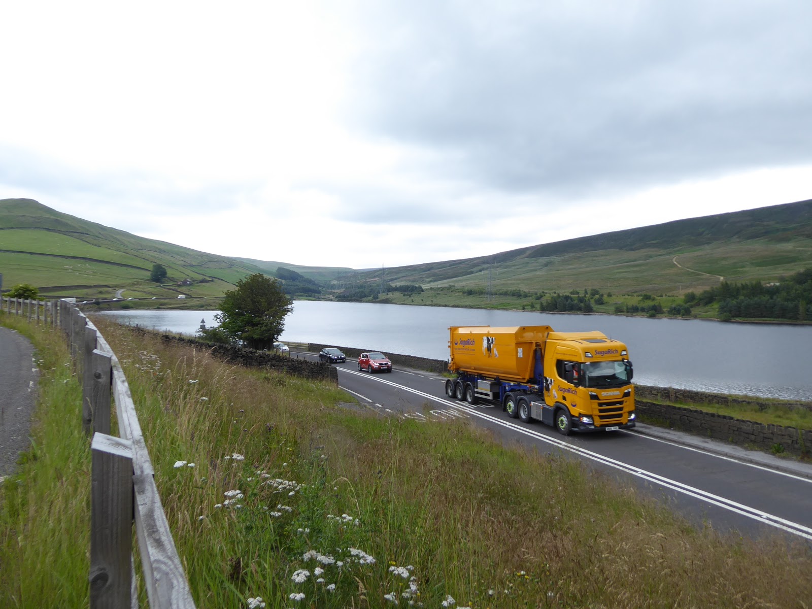
Above the road, we can see that there's still a lot of valley to come, so feet need to be warmed up again as we set off downhill once more, where the channel of the Etherow describes itself well above Torside reservoir, and we come around to the sole village of any size up the valley, Crowden, which loiters below the roughly hewn Loftend Quarry high above, with the turnpike road mostly avoiding it and its Caravanning and camping park, it's outdoor education centre and its red route to Black Hill, which we'll hopefully be seeing ourselves before we're much older. We soon land above the Reservoir and get the reveal of the deep cleft of Torside Clough on the south bank, above which the Pennine Way runs down into the valley, and we briefly get a fine all round vista before the road pulls away behind a bank of trees and gives us little to see, with the footway soon getting lost below a crash barrier, and we have to deal with walking along the top of the concrete block or contending with the litter and undergrowth that has accumulated behind it, which slow progress for a while. Cross the Pennine Way path at Highstones Lodge and continue on into open fields at a remove from the water, meeting the hamlet-let of Hollins, which is merely cottages and a former inn these days, which we meet as the sun finally breaks into the day, and we see nothing of Torside dam as we pass it, and then little of Rhodeswood reservoir as the road moves further from the valley floor, passing through the wood that names it, and getting little of contextual location until we meet the access track down it the dam, which start to make it feel like choosing this roadside route was a poor idea. A downstream reveal comes as we emerge above Valehouse reservoir, showing the dynamic terrain easing off at the dale's end, before we meet the eponymous woods where we make a dramatic crossing of a minor stream, and vanish into tree cover, where we meet the first place on the road where there's enough space to provide a layby and to widen the carriageways enough to accommodate overtaking, and beyond we rise to meet a better view of the lower valley above the last pair of reservoirs, where the old MS&LR line and contemporary Trans-Pennine Trail can be picked out of the southern bank and proximity to the finish line can finally be felt after these deafening miles on the A628.
 |
| Crowden village (?) |
 |
| Torside reservoir, and clough. |
 |
| Hollins hamlet. |
 |
| Rhodes Wood. |
 |
| Lower Longdendale revealed. |
Signage welcomes us to Tintwistle, and cottages start to arrive by the roadside, including one designed to maximise the upstream view of Longdendale and the westward view towards Hadfield, and as we hit the end of Old Road, we split off the turnpike with a great feeling of relief, entering the first village we've seen since Holme, right on the outermost edge of greater Manchester, so remotely located that it's still in the High Peak of Derbyshire, rising past the bucolic cottages to meet the recently dressed well, which maintains an tradition that seems to be exclusive to the Peak District. Take in the view above Bottoms reservoir and then pass into the village proper past the chapel above the road, coming down among cottages and terraces that still retain all their rural charm, with the top end of the village above the URC and the Bulls Head inn looking like commuter belt living has hardly scratched it, which makes some sort of sense as beyond the Stocks Brow gardens and War Memorial, we exit the National Park and the surroundings get a bit more mundane, and probably less expensive as we head down to meet Manchester Road, passing the rehearsal rooms of the Tintwistle Band, which amuses me a lot more than it ought. Down among the slanted terraces of New Road we head, bottoming out the day as we pass over the River Etherow in the shadow of Bottoms dam, and then rise along Hadfield's suburban edge, opposite the 'historic' Waterside district where the town's industry once thrived, now hidden below the most ordinary of industrial estates, beyond which we elevate ourselves up to Bankbottom which we cross by the New Lamp inn and meet the town's main drag on the rising Station Road. There's a singular look to this main street, with its curved terrace ends, which we pace up while pondering just how remote it felt when I first started seriously planning the idea of walking from here in 2014, but now feels not all that remote at all as we come up upon the Palatine inn and the War Memorial, where we meet our start line from five seasons back by the station, which seals that route as the southern boundary, and today's as the new and hugely extended western one to our field of walking experience at Hadfield station, where the trip concludes after 2.50pm, early for the distance, but there's a 2+ hour ride home via Manchester Piccadilly to come to offset that benefit, the pain of which will be eased by the cost of the open return that will bring us back this way to move the western border again, in a few weekends time.
 |
| A last look up Longdendale. |
 |
| Old Road, Tintwistle. |
 |
| The River Etherow between Tintwistle and Hadfield. |
 |
| Station Road, Hadfield. |
5,000 Miles Cumulative Total: 3998.6 miles
2019 Total: 348.2 miles
Up Country Total: 3581.6 miles
Solo Total: 3708.1 miles
Miles in My 40s: 2592.4 miles
Next Up: Finally tilting at the Witton Weavers Way, with 4,000 miles on the horizon!


No comments:
Post a Comment