15.6 miles, via Kirkby Bridge, Minsthorpe, Upton Moor, Royd Moor, Low Field, Hemsworth,
High Field, Vissitt, Barewell Hill, Brierley, Shafton Two Gates, North Field, Shaw Dike Bridge,
Carlton, Carlton Green, Athersley South, Smithy Hill, Smithies, Honeywell, Greenfoot,
Old Town, Pogmoor, Gawber, Highham Common, and Lane Side woods.
After the much commented upon hot Summer we had this year, not mush is being made of the hot Autumn we are experiencing, possibly because the weather is a bit up and down and the warm bright days are coinciding with the weekends, but we are again looking at a Saturday that promises to be decent enough to be travelling a distance away from home and putting down 15+ miles on the trail, which is just as well as we have the year's third target to aim for, as the 1,000km marker sits only 6300m distant, and a less inspiring day might have had me reconsidering my walking plans after rising after far too little sleep and with claggy-feeling lungs that feel like the harbinger of something nasty setting in. The last South Yorkshire traversal of the year actually gets going in West Yorkshire's southeastern corner as we alight at Moorthorpe at 9.25am, and set our initial course away to the northeast, rather counter-intuitively as we negotiate away past the considerable station building to meet the steps up to Minsthorpe Lane, where we'll set off across the S&K line, south of the station junction, and past the top end of Moorthorpe cemetery and on among the vintages of suburbia that have filled in the land between the two local railways, passing over the West Riding Line beyond the Minsthorpe Inn and ahead of the South Elmsall Curves railside path, visited in 2016 before we carry on through the suburbia to bottom out at Kirkby Bridge. It's a rise from there, uphill past the extensive grounds of Minsthorpe Community College and the edge of the suburban spread to meet the Barnsley Oak inn and the northward turn through the old Minsthorpe village to aim ourselves towards Upton, gettins a better impression of the southwestern horizon than we did on our prior visit as we tangle with the A6201 and A638 in the landscape around North Elmsall, before me meet the remains of the H&BR and its old station, where we turn to follow the Doncaster Road to the northwest, but slip away from its verge as a shaded and concealed footpath presents itself, linking together the suburban closes that have grown out from Upton, and almost providing a traffic-free route out to the Common Lane corner.
 |
| Moorthorpe station buildings. |
 |
| Kirkby Bridge, Minsthorpe Lane. |
 |
| The Southwestern Horizon, from Minsthorpe. |
 |
| The Doncaster Road avoiding footpath. |
It unfortunately stops one street short, in Buttercup Close and a wonky detour is needed to get us back onto the side of the A638, to match a route that we saw on a gloomier sort of day at the start of the month, again taking us on through the fields up towards Upton Moor Top Farm, while placing water tower and microwave mast on our local horizon for the last time, as we seek out the driveway path that leads us toward Elmsall Lodge farm, found beyond the lodge house of the demolished Elmsall Lodge itself, where we finally start tracking west, along the tree-lined tarmac and then across the muddy bridleway groove across the field fodder crops, in sight of Elm Leys farm and St Mary's Badsworth on the northern horizon. Past the farm track we're onto a field walk again, across the plot which maps of all vintage name Grey Cocks as the dirt track leads us downhill to a passage over the Swinton & Knottingley line, and thence onto the field boundary tracks that lead below Royd Moor House and farm, and across the moor itself as we skirt the high edge of the local catchment of streams, coming around above Bullinger Wood and the fields of Wheat Royds, passing the one turbine on this upland that stands as a landmark and getting some sense of the proximity of our next town destination as Hemsworth Academy lingers on the western horizon, before we drop down to meet the end of the track of Lowfield Lane, approaching the A628 bypass road. If calculations are correct, the 1,000km marker is met as we come by the bypass bridleway, and a brief interlude is taken to mark the achievement in the morning sunshine before we pass under the road bridge and follow the meander of the lane onwards and uphill, towards the grounds of Hemsworth RUFC and over the West Riding line (a little ways north of the garden feature signalbox that's been observed so many time this year), to enter the town through one of its many suburban branches, leading us up to the Station Road again, and into the centre below the still refitting acedemy in the old Hemsworth Hall and up through the yard of St Helen's church, before arriving at the Cross Hills 'green' or plaza by the central crossroads.
 |
| Water Tower and Microwave Mast, from Doncaster Road. |
 |
| Field Walking past Elmsall Lodge farm. |
 |
| Field Walking across Grey Cocks, the Swinton & Knottingley Line. |
 |
| The wind turbine on Royd Royd, from Bullinger Wood. |
 |
1,000km in 2022 achieved,
at Lowfield Lane by the Hemsworth Bypass |
 |
| Hemsworth RUFC and the Lozfield lane passage into town. |
 |
| St Helen's church, Hemsworth. |
Stop here for elevenses and contemplate the fact that there really are no routes left by which to traverse Hemsworth after this year, and prove our point by setting off along the Barnsley Road again, past the Gospel hall and Methodist church and rising on through the Highfield half of the town past the Beeches and West End WMCs, and on southwesterly through the suburban ribbon, past the sign that reminds us that it's only 7 miles to Barnsley, and passing out of town as we come past the Vissitt Cottage inn, where the high fields among the valley falls give us quite a good panorama, across the Went Valley to the north as far as the high points of Leeds, and forwards towards the upper Dearne Valley as we crest beyond the end of Robin Lane. That's appropriate as we cross the boundary back into Barnsley Borough as we pass over Barewell Hill and scan the horizon around, back down the fall of the streams that form the catchment that we've left, which still doesn't have a clear identity, and forwards to South Hiendley on its own nab, with the Holgate Hospital almshouses still doing their best to hide from view as we set a course towards Barnsley, now appearing briefly and crisply on the local horizon, as we come down to meet the A628 at the southern end of the bypass road, where it and we pass over the passage of Brierley tunnel, on the H&BR mainline, which we can then watch fall away down below the recently harrowed fields in the headwaters of Frickley Beck, as we are kept elevated to pass below Brierley village. It's odd to think how this local landscape went from unfamiliar to commonplace as we pass by this way for the third time, past the top of Frickley Bridge lane and down Cross Hill past the Church Lane end and the old Three Horseshoes inn, before carrying on downhill along the surprisingly long terraced and suburban ribbon, as we make a definitive move into the Dearne catchment, briefly finding ourselves in a country space that places us below the Shafton railway junction, and north of Grimethorpe, before the A628 starts its bypass meander and we carry on along its old turnpike course towards Shafton Two Gates, taking us over the passage of Shafton Tunnel on the Dearne Valley Railway line and on past the long terrace and the Plumbase store to meet the next enduring milepost, ahead of the crossroads by the Fox & Hounds inn.
 |
| The West End and the Beeches WMCs, Barnsley Road, Hemsworth. |
 |
| The Vissitt Cottage inn, Barnsley Road. |
 |
| Tracking the Barnsley Road over Barewell Hill. |
 |
| The H&BR mainline, in the Frickley Beck-South Hiendley landscape. |
 |
| The terraced - suburban ribbon of Brierley village. |
 |
| The long terrace on the old road, Shafton Two Gates. |
Pass to the right and north of the pub, to take us north of Cudworth village, to follow the old Weetshaw Lane westerly, which has the A628 Cudworth Parkway bypass road wandering its way across its overgrown and forgotten bridleway path twice before we lose the main road at the traffic island by the Avis Army Supplies store, apparently in someone's cottage back garden, beyond which we are drawn into the suburban enclave of Northfield, an odd collection of semis in a road triangle that doesn't seem to be attached to either Shafton or Cudworth villages, while not being quite part of greater Barnsley either, perched above the fall of the hillside and lane down towards the Carlton Marsh nature reserve, placing us north of Monk Bretton and south of Royston. Past the Shaw Lane terrace we encounter the H&BR mainline again, ahead of the landscape of exclusively scrap and metal recycling yards that have filled in the space around the lost Shaw Dike bridge, and upon the railway yards between it and the North Midland Main line, which we pass under via the over-named Shaw Viaduct, to emerge by the site of Carlton Main colliery, and also on our very first route into Barnsley, on the TPT -Barnsley Canal route which we tangle with as we rise uphill, behind the Mr Kipling bakery and into the suburban spread of Carlton village, definitively passing into greater Barnsley as we emerge onto Church Street by the former Wharncliffe Arms inn. Push up towards St John's church, but turn left with Spring Lane before we've arrived below its tower, passing the village hall and it's own suburban surroundings before we come down to meet the B6132 Carlton Road by the Carlton Green council estate, passing over the stream that will become Small Bridge Dike, and pressing on up the rise that takes us towards the Carlton Green industrial estate, which is dominated by the Gist depot on the Industry Road side and the glass recycling plant on the side by the Wharncliffe Woodmoor colliery site, which we'll scratch before we split off with the Carlton Road as it presses south along the eastern boundary of the Athersley South estate, on the long drag up, past the Holy Trinity academy.
 |
| The bypassed section of Weetshaw Lane. |
 |
| Carlton Marsh Nature Reserve, from Northfield. |
 |
| Shaw 'Viaduct' and the scrapyard district. |
 |
| The Wharncliffe Arms (former), Carlton. |
 |
| Carlton Green Industrial Estate. |
 |
| Carlton Road passing around the Athersley South estate. |
Autumnal shading sets in overhead as we reach the road crest by the Barnsley Bowl, our proximity to the Deanre valley and the Pennines robbing us of the sunshine's warmth as we top out and descend among the semis and terraces on the southwest shift of the road at Smithy Hill, bringing us down to cross the A633 Rotherham Road by the Tesco Express, and then down among the long runs of stone terraces that sidle down the valley as it takes its shape ahead of us, shifting onto the Old Road path when it presents the most straightforwards path down to Smithies, giving direst sight to our next hill passage before we drop sharply down to the A61 Wakefield Road before following Smithies Lane down to the passage under the Barnsley Coal Railway. That's has us tangling with our second route into town as we come down to passage over the Dearne at Smithy Bridge, between the Fleets and Tinkers Pond lakes, and then it's uphill, again as we rise up to the unseen passage of the Barnsley Canal towards Barugh wharf, where a bench provides a rather chilly late lunch spot, before we press on past the Fleets campus of Barnsley College the north edge of the Honeywell estate, and bunch of stray terraces at the town's fringe before crossing the railway line to Wakey and Barney, and landing ourselves among the suburbia and villas at the top of the lane, with our climb continuing up Hall Balk Lane, which draws us up to the A635 Huddersfield Road, by the former Barnsley Girls School campus. Join the footpath that traces the park in the former reservoir cistern and the back gardens of Granville Street as it leads us over to Greenfoot Lane, meaning we must have passed through its district as we rise on uphill among more terraces and above St Paul's church with its green copper dome, to meet Old Town, where the Barnsley Union workouse sat, now replaced by Barnsley Hospital, which I's swear used to be the Infirmary and finally arrives in our locality after being spied from afar across today, and every walk in the borough it would seem, and we'll trace a way up its southern side as we rise to the top of this hillside along Pogmoor Road and away from the town centre.
 |
| The fall of Smithies Lane, into the Dearne Valley. |
 |
| The Barnsley Coal Railway, at Smithies. |
 |
| The climb of Smithies Lane, out of the Dearne Valley. |
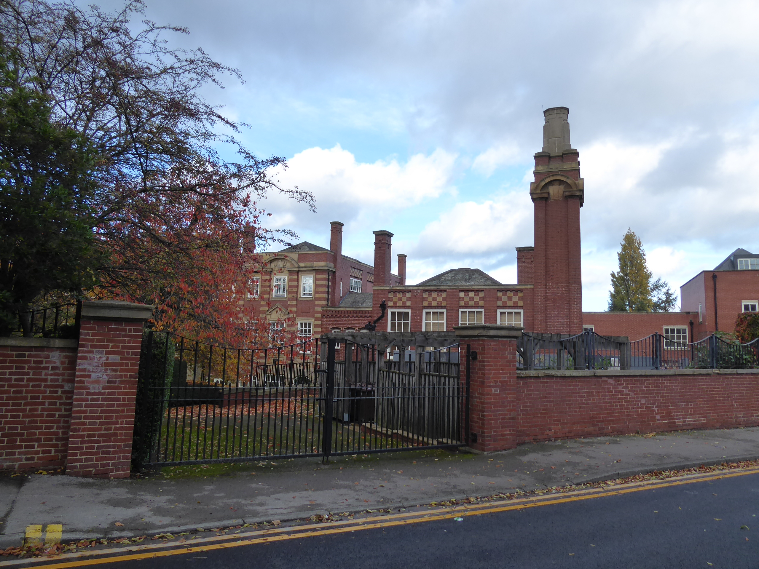
 |
| Barnsley Girls School, Huddersfield Road, Greenfoot. |
 |
| The Rise of Greenfoot Lane, Old Town. |
 |
| Barnsley Hospital, Pogmoor Road. |
The old Pogmoor settlement has a chaotic sort of feel, having been absorbed by the growing town over the last century plus, and its pub, the Tom Treddlehoyle, surely has a history that needs proper explanation that will have to wait for another occasion, as we need to set off among the suburban pavements, getting off our planned trajectory as I'm not fancying a field walk, setting off north along Oakfield Walk and Wharfedale Road as they hang above the views to the upper Dearne and Cawthorne valley division, leading us up to Gawber urban village, which needs a prod while we're in the vicinity, with Church Street pressing us west by the Barnsley Hospice and the modest parish church of St Thomas, ahead of the town/country boundary. Hermit Lane wanders us among the woodlands and fields around the northbound fall of Red Brook, with Hermit House farm among it all, which we pass as the ascent renews, among fields which are filled with ponies, some silhouetted on the horizon as the late afternoon sunshine bids to return as we press uphill, rejoining the route originally plotted as we rise to meet the edge of Highham Common, landing by Alams Lounge in the old pub and across from the long blocks of colliery terraces on the perch above the M1, which we'll cross as we find ourselves matching our original southbound route into Dodworth, a route choice that was situationally inevitable. Passing around the woodland boundary again, we can absorb the autumnal colours and pass the Lane Side and Lane Head farms, and also find that this is the moment where my belt decides to break (knowing that it was almost knackered, it still didn't snap in either of the places that I might have expected it to), compelling me to empty my pockets and cling onto my waistband for dear life to maintain my dignity (as I'm not yet fat enough for my own gravity to hold them up, it seems) as we join the rough woodland path that leads us around to the A628 Dodworth Bypass, which is crossed to meet the railside path that leads through the tree-lined passage below the Old Silkstone Colliery site, where a coal-gas relief valve has to be noted, on the fringe of the industrial estate.
 |
| The Tom Treddlehoyle inn, Pogmoor. |
 |
| St Thomas's church, Gawber. |
 |
| The fall and rise of Hermit Lane. |
 |
| Alam's Lounge, Higham Common. |
 |
| Lane Side Woodlands. |
 |
| The railside path, by Old Silkstone colliery, Dodworth. |
Arriving on the B6099 Station Road, its only a couple of turns and a passage over the level crossing to arrive at Dodworth station, on the Penistone line, the last of the local stations that will be landing on our radar this year, finishing our day at 3.30pm, and selecting the ride home the 'short' way home, as that's then ext train due in 25 minutes time, and only once we've stopped and refreshed for a last time do we get the realisation that I've actually been toiling hard today, as my limbs and abdomen ache in a way worse than you'd usually experience after a cold weather walk, and there's definitely something unpleasant settled on my chest, which is a nice thing to feel anxious about as the three train ride homeward unfolds as the day's notable achievement already starts to feel rather remote in my mind.
5,000 Miles Cumulative Total: 5922.2 miles
2022 Total: 633.5 miles
Up Country Total: 5,441.5 miles
Solo Total: 5586.6 miles
5,000 in my 40s Total: 4512 miles
1,000 km in 2022 Ticker: 1018.8 km
Next Up: Can we overcome a respiratory ailment to keep the season going?


No comments:
Post a Comment