12.7 miles, via the Greenwood Cut, the Calder Valley Greenway, Northorpe, Crossley,
Finching Dike, Norristhorpe, Liversedge Hall, Lands Beck, Hightown, West End, Scholes,
Stubs Beck, Oakenshaw, Victoria Park, Toad Holes Beck nature reserve, Woodhouse Hill,
Staygate, West Bowling, Ripleyville and Broomfields.
It's immensely frustrating to lose a weekend's walking in May, especially when it's due to foul weather, with a double-raindrop sort of day completely blanketing Saturday, and brain fog coming on to completely discourage me from the idea of aiming at 16+ miles on a Sunday, or any other distance for that matter thanks to the issues with Sunday train services hereabouts, and thus hopes for a tilt at my first 5,000 career walked miles target before the end of the month fade from view, having just entered the final 100 miles on our last excursion out. It's already looking like this might be the worst May of all my walking years so far, barely able to string two nice, or even warm, days together, and I'm immediately feeling anxious that we might be looking at 2021 turning into a repeat of a garbage year like 2007, when it rained from June right through to its conclusion, as we ride the train out to Ravensthorpe, to alight at 9.10am under glum skies and a persistent light drizzle, taking in our spartan surroundings for plausibly our last visit to the station on its current site before we set off properly. The day's plan is to make my second trip from Calder to Aire via the city of Bradford, and our initial steps take us out over the former river, and onto the north bank if it, having finally located the accessible path that slips down a cobbled hairpin slope to find the way upstream that I completely failed to locate when tracing the length of the C&H Navigation in 2012, and as we pace along the riverside, below Ravensthorpe's industrial band, it's clear that someone has recently been down here to keep the grassy track mown, keeping the damp leaves from soaking my legs in the early going. It's positively damp with atmosphere down here, with the path coming around to Greenwood Lock, at the start of the Navigation's Greenwood Cut, slicing off a corner of the river above Shepley Weir, forming another quite green strip along the waterway that conceals the industrial buildings on both sides as it lead us up to and under the Low Mill bridge and flood lock, and on around the long curve of the sweeping Calder before we rise away to join the side of the A644 by the sole riverside house in the area.
 |
| Ravensthorpe Station, for the record. |
 |
| Calder Road Bridge, on the Calder. |
 |
| The Greenwood Cut on the C&H Navigation. |
Meeting Huddersfield Road leads us up to the edge of greater Mirfield, and also fills in the short section of its length that has somehow been omitted on all my previous travels hereabouts, leading us up to the Calder Valley Greenway, heading northeast away on the former L&YR Mirfield to Heckmondwike line, which notably hasn't made any further progress southwest in the last nine years, which leads us back towards the suburban edge of Ravensthorpe, while offering views through the wet haze to St Mary's church, the true sentinel of the southern Spen Valley. Beyond Holroyd park, the path slips us between the housing development that claimed the local colliery and mill sites ahead of Northorpe station, which we meet where it once passed over North Road, at about the same time as the first blast of morning rain, where we take a left to join Shillbank Lane as it drifts us into the edge of greater Mirfield again, rising us up to Northorpe proper once again, beyond the L&NWR bridge and around the Plough Inn, with our passage leading onto Crossley Lane and its rise among the suburban outliers. Soon rise into the countryside around Primrose farm, and all views east across the Spen Valley are lost below a whiteout haze thanks to the continuing drizzle, and our way wanders on through these field that suburbia has yet to claim, noting the outlying rural terraces scattered around as we wander and twist out way with the lane to make our third and final touch on greater Mirfield, where the estate lanes have reached all the way to the site of Lower Crossley hamlet where a view east to that massive railway embankment would be available in better conditions. The lane leads on to Upper Crossley, a more considerable farm hamlet with a single apartment building within it, where our route slips off the lane and down a field access track that is about a walker unfriendly as it gets, with the descending field path beyond showing up the other major issue that we're needing to face today, as these many days of May rain have saturated the soil completely, which is really going to challenge my aging boots, and muddy going persists all the way down to the passage over Finching Dike, concealed by trees and approached via slippery slopes.
 |
| The Greenway entrance on Huddersfield Road. |
 |
| Northorpe L&YR station throat. |
 |
| Damp Haze over the Spen Valley. |
 |
| The wet, muddy descent to Finching Dike. |
Elevate to the field path beyond, and feel cheered by the fact that the rainfall has at least eased as we come up to the farm track that leads us up to Owlet Hurst farm, beyond which we rise away from this first branch of the river Spen, up the track that leads past the South Field terrace and up to the hill crest, where we meet the 124m trig pillar at the edge of the recreation ground, and land on Norristhorpe Lane, opposite its eponymous club, before we start our next descent into the landscape where suburban Liversedge and Heckmondwike reached their limit. Liversedge Hall Lane guides us through the suburbia, and the former hamlet that sits around the mostly concealed old house, as we are lead on through the leafiness to meet the lodge houses by the A62 and the Roberttown Lane, where an ongoing route feels like it ought to be available up one of the Headlands closes, but what's apparent as an old track on the map no longer exists on the ground and thus we have to pass back down the side of the main road to meet Headlands Road, and seek the path beside the factory complex that leads to Spen Valley High School's playing fields. Here's a track that we traced a good few season ago, back in 2014 when I'd thought three years was longer enough to do a good number on all of West Yorkshire's paths, and it's even muddier an nastier than it was back then as it traces the boundary of the former Woodfield Mill site, which has been replaced by a bed factory, the number of which we've seen around Spenborough and greater Dewsbury seems honestly countless, as it leads down to eventually meet Lands Beck, bottoming out another side valley of the Spen. A short upstream stretch lead us to the rising path up the north side of the valley, tracing its way rather damply up the boundary of a narrow strip field that has been consumed solely by allotments, rising towards Hightown behind the Shears Inn, where we don;t join the Halifax Road and instead find the field path that presses west above the fields, which hasn't been spoiled by minor suburban encroachments, and the back gardens of the ribbon settlement on the ridge have themselves a fine southern aspect, and our elevated going isn't hindered by either recumbent cattle or the long, wet grass.
 |
| Climbing the farm track to Norristhorpe. |
 |
| Liversedge Hall hiding in plain sight. |
 |
| The descending path to Lands Beck. |
 |
| Lands Beck valley, from the Hightown avoiding path. |
Showeriness returns to the atmosphere as we land on Clough Lane, and rise up to meet the A649 by Patrick Bronte's house, crossing over to follow an old right of way that has endured up the long close of council houses of Laverhills, leading to a ginnel that slips through the suburban close beyond and across the Hightown Road which leads down to Cleckheaton, before taking us above the grounds of Aquila school and below the yard of St Barnabas's church, a modest little basilica with a bellcote on this hilltop, beyond which the Halifax Road must be met, leading us past Parmar's restaurant and the Hightown Club. Slip onto another field path by the post office, resuming our northbound track as it starts another descent down, through the rough plots above Upper Blacup farm, to join its lane via a steep ladder stile, and then progress muddily downhill with the westwards reach of Cleckheaton, spreading out of the Spen valley ahead of us, entering the wild little woodland at the bottom along the track that we assume is leading us where we want before we land at the edge on an industrial estate. Passage is made over Blacup Beck, where water drains freely from all the surrounding plots, before we rise up to meet Cleckheaton's West End, and join the A643 Moorside for a westwards stretch, past the Broomfield Mills gates and its associated pub, and up past St Luke's church, with its lofty spire concealed away in this third side valley of the Spen, beyond which another ascent rote need to be found, beyond the suburban close and former farmstead at Wellands Green, with the bridleway of Wellands Lane leading beyond it, between high green hedges and wending a modest rise up through the fields to make our passage under the M62. The climb gets more pronounced as we meet the Kirklees Way's northernmost reach, retracing more steps from 2014 as it elevates us up the tracks around the small holding that still has its fields filled with a forest of canes, drawing us up towards Scholes, which is met by the Low Fold corner and we are lead in to the end of Towngate by Baden Powell hall and the church of St Phillip & St James, where we break for tea and snacking by the side of the B6120 Whitechapel Road, as we find a bench to sit on while it's not actually raining.
 |
| St Barnabas, Hightown. |
 |
| Cleckheaton West End in the Blacup Beck Valley. |
 |
| Wellands Lane is green and leafy. |
 |
| Towngate and the Parish Church, Scholes. |
The afternoon push continues with the Kirklees Way route, wandering out of Scholes via the Branch Road corner, which reveals the way ahead beyond the fields, featuring two more descents and ascents to make before we reach the Spen Valley's final watershed, at the Aire-Calder ridge, so attention focuses there as we sidle downhill with the lane, noting the curiosity of the horses in the neighbouring field, ahead of coming down to passing over the A58 Whitehall Road and joining the path route beyond, stickily making down to the next watercourse crossing, at Stubs Beck. The path still calls itself Oakenshaw Lane, but doesn't have much stature to warrant such a name as it tracks the edge of Cleckheaton Golf Course, only gaining a width worthy of a farm track once that has fallen away to the east of us, as we gradually rise on, downhill and across the fields from the Nufarm Chemical Works, the prominent landmark in this quarter, and getting the hint of the cloud breaking apart as we come up by the field full of grazing cattle, beyond which the track gains all the issues to be associated with herding cows. So it's dirty and foul smelling going for most of the way on, as sunshine threatens to illuminate the day as we look east towards the spire of Oakenshaw church and come around to the farmstead at the lanehead, partially parked above Oakenshaw Tunnel as it slips the Spen Valley Greenway below the rise of Wyke Lane, ahead of tracing the rough track of Green Lane down to the house cluster at Wyke Bottoms, where Low Moor Beck is passed over and the suburban edge of one of these settlements at the Kirklees - Bradford boundary butts up against the lane, across from Victoria Park and its war memorial. Cross the A638 Cleckheaton Road and head up Albert Terrace, across from Woodlands Cricket club, where efforts are being made to dry the wicket, as we drop down into the wooded paths that reach around Toad Holes Beck nature reserve, where a depression between the former Low Moor rail yards and the industrial estates by the side of the M606 has been allowed to become a wild green space, with its former dammed ponds allowed to become wetlands, and it's a nice little landscape place to find as we rise with the path at its eastern edge.
 |
| The way to the Calder - Aire watershed from Branch Road. |
 |
| Oakenshaw Lane crests another hillside rise. |
 |
| Wyke Bottoms, by Low Moor Beck. |
 |
| Toad Holes Nature Reserve. |
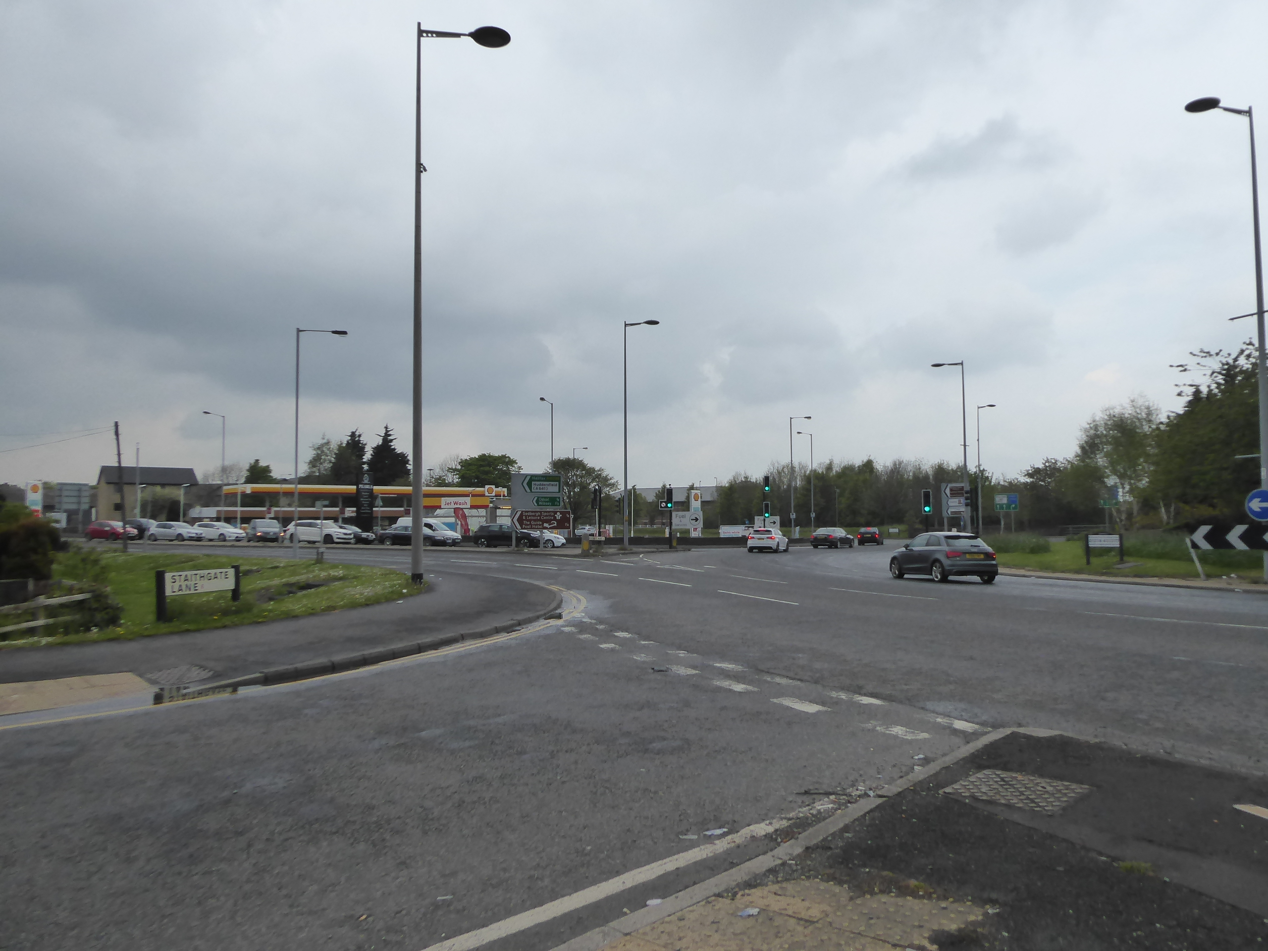
This rises us beyond the last stream of the Spen valley that we'll be seeing on this excursion, and I'll promise to never understate its extent in the landscape again, after all the ups and downs its put onto the day, and there's one more climb to come as we meet the industrial estate access road at Commondale Way, which offers us footway-less access up to the passage over Transperience Way, just west of junction 2 on the motorway, beyond which we rise with Staithgate Lane, tracking its way up Woodhouse Hill and keeping us away from the boy racers burning it up on the narrow grassy verge. You'd not know that this is an old lane, or at least the replacement of one, as it leads us up to the Astonish cleansing products factory, and the Expect Distribution depot, across from the vast M&S facility across the M606 which is the second most distinctive building on the ridge to the south of Bradford, the city that we'll finally start wandering into on pavements again as the Link 606 business park and the suburban edge of Odsal reach the roadside, ahead of us tracking over the A6036 Rooley Avenue and the A6177 Mayo Avenue ring road at the Staygate interchange. The view from the top of the motorway, across the city and into the Aire catchment offers little more than more damp haze, and thus we start down, by following the footway into the Hope Park industrial estate, where a path links Trevor Foster Way to the top of Birch Lane, where we meet the suburban extent of West Bowling, and we are tidily led down to Parkside Road, where we pass over the Bradford - Halifax line as it disappears into Bowling Tunnel through the catchment ridge, and we can look down to the site of Bowling junction station, in the deep cutting below. Progressing on, we take a turn into Springwood Avenue, where semis filled in the spaces clearly intended for terraces which were never built, which leads us down to the parade of almshouses on New Cross Street, where we switch back over the railway line, peering south to the tunnel portal but gettin no feeling at all for the presence of Bowling Junction itself, which split off northeast carrying the former line that avoided Bradford, ahead of slipping down another pathway, down the side of Bowling Primary School, to Upper Castle Street, as the air suddenly gets filled with the imminent risk of worsening weather.
 |
| Staithgate Lane ascends Woodhouse Hill to the watershed. |
 |
| Staygate Interchange at the ridge top. |
 |
| Bowling Junction station, from Parkside Road. |
 |
| Darkening Skies above Upper Castle Street. |
Dryness remains as we spy the City Hall tower beyond the terraced horizon, and take a turn into the suburban closes of Dalcross Grove, to pass over the railway again via the footbridge that led into the Bowling dye works site, but as we pass up the litter and sand strewn path beyond, partially courtesy of the stone yard nearby, the heavens open in the sort of rainfall that was not projected for today at all, and there's no option for shelter at all down here, as we pass below the site of Bowling Viaduct and along Ripley Road, getting soaked through despite the waterproofs still being donned. Pooling water, and cascading runoff down Ripley Street, from the now wholly industrial district of Ripleyville soon has the boots overwhelmed and as Bolling Road is joined passing over the railways former and current at St Dunstan's junction, and on past the Bronte Academy girls school, the decision is made to bale from the trail as the weather to come looks immediately no better than that which has just passed over, and traversing the surging cataract at Mill Lane seals that decision. So, along the odd stretch of dual carriageway that runs through Broomfields, where another industrial estate has replaced what was once a wholly terraced residential district, where only the presence of the former church and Sunday school on Edward Street give any suggestion of things being otherwise, as more puddles and pools are negotiated around as the downpour continues, all the way down to the edge of the city centre and the tangle of Wakefield Road, Croft Street and the Shipley Airedale Road, before striking down Bridge Street and into the complex at Bradford Interchange. We're done at the edge of 2.20pm, and can make a hurry to the bus station knowing that the departure of the #427 back to Morley is within easy reach, to soo ride home wondering if Spring 2021 is going to be a completely busted flush, and feeling that discretion really is the better part of valour after taking 30 minutes of a relentless dousing, while we're not feeling too disheartened as the four remaining miles of this day's plot, up to the Aire valley proper, will easily attach themselves to another urban route in the future, and as the rainfall continues un-abating for half of the 30 minute journey homeward.
 |
| Bowling Viaduct site, with downpour. |
 |
| Bolling Road beneath the deluge. |
 |
| Bradford Interchange station. |
5,000 Miles Cumulative Total: 4919.2 miles
2021 Total: 177.1 miles
Up Country Total: 4456.2 miles
Solo Total: 4587.6 miles
5,000 in my 40s Total: 3517 miles
Next Up: Spring Jollies at Home, and a Cross Country trip with Literary History!


No comments:
Post a Comment