15.6 miles, via Dark Lane, Foster Clough Delphs, Churn Milk Joan, Midgeley Moor,
Dimmin Dale, Back Clough, Low Brown Knoll. Catchwater Drain, Bare Clough, Parcel Beds,
Spa Clough, Warley Moor Reservoir, Nab Water, White Moor, Delf Hill, Sawood, Trough Lane,
Black Moor, Brow Moor, Hardgate, Barcroft, Lees Moor, Harden Moor, Deep Cliff Hole,
St Ives Estate (Heather Park, Peat Dykes, Coppice Pond, Home farm, St Ives House,
Cuckoo Nest Wood), Clay Gates, and Myrtle Park.
Only a few days into it and it already looks like the Autumn of 2021 is going to be throwing us weather that is just as inconsistent and unpredictable as the alleged Summer did, as gloom comes on when a white cloud day was projected for its first Saturday, much more mediocre than the forecast would suggest, which is a real shame as we need a few more good walking days before the inevitable fade of the season as we've three more trips over the Calderdale - Airedale moors to get in, and some residual warmth and no rain would be most welcome for them, thank you very much. The promise of the morning seen in Morley has already passed as we arrive in Calderdale, alighting the train at Mytholmroyd at 9.10am, as a wall of low white cloud is slowly drifting downstream from the west, looking to obscure everything from view as we aim a new trajectory out of the village, directly north, which means that early paces will match those taken before as New Road leads us beyond St Michael's church and over the Calder to Burnley Road, where the A646 is crossed ahead of us joining Midgley Road by the Russel Dean store. Uphill we immediately press over the Rochdale Canal, past the Clog Mill and the local school on its perch ahead of the lane starting to trace the descending wooded clough, finally getting off the road as we meet Dark Lane, which could be mistaken for a driveway to some high cottages before is starts its own snaking path uphill between high walls, giving us some elevation that ought to give us some grand views backwards, but the world seems to be ending to the west, as greyness bleaches out the horizon with the cloud hanging heavy at moorland altitude. A lightly teeming rain also falls, ensuring that the going underfoot is damp, saturating my trews in the long grass as we find our way onto the higher and rougher Stony Lane path, shadowing the fall of Foster Clough as we elevate ourselves above the valley, already wondering if it was wise to come out on a day like this, as we'll be at altitude for the full run to distant Airedale, as while Cragg Vale can be clearly defined on the horizon behind us, the moorland tops to both sides of it linger below a deepening pall of distinctly unfriendly cloud cover, below 400m, which gives me every reason to pause.
 |
| Mytholmroyd Clog Mill, Midgley Road. |
 |
| Dark Lane. |
 |
| Cragg Vale and Mytholmroyd, below the gathering haze. |
Land on Height Road, presenting our only available escape route before the moorland ascent, if we were going to take it, but we've had enough problems with trail quitting this year already, so we press on, joining the driveway up to High Rough farm before peeling off with track that leads up to the quarried remnants of Foster Clough Delphs, before soon being forced overland by the descending stream on a rough path over the moorland turf, guided by posts as the higher horizon arrives ahead of us, with the local Crow Hill elevating to the east of it. The cloud still slowly drifts in from the west, hiding the horizon as we press uphill, wondering why the weather to the east still appears welcoming, following the guide posts and the moorland wall as we are directed over the Calderdale Way route, amazingly the only previous time we've ventured up to this portion of the local moorland, as we rise to the ancient pillar on the high crest, Churn Milk Joan, beyond which the way across Midgley Moor lies, though immediately a break needs to be taken, to take stock as the low cloud drifts over. It turns out the lack of visiblity is not as bad as it could be, and we're encouraged to continue as a pair of dogwalkers are spied coming off the moor, and thus we resume north, eschewing the option of detouring to the Crow Hill top as it's not a moorland summit, and there'll barely be a view to be had once up there, and we find a clear and dry path to follow across the heather clad rise to the 400+m plateau, with the Calder Valley soon retreating behind us and the way ahead remaining clear, despite the lack of an obvious horizon ahead, with only Ovenden Moor and the eastern fringe of Luddenden Dean giving us any sense of a location. It looks like the moorland heather has been burned, as we come over its first crest, indicative of grouse shooting still going on up here, and it takes a while to get a scope of where we are on this moorland rib as Dimmin Dale forms the depression ahead of us, with the high top narrowing and soon revealing the view over Crimsworth Dean and the wooded branches of Hebden Water arriving to our west, putting the Old Town mill suspiciously close to us on the high apron of fields below, though all the Pennine watershed hills beyond are utterly obscured, to be taken in like a fond memory before we focus again on the way ahead.
 |
| Foster Clough Delphs. |
 |
| Churn Milk Joan and Crow Hill. |
 |
| Midgley Moor. |
 |
| High Brown Knoll and Low Brown Knoll from Dimmin Dale Edge. |
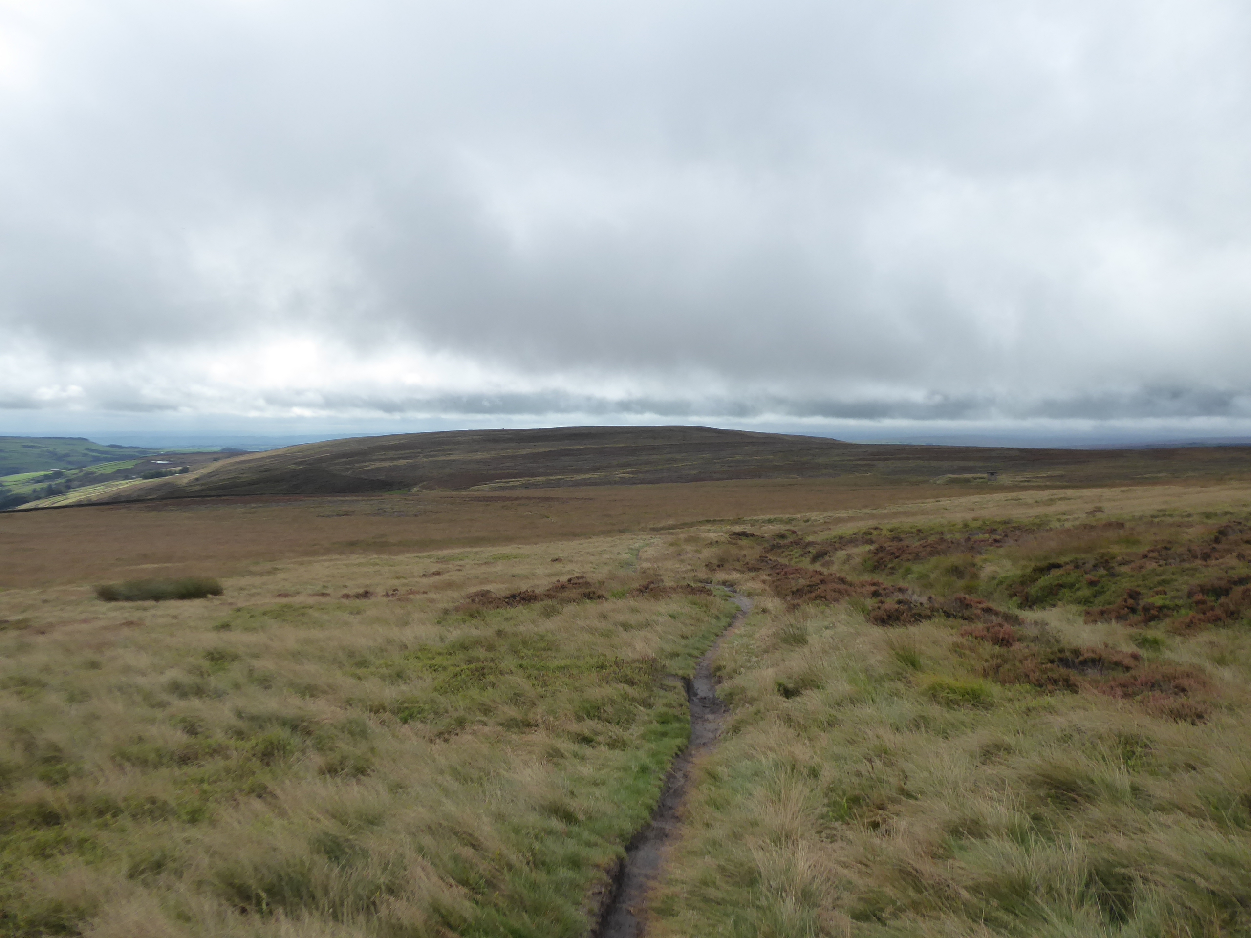
High Brown Knoll dominates the horizon ahead, beyond the narrowed portion of moor between the valleys to the west and east, and the path keeps us on a clear route ahead, taking us across a line of grouse butts and dropping gradually downhill, with the mysterious shafts and their spoil heaps sitting in the middle distance, with the lower of these being our next target, easily seen as the cloud has thankfully lifted, as we pass back onto the Luddenden Dean side of the moor, and suddenly find the going getting difficult and damp as we approach our target. This capped shaft is clearly a waterworks feature, as we correctly speculated, as the echoing cascade of the underground aqueduct feeding water to Halifax can be heard as we approach it, and its spoil heap can be doubly useful as we pause here for elevenses and also use it as a look out as we need to pick a route north to Low Brown Knoll, as the paths have become obscure and the turf waterlogged around the easterly flow of Back Clough, a terrain problem that I had not been anticipating while getting myself worried about low cloud and visibility issues. The route we choose seems obvious, but turns out to be a terrible choice on the ground as the red grass and marshiness combine to utterly overwhelm my boots, washing away whatever waterproofing they had and saturating my feet feet rapidly, and pressing on is the only choice once you've gotten tangled up with it, somehow finding a drier groove which leads up to the path that we traced before, and giving another indication of why open moorland walking shouldn't be my thing, trusting my regards of Google Maps and no the terrain, where finding a detour over the heather moor might have kept us drier. We're going to have to squelch our way through the remainder of today then, hitting Low Brown Knoll and getting the best break in the weather that we're going to get as we regard the triangle of high moorland that we've traversed today before we press north, not aiming to the High Brown Knoll upland this time, but aiming towards the catchwater drain that leads to the northeast, easily located and offering an occupation bridge for the moorland sheep as it southern end where we can stop to remove my boots and thoroughly wring out my socks, feeling grateful that it's not actually that cold today, despite the gloomy conditions.
 |
| Low Brown Knoll and the Aqueduct Shaft. |
 |
| Aqueduct shaft and spoil heap, Back Clough. |
 |
| Looking back from Low Brown Knoll. |
 |
| The Catchwater Drain. |
A permissive path will take us on our way, hanging at the 410m contour and not providing any challenges as we progress above the western edge of Luddenden Dean and below the rise of High Brown Knoll Flats, taking us above the Castle Cragg estate in the valley and directing us towards the Nab End of Ovenden Moor, while also providing plenty of plausible access point via bridges onto the moorland cap while also revealing open tubular metal shafts at regular intervals, clearly draining water into he reservoirs in the valley, and looking utterly terrifying in the process. Taking turns around the edge of the moorland, it also has to pass over the cloughs which drain into the dean below, and the passage around Bare Clough indicates what a substantial piece of engineering this is, passing over the stream on an embankment while also draining it into the channel which we are following, and we can look down to spy the Dean Head reservoirs before carrying on around the hillside, directing us toads the Ovenden Moor windfarm, which really is a bit of a sentinel and a constant companion when out on these uplands. Another corner means another clough, where a view back and ahead can give us a full scope over the High Brown Knoll Flats, back to its nab to the south and across to the outcrop of the Whinny Stones at its northern end, all to be taken in before we pass around Spa Clough on another embankment, this one with a substantial overflow built into it to allow run off into the valley, beyond which the moorland drain makes its decisive final turn towards its destination, Warley Moor reservoir, the narrow strip of which reveals itself beyond its long earthen dam at the valley head. A track does pass over its embankment, but the right of way situation isn't clear, with the permissive route directing us around its northern end, over some extremely soft and boggy ground which needs more duckboards than just those which feed into reservoir flowing down from the Calder - Aire watershed, that's literally just off to the left of us as it passes between Luddenden Dean and the Worth Valley, a sight we'll take in as we gain a hard track, which is welcome, that rises, rather unwelcomely, up to the Nab Water Lane in the shadow of Nab End, which marks the summit of this trip at 430m up.
 |
| Drain Shaft for the Castle Carr Reservoirs? |
 |
| Tracking the drain towards Ovenden Moor. |
 |
| Spa Clough Overflow. |
 |
| Warley Moor reservoir. |
A last look to Calderdale can be taken before we move on into Bradford district, getting a reveal to Boulsworth Hill over the nearby rise of Oxenhope Moor, probably making its last appearance during this years travels, before the unclassified road takes us sharply downhill, supposedly not open to through traffic, though plenty seems to be travelling in both directions, on a surface that seems utterly unsuited to modern usage, with a roughly laid tarmac surfaces falling into deep grooves on either side, which are better suited to being walked in, while being apt to damage any vehicle which might drive into them. There's also a lot of quarried stone protecting the verges from being parked on, and the challenging going eases one we've gotten off the steep descent, becoming a viable road once we land on the passage across another catchwater drain, which feeds Thornton Moor reservoir, and was encountered to the west of here on the Hebden Bridge Road, as we're drifting below the rise of the northern promontory of Nab End, and tracing Nab Water as it starts to dig its own cleft down ointo the Worth Valley, which apparently needs its own protective fence below where we split off. We join the route of the Aire - Calder Link, a path that links from Bingley to the Pennine Bridleway, as we stay high above the Worth Valley, tracking onto its eastern side as White Moor Lane cuts a rough and uneven route across White Moor, naturally, where all the sheep that we didn't see on Midgley Moor seem to be grazing and getting easily startled as we track easterly, below the rising ends of Ovenden and Thornton moors, and above the evolving view over the Worth Valley towards the high edges of Airedale, ahead of a track that become increasingly grassy. There's a substantial bridge built over the conduit that feeds into Harden Clough, ahead of the quartet of trees that indicate the location of the sole lost farm on this route, High Fold, beyond which Sawood Lane starts to drag us uphill again, on another stony and muddy surface which is also increasingly damp, which is especially testing now that all the moisture that had been in my boots has now migrated into my socks, coupled to the knowledge that if the path had been laid to follow the reservoir drain, all this hard going, down and up on a horrible track, could have been so easily avoided.
 |
| Rising to Cold Edge Road. |
 |
| Descending into the Worth Valley. |
 |
| Nab Water Lane and Clough. |
 |
| White Moor Lane and Nab End. |
 |
| Sawood Lane |
Meet the end of Hambleton Lane as it makes its own route over from the south, and come around the northern end of the Thornton Moor reservoir enclosure as our track again lands us on Delf Hill, high above Leeming Reservoir and Oxenhope, where the view is again appreciated as we stop for late lunch and another shot at getting my socks wrung and feet dried, before we move on, feeling like we're sufficiently steeled to get to the finish line, now seen beyond Sentry Hill, remaining on our high route but getting off the highest moors as the lane directs us down into the hamlet of Sawood. This farm cluster is the first habitation we've seen since our trip was barely 40 minutes old, way back on the edge of the Calder Valley, and well shed a big old chunk of altitude as we come down through it, getting back down to the 300m sort of level as we come across the B6141 Denholme Road by the Dog & Gun inn and its companion hotel, where a couple of outdoor drinkers take more than a friendly interest in my walking progress before we join Trough Lane, which conceals us below the rise of Whinny Hill and its farmstead. This is another small lane that sees more traffic than it seems to be due, as well as being particularly poplar with cyclists as it traces a path northeasterly, giving us another indication of where we're headed towards as it passes through the depression between two hills, while putting Black Moor on our immediate horizon, to be met beyond the road kinks at Trough Bottom farm, which thrusts us back into a landscape of heather growth and thankfully dry going, entering a moorland that seems vast and remote while not really being either of these. As the track rises, the landscape reveals the fall of the Harden Beck valley between Cullingworth and Wilsden, ahead of us cresting and heading back towards the Worth Valley side, revealing again the Lees Moor - Harden Moor ridge that we're still aiming at, as well as the Hallas Rough Park plots which the A629 Halifax Road traces the edge of, making it feel like its traversing a route as remote as Stainmoor, but its rather easy going in reality, with many clear and grassy tracks making themselves available, as we are drawn over to its northwestern corner, in the direction of the manicured fields of Cullingworth Moor.
 |
| Hambleton Lane and the way forwards. |
 |
| The Dog & Gun, Sawood. |
 |
| Trough Lane and Black Moor. |
 |
| Black Moor looking to Cullingworth Moor. |
The moorland seems to have escaped down the enclosed track that departs it, reaching down to Cuckoo's Nest farm, where a hard surface is gained as we pace onto its eponymous lane, leading us out to Black Moor Road by Mount Pleasant farm as it perches itself above the eastern edge of the Worth Valley, giving us another southern and western panorama to take in as we again avoid descending into it, walking the road north as we overlook Oxenhope and Haworth, and get in another perspective on Penistone Hill at the valley's heart. Take our path northeasterly again as we tangle with the Worth Way route, joining the rough track that traces the eastern boundary of Brow Moor, rising above the quarry where one machine drills away idly to itself, passing through the heather and long grass at barely the 300m contour as we take in what this landscape would have looked like if enclosure hadn't happened, followed by several centuries of agricultural husbandry to render it cultivatable, like all the plots on Cullingworth Moor to the east, directing us towards the last high rib of the day. It rises above the lower valley and Keighley ahead of us, but we'll have a descent to do before we get there, once past Stump Cross House and Brow Top Lane, joining the track of Hardgate Lane as it drops us downhill, through the escarpment that rises on the valley side and down a rough path among rock faces that have been quarrried in their not too distant past, meeting a short terrace below the crags and coming as close as we'll get to concluding the day in the Worth Valley as the tarmacked lane leads us out to the side of the A629 as the Halifax Road arrives from the southeast. Cross over and make our first real encounter with a settlement since we started out, joining the rising lane that leads us among the terraces of Barcroft, just to the east of Cross Roads with Lees, and only metres away from the route down the A6033, while not being immediately familiar despite having crossed over this way in 2013 while tracing Lees Moor tunnel and the remainder of the GNR line into the valley, a recalled sight only gained as we pass out of the village and look towards Oakworth on the far side of the valley.
 |
| Black Moor Road, and Penistone Hill. |
 |
| Brow Moor. |
 |
| Hardgate Lane. |
 |
| Barcroft Terrace, Barcroft. |
Having done the descent down to 100m below moorland altitude, it's immediately time to regain much of the lost height as Bingley Road starts off a long uphill drag to the northeast, leading us above and beyond the brow of the Worth Valley, elevating us among the fields and farmsteads of Lees Moor, and landing us above the ragged edge on its western face, taking us past the New Quarry House inn, splendid in its isolation and onto the high rib that gives us views east to the valley of Harden Beck and its many branches, placing Ovenden Moor and it windfarm back onto our reverse horizon. You can also spy the lack of extent that Black Moor really has from this angle too, while Cullingworth village makes a rare appearance in the landscape as we rise on up among the stone walls and regular plots of fields up to the hill crest, regarding the ominous clouds gathering on the Pennine ridge before we are forced into rather more mundane duties, of attempting to direct traffic among the high walls as the kinks of the lane obscure the sight lines for passing motorists who are not treating the twisty and narrow lane with the respect it deserves. Soon enough we arrive by the converging five, or six, lanes that meet by The Guide Inn which is having a bit of a refit on it corner by the Cullingworth - Keighley Road, where we cross over and maintaining our route towards Bingley by finally settling in above the Harden Beck valley, tracing the side of Rycroft Road as it meets the southern edge of Harden Moor, which is entered as a track is met by the remnants of Midgeham quarry, starting our route through the extensive complex of wild parklands that sit to the southwest of the town, where more people will be seen enjoying the great outdoors than on the wilder moors to the south. Break for a final round of watering and sock adjustment before we set off across Midgeham Flats, following the clear path through the extensive reach of the heather, beyond the quarried out southern edge and the landing strip that seems to be used by model aircraft enthusiasts, feeling that the dull weather and and late season conditions are not quite giving us the colour burst that this landscape could offer us, as the gentle rise over the level moorland finally gives us an horizon which places us in Airedale, sitting beyond the wooded elevation of the St Ives estate to the north.
 |
| The New Quarry House, Lees Moor. |
 |
| The view back to Black Moor and Ovenden Moor. |
 |
| The Guide Inn, Keighley Road. |
 |
| Midgeham Flats, Harden Moor. |
Our passage over Harden Moor reaches it summit as we meet the rocky outcrop of the Grinning Stone, before we pass over the pronounced edge of Spring Head height and start down through the sea of Bracken that extends below, with the rough and steep path leading us down to the bridleway as the western edge of the moors, taking us into a much more wooded landscape at the northern extent, which is suddenly bisected by the sharply defined cleft of Deep Cliff Hole, falling away towards Harden village and ahead of our push along the boundary path to the Keighley Road. There will be no matching of the horrible ascent we made this way in 2017, as our descent takes us onto a path into the St Ives estate, following the rough path that sits a a short remove from the road at the edge of Heather Park, so called for it increasingly dense arbor, finding ourselves back on the E288 OS map plate again for the first time in a while as we also mark the route of the Aire-Calder link again, having joined it again without noticing, and feeling that we really ought to be closer to the end of today's route than we are. Signage isn't great in this corner of Bingley's main leisure park, and thus guessing is used to get us onto the path that cuts away from the road, leading us eat though the reclaimed marshes of the Peat Dykes to meet the Coppice Pond, the woodland-bounded lake that is managed to attract birdlife and offers a perimeter path that is certainly popular with local perambulators and would be ideal for a circuit of our own if this day wasn't going on for quite so long, and thus we'll stick to is southern shore, pacing among the exposed tree route before we meet the main metalled road through the park. This leads us between high walls to meet the Home Farm complex, passing the Ivy Kitchen restaurant and the Stables block that doesn't seem to be in full use as an equestrian facility, and looks in need of a thorough re-purposing, before meeting the rugged block of tied cottages and the passage of the lane as it takes the turn around the lawn, grazed by multiple horses, in front of St Ives house, one of those large estate piles of distinctly uncertain vintage, probably not being as old as you'd imagine it to be.
 |
| Deep Cliff Hole. |
 |
| Heather Park, St Ives Estate. |
 |
| Coppice Pond, St Ives Estate. |
 |
| St Ives House. |
Our path out of the estate shadows the main driveway, taking us below the Golf Course and allotment gardens, and around the car park and adventure playground before taking a long wander down through Cuckoo Nest Wood, above the Low Park fields and keeping on an eastward trajectory until we meet the South Lodge house and the Blind Lane car park, where a path need to be sought through the woods above the Harden Road to cut off an awkward corner, a decision that is much more easily said than done in order to land us where we intend to be. Cross over the B6429, rather than retrace its pavements, and join the only vaguely advertised footpath that leads downhill through Clay Gates wood, taking us off the steel elevation above the River Aire, and down the stepped path that drops us onto the riverside meadow, ahead of a rare passage over the river itself via the 1951 Festival of Britain bridge, which leads us onto the north bank and into Myrtle Park, Bingley's main urban park, where our lack of local knowledge bring us into our most complicated stretch of route finding for the whole trip. What looks like it ought to be the main route out of the park, actually gets us tangled up in the park-keepers yard and the tennis courts, before taking us behind Myrtle House itself, the former estate house that now functions as Bingley Town Hall, before we are shuffled out via the tradesmen's entrance onto Myrtle Place, some way down from the formal gates, and thus our arrival in Bingley is a rather unceremonious one, rising to the Main Street past the swimming pool and the Lidl store. Cross over the B6265 at the bottom of the main shopping drag, and feel like stopping for dinner and a brew somewhere would be just as appealing as immediately snaring a ride home, as we're going to hit our latest finish of the year as we follow Chapel Lane and the passage down the steps to Wellington Street, landing at the railway station at 5.10pm, an hour over-schedule and just ahead of the S&C train again, and the still-damp socks will clinch the decision to ride away now, braving the Leeds-bound party express, which is crowded with would-be revellers with nary a facemask in sight.
 |
| South Lodge, Cuckoo Nest Wood, St Ives estate. |
 |
| The 1951 Festival of Britain Bridge, to Myrtle Park. |
 |
| Myrtle House. |
 |
| Main Street, Bingley. |
5,000 Miles Cumulative Total: 5197.2 miles
2021 Total: 455.1 miles
Up Country Total: 4734.2 miles
Solo Total: 4865.6 miles
5,000 in my 40s Total: 3795 miles
Next Up: The High Moors and the Big City in a single trip, weather permitting.


No comments:
Post a Comment