16.8 miles, via, Sowerby, Wood Bottom, Luddenden Foot, Luddenden, Oats Royds Mill, Booth,
Luddenden Dean, Dry Carr - Slack, Clough Hole, Garnett Edge, Midgeley Moor, Back Clough,
Low Brown Knoll, High Brown Knoll, Flaight Hill, Robin Delph Flat, Gib Slack, Crimsworth
Dean, Lumb Bridge, Shackleton Knoll, Rowshaw, Walshaw, Rowshaw Clough, Hebden Dale,
Gibson Mill, Gibson Wood, Knoll Top, Colden, Colden School, Blackshaw Head, Hippins
Clough, Great Rock, Great House Clough, Cross Stone, and Priestwell.
Having been NIW and Down Country for the week, travelling without walking plans and ending up doing a whole mess of not much as we endured a blast heatwave conditions, we return to the North Country feeling like we ought to get back on the trail as things cool down and gloom over again, as some more mileage needs to be put down among Calderdale's hills and valleys while it's not raining, not least because July needs to be redeemed after that damp spell got it going on completely the wrong foot, and having had too much enforced R'n'R. With a lot of miles planned, we travel early, to alight at Sowerby Bridge at 8.05am, under skies that look like they'll be keeping the sunshine at bay all day, as we start off with the morning chill still hanging heavy as we decline down Station Road, past the builders yard in the coal drops, and the old police station, down to the crossing of the mouth of the Ryburn as it flows under the railway to merge into the Calder, taking a left as we meet the A58 and crossing over West Street by the Sowerby Bridge flat iron to start the ascent to Sowerby village. We're coming this way as the options for low down and westbound routes up the Calder Valley are rather thin on the ground, and so we rise sharply with Quarry Hill, passing the Royal Oak inn and St George's church on the sharp rise up to Fore Lane, which skirts us around White Windows house, and St Peter's Avenue pushes us between the suburban and council estates on the hilltop, giving us a view over the lower Ryburn valley towards Norland Moor,for a change, before we pass the grounds of Ryburn Valley High School, with its old schoolhouse almost concealed in plain sight at the roadside. Arrive at the site of the Victorian village school, across the way from St Peter's church, which shares some of the neo-Classical vintage of its companion downhill, and pass through the old heart of Sowerby village by the shopping parade and the Old Hall, before the turn northwards and downhill comes by the Church Stile inn, taking us down Pinfold Lane as it clings on to the high edge of the Calder Valley, which opens out ahead of us, drawing our attention across the way towards Luddenden Dean, our first target for the day, as it merges in between the high hillsides, west of Halifax and below Midgeley Moor.
 |
| The Sowerby Bridge Flatiron. |
 |
| St Peter's Avenue, Sowerby. |
 |
| Pinfold Lane and the way to Luddenden Dean. |
Our route off the south side of the Calder valley starts as we meet the top of Styes Lane, which takes us down past its eponymous farm, on an unusually tightly constrained surface, passing the Finkle Street terrace, perched on the valley side above the reservoir above the site of Wood Bottom mills, which has since vanished from view along with it neighbouring gasworks, as we come down below the dam and run in parallel to the railway line, before Ellen Holme Lane takes us under it, and into the former landscape of riverside mills below Luddenden Foot. It seems caravan storage is a major theme along here, with tow separate yards dedicating themselves to it, while the Calder Valley Auctioneers proudly trumpet their appearance on the BBC's 'Flog It!' before we note the former Congregational church looming over the valley on the north side, and then rise to pass the Boy Mill terrace, and to take a look over the wall to see if the site of Luddenden Foot station can be spied below the Blackwood Hall Lane bridge, and to theorise if either of the old houses by the railside are of L&YR vintage. Boy Mill Lane also lands us at the riverside and we turn to cross over the Calder and the Rochdale canal with Station Road, taking the other pavement from last week as we rise up to the A646, crossing the Burnley Road by the 'That's A Mori' Italian cafe and the outspill of Luddenden Brook, joining the rise of Luddenden Lane by the derelict pub and starting the rise up into the valley, quickly finding ourselves elevated above the stream's wooded cleft and passing below the council estate that seems rather incongruously located this far west of greater Halifax, around the old Kershaw house. The ribbon of 20th century development stretches up the valley to the New Road corner, and we rise on the lane as it pushes above the old heart of Luddenden village at the valley floor, only to find that there's plenty of the 19th century's growth up here, with villas, lofty terraces and the old Methodist chapel all perching on the valley's western side, affording views across this valley's tight and dramatic landscape as we head up past the tops of High Street and the steeply cobbled Old Lane, to meet the terraces and close on the Pepper Mills site at the top of the village.
 |
| Finkle Street terrace. |
 |
| Calder Mills and the old Chapel, Luddendenfoot. |
 |
| Burnley Road, Luddendenfoot. |
 |
| New Road, Luddenden. |
The next rise of Railes Lane leads us up to the Oats Royd Mill complex, which is almost completely intact, with low and high rise ranges of buildings, along with mill house and associated auxiliary structures, having endured in use for manufacture of woollen goods from the 1840s to 1980s, and now a residential complex which looms large in the landscape, which we wander further into, admiring the steepness of the eastern banks of the valley as we press on upstream towards Dean House farm and the grounds of Broadroyd House, complete with the valley's cricket field. There's a hamlet to meet at the junction of the valley, named Booth and seemingly amounting to little more than a pair of terraces flanking the road, with barely space for parking and traffic between them, beyond which the roads divide and either dive down to the valley bottom to the Goit Side terrace and the old chapel, or rise on the southwestern side of the valley as it branches to the northwest, and we'll join Jerusalem Lane as it heads this way, through and above the woodlands that fill this arm of the valley, passing Jerusalem farm and its campsite and rising on with the lane that the Calderdale Way descends. Rise past Hawkclough house and meet Bob's Tearooms and Gardens on the Dry Carr Road corner, where we hit the switchback that propels us across and above our prior route up Luddenden Dean, elevating us up to the steep driveway that leads across the rough ground of Dry Carr - Slack, and projecting us onto Slack Lane, the high track at the edge of the moorlands above, passing the quarry remnants and the cottage at Clough Hole, which is well located for the view across to Warley Moor and Cold Edge, which is looking much more suited to its name than it did a week ago. Follow the sunken stretch of Clough Lane, between stone walls and long grass, as is gently rises up to the moorland edge, passing Hollin Top farm and peering down the valley to pick out last season's downstream path, and looking up to the valley head, towards the concealed estate of Castle Carr house, and looking over the hills in the hope that the low cloud isn't going to interfere with our moorland passage as it comes on, as all the horizons look pretty crisp now, as we linger around the 300m mark, but as there's another 125m of uphill to come, we can only hope that the weather will remain kind.
 |
| Oats Royd Mills. |
 |
| Booth Hamlet, and the Luddenden Dean corner. |
 |
| Ascending Jerusalem Lane. |
 |
| Ascending Clough Lane. |
 |
| On the high lane, above the Upper Dean. |
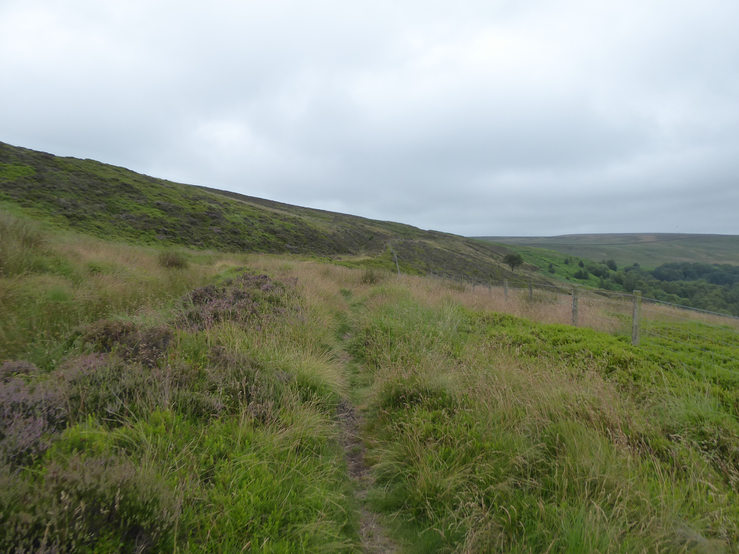
The hard track ends at Ferney Lee cottage and the moorland path commences beyond, tracing a stone wall and wire fence as our northwesterly route continues, sitting on the eastern edge of Midgeley Moor as it traces its way on among some moorland grooves and horribly damp patches in a landscape of long grass and heather as we pass above the habitable head of Luddenden Dean, spying the Castle Carr house remnants and reservoirs down in the valley and spotting the Ovenden Moor wind farm getting grazed by cloud on the hillside above, at 450m up, just low enough to make me feel anxious. Meeting the path rising up from the valley head, and getting a clear sight line onto the moortop which we are aiming for, we meet a string of other folk joining the moorland route as it heads up to the passage over the feed into Black Clough and it's good to have some bodies to follow, albeit fast moving ones, as we track the way to Low Brown Knoll, though attention drifts westwards as the rise starts, towards the air shafts and spoil heaps that sit above a tunnel passing under the hillside, the purpose of which is vague but probably water supply related, as we lack railways under these hills. Ascending further to the wide moorland level beyond the notional top of LBK, we again find ourselves following moorland grooves, with the path notably keeping out of their dampness as we wind a way northwesterly, passing the end of the drain channel that runs down to Warley Moor reservoir, and getting a scope to the rising lumps of the moor above the Calder valley, Crow Hill and Sheep Stones Edge, standing tall above Mytholmroyd and Hebden Bridge behind us, as we climb on beyond the limits of the heather growth and on through the grass to the top plateau. It's barely a hard push to get there, arriving by a tall standing stone the Wadsworth Lowe, that acts as a boundary marker and guide post, and the local summit at High Brown Knoll sits only a few minutes walk over the level top ahead, with a trig point at 443m at the southern end of the plateau that reaches all the way up to the A6033 summit at Cock Hill, from where we can get a 270 degree aspect around the southern horizon, inviting the views around before we carry on, up the bridleway to the exposed outcrops of gritstone.
 |
| Garnett Edge, Midgeley Moor. |
 |
| Above Black Clough, Midgeley Moor. |
 |
| Mysterious Air Shafts, Midgeley Moor. |
 |
| Low Brown Knoll to High Brown Knoll. |
 |
| The High Brown Knoll Trig Pillar, with Ovenden Moor. |
It's clear we're not having this moorland walk to ourselves as a steady stream of folk, frequently travelling at speed, overtake me as we progress on, away from the Luddenden Dean and Ovenden Moor horizon to the east, and on to Crimsworth Dean and Wadsworth Moor ahead, looking like they're all on some sort of challenge trek as they burn me off over the edge at Flaight Hill on the Limers Gate path, and attention wanders to the grey horizon to the southwest, where our path is ultimately leading today, and hopefully for the remainder of the high season. Those many rises and elevations are for the future though, as we have a valley traversal to come, beyond the crest that reveals the Boulsworth Hill upland and the Gorple and Widdop reservoirs concealed in the western horizon, with our way down appearing rather suddenly as have 80m to shed on the way down to Robin Delph Flat, pausing to use the only bench on the moor to take elevenses and let more energetic travellers rip me off before we drop out onto the A6033, just downwind from the bus turning circle and up from an impromptu feeding station. It seems that the endurance athletes are going the same way as we are, downhill into the dean via the bridleway path through the long grass on Gib Slack to meet the sunken and walled-in path down to Old Lane, where we land by Gib farm, briefly touching capitation before we turn with the lane upstream for a short stretch and meet the descending path of Lumb Lane, where the other walkers and runners are allowed to overtake me before we start down on the steep and cobbled track, not too friendly a one either one as blind steps are taken beneath the frustrating amount of over growth. It does allow views up and downstream in the wooded valley floor, which we land among with my right knee shrieking in discomfort, having tweaked a tendon among my many baby steps down, and thus speed for the remainder of the day might be in short supply as we complete this descent down into the wooded glade that surround the ancient Lumb Bridge, passing over the streams that feed Lumb Hole Falls, one of the better known secret waterfalls of West Yorkshire, where the relative tranquility brought by the cascades under the tree canopy can be absorbed before we hit the immediate rise to come.
 |
| The Limer's Gate path, to Flaight Hill. |
 |
| The descent to Robin Delph Flat. |
 |
| The path over Gib Slack. |
 |
| The descent of Lumb Lane. |
 |
| Lumb Bridge and Lumb Hole Falls. |
So straight uphill on the western side of the valley is the order of the day, a tough spot with a sore knee to be sure, emerging from the tree cover and aiming directly up what calls itself Sunny Bank Lane, which leads us up to its eponymous ruined farmstead, and then directly up through the moorland turf to Baby House Hill Lane and the pervasive smell of sheep poo around the ruin of Nook Farm, and thence uphill further on Coppy Lane, where the high farmstead is also abandoned, as if no one wants to reside on this side of the valley, unlike the habitable ribbon that drifts up the eastern flank. Land on the high bridleway, which drifts around the southern end of Shackleton Knoll, the southernmost knob of the entirely trackless bulk of Wadsworth Moor to the north, and we'll track over the watershed out of Crimsworth Dean, above the rough pastures on the hillside above Hebden Bridge, while the last group of people on the organised run-trek overtake me and leaving me to solitude again as we crest into the Hebden Dale valley, flowing down from the Lancashire border watershed and illustrating a lot of moorland and fields above the valley cloven below. The hard bridleway track moves into a field walk as we come around the open sheep pastures of Rowshaw, tracing the moorland wall as it marks our northernmost apex on our trip westwards above Calderdale, and gradually redirecting us southwards as we briefly feel rather far from anywhere, with only the Horodiddle and New Cote farmsteads providing us with any feeling of proximity to civilization, despite there being a town only an hour's walk to the south of us, with the woodlands choking Hebden Dale soon becoming the landscape feature of note as we head down. Pass over Rowshaw Beck and rise with the renewed track as it angles us over towards the Walshaw farm hamlet, where five routes above the converge, offering us a plethora of route choices, two of which were traced in 2013, and it's got to be either directly south or west from here on our southwesterly trajectory, and we'll take the former as it leads us among the farms, and the impressively scaled Walshaw Lodge, the former shooting lodge that dominates the horizon above the wooded valley, which we'll approach on the steeply descending path through the fields below it, quitting the moorland landscape as we go.
 |
| The ascent to Nook farm. |
 |
| The path around Shackleton Knoll. |
 |
| Crossing Rowshaw's pastures, above Hebden Dale. |
 |
| Walshaw Lodge. |
Out of the fields we head and into the forest of tall conifers which clad the steep and high banks of Hebden Dale, carefully stepping our way down the built-up but lightly used path that winds its way downhill above the western side of Rowshaw Clough, listening to the stream cascade over well concealed waterfalls beyond the ferns and foliage and taking great care not get too ambitious in my attempt to get a close view as we head down just that bit too close to the edge to be comfortable before we meet the access lane that reaches west up the dale, beneath the tree cover. Pass over the footbridge at the beck's outspill and join the low riverside path that traces Hebden Water as it flows south below the confluence, a path that we traced with my local friends long before my walking career started, met as we cross to the west bank via the footbridge above on of the many weirs on the river, with the path south hanging close to the bank on dirt paths and duckboards as we shift among the steeply rising banks, in close proximity to Hardcastle Crags, which sit somewhere above hidden by the tree cover, and swapping banks via footbridges when the water gets too close to the rock faces. It's certainly not the easiest of riverside walks, as the going is rarely even underfoot, but it's certainly a popular one, with many rocks and fallen trees for the adventurous to scramble upon, and it's definitely a place to consider being in when the foliage is lighter and the watercourse busier, though the stream in spate would probably render the path inaccessible in place, certainly plausible in the stretches above the millpond, where streamlets run across the path and signage from the National Trust estate illustrate the risks. The pond provides a quieter spot, with the still water advertising the proximity of Gibson Mill at the heart of Hebden Dale, where a source of free energy from the river brought cotton production way upstream from the nearest accessible point at Hebden Bridge, now forming the commercial focus of anyone travelling up the valley and its estate, where benches are provided and we'll break for lunch to re-energize before we press on, along the rising track that enters Gibson or Greenwood Lee Wood, away from the daytrippers and back into our regular solitude.
 |
| Descending by Rowshaw Clough. |
 |
| Hebden Water, Hebden Dale. |
 |
| Hebden Water, again. |
 |
| Gibson Mill Upper Pond |
 |
| Gibson Mill, Hebden Dale. |
It's a steady climb to a point midway up the valley side, offering us impressive views across the wooded valley to the eastern bank that show up well its depth when the tree cover breaks, until we meet our footpath out, which is steeply stepped up through the fern and long grass, the only part of the route which feels like its more challenging that it ought to be, making us wonder why we didn't approach the moorland option to the west, but once we emerge onto he uphill field trek beyond, the views make this route choice rather worthwhile as we glance back to Walshaw Lodge and the rising moors to the north. We focus to get back onto a southwesterly route as we meet Widdop Road, the trans-Pennine route that still awaits a passage, with our route taking us up past the next ribbon of farmsteads and up Acre Lane and through the garden of its cottage to rise on the walled track beyond to the crest at Knoll Top, the easternmost point on Heptonstall Moor, landing us above its village, itself above the merging Hebden Water and River Calder valleys, from where we can regard the route travelled in the north and east before we look forwards, gaining Stoodley Pike on our horizon. Finally exiting the catchment of the combined valleys of Hebden Dale, we move over into that of Colden Clough, landing on Slack Bottom by the high terraces of Colden hamlet, perched on the declining side of the road, with informal gardens and summerhouses created on the rising side, all with views down to the wooded clough as it reaches down to the east, ahead of us following the declining Smithy Lane, on an actual pavement down to our passage over the Pennine Way route, rising by that still odd cluster of council houses, and elevating up onto the Hot Stones hill. The wide reach of the clough's headwaters spreads beyond, not short of path but lacking obvious routes that directly lead over to the south side, and thus we sit with the lane, passing outside our experience field again as the footway leads us down to the signs greeting us as we meet Colden School, with its establishment surely being one of the remotest in the county, perched on the hillside ahead of the descent down to the stream crossing, at Jack Bridge, next to the site of its former mill and ahead of the New Delight inn, and its campsite, which are doing brisk business today.
 |
| The ascent through Gibson Wood. |
 |
| The field walk up towards Knoll Top. |
 |
| Hepton Stall from Knoll Top. |
 |
| Edgehey Green terrace, Colden. |
 |
| Colden School, or Jackson Bridge. |
Briefly, it looks like the sun might break through as we fall and rise here, but that turns out to be a brief illusion as we carry on uphill, and glumness resumes as we briefly peel off the road, to follow Old Shaw Lane as it avoids the long hairpin of New Shaw Lane, rising past Low Murgatshaw farm and up the overgrown path beyond to resume the road walk as we crest out of another of the Calder's seriously graded side valleys, and making the mistake of thinking that we've just made the last valley traversal of the day as we rise on towards Blackshaw Head. It's really the only settlement of not to be found on this northwestern high-land of Calderdale, with the Wesleyan Chapel on the corner and its pair of foremr pubs on the eastern end of The Long Causeway, and also a bus terminus, while being large enoiugh to attract some new housing growth amongst its cottages and farmsteads, though why anyone would fancy commuting from here is anyone's guess as its a long way down in all directions, and it soon passes into our wake as our route drops us down Davey Lane, away from the hamlet on its bluff hillside. The spread of Hippins Clough opens out to the southwest, with the rise of Staups Moor and its summit at Chiserley Stones elevated beyond, giving us an unexpected late burst of landscape dynamism as we drop down with the sunken lane to cross the clough via the same bridge that we crossed when the Calderdale Way brought us this way on 2012's infamous 9 mile/6 hour debacle, drawing us back inside our experience bubble as we rise above the clough's flow down towards the Calder and giving us a prime view of the Alpaca trekking going on around the grounds of Apple Tree farm. Staups Lane drifts us around the third finger of protruding moorland on this edge of Calderdale, as if we'd planned it deliberately to avoid the elevations to the west, which isn't the case as we pass around the Staups farms, one with the whitewashed Staircase cottage next to it, while the other has its own reservoir, contained by a high dam, and its own local produce farm shop collective, with both sat on the edge above the cleft of Jumble Hole Clough, offering views downstream towards Hebden Bridge, still close in the landscape despite all the miles we've travelled.
 |
| Old Shaw Lane. |
 |
| Blackshaw Head. |
 |
| Downstream Hippins Clough. |
 |
| Staircase Cottage, Staups farm. |
With Stoodley Pike rising on the immediate horizon to the south, it must mean that we are finally drifting back into Calderdale proper, and our road drifts around the corner to reveal Great Rock sitting above the Eastwood Road corner, the easternmost of the gritstone outcrops that rise along this northern side of the uppermost valley, where the tenacity of those who've carved their graffiti into it demands admiration, though it will be the only formation that we'll be seeing up close as plans to carry on to Bridestones Moor are junked as there's no need to add another hour to this trip. It's been too long a day despite our early start, and the route down can be found as we drop down with Crossley New Road, taking us downhill, inside the Calderdale Way bubble and past the high farmsteads as the wind farms on the Rossendale horizon rise directly ahead of us, eventually coming down to a stretch on lane that's again really too narrow to accommodate cars and walkers, taking us down above Great House farm, home to possibly the first dairy herd that we've seen all year, before we combine up with 2015's Irish Sea Trek route. I'd forgotten that we'd travelled this far up the valley side all those years back, and so we're tracing a supposedly familiar route as we come down to cross over Great House Clough, the absolutely last of the Calder's side valleys that we'll be seeing today, and following Cross Stone Road onward as it rolls past the multitude of farmsteads on this mezzanine level of elevated fields above the valley, while we still look across the valley to see Harvelin Park and Mankinholes passing behind us as we come up to the outermost corner of Todmorden, at Cross Stones. We'll not be passing the high church and cemetery again though, as Slant Lane offers us a steep and uneven footpath route down into the valley below, taking us from Scar Top cottage to the Carr House Fold terrace and the Carr House farmstead, perched above the eastern reach of the town below, across the way from Lumbutts Clough and Old Royd, with their driveway dragging us down further to sharply drop down to meet Cross Stone Road again at the edge of town proper at Priestwell, and it does feel odd to suddenly be back in suburbia again after so many miles over the moor and fields.
 |
| Great Rock. |
 |
| Crossley New Road above Great House. |
 |
| Rodwell Hall, Cross Stone Road. |
 |
| Carr House Fold. |
There's one last drop to make before we hit the valley floor, taking us over Millwood tunnel where we can miss the passing of the Drax-bound binliner train by mere seconds again, also passing the old Priestwell school, now a funeral parlour, before we finally bottom out, landing on the side of the A646 Halifax Road, and making our way down to the Stansfield Bridge to seek the riverside walk, which turns out to be not accessible behind the council flat blocks of Hallroyd Crescent, and we're forced through the small estate to meet the path by the Calder. It's certainly an easier passage to make along the north bank compared to the one we tried on the south side among the Industrial Street terraces, and it's well used, taking us past a bunch of lock-up garages, a playground and a pleasant little green space tucked between the town and the looming railway embankment, which we depart as we pass over the bridge above the meeting of the uppermost Calder with Walsden Water, passing the market hall and below the massive bulk of Todmorden viaduct as it passes overhead. The shortest route to the railway station still seems to be along the side of the A646 Burnley Road, and behind the curved end of the Town Hall, before rising up the path and steps that cuts off the corner of Ridge Road, noting that the three pubs that we pass, the Polished Knob, the White Hart and the Queen's Hotel all seem to be crammed with folk now that all social Covid restrictions have been lifted, and despite the desire for a brew, I'll hit the station instead, to finish lunch after my 3.45pm conclusion, sat on the platform and wondering if that apparent sinkage in the fabric of the viaduct is new or a reason to be worried. ~~~ In spite of my attempt to not drag the journey out unnecessarily, it turns out that the 16.08 train has been cancelled, due to a crew shortage caused by the number of staff being forced into self-isolation after having made contacts with Covid positive patients over the preceding week, and thus we are placed on the horns of a dilemma, wait for the next one or start busing home immediately, and choosing the latter does feel like the practical option, even if riding the three services back to Morley, via Halifax and Bradford, results in a journey that's over three hours long.
 |
| Priestwell School, Todmorden. |
 |
| The Calder at Todmorden. |
 |
| The Market Hall and Place, Todmorden. |
5,000 Miles Cumulative Total: 5078.1 miles
2021 Total: 336 miles
Up Country Total: 4615.1 miles
Solo Total: 4746.5 miles
5,000 in my 40s Total: 3675.9 miles
Next Up: Hitting the High Road to Lancashire.


No comments:
Post a Comment