15 miles, via Lands Head, Upper Shibden Dale, Shibden Head, Ambler Thorn, Raggalds,
Soil Hill, Ogden, Ogden Reservoir, Ovenden Moor, Cold Edge, Withins Head, Hunter Hill,
Wainstalls, Reap Hirst, Peel House, Luddenden, Roebuck Wood, Luddenden Foot,
Calder Valley Greenway, and Brearley.
After two consecutive weekends of garbage weather, shedding my walking plans on principle, coupled to the intent to travel away Down Country, seems like a rather foolish course of action once a veritable heatwave washes across the country, offering the hours of sunshine that we'd desired for a scenic walk, albeit attached to a temperature spike that you could probably do without, meaning that the trail is rejoined with hope that the month of July might be redeemed, while dressed in my light summer gear that hasn't been out in three years and loaded with liquids for what could be a very testing day indeed. This time busing out to Northowram goes without a hitch and it's already hot as our feet touch the ground opposite the surgery and across from the end of Hall Lane at 9.35am, so we already know that it's not going to be a rapid sort of day, which means a slightly more leisurely pace will allow a chance to properly see the landscape that we hurried through two weeks ago, seeing how suburbia has butted up to and penetrated the grounds of Northowram Hall, which still hides in there behind the wall and the trees, and how much of the associated estate has endured outside the boundary. Further on, we enter the landscape of fields and farmsteads scattered on the high land that Shibden Dale digs into, with Marsh Hall being by far the most impressive, with its apparent 17th century stylings and vintage, while Land Head almost form the heart of a rural mini-hamlet among the undulations and hillocks that rise around the concealed valley which remains our point of focal interest, to be found down Cave Hill where the view from the Brow Lane corner is as marked a contrast as you could want as the sunshine blazes down. Our traversal is thus resumed, as Blake Hill End Road traces the eastern branch of the valley, past Bleak Hill End farm, before turning back along the valley side with Paddock Road, past its eponymous farm and the only suburban house with an aspirant view in the area, before we join the track of Addersgate Lane, wending its way down the hillside past the farmsteads perched on the dale's brow, passing by Plough Royds, Woodcock and Adders Gate and getting quite the most superlative views of downstream Shibden Dale, as we go.
 |
| Northowram Green. |
 |
| Lane Head farm - hamlet. |
 |
| Downstream Shibden Dale, from Addersgate Lane. |
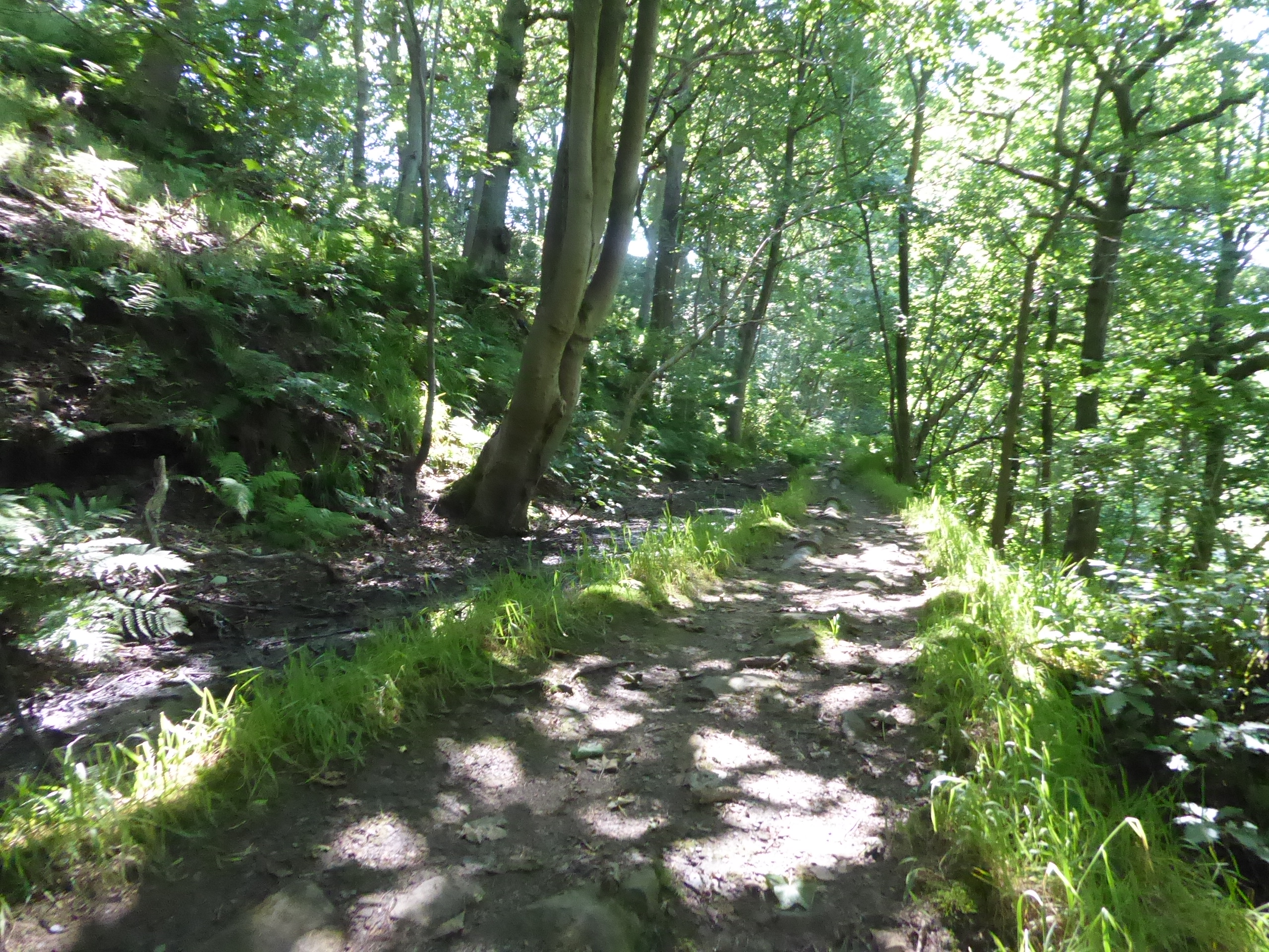
Once back on the northern trajectory, we join the track of Fall Lane, which isn't much more than a footpath these days, which offers a view across the way to Scout Hall, the Restoration-era Calendar house that we failed to get a good look at the the Calderdale Way first introduced us to the joy of Shibden Dale, a track we slip off as we make our way upstream, passing the top of the last lane in the valley, rising up to the Lime House farms, and carrying on beneath the shade on Bare Head Lane, wondering where all the noise of machinery might be coming from as the landscape becomes wholly arboreal. We're not tracing the upper reaches of the valley for as far as possible, and instead break off onto a descending track, which is super-soft underfoot, taking us down under the high canopy of trees to the shaded passage of Shibden Brook, a fine secluded spot that few seem to visit, where a footbridge crosses the stream and our track winds its way up the far side, into Bradford district and testing the limbs and lungs as the first proper exertions of this hot day get going, mostly going directly uphill on rough tracks up to the former access lane to Hanging Royd farm and the Queensbury sewage works. The lane traces the edge of the northernmost of the branches of Shibden Dale as we rise up to the site of the Shibden Head brewery, now a suburban enclave at the outermost edge of greater Queensbury, which we'll be avoiding most of as Shibden Head Lane angles us among the older houses and the later arrivals, offering us a view across to the town's high points, Holy Trinity church and Black Dyke mills, across the open fields before we are propelled out onto the A647 Halifax Road, the main road from the southwest that still hasn't fallen on my walking radar, after nearly 10 years. We cross over to meet Roper Lane, taking us through the southernmost corner of Queensbury at Ambler Thorn, where the village's extent sits above moorland altitude and a strip of suburban houses have been developed on the lower side of the road to guarantee the superlative views down the Holmfield valley, which we can only get once we are above Queensbury Tunnel, which Highways England is trying their damnedest to ruin beyond repair and redemption, while also noting the apparent South African theme on the old terraces above, named Ladysmith Road and Cape of Good Hope, respectively.
 |
| Scout Hall from Fall Lane. |
 |
| Descent to the passage over upper Shibden Brook. |
 |
| Ascending out of Shibden Dale. |
 |
| The Brewery site, Shibden Head |
 |
| Roper Lane, Ambler Thorn. |
The evolving view over greater Halifax will keep us company for a while, as we skirt around the edge of Queesbury's suburban growth across its hilltop (around about were some university friends of ours moved some two decades ago, to barely be heard from again), while the view ahead will tease the interest as the high points of the day are revealed, with Soil Hill, the Ogden reservoir plantation and the transit up to Withins Head all appearing on our horizon past the Warmleigh Caravan park and Roper farm, with the picturesque ribbon of Bradshaw village stretched up the valley below. The spread of the town below, shows up multiple paths we've traversed, but the way up to this ridge, with its quarry delves and microwave masts, is one that I've yet to trace, and we skirt high above the uppermost reach of Strines Beck as it cuts deep into the watershed ridge, the steepness becoming pronounced as we wander past the Shugden farms and roll with the lane towards the Queen's Head inn and the hamlet of Raggalds on the A644, landing mere metres away from our previous track up here, before we split off with Pereverance Road. This is possibly the narrowest point on the entirety of the Calder - Aire watershed, as a single field's width between the roads contains crest, beyond which the northern horizon peeks, ahead of us meeting the most northeasterly terrace in Calderdale district, back over the border as we rise up to Soil Hill, with the road angling us some fine views down the ridge, with Bradford and Leeds showing up on one side and Halifax and the Calderdale - Kirklees horizon rising on the other, as wells as getting the North York Moors and Yorkshire Wolds in the far distance to the east. There's farmstead up here too, with Sun farm and Cloth Row not feeling at all blasted at almost 400m up, and we'll divert here onto the farm tracks and among the wind turbines to find the 399m trig pillar on the way to the northern side of the hill, where the Yorkshire Dales horizon is as crisp and cloudless in the northwest as I've ever seen it, regarded while we trace what feels like an ancient rampart ditch on the perimeter before we join a quarry access track, that isn't the right of way, and doesn't take us over the actual top of the hill as we return to the south side.
 |
| Roper Lane. |
 |
| Soil Hill and company |
 |
| Raggalds hamlet. |
 |
| Ascending Perseverance Road. |
 |
| Queensbury from Soil Hill. |
 |
| The 399m trig pillar, and the Dales Horizon, Soil Hill |
Having avoided a transit of the Holmfield valley by passing all the way around the top of it, there's no avoiding a passage across the Hebble valley as it arrives ahead of us and the return to the road has us heading downhill sharply, with the twists and turns of Ned Hill Lane shifting us down around the plots of Stony Hall and Soil Hill End farms, dropping us down to Syke Lane and a single stray parade of suburban houses as we are drawn over to the A629 Keighley Road, where we cross by the Causeway Foot inn at the outer edge of Ogden hamlet. We pass along Ogden Lane with great care, as the way among the cottages is also the way down to the Ogden Water Country Park, the major sociably interesting point on the hills above Halifax, and the traffic and amblers are to be avoided as we descend through the trees to meet Ogden Reservoir, to pass over the dam via the Promenade path and to admire the tree fringed surface of the water, reflecting bright blue beneath the cloudless sky, with the turbines of the Ovenden moor wind farm turning above it, with the shade of the south bank offering a lunch break spot. A circuit of the perimeter path feels essential, as it would have to have been omitted if we'd traced this route as originally planned, and it's fine level and accessible path to take, staying close to the shoreline without some of the alarming undulations that other circumference paths have shown, as I think they've been allocated to the off road path concealed a short way into the woods, with bridges crossing the extremities at Skirden and Ogden cloughs, and various rest stops to be found along the way, where a good cross section of the local population have come out to enjoy the first decent weather we've had this season. The refreshment that comes with the shade needs to be enjoyed, as once we've returned to the promenade over the dam, there's not going to be much to see for the next couple of hours, as Withens New Road has to be joined to rise us up to the day's crest at Cold Edge, and the unyielding climb starts as we pass around the southern edge of the reservoir plantation, revealing a new aspect of Halifax by looking down the Hebble valley over Mixenden, and looking like an old moorland track with a rough and ancient surface, despite not actually showing up as a road on the old OS map of only a century's vintage.
 |
| Ogden Plantation and company. |
 |
| Ogden hamlet, and the Causeway Foot. |
 |
| Ogden Reservoir dam. |
 |
| Ogden Reservoir from the South Shore. |
 |
| Ogden Reservoir from the North Shore. |
 |
| Withens New Road. |
Theoretically we're on the inbound leg now, having visited to the two main highlight locations, but we are still progressing east and uphill to the day's actual summit as a straightforwards route to Luddenden Dean isn't forthcoming, as the depression of Mixenden Ings theoretically has footpaths running across it, but this wide clough is home to Halifax Golf Club, and there's no way to trace the RoWs as they track across the course, making it feel safer to stay on the lane in spite of all the ascent you're have to make over nearly 100m of moorland altitude. Having eventually risen far enough, the reward granted to the traveller is the view beyond the elevation of Round Hill to place the Ovenden Moor wind farm directly ahead of you, and having draw so close to them, it's astonishing to see how small they appear up close, as if they do a better job of looming in the landscape when viewed from further away, and they're still turning merrily, despite the relative lightness of breeze, as their hilltop maintains its reputation as being consistently windy, at well over 400m up. Hitting the easing climb at the top, we cab finally approach the buildings and masts that we've been heading up towards since starting the climb, both located on Cold Edge, by the side of the old road from Halifax over to the Worth Valley, where the Withens Inn must have been on of the pubs at altitude for the ages, but now merely stands with its companion, Withens Gap across the way as one of the most elevated houses in the county, at the head of it company on the upper branch of Luddenden Dean, below Warley Moor, where our descent to the finish line can finally start. Of course, the horizon to the east of us still has Queensbury upon it, but the rise ahead to the south gives us the development of the mid-Calderdale hills and valleys, making it feeli like we're close to home despite the fact that Withens Road has a long way to go down amongst its high fields, while not really passing by very much, so interest is directed into the valley to the Cold Edge Dams, where someone can be observed jet-skiing up a storm on Haigh Cote dam.
 |
| Mixenden Ings, and Halifax Golf Club. |
 |
| Ovenden Moor wind farm. |
 |
| The Withens Inn, Cold Edge. |
 |
| The Cold Edge Dams. |
It's hard to tell where we are relative to the foot of our descent from the high moorland level, at least until we've come down upon Hunter Hill where the Calderdale Way brought us on one of the very long days of 2012, and so interest turns back up hill to confirm that wind farm does look larger from further away, and that there is more habitation in this valley than you'd find by only looking at the roadside, ahead of the road finally starting to drop, and revealing our distant finish line at Cragg Vale, as well as the main branch of Luddenden Dean. Wainstalls soon announces itself into the landscape, mostly due to the fact that it has a factory and a business park complex attached to this remotest of hamlets, not that we'll be getting to close to it as we come down past the return of habitation at the roadside, with the Cold Edge Bottom and New Holme farms flanking the industrial sites, ahead of us coming down below the lump of Hambleton Hill to meet the old New Delight inn and the old Methodist chapel, missing much of the village-let on the rising Wainstalls Road, and carry on down Mount Tabor Road to the Crossroads inn. This was once the limit of the Halifax tram network, apparently, and we'll rise towards the town as we settle onto the eastern side of Luddenden Dean, until we get to the Sandy Ford houses and drop down on the driveway-bridlepath that drops below the footways already traced, taking us past the Reap Hirst farms and giving us a panoramic view of the valley, up towards the estate of Castle Carr house and the bulk of Midgeley Moor above, and downstream to the way yet to come, giving us a fine view of the farmsteads on the valley margin upstream as we land back on the road surface. It's going to be downhill all the way once we arrive on Stocks Lane, taking us through the apron of high fields around Mount Tabor and past the Mare Hill farmstead, where the aroma of barbecue fills the air, before we settle inot the long desent down the edge of the valley, which offers a grand vantage point to see Oats Royd Mills across the valley, as well as seeing the horizon evolve under the blazing sunshine, and revealing more impressive retaining walls keeping Trough house on its perch.
 |
| Cold Edge and the upper valley. |
 |
| Wainstalls revealed from above. |
 |
| The Crossroads Inn, Wainstalls. |
 |
| Luddenden Dean, from Reap Hirst. |
 |
| Oats Royd Mills, from Stocks Lane. |
Even a long steady descent seems to require a sharp hairpin bend along the way, which we meet above Peel House, beyond which the lane runs its way down to meet Luddenden village, which has its terraces reaching up the lane to Glen Royd House and revealing views over the rooftops into the ancient heart around St Mary's church and the Lord Nelson inn, and while the brain wants to make the most of its rural idyll, its industrial vintage brought by the mills and ropeworks are probably more significant to its history as visualized, ahead of it continuing suburban swell. Crossing the last route we made this way, we join the footpath that leads through the site of Luddenden Mill, where the suburban close of Bluebell walk has grown, but we've got a green path to seek that leads us away from the village into the shade of the trees around Luddenden Brook, getting the sunshine off our face as we track south, hearing the stream far more than seeing it despite its proximity, heading down to the end of the advertised right of way at the stone footbridge that leads back the west bank. The continuing path through Roebuck Wood isn't marked on any maps, but Google Maps claims it exists, and thus we track on by the side of the brook, as it widens and gets more voluble, with us being sent up the bank to meet the passage of a dry mill stream, perched high on the east side, which leads us downstream, above the Mill Stream Drive housing development on the Luddenden Foot Mills site and among various red brick chambers whose obvious purpose has been lost to time, before we rise out to land on Ripley Terrace, with Danny Lane then leading us down to the Burnley Road. Cross the A646 by the old Library and make our way onto Station Road, which takes us over the Rochdale Canal, past the Old Brandywine inn and the new Congregational chapel, and over the Calder into the locality of Luddenden Foot's former station site (where one Branwell Bronte was once station clerk in the 1840s), where some platforms would still be appreciated, taking our turn into the old goods yard, where the Calder Valley Greenway picks its route across the industrial estate and through the yard where Vocation brewery maintains its barrels, before sending us upstream at the side of the railway.
 |
| Peel House, Luddenden. |
 |
| St Mary's church, Luddenden. |
 |
| Luddenden Brook. |
 |
| The former millstream, to Luddenden Foot Mills. |
 |
| The Old Brandy Wine, Luddenden Foot. |
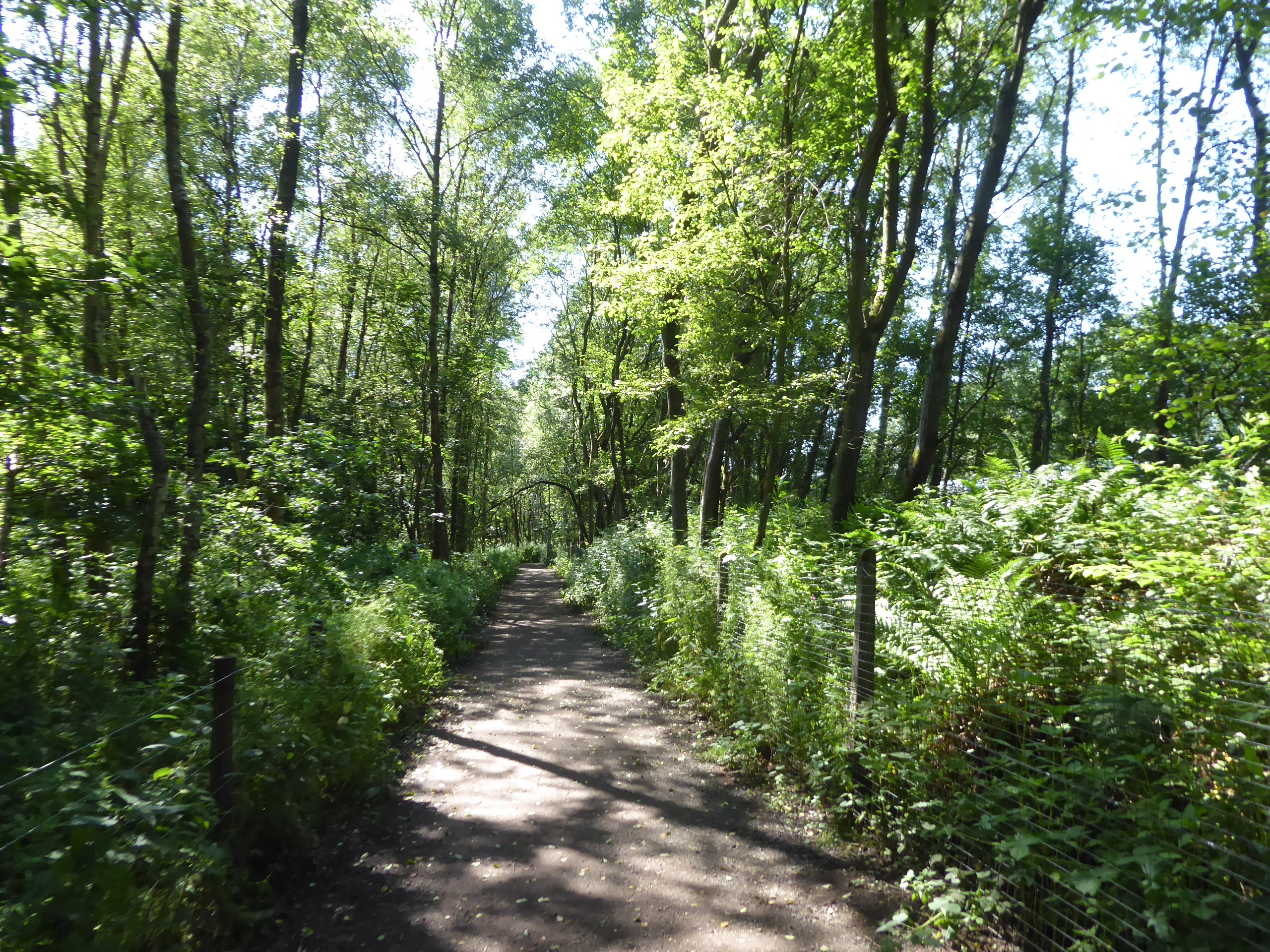
This is a path that I've tramped a whole bunch of times with my local friends in Mytholmroyd, but this is the first time that I've managed to come this way in season, and it brings some welcome and expected shade in the hot late stretch of the day, keeping us under tree cover as we hang on the high side of the embankment between the railway tracks and the river Calder, before slipping down to the track by the riverside meadows near Brearley, the sixth and final of the unique routes to be traced as they reach up this narrow stretch of the valley. The track leads us past the Microsearch Laboratories plant, and the short terraces that once served the mills in the area, continuing upstream and west as the lane takes us past the former Baptist Chapel and Sunday School, which really make a bold statement from the valley floor, with the high wooded sides rising around it, as the Greenway rises back up to the railway, greeting us into the vicinity of Mytholmroyd as a trackside marker indicates that we are in Coiners country, the landscape we did much to learn about on our bubble walks, last year. Just miss getting sight of the downhill passage of the Drax Binliner train as we settle back into the woodlands by the railway, with the L&YR markers indicating that we are within Network Rail's territory as we press west in the shade of the trees, noting the odd vintage retaining wall that doesn;t appear to support anything, and meet a few rare cyclists out on the trail, as if the heat of the day had actually inspired most to stay in and not risk getting broiled by too much physical activity, even on the shady couple of miles down this stretch of Calderdale. The green tube spills us out on the south side of Mytholmroyd station, only a half hour behind my intended schedule, where a brief train spot and an examine of the revivification of the old station building are due before we depart, carrying on down to the main road and taking a left past the Shoulder of Mutton as my good friends have made me an offer of refreshment at their base on Cragg Road, and that only 10 minutes more to travel, to wrap this trip at 3.55pm, to find that it's not just glasses of iced squash on the menu, but drinks and dinner too, all of which are massively appreciated at the end of a long, hot Summer's day like this one.
 |
| Train action by the Calder Valley Greenway. |
 |
| The riverside meadows, near Brearley. |
 |
| Brearley Bpatist Chapel, and the Coiners Stone. |
 |
| The Greenway Path to Mytholmroyd. |
 |
| Train Action at Mytholmroyd. |
5,000 Miles Cumulative Total: 5061.3 miles
2021 Total: 319.2 miles
Up Country Total: 4598.3 miles
Solo Total: 4729.7 miles
5,000 in my 40s Total: 3659.1 miles
Next Up: Resting through a week NIW, then testing the Calderdale Trails again.


No comments:
Post a Comment