14.5 miles, via Calder View, Battyeford, Littlemoor, New Scarboro, East Thorpe,
Castle Hall Hill, Northorpe, Ponderosa Zoo, Heckmondwike (Cuttings & Spen),
Liversedge (Spen), Royds Park, Cleckheaton (Spen), Manns Dam viaduct,
Cleckheaton (Central), Liversedge (Central), Heckmondwike (Central & Junction),
Carr Lane, and Dewsbury Country Park.
With Spring feeling like it might have finally Sprung, more than two weeks later than usual, but ahead of having had long enough for my second vaccine dose to work its full effect, we aim to keep things kinda local before we look to start expanding the walking field much wider as we march on into May, and as this tenth season has seen us retracing some old routes among my continued explorations, that seems like a good theme to continue as we aim to revisit the lost railway lines of the Spen Valley, first seen in the early days of 2012. So, to Mirfield we return, with another wandering route planned ahead of us, alighting just ahead of 9.15am, with the early morning chill still in force as we head off west along Back Station Road below the long brick retaining walls of the station plinth and past the looming bulk of Ledgard Mills, before we head across the Calder to its south bank via Ledgard Bridge, to graze the corner of Lower Hopton and pass back under the railway with its many arches above Chadwick Fold Lane, around the Butt End Mill site and the Hopton Cottage residential home. This leads us into the Calder View housing development still on a counter-intuitive route westwards, but my reason to be here among these still blooming lego houses is because we are on the site of the L&YR Mirfield engine shed, which operated from 1885 to 1967, of which nought remains aside from the access bridge across the modern railway, which itself will be soon removed with the expansion and widening of the lines through Mirfield so that's one to snare a look at before it's day is done. Through the brownfield site development and away across the flood plain that's sensibly being laid out as a riverside garden, to get us on track for our exploration of the bulk of the L&NWR's Leeds New Line, landing on the path on the south bank of the Calder to progress west once more, soon meeting the arched remains of the northern side of Battyeford viaduct ahead of the embankment on the far bank, ahead of the high abutment on the south side, east of Heaton Lodge junction where the projecting iron girder span passed over the river at an acute skew.
 |
| Mirfield Viaduct over Chadwick Fold Lane. |
 |
| The Mirfield Engine Shed access bridge. |
 |
| Battyeford Viaduct remnant, by the Calder. |
Our late Spring arrival means that greenery is yet to completely obscure our views here, but there's enough to provide foliage cover to the woodlands beyond, where a fairy village has been grown out of sight to many, ahead of us being led onto the towpath through the Battyeford cut of the Calder & Hebble Navigation, where we pass the boatyard and moorings before being compelled up Waterside Walk to the Wood Lane bridge and on over the Calder via the Battyeford toll bridge and onto the A644 by the Pear Tree inn. Having travelled so far west, we now have to return east by tracing Huddersfield Road as it leads us below the rising side of Stocks Bank, coated by the suburban expansion of Mirfield and onwards above the industrial band that maintains is residence on the north side of the Calder, obscuring views south to the viaduct remnants on the bank, and hiding the embankment completely, through a sneak down the Bankfield Mill access road does give us a good spot to get us a reverse angle on the blue brick arches that endure in the hands of Mirfield Motor Spares. Across the A644 at the stub of another embankment lies the remains of Battyeford station, its brick arches that supported its southern side platforms still in situ, with a footpath leading us up to its northern side, where a grassy path sits on the station site, with the trackbed and goods yard to the east now being covered by the low rise bungalows of the Littlemoor Grove Housing estate, through which a footpath leads us as we seek to trace the lost railway across greater Mirfield. It once crossed Nettleton Road and Doctor Lane via a viaduct, of which nothing remains, aside from some local houses having some substantial stone for their garden walls and a local pub calling itself the Railway, though a keen eye can still spot the alignment as it passes through the suburbia of New Scarboro where the older houses aren't, and a new housing development up the hill gives up some more history with its name of The Embankment, seemingly the last local remnant to have been erased by new building, according to the OS map.
 |
| Battyeford boatyard, on the Calder & Hebble Navigation. |
 |
| Battyeford Viaduct remnant, by Huddersfield Road. |
 |
| Battyeford Station remnant, by Huddersfield Road. |
 |
| The New Line's Mirfield Viaduct was here, Doctor Lane. |
Meet Knowl Road and seek the footpath that endures from the lost overbridge tracking northeast behind a number of East Thorpe's back gardens, as the alignment vanishes behind conifer hedges and various fences before the passage drops us out on Parker Lane where a substantial parapet endures at the roadside corner with Crowlees Road, which shadows the infilled cutting below the Pinewood Gardens and Crowlees Court development before coming around to Pinfold Lane where another path matches the line adjacent to the Castle Mount close. This brings us up to Dunbottle Lane, and the path continues, north of St Mary's church in its graveyard and the motte of Castle Hall Hill, taking us alongside the close of of Dunbottle Way before we meet the rough ground to the east, where a direct path towards Shillbank View, the long cul-de-sac occupying the entirety of Northorpe goods yard, feel like it out to be accessible through the brambles, but isn't, forcing us onto the footpath that goes far off the railway piste behind the suburban back gardens to land us on Shillbank Lane, way up its hill by Paper Hall. Downhill we are compelled to go at Mirfield's suburban edge by the Plough inn to find the abutments of the railway bridge, which had Northorpe stations at either side of it during its 65 year history, and on the northeastern side, we have a substantial embankment to climb, giving us some proper railway walking to go out of the town, following a clear path among the undergrowth that someone has been taking care to maintain by felling trees despite the lack of a right of way. Above the fields we travel until we come down by the Jill Lane bridge remnants, and then briefly lake a loop around to pass through the foot tunnel between field paths a short way to the south, known as Henry's Tunnel to the locals, apparently, and neatly dressed in blue brick, before we pass back around to the lane, and proceed to shadow the alignment up past the odd rural street of Cyprus Crescent to get back on the trackbed by the 69m trig pillar overlooking the Spen Valley to the east.
 |
| Bridge Parapet, Parker Lane. |
 |
| St Mary's Mirfield, and Castle Hall Hill |
 |
Shillbank Lane bridge, Northorpe.
|
 |
| Henry's Tunnel, near Jill Lane. |
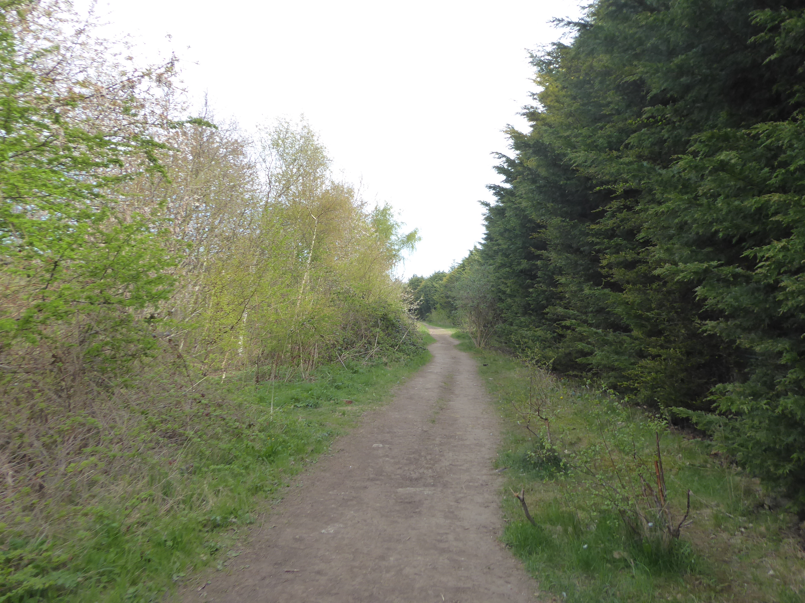
Keep away from the heavy reclamation work going on in the adjacent plot and follow the railway as it passes behind the Ponderosa Zoo, concealed away behind a tall conifer hedge that hides the fact that we are on an embankment passing over Finching Dike, not following a right of way but certainly on a path that's well used by hoofed animals, which leads us up to the establishment's car parks and the tangle of the local lost railways, where the route of the Leeds New Line has been landscaped out of existence. We instead land on the L&YR line between Mirfield and Heckmondwike to its east, which now has the zoo's driveway and access road for the local sewage works upon it, where walking rights are available as the spring traffic for the wildlife park passes us as we head north, to seek the L&NWR's overbridge remnant where it passed above on another iron skew bridge ahead of wandering further down this tree-lined boulevard to Smithies Lane by the Adult Day Care facility. Both railways crossed the River Spen down here, and ahead of us doing so too, we need to seek the remnant of the New Line's Heckmondwike Viaduct, of which a towering abutment that projected the railway high over the river on multiple spans still endures, hidden from obviuos view but just about visible due to the lack of Spring foliage, though very obviously parked over a private driveway, so we'll not study it too closely before we go back to cross the Spen and then rise sharply up the wooded bank on its north-east side. The sunshine makes its definitive breakthrough on the day as we pass around the angling pond that has replaced the New Line route, ahead of us coming upon the Spen Valley Greenway, as it rises up from Thornhill towards Heckmondwike on the old L&YR line, and we cross over to follow the link path on the 1966 spur which combined the lines to service the Liversedge oil depot, getting us back on the L&NWR route as we meet the Walkley Lane bridge and pass under it into the deep cutting beyond, noting the banners of the recently launched campaign to save it.
 |
| The hidden embankment, behind Ponderosa Zoo. |
 |
| The L&NWR line passes over the L&YR line, Smithies Lane. |
 |
| Heckmondwike Viaduct, south abutment. |
 |
| The link path up to Walkley Lane bridge. |
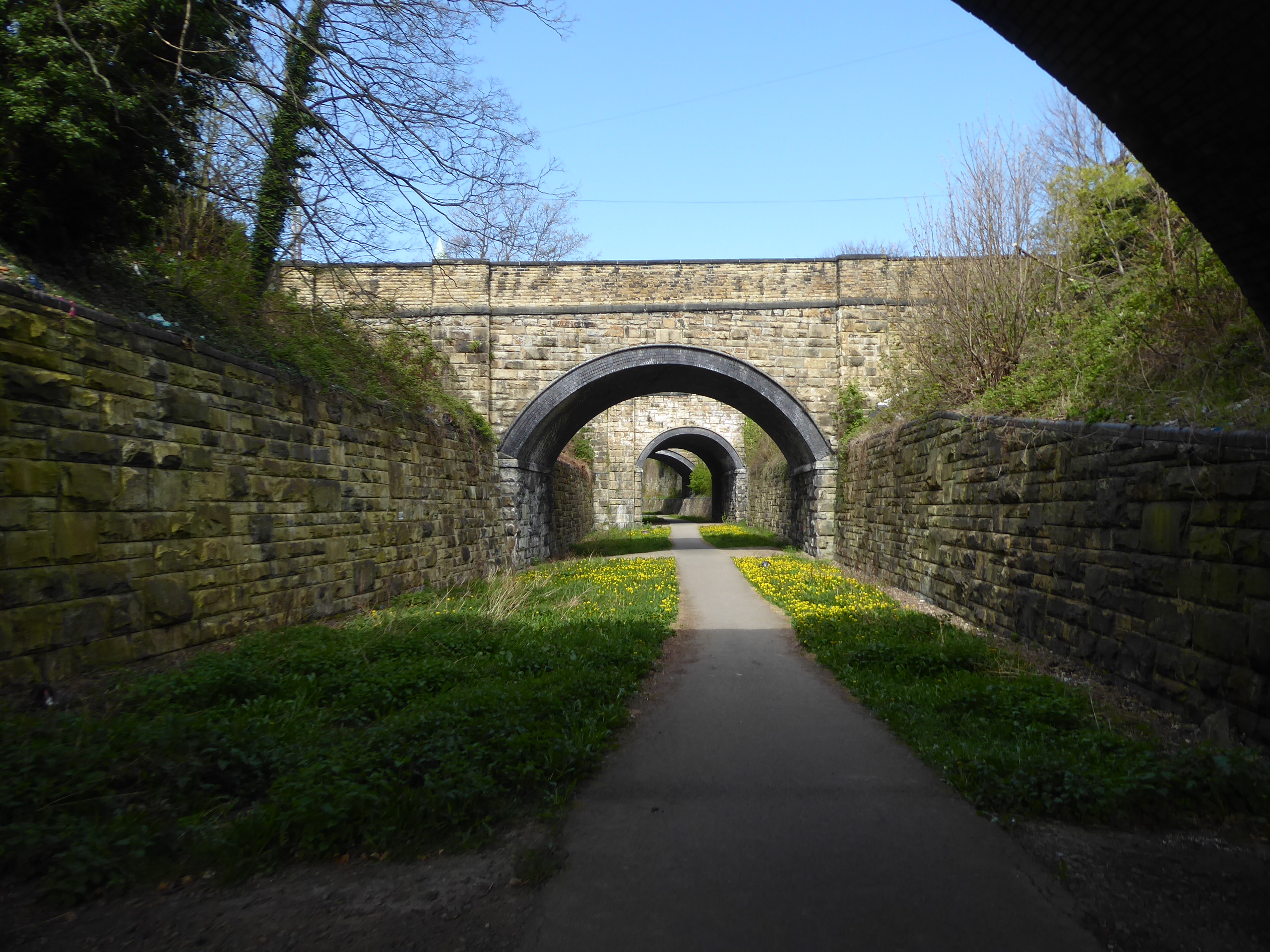
This wide and 48ft deep cutting has had planning applications dropped on it for it to be infilled and developed for housing, while campaigners are opposing such plans in order to extend the Spen Valley Ringway instead, which would have so much more cultural value for the locality, a plan which I could get behind as we progress on north, below the steep grassy sides, admiring the amount of labour that went into it construction and enjoying the fact that locals are using it as a path in the wake of recent mass trespass event. It's also not nearly as overgrown or as damp as I'd expected, as the hard ballast surface still endures underfoot despite the amount of dumping and littering that has gone on since its 1986 closure, and thus a firm walking surface endures as we enter Heckmondwike's other stone lined cutting that leads us under Brunswick Street and Church Street before passing under the 50 yard tunnel under the A638 High Street to land us on the Heckmondwike Spen station site, among the houses that have been developed here. Beyond the Old Station Court, we meet the famous Heckmondwike cutting with its run of five bridges and one short tunnel burrowing under the town as it passes to the northwest, from Cemetery Road to Cook Lane (with the tunnel naturally under Bridge Street), its yellow stone and dark brick accents all illuminated with the Spring sunshine at the best possible angle and looking pretty well maintained, though I do wonder if the availablity of urban walls is seen by some as an invitation to fly-tip, regardless of the use of the land below. Nine years on from my first visit, I still think it might be my favourite railway walk of all those I've done, and I had it all to myself as I made my passage too, unlike the path beyond Heckmondwike Old Hall, where the locals seem to pass in quantity, showing just why the Ringway ought to have its extension approved, as we pass through the green space between Heckmondwike and Liversedge, running up to the A62 Leeds Road bridge and passing under it to meet the Thornleigh Drive housing development on the former goods depot and Charrington Hargreaves oil terminal site.
 |
| Heckmondwike Deep Cutting, in need of preservation. |
 |
| Church Street bridge, and 50 Yard tunnel, Heckmondwike. |
 |
| Heckmondwike Cutting, southern end. |
 |
| Heckmondwike Cutting, northern end. |
 |
| Huddersfield Road bridge. |
Liversedge Spen station actually sat further to the northwest of here, on the resuming path between the Firthcliffe Lane and Listing Lane bridges, and elevated just high enough up the valley side for us to be able to get a look across to Christ Church beyond the rooftops of the various estates of Littletown that have crammed themselves up to the side of embankment, which we'll briefly slip of to see the Well Street foot tunnel, ahead of meeting the Garden Avenue road, where our last passage across Spenborough brought us. Arrive in Royds Park, which is still light on foliage for its many trees, but the blossom is blooming in a big way, rendering the air particularly fragrant as we break for our brew at midday, ahead of our passage out of the 2021 bubble, passing out of the D&DRCW loop as the path shadows New Street and then enters the fields as they trace a way north through the equestrian fields below Mount Pleasant farm, wandering somewhat with the rights of way as we pass above the infilled cuttings and beneath the towering embankment that approaches the Spen Bank Road. Land on the A643 by the broken bridge at the southern throat of Cleckheaton Spen station, and again rise up Spen Lane to enter the station and good yard site, still firmly in industrial use, and offering the plausibility of following the Leeds New Line all the way to its northern terminus at Wortley Junction, but as the mood to tussle with the passages of Gomersal and Gildersome tunnels isn't being felt today, we'll mark this point as out apex for the day, and hold onto the remainder of the trip for the late season. Instead we'll start the path back by heading over to the south and west side of the valley by crossing the Mann Dam viaduct, still the most impressive footbridge in the county, projecting high above the River Spen on its many lattice girders and constructed to make the L&NWR station feel even slightly accessible to the town, high on its embankment on the wrong side of the valley, with us making our second passage across it, but having still failed to pass under it.
 |
| Well Street foot tunnel. |
 |
| New Line alignment near Mount Pleasant farm. |
 |
| Spen Bank bridge. |
 |
| Mann Dam viaduct. |
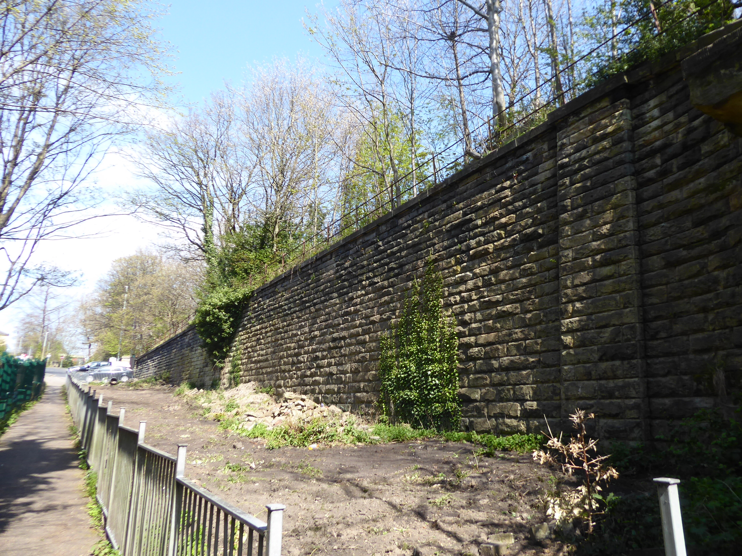
Land ourselves in Cleckheaton itself, via Valley Road, by the Commercial inn on the A638, and we follow the Bradford Road south to the crossing by the Savoy Cinema site, across from the Town Hall, and head up Horncastle Street pondering if I ought to visit the local stationers to see of the still stock the route guide to the Spen Valley heritage Way, the local route that I'm yet to make a proper attempt at, and also noting that the townsfolk seem to be ready to enjoy their shopping at the market in full force now that their commercial lockdown has been over for a couple of weeks. There's also an historic coal wagon to spot on the corner of Serpentine Road, before we take the turn onto Northgate by the Old House at Home inn, and find our way to Railway Street, where Tesco has built their supermarket atop the retaining walls of the goods yard, and the site of Cleckheaton Central station can be found across from the Station Tavern, with the Station Approach taking us below the whitewashed arches and steel girders, past the old entrance, with the Greenway route passing overhead. We'll not join it here, instead emerging onto Tofts Road and passing alongside it down to the A643 Northgate, where we'll pass the overbridge and site of the 1928 shunting accident, to head along the footpath in the shadow of the high retaining walls that support the embankment, moving on with the intention of spying as much of the old L&YR line from below as is possible as we make our way south, landing ourselves into suburban Cleckheaton as we arrive on Hightown Road, and seek a path that I imagine exists. It's located as we pass through the close of Moorlands Road, the very epitome of a suburban growth on a former brownfield site, which nonetheless leads us under Thoms Bridge, an access point below the railway line that probably has more obvious use now than it did when constructed in 1848, which leads in turn us onto the rising pavements of Pyenot Gardens, where the many suburban bungalows are afforded a pretty decent view across the Spen Valley over the town and towards Gomersal on the eastern side.
 |
| Cleackheaton Town Hall. |
 |
| Station Approach, Cleckheaton Central. |
 |
| Retaining Walls, near Northgate. |
 |
| Thoms Bridge. |
A footpath propels us through the Lego houses and its end and through the small woodland where a number of paths converge, one of which we saw very recently as we pass back under the old line at Pyenot Hall bridge, where we could again break for afternoon elevenses in the Jo Cox Community Woodland, but instead forge a way forwards by rising up alongside the embankment to finally start walking the Greenway route southeasterly, noting the vintage stream drain passing below it as we elevate. A sunny spring day is a fine time to see how well used this trail really is, essentially forming a seven mile long, traffic free linear park that services five towns, which after the year we've all experienced has really demonstrated its value as a place for the local folk to exercise without difficulty, as it's not just a space for the walkers, joggers and cyclists, as demonstrated by the number of older and younger folks out for an amble, basically an Exhibit A in the case for preserving and maintaining every accessible heritage route in the face of indifference from Highways England and their ilk. There's a good view across the valley to Mann Dam viaduct from up here too, snared before we exit the green space between Cleckheaton and Liversedge, snared before we enter the woodlands at the latter's northwestern edge, crossing over the the Primrose Lane bridge, passing the Stanley Colliery site and sneaking a view into the Eddercliffe Lane passage beyond that appears to be little more than a stone tube lined with corrugated steel plate, beyond which we slip into a cutting that suburban Liversedge crowds up to the edge of. This leads us under Knowler Hill via its eponymous tunnel, a pleasingly cool space to be found amidst the growing heat of the early afternoon, which in turn leads to us passing under the A649 Halifax Road bridge, and onto the site of Liversedge Central station, where the cyclists cafe has reopened to do a roaring trade and the extant good shed hides well from the railway alignment, as we're lead on over the Ashton Clough Road passage and into the cycling feature of steel hoops in the rock cutting which once accessed Strawberry Bank Colliery.
 |
| Pyenot Hall Bridge. |
 |
| The Spen Valley Greenway. |
 |
| Eddercliffe Lane foot tunnel. |
 |
| Halifax Road bridge and Knowler Hill tunnel. |
Again, it's delighting to see this space being so well used and appreciated, and it's almost a shame to leave it as we meet the A62 Huddersfield Road bridge, where we rise up the switchback path to exit the Greenway, reminding ourselves that there's more infrastructure to see around here than just the path that we traced nine years ago, as we pass over the old railway line and meet Union Road to shadow it through the southern half of suburban Heckmondwike. It's an attractive sort of quarter down here, a mix of stone semis and terraces on the eastwards push towards the town, but our points of interest are to be found beneath the passage of the railway, the first of which can be found at the end of James Street, beyond some later suburban encroachments, where a narrow underbridge leads to a pair of cottages, isolated by the railway's construction, while further along we can make a turn onto Wormald Street to pass below the line via Berry Hill bridge, which is just about wide enough to accommodate traffic. Cornmill Lane presses on eastwards, below the suburban spread that rises up the valley side towards Norristhorpe, taking us alongside the railway alignment on its embankment up to the playing fields of Littletown FC, where a sport-starved crowd is gathering for the entertaiments, as we take the turn under the bridge that leads us to Beck Lane, behind Union Mills and the Heckmondwike branch of Morrisons, and over the River Spen as it makes its passage under the Central station site, which we can't approach directly as we have to pass between the Arriva bus depots on Swallow Street. Arrive on Station Road and approach the old station via the cobbled front yard ahead of where its relatively tiny main building once stood, and take the steps down to Station Road to pass below the plate girder bridges that divided the lines around the island platform of Central station, admiring the fact that they remained in place after the line closed in 1965, thanks to sporadic freight use until the early 80s, and an eagle eye will spot that to the south, the access road to the goods yard, now a private driveway, still has its railway era cobbles in situ.
 |
| Huddersfield Road bridge. |
 |
| James Street bridge. |
 |
| Beck Lane bridge. |
 |
| Heckmondwike Central station yard. |
Turn down Spen Vale Street, between the Spen Vale and Orchard mills site, and the industrial ban below the station to find the footpath up to Heckmondwike junction, where more vintage cobbles can't be walked on, but the concrete retaining wall that reinforced the line splitting south towards Mirfield can be seen thanks to some recent tree felling, and having risen to the Greenway level once again, we can wander along that alignment through the woods for as far as it will allow before sending us back to the L&YR branch towards Thornhill. We arrive below the old malthouse that's the last vintage building before the place where Bridge 21 took the L&NWR line overhead, now landscaped out of existence and concealing just how wildly the railway lines once piled up here as they switched sides on the Spen Valley, as is the fact that most of the land to the west, between the dividing/merging L&YR lines is filled by the spoil dug from the deep cutting into Heckmondwike to the north, and from here we get back on course with National Cycle Route 66, rendering the whole Greenway of much more than just local interest. Thus crossing the morning's northbound route, and heading south, and rising where the path follows the rise that once lead over an missing occupation bridge, we gain ourselves a westwards view over the Spen valley, rendering it much more dynamic than we'd previously considered it we look up to the Ponderosa Zoo site and back to the narrow bottleneck where the viaduct once passed over, before we set us course towards the Calder Valley, passing the foul stink of a nearby chemical works and the pondered though of whether a bridge that we here in 2012 is now missing. Depart the Greenway at Carr Lane, and follow it as it shifts to the southwest, past the Spring Cottage equestrian facility and down its shaded passage down to the side of the River Spen, where we break for late watering and find that we're at an ideal point for a hurry up walk down to our finishing line, crossing over to meet the end of Jill Lane but not following it as all other paths lead into Dewsbury Country Park, and our keeps us close to the riverside, wending its way south in a plainly unnatural channel.
 |
| Heckmonwike Junction. |
 |
| The Greenway in the vicinity of Bridge 21. |
 |
| The geography of the Spen Valley revealed. |
 |
| Carr Lane bridge, on the Spen. |
It's large park to be sure, but quieter than you might expect, though the crowds might be dispersed thinly across these fields to the west of Dewsbury Moor, and as we meet a firm track that follows the river further, the obvious canalization and the odd rising banks of trees has the whole landscape looking like it's been reclaimed from industrial workings, which old maps suggest as having been a sewage works at the turn of the 20th century, one which appears to need methane venting machinery now. The track leads us down to the top of Park Road, where the country park's car park gates are locked shut, not in accordance with current Covid protocols it seems, and we pass over the Calder Valley Greenway route as we arrive at the top corner of Ravensthorpe, feeling like that there ought to be a good short cut to the main road from here, but stick to this lane as it leads us between two plots of playing fields where one is being ripped up by local kids on their quad bikes and the other is occupied by local amateurs footballing in the colours of Huddersfield Town and Watford FCs. Land on the A644 Huddersfield Road again, only a mile or three east of where we last saw it, and press west, passing the local mosque and what feels like an unending run of takeaway restaurants opposite the deep band of industrial concerns that fill the whole south side of the road down to the river, which we trace a path around as Calder Road leads us past its long terraced and mill sites, ahead of the passage over said river and up past the power station and the old railway goods shed. It's about time that we finished a trip at Ravensthorpe station, after all the starts we've made here, and we do so just after 2.50pm, with the knowledge that we aren't going to have many more opportunities to do so as this 1890 vintage site is due to redeveloped out of existence with the Trans-Pennine Line improvements, which are planned to have it moved to a more versatile location to the west of Dewsbury Junction, so let's get it visually recorded now, which is easily done in the 10 minutes ahead of our ride home arriving.
 |
| Dewsbury Country Park, and the River Spen. |
 |
| Park Road Playing Fields. |
 |
| Huddersfield Road, Raventhorpe. |
 |
| Ravensthorpe station. |
5,000 Miles Cumulative Total: 4889.5 miles
2021 Total: 147.4 miles
Up Country Total: 4426.5 miles
Solo Total: 4557.9 miles
5,000 in my 40s Total: 3487.3 miles
Next Up: May means the Serious Business of trekking Calder to Aire!


No comments:
Post a Comment