9.8 miles, from Morley Station, via Morley Hole, Lane Side, Churwell, Cottingley Hall,
Beeston Royds, Far Royds, New Blackpool, New Farnley, Upper Moor Side, Cockersdale,
Drighlington, Adwalton, Gildersome Street, Bruntcliffe, and Morley Hole.
The climate has returned to something approaching its February norm as our walking year gets back onto it's regular sequence of filling in the Saturdays that follow my walking weeks, with the glumness remaining, but the bitter cold being replaced by a more tolerable temperature, so we're free of snow and the bleaching effect of so much gritting as we alight on the second of my pair of obvious road circuits around the town, but starting out as late as possible to let the morning's inclemency pass, getting to my starting line at 11am. To match my last trip, we this time start out from Morley station, to pound the uphill pavement of Station Road and its pitch that gets more noticeable the older I get, noting that someone has recently been planting trees in the middle of the recreation ground's slope, as if someone wants to render this parkland even wilder than it was before, and then rising up to Morley Bottoms to see yet another empty property getting a makeover to join the local bar culture, drawing these three commercial blocks to as close to full occupancy as I've seen since first moving here, nearly 14 years ago. Then on, around Victoria Mills/Court along Brunswick Street to start the road loop proper at Morley Hole, joining the side of the A653 as it heads towards the city, rising from the primary school past the Ingles Estate and following Victoria Road as it heads past the Springfield Mills roads, St Peter's church and is its pubs on the junction corners, and on to the long downhill stretch, easing us past the villas of the Victorian town above Laneside farm, and the mills sites across the way with the own impressively scaled houses. Walking a north-easterly trajectory on hugely familiar road means there's not a whole mass to describe as new as we run into Churwell, still distinct beyond the open fields to one side of the road, heading down Elland Road on its absurdly steep stretch between the many former churches and chapels, and its enduring pair of pubs, passing the community hall and the memorial gardens before angling to pass down below the bulk of Churwell viaduct, still obscured from view by all the trees despite the seasonal lack of foliage, and over Farnley Wood Beck as it emerges from below the various railway lines that hide it away.
 |
| Morley Bottoms and the expanding Bar Culture. |
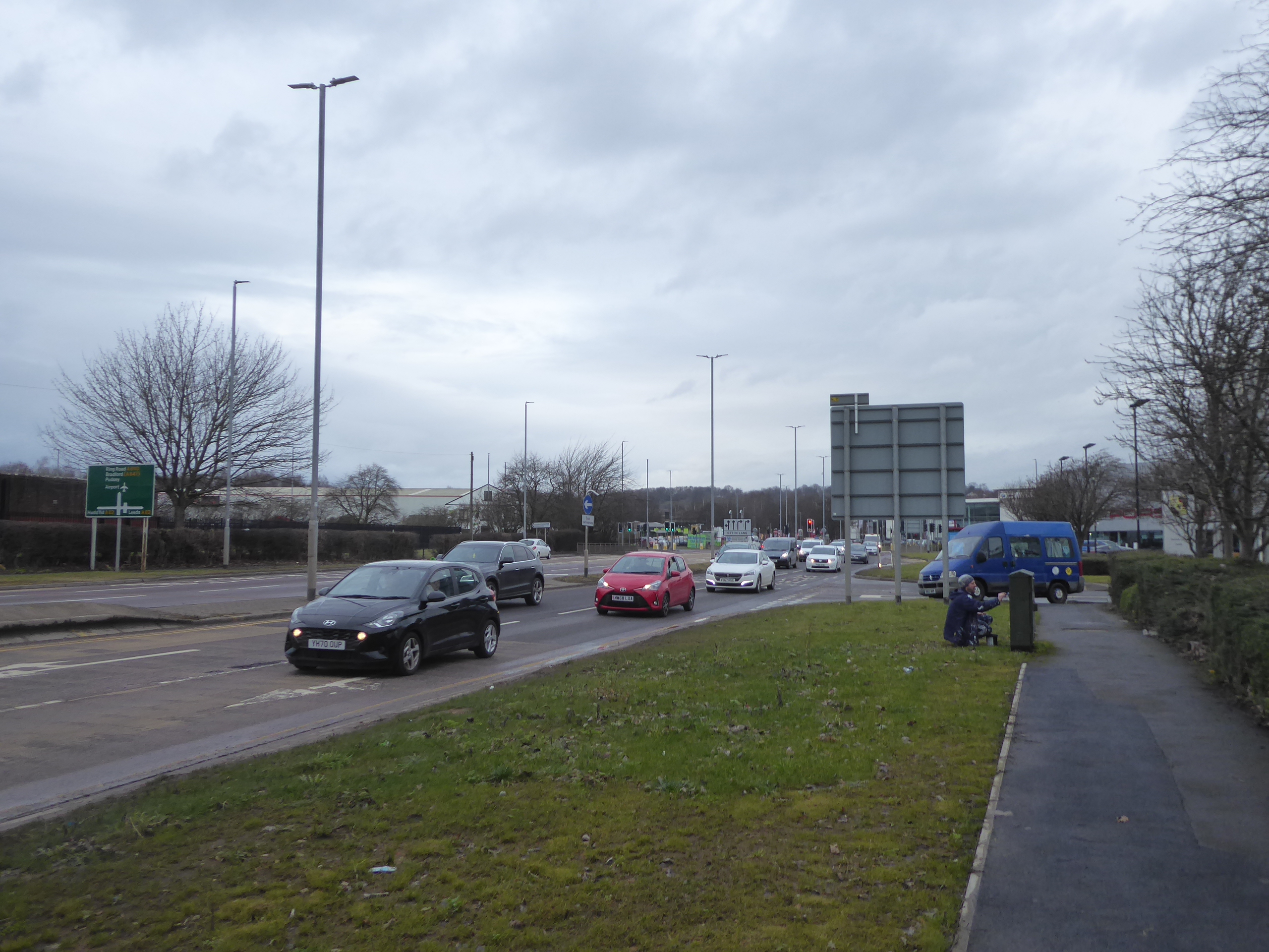
 |
| Victoria Road, departing Morley. |
 |
| The long descent of Elland Road, through Churwell. |
Thence it's on around the Cottingley Hall estate on rising ground to the left of us, and coming down to meet the A6110 Ring Road Beeston, we run into the problem of tangling up with my previous road loop, and so we have to switch sides on the road to keep our perspectives interesting passing directly in front of the Sulzer factory, the Drysalters inn and the Kia dealership before starting off up Elland Road towards the city as the ring road lacks a footway on its east side, and we have to detour via the footway through the Elland Way industrial estate to get back on course northbound by Junction One. That's both the retail park and the traffic island on the M621, which we pass under on its eastern side, with Millshaw Beck culverted somewhere below as it makes its passage towards the city, and we pass the guy who unofficially paints all the local telecoms connection boxes in Leeds United colours, quietly doing his business as we come to pass over the A62 Gelderd Road, flanked by the Porsche and BMW dealerships as our path alongside the ring road take us on beyond Beeston Royds, past the self-storage units and under the massive bulk of the railway bridge between the trio of former Farnley junctions. Heading upstream and westerly into new valleys we carry on among the factories and car dealerships that flank Ring Road Low Wortley as it passes through the district of Far Royds, shadowing Wortley Beck as we approach the traffic island where the A58 crosses at an oblique angle, and it's along the Whitehall Road we'll continue as it rises off to the south-west, once the footways permit us to travel in that direction, rising on at a steady pitch among the semis at this far corner of the city of Leeds. Pass the redeveloped Farnley Low Mills site, and the edge of the terraces of New Blackpool as we come up to the embankments of the branch line into Farnley Iron Works as they loom at the roadside, once elevating a bridge across the road, and there's a run of period terraces to the south side of the road as we come past the Whitehall Park industrial estate on the north side, and find our well-located bench for our lunchtime brew-time break, where I can report that my new flask keeps my tea warm much more happily when not contending with sub-zero temperatures.
 |
| The Sulzer plant, Ring Road Beeston. |
 |
| Guerrilla Artistry by the Gelderd Road Junction. |
 |
| The A6110 tangles with the A58. |
 |
| The Last Terrace in Leeds, Whitehall Road. |
Countryside beyond the city awaits as we continue the rise, below the fields on the northern slopes of the hillside that we're still calling Farnley Wood, and presenting a lot more unseen terrain than the A62 did on the southern side, and we come up past the Ashfield Way business park and meet the wall and wrought iron fences at the roadside which once contained the Iron works site, of which a few period building and workshops remains, among the organised chaos in the industrial landscape bowl below the lane, with the wooded slopes to its west still bearing the scars of the mining workings that created it. Beyond, concealed by woodlands, we meet its old mill dam, now an angling lake, and start to pass into New Farnley, passing the sad sight of the modern yet neglected St James church before coming upon the estates and runs of semis that fill out the north side of the increasingly wide Whitehall Road, where multiple trails from home have passed before, which reminds us that we're still relatively local despite being in a different borough over here, as well as being still within the suburban reach of Leeds despite the green spaces already traversed to get here. Take a look back to the city's distant towers by the Walsh Lane corner, before the going levels off a bit, and pass the route of the local colliery tramways and the other Jewish Cemetery complex on this side of town, before we run into Low Moor Side, where the proximity of Gildersome can be seen on its hillside beyond Ings Hall farm and across the undulating fields to the south, before the B6126 passes through the hamlet towards Wortley by the Woodcock Inn, and we follow the A58 on as the view over the fields to Tong, Fulneck and Pudsey emerges in the northwest. Past the equestrian enclosures and the pallet farm, the road takes a dive downhill, proving that we aren't on a consistent rise all the way to the Aire-Calder watershed, and this is a decline that I ought to have expected having made a passage through Cockersdale on multiple occasions, further down the hill from Valley Mills and the Kingfisher widow and conservatory factory, by the retaining walls above Old Lane (currently in the midst of some serious reconstruction works), and the Valley Inn, a notable waypoint along the passage of the Leeds Country Way.
 |
| Farnley Iron Works (former) |
 |
| Suburbia Rules in New Farnley. |
 |
| Back Lane, Upper Moor Side. |
 |
| Valley Mills, Cockersdale. |
We restart the climb beyond, past the outlying former Co-operative store and the field full of carnival caravans, by the looks of it, and come up below some seriously stacked up stonework that seems to hold the rural-industrial yards of Nethertown and Lumb Bottom in place above the road, while below through the trees of Lumb Wood we have a large pond that doesn't feature on any old maps, which appears to be stained a shade of blue-green that looks wholly unnatural, ahead of meeting the bottom edge of the estates that seem to be continuing to swell the settlement of Drighlington. The Kings Park housing estate we passed around during last year seems to be growing still, and the field down the hill from the 17th Century Lumb Hall also has that look of having been prepared for future building, but if unappealing and swelling suburbia seems to be the rule at the top of the A58's local rise, we still have the parish church of St Paul, the Italianate former board school complex, the Spotted Cow inn and the long wall flanks of Manor farm ahead of us to give us a look of a more pleasing vintage. We turn inbound here, feeling like we're home again, back in the borough but still three miles distant as we join the old Wakefield Road, as we don't need to trace the A650 bypass to the south, following King Street as is heads to the southeast and finding that beyond the Methodist Chapel and hall, a whole plot in the heart of the village, which had once been lightly industrial or derelict has been cleared to to build the King Charles Walk development, which illuminates further the appeal of the corner for suburban living, though it's brown field this time, so I have no real grounds to complain this time. Rise with the B6135 as it passes seamlessly into Adwalton, past the medical centre and the rugby clubhouse with no obvious playing fields, and on past the red brick council estates and the view over the fields toward Gildersome on its other face, before passing the New Inn, which looks like its been made over to look vaguely hospitable, before we meet the portion of the Wakefield - Bradford turnpike that gives us views down into the Aire and Calder valleys, a spot best observed from a ride on the #425 bus.
 |
| The inexplicable Blue-Green pond, near Drighlington. |
 |
| St Paul's Parish Church, Drighlington. |
 |
| The Suburban Growth Never End, on King Street. |
 |
| Wakefield Road and the tapering end of Adwalton. |
As one village peters out, the next one emerges, and we slip onto the forgotten stub of the old road as we pass the Old Brickworks Premier Inn and Brewers Fayre site, with the best chimney on the local horizon, entering Gildersome Street and taking a gander over the hedge of Grey Stone house and noting the terraces which once served the neighbouring mill site, now suburbed over, before we meet the dual carriageway section, with its own fascinating car parkin arrangements, ahead of taking the footways that lead us over the A62 island, at the top of Junction 27 on the M62. Finally get onto the A650 to push that longer than you'd think it push back to town, keeping to the north side of the road by the old farmstead remnants of this settlement, almost witnessing a snarl up at the new service station, thanks to motorists unfamiliar with the new road layout, before we rock up past the Gildersome Spur business park, where the former ambulance depot site looks like it was cleared without much of a plan for what was to happen to it next, and then pass over the M621 and take in the Kirklees horizon again, which is much less white today. Rise to Bruntcliffe crossroads, and switch onto the A643 again by the Toby Carvery, noting the Dr Seuss quote displayed in the In Bloom garden again, and take the direct route as it leads downhill, past Howdens building suppliers, the Bruntcliffe Academy and Morley Cemetery, which still hasn't attracted me for an amble around, before we drop downhill, across the path of the old GNR line, and pausing to snare that weird and apparently telescoped view that leads the eye all the way to the tower blocks at the eastern edge of Leeds. Downhill we go, past the Wynyard Drive estate, the industrial plant and flats on the Highcliffe Mill site and the bottom of Corporation Street, making our final footfalls along Bruntcliffe Lane before pausing to snare a late lunch of F'n'C at Hillycroft fisheries, thinking that I'm sure to have beaten the dinner rush, but still find the queue to be six people and ten minutes deep before we can exit to Morley Hole, where the finish line is only a single road crossing away, where our tours of all of the local A-Roads wraps at 2.30pm.
 |
| The stub of Bradford Road, Gildersome Street. |
 |
| The absent ambulance station, Gildersome Spur. |
 |
| Morley Cemetery. |
 |
| Morley Hole, where so many lockdown days have ended. |
5,000 Miles Cumulative Total: 4771.6 miles
2021 Total: 29.5 miles
Up Country Total: 4308.6 miles
Solo Total: 4445 miles
5,000 in my 40s Total: 3365.4 miles
Next Up: A walk in the not-so-local parks of South Leeds.


No comments:
Post a Comment