7 miles, from Morley Station, via Lewisham Park, Magpie Lane Rec, Glen Road Playing Fields,
Hembrigg Park, Hopewell Farm estate, Dartmouth Park, Scatcherd Lane Playing Fields,
Scatcherd Park, Scarth Gardens, Morley Hole, Springfield Mill Park, Clark Springs Wood,
Daffil Wood, Japa Wood, St Peter's churchyard, and Station Road Rec.
My original walking season plans for 2021 hadn't intended us to get off to the rapid starts that have featured in previous years, but the renewed lockdown has me thinking that the Nine Day Weekend (which is what we can regard weeks of annual leave as if we are unable to travel away) might be put to getting down multiple days of local mileage, but no such luck as my start-off Saturday, the 6th, is lost due to constant rainfall, and the subsequent four days are blighted by repeated snowfalls and persistent sub-zero temperatures as the third storm that I can recall being named 'The Beast from the East' passes over. So it's not until Thursday that the risk of further snow has passed, and the climate has settled into one of generally cloudless skies and arse-freezing-ness, and 2021's walking year has to be kicked off before I start to succumb to the risk of going stir crazy, donning all my thermals and leaving my flat to see if all the local walking from last year has left enough of an impression in my mind to tour around all of Morley's notable parks and green spaces without the need of a map, hopeful that the constant coldness won't have blighted the town with sheet ice literally everywhere. So it's to Morley station we head to start our circuit, departing at 10.30am, and full of intent to get around without stopping, heading off southbound and clockwise as we depart Valley Road and head up the non-treacherous flight of steps up to Albert Road, arriving between the Miners Arms and Fisheries and pacing on along Ackroyd Street to the old Co-op and chapel, and then on to the terraces of Cross Peel Street and to Peel Street itself, carrying on up its pavement to the City Mill and former Board School, where we take a left onto South Parade. He we can detour into our first green space, Lewisham Park, which was laid out with the building of the Middleton Road estates, and now offers a dog-exercising and perambulation space behind the semis, as well as frozen playing fields and a pavilion complex that aren't seeing much business as of now, as we traverse our way along the northern perimeter path, which leads us east over its long axis to the exit onto Clough Street, where we renew our wandery trajectory southbound, directly into the low sunshine along the estate's snow-dusted pavements that are doing their absolute best to melt off in the radiant heat of the sun.
 |
| Morley Station. |
 |
| Lewisham Park. |
Meet Wide Lane on it's bypassed route, by that proudest of vintage houses, where our next park can be found laid out on its south side, filling the undulating fields that stretch down to Magpie Lane, which doesn't have a formal name, but is nonetheless considerable as a long path reaches south west across its length, tracking uphill past its playing field and basketball court, directing us onto the southern road at the end of the housing estates that have developed along its length, with our ongoing route splitting south onto the first stretch of sketchy footpaths that we have traversed so far. This lead us to the Glen Road estate, and the playing fields where Morley Town AFC of the Yorkshire Leagues would normally ply their trade, and our uphill route beyond lead us up among the flagged paths of the council estates, where the developers clearly preferred communal green spaces to individual back gardens, making my passage look less unusual as we are lead up to the passage over the old railway line through Morley Top station and on past the expensive allotment gardens and factory complexes on the way up Elmfield Road to Bridge Street. We emerge among its bold terraces by the old chapel and the LDS church and head in towards town along the B6127's side as the only accessible point to this side our next green space can be found off Quarry Lane, which is Hembrigg Park, probably the newest arrival on the local scene, with its playing fields filling in the disused quarry which blighted the scene for decades, and we keep to its northern side as we track across to the exit at the north-eastern corner, where we should have exited when Leicester-bound in 2019, arriving onto Dartmouth Avenue. Its steeply descending, slippery and cobbled end drops us down onto High Street, which we trace southwest until we split off onto Harlington Lane to make our way northwesterly across the Hopewell Farm estate, and there's a green space here among the Lego houses, but as it forms a narrow, grassy dome beyond Elvaston Road, it's useless for ball games and energetic play, so barely qualifies as a park in my mind as we pass across it to Watson Street and the drag up to Fountain Street, where we land by the Morley Academy and turn left to pace south west, once again.
 |
| Magpie Lane Rec. |
 |
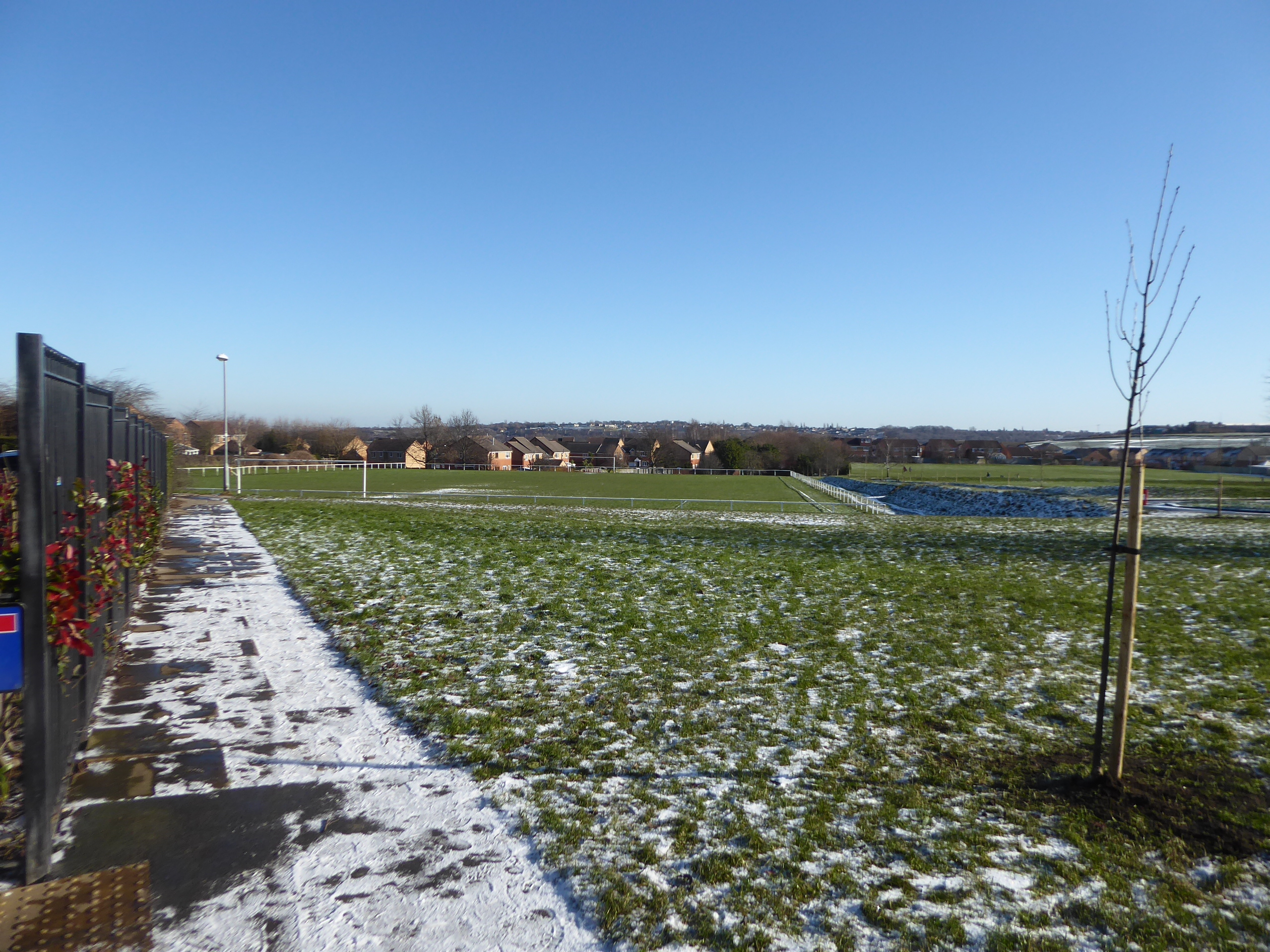
| Glen Road Playing Fields. |
 |
| Hembrigg Park. |
 |
| Hopewell Farm estate. |
We move on among the terraces on the B6123, until we make our next turn, onto New Park Street which sits two roads further along than you'd anticipate to make the approach to Dartmouth Park, to be found beyond the island on the the St Andrew's Avenue corner, the largest best presented of the parks in town, and still feeling slightly hidden amidst the most prosperous Victorian district of terraces and villas, where the snow still sits most boldly on the ground and the tree shaded path at the western side seems well populated with dog walkers. Indeed, it's a very fine park for a proper perambulation, though the route around the circular sports field has gradually been lost, and a loop can still be formed by joining the main route in from the Lewisham Street entrance at the south side, before wandering past the playground at the heart of the park and heading around to the north side by taking the route below the tree cover and the embankments that enclose the bandstand and the formal gardens, a route which I'm sure many locals to this corner have blazed whenever the weather hasn't been dank, since the renewed session of lockdown. We return to the main entrance, and set off back towards the town, choosing to not visit Morley Cemetery out on it's own little tangent, pacing our way on along Scatcherd Lane as it takes us past both of Morley's Rugby Union and Cricket Clubs, where the snow remains pristine on the fields that the public have been unable to access for snowball fighting or snowman building, before we pass over the town's lost railway passage once more and come down to Corporation Street and cross over to join Queensway. Head past the leisure centre, which is apparently doing the business of being the town's Covid vaccination centre at present, before joining Scatcherd Park, conveniently located right next to the town centre, and pass through it by a circuitous route, along the path between the playground and the skate park, observing the sledgers using the slope on the edge of the extensive playing fields to the west before passing around the formal gardens, with its memorial to the church of St Mary's in the Wood and its long history, before passing below the town Cenotaph and exiting onto Queen's Promenade on the north side.
 |
| Dartmouth Park, eastern perambulation. |
 |
| Dartmouth Park, northern perambulation. |
 |
| Scatcherd Lane Playing Fields. |
 |
| Scatcherd Park. |
Right opposite is Scarth Gardens, which is a terraced garden where the best of Morley in Bloom's work is usually done, though it doesn't do much for displays of flora and colour at this time of year as we rise up into it pacing its path as it leads us up to the back of the well-hidden Morley Hall, and while it may lack the vibrancy it usually has across the Spring, it still offers a fine view from the edge of Dawson Hill, towards the Memorial garden and up Queen Street as it rises up to the town below Troy Hill, with the derelict church at its top. We then drop down and take the old road path as it leads around the edge of Dawson Hill, above Morley Bottoms and across from Banks Hill and Chapel Hill, concealed by the urban landscape, passing the old graveyard which is apparently up for sale, before coming down to Brunswick Street and crossing over to the green space at Morley Hole, which has a considerable lawn that isn't really much use as a park, but could easily be redeveloped as more exciting wildflower garden with only the slightest of extra efforts. Away from our regular start point, we head into the northern half of town, by joining the side of the A643 Victoria Road as it passes the Morley Victoria School, the Ingles estate and the redeveloped site of Prospect Mills before we cross over to join Springfield Road and pace into the suburban sprawl that has surrounded the long run of terraces which once stretched up to Springfield Mill, which has itself since been replaced by a welcome, and eponymous, little park which brings playground, playing fields and wooded nature trail, with pond, well concealed from all those who don't know about it at the end of this long cul-de-sac. Of course, this is all terrain known to us from our tours last spring, and to enhance our green space quota further, we drop from Rooms Lane to join the path that leads through the cleft of Clark Springs Wood as it flows north-eastwards through the suburban growth of upper Churwell, offering us a completely different aspect in this chine to the one we got in May but still feeling like a remarkable survival that could co easily have been culverted and erased from the landscape, now providing the sort of winter woodland environment that I enjoy so much, complete with shaded and icy gravel paths.
 |
| Scarth Gardens, and Queen Street. |
 |
| Morley Hole. |
 |
| Springfield Mill Park. |
 |
| Clark Springs Wood. |
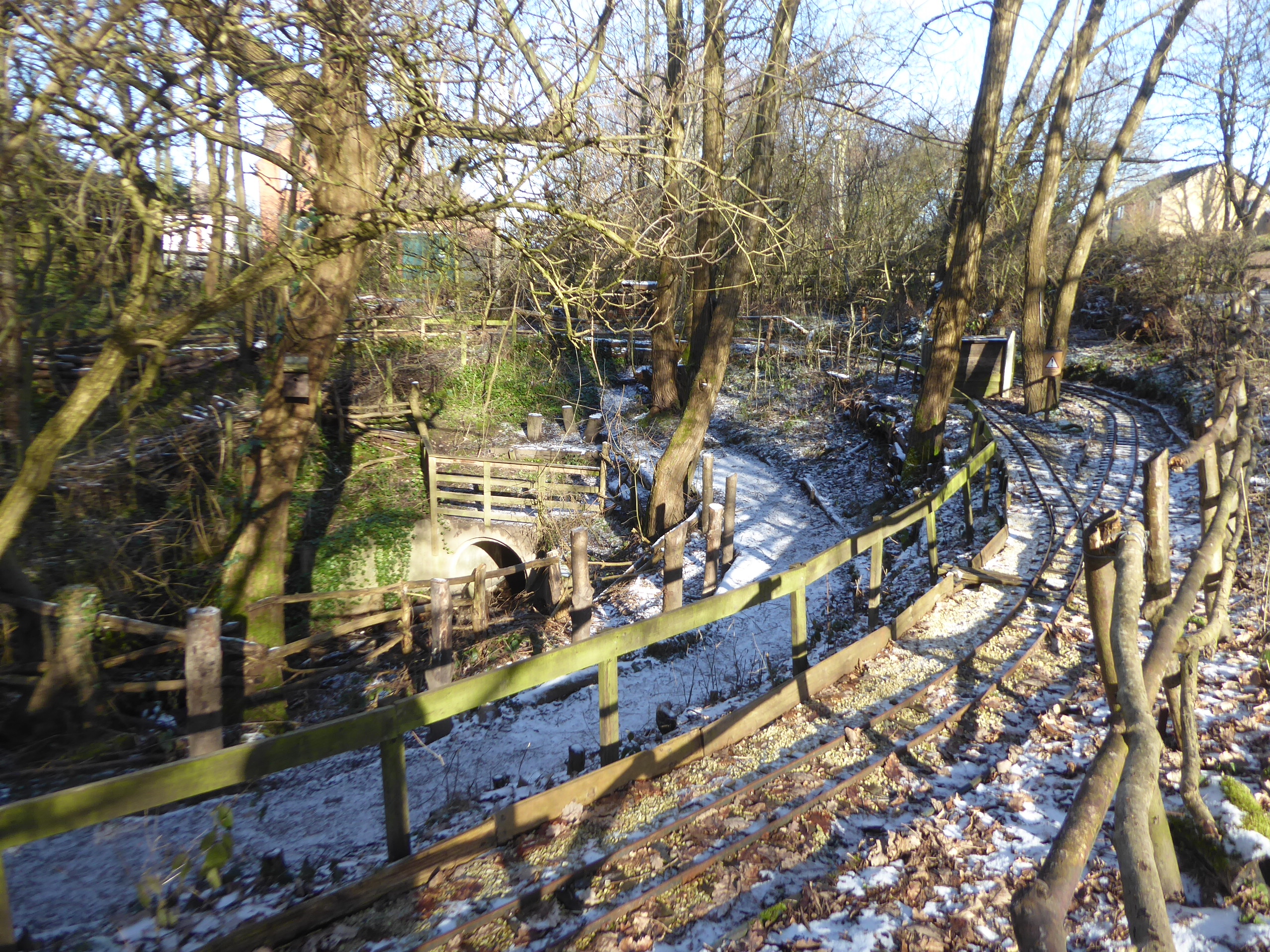
At the top end we meet the Churwell Woods miniature railway, which is, despite its scale, a pretty impressive feat of engineering as it forms its loop above the beck, which itself makes its own deep passage under the road at the northern perimeter, beyond which we can join Daffil Wood, home to the Churwell Urban Nature Reserve and the Smools Lane path, routes that we seem to have seen many times on our local transits, and as we're not going to be heading any further on to see Churwell Park, the path's here will be our northern apex before we turn back along the narrowest of enduring woodland ribbons through the suburbia. Across Westwood Side and Clark Spring Rise we head, and passing through Japa Wood, below the shadow of the former Lane Side mill site, before we join the pavements again, and head up to join the passage of Woodcross, taking us past an almost hidden mill pond on the way up towards the ginnel past the bungalows that leads us uphill toward the town again, past the allotment gardens on the side of Rooms Fold to join Rooms Lane by the house with the prospect windows that has since had its view spoiled by suburban spread. We trace through the vintage transitions of Morley's suburbia, avoiding the workmen doing roadworks, and take a detour into the yard of St Peter's parish church, to take a closer look than usual at this oft-seen Victorian pile with its slender spire and its excess of tall lancet windows, getting a look at all side of it before finding that the way out to Victoria Road via the Lychgate and the church hall gate are both locked and we have to leave the way we came in, to finally cross over by the former Prospect Hotel and join Church Street, to lead us past HH Asquith's house, and the old Co-op, and the eponymous Chapel on this Hill. We then turn onto New Bank Street, from where we can seek our last park of the day, hidden beyond the terraces, where a concealed passage leads us down to Station Road Rec, which no longer has much formality to it but is good for dog-running and is probably the premier sledging hill in town, though it's all green today thanks to the sunshine exposure, all sitting a few minutes west of our end point at the bottom of the lane, beyond Dartmouth Mills, where our first loop of the year seals at the station at 1.10pm, with us feeling the need for lunch and a warming brew post haste, but thankfully not frozen at the extremities by a day that never breached 0C, even at its peak.
 |
| Churwell Woods Miniature Railway. |
 |
| Japa Woods. |
 |
| St Peter's Parish Church. |
 |
| Station Road Rec. |
5,000 Miles Cumulative Total: 4749.1 miles
2021 Total: 7.0 miles
Up Country Total: 4286.1 miles
Solo Total: 4422.5 miles
5,000 in my 40s Total: 3342.9 miles
Next Up: Circuiting the local Main Roads, Part One...


No comments:
Post a Comment