14.5 miles, via Fleet Mill, Lemonroyd Bridge, RSPB St Aidan's, Shan House Bridge,
Methley Cut, Caroline Bridge, Lowther Colliery, Wood End, The Linesway, Allerton Bywater,
Newton Ings, Newton, Fairburn Ings, Fairburn, Brotherton, Byram, and Ferrybridge.
 |
My New Lumix is Ready to Go, &
Old Lumix becomes a Paperweight! |
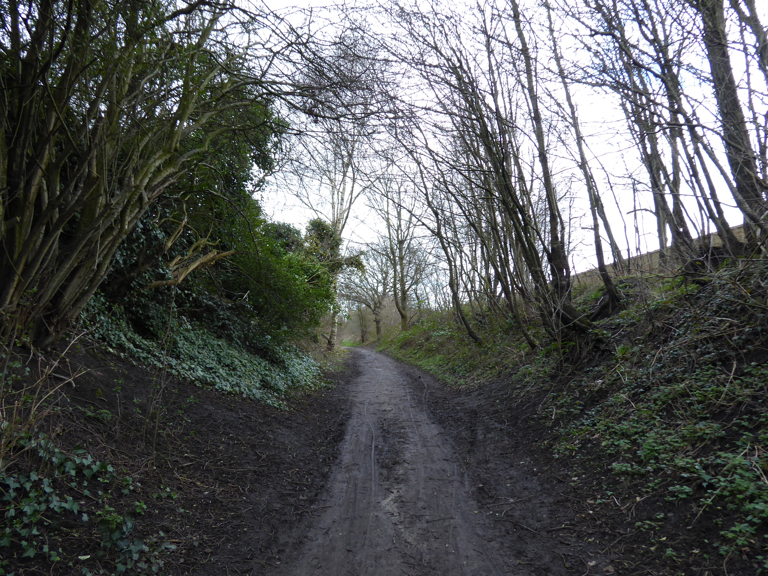
After the expiry of my old Panasonic Lumix, and the temporary revival of my old Fuji Finepix, we are compelled to introduce my third camera of my walking career, another DMC-TZ70 which I managed to acquire at very short notice via John Lewis's, at a pretty modest price seeing that its model has been superseded a couple of times since I got my original one, while I'm not looking to upgrade as that would be an unnecessarily expensive and complicated business when I need my tool to be as ready to go as I am, and thus the black model replaces the silver one, restoring to my arsenal all the familiar benefits and drawbacks that I've grown accustomed to over the last four years, with the important reminder to try to keep it dry whenever possible. Thus armed we set out again, questing for the remotest of the Five Towns, travelling to Woodlesford to find it further away in time than it is in distance at the southeast corner of greater Leeds, alighting at 10am, and aiming a path down the course of the lower Aire valley, joining the pavement of the A642 and following it down to the canal were we join the path alongside the wide channel of the Aire & Calder Navigation, and follow its long length down to Fleet Bridge wharf, where the oil depot is gradually getting demolished and rise to the embankment of the river Aire, which we'll be tracing along the length of the section that we re-chanelled after the catastrophic flooding of 1988. All the river below the former opencast pit of RSPB St Aidan's is wholly man made, to be crossed above the weir at Lemonroyd Bridge, and leading us directly into the bird sanctuary, where the originally planned path has to be traced to its west, just to check that the path through the northwest lakes is indeed still flooded, with the floodwater still not going away after a month, before we resume our eastern track, taking us past a reedy lagoon, formed by the old river course, and the old Lemonroyd Lock chamber, and the old canal channel beyond, isolated by the passages of both having been completely re-dug, a short distance to the south.
 |
| The Aire & Calder Navigation's Woodlesford Cut. |
 |
| The redirected River Aire and RSPB St Aidan's. |
 |
| The Northwest Path is still flooded. |
 |
| Old Lemonroyd Lock. |
While we are here, we also need to check on the central causeway, to see that it too is still underwater, and resolve to make any future visits to this site in a drier period before we return to the trajectory downstream, crossing the Aire to the south bank via Shan House bridge, and joining the track above the deep channel as it flows east, behind the expanding reach of Methley–Mickletown, and the old colliery site, taking us along the Leeds Country Way route for a stretch, before rising onto a high bluff, with most of the views obscured by trees, along the riverside to Caroline Bridge. We’ll not cross here yet, despite it being the last crossing above the Aire-Calder confluence, as we have something interesting to seek out beyond the end of the decent track above Pit Lane, as beyond lies what looks like the remains of the eastern end of the old Navigation channel, on the map at least, to be observed from the high protective embankment created above the low fields east of Mickletown, with two clear ponds to be seen at the far end, looking like an obvious remainder of the Methley Cut pound, ahead of the site of Kippax Locks, now lost below overgrowth at the riverside. We could wander down to the site of the Allerton Bywater ferry at Boat Lane, but we’ll return along the hard path south of the embankment, which a closer examination of the old OS map reveals is actually the old towpath route, and the flood barrier sits where the pound had lain, making the ponds appear to probably be excavation remnants from the redevelopment of the landscape some 30+ years ago, rendering this detour slightly pointless, despite satiating a small amount of historical curiosity about the redirected river as we return to Caroline Bridge and the north bank, where we'll not be bothering to detour again to see the Lowther Lakes.
 |
| The Central Causeway is still flooded. |
 |
| Riverside walking, by Methley-Mickletown |
 |
| The Flood Embankment, east of Mickletown. |
 |
| The remains of the Methley Cut? |
 |
| The original Towpath route? |
 |
| Crossing the Aire via Caroline Bridge. |
After three digressions and almost two hours of walking, we’re still in the vicinity of where we started out, and it feel like we ought to be getting a move on as we trace the dirt path over to the RSPB St Aidan’s outlet channel, where the coal staiths at the riverside used to dwell, returning to the hard track to the east of the mine site as the old pit road leads us up to the Lowther Colliery site once sat, where rails embedded in the concrete can be found at the west end of the railway yard where the coal wagons where marshalled for a century, at the end of the spur that came off the line to the east. Having done river and canal along the passage of today, we’ll add railway walking to it as we join the route as it gets squeezed in between the suburban edges of Hollinhurst and West End, passing over Leeds Road by the KE7 WMC, and curving around behind the West End estate before leading us onto the Linesway path on the old NER Castleford to Garforth Line, retracing it east on the rising embankment behind the estate, which appear to have been constructed entirely out of mining spoil, interrupted only by the passage of Doctor’s Lane, and providing a bench to rest on as we take late elevenses. Finally, we can be on our way east properly after descending to Park Lane, and having examined the foot tunnel below the embankment, taking us around the top edge of Allerton Bywater, getting onto a hard surface after so much off-roading, taking us past the Kiln Park industrial estate and Tesco Express store, all constructed in wood among the reach of suburbia, and getting sight up to Ledston Hall on the way over to the A656 Barnsdale Road crossing, getting us back onto Newton Lane behind the factory complexes, again.
 |
| The RSPB St Aidan's outspill. |
 |
| The remnants of Lowther Colliery's Railway yard. |
 |
| The colliery spur, West End. |
 |
| The Linesway above West End. |
 |
| The Lineway above Allerton Bywater. |
 |
| Park Lane, Allerton Bywater |
After only a week away, we can find that the Newton Lane Ponds have not had their flooding issues endure, and we can thus make start our eastward passage drily and not having to detour via Ledston village as this country lane leads us quickly to the edge of the Fairburn Ings RSPB site, eschewing to option of a detour down Arrow Lane to look at Castleford Viaduct and the ponds of Ledston Ings as we need to stary on a clear course now, with the morning gloom finally lifting as we progress on, above the flooded fields of Newton Ings, where Highland Cattle graze below the landscape disturbed by coal mining. The proximity of the finish line is illustrated by the presence of the remaining cooling towers of Ferrybridge power station sitting on the horizon, as we stick to the road verge, getting the evolving view over the ponds to the south, wondering if the stone wall fragment in one place is a small remnant of the site of Newton Abbey, claimed on old maps, ahead of the arrival of Newton hamlet, one of the tiniest settlements I’ve ever encountered, judging by the distance between its signs, amounting to little more than a few stone cottages around Newton Farm, perched above the fields. The lane beyond leads us up to the main buildings and car parks of the Fairburn Ings RSPB preserve, right on the edge of West Yorkshire, where we slip into North Yorkshire as the path settles us in above the large lake that forms the main bird sanctuary, which is pretty certainly man-made, by quarrying or mining in the low land by the riverside, now forming a calm surface beyond the surrounding fringe illuminated by the bright sun from the south, without much by way of habitation in its western reaches, with only the hamlet-let around Beckfield quarry giving a secluded residential aspect over the water.
 |
| Newton Lane is no longer flooded! |
 |
| Newton Ings. |
 |
| The remains of Newton Abbey? |
 |
| Newton Hamlet. |
 |
| The hamlet-let around Beckfield Quarry. |
 |
| Fairburn Ings. |
Take a watering break at the last available viewing point, before the road wanders away from the shore, with our old friend in the waxing gibbous moon making an appearance in the sky as we approach Fairburn village, spying the rise of Caudle Hill to its north but still being surprised as the road pulls us uphill after so much level going, bringing us in among the suburban growth that seems to have jostled to get the best views to the south west, elevated on its bluff, ahead us coming up past the village gaol, carved into the rocky cliff face, and our previous passage into the village. Silver Street angles us south, revealing the view to the far side of West Yorkshire on the far horizon, and putting Ferrybridge power station back on the horizon as we pass among the ruggedly hewn farmsteads and suburban cottages at this corner of the village, passing St James church and the neighbouring recreation ground before our quiet passage ends rather suddenly as we find ourselves meeting the old Great North Road, the contemporary A1246, which we’ll pace the side of as it rises above the railway line east of Castleford and the modern A1(M) as it cuts across the settling beds on Brotherton Ings. It’s a perch that reveals the we’re on the last rise on the western edge of the Selby Levels, which await a future revisit, as we quit the superseded A1 and join the old bypass road above Brotherton village, pausing for one last watering break and giving my sore feet a breather before we progress on, getting a perspective on the other side of the village, as we pass its chapel and schoolhouse at the roadside, and over the railway line emerging from its tunnel and the bypassing A1246, ahead of the Thaal Indian restaurant on the corner of the A162.
 |
| Caudle Hill and Fairburn Village. |
 |
| Fairburn and its cliff edge. |
 |
| Fairburn and the Ings, looking west. |
 |
| The A1(M), crossing Brotherton Ings. |
 |
| The remains of Ferrybridge Power Station, from Brotherton. |
 |
| The Old Great North Road, Brotherton. |
It’s a real tangling of lanes in these parts as we pass Brotherton village hall, and the Byram Park social club, in the knot of woodland above the former Byram Park and the suburban village that developed on it, as we are drawn with the pavement over the A1246 as it splits from the A162, keeping us with the latter as we push east of Brotherton, getting a clear sight over the diminished Ferrybridge power station, where only three of its eight cooling towers remain, while none of them endure at Eggborough power station, far off to the east, as it gradually gets demolished. Come down to the Ferrybridge itself, and return to West Yorkshire while crossing the 18th century John Carr bridge again, to admire the Aire’s other crossing in the vicinity as we return to the south bank, and again get tangled up with the bypassing roads as we pass the toll house and power station entrance, joining the old Great North Road as it passes west of the village, parallel to the railway where the Drax-bound Bin-Liner passes ahead of us meeting the old village school and our route under the old A1 and onto Ferry Bridge High Street, tracing it south as it comes down to the split point on the old bypass, under the railway lines and alongside the A162 for the last time. Leaving Donacaster Road, we come around to the last corner and join the A645 as it leads up the last nab of the day, taking us over the railway bridge above Knottingley junction and leading us into the very edge of the fifth and final of the Five Towns, on a diminishing pavement before we come around by the thankfully revived Railway Hotel, and our path down to the railway station itself, to conclude the excursion at 3.30pm, with the afternoon sun really giving a feeling of a Spring about to be sprung before our long train ride home commences, a mere ten minutes distant.
 |
| The tangling of the A1246 and the A162, Byram. |
 |
| The pylons leading to the increasingly absent Eggborough power station. |
 |
| The Ferrybridge Toll House. |
 |
| High Street Ferrybridge. |
 |
| Quitting the old Great North Roads. |
 |
| The Railway Hotel (revived), Knottingley. |
5,000 Miles Cumulative Total: 5371.5 miles
2022 Total: 87.8 miles
Up Country Total: 4909.5 miles
Solo Total: 5040.9 miles
5,000 in my 40s Total: 3966.3 miles
Next Up: From the Five Towns to the Big City.


No comments:
Post a Comment