14.8 miles, via Lane Head, Slead Syke, Hove Edge, Broad Oak, Hipperholme,
Common Wood Head, Jum Hole, Lane Ends, Stone Chair, Cock Hill, Hunger Hill,
Queensbury, Hill Top, Fox Hill, Mountain, Raggalds, Keelham, Denholme Clough,
Denholme Gate, Denholme Mills, Denholme, Lodge Gate, Doctor's Bridge,
Manywells Height, Cullingworth Gate, Cullingworth, Cow House bridge, Hill End,
Harden, Low Park, Birkey Bank Wood, Holme House Wood, and Ireland bridge.
I'd hoped that the passing of my 5,000th mile in the walking career would be marked somewhere dramatic, in a landscape worthy of the achievement, but the location I'd had in mind for a while would involve a long trip away, and right now I'm still not in the mood to cram myself onto a Dales-bound train with all the others who've grown to love the great outdoors during these pandemic times, and thus we'll save that idea for another day, as I've still got three more 5,000 mile targets to hopefully attain before we get to turning 50, still three years distant from now. Thus we ride to Brighouse, as our westward progress up the Calder valley continues for another start new start line as we aim our routes towards the Aire still, alighting at 8.55am under gloomy skies, some 40 minutes ahead of the day's sunshine, and we're short of original route to take when heading north, over the River Calder via the A641 bridge, between the climbing walls on the mill and flour silo on Mill Royd Street, and over the Calder & Hebble Navigation via Anchor Bridge, beyond the western end of the town and joining the tangle of the main roads as we rise to the island at the end of Ludenscheid Link. The new path thus starts as we rise with the A644 Halifax Road, rising through the villa district of the town, with the Brighouse Library and Art Gallery sitting in the midst of the smart houses, as does the ambulance station, and the Success Chinese takeaway, which is a nice auger for the day's progress, with our northwesterly trajectory taking us beyond the terraced district of town, to the south of Lane Head Rec, and on into the swelling suburbia, which has grown around the urban hamlet of Slead Syke and the associated big houses concealed in their grounds. Uphill all the way feels like it's going to be the order of the day as we rise past the Charles Kershaw nurseries, as the suburban front falls away from the west side of the road, as we draw up close to the valley edge above the passage of Red Beck below, while the road still manages to roll some as we meet the urban village at the top of Brighouse, Hove Edge, where we are flashed a view of the ridge passage to come to the north, ahead of passing St Chad's church and the Dusty Miller inn, all dressed up to mark the arrival of the Euro 2020 tournament, a year behind schedule but still feeling like its come too early.
 |
| The Flour Silo, and the Navigation, Brighouse. |
 |
| Lane End Park, Brighouse. |
 |
| St Chad's, Hove Edge. |
The countryside appears to arrive beyond, but it turn out to be barely wider than the playing field of Brighouse Juniors FC, as an industrial band follows, as an aggregate yard and multiple factories cluster around the Broad Oak terrace, a landscape that looks like it could soon become much more residential after the demolition and leveling of the extensive Crosslee plant, beyond which Hipperholme's church spire rises, advertising the next settlement up the road so soon, met as we pass the old mill that doubles as a motorhome garage and the Halifax Steam Brewery, with it own bar, the Cock o' the North, attached. The village then clusters to the roadside as we rise among the terraces to meet the crossroads by the chapel and the Whitehall inn, which is need of a new tenant, if anyone is willing to ru(i)n it, and over the A58 our route uphill continues with the Denholme Gate Road, beyond the Co-op and through the surprisingly large spread of suburbia up the hillside, past the Grammar School and the Hare & Hounds inn and reaching on to the fields of Old Brodleians RUFC and the stray terraces, without an immediate reason for their removed location at Common Wood Head. The A644 going north os one of the great hidden scenic routes in West Yorkshire, and it's as good a place as any to mark the ticking off of the first 5,000 miles of my walking career, which comes as the road skirts the upper reaches of the deep cleft formed by Jum Hole Beck as it drops away to the southwest, one of the branches of the Red Beck - Shibden Dale valley that hides its drama from nearly all travellers, where we can briefly bask in our latest milestone being passed, admittedly so far ahead of my 50th birthday as to make the concept of '5,000 miles before I'm 50' seem rather meaningless. So move on, with only 300+ miles to go until my next target, skirting the head of the valley-let, past Sawood House and the Coley Bar cottage, just down the hill from the local parish church that seems to lack a village, even though an odd little close has grown up behind an old farmstead at Cinder Hill, while the pub beyond would have all the view potential over the cleft below, if it wasn't for tree growth, and it also advertises itself as the only Brown Horse in the county, which doesn't seem like a brag until you register how many Bay Horse inns you might encounter elsewhere.
 |
| The absent Crosslees plant, Broad Oak. |
 |
| Denholme Gate Road, and the Grammar School, Hipperholme. |
 |
| Jumb Hole, and 5,000 career miles walked! |
 |
| The only Brown Horse in Yorkshire. |
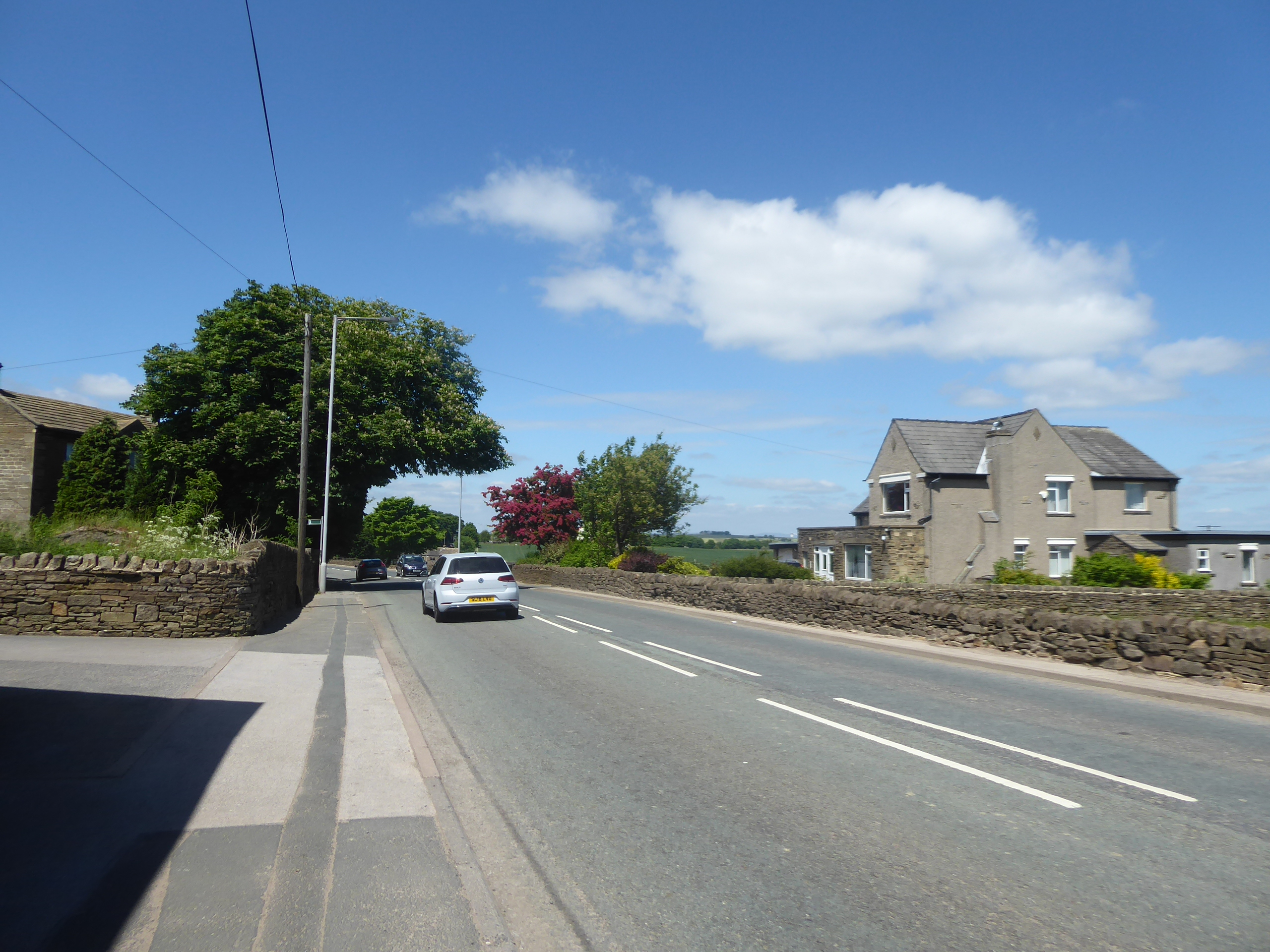
The keen eyed will have already spotted the proximity of Northowram to the west of us as we rose, and the hamlet of Lane Ends offers the passage of possibly the level-est road to access it, as well as a surprisingly large area of commercial trucking yards among the greenery, beyond which we climb further, passing the Laura Brannan Equestrian Centre, and the boldly stated but rather short tree-lined driveway to Hargreaves Head house, before we hit the foliage clad passage up to the bottom end of Stone Chair, meeting the suburban termination as we merge with Coley Road. It looks like there's an old road shadowing this turnpike too, but we'll keep to the 'new'road as we again start to graze the very outermost edge of greater Bradford, meeting the traffic island with the A6036 and rising to the older settlement beyond, where the high landscape shelf is met to offer the elevation of the distant southwestern horizon behind us, before we briefly water at the stone chair itself, opposite the Duke of York inn, with its improvised beer garden marquee outside, and then rise back into the countryside, beyond the low rise blue cottage at the roadside and the redeveloped grounds of Spring Hall. That wide apron of fields below the Calder watershed is thus met, with the road rising beyond meadows full of buttercups and grazing horses with our reverse horizon ever evolving, soon dropping upper Shiben Dale into the fields to the west, with the Calderdale hills soon rising beyond, while the downstream Calder valley soon appears to the southeast as we pass Dundee and Ash Tree farms, before a sort of agricultural chaos seems to take over the landscape ahead of us, as we past the yard of another used truck dealership and an apparently improvised quarrying operation. It's hard to put an identity on this location, as Cock Hill is the nearest name on any map, though Pepper Hill or Barms Hill, after the nearby hamlet or farm could be equally appropriate, so instead we ought to focus our attention towards Queensbury as it rises ahead, at over 300m up, and despite having come up here recently, a short way off to the east, and crossed this route as recently as 2017, it all seems a bit alien to me up here, so perhaps things will get more familiar as the name of Hunger Hill lands on the map, with the Brighouse Road tracking us into Queensbury between its council houses and golf course.
 |
| Hargreaves Head lodge. |
 |
| Brighouse & Denholme Gate Road, Stone Chair. |
 |
| The Calderdale view, from the watershed plateau. |
 |
| Ascending Cock Hill and Hunger Hill to Queensbury. |
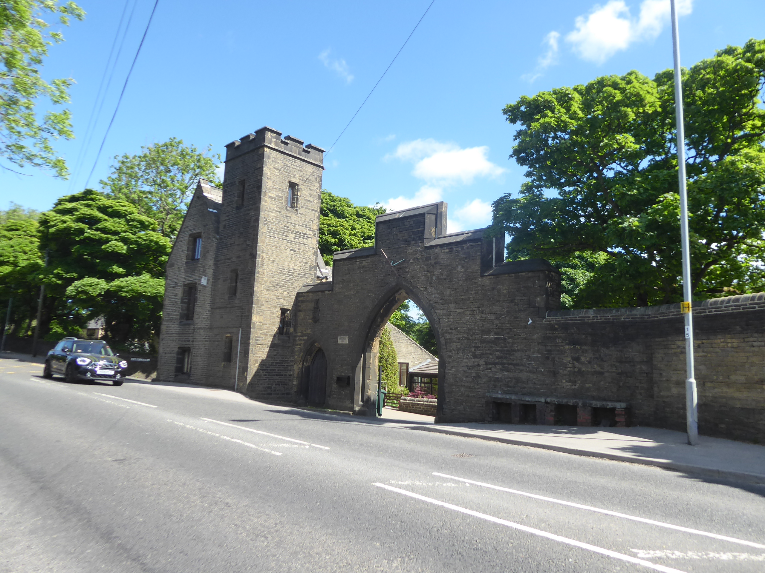
The run into the town is longer than expected, tracking past the long wall of what appears to be a park, complete with lodge and gate, which turns out to be suburban development on the grounds of Harrowins house, all part of the swell that has grown below the Tesco store and the opening out to the view of the massive southern frontage of Black Dyke Mills, which we track the western side of at close quarters up to the crossroads with the A647 by the Prince Albert memorial fountain and the Queensbury tavern with the High Street reaching west with the rising Calder - Aire ridge. The mystery of exactly where we cross the watershed is deepened as our road rises beyond, and doesn't relent, despite the fact that the hillside is clearly falling away to the northeast, as the town's terraces and closes sit loftily abounds, with the bulk of it to the south of us as the A644 keeps going up steadily up, passing the George III in and the Hill Top playing fields as the view teases its appearance, but stays mostly concealed until we are past Queensbury Park, the Pineberry inn and the Fox Hill primary school, perched on its plot on the wrong side of the road. The reveal is met beyond, over the valley of Thornton Beck and across west Bradford to middle Airedale and the bulk of Rombalds Moor, one of the finest secret views in the county, one which My Mum continues to travel to see when going north from mine since first meeting it by chance in 2013, and it'll do well to be my foreground for an early lunch break, where I can make a call to tell Mum that my 5,000 miles marker has been passed, and to display some of the elation and good cheer that comes with being mid-trail, rather than being completely gassed, like she usually sees me. Resuming on a steady northwesterly route along the footway, we meet the hamlet of Mountain, the last urban corner of greater Bradford, where the Speak Institute house holds the most prominent of viewpoint plots and the neighbouring home of the Bradford Sub-Aqua Club, in the highest village in the district, never fails to raise a smile, and it's here, by the Harmony Place terraces, across from the old mill sites, that the Brighouse & Denholme Gate Road finally crests, meaning that it's theoretically all downhill from here.
 |
| Harrowins House lodge, Queensbury. |
 |
| Chapel Street corner, and the still-rising road, Queensbury. |
 |
| The revealed view over Thornton and Airedale. |
 |
| Harmony Place terrace, and the road crest, Mountain. |
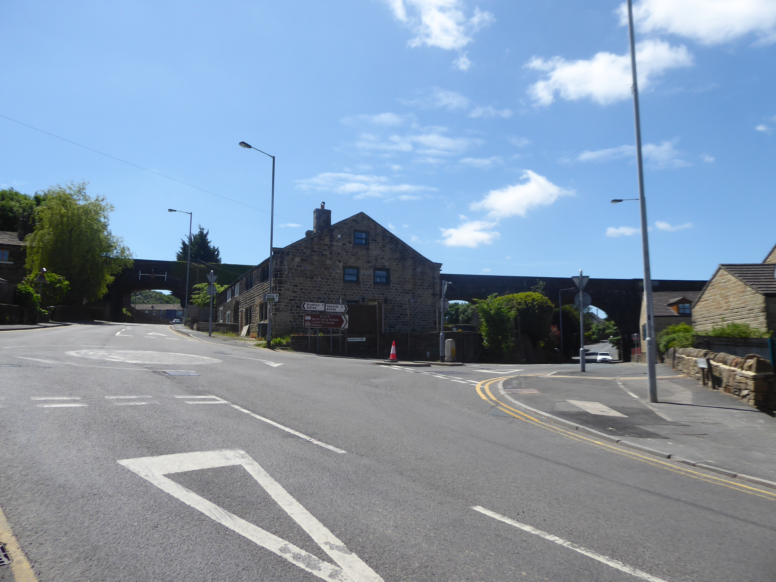
Start a new trajectory across this quarter once we are past Old Guy Lane, our last path up this way in 2017, with the fields of Queensbury Celtics FC arriving ahead of us, as does the looming rise of Soil Hill, the 400+m lump on the ridge beyond the town, and as attention is drawn to our passage through the hamlet of Raggalds, home to the Queen's Head inn and a number of converging lanes, the fall of the ground to the south has us right up near the watershed again and looking directly down towards Illingworth and the upper reaches of Halifax, mere miles away from here. So that's a last look to the Calderdale horizon before it slips back behind Soil Hill, obscuring the views that way, so attention drifts to north instead, getting a feel for the spread of Thornton village along its valley and hillside below us as we pass the Travis House farmstead, moving below the flank of the watershed ridge and the seeming multitude of cottages that cling to it, before we Keelham Hall farm, and the Robertshaw farm store, which is doing a roaring trade today, ahead of the upper Airedale view reveal, extending our horizon all the way to the Yorkshire Dales horizon. Now descending with the road, we get Ovenden and Thornton moors rising on the high watershed ridge, and the valley of Denholme beck, and its company opening out ahead of us as we drop down to meet the Well Heads ridge as it merges in to the west of Thornton, meeting the hamlet of Keelham at the crossroads, which seems to be substantial enough to maintain its own primary school, but not a pub, at a remove from its larger neighbours, as the road becomes a one way stub ahead of the drop down to Denholme Clough, where we make our obligatory contact with the Bronte Way. Rise to meet the A629 by the former Denholme Gate inn, where the sharply merging roads would not form a plausible junction if traffic were bi-directional up to Keelham, and thus we settle into the valley landscape that will form the latter part of this trip, with us looking initially over the Well Heads and Birk Hill ridges to the east as we move on, passing the Denholme Business Centre, which seems to be all pet stores and bespoke furniture manufacturers in the long, low factory site across the way from the Denholme House farm redevelopment and St Paul's parish church, very High Victorian and prominent at the roadside at a quite a remove from the village, where there probably wasn't enough level ground to accommodate it.
 |
| Soil Hill, and Raggalds hamlet. |
 |
| Turbines on the flan of Soil Hill. |
 |
| Keelham crossroads. |
 |
| St Paul's, Denholme. |
We slip off the pavements for a bit as we meet Old Road, which takes a shorter routes across the clough of Carperley Beck, deep enough to accommodate Stubden Reservoir to the west of here, and it's a rough track down by Dean Brow farm, gouged up by a lot of running water, followed by a sharp ascent up the far side, below the plinth of the new houses arriving on the site of Denholme Mills, which at least gives a reason for this village being here, which we meet at the top of the rise, with its smarter than usual terraces reaching out from the Main Road, which we meet again past the top of Station Road. So its vintage is explicable, as both a rural and industrial village, but its suburban appeal passes me by, despite the road access to four towns at not a huge remove, and I'll admire the older parts of the village as we reach beyond Lodge Gate, where the newer residences have swelled on both sides of the lane, before we meet the old Congregational chapel and the view beyond the cricket field, which places Hewenden Viaduct in the middle distance, enhancing the aesthetic appeal of this road even further, before the tapering of the village commences past the New Inn, terminating past the Low Fold and Denholme lane farmsteads. We're definitely starting to feel the afternoon heat as we pass back into the countryside, with the downstream view evolving to the northeast, and despite passing the signage that marks the limit of Denholme, and shifting back into a landscape of farmsteads, greenery and welcome blocks of shade under the trees, we can still find a single close of houses at Beech Grove beyond the limits, ahead of the drop of the lane down to Doctor's Bridge, over the flow of Milking Hole Beck and then up to Manywells Heights, where the A629 breaks away on its lofty path over to the Worth Valley along the edge of Black Moor. We'll join the B6429 by the converted farmstead at Ripon House, an apartment complex at quite a remove from anywhere, making for a north-easterly trajectory to the finish line as we finally start to come down from the high land that we've been on for a while via Manywells Brow, passing around the wooded banks that conceal the quarries that have been used as a landfill, while Cullingworth starts its apparent drift up the hillside, with the outlying Sand Beds terrace looking like it may soon be consumed by the swell of a pair of suburban developments, with the Hewenden Ridge one claiming a brown field site, at the very least.
 |
| Old Road, Denholme. |
 |
| Congregational Chapel, Lodge Gate. |
 |
| The cottage and farmstead landscape, beyond Denholme. |
 |
| Descending Manywells Brow. |
The other takeaway from travelling along this route is that Cullingworth Viaduct has a unique ability to remain hidden, even from an elevated angle from the southwest and up close, where it could be mistaken for a single span bridge as we pass under it, confirming that the best view of it really is the one from outside the Fleece Inn on the Haworth Road corner at Cullingworth Gate, beyond which we turn our attention to the appearance of the old village, with its long terrace blocks running along the west side of the road all the way down to the village's old mill site. Most of the ongoing commerce here seems to be centred around the Co-op store and the antiques centre, and the cenotaph gardens along the way, across from the main chapel and the parish church of St John, offer a spot for a shaded rest to finish lunch before the Bingley Road id rejoined to take us downhill off the village's level plateau, between the cricket club and the George inn (KG2 if I'm identifying the portrait correctly), taking us down the tree-clad passage down to the cottage cluster at Cow House bridge, where Woodfield Mill has had its makeover and we pass over Eller Carr beck. We'd seen this rise coming from above the village, and thankfully its not as hardcore as it appeared from across the way, taking us past Cow House farm, which it the third one seen today that's had a residential do-over, and rise ourselves above the sea of greenery below, with Royd and Pellon Woods coating this side of the valley and Goitstock Wood rising beyond, while above us we have the quarried end of Catstones Moor and Hunter Hill plantation as we rise to get the reverse view back to path just traversed off the high watershed ridge, and the sight of Wilsden village across the valley. The northeasterly look at the road crest frames Baildon Hill ahead of us, far downstream, and as the road falls and rises among the fields on this valley side, we get fine visualisation of the many woods of the Aire Valley, as we are certainly not short of them in this quarter, rising both above and below as we follow the streams flowing away, and that ought to be a good reminder to acquire my next volume of Christopher Goddard's ongoing series as we rise to Hill End, and its farm, beyond which the suburban spread of Harden Village is met, the only one of the four local villages that didn't get a station on the GNR's old line.
 |
| The best possible view of Cullingworth viaduct. |
 |
| Parish church and chapel, Cullingworth. |
 |
| The secluded woods of the Aire valley, above Harden. |
 |
| Hill End, and the way to Baildon Hill. |
Slip to the shaded side of the road as Long Lane takes is passage downhill, with the backdrop of the forestry of the St Ives estate rising above it, while the terraces stretching down to the Golden Fleece inn seems to have created some issues as the need for road parking appears incompatible with the traffic movement, causing fun and games all the way down to the village school and St Saviour's church on the Wilsden Road corner, by the Wart Memorial and Congregational chapel, and across from more suburban arrivals in the village landscape, themselves across from the Spring Row terrace. At least there's leafiness and the village park to be met beyond, ahead of the cricket club (creating its own parking issues), the Woodbank Garden Centre (another theme for this quarter), and the stray bock of council houses above the roadside, with Ruin Bank wood rising on the far side of the valley to the south beyond Harden Grange, and the open parkland fields of Low Park, rising above, though mostly concealed by high walls and framed by Cuckoo Nest Wood, as the lane undulates further, as if it can't quite commit to being downhill all the way to the Aire. Greenery rules the surroundings completely as we slip into the woodlands that reach down below the St Ives estate, with Birkey Bank making the first appearance, opposite the park's main entrance, before we have Bell Bank wood coating the slopes above the B6429 and Holme House wood reaching steeply down to the banks of the river Aire, which feels like it ought to be visible ahead of the sharp turn and decline of Harden Road, to rather suddenly land us by the Brown Cow inn and the passage over the river via the Millgate (or Ireland) bridge, arriving us in Bingley. Take the right turn onto the main drag of the B6265, where a local eatery, or drinkery, could easily have been found to celebrate today's momentous achievement, if I'd been able to rustle up a receiving party, but it's honestly too warm to consider lingering anywhere, and so we cross to Park Road and the way to Bingley railway station, where it's extremely cheering to find that the Stationmaster's house has been redeemed, and our day can wrap at 3pm, knowing that if there is a need for booze and a dirty burger for the occasion (and we all know that there is), we can get that at home, after we have showered and refreshed ourselves.
 |
| Long Lane terrace, Harden. |
 |
| Low Park. |
 |
| Below Bell Bank Wood. |
 |
| Bingley Main Street. |
5,000 Miles Cumulative Total: 5011.6 miles
2021 Total: 269.5 miles
Up Country Total: 4548.6 miles
Solo Total: 4680 miles
5,000 in my 40s Total: 3609.4 miles
Next Up: Testing out a moorland road, betwixt Calder and Aire, against My better judgement.


No comments:
Post a Comment