14 miles, from Morley Station, via Troy Hill, Scatcherd Park, Bruntcliffe, Howden Clough,
Brown Hill, Birstall, Gomersal (station), Birkenshaw Bottoms, Birkenshaw, Tong Moor,
Cross Lane End, Tong, Roker Lane Bottom, Farnley Park, New Blackpool, Farnley Wood,
St Bernard Mills, Rooms, Clark Springs Wood, Lane Side, and Daisy Hill.
Having spent the bulk of my just-passed 10 day weekend making myself useful elsewhere, we return to the trail, having passed the first anniversary of the start of our first national lockdown and finding ourselves at the hopeful end of our third national lockdown, a situation we probably hadn't imagined when we rolled into that long weird Spring of 2020, but at this time around, we can start to imagine trails a bit further afield once the 'stay local' restriction ends as of next week, and thus we aim ourselves into the last local circuit for this phase of the Covid pandemic, at least. Our targets all lie to the west and north of Morley, so it's natural that we will pick our eastern start line for this occasion, departing Morley station at 9.25am, and heading up Station Road as far as Dartmouth Mills, and joining the ascending footpath that rises up the wooded angle above the valley and the recreation ground, up to Albert Road and across to the bottom of Troy Road, and continuing the ascent onto Troy Hill, possibly the most pronounced of the town's seven, along the terraced parade on the south side. At the top we meet St Mary's in the Wood, with the church building still derelict after being gutted by fire in 2010, and its graveyard looking increasingly forgotten in the interim, a site we skirt around as we drop out onto the top of Queen Street at Coffin Corner, before heading up Queensway, passing Scatcherd Park, Morrisons and the leisure centre on the way up to Corporation Street, which is crossed as we make our way forward through the council estate along Wynyard Drive. We're obviously varying the routes so we aren't always making the exact same footfalls, but emerging onto Bruntcliffe Lane again, it's equally clear that we are running short of dynamic routes after all these local walks, and thus everything remains familiar as we pace on up the A643, beyond the cemetery and the school on the rise up to the cross roads, where every plausible crossing option has already been used this year, heading on south past the Bruntcliffe Club and downhill beyond the Methodist Chapel and the Cassellie plant, and over the M62. Southwest again we head with the Howden Clough Road, past the outying terraces and the expansive view over Kirklees district, and through the edge of Birkby Brow woods as it reaches up to the roadside, descending to the bottoming out by Howden Clough mills and the stream that feeds the valley, where it's already been noted that neither Leeds or Kirklees seem to want to claim the valley floor, according to the signage, and as we rise among the terraces at the edge of Howden Clough village, a novel route forwards needs to be sought.
 |
| The Station Road to Albert Road short cut path. |
 |
| St Mary's in the Wood, still derelict after all these years. |
 |
| The Bruntcliffe Club, at the Cross Roads. |
 |
| Birkby Brow woods and the bottoming out of Howden Clough. |
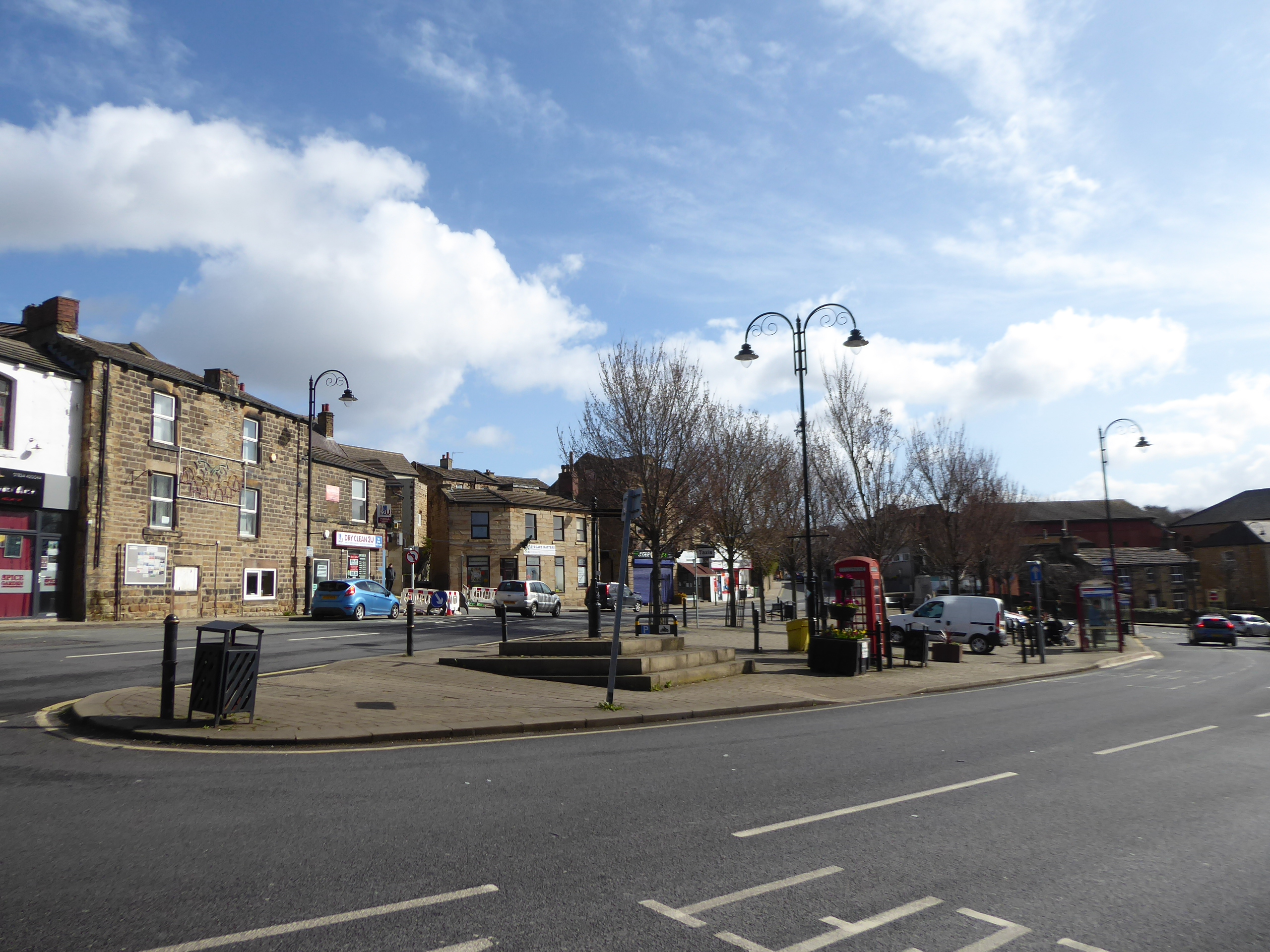
So past the Mission centre and the Manns Buildings terrace, we depart the A643 to join the Upper Batley Lower Road, as it wanders among its own terraced company before opening out, for the view down Howden Clough and down the embankment of the GNR's old line from Batley up towards Adwalton, with its notably missing bridge, where we turn onto Windmill Lane, where the reaches of both Birstall's suburbia and council estates butt up against the road, through the presence of both the Batley Sports Centre and Girls School means it larger neighbour might still be claiming this hillside. The point of interest among here is the Brownhills windmill, unfortunately concealed in the grounds of its eponymous primary school by a hedge that's almost visibly impenetrable even without foliage, which makes it almost tempting to ask a window cleaner across the way if I could borrow his ladder to spy the headless tower, but passes mostly unseen as we come out onto Upper Batley Lane, which is soon crossed as we start down Intake Lane, starting high above the edge of Birstall's valley, passing the Nook terrace and down among the suburbia that has grown up the side of Sugar Hill. This takes us down to the old Brown Hill settlement, where the school has become a Territorial Army recruitment centre and Brookroyd lane is joined a whisker above the old Birstall Goods line, which leads us past St Saviour's church among its company of smarter terraces away from the industrial valley floor, ahead of the drop down towards the A62, where the Huddersfield Road is crossed by the Old Wine and Spirits Vaults and Chapel Hill leads us up towards Birstall's centre, past the proudly located former Methodist Chapel and its Sunday school. Thus we land on Birstall Market Place again, acknowledging the statue of Joseph priestly once more as we process around its southern side before we tangle up with the A643 again, with Low Lane taking us past the Co-operative store and the main shopping parade before are soon past the town centre, and heading on beyond the Conservative Club and the Horse & Jockey inn, to meet St Patrick's RC church on the north side of the road, a relatively contemporary composition that has replaced the old church which has since been interestingly incorporated into an apartment complex on the Kirkgate corner.
 |
| The railway embankment by Upper Batley Lower Lane. |
 |
| The Brownhills Windmill, hiding from view. |
 |
| St Saviour's church, Brown Hill. |
 |
| Birstall Market Place. |
At the corner with the A651, we again meet the old schools complex, with the 1818 National School building in a Tudor kind of style at its heart, beyond which we meet the Bradford Road, which is to be traced past the terraces and suburban ribbons of Birstall as it reaches up its valley for about as far as is possible, tangling with Lockdown paths from this year and last as we go, noting that we've found another road that numbers houses in excess of one thousand, before the town's limit is met beyond the Scotland inn and the Oakwell Garden Products yard. That has us at the entrance of Oakwell Hall Country park, and across from Gomersall's former station again, which we still won't be exploring as we pass below the broken Bradford Road bridge of the New Leeds Line ahead of our next decisive turn, onto Moor Lane in the shadow of the railway embankment, and into the countryside space below the motorway, with the Gomersall Hall hotel complex on the one side and the open fields of Breaks farm o the other, with the lane rising steadily to take us under the M62 in the direction of Birkenshaw, our next target on the circuit. This village at the top end of Kirklees district has swollen to considerable proportions over the course of the last century, with its southernmost suburban reach soon brushing up on the lane's west side, but the interest is drawn from meeting the older corner at Birkenshaw Bottoms, where a long stone-built terrace sits at the road corner, across from a whitewashed farm complex, drawing some necessary vintage flavour into this suburb to nowhere-in-particular, ahead of the council house estates filling up the eastern edge of the village up the rising Birkenshaw Lane. It does at least seem the that eastwards spread of the village has been arrested here, as nothing of note has been developed beyond this one ribbon of semis, a pattern which continues past the A58 Whitehall Road, which we cross to continue up Old Lane, which displays some older features as we rise on, nearing the oldest and central part of the village, which seems to have done all of its growth on a north-south axis, bounded by this lane and the A651 Bradford Road, with the smattering of terraces and cottages at this end clearly holding all the vintage appeal, ahead of the Town Street corner.
 |
| The 1818 National School and companion, Kirkgate, Birstall. |
 |
| The Moor Lane retaining wall, on the Leeds New Line. |
 |
| The long terrace, Birkenshaw Bottoms. |
 |
| Vintage terraced flavour, Old Lane, Birkenshaw. |
Here we alight among the landscape of villas with large gardens, close to the village heart, which once held an out of town appeal away from the industry of Bradford and a rural aspect down the valley to the southeast, a landscape which we took in when the Kirklees way drew us up here in 2014, and those steps will be retraced as we rise up Station Lane, and then beyond as we pass The CofE primary school on the rise of the lane up towards the Aire-Calder watershed ridge, snaring our view back across the Calder's side as we meet the fields at the top of the village. The scrubby and open plots of Tong Moor sit at the head of the lane, as does our entry into Bradford borough, crossing the boundary and passing the site of Birkenshaw & Tong station, on the Ardsley - Laisterdyke line, on which Bradford's TNT depot (for distribution, not explosives) stands, with Cross Lane meandering on through the industrial unit landscape beyond, passing the Speedibake bakery complex and soon landing on the A650 Drighlington Bypass island at its end, which we scoot around by the Shell Garage to join the old turnpike route. On down the B6135 beyond Nawaab's restaurant and as far as the Lane End equestrian centre and the 6 Acres inn, where we take a left and join Tong Lane as it sets off down it own promontory in the green gap between Bradford and Leeds, scooting its way past the Lane End farm store and Shawfield fame before allowing us a view towards Leeds down the southern side across the valley of Tong Beck, or Cockersdale if you prefer, before we come around below the Tong garden centre, which is doing roaring lockdown trade, and the way towards the village, with views northwards in shorter supply than recalled. Having passed New Lane and looked south to Gildersome, and felt close to home again, we come around past the Tong Holiday Inn, still in a puzzling location to my eyes, before we come down on the village, passing the exits to the Parkwood outdoors facility and the Tong Hall business park, before landing by St James's church and the ancient and whitewashed Church Farm, where it feels like time for a brew as we're past the middle of the day and the circuit, where a few minutes off my feet for snacking turn into a quarter hour in the sunshine.
 |
| The Villa Landscape, Station Road, Birkenshaw. |
 |
| Among the industry at Cross Lane End. |
 |
| The Tong Valley, and the view to Leeds. |
 |
| The Holiday Inn, Tong. |
Back on our feet, we head on northeastwards, through this village that has done so well to resisit the expansion that has afflicted so many others, while keeping new arrivals to a sympathetically designed minimum, a thought that's brought out on every passage among the cottages which surround the Greyhound inn and the Village hall, though noting the pinfold and ornate water fountain are new to me, found beyond the village cricket field, and as the village peters out we do well to look north to see if there's any indication of the top of the Alexandra incline still being in situ. There's no trace of that coal supply feature to be gained, but beyond the hedges we do get the expanding view of the Fulneck valley finally emerging, looking beyond South Park mills and the Moravian settlement to the spread of Pudsey on its hillside, the primest natural green space in the area which is nonetheless threatened by having the Bradford Eastern relief road ploughed into it against many local objections, so observing it now in its unspoiled form might be our last opportunity to see it as is as we trace the long decline of Tong Lane. I'm still mentally picking a route as we come down past the farms and caravan dealers at the foot of the lane, ahead of the reveal of Union Bridge Mills at Roker Lane Bottom, where we can pass back into Leeds district and plump for the ascending route away from Tong Road beyond the old chapel and the immaculately located Lane Side house, where we can finally start off-roading on the contained path that sweeps us steeply uphill to Back Lane, and then back around Parkside Farm to the high plateau beyond, all the while offering us views back to the Tong and Pudsey hills, with the Fulneck valley between them. Immediately, choosing to come this way proves to be a great idea, especially as the sunshine persists, and we make our way along the hillside edge until we meet the high stone wall of Farnley Park, which we'll trace along as its south side as a path runs on along its full length, where cows graze on the plots within and local folk roam with dogs and toddlers without, drawn out from New Farnley, beyond the open fields to the south of us, as we approach the park's south-eastern corner entrance, by Lawns Lane.
 |
| The Village Hall, Tong. |
 |
| The Fulneck Valley, and Pudsey. |
 |
| Off-Roading it up to Back Lane. |
 |
| The Farnley Park Wall. |
Cross over here to join the path that skirts the lower edge of New Farnley cricket club, before joining the less popular path that heads south of Farnley academy and its fields, sending us through tree cover on a track that does both vague and sticky before arriving above the woodlands that surround the bowl in which Farnley ironworks sat, finally arriving in a rougher sort of arbor on the hillside above the Farnley estate too, gradually merging in with last year's lockdown circuit up here on the way down to Whincover Road, down the side of the grounds of Cobden Primary school. We'll trace that route again as we pass out of the council estate, and in among the terraces and allotments that accompany Cobden Road into New Blackpool, not because this route through this corner of west Leeds is especially picturesque, but because I'm wanting to trace our way up the side of the embankment of the Farnley Ironworks branch again, as it dominates the southern side of this landscape, and it's path that makes a lot more sense now, as it lacks the overgrowth that blighted it last July, though it's fresh leaf cover is already burgeoning. Descend to meet the A58 Whitehall Road, and it's tempting to continue the railway walk by tracing the line as it heads to Farnley Junction alongside the Kirkdale estate and the residential development on the Dunlop & Rankin factory site, and we shall probe that not-really-public path a little way before deciding that it's already a bit overgrown and under-interesting to pursue now, as well as heading us in the wrong direction, and so we retreat away to the path over the Farnley Wood hillside, joining Wood Lane as it leads us away from the Lego houses and up towards Ochre House Farm. We've done well to have a mostly sunny day up to this point, but as we hit this rise, onto the most exposed section of the circuit, we get a weather change coming on, with the cloud cover dropping the temperatures and us walking into the teeth of the day's prevailing breeze, which means that tracing the farm track and field walk up to Farnley Wood farm gets very chilly indeed, meaning that the mind focuses solely on getting home, rather than reabsorbing the views over west Leeds and over to the City centre as they are revealed behind us.
 |
| The path behind Farnley Academy. |
 |
| Ascending the Farnley Ironworks embankment. |
 |
| The Ironworks Branch, looking towards Farnley Junction. |
 |
| Farnley Wood Farm, atop Farnley Wood Hill. |
Coming this way does at least help a lost walker find their own way homewards after losing their place on this hillside, and we trace the Farnley Wood Lane across the top until we need to find the quick route downhill, across a pair of field paths as they drop down from the crest to meet the bridleway path that we've ascended multiples of times as it leads us down through the mostly concealed embankments of the coal and ironstone tramways that once littered this hillside, before we bottom out at the passage over a strangely coloured Farnley Wood Beck, and then rise to the side of the A62. Walk with the Gelderd Road up to the waste processing plant at St Bernard Mills again, and cross to Rooms Lane to get onto the last leg inbound, rising to the infilled railway bridge at the north end of Gildersome station on the New Leeds Line, and then angling uphill past the block of Listers Cottages, as the road diminishes to a rough track before regaining its surface to make the passage over the M621 via another bridge that just keeps on appearing on my travels, though the route beyond does offer a rare local novelty as a route choice. A squeeze stile leads us onto a path through the Ibbetsons block of upper Churwell, or Lower Morley's, suburban sprawl, taking us across the Road and Drive before leading us down through Clark Springs Wood on a steeply stepped path, falling and rising through this pleasing, and locally popular glade on a route that doesn't follow any old rights of way, and is thus to be applauded for it's suburban picturesque value, as well as providing a useful link across to Woodside Drive and Westwood Side, and the way out to Victoria Road behind the Lane Side mill site and the suburb that buried it. Cross the A643 at Morley's old suburban edge and make the final strides for home along King George Avenue, around the northeastern edge of the empire of bungalows that is the Croft House estate, which I've never felt the need to penetrate, as we are led around to Dasiy Hill once more, feeling happy that there's some late sunshine to warm us again, on this last trip through the hours of GMT and through probably the last foliage-free trip of the early going, descending down to the railway station to wrap the day at 2.40pm, hopeful that this will be the last time we are restricted to Local Bubble Walking Circuits by this damned pandemic.
 |
| Spot the tramway remnant on Farnley Wood hillside. |
 |
| Listers Cottages, Rooms Lane. |
 |
| Clark Springs Wood, Churwell. |
 |
| Closing down the final local bubble walk on King George Avenue? |
5,000 Miles Cumulative Total: 4839.9 miles
2021 Total: 97.8 miles
Up Country Total: 4376.9 miles
Solo Total: 4513.3 miles
5,000 in my 40s Total: 3437.7 miles
Next Up: Not Staying Local any longer and starting the Multiple Part Trail I'd promised You.


No comments:
Post a Comment