18.4 miles, via Old Town, Gawber, Redbrook, Barugh Green, Cawthorne, Daking Brook,
Nether End, Dunkirk Crossroads, Denby Dale, Upper Cumberworth, Lane Head, Shepley,
Shelley, Kirkburton, Highburton, Fenay Bridge, Almondbury, Moldgreen, and Aspley.
Having made four trip to Barnsley over the years, by four rather tangled and straggly routes from the north, it's time to definitively add South Yorkshire's closest major town to my field of walking experience by blazing a trail from it through the heart of Kirklees District to that borough's administrative centre, a long trek that will probably be the longest of the season, and one that has felt like it might just be that bit too far as Huddersfield doesn't sit all that proximately in the mind. It's a good one for that start of the High Season though, as we start our burst of trails in the hinterlands of hills and valleys around the Dearne, the Don and their various branches, and despite the distance on the slate we don't get an early start, not landing at Barnsley until 9.10am as despite the lengthening days of June being afoot, this one looks like it'll have little by way of sunshine in it. So we set out by passing through the Barnsley Interchange bus station, which sits on the site of the former Barnsley Court House station, where services on the Midland Railway's metals used to stop before they were combined into the enduring L&YR/MS&LR Low Town station in 1960, and as we cross Eldon Street we pass the court house itself, now a branch of Wetherspoons, before we ascend Regent Street, where the Town Hall stands at it head, dramatically. Pass around this impressively huge pile in Portland Stone, leaving the town's early morning shoppers behind, as we move onto Westgate, which passes into the town's legal and administrative district as it passes the Police station, the law courts and the district council offices, before we make the dynamic turn onto Sackville Street by the Lamproom Theatre and the Premier Inn to enter the Old Town. Barnsley is so mentally synonymous with the coal industry that it's hard to conceive of it having a part that looks like an upscale district for the Victorian Mercantile classes, but endures here as we pass among smart stone terraces and the odd urban villa before we pass over the railway line to Penistone and beyond, to meet more bold terraces in stone and brick on the rising Gawber Road beyond. It's definitely going to be a day of up and down on this trail, as we land on the high crest on this corner of town, moving among much more recent estate buildings as we pass Barnsley Hospital, aka the District General, which is not a building to inspire love, but one that sits large and distinct on its hillside on the site of the former Union workhouse, a very 1960's edifice facing the most 1950s of council estates, where the sole hint of rural vintage is the Gawber Road WMC in the former Halfway House Inn.
 |
| Regent Street, Barnsley. |
 |
| Sackville Street, Barnsley Old Town. |
 |
| Barnsley Hospital, the most prominent building in town. |
As with all towns suburbia has spread beyond the boundaries of a century ago, and that's definitively the case here as the town has spread along Redbrook Lane to consume the village of Gawber, which has its vintage largely concealed by the growth around it, aside from the Gawber Heights farmstead and the long terrace on the descending lane, and it's worth pausing by the green to read up on the history of Gawber Hall, the major house in the vicinity that is now lost to time. Then on, down the woodland coated lane as it twists downhill to the recently developed apartment buildings on the former Redbrook linen mill site, beyond which we tangle up with the path of the A637 Wilthorpe Road, not that we'll be following it on to Huddersfield as it passes the edges of the Claycliffe Office Park and the Redbrook estate, instead shifting onto the alternate option of the A635 Barugh Green road, which is rurally green on one side, with the other occupied by the Claycliffe Business Park. This leads us up to Barugh Green itself, where terraces and the old school site are to be found as we approach the Higham Common Lane corner, our first familiar point along the long establishment of another new southern border on our field of walking experience, crossing it by the Little India restaurant and the blackened rows of terraces at the head of Cawthorne Road, beyond which Greater Barnsley ends and we slip into the Cawthorne Valley, with the Hoyland Bank on the northern horizon again. Some cows in the field above really give me the shit-eye to keep me out of their field as I pass by with the road descending to go under the M1, the carriageways carried over on split level bridges before we find a lot of interesting landscape beyond, getting a sight line to Hugset Wood to the south before passing through the route of the Stanhope Colliery branch on its embankment, and then meeting the site of Barnby Basin, the terminus of the Barnsley Canal, where I hope the few old cottages are it head are contemporaneous to it. Opposite sits the railhead of the Silkstone Waggonway, and that's a lot of industrial heritage to find in an otherwise green and rural landscape, probably not acknowledged by most of the motorists who tear by at speed, and not having any of the bucolic charm of what we find a stretch further along beyond the Lane Head turnpike's 3 mile marker, the cottages and farmsteads around Barnby Hall with its prominent gables and high chimneys.
 |
| Gawber village green. |
 |
| Cawthorne Road, Barugh Green. |
 |
| Canal Cottages, Barnby Wharf. |
 |
| Barnby Hall. |
We run on towards Cawthorne village but get some more good local context to the valley as we look north to spy High Hoyland above the wooded banks of Cawthorne Park, spying Dean Hill farm below Margery Wood and noting the Emley Moor masts above the ridge, and that's a bunch of sights seen from a fresh angle before we meet the green at the southern edge of Cawthorne, which we elect to not enter as the miles need to be put down without more distraction, and thus we avoid it by joining its bypass road. We do still get village views as we pass though, getting a better look at All Saints' church from this remove than we did up close, and gaining views over the suburban rooftops towards Cannon Hall, which only seems to be decently visible from this distant vantage point, and into many suburban back gardens as the level of the road shifts downhill into the tree lined passage to the Tivy Dale end of the village. We then follow the lane past some well concealed upscale developments below the tree cover at the west end of the local suburban spread, before we meet the corner of Bark House Lane, where half of the traffic on the A635 seems to be turning off towards Cannon Hall, and where we can find a bus shelter on a road that seems to have no services on it, where a break for early lunch can be taken, where the lack of late Spring warmth can be cursed as the day's greyest portion passes before we strike off again with purpose. As this side valley of the Dearne wants for notable villages, we'll be passing through a whole mess of not much for the next few miles as Lane Head Road leads us to its 5 mile marker in the hamlet-let of Clough Green, where a few cottages sit opposite a sole farm, with their own views towards High Hoyland and Cannon Hall, though our route to Penistone hides very securely below, as we move on by the major industrial plant in the vicinity, the Naylor brick and ceramic works. Our footway vanishes beyond Flash House farm and thus wits will have to be tuned up to keep away from the traffic, including a speeding vintage wedding car as we press on down towards the valley's bottom, past Hollin Royd and Daw Walls farms before we pass over Daking Brook, the stream that feeds the main watercourse of this locality, and gain a better verge to walk on as we move below Spring House farm and meet the route of The Long Walk again, our third point of contact with our trails from earlier in the season.
 |
| Cawthorne Village Green. |
 |
| Looking over Cawthorne's rooftops to Cannon Hall, et al. |
 |
| Clough Green. |
 |
| The A635 bottoms out at Daking Brook. |
We split off to the northwest, with the narrowest of verges to retreat onto as the road rises along the edge of Hagg Wood, and soon find the edge of Barnsley district as the signage welcomes us to Kirklees district and to West Yorkshire (while not acknowledging the continued existence of South Yorkshire?), a few miles earlier than expected, continuing on uphill on the twisting lane until we are high enough to place ourselves to the south of Deffer Wood and Denby Hall farm, with a sightline directly back to Barnsley Hospital, prominent on its high ridge, just like I'd said. Rise on, looking south to find us north of Hoylandswaine, Cat Hill and the Don watershed, and after a couple more nasty twists the A635 arrives somewhere, even if it is the farms and cottages hamlet of Nether End, where three distinct and active farmsteads are grouped together with all the associated bucolic charm and aromas, not significant enough to have a footway but close enough to the stray villages of Lower and Upper Denby to lose the feelings of remoteness. Onward uphill and we pass the 7 mile marker, which has us half way between Barnsley and Holmfirth, which would be a wiser destination for the day, before we get sight of a Yorkshire Tiger bus, which means we are back in the realm of accessible transport again as we arrive at Dunkirk Crossroads, where the pub at the junction (formerly The Junction inn) adopted the name of the neighbouring farm, and thus named the junction, while also preceding the events of the Dunkirk evacuation of 1940, if that makes sense. It marks the top of the ascent of the Cawthorne valley watershed, and the declining Barnsley Road beyond leads us down into the upper reaches of the Dearne Valley with a footway beneath our feet once again after too many miles without one, as an uninterrupted view emerges to the Emley Moor masts across the fields and the rooftops of Denby Dale gather at the valley floor as we pass the Zion chapel at an extended remove from the village. Further down the villas with views rise above the road, including Inkerman House with its public heated indoor pool, which sits opposite Inkerman Farm, which could easily be mistaken for a cluster of almshouses, and it's all downhill to only get sight of the vastness of Denby Dale viaduct as we arrive above Churchfield park, 30m high and 21 arches long, describing a concave curve from the east, and absolutely dominating the valley, 8 miles out from today's start line according to the Lane Head Road sign below.
 |
| Looking back down the Cawthorne valley to Barnsley. |
 |
| Nether End. |
 |
| The Dunkirk, Dunkirk Crossroad. |
 |
| Looking into the Dearne valley, above Denby Dale. |
 |
| Denby Dale Viaduct. |
It also has odd stubs at both ends of its western side, as if it had been intended to be doubled in width at some stage in the enterprising past, and that would have made it seem even more massive above the valley as it sits high behind us on the reverse horizon, as we pass the sole stray terrace on this laneside and Hinchcliffe Mill at the valley floor as we dive towards the narrowing valley head through the trees of Toby Wood to pass over the young River Dearne. Then rise, to meet the merging A636 Wakefield Road by the battlemented Rookwood Lodge, and then follow the Barnsley Road as it carries non through the trees of New Park wood before emerging above the open clough of the high valley, where the suburban spread of Upper Cumberworth has gradually spread away from its old heart up the valley, with the houses at the southernmost end both having grand starting windows to enjoy the downstream views eastwards. It's mostly back gardens that we pass as the houses orientate themselves for the best use of their southern faces, before we meet the end of the old village by the former Wesleyan Chapel and the Star Inn at the Cumberworth Lane crossroads, where a convenient little garden can be found behind the Post Office, ideally for a break for second lunch at the top of the day's climb out of the Dearne's catchment, about half way along the day's trail. Post-rest we press on, and beyond the gardens of the houses on the high road we get our dynamic scenery change, as views open out to the north, above the valley of Shepley Dike, which means the Emley Moor masts rise above Shelley on the next ridge over and the eye wanders north towards the Colne Valley and Huddersfield, which sit distant beyond Castle Hill, a view to get the mind ready for the long downhill stretch to come as we pace the pavement above the rough fields on this high edge of Carr Hill. We then run into the quarry workings and industrial units that sit by the filling station and The Sovereign inn at the crossroads with the A629 at Lane Head, where we abandon the elevated road to Holmfirth and split northbound onto the descending Lane Head Road, heading down steeply among the houses located for the views rather than the convenience, and getting views west to the rough edge of the Holme valley before we lose altitude and find ourselves running into the upper edge of Shepley, passing Cliffe House and the Methodist church before arriving among the many townhouses by the roadside before landing opposite the village heart around the Black Bull Inn.
 |
| Rookwood Lodge and the merging roads |
 |
| The bottom end of Upper Cumberworth. |
 |
| The view forward from Upper Cumberworth. |
 |
| The Sovereign Inn, Lane Head. |
 |
| The Black Bull et all, Shepley. |
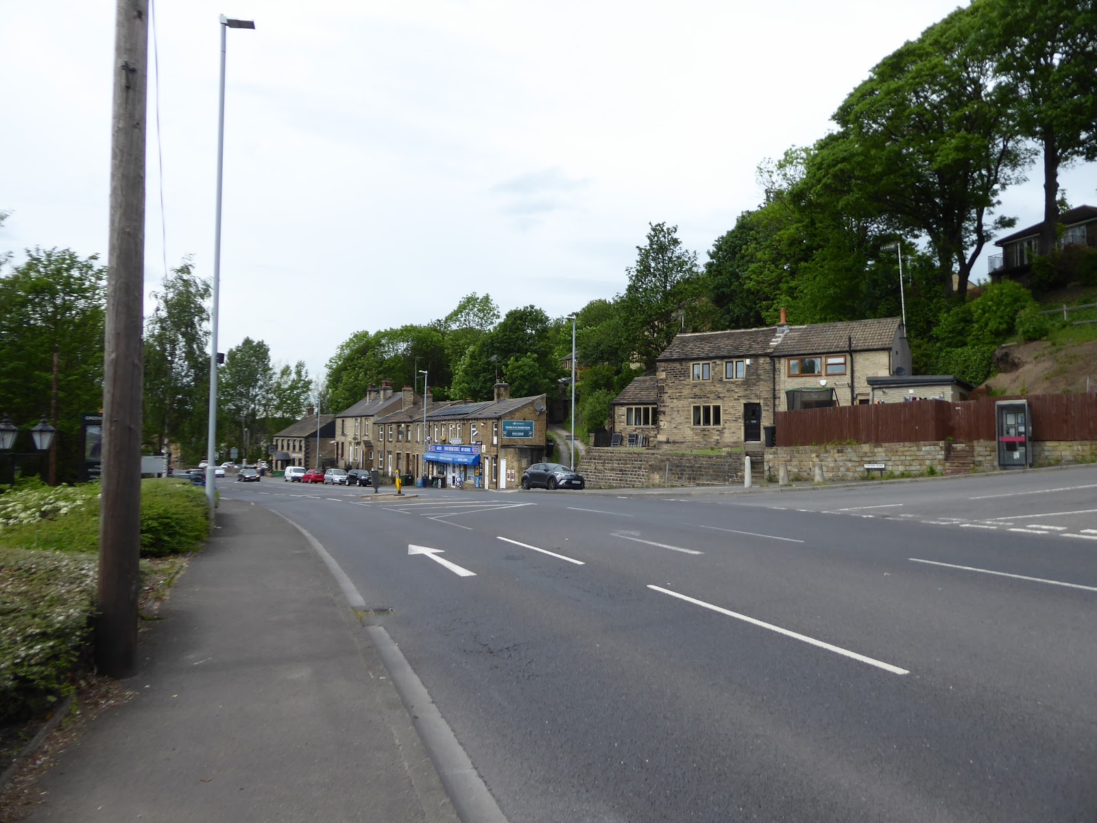
The main road takes great care to avoid getting any closer to Shepley than that, so as we descend further, we can feel that we are walking among the deliberately outlying terraces at a remove from the village, noting the 1620 dated farm across the fields before passing the 7 miles to go milestone and meeting the textiles themed bench by the passage of the Kirklees Way route, which marks us back inside our field of walking experience having blazed about 11 miles of a new southern boundary along today's route. Thence it's downhill to pass under the railway, where we could bail if the day had gotten to hard, but we carry on, noting the Cask & Spindle as another ideal pub for a potential retirement plan and admiring the strings of old terraces that occupy the west side of Abbey Road North around Whitby Mill as the lane comes to the end of its long descent at Shelley Bank Bottom where we pass over Shepley Dike and the road makes a sharp 90 degree turn to start rising again among the terraces that clustered here around the now vanished Shepley New Mill. Rise to pass the top of Stretch Gate and the passage of my very first trail in this quarter, and observe that Shelley village has a great many aspects as it scatters itself over the northern side of this valley, presenting a more aspirant face as Penistone Road leads us through Far Bank, and on to the edge of the suburban growth that arrived in the late 20th century, opposite the Rising Sun inn and the Shelley Millennium Green, and also home to Cleveland Way, which one could walk briefly instead of committing to the much longer namesake path around North Yorkshire. Past The Mill 150 and the junction down to Thunder Bridge we enter countryside again, below the fields of Hill Top and Healey farms, where we can look back the high edge at the southern valley side to illustrate what a wandery route we've taken to descend with the main road before we slip into the shade of Hartley Bank woods, where signage indicate the proximity of the Woodman Inn, if one were willing to take a very steep stretch down through the tree cover. The lane comes around to a northbound course again before we exit the woods by Oakwood house, Bank End and the sizeable Hartley Cottage, just shy of the turn up to Kirkburton by the outsized stone waymarker, staying low this time as the A629 hugs the edge of Tanyard Plantation, high above Thunder Bridge Dike and only getting some views down opening out once we're past the terrace at the bottom of Lee Lane.
 |
| Terraces and Railway Bridge, Abbet Road North, Shepley. |
 |
| Shelley Millennium Green. |
 |
| Hartley Bank Wood. |
 |
| Tanyard Plantation. |
Signs then welcome us to Kirkburton, despite it being mostly at a remove up the valley side, but there's strings of semis and terraces down here, around the petrol station and the enduring Springfield Mill, as well as the nice Springfield House and the Foxglove Inn, which means there's a bit more to the village than had been previously noted as we come upon Dean Bottom by the Spring Grove tavern, where a bench can be found opposite the terraces that once sat around the railway station, where our third and final lunch break can be taken. Then on, feeling sound that we have met the boundary of Greater Huddersfield as we meet the houses that form the lower edge of Highburton, by the White Swan inn where roadworks have caused a horrible traffic snarl, but being on foot means we can slip around that and soon meet the mills, cottages and chapel at Dogley Lane, feeling that we ought to be close to Beldon Brook viaduct but get no sight of it before we land on the Rowley Lane corner and the very outermost edge of suburban Lepton. My analysis of greater Huddersfield feels somewhat flawed as we press on as the valley becomes green on both sides of the lane, and the town clearly doesn't extend this far in any meaningful way, so fields and woods accompany the road for a stretch further as we look west to get a sneak peek towards Almondbury and finally spot a railway remnant of substance as we see the bridge abutments on Whitegates Grove. The lane then descends on towards Fenay Bridge, where the eponymous pub doesn't have vintage on its side, but we do now land on the edge of Huddersfield, opposite the terrace of shops and cottages that sit below the railway embankment where the station once sat and where a sole abutment of the Station Road bridge still endures, and Penistone Road beyond Harvey's bar & kitchen could lead us to the day's end but an alternate route invites itself if we abandon the main roads and pass over Fenay dike by Fenay bridge itself. Fenay Lane leads us past Brewery Yard and uphill, somewhat testingly on my tiring legs, into greenery and trees because we ought to get a closer look at Almondbury, where the big old houses like Fenay Hall and Fenay Grange hide from view at a remove behind trees, and the newer suburban face conceal themselves with large gates and hedges, but it's still a fascinatingly expensive lane to walk, as you could never hope to afford to live here, and it's notable the Fenay Royd house fails to conceal the fact that they have red Routemaster London bus in their yard.
 |
| Springfield Mill, Kirkburton. |
 |
| The White Swan, Highburton. |
 |
| The A629 proves we are not in Greater Huddersfield yet. |
 |
| Fenay Bridge. |
 |
| Fenay Royd house and its Routemaster Bus. |
Almondbury awaits beyond, its vintage as a consumed village illustrated by the sweep of weavers cottages at the top of Fenay Lane, ahead of All Hallows Church on the Northgate - Westgate corner, where the War Memorial has seven panels of names of parishioners who died in the two world wars, and despite the 20th century having encroached hard, there's still a strong feeling of the domestic industry that used to live here among the long terraces on Northgate, before desirable suburban living came this way. Definitely a place for a closer look but today starts to feel like it's had too many miles as we pass another hidden Tardis and the bafflingly closed Rose & Crown inn to meet the Somerset Road - Town End corner which offers a choice of routes downhill, and we pick the former of the these as it's the newer and more direct, which once brought Huddersfield's trams up the hill and now sends us down among terraces, suburban gardens, desirable apartment blocks and much greenery on the way into the town. A town which sits much further away than seems reasonable as we pass a playground and blocks of suburban houses that seem encased with ancient woods, which definitely feels like a theme for Huddersfield's residential expansion, before the road snakes around, grazing the edge of Huddersfield's student land, to give us a view to the town centre as we arrive above Moldgreen, above the industrial plots that sit along the A629 Wakefield Road. Descend the last corner past the edge of Longley Park and land on the main road by St Joseph's RC church and the local Lidl, and cross over to its north side to get a varied perspective on the path previously travelled, before we pass over the River Colne via Somerset Bridge, and the Broad Canal at Aspley wharf before we pick a fresh route to the finish line, passing the university campus, the Kingsgate shopping centre and the Sainsburys superstore before crossing the ring road to meet the bottom of Kirkgate. Rise past the Huddersfield Hotel and the Palace Studios apartments to meet the parish church of St Peter and then pass around its former graveyard via Lord Street and St Peter's Street to meet the main drag of John William Street, just at the day's heavy cloud feels like its starting to break up, arriving in St George's Square with my legs feeling unable to get the kick on after 18+ miles, so despite arriving at Huddersfield station at 4.20pm, the nearest available train home will not be hurried for, and thus a nice long rest can be taken after the longest trek of the year, having successfully stitched another two distant towns together.
 |
| Northgate and All Hallows church, Almondbury. |
 |
| The Green Somerset Road. |
 |
| The Urban Somerset Road. |
 |
| Aspley Wharf, the Huddersfield Broad Canal. |
 |
| St Peter's Gardens, Huddersfield. |
5,000 Miles Cumulative Total: 3903.5 miles
2019 Total: 253.1 miles
Up Country Total: 3486.5 miles
Solo Total: 3613 miles
Miles in My 40s: 2497.3 miles
Next Up: Further Extending the Southern Boundary of my Field of Walking Experience.


No comments:
Post a Comment