13.5 miles, via Dirker, Sparth Reservoir, Slaithwaite Hall, Booth Hey Top, Cop Hill, Cop Rough,
Bradshaw, Pole Moor, Wilson Hill, Broom Hill, Moor Hey, Sowood Green, Holywell Brook,
Dean, Jagger Green, Broad Carr, Bradley Mills, Greetland, North Dean Wood, Copley,
Skircoat Green, Manor Heath Park, and Shaw Hill.
Autumn, and the Late Season, is now upon us, which is frustrating as my walking brain is ready for the Summer, while my body is prepped for the season to be over ASAP, leaving me in an odd place as local lockdowns haven't pushed inessential travel off the permissible activities list yet, though Saturday falls from the schedule thanks to an all-day downpour, meaning that we are having to test out the weird public transport vicissitudes that come with needing to get out to the Colne Valley on a Sunday morning, travelling via busing it to Leeds so we aren't starting out with most of the morning hours already lost. So ride the express to alight at a whisker after 9.35am at Marsden station, where a familiar pall of low cloud hangs above the hills to the south and west of the town, which we won't be venturing into as our path aims us out of the north side of the Colne valley, starting out by joining Dirker Drive as it runs above the railway, among the council estate and on to the Plains terraces, which give us a look at the residential aspect of Marsden which has eluded us on many prior visits, ahaed of dropping over the metals via Planes Lane bridge and joining Marsden Lane as it runs east, along the suburban ribbon that spreads down the valley. The countryside soon take over though, beyond White Syke farm and the stream aqueduct over the railway line, placing just above the Narrow canal as we head downstream, ahead of passing around the north side of Sparth reservoir, one of the feeders for the navigation channel, which is as close as we'll be getting to any reservoir walking today after last weekend's excess of it, passing below the canopy of twisted trees as we rise up to meet the passage under the rails to meet the wooded lower reaches of Drop Clough, the deep groove in the valley side that prevents a straight forwards ascent to the northeast. Pass over the noisily running stream before we meet the ancient packhorse track which pushes up out of it eastern side, a pleasing runs of setts in a deep groove that wends its way up through the tree cover, an old lane that the modern world has mostly forgotten about, rising to a reveal over the Colne Valley, across from the sadly demolished Cellars Clough mills, and running us up to Marsden Lane, again, as it rises steeply up the side of Booth Gate Clough. It's steep pull to finally get us going in the direction that we wish to travel, revealing the sharp moorland nab of Booth Hey to the east of us, and passing the farm hamlet of Slaithwaite Hall to the west, feeling happy that there's no traffic trying to use this narrow track as we press on uphill, meeting the other walkers out in the morning gloom, as we rise to meet the high apron of fields above the valley, 100m up from its floor, as we pick a deliberately wandering route ahead, eschewing the option of available shortcuts.
 |
| The Plains terraces, Marsden. |
 |
The stream aqueduct, White Syke farm.
|
 |
The ancient Packhorse route out of Drop Clough.
|
 |
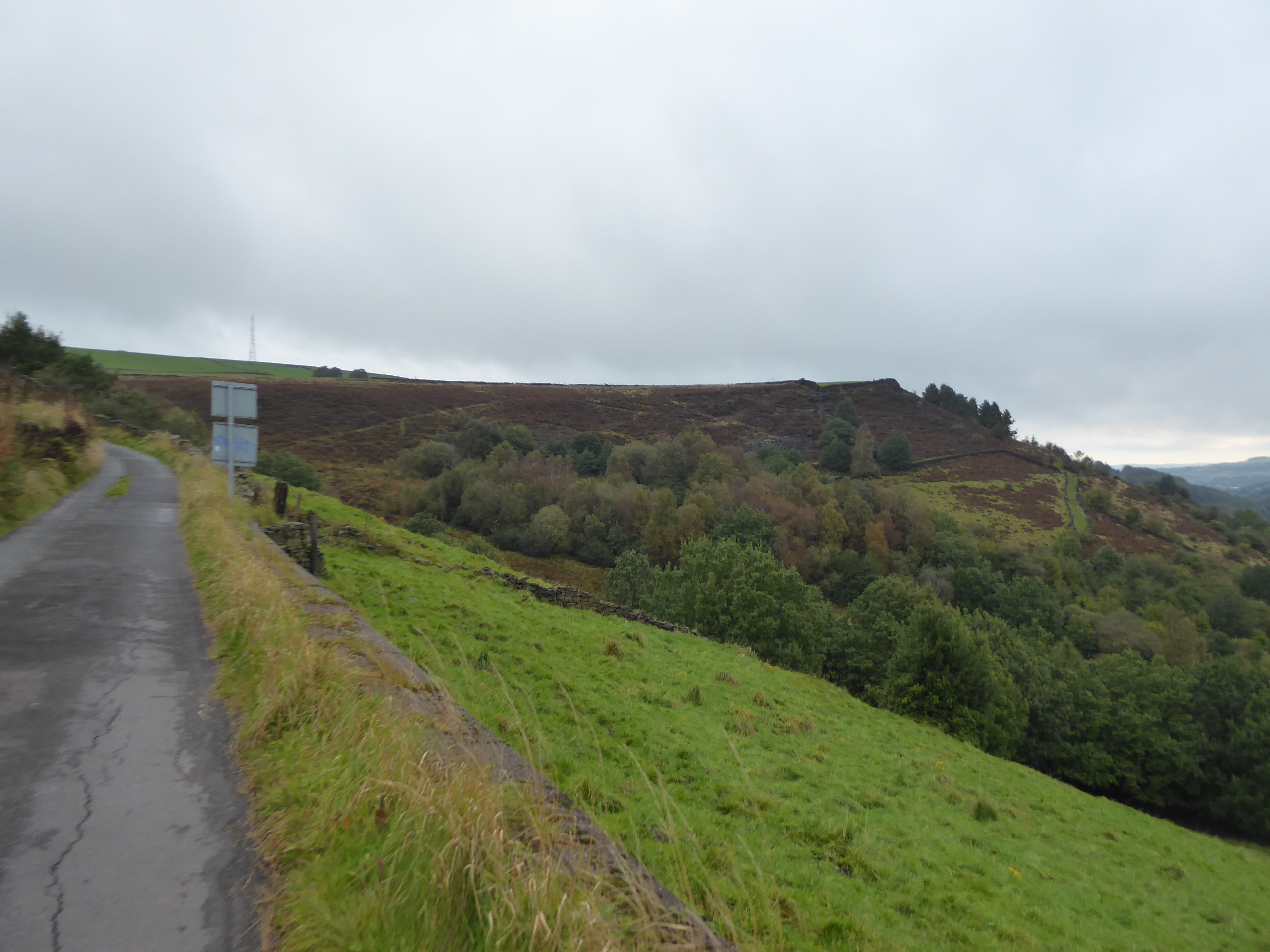
The Booth Hey edge, above Booth Gate clough.
|
So we continue to progress east as we pass above Green Lane Top farm, among the plots of Booth Hey Top, rather than cutting a corner to head northwest, maintaining our view over the cloud fringed downstream valley, and coming around to the sharp end of the Cop Hill upland where the Rose & Crown inn sits at its sharp end, claiming the view towards Slaithwaite all to itself, before we come around to pick the route that will take us around the intervening Bradshaw/Merry Dale Clough to the north of us, and not taking the Scout Lane route that descends through it, preferring to add miles onto the walking day. It's a good choice to make though, rising again along Cop Hill Side, below the mast on the hilltop and among the cluster of farmsteads that fill out the fields at the roadside, while also getting an increasingly illuminated view across the side valley to the hills that flank its north-eastern end, from Worts Hill to Moorside Edge, as we rise to meet the passage of the Colne Valley Circular route by Wham farm, ahead of the reveal of the western horizon, dominated by the spread of Slaithwaite Moor. It would be easy to be drawn to it, as the Old Ground Lane seems to will us on to the west, but our track is around the clough head, along the descent of the Coal Gate lane, along with the motorcyclists finding the most interesting route to light up on two wheels, passing among the moorland field of Cop Rough, above the plantations of Scout Wood, as the copper coloured moorlands spread down from the west, almost encompassing Reaps Farm at the valley head, and sneaking us a look up to the traffic pelting over the Pennines via the A640 New Hey Road far above. Hitting the valley head, it could be believed that the pall hanging over the morning is soon to break apart, as we arrive at the valley's apex and come around to heading northeastwards again, passing over the angrily charging Bradshaw Clough beck, swollen by the rains of the preceding day, and passing around the local equestrian farm at Newgate, and snaring the views down the clough and over the revealed coniferous woodlands below, across the fields where many miniature horses reside and graze. Bradshaw Lane leads us between the Upper and Lower Bradshaw farmsteads, and that's enough habitation in this quarter to constitute a hamlet according to the maps old and new (and who'd have thunk that Kirklees district would house a Bradshaw and a Newsome, sharing the names of the two boys who used to be regularly goaded into fighting on my school bus, many moons ago?), and the cool morning passes as the sun breaks through as we meet The Shred, the independent chapel and pre-school that we met on the CVC route last year, revealing a much better face on its roadside aspect at the top of Scout Lane, while also bathed in Autumnal sunshine.
 |
Green Lane Top farm, above the Colne Valley.
|
 |
The view over Bradshaw Clough to Worts Hill and Moorside Edge.
|
 |
Slathwaite Moor above Reaps Farm.
|
 |
Scout Wood, above Bradshaw Clough
|
 |
The Shred, chapel and school, and the Cop Hill mast.
|
That's us done with our choice of wandery paths as we carry on up Laund Lane, sneaking another view down to Slaithwaite as we pass the Woolroyd farm block, one of very few that haven't had a smartening up in this landscape of expensive country retreats with a view on the fields that descend down from Worts Hill, noting another Highland cattle herd grazing as we snake around the top of the clough that houses the Ainley Place and Wilberlee hamlets, ahead of passing the Lower Laund farmstead and striking on to meet Pole Gate, crssoing over the Kirklees Way path and tangling up with the first of the many routes that we've blazed since July. So onwards, with the sentinel masts passing behind us, coming up to the Colne Valley crest and gaining Wholestone Moor on the immediate horizon, and burning a new path as we pass up between the former Pole Moor chapel and its burial grounds, with the village mostly located beyond, looking that bit more hospitable than it did on its moorland facing side to the west, even if there's little more to it than the being the last bastion of civilisation on the trans-Pennine A640, with the farmsteads to claim the cultivatible fields and supplying inns for the passing travellers. The old Upper George is now a dog hotel, of all things, and a previous route brought us past the Lower George, which still endures in business, ahead of the New Hey Road taking a bit of a wander to pass over the M62, which has gouged its way into the hillside above the Blackburne valley and below the moorland top to the south, and despite having spent two months investigating this valley earlier in the year, it's still a good feeling to be back here again, still finding new ways to regard it from above. Split off the main road at the Wilson Hill farmstead, and am presented with the choice of routes, either over the level top of Stainland Moor or around its northwestern edge on a more dramatic route, and it's the latter I'll pick as absorbing the landscape of the Blackburne Valley seems more important as the day promises some decent illumination to the west, so on we progress, descending come around the rising edge of Broom Hill, taking in the landscape to the west that served me so well this year, as far as Rishworth Moor and Manshead Hill beyond. The upper valley sure does give me a fine revelation or two up here, giving us sight to Stoodley Pike on the horizon, up to the fields and cloughs that are really hard to access, and beyond Scammonden Bridge to Moss Moor and Windy Hill, to tie us to our most recent trails, though the best of them is surely to look beyond Scammonden Reservoir to Deanhead, which shows how high its moorland surroundings loom thanks to its length telescoping down and its 450 height getting rather exaggerated, something that's so hard to appreciate when actually walking upon it.
 |
Ascending Laund Lane to Pole Gate, and the Masts.
|
 |
Pole Gate hamlet, on the New Hey Road.
|
 |
| Wholestone Moor, rising above the M62. |
 |
Broom Hill Lane, below the edge of Stainland Moor.
|
 |
The upper Balckburne view to Scammonden Dam and Deanhead.
|
There are also farmsteads clinging to this elevated lane, with New York Gate and New Peel Castle having both been developed to make the most of the views as we come around to the downstream portion of the valley, which brings a bank of dark cloud our way with the prevailing north-easterly wind, dropping a persistent drizzle that wasn't predicted as we pass the Broom Hill and Broom House farmsteads on the decline down towards Forest Hill Road, greying out the horizon towards Norland Moor and Barkisland as we pass the New Bailey terrace. That's another previous path traversed, as Moor Het Lane keeps us on this elevated trajectory, past the Only House and Prospect Place houses, which are again being redeveloped to make the most of their views, which are spoiled by the toxic stench drifting up from the Sonoco recycling plant in the valley below, beyond which Stainland village rises on its hill, and we can look beyond the Providence Hill end to get sight of the wrinkles of the Calder and Hebble valleys which we are yet to approach today, while Sowood Green arrives to the south of our route, as we pass the suburban back gardens and the Moor Hey Row terrace. We drop down to the B6112 with hints of sunshine resuming in the east, soon revealed as a proper breakthrough of seasonal warmth as we pass below the old school house and the Moormires house block to get back to some proper off-roading, joining the footpath that will take us through the side valley of Holywell Brook, tracing the steeply descending farm tracks that head down on a surface of roughly ground aggregate that is frankly horrible to walk on, which eventually leads to an open field path to the valley floor that is as slick as you could wish for. So wearing the heavy boots was a wise choice as we come down to the noisy stream at the bottom, where a bench finally appears to provide a lunch spot, ahead of us passing over the clapper bridge and into the beech woodlands that are protected by over-large gates, tracing the path as it runs into the grounds of the Carr Hall Castle hotel, well secreted beyond its woods, and we've another sketchy stream crossing to make before we can meet the bridleway across the valley that will elevate us up the southern side. We rise to the small collection of farmsteads that the map names Dean, as if its a hamlet worthy of an identity, but the sunshine falling on the Jagger Green Dean lane beyond, gives us a grand view ahead, looking across Stainland and Greetland towards Halifax, and back up the valley just crossed, a picture of seasonal greenery, and here too the rural cottages have been adapted to make best use of the picturesque, rendering an old Sunday School into a modern residence or building a very large garden terrace by a modestly small but decently elevated terraced house.
 |
Rain falls over the middle Blackburne Valley.
|
 |
Sunshine resumes on Moor Hey Lane, Sowood Green.
|
 |
Descending the horrible surface into the Holywell Brook valley.
|
 |
Holywell Brook in the Carr Hall Castle estate.
|
 |
The Holywell Brook valley, looking towards Sowood.
|
At the lane top, we run into the hamlet of Jagger Green, predictably enough, another super-rural enclave for those who'd find the bustle of the surrounding villages just that bit too accessible, and that's surely just about every settlement in this quarter seen by now, as we hit the steeply descending lane as its winds downhill, giving us sight to the hillside to the west of Elland ahead of coming down by the incongruously located Ben Royd Terrace, which may have served the neighbouring farm or mills that flank it, ahead of the descent down to meet Broad Carr village, down at the valley floor. Cross another path and follow the route of Rawroyds as it folows the stream as it runs into the clump of industrial units that fill out the Brookwoods estate down here, ahead of us passing over the old Holywell Green branch line, and the driveway up to the Solvay Soltions chemical plant which occupies its upper reach, and following Burrwood Way as it reveals the Holywell Green viaduct to the east, or it would if it wasn't completely shrouded by tree cover. There's no way to get a good shot of it at this stage of the season, so we progress on, back over the A6112 and down into the foot of the Blackburne valley, joining Ellistones Lane as it seem to offer the most direct way over the river, but finding a way around the farm on the Upper Bradley Mill site seems to be less obvious on the ground than it is on the map, and so several paths are explored before we finally land by the heavily flowing course of Black Brook and pass over the bridge to its north side, ahead of meeting the footpath that first brought us this way in 2014. It's a more familiar landscape now as we rise up to the whitewashed terrace by the side of the A6114 Saddleworth Road, which we cross to meet the enclosed footpath that was once a country ginnel that has now had suburban Greetland squeeze up to both sides of it, causing some of its retaining walls to need replacing as we head sharply and shadily up to Sunny Bank Road, where the locals really are gifted with the views to the southern horizon, ahead of our rise up to meet the A6113 Rochdale Road, which we land on by the Nisa store, via a little stone lined shortcut. That's the seventh of this year's paths crossed, if we're still keeping count, and our adventure to see more of Greetland continues as we rise northbound still, along Ashfield Road as it leads us between the council houses and suburban bungalow that render this village much larger than I'd anticipate it, ahead of meeting the terraces that fill out the corner with Hoults lane, beyond which the level fields claim the landscape, keeping the closes to its southern side as we head for another river crest, passing under those power lines again that we've already noted the pylons of which on both sides of the Pennines so many time this year.
 |
Ben Royd terrace, between Jagger Green and Broad Carr.
|
 |
Holywell Green Viaduct barely shows its best side.
|
 |
Black Brook near the Bradley Mills.
|
 |
The Ginnel between the Saddleworth and Rochdale roads, Greetland.
|
 |
The Ashfield Road terraces, Greetland.
|
Scholes Lane leads us towards the top of the Blackburne - Calder ridge, passing through the Scholes farms with the valley to the south retreating behind us as we shift onto a westwards tack, arriving above the bulk of North Dean Woods, on the steep south side of the Calder valley, keeping our distance from them until we meet Moor Bottom Lane, where we are take in on the descending track, passing across the Calderdale Way route for good measure and seeking the most direct route downhill, via a footpath between the obvious PRoWs, that takes a soft route down among the canopy of beech and oak. This leads us down to arrive above Lower Tinker Hey house, which seems to be placed for the best possible view of Copley Viaduct and Bridge, carrying the divided railways to the east of Milner Royd junction, a sight spoiled when our burst of sunshine suddenly passes, and wee thus pace down the steps at its plot side to meet North Dean Road, which sharply concludes our downhill route as we walk against the steady stream of folk ascending it, coming out by St Stephen's church and the bridge toll house, ahead of crossing the heaving River Calder. On the north bank we meet the Copley model village, built to service the now vanished mills to the west, and we've also got the Old Rishworthians Rugby club on the level fields down here, ahead of our passage under the lower railway line and our ascent to pass over the Calder & Hebble navigation with Copley Lane landing us onto the A6026 Wakefield Road, and an early season route, ahead of us crossing over by the Volunteer Arms and the new recreation ground to continue the ascent to the upper railway line and the long since erased site of Copley Station. The nature of this section of the Calder valley, which had seemed untraversible, with its steep and wooded sides means that there's a lot of uphill to pace again, on a steeply angled, frequently view-free and footway-deprived Copley Lane to make our way into Halifax, and the town has done its best to creep down here, squeezing residences into small and level plots as we rise to the old cluster at Lower Skircoat Green, ahead of emerging into the town proper at the Dudwell Lane corner, among what looks like the south-eastern town's major suburban artery. We head north with Skircoat Green Road, as it dives it's way into a deep stone lined cutting below the estate to the east before arriving on the local high street, which has the Murgatroyd Arms and the Old Bakehouse as its major cultural features, ahead of its old Co-op and the runs of old suburban terraces that do their best to give the town a presentable sort of face, indeed, on passages made so far, Halifax is doing well on the presentablity front, as if there was plenty of money to be made and spent residentially here in its Victorian heyday.
 |
Above North Dean Wood, on Scholes Lane.
|
 |
Below North Dean Wood, on North Dean Lane.
|
 |
Copley Model Village.
|
 |
Copley Lane (everywhere is uphill in Halifax!).
|
 |
Skircoat Green's High Street, with pub and bakehouse.
|
We press on to cross over the A646 Skircoat Moor Lane, not too far up from Calderdale Royal Infirmary, before we pass along the eastern edge of Manor Heath Park, which has a decent cross section of folks out enduring its Autumnal loveliness, as Skircoat Green Road draws us on towards the town, gradually drawing closer to our last route into the town from the south, as we pass a socially distanced park meeting of some sort, and then pick out a route that leads us on past the long runs of smart terraces that parade along from the division with Heath Road. Thus we are directed out to the A629 Huddersfield Road, meeting our February approach by the Tesco Express and then getting somewhat tied up in making the road crossing that takes us over to the side by the Spring Hall sports facilty and athletics track, ahead of descending down Shaw Hill between the Elmwood garage and the old tram depot, now both facilities operated by First Bus, and also passing the Shaw Hill tower block and the other side of Shay stadium as we ponder if we've come this way before, which we haven't, until we meet the top of Gaukroger Lane. Shay Syke thus leads us past the B&M store, on the southern end of what was the town's once extensive railway goods yard complex, which is made apparent as we join Water Lane, and pass under the additional metalwork that has been added to the railway bridges above, as we drop down into the still industrial band at the bottom of the Hebble Valley, where the canal once reached and the brook can be traced along the Waterside road, between the Hargreaves Foundry and the Waterside Colours paint factory. It's not a notable river by any means, but it's running pretty fast and loud in its channel, best viewed from where the road concludes and passes over it via a double arched bridge, before our way forwards continues along the barely used footpath by the side of the elevated railway as it runs into Halifax station, and along the perimeter if the Nestle factory, that trumpets itself as the home of After Eight mints and Quality Street, developed over the site of the Hebble branch's canal basin that passed out of use in 1942. It feel like this path ought to offer us a short cut to our finish line, but while there is a passage underneath the railway, its accessibility has been cut off, probably for safety reasons, though seeking its other end becomes an immediate priority as we carry on past the Bailey Hall flour mills and land on Berry Lane, which takes us under the viaduct that take the railway off towards Beacon Hill tunnel, ahead of passing below the GNR viaduct stub, and noting that the old coal drops have disappeared behind a shroud of foliage since being spotted in 2013. Then it's uphill along Church Lane, past Halifax Minster and the Ring o' Bells inn to enter the Eureka car park, on the station's old sidings complex, which allows us to approach the old GNR station site next to the extent L&YR buildings, where we can pass under the metal bridgework that passed over it, find its old platform remnants and indeed the subway entrance to the east side that we saw earlier, dropping us some industrial age amusement before we rise up the steps to the modern station to wrap up the trip at 3.05pm, and to find that Halifax might actually be better served for trains on a Sunday, not that it will necessarily get me home any quicker, of course.
 |
Manor Heath Park.
|
 |
The Tram and Bus Depots, Shaw Hill.
|
 |
Railway Bridgework above Water Lane.
|
 |
Hebble Brook at Waterside.
|
 |
The hidden passage under Halifax station.
|
 |
The old GNR station site, Halifax.
|
5,000 Miles Cumulative Total: 4668.8 miles
2020 Total: 402.3 miles
Up Country Total: 4205.8 miles
Solo Total: 4342.2 miles
5,000 in my 40s Total: 3262.6 miles
Next Up: Hebble to Colne, if weather and lockdowns permit it.


No comments:
Post a Comment