11.6 miles. via Battyeford, Cooper Bridge, Nun Bank Wood, Clifton Wood, Brighouse,
Brookfoot, Freeman's Wood, Cromwell Bottom, Binns, Elland Park Wood, Elland Bridge,
Elland Wood, Salterhebble, Copley. Long Wood, and Bolton Brow.
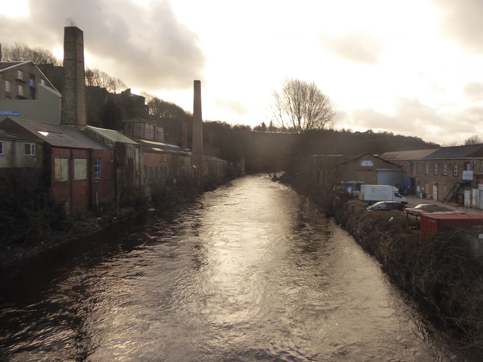
Another weekend in February brings another Atlantic Storm, and thus walking plans get shuffled to the Sunday, which presents a better sort of day weather-wise, which is fortunate as I need to make an early morning trip to the opticians to collect my new specs, and the day also has My Sister and Nieces making the trip over the Pennines for a visit, as their day had been cleared for a mountain biking event that they really didn't fancy in the windy conditions, so we are instead able to burn the day off with a trip around the town and dinner at Trinity Kitchen while having more of the catch up that we didn't complete at Christmas. A day off is also useful for starting to get used to the vari-focal lens in my new glasses, and the art of learning to focus at three different distances, not that I'll be taking them out for a walking trip the following day, as I need the familiarity of my old specs as we seek to trace a route to the edge of Upper Calderdale, in keeping with the proposed theme for the year, and matching a trajectory from 2012 to test the theory that a difference of a mere half mile from a previous path can reveal the world in a completely new way. So to Mirfield we ride, starting late to allow most of the day's rain pass early on, and giving us a short window before the heat loss of winter starts, so we are wrapped up in thermal and windcheater as we alight at 11.20am, setting our course under the railway and along Station Road up to Bull Bridge, to make our base-tough with the Calder & Hebble Navigation before rising to meet the main road up Calderdale, turning onto the A644 Huddersfield Road at the town's heart and setting off west, past the library, the Co-op and St Paul's church. Past the wholly intact buildings of Fold Head mills, and war memorial in Ings Grove park, we are soon slipping out of this most urbane of villages, with a band of industry filling up the strip of land between the road and the River Calder, in the middle of which we find the remains of the L&NWR's Battyeford viaducts on the Leeds New Lines, with a runs of blue brick arches running up to the roadside, and a string of stone arches sitting by the riverbank, easily the most interesting thing to my eyes at this edge of the town, so naturally this is where the last rain cloud of the day passes over to spoil my photography opportunities. The damp gloom doesn't last though, as the sunshine breaks out as we pass on through Battyeford among its roadside cottages below the rising bank to the north, coming upon the side of the Calder beyond the Pear Tree inn, and it's high and thundering after the overnight rains, looking ominous below Wood Lane bridge and keeping its volume up as we pass the band of playing fields on the low bank, with the river showing the most of its agitation as it runs over the weir by the former West Riding flour mills site.
 |
| The Station Road - Huddersfield Road corner, Mirfield. |
 |
| The remains of Battyeford viaduct on the Leeds New Lines. |
 |
| The loud and busy Calder at Wood Lane Bridge, Battyeford. |
The river slips from view as it passes behind the John Cotton Non-wovens factory, with the A644 soon coming up to meet the A62 by the Three Nuns, the Miller & Carter Steakhouse, where we agian pace the slick pavement down by the gradually redeveloping sewage works site, to meet the traffic island that leads the road under the old Cooper Bridge station site, across the way from the Dumb Steeple, the roadside pillar which was a focus point during the Luddite rebellion of 1812, a place where the roads do not seem well organised for anyone travelling west on foot. We get ourselves onto the A644 Wakefield Road and pace on into Calderdale district, passing the Synetiq car recovery yard, where derelict vehicles are stacked on frames four high like so many Corgi and Matchbox toys, a familiar site from the nearby railway, before the road shifts into the shadow of Nun Bank Wood, which coats the north bank of the valley as it bounds the perimeter of Kirklees Park, where we make ourselves another acquaintance with the the Calder and the Navigation, across from Kirklees Lock. The next feature crammed in at the riverside is the Huddersfield North Premier Inn, along with the Old Mill inn and the Mill Cottage Montessori, beyond which we rise away from the river again, past the entrance tro Kirklees Hall and the Big Baps transport cafe, as we rise through the bulk of Clifton Wood, though which the M62 has burrowed, north of the viaduct over the river valley, and we have to make our way around the junction 25 island with care to reach the outer edges of Brighouse, where the Armytage Road industrial estate has filled out the north riverbank. We pass below the Brighouse Holiday inn and the road up the hillside to Clifton village, with the sight of the wooded banks up the valley drawing us on as the lost Pickle Bridge line fails to make its former crossing apparent as we move alongside the many industrial units on the way into town, before finally making an arrival in the residential town among the terraces around the local Lidl, the wire works and the angrily loud Clifton Beck, around about where the Calderdale Way route also makes its appearance.
 |
| The Three Nuns, near Cooper Bridge. |
 |
| Synetiq's Stacked Cars, by the A644. |
 |
| The Old Mill and Mill Cottage Montessori, below Nun Bank wood. |
 |
| The industrial lead in to Brighouse. |
The way into the town needs to be found across the Ring Road, where the three local A-roads tangle up by the Subway store, landing on the end of King Street by the Salvation Army hall and the solicitors office with the impressive curved frontage, carrying on west to the main shopping drag, crossing our previous path through the town, and on to Commercial Street, by the George inn, finding that it's all a bit busier than anticipated for a Sunday lunchtime, while also showing a lot more character than might be expected for a small town between its more expansive neighbours. We depart the town centre via Gooder Street, rising to meet the A644 Halifax Road between the Central Methodist church and the Wilko superstore, ascending away to the island where its splits off toward Hipperholme and Queensbury, a route for another day, and we'll carry on along the valley with the A6025 Elland Road as it slips around the high ban to the north and makes its way downhill towards the canal and the sharp bend of the Calder again as we land in Brookfoot, at the bottom of the valley of Red Beck, which charges under the road around this cluster of terraces an industry, where the Red Rooster inn doesn't seem to be doing business anymore. Press on, past the mills sites and passing outside the Calderdale Way route again as it ascends into Freeman's Wood, right where water running off the wooded bank has almost completely inundated the road with a deep puddle, which we pass while keeping dry to meet the oddly stray Grove terraces, at a quite a remove from the town, next to the Casa Brighouse hotel and venue, which offered quite the view over the Freeman's Cut boating lake at the valley floor when it was doing business, which it doesn't appear to be doing presently. Fields briefly open out to the north as we pass Fort Montague farm and the other stray farms and light industrial sites at Cromwell Bottom, where the newest build conceals the Ashdene Naturist Club up the hillside, beyond which we find the residential redevelopment of Ashdene House and the WT Knowles fireclay and pipe works, hidden in the edge of Binns Wood, with its chimneys rising prominently over the valley, and samplings of its wares scattered through the yards and woodlands surrounding it.
 |
| Commercial Street, Brighouse. |
 |
| The terraces of Brookfoot, on the Elland Road. |
 |
| The Calder Valley around Freeman's Cut, Cromwell Bottom. |
 |
| The WT Knowles Pipeworks, Binns. |
Elland Park woods crowd the roadside as we descend from our remove from the river, where we can spy the depression that Elland sits in before we meet its outermost terraces, the Water's Edge nursery and the Collier's Arms inn, below the Park Wood crematorium and above the canal, which comes up by the roadside and reveals that it's closed for repairs at Low Lock, where the water if held back by scaffold poles and tarpaulins, beyond which industry piles up by the roadside, with Park Road mills still in business and Valley Mill has had the most dramatic of residential makeovers. The Calder Valley railway line rises over the road beyond, with the plinth of the former Elland station clearly evident to the north and looking amply reusable to my eyes, and thence it's on to pass under the flyover of the A629 and to come up by the Barge and Barrel at Elland's canalside and wharf, where all is calm, but a short detour is in order to get a closer look at the Calder again, by pacing over to Elland Bridge to observe the river looking a couple of feet higher than previously seen a week or so back, while sounding a whole lot angrier. We thence return to the side of the A6025 for its last legs, choosing not to seek the path on the other side of the A629 as there's more to see among the buildings above the canal bank, along with a previously unseen turnpike milestone and the gateposts of houses lost when the dual carriageway was constructed, which we join the side of on a familiar track, noting that it's a bit early in the season to be duplicating miles as we again come below the rocky bank on north side of the river and pass again over the mouth of Elland tunnel and the railway viaduct over the canal and river below Long Lee lock. Cross with the Calderdale Way path again, returning inside its route as we advance on, along the elevated cycleway below the banks of Elland Wood, arriving below greater Halifax as we meet the tangle of roads at Salterhebble, where we cross the Stainland Road and join the A6026 Wakefield Road as it passes over Hebble Brook, which roars away down the deep flood channel that it usually trickles along, and pass over the lock flight on the canal, and its division point as it accesses the Hebble and upper Calder valleys.
 |
| Valley Mill, Elland. |
 |
| The upstream Calder at Elland Bridge. |
 |
| The viaduct over the Calder and Canal, above Elland Tunnel. |
 |
| Salterhebble junction on the Calder & Hebble Navigation. |
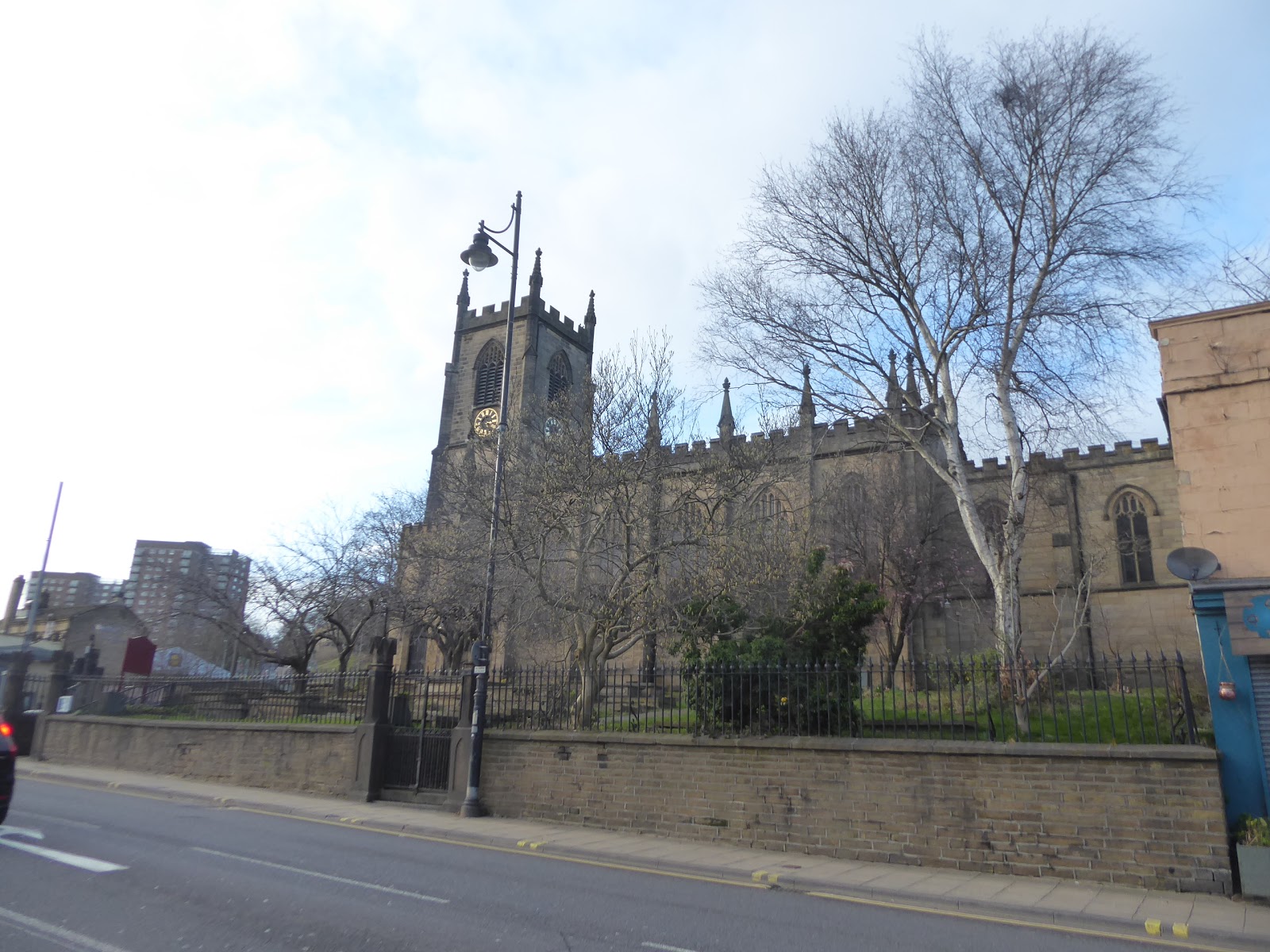
Pass under the railway as it rises away towards Halifax and get the feeling of being on the last leg with only an hour to go, as the Calderdale problem of the sun dipping below the apparent horizon long before sundown starts to feel like it might be an issue, especially as the air chills whenever the cloud comes over as we press on along the suburban parades of semis that line the road on the way down to Copley village, located past the motor-home retailers, where the village school and the Volunteers Arms form the focus. A short way to the west, the railway comes down to pass over Copley Viaduct, which is almost invisible form view even with the winter's lack of foliage on the trees, and beyond the valley feels rather wild as the trees of Long Wood cower over the semis on the north side of the road, with the ancient Wood Hall located at their end, where the views open up to reveal the offices of the Lloyds Banking group (which encompasses the Halifax Building Society, theses days), above which Wainhouse Tower looms over the valley, at the southern edge of Halifax. In the valley below the space between the canal and river has been filled with a new housing development, and you can only hope they've planned in some good flood protection, and that's a thought to keep the mind stoked as we pass through the green space that keeps Sowerby Bridge distinct at this corner, before arriving by the Memory Lane furniture store with its old Visa and Access card ads on its wall, before we cross the Washer Lane junction and enter town via Bolton Brow, passing below its run of brick and stucco council houses, and its primary school, while feeling certain that university friends of ours once lived in one of the canal-facing terraces along here, many moon ago. Meet the corner of the descending A58 as we enter the centre of the village, where the Hebden Bridge-ification of the main street seems to be taking hold above the canal wharf and its warehouses, and you'll never be short of a place to eat or drink on the way down to Christ Church and the Rochdale canal as it disappears under the road to find Tuel Lane lock, as we progress along to the covered market place. From the main drag, the way to the station is found down the most well concealed of alleyways, dropping us down sharply to the back road of Old Cawsey, where the footbridge leads us over the Calder, which isn't looking quite so busy or frightening here, between the Carlton and Lock Hill mills, leading us on to Holmes Road amongst the works sites that endure here, landing at the back entrance of the station (which actually faces the town) at 3.30pm, ahead of the fading day and only 10 minutes off the most convenient train for the long-way-round ride home.
 |
| Wakefield Road, Copley. |
 |
| The Lloyds Bank et al Offices, and Wainhouse Tower. |
 |
| Bolton Brow, Sowerby Bridge. |
 |
| Christ Church, Sowerby Bridge. |
 |
| The town-facing, back entrance of Sowerby Bridge station. |
5,000 Miles Cumulative Total: 4320.7 miles
2020 Total: 54.2 miles
Up Country Total: 3857.7 miles
Solo Total: 4006.5 miles
5,000 in my 40s Total: 2914.5 miles
Next Up: Trekking on the fifth Saturday in February!


No comments:
Post a Comment