The small benefit of a long trip home from the trail is a chance to score some more cheap walking togs, in the most recent case being finding a new pair of intermediate boots for pavement walking, #7b if we're keeping score, a pair of Regatta Samaris located at TK Maxx in Leeds for £40, hopefully a good replacement for pair #6b from Cotton Traders, which really absorbed the abusage over the last two years, and they'll be put to immediate use today, as we head out for a third consecutive day on the trail, starting out early on the rides to Halifax in hope of staying ahead of the next wave of bad weather. So to our start line, for a 9.50am start, emerging from the station and wondering just how long the early sunshine is going to last, setting a course to the east, which isn't the easiest of route once you consider the bowl in which the town centre is located, tracing a route that seems awfully familiar, up the single street with four names past the Woolshops Shopping centre, the Royal Mail depot and the Bus Station, to meet Northgate by the Halifax Vue, which leads us to North Bridge, which spans the gap below, in which Hebble Brook roars away, by the car parks on the old GNR good yard and station sites. Away from the Dean Clough valley, we will follow the flyovers of Burdock way as we press uphill out of town, rising with New Bank road to the side of the A58, above the apartment blocks on Charlestown Road to the footbridge to the north side of the turnpike, below St Thomas's church and school in Claremount, where a fine view panoramic over the town to the south can be gained, even with the gloom gathering so early in the day. The main road to Leeds will be our route for the initial going, rising with Godley Road to pass out of the Hebble valley, under the ornately styled Godley Bridge at the crest and passing into the deep rock cutting beyond, proving that heavily engineered roads did not come with the motorways, not feeling like a road that particularly apt to being walked, despite the footway as it drops away into the lower reaches of Shibden Dale with Halifax's town soon behind us, hardly surprisingly as surely 90% of its reach and suburbia lies to the west of its ancient centre.
 |
| Halifax North Bridge. |
 |
| Halifax from the New Bank footbridge. |
 |
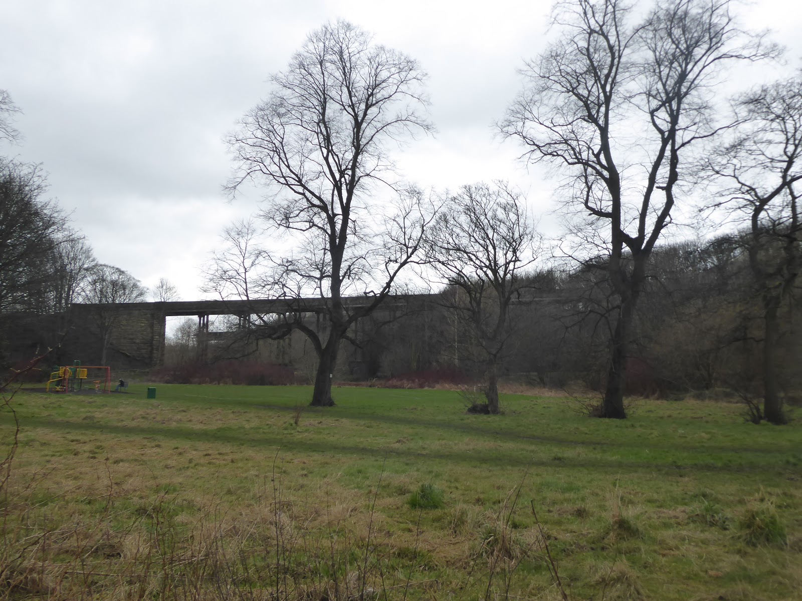
| The Godley Road rock cutting. |
Away from Halifax we may be, but it's main park is on this side of the hill, with the main gate of the Shibden Hall estate passing as we exit the cutting, but the tree cover at the roadside ensures no real views into it as we pass, which is also the case as we try to sneak a look up into the upper reaches of Shibden Dale, another of the finest hidden valleys of this county, and thus we look forward with the lane instead as it heads down to Stump Cross, a satellite village located below a high bank of woodlands, with high terraces and suburban houses around the inn and the two main roads that split off towards Northowram. That previously unseen townlet, now the largest unseen so far in West Yorkshire, will have to wait for another day as we stick with the A58 and the challenge of keeping on a secure footway as we process on, below the long run of south-facing semis, still failing to get views to the south and the passage of Red Beck thanks to the foliage-free tree cover, and only briefly getting a view up the side valley of Hole Beck before attention turns to the nearby railway line and the passing trains of new-ish 195 units on the line to Bradford. The passage of the valley down to the Calder at Brighouse will also wait for another day as we start to run into the suburban edge of Hipperholme, which is pretty large for a crossroads settlement, stretching all the way up from the Tannery inn to the White Hall corner, even possessing its own veterinary clinic and pet food store, where we cross the A644 Denholme Road (and our second original path to Halifax), by the Christ Church and then change routes, joining the A649 Wakefield Road, not feeling entirely sure that this road ever gets there directly. We thus press east through the spread of this extensive village that still needs its railway station back, for my convenience's sake, among its council houses and smart cottages, to come around below Lydgate Park, which sits opposite the Lightcliffe Club, which leads us to the local tea rooms and primary school which share its name, and the proximity of the former station site, ahead of the tunnel passing under the road, suggests a village boundary change that we've failed to notice, somewhere.
 |
| Stump Cross, the furthest eastward reach of Halifax. |
 |
| The Hole Beck valley. |
 |
| The Whitehall crossroads, Hipperholme. |
 |
| Lydgate park, Hipperholme. |
What feels like Lightcliffe village lies further down the lane, beyond the gatehouse of the now lost Crow Nest house which was once the residence of the industrialist Sir Titus Salt (who seriously needs no further introduction here), where two parades of clearly tied and modeled terraces sit by St Matthew's church forming a very deliberate little composition that's wholly in keeping with the fashion of Saltaire, and from the fields beyond we can spy another well hidden feature of the county, Bottom Viaduct, carrying the railway over Bottom Hall Beck on its way to Bradford. It seems that Lightcliffe isn't beyond surprising me though, as ahead stands a campanile in another graveyard, which turns out to be the tower of the original Georgian parish church, now standing sentinel opposite the Sun Country Inn, and on the outermost edge of greater Brighouse as we merge almost seamlessly into the suburbia and rural outliers of Bailiff Bridge, noting Holme House as we go, and not solely because one Algernon Firth was amongst its 19th century owners. Having been on the relative level since Shibden Dale, it's a surprise to sudden find the road hitting a sudden decline, even though we shouldn't be as we know that the valley of Wyke Beck lies ahead, with Bailiff Bridge at its bottom, and we scoot down with the A649 pretty sharply to meet the crossroads with the A641, only seen six days prior, as well as the passage over the noisily visible beck, and once we've bottomed out, our eastbound path has us immediately heading uphill again, much more steeply to pass under the bridge of the Wyke - Brighouse line, just north of another former station site. It's a long and hard push uphill with the 14% slope of Birkby Lane (not sure which Birkby it might be leading to) as it rises up the valley side to reach the high exposed fields of Hartshead Moor, which really earns its name with the wintery breezes blowing over it from the west, where we can look back to the Colne and Calder valleys, with hints of snow on the distant hills beyond, giving us the best panorama of this season's opening before we press on with the wind behind us, knowing full well why the suburban growth from Wyke and Scholes never reached this far south into this blasted landscape.
 |
| The model village of Lightcliffe. |
 |
| The original St Matthew's church, Lightcliffe. |
 |
| The Pickle Bridge line bridge, Bailiff Bridge. |
 |
| The blasted landscape of Hartshead Moor. |
There were once coal pits and tramways to feed the Low Moor iron works up here, now mostly lost from the fields, which give the feeling of being pleasingly rural in the modern world, and as we come past Pond and Haefield farms, it's hard to believe that we've been up here before, twice actually, on my trip on the Kirklees Way and on my first route to Halifax from Morley, which shows up a small problem with route selections after eight years on the local trails, and thus previous footfalls will be retraced through Hartshead Moor Top, to meet Halifax Road's tangle up with the A643. Pass the Wesleyan chapel and the way over the M62, and then suffer a rare moment of not reavcling my route, feeling completely lost as we meet Hartshead Moorside, uncertain of whether to stay on the A649 or to head downhill to Cleckheaton, picking the latter (correctly, it turns out) to find this village has lost its joke of having two pubs with the same name, with the Old Pack Horse having not just closed down since 2014, but having also been demolished, leaving the New Pack Horse supreme. It's thus a downhill press with Moorside Road from here into the Spen Valley, retracing steps that seemed like only a short stretch when plotting, but which actually turns out to be a pretty solid distance among the suburbs and rural outliers once on foot, gathering up the half remembered sights as we come down into the West End of Cleckheaton on the A643, passing St Luke's church (of a not immediately recognizable parish), the Broomfield inn and mills gate combo, and the Lion-Tangerine confectionery factory. The road beyond, Westgate, throws up few memories of what I saw in 2014, so maybe five years is long enough to forget what you've seen if suitably unmemorable, but coming down to the old railway bridge at least sparks some familiarity, and we pass below the contemporary Spen Valley Greenway to find the centre of Cleckheaton beyond, passing the Malt Shovel, the Rose & Crown and the George inns before we land by the KE7 Memorial Park (and did he do all the visiting to these parts in a single trip during his nine year reign, I wonder), by the side of the A639 and downstream from the town hall, which we last saw a mere two days ago and definitely haven't forgotten yet.
 |
| Another Hello to Hartshead Moorside. |
 |
| The New Packhorse, and the absent Old Packhorse, Hartshead Moor Top. |
 |
| The Broomfield Mill gates and inn. |
 |
| The Westgate bridge of the Spen Valley Greenway, Cleckheaton. |
Fresh footfalls await as we cross to St Peg Lane, not named after the Saint of the local parish church (which is John), or even one that I could be convinced exists, and this lead us and the A643 forwards, among runs of terraces down to the valley bottom, by Howard Park school, but before we cross the River Spen, we have to take a short detour over the urban fringe to get a view of Mann Dam bridge while its un-obscured by foliage, because this footbridge to access the former Cleckheaton Spen station has to surely be one of the most over-engineered of its kind in the country. Thence over the river and uphill up Spen Bank, a wholly more sensible lane name, which leads us to the former passage of the L&NWR Leeds New Lines, where the bridge has been reduced to abutments since closure, but that hasn't stopped it being an obstacle to modern traffic as temporary traffic lights for roadworks beyond have caused all sorts of shenanigans thanks to a truck getting caught in the one way system, and the unraveling of all this amuses as we press on through the hamlets of Spen Lower and Spen Upper, home to the Old Saw inn and the Spen Victoria Cricket and Bowling club, perched high above the valley side. The reach of Gomersal arrives rather suddenly, revealing itself to be far larger than my prior observations suggested with 80s suburbia and council houses stretching down around the MA Living bed factory, with the rising Spen Lane leading us up to the parish church of St Mary the Blessed Virgin, revealing that the village does have one after all, and that its centre is even harder to locate than thought as we come up to the A651, which clearly identifies itself as Hill Top, distinct from the main settlement. We cross over by the old and new Co-ops and hit the decline of Church Lane, marking our final ridge and valley traversal of the day, one which has really be one of ups and downs, returning us to the route of our second Morley-Halifax trek from 2015 again, showing once more the difficulty of mixing up familiar trajectories in West Yorkshire, and it's the rural outliers down here that take the interest, rather than the suburban runs that link Gomersal and Birstall, as we descend to the valley bottom, where we don't spy St Peter's church before we emerge onto Bradford Road.
 |
| Mann Dam footbridge, Cleckheaton. |
 |
| The Old Saw, Spen Upper. |
 |
| St Mary the Blessed Virgin, Gomersal. |
 |
| Rural Outliers on the Gomersal - Birstall boundary. |
The A652 will lead us to the day's end, a couple of miles distant, around the edge of Birstall's village centre, following the downstream course of Smithies beck where industry once boomed in quantity and still largely endures as we pass Birstall Mill and the contemporary works at the valley floor on the way down to the Birstall Smithies corner where the A62 and the original Leeds & Huddersfield roads cross, just down from the Birstall Lower station at the terminus of the L&NWR's ill-starred goods branch. That's a path the we traced back in 2014, and we'll shadow it downhill at only a hundred yards remove or so, but gaining a different perspective as we pace on, among houses and industry, past the Jemspeedshop motorcycle store and on alongside Wilton Park, Batley's major green space with the arched railway bridge located beyond its gates, and the large pond occupying much of its southern reach, opposite the smartest run of terraces in this quarter. It gets industrial again as the beck puts in an appearance at the roadside, with the castellated tower of Docking Mills rising over more fast food joints than you might expect to find, upstream from the old schoolhouse next to the Victoria Inn, which leads us into another run of factory buildings that terminates at Carlinghow Mills, with the size of Batley becoming apparent as the wander on to the B6123 corner at Bankfoot takes rather longer than expected. Here's another spot where paths seem to like to converge, opposite the town's Conservative club that looks like its best years are now in the distant past, with the road beyond passing the bus station and the trio of supermarkets that emphasize Batley claim to proper town status, and the final stretch of the day among the last industrial run of the day takes a while as we come down to the Mill Outlet, where we detour in, still ahead of the weather to engage in some light shopping, landing at 2.15pm and burning 40 minutes off route to snag another cheap fleece to add to the reserve pile. The rain's back on again as we hit the sub 10 minute stretch up from the Rouse Mill Lane corner, past the Bat gate, for want of a better description, and on among the proud warehouses of Staion Road, to conclude the trip at 3.05pm, ready for a short ride home, and prepared for Storm Dennis to do its worst as I hibernate through the remainder of my week off work, nonetheless feeling immense satisfaction of having already put down a good mileage start for season #9, which will hopefully auger well for 2020 and the walking days to come.
 |
| Birstall Mill, Birstall Smithies. |
 |
| The gates to Wilton Park. |
 |
| Docking Mill, Batley. |
 |
| The former(?) Batley Concervative Club, Bankfoot. |
 |
| The 'Bat Gate', Rouse Mill Lane, Batley. |
5,000 Miles Cumulative Total: 4309.1 miles
2020 Total: 42.6 miles
Up Country Total: 3846.1 miles
Solo Total: 3994.9 miles
5,000 in my 40s Total: 2902.9 miles
Next Up: We probe into Calderdale proper, with an eye on another walking milestone..


No comments:
Post a Comment