12.7 miles via Havercroft, Ryhill, Royston Junction, Newmillerdam Country Park, Hall Green, Crigglestone, Great Cliff & Addingford.
A glum Saturday almost scuppers the revival of my walking season, but it's essential to get back in the saddle before the season starts to get away from me, and so a Sunday morning stroll has to be brought on, once I've found out where in the county is actually straightforwardly accessible, and it looks like I'm starting to get out of practice with heading out on the first day of the weekend, having not seen one in the whole of September, and my last being 22nd August. Once underway, it's quickly apparent that Summer has gone in the weeks since I last walked, heavy fog have settled over all of West Yorkshire, and an early 9.15am start from Fitzwilliam station, in the middle of an unexplored corner of the district, shows up a lot of mist that mostly prevents me from getting much of an impression of the town once away from the colliery terraces and the country park on the site of Hemsworth colliery. So away from Wakefield road and along the footpath to the bungalows on Farm Road and soon into the countryside, first past Ings Farm, and on via a field walk to Carr Farm, with hedges to follow to prevent me getting lost, and than it's a long field walk to head in the direction of Havercroft, with decent signage and trods to follow to keep me on my way. Only on the last field to I have no path to follow, and at the point where I think I might have got disorientated, I spot the way into Havercroft's estates and I avoid walking round and round in the one field, and so onwards to road surfaces again. Cow Lane has us on a familiar track once again, and there's not much happening in and around these many council houses as the heavy fog settles among them, and so I figure that there will have to be another time to see this village's best face, pressing on past the Millennium Park to seek the footpath that draws me toward Ryhill. Immediately the day gains atmosphere as the tolling bell of the parish church rings through the mist, and Ryhill reveals a rather older face than its neighbour, and I seek the footpath through the equestrian fields to meet the railway walk, an hour into the day, and rise up onto the permissive path that has developed on embankment of the MS&LR's Barnsley Coal Line of 1885, a section I should have approached a few weeks back but somehow missed, following it down to the site of Ryhill station, where I am disappointed to be unable to find any of the platform remnants that are claimed to endure beneath the undergrowth.
Monday, 28 September 2015
Sunday, 20 September 2015
Rumination: To Coast, and Coast.
After a holiday, a break is usually necessary, a sad cliché that any time out from work leaves you tired enough to need another holiday, and after completing the major plank of my walking plans for the year, some rest, self imposed or otherwise, is a good idea before the final quarter of the season goes down. As it happens, there proved to be no scope for a fourth day of walking as my holidays came to an end, the third rest day being used for a trip to Fleetwood Freeport for some useful retail therapy, and then for a drive back down the Blackpool promenade without actually stopping, surely the best way to experience that town. The only stroll of note coming as I wandered up to the viewpoint at the top of Mellor Moor, 200+m above the Ribble Valley, and only half a mile distant from Finch Cottage, to examine the remains of the Royal Observer Corps bunker and to take in the panorama that encompasses the entirety of the county of Lancashire. With the West Pennines to the south, the Forest of Bowland to the north, inland towards Pendle and Rossendale and the coastal plains spread to the west, clearly this a county to explore further, though my next pair of holidays are already planned for 2016-17, and the Ribble Way might have to wait until 2018 at the earliest. The Saturday than brought the poor weather that we had dared to anticipate for the whole week on the other side of the Pennines, so no opportunity for a dash out with My Sister could be found between the rain showers, and anyways, my nieces had a cycle ride to do in the morning and a school fete to attend in the afternoon, so sociable brews were to be had in Egerton instead. The plotted walks will have to wait for another time then, and there's still plenty of future time to fit in the railway walk between Ramsbottom and Accrington, the Leeds & Liverpool canal between Wheelton and Wigan, or the railway and moorland fringe paths on the edge of the West Pennines. So altogether a triumphant holiday, getting in plenty of sights around Lancashire, a county which all of the family could use to spend more time exploring, not least because My Parents still haven't managed to visit Rivington Park in more than a decade of travelling this way.
Friday, 11 September 2015
Leyland to Southport 10/09/15
17.6 miles, via Moss Side, Bretherton, Sollom, Mere Brow & Long Meanygate.
Second rest day, has a lot more rest than the first, the only trip out going to Whalley Abbey in the afternoon before lethargy takes hold, and we retreat back to Finch Cottage so I can chill out before the final push comes on, hoping the mileage to come is not going to psych me out. Fortunately, the coming day is of a completely different profile to those that preceded it, just like the last day to the North Sea coast, level going and heavily drained agricultural land, though this quarter of Lancashire lacks a distinctive name and identity like Holderness. Anyway, back to Leyland by the Parental Taxi, resuming my walk from the railway station carpark, starting out at 9.30am and giving myself a 7 hour window for the long day ahead, passing over the West Coast Mainline and down to the town centre, along Chapel Brow and Hough Lane, and having seen the smarter parts of town yesterday, we now pass through the more ordinary quarters, and they are to be expected in a place that it synonymous with the motor industry, its name still attached to vans and buses worldwide, and at the bottom of Thurston lane we find the British Commercial Vehicle museum in its natural home. Press on westwards, Towngate and Lancastergate suggesting that they ought to be the oldest part of the town, but aren't despite being host to the civic centre of South Ribble district, and we lead out of the town past the duelling Seven Stars pubs on the Leyland Lane - Fox Lane corner and on out over the River Lostock, which is surely a completely different channel from the one I encountered yesterday. Dunkirk Lane crosses the bypass and the remains of surely the oldest building in town in the Dunkirk Hall pub, and on into the suburb of Moss Side, and altogether more pleasant corner than its namesake in Manchester, all 80s suburbs with a couple of old building hidden in among. Thence we are out into the countryside, following the B5248 as it kinks its way through the fields, and even with the amount of traffic on it, it's preferable to anymore field walking, as we are deep into the harvesting and harrowing season. Pass over the Preston - Ormskirk Line, and the bridge provides the most challenging rise of the day, as we are soon below the 15m contour and among some remarkably flat lands, the long straights of the road giving me plenty of cues to dive out of the way of traffic before we finally find a footway at Four Lane Ends, and after observing the Ribble Valley as being the hotbed for Lancastrian cycling, this quarter is revealed to be the place for the Senior riders.
Second rest day, has a lot more rest than the first, the only trip out going to Whalley Abbey in the afternoon before lethargy takes hold, and we retreat back to Finch Cottage so I can chill out before the final push comes on, hoping the mileage to come is not going to psych me out. Fortunately, the coming day is of a completely different profile to those that preceded it, just like the last day to the North Sea coast, level going and heavily drained agricultural land, though this quarter of Lancashire lacks a distinctive name and identity like Holderness. Anyway, back to Leyland by the Parental Taxi, resuming my walk from the railway station carpark, starting out at 9.30am and giving myself a 7 hour window for the long day ahead, passing over the West Coast Mainline and down to the town centre, along Chapel Brow and Hough Lane, and having seen the smarter parts of town yesterday, we now pass through the more ordinary quarters, and they are to be expected in a place that it synonymous with the motor industry, its name still attached to vans and buses worldwide, and at the bottom of Thurston lane we find the British Commercial Vehicle museum in its natural home. Press on westwards, Towngate and Lancastergate suggesting that they ought to be the oldest part of the town, but aren't despite being host to the civic centre of South Ribble district, and we lead out of the town past the duelling Seven Stars pubs on the Leyland Lane - Fox Lane corner and on out over the River Lostock, which is surely a completely different channel from the one I encountered yesterday. Dunkirk Lane crosses the bypass and the remains of surely the oldest building in town in the Dunkirk Hall pub, and on into the suburb of Moss Side, and altogether more pleasant corner than its namesake in Manchester, all 80s suburbs with a couple of old building hidden in among. Thence we are out into the countryside, following the B5248 as it kinks its way through the fields, and even with the amount of traffic on it, it's preferable to anymore field walking, as we are deep into the harvesting and harrowing season. Pass over the Preston - Ormskirk Line, and the bridge provides the most challenging rise of the day, as we are soon below the 15m contour and among some remarkably flat lands, the long straights of the road giving me plenty of cues to dive out of the way of traffic before we finally find a footway at Four Lane Ends, and after observing the Ribble Valley as being the hotbed for Lancastrian cycling, this quarter is revealed to be the place for the Senior riders.
Wednesday, 9 September 2015
Haslingden to Leyland 08/09/15
18.5 miles, via Haslingden Grane, Pickup Bank, Hoddlesden, Darwen, Sunnyhurst Wood, Roddlesworth Reservoirs, Withnell, Brinscall, Wheelton & Whittle-Le-Woods.
First rest day of my jollies features catching the Tour of Britain cycle race, and the Roman remains in Ribchester, as well as me feeling deeply tired after Sunday's excursion, but I'm going to have myself prepped for a big day as the plan for Tuesday is one of those routes in which I might well have over-reached myself, such is my desire to cross Lancashire in only three days of walking. Inspire my parents to get me out early and down the A680 for a start at the main crossroads in Haslingden at 9.20am, departing down Warner Street and Grane Road, immediately noticing that we are going downhill, a good start when you know there's a lot of uphill to come, passing below the A56 and the former L&Y line that ran up the valley between Ramsbottom and Accrington. Grane Road continues, rising into the Valley of Haslingden Grane, past cemetery and the Holden Arms, where I break off from the road to meet the path over the dam of Holden Wood Reservoir, following the path up towards Tenements farm and then rising over the rough grass to the elevated path which will lead us up the valleys side. A decent surface and clear waymarking of the Rossendale Way means easy going as we rise above Ogden Reservoir, with the steep slopes up to Musbury Heights off to our south, and sight of the windfarm on Oswaldtwistle Moor to the north, continuing above Calf Hey Reservoir which seems to be a popular spot for joggers and dog walkers. Slip into the woods and traverse a couple of stream crossing before getting a confusing moment as we start to rise up the valley head as the path has been moved from its location on my map. The clear route is the correct one though, leading through stickiness at a clough crossing and around some romantically ruined farmsteads before a grassy rise takes us up to Edgerton Moss and the remnants of quarrying, where I manage to completely lose the correct path.
First rest day of my jollies features catching the Tour of Britain cycle race, and the Roman remains in Ribchester, as well as me feeling deeply tired after Sunday's excursion, but I'm going to have myself prepped for a big day as the plan for Tuesday is one of those routes in which I might well have over-reached myself, such is my desire to cross Lancashire in only three days of walking. Inspire my parents to get me out early and down the A680 for a start at the main crossroads in Haslingden at 9.20am, departing down Warner Street and Grane Road, immediately noticing that we are going downhill, a good start when you know there's a lot of uphill to come, passing below the A56 and the former L&Y line that ran up the valley between Ramsbottom and Accrington. Grane Road continues, rising into the Valley of Haslingden Grane, past cemetery and the Holden Arms, where I break off from the road to meet the path over the dam of Holden Wood Reservoir, following the path up towards Tenements farm and then rising over the rough grass to the elevated path which will lead us up the valleys side. A decent surface and clear waymarking of the Rossendale Way means easy going as we rise above Ogden Reservoir, with the steep slopes up to Musbury Heights off to our south, and sight of the windfarm on Oswaldtwistle Moor to the north, continuing above Calf Hey Reservoir which seems to be a popular spot for joggers and dog walkers. Slip into the woods and traverse a couple of stream crossing before getting a confusing moment as we start to rise up the valley head as the path has been moved from its location on my map. The clear route is the correct one though, leading through stickiness at a clough crossing and around some romantically ruined farmsteads before a grassy rise takes us up to Edgerton Moss and the remnants of quarrying, where I manage to completely lose the correct path.
Monday, 7 September 2015
Todmorden to Haslingden 06/09/15
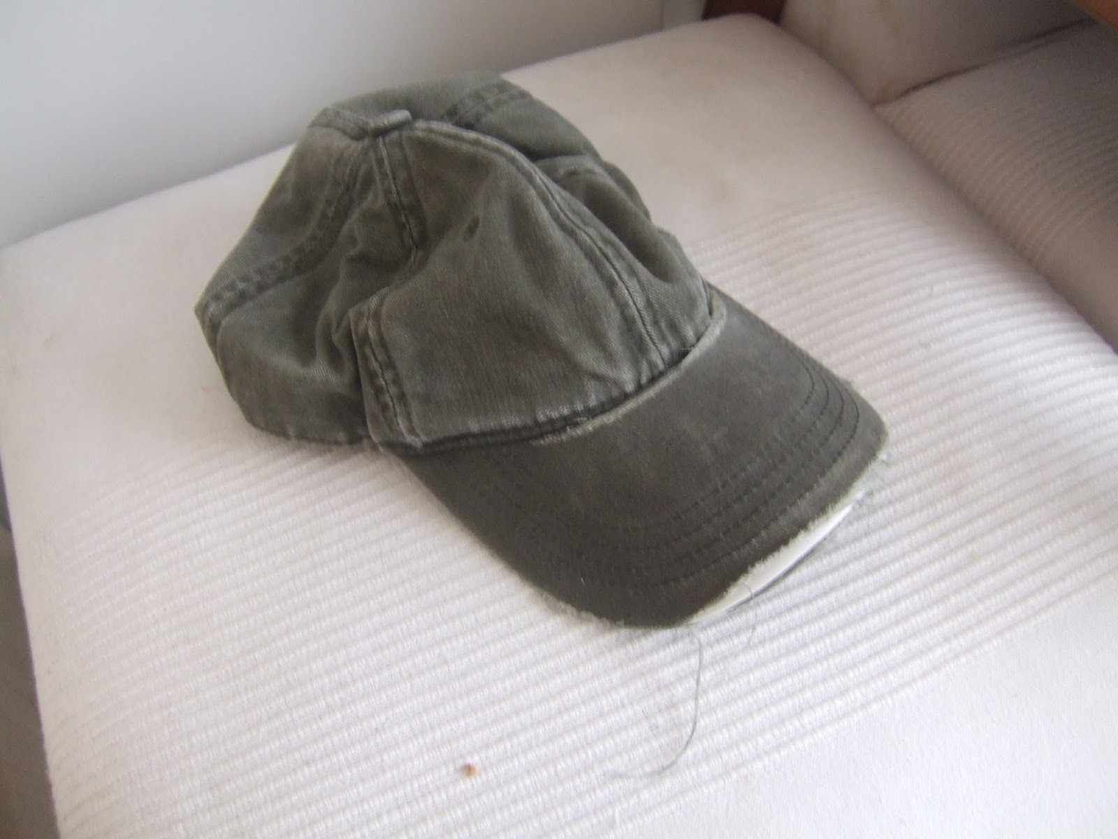 |
| My Faithful Companion of 5+ years, Dead but not yet Buried. |
11.4 miles, via Todmorden Moor, Bacup, Rossendale & Rawtenstall.
Monday, 31 August 2015
Moorthorpe to Pontefract 30/08/15
13.6 miles, via South Kirkby Colliery, Upton, Badsworth, Low Ackworth, East Hardwick, Darrington & Baghill.
August Bank Holiday weekend comes around, but only one day of walking can come from it as I really needed the lie-in on Saturday morning, and the Monday drops from the schedule because the weather looks like utter garbage, again, so the Sunday is the only good day of the weekend, with the restricted transportation options spoiling my original plan, but a small amount of tinkering means it's virtually walkable in reverse. So early trains ahoy for a ride out to Moorthorpe, the other station on the other line in the South Kirkby - South Elmsall conurbation, and it's a 9.25am start once I've gotten away from the confusing mess of ramps and footbridges, heading west along Barnsley Road to the Carr Lane corner and find lot more late 20th century suburbia in the vicinity than I had expected, having anticipated many more colliery terraces in the lands which surrounded the South Kirkby site. Graze the edge of the main sit by the landscaped tip, and meet the path that leads beneath both of the railway lines again, taking care to stay on the correct surface this time, and the ongoing route north will spend a most of its distance shadowing the latter of these lines, and calling it by its original name of the Swinton & Knottingley Joint Railway makes a lot more sense than its contemporary name of the 'Dearne Valley Line'. What I thought would be a walk along a field track turns out to be a long trek through a lot more landscaped colliery workings, making the South Kirkby site easily as extensive as the one at Frickley, and it's a popular track with the dog walkers too, a large green space to keep Upton separate from South Elmsall and Kirkby. The arrival by the A6201, post-dating my map, forces me into a bit of guessing to pick the right path into Upton, and once past the old house by the former Hull & Barnsley railway, this coal town reveals itself to be almost entirely suburbia in this quarter, the only notable old buildings be the rough stone Old Shop on the High Street corner, and the farmhouse on Field Lane at the crest of Beacon Hill. The notable feature, visible for miles, is the water tower, concrete and funnel shaped, but an extra trip over toward it seems unnecessary as it hides behind the houses for most of the trip through the village, only showing up well once the walk down the other side of the hill starts. By that point however, attention goes forwards to the vista to the north, Badsworth looking picturesque among the harvesting fields, and Pontefract on its hillsides appearing off in the distance, giving the deceptive impression of us already being close to the day's end.
August Bank Holiday weekend comes around, but only one day of walking can come from it as I really needed the lie-in on Saturday morning, and the Monday drops from the schedule because the weather looks like utter garbage, again, so the Sunday is the only good day of the weekend, with the restricted transportation options spoiling my original plan, but a small amount of tinkering means it's virtually walkable in reverse. So early trains ahoy for a ride out to Moorthorpe, the other station on the other line in the South Kirkby - South Elmsall conurbation, and it's a 9.25am start once I've gotten away from the confusing mess of ramps and footbridges, heading west along Barnsley Road to the Carr Lane corner and find lot more late 20th century suburbia in the vicinity than I had expected, having anticipated many more colliery terraces in the lands which surrounded the South Kirkby site. Graze the edge of the main sit by the landscaped tip, and meet the path that leads beneath both of the railway lines again, taking care to stay on the correct surface this time, and the ongoing route north will spend a most of its distance shadowing the latter of these lines, and calling it by its original name of the Swinton & Knottingley Joint Railway makes a lot more sense than its contemporary name of the 'Dearne Valley Line'. What I thought would be a walk along a field track turns out to be a long trek through a lot more landscaped colliery workings, making the South Kirkby site easily as extensive as the one at Frickley, and it's a popular track with the dog walkers too, a large green space to keep Upton separate from South Elmsall and Kirkby. The arrival by the A6201, post-dating my map, forces me into a bit of guessing to pick the right path into Upton, and once past the old house by the former Hull & Barnsley railway, this coal town reveals itself to be almost entirely suburbia in this quarter, the only notable old buildings be the rough stone Old Shop on the High Street corner, and the farmhouse on Field Lane at the crest of Beacon Hill. The notable feature, visible for miles, is the water tower, concrete and funnel shaped, but an extra trip over toward it seems unnecessary as it hides behind the houses for most of the trip through the village, only showing up well once the walk down the other side of the hill starts. By that point however, attention goes forwards to the vista to the north, Badsworth looking picturesque among the harvesting fields, and Pontefract on its hillsides appearing off in the distance, giving the deceptive impression of us already being close to the day's end.
Sunday, 23 August 2015
Normanton to Barnsley 22/08/15
14.4 miles, via Goose Hill, Crofton, Anglers Country Park, Cold Hiendley, Royston Junction, Athersley & the Dearne Valley.
Three years on from making my initial discoveries of the lost railways of West Yorkshire, by brain has finally started to make sense of the confused tangle of lines that developed across the Wakefield and South Yorkshire boundary, and with the 2015 season in its final third, it's time to start putting them down before the days start getting short again. Not that I'm managing to get going at speed, hopping off the train at Normanton station at 10am, hoping that the early mornings rains have had a chance to pass, and making the long way off the station by the hugely long footbridge, away from the ridiculously large single platform that had been intended as the major junction of George Hudson's railway empire in the 1840s. There's not a lot of vintage buildings to be found in the immediate vicinity, but I note that the new apartments on Railway Terrace at least attempt to ape the style of the original station buildings, and I soon meet my track out of town, along Wakefield Road, with mostly council flats for company, though the Roman Catholic church of St John the Baptist and the primitive Methodist Chapel both have a style to attract attention. Goosehill Road has a ginnel at its end to lead me into the countryside, sending me on a field walk to the private road leading to the Welbeck reclamation and recycling site which is gradually filling up the opencast pits which once mined coal along the banks of the Calder, and I'm coming this way to get a look at the site of Goose Hill Junction, and I'm sure that they won't mind me trespassing on the old industrial tracks to get there. I've talked about the old North Midland Mainline before, (1840-1985 for those keeping track) and tracing the section from Goose Hill to Oakenshaw is a trek which cannot be done a track level as it is so thoroughly overgrown, and so a path needs to follow paths that shadow it, passing over the bridges at Goose Hill, and shadowing it on the footpath from Cross Hills farm to Warmfield Road, where a peer from the high bridge will reveal that a lagoon has developed at track level, large enough to go boating on. Shadow again down to the A655, where trees obscure any view down into the cutting, and the main road's footway is paced down to the cluster of buildings at the edge of Heath Common before field walking to an old footbridge over the formation, where the only decent look down to the trackbed can be obtained. Odd that it could be so overgrown after having been closed only 30 years, and that Wakefield MDC hasn't been able to gain access to it, I'd imagine that this is one line that might be on the future slate for revival as an international heavy freight line.
Three years on from making my initial discoveries of the lost railways of West Yorkshire, by brain has finally started to make sense of the confused tangle of lines that developed across the Wakefield and South Yorkshire boundary, and with the 2015 season in its final third, it's time to start putting them down before the days start getting short again. Not that I'm managing to get going at speed, hopping off the train at Normanton station at 10am, hoping that the early mornings rains have had a chance to pass, and making the long way off the station by the hugely long footbridge, away from the ridiculously large single platform that had been intended as the major junction of George Hudson's railway empire in the 1840s. There's not a lot of vintage buildings to be found in the immediate vicinity, but I note that the new apartments on Railway Terrace at least attempt to ape the style of the original station buildings, and I soon meet my track out of town, along Wakefield Road, with mostly council flats for company, though the Roman Catholic church of St John the Baptist and the primitive Methodist Chapel both have a style to attract attention. Goosehill Road has a ginnel at its end to lead me into the countryside, sending me on a field walk to the private road leading to the Welbeck reclamation and recycling site which is gradually filling up the opencast pits which once mined coal along the banks of the Calder, and I'm coming this way to get a look at the site of Goose Hill Junction, and I'm sure that they won't mind me trespassing on the old industrial tracks to get there. I've talked about the old North Midland Mainline before, (1840-1985 for those keeping track) and tracing the section from Goose Hill to Oakenshaw is a trek which cannot be done a track level as it is so thoroughly overgrown, and so a path needs to follow paths that shadow it, passing over the bridges at Goose Hill, and shadowing it on the footpath from Cross Hills farm to Warmfield Road, where a peer from the high bridge will reveal that a lagoon has developed at track level, large enough to go boating on. Shadow again down to the A655, where trees obscure any view down into the cutting, and the main road's footway is paced down to the cluster of buildings at the edge of Heath Common before field walking to an old footbridge over the formation, where the only decent look down to the trackbed can be obtained. Odd that it could be so overgrown after having been closed only 30 years, and that Wakefield MDC hasn't been able to gain access to it, I'd imagine that this is one line that might be on the future slate for revival as an international heavy freight line.
Subscribe to:
Posts (Atom)