Saturday brings us our first washout day of the year, as rain falls consistently from dawn to dusk, as well as through many hours of the night, and with the wisdom borne of age I reschedule my plans for Sunday, which promises a much clearer spell of weather, but a tighter window of opportunity with no buses running out of Morley until it's too late to be useful, and with fewer trains homewards on the other end, so we have to get a move on to fit in a pretty modest distance. To get to the start line in Wakefield, this means having to bus it into Leeds to get a rail connection, with the added bonus of getting to see just how high the Aire has gotten around Victoria Bridge, and how angry is sounds running under the Dark Arches, after the most rainfall the county has experienced in over 3 years, and thus run on to get to Westgate station for a 9.05am jump off, full of intent to strike away towards Denby Dale, a small town that seems many miles away from here in the mind (actually beyond the path of the Kirklees Way and thus outside my field of walking experience), despite having the A636 sharing a name with it. So on, aiming for the Penistone Line having done with the six excursions to create the local framework to hang the season upon, setting off north to with the intention to start my trip from the bus station as had been originally planned but only get as far as the Civic Quarter before deciding that my time margin might be a bit tight for ten extra minutes of walking and thus turn south towards our proper destination, heading down Wood Street and past the old courthouse that is still clad in the scaffold that enclosed the building 5 years ago, and also the Town Hall, on down then late Georgian shopping parade to land on Bull Ring by the corner that leads down to the cathedral, turning down to the way down to Westgate, which seems quietly devoid of life after the night before and ahead of the early Sunday shoppers heading out. Cross over the main drag to head down Queen Street, passing in the shadow of the local Holiday Inn Express and noting that this is a lane that completely lacks the antique interest of its more interesting neighbour Market Street, which we align with as George Street leads to the top of Denby Dale Road, along which most of our day will be carried, as we are lead out of town, down to the crossing of Ings Road by the Royal Mail office and the 1960s stylish Raines House, over Ings Beck with its tablet commemorating the establishment of the turnpike roads in the 19th century and under the broad arch of Wakefield Viaduct, carrying the railway south to Doncaster and beyond.
 |
| Silent Wakefield on a Sunday Morning. |
 |
| Raines House, Denby Dale Road. |
Victorian suburbia awaits beyond the traffic island flanked by B&Q and multiple car dealerships, joining the A636 as it slips between towns of terraces, and past the Thornes Corner gardens, arriving by the side of Clarence & (or?) Holmfield park(s?) taking us past St James' Thornes, and the Motte and Bailey fort in the park across the way, which lies behind the long parade of bare trees at the roadside, and thus if you want a commentary on that , you'll have to seek out my previous account of a trip this way. Past the Queens Arms and the Majestic Wine Warehouse we peel away from the parkland as road leads us under the Wakefield to Mirfield line below a very impressive plate girder bridge, rising us away from the old face of the town and on among the factories and industrial units that fill out the plots on the north side of the Calder and the Navigation channel, which we rise over to pass through the commercial park on Calder Island, before passing over the loop of the River itself, seeing that the channel looks worryingly full and busy, which means there's probably been all sorts of fun upstream through the preceding day. Onward with the road away from the city, then, past the terraces that once served the gravel pits by the riverside and the outlying parade of houses that fancied their chances on the flatlands by the river, past the entrance to Pugney's Watersports Centre and Country Park, and many more car showrooms that saw these level plots as prime real estate for their businesses, counting Mercedes, Audi and Kia off the list as we go. The bright early going passes as we pass the shed dealership and split off the A636 to follow the old path of Denby Dale Road through the suburban village of Durkar (or Dirt Carr as old maps would have it) feeling the risk of rain coming on as pass among formerly rural outliers, the stray terraces, and the former chapel and the New Inn that form the visual interest out here, before meeting the path that loops us around to the new road again as we pass under junction 39 of the M1. Meet the Clarion Cedar Court hotel on the other side, a building distinctive and locally significant from many trips up the motorway, and we get back on track as pass through Calder Grove, and the rain showers pass as quickly as they arrived, passing St John's church and more residential builds that have me not entirely convinced that this isn't just another piece of Durkar that wasn't given a new identity after the building of the M1 separated it from its original community, and all is sunshine once more as we land back on the A636 by the Kingfisher Chop shop, and the end of Navigation Lane, the previously travelled way down to the long Horbury Cut of the Calder & Hebble.
 |
| St James's, Thornes. |
 |
| The churning Calder at Calder Island. |
 |
| The New Inn, Durkar. |
 |
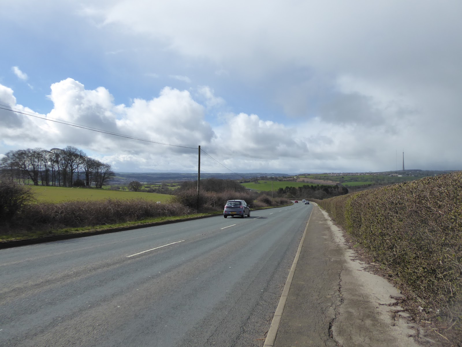
| Denby Dale Road, Calder Grove. |
The road starts its long rise away from the Calder as the Denby Dale Road heads up to and over the railway down towards Barnsley, which takes us into the lower portion of the Horbury railway triangle, which once contained the coal tramway that came down from Caphouse colliery as well as the extensive British Oak mine, and is now only home to a cricket field and the enduring Calder Grove viaduct, on the same MR route as the one at Horbury Bridge, equally imposing and vast in blue bricks and showing off its best faces as we pass under its eastern end and find it unobscured by tree cover while Spring is still unsprung. Another one to love and photograph many times as we meet the suburban parade that leads up to the British Oak, the pub that named the colliery or vice versa, and on under the bridge of the still disused West Curve, where open countryside awaits beyond, as the road start to rise more rapidly, taking us past the Blacker Hall farm shop, which transpires to be the last notable roadside trace of civilisation that we'll be seeing for the better part of an hour as road starts its long traverse over Bretton Common. We start on the long drag up to the passage through Bullcliff Wood, which houses an unseen paintballing facility and provides just enough cover from the weather as another rainstorm rapidly passes overhead, with things getting a whole lot clearer once we rise above it to get sightlines back towards Wakefield and the lower Aire valley, as well as getting a variant of the view north over the middle Calder that got me into so many raptures last weekend, eventually rising to meet the A637 roundabout, which doesn't even have a service station as it sits midway between Barnsley and Huddersfield. Completely miss spotting the nearby Pot House farm as I get distracted by the noisy Rookery in the tree branches overhead and press on, to meet the road crest as it passes through Top Lane plantations, and over the track that leads down into Bretton Park, which is completely concealed from this side of the hill, and start our descent into the Dearne valley as we pass over the top. The road gets rapidly steep as we absorb our new vistas, with the surprisingly deep ands narrow cleft of the valley ahead of it, flanked by the wooded bank of High Hoyland on the south side side and the barren, aside form the masts, top of Emley Moor on the other, and the sunlit view rapidly diminishes as more rain become visible as it erases the north western horizon, and we charge on downhill trying to stay ahead of it as we fail to see Bower Hill farm in the fields to the south, secure in the knowledge that it is there somewhere as we saw it when the Wakefield Way carried us out here in 2015.
 |
| Calder Grove Viaduct. |
 |
| The British Oak. |
 |
| The Long Ascent to Bretton Common commences. |
 |
| The A636 - A637 junction, Bretton Common. |
 |
| Off Bretton Common and into the Dearne Valley. |
Beyond the Bentley Spring Woods and the end of Woodhouse Lane we again enter that previously untrammelled gap between the Wakefield and Kirklees districts, which we soon enter as the road swings around to head into the channel of the Dearne, which hides from view below the High Hoyland flank, while the wind and rain bite in hard for the longest stretch of the day, making me regret the fact that I trimmed by beard down in expectation of spring as it blow in so cold that it actually makes my teeth hurt. I've experienced warmer weather when we've been out in the snow, if we're being honest, and there's no shelter to be had as we run on to meet the passage of the Kirklees Way across the A636, where the rain finally passes and the Emley moor masts reappear on the horizon and we can start to feel close to civilisation again as Clayton West lies not to far further along our south-westerly track, a bit further than you'd expect, but once past the Kiln Lane corner and the Woodman inn, the hour spent amongst a whole mess of not much feels very distant all of a sudden. Cross over the Dearne, that isn't much wider than a large stream here, though it still churns away aggressively, despite not having a catchment that gets even that close to the Pennines, and then press on past the Junction Inn and the northern suburban edge of the town before meeting the railway bridge that currently carries the Kirklees Light Railway into the town on the former branch of the L&YR that never grew to be their own independent line into the South Yorkshire coalfields, a line that I probably need to get ridden during the course of this season. Press on, feeling the puzzlement that comes with thses villages on the Dearne, that seem larger than somewhere purely rural would become at this remove, concluding that it was probably industry, using the fast flowing river for power, that sustained their growth through the years rather than farming, now being places that the ambitious commuter or country escaper might wish to reside. There's certainly an appeal and wild energy of sorts to this corner, with the valley sides rising beyond the main road away from the terraces and mills, and the Dearne is crossed again as we slip over into Scissett, one of those really guessable pronunciations, where we'll pass the local swimming baths and working men's club before passing on among the stone terraces that line the road, leading us on towards the playing fields and the elevated yard of St Augustine's church at the junction of the road up to Skelmanthorpe, perhaps one of the definitive places that my local trails have so far avoided in this borough, which will also need remedying as so as is possible.
 |
| Cold Winds and Rain below High Hoyland. |
 |
| The Woodman Inn, Clayton West. |
 |
| The Kirklees Light Railway bridge, Clayton West. |
 |
| Scissett Swimming Baths. |
Heading out of town beyond the Crown Inn as the valley grows tighter and leafier we meet a lot of narrow industrial building clinging to the roadside, confirming my industrial theory of the local development, making good use of the limited level space and plentiful water power available in the area, finding the large Nortonthorpe mill complex at the southern edge of the village before the road slips off into the wooded cleft of the Dearne, which we got no real impression of when the Kirklees Way wandered over the higher fields around Bagden Hall to the south of here. We're also on a uphill climb from here, only three mile or so from where the Dearne rises, and rising through High Bridge Wood, we'll pass the 'Pigs in the Wood' complex, where the farm allows their pigs to roam freely among the trees in an attempt to create a more natural environment for the animals and a new perspective for the visitors, which certainly makes for a more interesting landscape use than mere forestry. Emerge into the open to meet the Kitchenroyd terraces, for urban living in adistinclty rural landscape, and above here we'll pass outside the path of the Kirklees Way, not that I recognise the route at all since our 2014 passage, finally starting to meet the suburban outliers of multiple vintages that start to settle on the valley side as we rise above the Dearne a half mile out from Denby Dale, which really seems to have arrived soon than expected, despite me being full aware of the distance. The signage indicates this place as being 'The Pie Village' which immediately appeals to me, and as we rise into this deeply lovely stone built settlement, associations to the name become apparent, as the village hall is called The Pie Hall, and further along by the White Hart inn and the local tearooms, we find concrete pie slices on the traffic island that illustrate many generations of history in relief carving. There's nowhere obvious to obtain pies, but there picturesqueness aplenty to make the wanderer wish to return as we ascend to the top of the village in the shadow of the railway viaduct that dominates the young and deep Dearne valley, carrying the Penistone Line over on 21 arches, and having arrived ahead of schedule after doing the excursion at a right old clip, there's time to get every photographic angle on its many arches from this side of the valley. So beyond it we pace, down to the access road to the mill site at the valley floor and on to the ancient clapper bridge on the charging river we go before the day wraps up, feeling inspired by the quality of Victorian engineering once more, as we find the odd and twisting route up to Denby Dale station (my first new station visit in nine months!), concluding the day at only 1.10pm, satisfied with my progress but also knowing there will be a long Sunday excursion home from here, punctuated by the promise of a sausage sandwich at the Head of Steam in Huddersfield along the way.
 |
| Nortonthorpe Mill, Scissett. |
 |
| The Wooded Cleft of the Upper Dearne. |
 |
| The Kitchenroyd Terraces. |
 |
| The Pie Hall, Denby Dale. |
 |
| Pie Slices on the Traffic Island, Denby Dale. |
 |
| Denby Dale Viaduct. |
5,000 Miles Cumulative Total: 3715.8 miles
2019 Total: 65.4 miles
Up Country Total: 3322.7 miles
Solo Total: 3429.5 miles
Miles in My 40s: 2309.6 miles
Next Up: Pretty Much Going Back the Way We Just Came!


No comments:
Post a Comment