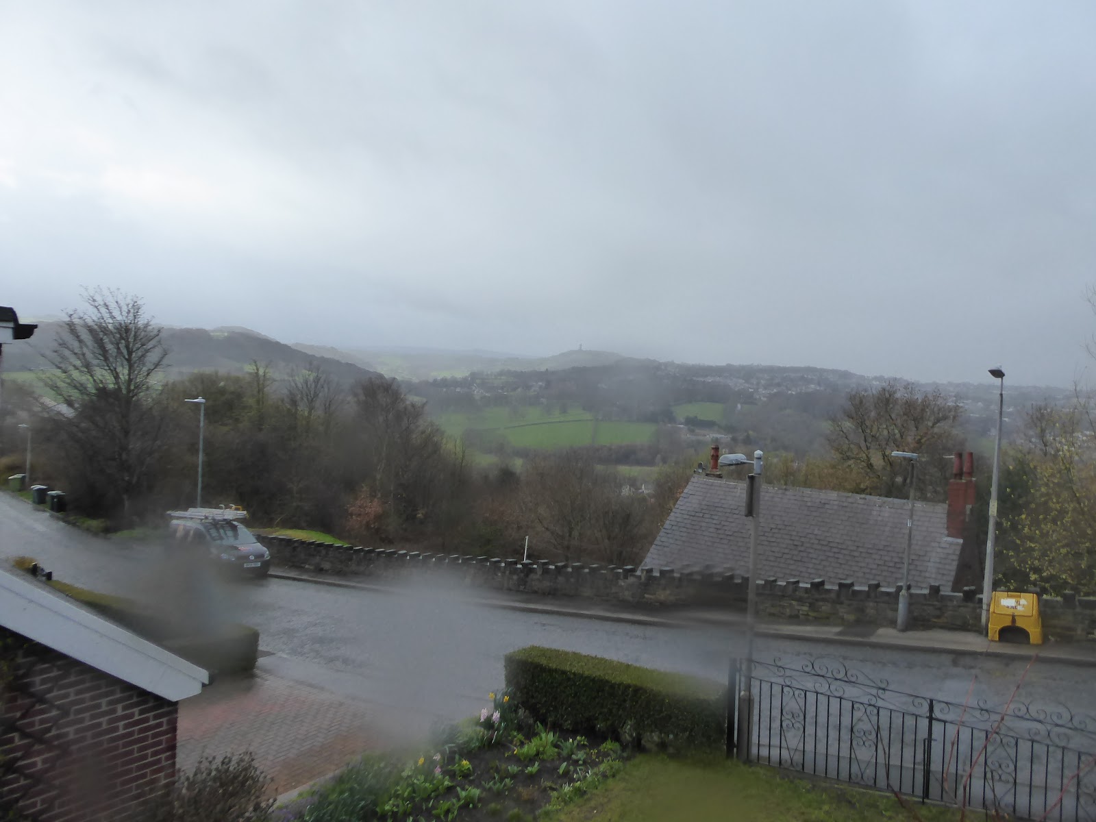
We are definitely back in the grip of Winter again as this day dawns, and plans to get off to an early start are immediately scuppered as I'm not even half way down to Morley station before the hiss of drizzle turns to a fearsome downpour and a retreat is beaten home to dress for colder, damper weather, and for a pause to hopefully get in behind it with a later start as the sunshine and showers cycle around rapidly. As it is we don't get to the start line in Huddersfield until after 10.35am thanks to a train getting cancelled, and that's far too late in the day for this time of year to be setting out to attempt the distance that we're about to travel, but initial indicators suggest that we might be in a good patch as sunshine bathes a damply shiny St George's Square and first steps are taken away up Railway Street, which displays a Jacobean Gothic feel that could easily be mistaken for a side road in Edinburgh. Things get a bit more West Yorkshire fashioned as we meet the Westgate-Kirkgate axis across the town centre, descending past the 17th century market cross and the parish church of St Peter, and approach the inner ring road past the converted cinema and the end of 'Beast Market' as we turn down Oldgate behind the rows of student flat tenements (with a touch of Glasgow atmosphere?) and skirt around the towering walls of the Kingsgate Shopping centre. Cross Queengate by the new landmark building of the University of Huddersfield on the Wakefield Road corner, and soon get indication that the weather still has a lot more life in it as leaden clouds gather overhead and a cold wind sets in from the north west, bringing steady rain on my back as we cross the Broad Canal by the Aspley Bridge wharf and press on past pub and chapel to cross over the River Colne, to find a Lidl, numerous takeaways and student houses aplenty as we set off with the A629 uphill. It's quite a drag to get going as we pass an enduring mill and long stone terraces at the Almondbury Bank corner, rising on though the suburban corner of Moldgreen, remotely passing its own shopping parade and corner pub, the Ivy Green, as we pass the boldly fashioned Methodist church and ascend on into a landscape of stuccoed and pebble-dashed semis as the clouds part up to give us bluer skies again.
 |
| Railway Street, Huddersfield, could be in Edinburgh? |
 |
| The new University buildings, Queensgate. |
 |
| The Ivy Green corner, Moldgreen. |
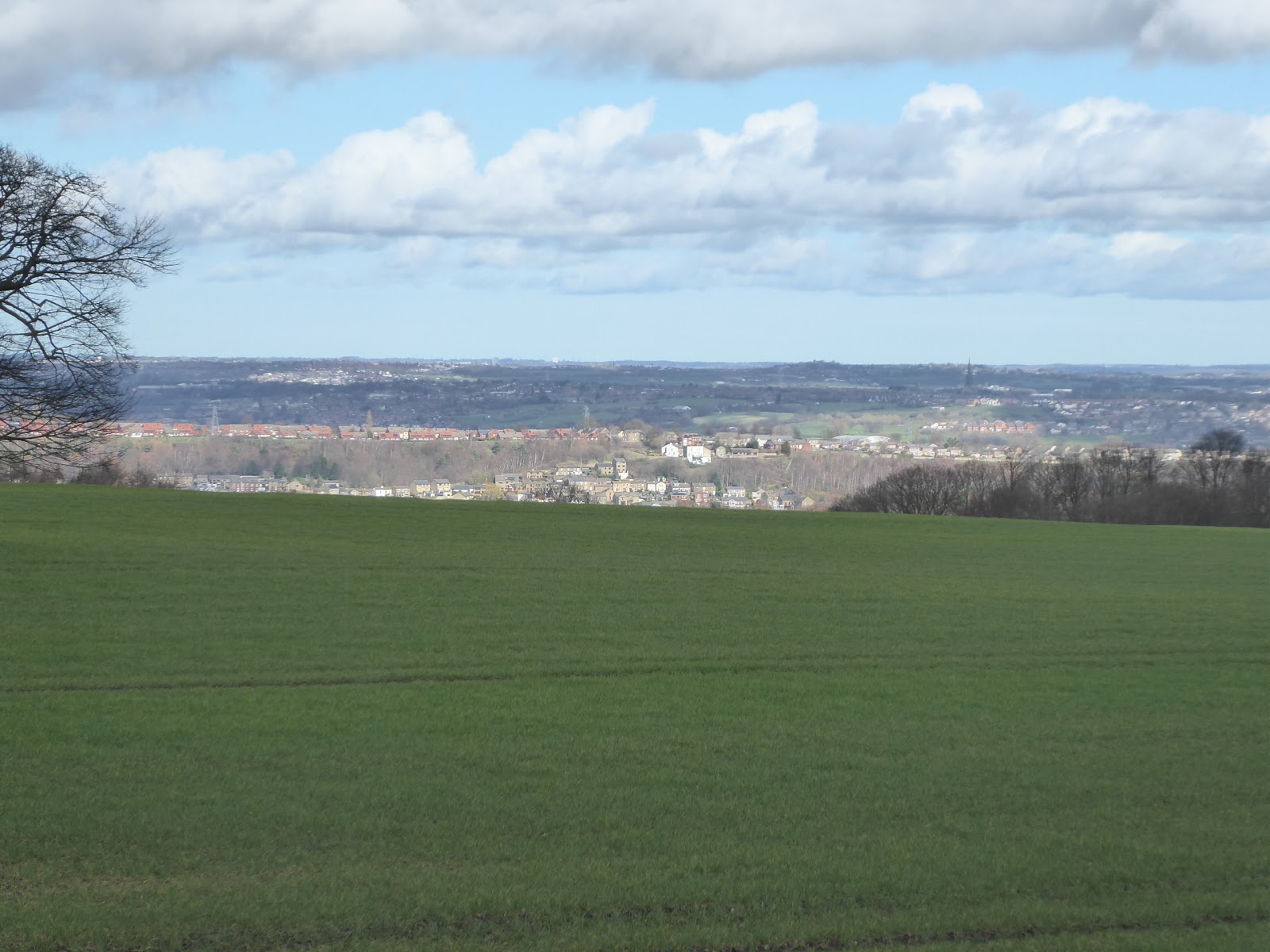
We now land on the edge of Ravensknowle Park, with its little Victorian suburb surrounding it and the Tolson Memorial Museum dwelling in the hall at its centre, which forms a neat little scene with the belvedered stables and clock surmounted bandstand flanking it, but hopes for a decent picture or twelve are scuppered as the rain comes on hard again, so we push on though suburbia once again, noting a couple of parades of alms-houses among the semis and terraces. The wisdom of carrying on starts to be pondered as the rain lashes harder and the buses running back to the town are noted as they descend, and as the rain soaks me completely from behind, I'll lament that it's still too early in the day to find a pub to retreat into for a dry off, like the Stag or the Waterloo, the latter of which sits at the corner of the turn onto the A642, which takes some fun traffic negotiating to get to as we don't take the road on to Penistone. Pass the bus depot and indoor football facility, and over Fenay Beck, which is the prime landscape feature of this part of the town, and rise on past terraces that form the vague district of Tandem, and gain a useful bit of geographical familiarity in this previously unseen quarter as we meet the vast bridge abutment of the former L&NWR Kirkburton branch, which we pass below before rising on and soon elevating ourselves sharply above the alignment as it presses southwards, past the Ashfield Liberal Club and neighbouring the care home. As we press on through the even vaguer district of Cowmes, we finally find ourselves high enough up to get a look back towards Huddersfield as it spreads itself over the Colne valley and its branches and finally get a feel of being on the outer edge of the town as the roadside cottages gains a rural flavour, and meet a random chimney by the lane as we meet a roundabout on an access road to a very well concealed housing development down the hillside. The town continues to string itself out along the Wakefield Road as we elevate on, gaining more views across the town, and over towards Castle Hill in the green lands to the south of it, a space that has been ventured into only once in all my travels, and the sentinel tower over there gets bathed in sunshine and lost in grey clouds as we hit the outer edge of Lepton's estates and playing fields as the weather here seems uncertain as to how it's going to unfold.
 |
| Ravenknowle Park and Tolson Memorial Museum |
 |
| The Waterloo corner, Wakefield Road. |
 |
| The former Kirkburton branch at Tandem. |
 |
| The Chimney Lane corner, Cowmes. |
 |
The view to Castle Hill, Lepton.
|
4+miles out, according to the Wakefield & Austerlands(?) Road sign, and the semis depart the roadside as fields finally emerge to the north of us past the randomly located Hyundai dealership, and we get some rural stylings abouts to counterweight the brick fashion of Lepton's council estates, getting brief sights of the tower of St John's church as it mostley hiodes from view, finally meeting a familiar corner as we hit the top of Rowley Lane as it directs the gaze directly across the outer edge of Great Huddersfield to Castle Hill. Pass the redevelopment of the old village school building and the random selection of houses at the town's edge as we are soon into the countryside at last, getting sight of the ridge of Whitley park on one side and the masts on Emley Moor on the other, with the Lepton Highlanders spots club and the 315 Spa and Restaurant being the very last urban features we'll see (where the spa mostly hides under grassy banks next to the former pub, rather neatly). The road climb continues, and the view northwest to the Colne and Calder from the driveway to the Happy Cat boarding cattery indicates that there shouldn't be much more by way of foul weather coming our way as the skies brighten thoroughly and the wind starts the task of drying out my togs, and as we rise to meet the open fields of Flockton Moor, the last views are taken back to the town, and to Castle Hill while the road-signage indicate that there have been 75 casualties on the A642 over the last five years, rather discouragingly. The trip finally plateaus as we approach Grange Moor, a rather remote urban enclave that sits away from the main road, but has enough enduring outliers to still feel like a village as we pass the Italian restaurant, the mechanics garage, the allotments and rural terraces that sit this side of the A637 junction by the Blacksmiths Arms, and the imagination can open out a view from here towards Barnsley and the Dearne valley. The road signs here indicate 125 casualties on the A642, confirming my opinion that it's surely the most dangerous road in West Yorkshire as we press on towards the day's crest, as Emley Moor retreats behind us and Emley village rises on the ridge to the south, while my brain ponders where I might have transited this lane on my 2014 excursions this way, not by the Kaye Arms, as my mind would insist, though if I had been up here the spectacular panorama to the north would have stuck with me.
 |
| The old Co-op, Lepton. |
 |
| The ascent over Flockton Moor. |
 |
| The Blacksmith's Arms, Grange Moor. |
 |
| The Kaye Arms, at the top of the world. |
Foregrounded to the north we have Thornhill and Ossett, and eastwards we can look to Wakefield's highpoints and down to the power stations along the lower Aire, while a keen eye looking north can see all the way to the tops of Leeds's highest buildings and as far as the tower blocks at Seacroft, and the super zoom on the camera can snag the remotest confirmed view of Morley town hall, many miles distant from up here on the Calder-Dearne ridge, looking to the Calder-Aire uplands. We meet our old routes about here eventually, around the fields of Denby Grange park, and past the Kirklees Way route at Rookery Farm we actually exit our familiar walking territory as a gap has been allowed to endure between the Kirklees and Wakefield districts since my last footfalls out here in 2015, so we actually move the border of my walked lands south as we run down the mile or so past Low Farm towards the 1814 Hope Pit and over the former wagonway that marks the western end of the National Coal Mining Museum for England, as well as the district boundary. Yet to visit this site properly, but we'll take in the feel of it as we pass by, past the silvery miner statues, the RS&H tank engine 'Progress' and the extensive buildings of the 1876 Caphouse Colliery, which endured in business for nearly 90 years while looking like a Victorian relic, and here we'll meet the Wakefield Way route as we depart the main road to head up Old Road, taking with us the belief that this lane will surely show us the more interesting faces of Overton and Middlestown. It's not easy to see where the boundary might be between the two, and the under-inspired naming of the villages (matched to its near neighbour Netherton) suggests an amount of utilitarian function, as if they aren't much older than the collieries in the vicinity, and suburbia rural the day along the lane as far as the Black Swan inn, with only a few mining terraces to see before we get a view over towards the wooded flank of Coxley Bank, which could easily be mistaken for Woolley Edge from over here. Then on, down through Middlestown, for more suburbia and terraces with at least a couple of rural outliers hiding among them, descending back to the A642 New Road via Cross Road to meet the corner by the Spiced Mango and the Little Bull, where the Wakefield Way also brought us, and then we can follow the run downhill towards the Calder, with Ossett and Horbury on the horizon ahead of us, with Horbury Bridge Viaduct teasing its future appearance as we continue down through the fields and among the terraces of rural stone cottages.
 |
| The view over Thornhill towards Leeds. |
 |
| Hope Pit. |
 |
| Caphouse Colliery. |
 |
| The Black Swan, Overton. |
 |
| The Little Bull, Middlestown. |
It's a fun beast to see as it rises its many arches in blue engineering bricks over the farmsteads, industrial units and suburbs of the settlement, still without a use having not had a railway using it since 1950, and having lived on for 69 years without purpose, longer than the 44 years that the MR and its successors used it, and I'll always love its presence, as we leave it behind us to cross the C&HN and the River Calder to get onto the last leg of our trip, feeling a mild disappointment that the Bingley Arms appears to be closed down at the moment. Onwards to the main body of Horbury Bridge, the home of 'Onward, Christian Soldiers', and also the Italian mini-car in glass case by the Bosco coffee shop, and we'll rise away from the river past the village school and along the urban edge that face the extensive spread of industrial works that fill the space on the north bank, where we'll cross the railway at the site of the L&YR's Horbury & Ossett station. This is one that seems to have resisted a necessary restoration, with its subway and good shed still enduring on the line between Wakefield and Mirfield, not that it's really that convenient for its towns which are a slog uphill away, as we carry on among terraces that sit below the escarpment that they sit upon above the Calder, and we depart the A642 into Horbury by The Quarry Tapas and Bottlery. Quarry Hill puts on a proud Victorian suburban face as it leads us forward to High Street, where Horbury show itself to be as much town as large village, showing a healthy commercial centre with a strong bar culture as we skirt below the impressive tower of St Peter & St Leonard's church, and finally finding a spot to break among the picturesqueness on a bench that illustrates the local turns of the Calder on its planks. Carry on among more villas and townhouses, and arrive below Carr Lodge Park, the town's major greenspace, where John Carr's house looks unloved and abandoned, ill-serving the architect who ought to be this town's favourite son, also passing Horbury Academy before Wakefield Road drive us into the suburbia that has grown to fill every bit of space between the town and the M1, which we'll pass under as we rejoin the A642 by the Malt House. Thus we arrive in Wakefield again, passing the Mormon Temple and pacing on among the suburban semis by the lower edge of the Lupset estate, which we won't be finding a fun router through, though a beverage in its pub cloud tempt, instead sticking to Horbury Road to get that feeling that this city is actually far larger than you'd expect as it road walks just keep on coming, as we're still 2 miles from the day's end.
 |
| Horbury Bridge Viaduct. |
 |
| Horbury & Ossett station (former). |
 |
| Horbury High Street. |
 |
| Carr Lodge Park, Horbury. |
 |
| Welcome to Wakefield, at the M1. |
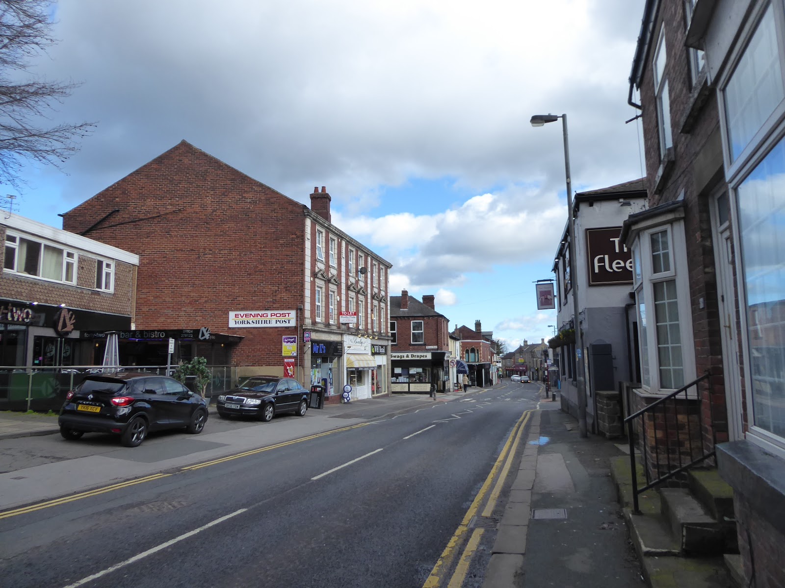
The Lupset estate seems larger than it looks on the map as you pace its perimeter until you realise that the A642 is effectively going round two sides of it, making our decisive shift to its eastern side as we pass the Whinney Moor inn, across the way from another pair of tower blocks in the Wakefield style of brick and cream painted concrete with colourful accents, which must have been all the rage with the town planners a few decades ago. The road widens as we come around to the side of Thornes Park, which is attached to Clarence and Holmfield Parks and offers no suggestion as to why it might have needed three names, but it does have an athletics track it, looking good enough to be used for properly competitive meets and training, and we'll cross to walk alongside it, still wondering how far we have to go as the landscape fills with low apartment blocks and takeaways. Arrive by The Redoubt, which advertises itself as the start of the legendary Westgate Run, and it looks like revellers are already out to start that pub crawl, and my interest is piqued as we arrive on Westgate Common once more by St Michaels church, intending to take note of how many hostelries there are between here and the town. Cross over to the side of Ings Beck and its waterfront terraces and get counting as we do the run into the city, which is a useful distraction from the fact that my local routes have really piled up along this lane, counting off four pubs before we get to the Ings Road corner and then tagging two more hiding in the Georgian parade at Westgate End, just short of the railway bridge. We could break for a train here, but choose to carry on for the shortest possible trip home by bus, and start the ascent of Westgate proper, tagging two more pubs to the Run route before we get to the Unity Hall and Theatre Royal, and that's eight establishments counted before the deluge of revellers bars start to fill out the rest of the main strip, and we peel off to head to our destination, up Drury Lane and Cliff Parade toward the civic quarter. Pass the Art House gallery and the York House Hotel, and get a small feel for the old city layout as narrow side streets spread off the main drag in a medieval fashion, while crowded with early 18th century townhouses and warehouses, and that will keep the mind entertained as we climb up to the Distict, County and City Halls around Coronation Gardens, home to the cenotaph and the Queen Victoria statue. Skirting around the top of the town, it feels like the bus station ought to be close but it's a lot further up Rishworth Street and Upper York Street than you'd think, beyond Northgate and the car parks that offer sightlines over the town as the day's heat starts to run out, just as we find the largest entrance to the bus station by the A61 Leeds Road, just across the way from the Lightwaves leisure centre and not especially convenient for the rest of the town, but fine for me as we wrap at 3.55pm, closing the triangle of local trips that we'll be hanging this 2019 season on.
 |
| The Tower Blocks on Horbury Road. |
 |
| The Redoubt, Westgate Common. |
 |
| Henry Boon's, Westgate End. |
 |
| More of hidden Georgian Wakefield, Cliff Parade. |
 |
| Late afternoon in Wakefield's Civic Quarter. |
5,000 Miles Cumulative Total: 3704 miles
2019 Total: 53.6 miles
Up Country Total: 3310.9 miles
Solo Total: 3417.7 miles
Miles in My 40s: 2297.8 miles
Next Up: Heading South, and Into the Unknown, already!


No comments:
Post a Comment