With an 18+ mile day plotted over much variated terrain in distant Wharfedale, and only one potential bus available to get me home again, it makes good sense to start out as early as possible on the longest available walking day at the top of the year, feeling like we've managed to arrive ahead of this Summer's weather as we disembark the train at Ben Rhydding and make for this station's hidden other exit to start our long day's journey at 8.25am. Our initial steps are down through the suburbia around Valley Road, down Strathmore Road and Wyvil Crescent to get to the passageway to Leeds Road, which is crossed so we can descend to the riverbank and cross the Wharfe via the Denton Stepping stones, a fine idea in theory and they might be slightly less friendly than those at Burley but they present a crossing without terrors until more than halfway across where a gap presents itself, far too wide to stride over and it's far to early to get to paddling and so we have to retreat. Back to Leeds Road to pace the A65 eastwards to pass out of greater Ilkley, as far as Denton Bridge to make our crossing of the Wharfe there, and that's why I'd felt the need to factor in as large a walking window as possible as this feels like its going to add an extra mile on my day as we make our way along Denton Road to the other end of the stone and walk out midstream once again so that I might have touched all of them, without having made a successful transit. So onwards, after that faff around, and hit the rising Carter's Lane to haul us uphill past Beckfoot farm and on to some fine emerging views to the southwest as we run on steeply to meet Westville House school, which must have a particular reason for it's odd location and large size, at the corner where the road levels out to pass through Middleton, where suburban houses with fine views have settled by the roadside in a distinctly rural landscape. Pass among the local farms, both active and holiday residential, to meet the corner with Hunger Hill and the very top of expensive suburban Ilkley where pricey bungalows face the rising fields below the high moors, and views down to the town and the panorama presented by Rombalds Moor and the rising high southern side of Wharfedale will keep us company as we progress onwards, the straight line of Slates Lane only being interrupted by the wooded cleft of a descending beck that has created someone a particularly good garden feature. The mind starts to feel a bit lost as to our location as we move on along Hardings Lane, but soon get a fix as we spot ourselves behind Myddelton Lodge, and the farm buildings associated to it, last seen 5 years ago after my trip up Beamsley Beacon, which gives me my orientation back as we start to ascend again, rising to meet 200m elevation and spotting an oft heard but rarely seen Wren in a hedge, and noting the most enormous Hare grazing away in a neighbouring field.
 |
| Denton Stepping Stones, not as accessible as they appear. |
 |
| The viable crossing of the Wharfe, at Denton Bridge. |
 |
| Westville School, Middleton. |
 |
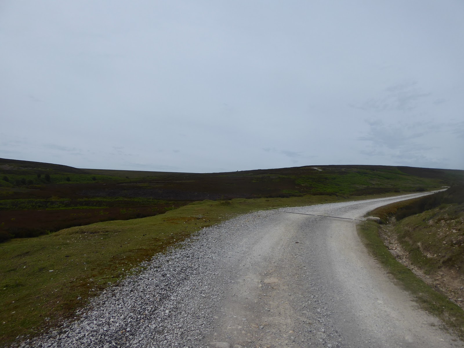
| Slates Lane and the suburban edge of Ilkley. |
 |
| Ilkley Proper, with Rombalds Moor. |
Eventually rising to meet the corner of Parks Lane, we hit a westward route, with Beamsley Beacon rising on the north-western horizon, while to road passes among the rough fields that sit below the moors, and we 've found an exposed spot where we are heading straight into the prevailing wind, that feels far colder than it ought after a sequence of warm days, and if the clouds are any indication, it looks like today isn't going to brighten up any time soon, as haziness rules at altitude to scatter the sunshine. A benefit of the exposed fields is that we have some fine views down into Lower Wharfedale and across to the ripples of Skipton Moor before we run into the farm cluster at Ling Park, and the road takes a dynamic shift along a rising s-bend to meet the low moor edge of Middleton Moor, and passing the 245m trig point on the edge of Ling Park plantation, our last spot to get a panormainc view of the trail walked so far before we strike on among the sheep and rough grass. The lane crests at 250+m as the Beacon Hill rises more prominently ahead of us with many scattered farmsteads on its lower flanks, and it's hard to say if Langbar exists as a village, hamlet or just a loose association of farms high above the Wharfe, but it starts to take on a form of sorts once we are past Moor End farm, and we pass Hardisty's, Black Foss, Spring Well and Beach House farms on the undulating lane as the eye wanders downhill towards Addingham and tries to place the path that we previously traced up here. It only becomes memorably apparent as we hit the rise up to the bungalow by the road corner below the woods around Beacon hall, with the big hill ahead now obscured from view as we reach the highest point of phase one of today's trip, at 260m up, as Lanshaw Bank reaches the should of Beamsley beacon (or Howber Hill, if we're feeling intimate with it), noting the path that will complete the remaining 130m of ascent peeling off by West Lodge house. Our full attention now falls forwards to the panorama over Barden Moor and Barden Fell, with the path of the Wharfe running down between them, a fine spot to see our route to come for the day as all of the moor to the northwest reveals itself, while also looking up Kex Gill for trails to come and down to the west where our many routes passed in previous weeks, a grand old view, even good enough for passing traffic to pause and get a load of. The lane wanders downhill, with the moorland grasses staying by the roadside all the way down to about 170m, where we pass the fine isolated cottage by the edge of Smelting Sike, where the bulk of the hill partially traversed rises to the south and phase one of this trip can be counted as completed, as our trail now hits phase two and a way up the valley passage of the River Wharfe for the next couple of hours.
 |
| On the High Road to Ling Park. |
 |
| Middleton Moor and Beamsley Beacon. |
 |
| Langbar, Hamlet? |
 |
| The Wharfedale reveal from Langbar, and the shoulder of Howsber Hill. |
 |
| Beamsley Beacon, this season's constant companion. |
With the views to the north devolved, it's time to make a break away from Lanshaw Bank to continue our passage up Wharfedale without passing through Beamsley village on an unnecessary detour, but unfortunately our shortcut of choice is blocked by a crowd of young bullocks who seem eager that I should not follow the path through their enclosure, and thus our way down to Kex Beck has to be made by clambering over a wall and steeply descending through a neighbouring field. Pass over this stream via stones and then rise along the field boundaries to meet the A59, which is still relatively silent and traffic free, and emerge opposite Beamsley Hospital, an ancient almshouse that was established at the end of the 16th century and still endures in residential use, with its famous circular chapel tucked away at the far end of its gardens. It's a nice little distraction to find adjacent to Hospital farm and the piano shop(?), secluded in its own little idyll, and we peel away from it via the driveway up to New Hall Farm, rising once again to get some views back, down to the valley and up to the moorside, while the local cows on the field above keep their distance, and soon discover that the path has migrated away from the farm itself to follow a rather Byzantine route around some various field edges before striking into the meadows in the direction of Storiths. My feet seem to enjoy the off-road going far less then the road walking, so it's good to get back on a firm surface as we arrive in this tiniest of hamlets, where all the activity in the locality seems to have concentrated itself into Buffers coffee shop in one of the two local farms, and then we head on, down the lane that offers fine views of the way to Barncliffe Top and Simon's Seat up on Barden Fell, while descending at a pitch that's not friendly to either my heading downwards or to cyclists pedalling uphill. This leads us into the woods that sit around the Bolton Abbey estate, a route already traced on a hot day in 2013, and again we paddle through the ford on Pickles Beck and acknowledge the many visitors to the grounds who are taking their kids out for a round of the Welly Walk, that might just still be damp, and we continue on with the road, which is thankfully as quiet as you could want a yellow road to be, even if it seems overly busy with cyclists. We are now firmly within the immediate presence of the Wharfe, only one field distant down below, and the views above Strid Wood and back towards Bolton Abbey are good to distract you from the track, which is far too narrow to accommodate more than one vehicle, and as we tick over the 3 hour marker, it's squarely time for elevenses, but bonus teas won't be forthcoming as the Cavendish Pavilion is just a step or twelve too far away on the far bank, over the Wooden Bridge.
 |
| Kex Beck. |
 |
| The Chapel, Beamsley Hospital. |
 |
| Meadow walking to Storiths. |
 |
| The Pickles Beck Ford. |
 |
| Cavendish Pavilion and the Wooden Bridge. |
Pass the junction up to Bolton Park farm, which will hopefully provide us with a route up to Hammerthorn Hill and Hazlewood Moor in the not too distant future, and then press on as the path starts to rise up the wooded side of Lud Stream Brow, a climb that I wasn't expecting as my mind was ready for a relatively level passage up the valley, and that's a proper schoolboy error to make as I've been this way before, spotting the path once walked as we crest by Waterfall farm and the route up to the Valley of Desolation. Drop a little to meet Posforth Bridge, where Posforth Gill descends down its wooded cleft and all the riverside paths get bottlenecked, before we rise again, purposefully to emerge above the woods by Laund House farm, but despite being out of the tree cover, there are few views to be had as the woods obscure all sightlines other than to the south, and quite a few steps have been put down before we get a look towards Carncliffe Top on the western edge of Barden Fell, whose the lack of paths really shouldn't hold any terrors for me now. Maybe I'll find a place for it in this year's schedule, but for now we slip into tree cover once again, into Park Plantation, where conifers add themselves to the ancient trees of Strid Wood for a half mile or so before we emerge to finally get some views up Wharfedale, directly up the 300m of rough fields and moor to Carncliffe Top and over to the bulk of Barden Moor, with the Hare Heads rising to the south, while attention turns to the mobile birdlife in the vicinity, again making me wish I had any ornithological insight. Pass the path up to Barden Fell by the cottages on the edge of Coney Warren, and get sight down to the Wharfe, and the Nidd aqueducts, not just the big and often seen castellated one over the river, but also to the smaller on that's mostly hidden from view on Barden Beck slightly up the river bank, and then its on towards Holme House farm as we try to pick out the route to come on the far side of the river, and also see if the old right of way that used to descend to Barden Bridge is still viable. We find its not as it would require walking through the farm's slurry store, but a shortcut downhill needs to be made as sticking to the roads would add a hairpin of over half a mile to the trip, and the only person to spot me trespassing down the steep pasture is the attendant in the ice cream van that always seems to be present by this ancient stone arched bridge. To the west bank then, and the hamlet of Barden, which seems to amount to only a farm or tow and an old school room if you ignore its major feature, Barden Tower, the Elizabethan hunting lodge that was once property of the Cliffords of Skipton (& Appleby, Brougham, Mallerstang etc) which now forms one of the most picturesque ruins in the county, and will form the backdrop for our lunch break, and for a wedding party that will be gathering later today at the Priests House restaurant and tearooms.
 |
| Posforth Bridge. |
 |
| Carncliffe Top, up close, sorta... |
 |
| The Hare Heads and the Nidd Aqueduct. |
 |
| The short way down to Barden Bridge. |
 |
| Barden Tower, and the Priests House. |
It's only three miles to Burnsall from here as the crow flies, but we are only half way through our trek as we depart to the south down the B6160, deciding the day is never quite going to get properly sunny as we approach Barden Scale farm and then split onto Barden Road but only for a short distance before it starts wending its merry way over the moorland fringe to Eastby, as we join the access track that leads onto Barden Moor, via Broad Park, feeling almost certain that a couple of hours of total solitude are due. Set off on a gentle rise, and note many logs from the recently felled Bull Coppy wood, seasoning by the side of the path, and rise on, not much more than a half mile further north than my previous transit, but getting a completely different perspective as we rise to the north of Barden Beck and get the revelation that this is a much more dynamically shaped moorland than you might expect, c-shaped rather than being the large slanted slab of gritstone that it appears to be. The eastern moors of Upper Wharfedale will form our backdrop as we rise with the rough track, with Lower Barden Reservoir as our first target and the landscape reveals features that suggest that it's a much more managed environment than you'd think as a stone aqueduct rises over a depression to the north and drainage channels regularly run across the path, just wide enough for you to catch your foot in if you're not paying attention. Actually meet traffic on the track as we run up towards the reservoir, coming and going from the still occupied house as the southern end of the dam, and our path rises more quietly on as we meet the sea of bracken that dwells around the reservoir, built to water Bradford before they were shown to be inadequate and the Nidd reservoirs were constructed. There are more people out here than you might think, mostly walking the lower paths in the valley of Barden Beck between the reservoirs, but there is a group of teenaged girls coming down this track, and they're as bemused to see me as I am them, and the Lower reservoir falls behind us we ascend on, over the stone bridge on Kittley Sike, with the eye being immediately drawn to the distant house by the dam of the Upper Barden reservoir, but the way there isn't going to be straightforward as the track deviates to take a detour around Pitshaw Dike. Pass over the 300m contour, at last, and get some fine evolving views as we rise around this interceding valley, and meet some other walkers coming down, who immediately recognise me after having seen me from their car going over the crest at Langbar hours previously, and they're all immediately impressed at the distance I've travelled (whilst I can't sus out where they might have travelled from), and past Pitshaw, and 350m up we can look back to see views from on high appear, sneaking us looks to both Ovenden Moor and Cow & Calf rocks, far beyond this moorland's fringes.
 |
| The way to Barden Moor and the remains of Bull Coppy Wood. |
 |
| Random Aqueduct, Barden Broad Park. |
 |
| Lower Barden Reservoir. |
 |
| The valley of Barden Beck. |
 |
| The path detours around Pitshaw Beck. |
Gain a tarmacked and firm surface on the last stretch of the ascent, approaching the dam of Upper Barden Reservoir, which can only be briefly touched at its north eastern corner from this path, though a circuit could have been added to the day if I'd been certain that it actually had a complete perimeter path, and so we shan't linger here, among the engineering of the 1880s, but do tag the reservoir house as unoccupied and ideal for occupation if you really, really want to get away from it all. Our route switches back to take us west and then northwards, around the Standard Hill side of Thorpe & Burnsall Fell, the summit of which might tempt if it wasn't more than a mile diatstent over open moors from here, and we'll stick instead to hanging on the 360m contour for a long old way around, with views coming towards the best face of Barden Fell, with Carncliffe Top and Simon's Seat prominent, as well as back down the valley of Barden Beck from above Pitshaw. Pass over numerous stone lined drainage channels as they pass under the track, showing that Bradford Corporation's water department really did as much as possible to catch all the water that ran off the moors back in the 19th century, a really handy illustration of how a perspective on a landscape can change by interacting with it as our route takes us off into the north eastern corner of the moors, the only part of it not seen so far. Finding another hidden valley shifts my mental picture of the moor again, the desending cleft of Gill Beck showing that the moor is actually E-shaped, and entering this depression shows a sightline up to the Thorpe fell shooting hut and the 506m summit, which would have been a long, long to approach from the southeast, and we pass over the valley by the small reservoir that has been dammed by the path, little more than a pond but still with all the attendant signage from Yorkshire Water that suggest it still has a purpose. There's no need to press north to the short route to Burnsall when we hit the path junction, and we can instead press to the northwest to add another 90m of ascent to our moorland day, with the shooting hut being the obvious target, though there's an additional point of interest to get to before that as a lone chimney rises midway up the ascent, a short stretch from the path. It's especially well preserved, when juxtaposed with the ruined walls of the building that once stood by it, and the maps suggest that it was once associated to the coal pits that used to be worked up here until the first half of the 19th century, and someone has clearly cared enough about it to ensure its preservation, like so many relics of former industries that litter these hills, the cataloguing of which would be a task for me if I could engineer the focus to do it, rather than preferring to amble on and on along my path in life.
 |
| Upper Barden Reservoir. |
 |
| The view back over Pitshaw Beck. |
 |
| Simon's Seat and Carncliffe Top, from Standard Hill. |
 |
| The reservoir on Gill Beck. |
 |
| The coal pits' chimney, Thorpe Fell. |
The last rise of the day takes us up to shooting hut at the 450m contour and to sights over the edge of Burnsall fell down into upper Wharfedale, to the moors beyond Grassington and to Grimwith reservoir, as well as up Skyreholme Beck and to the accessible moors between Wharfe and Nidd, while also getting a panorama back to Rombalds Moor, all seen when I last came this way in 2013 but appreciated a whole lot more this time around. The hut itself may be shut up still, but a shelter it open to hide from the wind and to finish lunch, where I can sit with a direct sightline up the valley to Great Whernside and Buckden Pike, and I can ponder what to do with the rest of my walking day as I still have 2 hours available before my bus is due, and so I figure to do some extra miles once down in the valley, as the alternative of striking for the Barden Moor summit has just that bit too much risk attached to it. So we need to leave the moor, and this is done by heading down the paths through the landscape grooves or droving trails that descend from the moorland edge, offering the way down to Hesker Gill and on to Thorpe village, a route that was pretty easy to follow when I was attached to the FOSCL group, but proves to be that bit more challenging when you need to pick a line for yourself and find yourself having chosen a track that's a bit too high and headed for an old quarry, so the local sheep can observe me with puzzlement as I wander. Of course the correct route is to keep heading downhill, which leads us to the right way, losing us 100m of altitude before we leave the moorland enclosure and join the rough path that leads between the lumpy hills behind Thorpe village, losing us another 100m as we head down between the high walls on Thorpe Fell Lane, on surface that me feet really dislike, and into this lovely little retreat, the largest settlement that we've seen since passing greater Ilkley, where the Manor house is the most desirable choice among its many cottages. Take Kail Lane to the east to get us onto a fresh track, away from the roads to Grassington, and get the feeling of being in a Limestone landscape as we pass among the walled meadows with the cleft of Hebden Beck's valley presenting itself across the dale, and we'll head in that direction as we still have time to wander as we run up on the B6160 again, and join the bridleway that leads into the fields beyond. There's livestock to startle as we field walk, with the sheep getting mobile and cows remaining sedentary, thankfully, and it's quietly remarkable that the last time I came this way was when I was blasting a trail into the unknown along the Dales Way, the route of which presents itself as the Wharfe arrives below us, flowing its way to the south at about 150m altitude, far removed from the heights of the moors mere miles distant.
 |
| The Shooting Hut & Shelter, Thorpe Fell. |
 |
| Decending to Hesker Gill, with Wharfedale panorama. |
 |
| Descending Thorpe Fell Lane. |
 |
| The Manor House, Thorpe. |
 |
| Kail Lane, and the way to Hebden. |
Back on a familiar, and busy path as we meet the riverside, and cross the Wharfe via the Hebden suspension bridge, which is as narrow and bouncy as it ever was to meet the field path that leads us to Mill Lane and the shortest route to Hebden, a village that has been seen on my travels but as most of it stretches out below the B6265 road from Grassington to Pateley Bridge, it's not one that would fit easily into on of my long linear trails and thus we do this detour to get a closer look for the sake of it. I could have done without the rising road, but that has to be taken on to see another village that does much to reinforce my love of Wharfedale, as we pass among more cottages and farmsteads at this remote corner of the touristy stretch of the valley, where the Old School tea room seems to be doing good business opposite the rather lovely old Methodist chapel, arriving by the Main Road by the Hebden Bridge over the valley of the beck and passing the Clarendon Hotel and the bus depot(?) at the Town Hill end of the village. I could bus from here back to Skipton, if it had been planned for, but my ride is due in Burnsall, and thus we need to track back, past the council semis on Brayshaw Lane and thence down Back Lane to pass the modestly scaled St Peter's church, which seems rather austere and Victorian for is surroundings, getting good views over to the northern flank of Barden Moor as we go downhill, with the road surface degenerating to a dirt track before we arrive again on Mill Laen. Steps are retraced back to the riverside, and a second crossing is made via Hebden's stepping stones, which do not present the risks present at the start of the day at Denton, aside from some wobbliness, as we stretch across the shallow and wide Wharfe before we locate the rising path beside Sandbed Beck that elevates us to the track of Hippings Lane, between limestone walls, before landing us onto the road into Burnsall. My Dales Way trek brought us here too, but we saw little of it as its path clung to the riverbank, and so all we have to see up here is new (aside from when we've ridden the bus), arriving by the farms at the top of the village as skies finally turn to blue, and descend past the village hall, St Wilfred's church and the school that has surely one of the oldest buildings used by an active state school in the country. Pass the spired former non-conformist church, now a nursery, and then run on down among the cottages that former the centre of the largest village on this stretch of Wharfedale, which forms a visitor magnet for the area thanks to the presence of the Red Lion inn and the fields by the riverside, and that's where today will wrap at 4.45pm, 20 minutes ahead of the #874 bus, and with 21(!) miles walked on the day, almost beating my seemingly unchallengeable distance record over terrain that was much more testing then the Vale of York, a fine achievement for the top of 2018's walking season!
 |
| Hebden Suspension Bridge, and Stepping Stones. |
 |
| Hebden Village. |
 |
| The North Flank of Barden Moor. |
 |
| St Wilfred's church, and the village school, Burnsall. |
 |
| The Red Lion, Burnsall, at the end of today's long, long trail. |
5,000 Miles Cumulative Total: 3377.1 miles
2018 Total: 264.6 miles
Up Country Total: 3046.9 miles
Solo Total: 3098.3 miles
Miles in My 40s: 1970.9 miles
Next Up: This High Season's Phase 2 will take us between the Wharfe and the Nidd!


No comments:
Post a Comment