13.4 miles, via Greenholme Mill, Askwith, Hundwith Beck, Denton Moor, Lippersley Ridge,
Stainforth Gill Head, Gawk Hall Ridge, Middleton Moor Enclosure, Round Hill, Fell Side,
Kex Beck, Hazlewood, Storiths, Bolton Abbey, and Bolton Bridge.
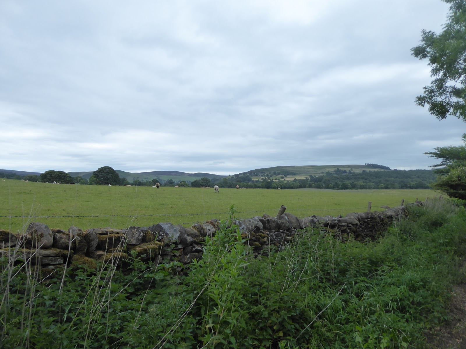
Six years ago, on 16th June 2012, and after taking a frightening soaking on the trail between Horton and Kettlewell, I learned what might have been my important walking lesson, namely 'If you're planning to walk a long and remote trail on a day that promises lots of inclement weather, Don't.', and that came lesson cam around again this year as the height of June once again failed to bring the weather that you'd hope it should, and I took the choice to hibernate whilst rain fell over the distant hills of Wharfedale. Not that a weekend will be lost to such things, and a reshuffling of the schedule brings up the other trip for the top of the year, over a slightly more modest distance and not quite so far away, which makes it ideal for a Sunday, even if the rail services don't allow me to make the super early start I might have wanted as the earliest I can get to my jumping off point at Burley in Wharfedale is 9.35am, which has the clock ticking for us even before any steps have been made. As the only way north to the moors is via the stepping stones, our route choice has to be creative to see a different face of Burley, which means starting off down Prospect Road, Hasley Road and St Philip's Way to get my fill of the local suburbia of council houses and many bungalows before we meet the more engaging landscape of terraces down Lawn Avenue on our way to meet Main Street, which is located from down the narrow land behind the Lawn House residential home. Cross to meet Iron Row, a very nicely presented terrace that sits on the former driveway to Greenholme Mill, which now provide access beyond the mill gates to the local playing fields and the passageway bathed in orange light below the A65 bypass road, from which we meet the lodge house and the way to the former Worsted mills, which isn't the way we need to go as our route leads us down Great Pasture Lane to the very oddly located cluster of semis and the way into the woods at the mill's perimeter. This popular track for local joggers and dog walkers leads us to the track alongside the mill's long goit channel, and the way to the Burley steeping stones, our passage point over the Wharfe which is looking pretty busy after yesterday's rains, even though these are not stones to intimidate anyone when crossing as they sit at a nice stride length across, even for a short-arse like myself. The way then leads to Askwith, but by the bridleway this time around, elevating us away from the noise of the river, and the A65 eventually, as we trace a path away from the local cattle and among the sheep as the moorland rises boldly on the southern horizon, while offering no distant elevation at all to the north, hitting the village by the Manor House farm, and showing up the Askwith Arm as currently up for sale and offering a unique business opportunity for anyone who'd want to run a country pub and restaurant in a not too distant corner of North Yorkshire.
 |
| Lawn Avenue, Burley in Wharfedale. |
 |
| Greenholme Mill, Burley in Wharfedale. |
 |
| Burley Stepping Stones, River Wharfe. |
 |
| Askwith Arms, up for sale, Askwith. |
Follow West Lane west as far as Sundial farm and then make our turn towards the moors up Hall Lane, which could easily be mistaken for a farm road that someone has forgotten to close the gate on as we start our steady rise of 150m or so that will last for much of the next hour, contained by hedges and getting a few views down into the wooded cleft of Askwith Gill as West Beck runs downhill beside us. A good few miles of solitude await as we rise away from the Wharfe, still feeling like we surely walking up someone's driveway as we run up towards Scales House Farm and then get that feeling enhanced even more as we lose the tarmacked surface and hit the rough track uphill beside a wood and a large open pasture where the local livestock can regard me with maximum curiosity. Soon note that we are about to land on a previously seen route as we meet the crowd of young cows by the path's angle up towards Whin Hill farm, and we can trace the path walked last year up towards the wooded cleft of Scales Gill, down which Hundwith Beck flows and has Askwith Moor rising to its east, even if there's still no view to our moor of choice on this path. Over the beck and through the wood, uphill on an easier-to-see-going-this-way path, meeting the pasture beyond with a nicely walked in trod that leads us to the driveway up to Dunkirk Farm, offering a good vantage point over the bulk of Middle Wharfedale before the banks of trees up here start to obscure the views as we set a firm course north, towards the distant farm, where the resident dogs are already barking up a storm when alerted to my presence. Pass the new-ish lake on Lady Dike, and the follow the track up to Dunkirk farm, where no one seems to be at home, and the dogs continue to go berserk as I arrive in their yard, though they are securely caged away so I can pass safely onto the rough fields beyond once the final ascent to the moorland comes, and that's only two plots distant, as Denton Moor finally appears beyond the trees that enclose it. There might be a right of way past the ladder stile, but there isn't a path of any kind, and the moor does not offer a clear route as I wish to head to the north east, so it's open moorland walking for a while as I aim uphill between a pair of stream channels to hit the one secure path that rises to the north east along the most prominent ditch on this half of the moor, soon found as it rises, though beyond a wire fence which is just that bit too high for me to clamber over. So eat turf on that passage and then set course onwards to get a view of Timble Ings wood at the northern edge, and rise with an emerging view beyond Askwith Moor to the valley of the Washburn, with Norwood Edge emerging above, along with RAF Menwith Hill and the Knabs Ridge windfarm before attention switches to the west, towards Lippersley Ridge and the way to the 400+m summit for today's walk on Round Hill.
 |
| Scales House farm, Hall Lane. |
 |
| Scales Gill Wood. |
 |
| Dunkirk Farm. |
 |
| Denton Moor, with fence. |
 |
| Denton Moor, and the view to the Washburn. |
There's a corner to cut off to get to the westerly path, and the uneven and soft going though the heather and grass tussocks to get to that track probably slows us so much that it would have been easier to have walked the longer route on the firmer surfaces, but that gets us onto a path that can been seen underfoot, which is what I really want when on the moors, tracing the perimeter wall away from the Washburn's remotest farmsteads and next to the Timble Ings Plantation. The maps call this route High Badger Gate, which is a name equal parts baffling and awesome, which aims us towards Lippersley Ridge and finally elevating us over 300m altitude, whilst tracing the boundary stones between Denton and Blubberhouses parishes, and just like the last time I came this way, the moor seems completely devoid of life, aside from a single party of cyclists, seen from a distance and then lost from view as the rise to the summit cairn is met at 330m. That's as good a place as any to break for lunch, as it offers a shelter from the persistent westerly wind, and despite occasional suggestions of a nice day being hidden by the dense white clouds, it seems unlikely that today is going to get any nicer, and so the view must be taken in under not the best conditions, and this a grand old secret place to look up to Round Hill and across Blubberhouses Moor to distant Nidderdale, quietly concluding that this might be my personal favourite location in this vicinity. So onwards to the big hill on this quarter of the moor, on a path that I'm glad I took in on my last visit, as it's not one to trace without having gotten some scope on it before, dropping off Lippersley Ridge to pass over the headwaters of the streams flowing to the Washburn at Stainforth Gill Head and wandering off Denton Moor into its northern neighbour as we go, getting some marshy conditions underfoot and startling some deer that rapidly dash from view as I try to get a picture of them among the bracken. Rise to Gawk Hall ridge, which hides the views to the south pretty comprehensively, and focusses attention to the rising track, as well as giving us views to the north-eastern horizon and the edges of the North York Moors, so many miles away, while the mind attempts to make a passage across the expanse of Blubberhouses Moor, which will probably never get a path made over it as none of its alleged ROWs seem clear on the ground, not even the alleged Roman Road which supposedly passed over it. Gawk Hall Gate is where we meet the wall that makes the edge of Denton Moor, and Middleton Moor Enclosure lies beyond, with a standing stone illustrating the way down to Ilkley, 3 miles away, and the damned lie that it is only 12 miles on a north easterly path to 'Rip-pon', which is so very wrong you wonder why someone even bothered carving it.
 |
| Lippersley Ridge and Timble Ings plantation. |
 |
| Round Hill from Lippersley Ridge. |
 |
| Stainforth Gill and Blubberhouses Moor. |
 |
| Looking Back to Lippersley Ridge, from Gawk Hall Ridge. |
 |
| Gawk Hall Gate. |
Round Hill awaits, not offering much of a profile, but then again it's one of those tops that's more the summit of an upland rather that a distinctive hill, much like Rombalds Moor, and as we pass us through the plots of scorched heather that sit on this portion of Middleton Moor, we start to get a panoramas of views emerging again, which gives clear sight to four river valley, namely the Wharfe and Aire to the south and the Washburn and the Nidd, and that's not something which comes with every hillside. You might even want to factor in the Ouse, and the Worth, as their surroundings appear too once we're made our way through the one horrendously marshy patch at the top of Gawk Hall Gill, and our route meets some firm footing beside the northern wall of the moor, a structure that has surely seen better days than this, as the view emerges to Ilkley 300mdown in the valley below, with March Ghyll reservoir sitting among the fields a mere 200m below at the bottom of the enclosure. Hitting the 400m mark finally gives us a view towards Beasmsley Beacon and to the wrinkles of hills beyond, as the path meets the route walked this way in 2013, establishing a new northern boundary to our walked territory as we meet the top corners of Langbar and Beamsley moors, though it's onto Blubberhouses Moor we need to pass to get to the top of Round Hill at 409m up, where no cairn or trig sits, but the panorama now has about 300 degrees of it well known to me on foot. It's the 60 degrees to the north that still have not been seen, and the stretch of moors from Barden Fell to the Washburn and the Nidd will come calling as this High Season progresses, and they will provide our horizon as we meet the descending track down Fell Side that leads towards the A59 in the valley of Kex Beck, which may or may not also be Kex Gill, as I's always assumed that was on the descending side to the east, but for now this valley will be our destination as we look down towards the Upper Wharfe and Barden Moor to the West, across to Rocking Moor and east to Kex Gill Moor. It all seems rather peaceful as we steeply descend to the altitudes conducive to landscape rearing, rapidly losing 150m and the summit just seen as we go downhill, and it seems that that A59 is still closed after the fracturing of the road surface on the eastern portion between the summit and Blubberhouses and all the traffic we can see is local folks, lost drivers of bikers out for their Sunday afternoon burn. An unusually quiet trunk road gets the mind wandering as to its improved walkability as we meet the bottom of the path, over Kex Beck and then up to the roadside, meeting a firmly padlocked gate which seems intended to stop people getting to the access land beyond, and so that needs to be clambered over, and it's been coated with that ghastly woodstain that sticks to both skin and clothes just so the landowner can have a laugh at the walker's expense.
 |
| Middleton Moor Enclosure, and Ilkley. |
 |
| The Middleton - Blubberhouses Moorland wall. |
 |
| The Round Hill Summit. |
 |
| The way west into Kex Gill, maybe. |
 |
| Kex Beck. |
Even with the A59 being super-bereft of traffic, we shan't be keeping close to its side for the whole way downhill to the west, as the road has been improved to avoid multiple kinks and provide a more straightforward route on its ascent up the gill (though maybe not enough if recent events are anything to go by), and these many little diversions provide a more distracting path for the walker, as we first move on to pass over Pace Gate beck and by its neighbouring farm, where a milepost that illustrates again the 22 mile distance on the turnpike between Skipton and Harrogate. Rejoining the main road, it seems quite bizarre to me that a valley like this could have stayed off my walking radar for so long, it's not even one that I've been driven on very often, mostly as it's not one you'd encounter much from West Yorkshire, and despite its relative proximity, I probably know it best from seeing the Tour de France come this way on TV in 2014, when crowds of people seem to cling to the looming edges of Beamsley Moor. It's certainly a dramatic sort of corner and a good one to sneak yourself a barn conversion or an out of the way farm, and several ideal examples show themselves by Summerscales farm and Lumb Gill bridge as the road takes its next detour and show us another milepost that has us a mile closer to Skipton before we meet the main alignment again, as it starts to make its dynamic shift down into Wharfedale, and the familiar profile of Beamsley Beacon finally arrives to the south, having been obscured by its companion moorlands since we arrived in the valley. Note the Red Kites flying en masse above Cat Crag to the north as we follow the old road on around a layby and then make our shift off the A59 to strike on to our path of choice into Wharfedale again, taking the sharp corner over Priespill Gill bridge, the contemporary A59 clearly having bypassed and avoided all these ancient crossings, and then rising away from Hill End farm on a road that seems too narrow for motor traffic but nonetheless ascends to meet the hamlet-let of Hazlewood, which is the apparent major settlement in this quarter. It's certainly the road less used back into Wharfedale, and not one to pilot any wheeled vehicle into as the drop and rise to Low House farm is as startling as any when negotiated on foot, and from there we can meet Storiths Lane, which turns us northwards to make for Bolton Abbey, and gives us the company of the mass of Skipton Moor, Barden Moor and Barden fell to our evolving horizon as we pace on in the shadow of the rising mass of Hazlewood Moor to our east, one of those rare Yorkshire uplands that just doesn't seem to want to offer up the paths to the intrepid traveller.
 |
| The Old A59 at Pace Gate. |
 |
| The Old A59 at Summerscales. |
 |
| The Contempoary A59, and Beamsley Beacon. |
 |
| The Old A59 at Hill End. |
 |
| The Fall and Rise on Hazlewood Lane. |
It's an undulating sort of road walk to get to Storiths, where the cars appear suddenly as the road rises and falls and care must be taken as we pass Storiths House and Hill Top farms, as too much interest can be taken towards the view to the west and tracing our path from last week up from Bolton Abbey to Hare Heads and Halton Heights, and onward to Barden Moor, altogether a grand horizon to take in around this angle of Wharfedale before we descend to meet this hamlet of surely only two farms and two houses. That has us back in the estate of the Devonshires, and the path down to Priory Bridge is one walked on a hot day five years ago, and the going down is definitely easier, though the view north to Carncliffe Top is just as cherishable under gloomy skies, as we pace down the walled track to meet the path junction that could take us straight to Bolton Bridge, but I figure that joining the crowds around Bolton Priory has to be a good choice. So drop down to the banks of the Wharfe and met the day-trippers out in quantity despite the weather, and make for the west bank via the bridge, only avoiding the stepping stones because the prevailing traffic is to the east bank and there's no traffic control in place, passing the ruins of Bolton Priory under skies that are glummer than they were in March 2013. Strike on up and over the riverside meadow to pass through the hole in the wall and eschew the temptations of various teashops to once again pass down the B6160 to Bolton Bridge for the third consecutive weekend, passing the converting tithe barn and noting that all my views towards Beamsley Beacon and the Barden Moor fringe from these journeys are all going to look exactly the same. Spot a helicopter landing at the Devonshire Arms, which answers the thought if why its been buzzing over these skies all day, Goodfellas style, and take the turn onto the old route of the A59 at the proper hurry up as we close in on our destination point and time, the road soon degenerating from former trunk road now used as parking space to little more than a bridleway that offers grand views back across the valley to the Hazlewood moor side. Follow the bridleway as it splits off the old road to switch back and pass under the modern A59, a turn that has me fearful that I will miss my connection, though it does offer a far better view of the Nidd Aqueduct as it emerges above ground to pass under the very eastern end of Bolton Abbey station, which is only a short rise away beyond its station cottages. It's certainly one of those stations that's actually nowhere near its eponymous location, but it's survived intact since closure in 1965 and has been in the care of the Embsay & Bolton steam railway since 1995, and it's where today's initial jaunt can end, having timed my arrival to perfection, just in time for the 3pm service.
 |
| Storiths, with Barden Moor backdrop. |
 |
| The Stepping Stones, Bolton Abbey. |
 |
| The Tithe Barn, Bolton Abbey. |
 |
| The flank of Hazlewood Moor. |
 |
| The Nidd Aqueduct, Bolton Abbey station. |
5,000 Miles Cumulative Total: 3353 miles
2018 Total: 240.5 miles
Up Country Total: 3022.8 miles
Solo Total: 3074.2 miles
Miles in My 40s: 1946.8 miles
Next Up: This trip has a Part 2!


No comments:
Post a Comment