13.9 miles, via Croft House, Springfield, Dean Wood, Gildersome, Upper Moor Side, Park Side,
Troydale, Little Moor (Bottom), Pudsey, Primrose Hill, Stanningley, Westroyd Park,
Farsley Beck Bottom, Bagley, Calverley Bridge, Swain Wood, Horsforth Low Fold, West End,
Beechwood, Horsforth Golf Club, Plane Tree Hill, Yeadon, and Shaw Lane.
After an immensely satisfying week away, our long week off, and holiday, continues as we return to West Yorkshire, bringing the bright and warm spell with us, which guarantees I'll be getting our for another trek despite still having Mum around the place, as she stays on for a Sunday dinner date, but as she's in the position of having some writing of her own to catch up that she didn't get done whilst away, it gives me freedom to get back into the business of Shuffling the Tiers by pulling up the first trail that I'd slated for this scheme, plotted quite a while back when I though there really weren't all that many original trajectories left to walk away from Morley, somewhat naively, it would seem. We start at Morley station, at 9.20am in the already gathering warmth of a late Summer morning, to observe the works at the new station where they've gotten very good at assembling scaffolding around the lift towers without actually building anything, before we set off up the steps to King George Croft and New Bank Street to find another original path through this town, this time tracing a pavement through the empire of bungalows on the Croft House estate, negotiating multiple corners to emerge onto Church Street and to cut a corner to cross the A643 Victoria Road and renew the theme by pacing the pavements of Springfield Road and Avenue through the suburban estate east of the Ingles, with its namesake house concealed within. Also note that The Arkle inn didn't survive the pandemic era closure before the way is found out via Woodland Drive and Horsfall Street to land us on the very familiar side of Asquith Avenue to bet onto our north-westerly trajectory, passing through Dean Wood and rising to the A62 by the Gildersome Arms to cross into the village and deliberately shift onto the right-side pavement to vary things up as we descend Branch End Road to pass the Old Griffin Head and come down Harthill Parade to the Green and the War Memorial, ahead of passing the Village hall and Library and the curious wood carved sculptures that grace the sides of Town Street.
 |
| New Scaffolding erected at Morley New Station. |
 |
| The Empire of Bungalows, Croft House Avenue. |
 |
| Springfield Avenue, and The Arkle (former). |
 |
| Asquith Avenue, and Dean Wood. |
 |
| The Old Griffin Head, Gildersome. |
Our new path commences as we join the ginnel ahead of the Street Lane corner, pushing us north to meet the estate suburban roads of the northern half of the village, undulating along Springbank Road and Church Avenue to meet the Suffield Road Rec and the rough path north, that leads us along the hedge line behind an enclosing wire fence to keep us away from the cattle who would appreciate the shaded edge of the their fields as we pass by to meet the A58 Whitehall Road at Upper Moor Side, to cross over by the Woodcock inn and press on northwards with Back Lane, one of the most obvious trajectories that I haven't traced away from home so far. The lane's fall, below the hill of Farnley Park and above the gatherings of the Tong and Fulneck valleys offers sight towards Pudsey on the next hillside along, which we'll eventually rise to after we've come down the surprisingly long drag between Upland and Park Side farms on the hillside, a route sometimes travelled many years back as a sneak route into West Leeds, to the lodge house on the Tong Road corner to switch back south by that odd suburban parade at a remove from all settlements around, and switch again almost immediately to resume north and downwards with Troydale Lane. Down the heavily shaded passage we are led to meet Pudsey Beck by Farnley Mill, to then pass into the odd urban enclave of Troydale, which we almost touched in 2016 but today marks my first encounter in the 25 years that have passed since my Sister set up home here with Dr G in the wake of graduation in 1996, and the sight into the small estate is not one immediately recalled before we start the rise towards Pudsey that is again the only one not previously traced, rising through the fields that fall towards Park Spring Wood, between the houses perched around the sweep of lane, with the heat starting to be felt as we come up to the Valley Road corner and the outermost edge of the town's estates, and the continuing westward rise into the old rural and/or industrial enclave of stone terraces at Littlemoor Bottom.
 |
| Church Avenue and the field path out of Gildersome. |
 |
| Back Lane, Upper Moor Side. |
 |
| A view up the Fulneck valley. |
 |
| Stray Suburbia on Tong Road. |
 |
| Troydale Gardens. Troydale. |
 |
| Valley Road, Little Moor Bottom. |
It's a steep and situationally challenging uphill push to come up to the level of Littlemoor Road at Littlemoor, naturally, taking a right turn to resume northwards and push deep into Pudsey proper as we rise to the old chapel and well-situated workshop terraces to pass over the lost Pudsey Loop line via the infilled Robin Lane bridge, regarding the chaotic development that seems to define this town and come around past the health centre and St Andrew's Methodist church, which offers the first available place to park myself for elevenses before we carry on, past the Scottish Baronial fashioned Town Hall on the corner of the Church Avenue - Lowtown main street. Rapidly passing though the shopping streets, we crest the local hilltop as we rise and fall down Lidgett Hill, following the previously unseen B6155 Richardshaw Lane as it passes The Grange school redevelopment and the West 44 business centre as we rather closely shadow our prior trajectory this way, passing over the A647 Ring Road via the high bridge and coming down through the largely industrial band beyond before we meet the Oddfellows Hall inn, the almost completely concealed St Paul's church and the site of Stanningley station, on the Leeds & Bradford line with goods yard and shed in use by a builders wholesaler. Pass under the east end of Stanningley viaduct and cross the B6157 Bradford Road, and then have to navigate for a bit as we enter the back streeks by Spring Valley Mills, letting Sun Street and Sunfield Place, lead us to the ginnel that takes us into Westroyd Park, where the Newlands Works memorial (noting the local history of David Crown and Aston Martin) has to be acknowledged, and then its on into the suburbia of Stanningley and Farsley, with the route ahead seared into my mind by pre-recognition, as the ways down Parkside Road, past Hainsworth park and on down the long curved sweep of Springbank Close, offer little in the 80s-90s vintage suburbia that would aid improvised route-finding on the ground.
 |
| Robin Lane and the Loop Line Bridge. |
 |
| Pudsey Tpwn Hall in the Scottich Baronial style. |
 |
| Richardshaw Lane passes off Pudsey's hilltop. |
 |
| Stanningley Station site, Stanningley. |
 |
| Westroyd Park. |
 |
| Springbank Close, Farsley? or Stanningley? |
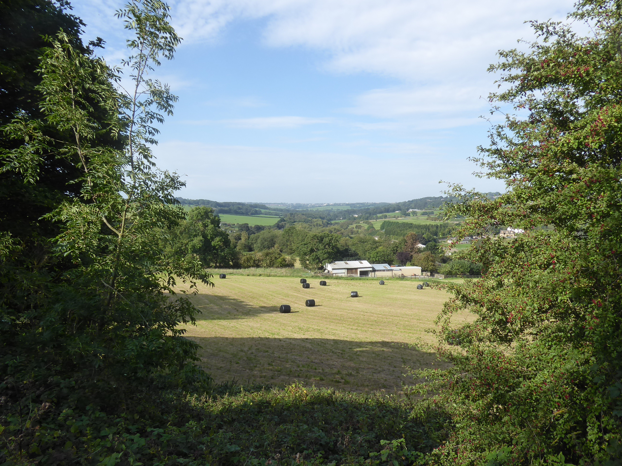
Springbank Road drag us down hill definitively toward Farsley Beck Bottom to land us on Bagley Lane by the complete Springfield Mills complex, and we press north with the road as it passes through Bagley Hamlet, where suburbia snares every available plot of flat land that it can find hereabouts among this former mill landscape, and we join the Oaklands Road track as it leads us along the field edges at the city's western perimeter, before we delve into the suburbs again, at the outer reach of Rodley and our emergence onto the A657 Rodley Road, where a brief upfill tug leads us to the interchange traffic island on the A6120 Ring Road, where passage across the Aire valley awaits. Thankfully, there's a footway alongside Horsforth New Road to keep us secure from the traffic that hurries by as we come down to pass over the Leeds & Liverpool canal and the river Aire, via the bridges just east of Calverley bridge, and thence uphill to pass over the other railway line to Leeds and Bradford (and Skipton, and Ilkley) in its deep cutting, and then its uphill further by the dual carriageway, grateful for the overhanging shade that comes at the edge of Swain Wood and beyond, but the effort needed for my third day of hot weather walking in a week has us needing to stop a refuel at the nearest available wall by the paddock of the farmstead at the edge of Horsforth Low Fold. Refreshed, we follow the remainder of Broadway to meet the horse-bearing island on the A65, where we tangle with an early season path as we join Rawdon Road and pace along the front of the elevated suburban block that overlooks the Aire valley, as far as the Hall Lane corner where a ginnel propels us away and uphill among the houses, noting the rather obvious perimeter wall of Grange House among the back gardens ahead of meeting the suburban pavements of West End, along its Grove and Rise, and up where the Leeds Country Way brought us in 2012. and we'll be carrying on far beyond its northern boundary this time, as we meet the rural edge of the city again, as the farmsteads endure while the suburbs peter out.
 |
| Bagley Lane, Bagley. |
 |
| Rodley Lane, Rodley. |
 |
| The Aire from Calverley (High) Bridge. |
 |
| The Ring Road and the shade of Swain Wood. |
 |
| The West End Ginnel, and the Grange house wall. |
 |
| Rural West End, in Suburban Horsforth. |
We get two hedges lining our footway along West End Lane as we pass the Kemps 'Pick Your Own' Farm, which is a bit of a blast from the past, leading us onto the high land beyond Hunger Hills and up to that odd suburban enclave of Beechwood, around the Southways circle, that feel like some historical architect's passion project, which sits ahead of the Lane Ends crossroads, passing over the end of Brownberrie Lane and losing our pavement as Bayton Lane carries on north, oddly one of the few lanes that Google Maps has never offered as a walkable route, which just piques the curiosity as we set off among the trees that conceal Leeds Trinity University's playing fields and the outlying farmsteads and cottages, ahead of the grounds of Horsforth Golf Course. There's a lot of greens and fairways to see on both sides of the lane as the verges narrow and the road walking gets a bit more testing as we emerge out into the high fields, taking a turn as Leeds & Bradford airport hides itself in the plots to the north of us, and Billings Hill rises to the southwest, apparently level with us as we pace the way up to Plane Tree Hill, against the charging traffic and up to the covered reservoir, from where we can get a view into the maany wrinkles of upper Airedale beyond the Idle and Baildon Hills, and over towards Wharfedale and Otley Chevin in the northwest, while a look back places Morley Town Hall's tower on the distant reverse horizon before we head downhill again, with the crown of Rombalds Moor lying dead ahead. Clear sight of where we're going, beyond the brief reveal of the airport complex has us feeling more secure in our going, past Cold Harbour farm and down to the suburban edge of Yeadon, just beyond greater Leeds, and soon enough upon the A658 Harrogate Road crossroads, by the Premier Inn and Murgatroyd's fish restaurant, passing the business park and cricket field as High Street leads into the stone terraced passage down towards this town's centre, beyond the White Swan inn and down to The Albert at the Cemetery Road corner, where we cross a Tier #3 trail for the first time in a while as the main street is met beyond the Clothiers Arms.
 |
| Two Hedges on West End Lane, leading to Beechwood. |
 |
| Bayton Lane, amid Horsforth Golf Course. |
 |
| Billings Hill, from Bayton Lane. |
 |
| Wharfedale and Otley Chevin from Bayton Lane. |
 |
| Murgatroyd's on the Harrogate Road crossroads. |
 |
| The terraced passage of High Street, Yeadon. |
Pass the Morrison's store on the shady side of the street, before a convenient shaded bench is found to take a third food and watering break, in front of the Town hall which simultaneously does Victorian Gothic, the 'Psycho' house and the Edward Hopper painting that hangs above my desk in its stylings, and immediately regretting not stopping at the supermarket as my last bottle takes a draining, so a thirsty last hour feels like it might be coming on as we head away, down the steep and cobbled Town Street to the corner of Kirk Lane by the memorial hall and take a right turn to head up Haworth Lane to vary up the path to our destination, along some un-historical roads for a change, as this patch along Queensway would otherwise remain resolutely unseen. It's not really a suburban landscape to warm the soul as aesthetics were not on the planning slate hereabouts as we are led to the far perimeter of Nunroyd Park, but it does have a Sainsbury's Local in its midst, allowing us to fulfil our refreshment needs for the reminder of the trip, and also get buzzed by a a Red Kite as we push on through the council houses and the local playing fields before we meet the field break ahead of the historic centre of Guiseley, still plainly evident to the keen eye as we come up to the Towngate end, above St Oswald's church and below the Memorial Green, at a remove from the new Main Street on the Otley Road. Oxford Road displays the era of Victorian growth, with a shopping parade, prominent town houses and a pair of churches along its length before we come upon the railway bridge and the turn along Station Road to meet the destination for the day, wrapping at Guiseley station at 2.50pm, taking a Tier #3 trail and maker off the map, with three more Tier #3 destinations theoretically within reach, but not on a hot day like this one, when we've already bested our longest trail for the year, at just under 14(!) miles from home.
 |
| Yeadon Town Hall. |
 |
| Queenway is the ahistorical way forwards. |
 |
| Sun shines on the Yeadon - Guiseley transition. |
 |
| Guisley Green, at the old town's heart. |
 |
| Oxford Road, Guiseley. |
 |
| Guiseley Station House. |
5,000 Miles Cumulative Total: 6153.5 miles
2023 Total: 231.3 miles
Up Country Total: 5,661.7 miles
Solo Total: 5810.9 miles
5,000 in my 40s Total: 4753.4 miles
Destinations Moved from Tier 2 to Tier 1: Guiseley
Destinations Moved from Tier 3 to Tier 2: Silsden Bridge
Trails moved from Tier 3 to Tier 2: 2
Next Up: Can we push the mileage further as the End of Summer comes on?


No comments:
Post a Comment