10.9 miles, via Owlers, West Wood, Sissons Wood, South Middleton, Thorpe on the Hill,
Lingwell Gate, Lofthouse Colliery, Lofthouse Gate, Stanley, The Nagger Lines, Stanley Ferry,
Newlands Park, St John's Field, and Smirthwaite.
We were very fortunate through the whole month of May to have not worked a single five day week across the whole width of it, and as we find ourselves at the first weekend of June, that five week run comes to an end, and thus we'll have to start worrying if the stamina is going to hold up after a very testing four day burst in the hospital libraries, followed by no scheduled time off until mid-July, so hopefully a return to sunny days will give me a mental lift to propel me on through the High Season, rather than proving physically draining as my body has yet to get itself into the early Spring mindset, as we veer dangerously close to your actual Summer. So, sunshine abounds as we head out, from Morley station once again, at 10am, and setting a course to the southeast as our quest to add new destinations to the local tiers, and to shuffle the routes beyond continues, rising from Valley Road up the long step flight again and feeling like we're soon going to be at a total loss for new routes away from this town as we join Clough Street again, ahead of visiting Denshaw Drive and Grove in our ongoing attempt to Watchperson every pavement hereabouts on our way towards Newlands Academy and the Gardeners Arms, where Wide Lane is joined to push us east, beyond the suburban reach and into the fields of Owlers. Meet and cross Dewsbury Road, and join the West Wood Road track for the n-th time as it drops down beyond the A653, passing over Millshaw Beck and rising under the railway lines current and former, before meeting West Wood and the intermittent shade that comes with paths along the periphery of the Middleton hillside, a route which I'm really glad that I haven't tired of having seen so much of it in recent years, and one which we surprisingly have to ourselves as the heat starts to bear down already, especially on the exposed stretch uphill to meet Sissons Wood, where the views back west across Morley, and northwest to Rombalds Moor, always entertain my brain, despite their familiarity to me.
 |
| Denshaw Drive, Morley. |
 |
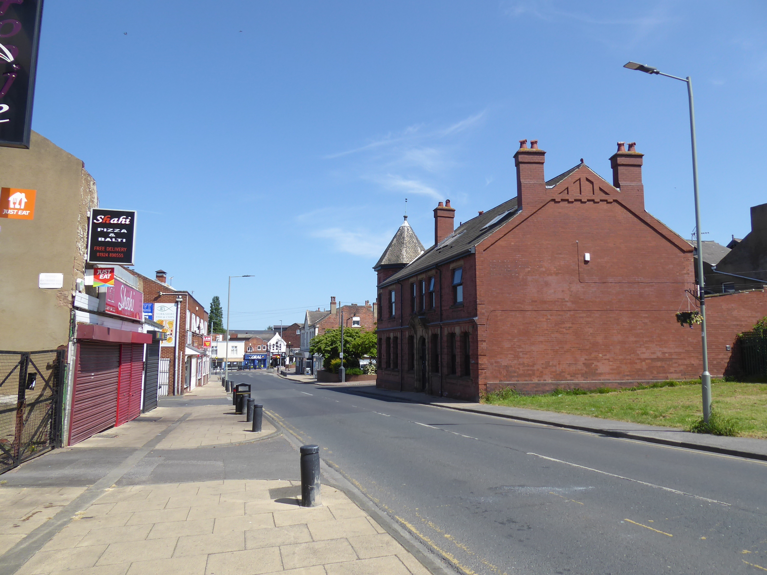
| The Gardeners Arms, Wide Lane. |
 |
| West Wood Lane. |
 |
| The West Wood - Sissons Wood path. |
The shade is welcome before we join the south-easterly turn behind the back gardens of the estate houses, placing us above Tingley viaduct and across from Tingley and East Ardsley in the south as we're swung around towards the A654, snaring the direct line sight of Upton water tower on the distant horizon before we are dropped out on Thorpe Road, where the route forwards take us below the Middleton estate, passing the bus terminus and the almost completed suburbanisation of Throstle Road rec, and also noting the pair of rural vintage cottage before the council house landscape fades as we meet the Falconers Rest inn. As open fields arrive to the south, incidentally giving sight of the distant Walton Wood mast, it's always a bit of a surprise to see just how much suburban growth has occurred on the land packets to the north, completely filling in the landscape around the access road of Towcester Avenue, and reaching all the way to the stray estate close at Whinthorpe Avenue and Crescent, beyond which open fields take over, finding that the 116m trig pillar at the roadside is vanishing into the undergrowth and the prominence of East Ardsley's churchyard woods is noted as we drift along towards Thorpe on the Hill, where Thorpe Hall still lies derelict. A change of route comes as Middleton Lane swings south, off the A654 and southerly onto the B6135 Lingwell Gate Lane, past Thorpe Hill farm and the terraced enclave that once served the Robin Hood Quarries to the east, before we pass over the busy M62, west of Junction 29, and off the B-road and its pavements, forcing onto the road surface tightly enclosed lane as it sidles its way downhill towards Bowling beck, past the picturesque farmstead and the developments of the old Ardsley railway yards before we land at Lingwell Gate, where the Nook Inn and its go-kart track no longer do business, and then rise on, below the West Riding Line and the M1.
 |
| The path to Thorpe Lane, with East Ardsley and Tingley. |
 |
| Throstle Road rec gets urbanized, Middleton. |
 |
| The edges os Suburban Middleton. |
 |
| Middleton Road, Thorpe on the Hill. |
 |
| The Quarry Terraces, Thorpe on the Hill. |
 |
| The Nook Inn, Lingwell Gate. |
Meet the chapel and terrace that are always noted from the motorway and split off onto Castle Head lane as it goes north, over the railway and shadowing the M1 until Lingwell Nook Lane can get us back on track south-easterly, through the strange little terrace cluster and past the remnants of the E&WYUR bridge on the way into the Lofthouse Colliery country park, where the rough path around its eastern side is met, returning us to shade that we need on a day like today, and offering a lunchbreak spot to refuel before we press on to the corner of the circuit that we haven't seen before leading to the ponds and the renewed hard track that leads below the fallow Lofthouse Hill golf course. We also track along the northern suburban edge of Lofthouse Gate as we go, all the way down to Potovens Lane, where we tangle up with the A61 Leeds Road , which needs to be crossed by the NHS Keyworkers benches and up from the Star Inn, to join Canal Road which presses us along past the Lofthouse Gate Sport & Social Club, and up to the substantial bridge remnant at the northern reach of the Nagger Lines, the narrow gauge colliery line that didn't seem to have a clear route to the north of here (actually turning west to the south of the road, it seems), and it would be temping to walk this path again, but as we need to vary things up a bit, we ought to walk Baker Lane instead. South-easterly this leads us again, past the terraces and over the Outwood - Methley railway alignment on its way down into the suburban swell of Stanley drifting downhill to rooks Nest Road and the left turn to the Lane Ends corner by the Travellers Inn and our turn down Lime Pit lane, among the crescents of council house and down to the familiar parklands at its bottom end, where the rails are still embed in the road surface and the A642 Aberford Road is crossed once again, onto the railway alignment for the fourth or fifth time as its still the best available path through the Calder's adjacent flatlands down to Stanley Ferry.
 |
| The Lingwell Gate terraces, Lofthouse Colliery. |
 |
| More paths to discover, Lofthouse Colliery. |
 |
| Canal Road, Lofthouse Gate. |
 |
| Baker Lane. Lofthouse Gate. |
 |
| Stanley Lane Ends. |
 |
| Tramping the Nagger Lines, again! |
Ferry Lane is met to take us over the River Calder and the Aire & Calder Navigation, and around the marina and boatyard to drop us down onto the towpath, leading us to the aqueducts and the trash screen bridge before we take a turn along the south bank of the Calder, onto a footpath that plainly exists on the ground but has no apparent ROW on it, which we and other locals will do our best to establish as it leads through the shade down towards Newland Park, along an embankment that once ran down from the wharf to St John's Colliery, making this a railway and river walk before we turn inland where Newland Hall once stood. The ruins seeming that bit more lost when a dense cover of foliage hangs overhead, not that it prevents a poke-around before we rise away, up Newland Lane to the east, pondering if the cattle have free reign on these fields, until a two heavy agricultural vehicles rise up the narrow track to pass us by, with St John's Fields elevating above the Calder and observing the views around to Warmfield, Emley Moor and the landfill hill that conceals the view to Wakefield, as we pass the angling lake and former brickworks site before we pass over the railway, in clear sight of Normanton station off to the north. The town lies beyond, with us meeting Smirthwaite park, and its neighbouring low-rise estate, next to St John the Baptist RC church and the pavements of the Wakefield Road which will take us north past chapels, pubs and the local takeaway parade on the way up to Normanton's leisure centre and library, where we'll turn onto Queen Street to loop us around to Market Plave and the end of High Street to ensure we tag both of the locally outbound routes before we pass behind Lidl to land at the station, but not quite finishing the day here, as we're on another train strike day, so there'll be no tangling with the footbridges or overly long platforms today.
 |
| The Trash Screen Bridge, Stanley Ferry. |
 |
| On the Riverside Colliery Tramway, Newland Park. |
 |
| Newland Park. |
 |
| St John's Colliery Brickworks. |
 |
| St John the Baptist, Smirthwaite. |
 |
| Queen Street, Normanton. |
 |
| Th apartments in a NMR fashion, Railway Terrace, Normanton. |
We need to pass back to the nearest bus stand, admiring the vintage styling of the apartments built where the original station buildings once stood before Railway Terrace leads us back to the leisure centre for a 2.10pm wrap up, with just enough time to re-water in the blazing afternoon heat before the first available bus toward Wakefield arrives, the #147 service that turns out to be the dawdlebug that rolls us around through suburban Normanton, Warmfield, Kirkthorpe and Heath before getting to it destination some 40 minutes later, reminding me again why touring West Yorkshire by bus might well be a fool's errand.
5,000 Miles Cumulative Total: 6035.3 miles
2023 Total: 113.1 miles
Up Country Total: 5,554.6 miles
Solo Total: 5692.7 miles
5,000 in my 40s Total: 4625.1 miles
Destinations Moved into Tier 1: Normanton
Destinations Moved into Tier 2: Thurnscoe
Trails moved from Tier 3 to Tier 2: 2
Next Up: Kirklees offers destinations that demand my attention.


No comments:
Post a Comment