8.6 miles, via Daisy Hill. Chapel Hill, Morley Hole, Bruntcliffe, Gildersome Street,
Adwalton, Moorside, Drighlington, Birkenshaw, Lodge Beck, Copley House, Chatts Wood,
Lower Woodlands, Dyehouse Fold, and Toad Holes.
Another 9-day engineering possession lands on the railway line through Morley as we arrive at the weekend bracketing the Top of the Year (already!), not that it will have that much impact on our plans, as we’re going to be walking from home for most of this year, and the difficulties will only become apparent on our return legs if we were to pick route that needed a pathway back via Leeds, Huddersfield or Calderdale, which we’re not up for today as energy levels are low while the days are at their longest, and we’ll be pulling the shortest possible trip up from our slate of plans. We might be planning to head west for today, but we need to linger at Morley station when we arrive, just ahead of 9am as there’s a whole lot to observe going on here, not least the fact that the line closure hasn’t been a factor in the installation of the new station footbridge which has had its support stanchions and deck installed while the line was still open last week, and removal of the old footbridge is going to be a primary objective over the next week, as well as track re-laying, as rails and sleepers are being removed on the ‘Up’ side toward Manchester, apparently only a few months after they were renewed. We’ll also visit our other vantage point while we are here, below the green space off Seven Hills Way, where the new station can be over-viewed, at least on the ‘Up’ side where it’s all fully surfaced, edged and fenced, with signage installed too and looking almost complete aside from the fact that it’s inaccessible due to a lack of steps on the footbridge, and no exits apparently existing to the Valley Road side, and it’s altogether difficult getting the looks that we had some months back from up here, as Spring growth of the vegetation atop the bank has gotten so thick and tall as to pose quite the obstacle to a short-arse like myself.
 |
| Another engineering possession occupies Morley Station. |
 |
| Morley New Station now has a footbridge, of sorts. |
 |
| New Station overview from the Seven Hills Way vantage point. |
 |
| Another New Station Overview. |
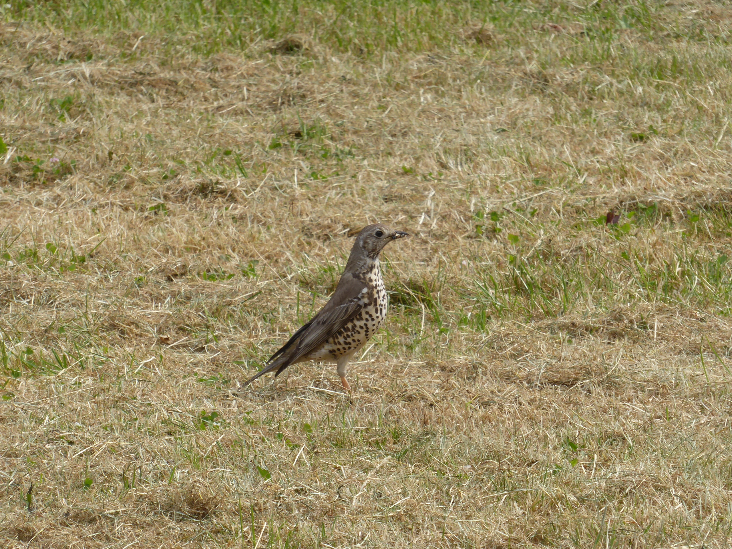
From atop Daisy Hill we get going on our route proper, westerly on the fall and rise of New Bank Street among the suburban houses and terraces, noting the chapel site has had its foundation dug out as we come upon Chapel Hill, crossing to meet Bank Street and descending to Brunswick Street behind the Conservative club and shopping parade to come out by Victoria Mills to pace the oft seen pavement around to Morley Hole, where a Mistle Thrush has to be noted as our ‘exotic’ bird of the day before we hit the rise of the A643 Bruntcliffe Road, heading up past the chippy for the umpteenth time. The day’s warm start, and the unbroken spell of warm weather we’ve been having ends comprehensively as we carry on past the cemetery and Academy, as murky cloud sets in from the south, which shows up as a feature for the day as we come up to the Bruntcliffe crossroads by the Toby Inn and land on the watershed ridge, joining the A650 Wakefield Road and seeing no hints of wider sunshine as we pass over the M621, not on the Leeds side or from the spread of Calderdale, and thus we feel a chill out for the first time in a while as we tramp on beyond the Gildersome Spur industrial estate and the new motorway ‘services’ ahead of the upper island of Junction 27. Across the A62 Gelderd Road and the pavements remain familiar as we pace on along the stub end of Bradford Road at Gildersome Street, drawing us on past the Old Brickworks and Premier Inn, onto the stretch of the B6135 that has Airedale and Calderdale views on both sides, which I don’t think I’ve ever seen in particularly good weather when travelling on foot, as we move on to meet Adwalton, where the New Inn looks in need of new business and new developments continue to fill odd corners, where we split onto the ginnel that sneaks between the gardens and suburban closes on the lead over to Penfield Road.
 |
| New Bank Street, Morley, from Daisy Hill. |
 |
| Bank Street and Victoria Mills, Morley. |
 |
| Bruntcliffe Lane and the Cross Roads. |
 |
| The Junction 27 Services. |
 |
| The Brickworks, Gildersome Street. |
 |
| Wakefield Road, Adwalton. |
Still no novel pavements are to be found as we join Moorside Road at the edge of Adwalton moor and overlooking the spread of Drighlington, taking an early elevenses break on a convenient bench by the exercise park before we press on past Moorside church and over the rise by the blasted rough plots of the Civil War Era battlefield, on to the Railway inn where a turn onto Hodgson Lane presents a road previously unseen at long last, past the nursery on the old goods yard site, the kitchen supply store and the rugby pitches to pass through the suburban southern edge of Drighlington on the way over to the A58 Whitehall Road. Back on familiar tracks, we tangle with the old railway embankment remains as we come across the A650 bypass road, and join the isolated half of Hodgson Lane as it shadows them as we meet the Kirklees Way route to be reverse walked for a good stretch of the remainder of this trip, on between the activity of the local farmsteads and down to the farmhouse which still looks in need of love after observing it nine years ago, and down to the field boundary walk that leads to the tightly confined path that passes in behind the back gardens of Sherburn Grove, on the suburban edge of Birkenshaw. Join Station Lane and turn south, incidentally avoiding a third station site meeting on the old Ardsley – Laisterdyke line, as it draws us down through the villas and rural terraces on the way over to the A651 Bradford Road which is met by the George inn and the old and new Co-op stores, with route memory taking us onto the turn into Oswald Street and the drop of the footpath beyond, definitively tilting us into the uppermost reaches of the Spen Valley, sharply downhill over the old tramway embankment that wanders the contour towards Bluehills farm, and on to the passage over Lodge Beck, and on through the meadows beyond, as Cleckheaton, Scholes and Wyke land on our local horizon.
 |
| Adwalton Moor. |
 |
| Hodgson Lane, Drighlington. |
 |
| Hodgson Lane track, by the lost Ardsley - Laisterdyke line. |
 |
| Field Walking to Birkenshaw. |
 |
| Bradford Road, Birkenshaw. |
 |
| Lodge Beck |
The ongoing route then hits the rising track, up by the still rough field of mining remnants, landing on the Hunsworth Road and getting back on our trajectory as we pass over the hillside rib and descend Lower Lane as it takes us through the farmstead cluster around Copley House, and then down the rough track that leads into a field full of livestock, where care to not disturb the sheep and lambs while descending is countered by trying to spy the remains of mining tramways that loiter among these open plots, needing to field walk without obvious tracks all the way down to Cockleshaw Beck and Chatts Wood, concealing its pleasant little glade. The way forward is kinda vague despite the Kirklees Way signage, through the trees and around below the mound behind Lower Chatts farm, which is itself a mining remnant, where the cows and calves scatter as we pass by, up the rise to the cottage on Cliff Hollins Lane, where the descent with the fall of High Royds beck is followed until we switch back so we don't carry on down to Oakenshaw, departing Kirklees and entering Bradford as we cross the stream and rise up among the stony terraces of Lower Woodlands and cross the Mill Carr Hill Road to join the bridlepaths of the local nature reserve, filling in the green space between the M606 and the Roydsdale Way industrial park. It's a proper wander we are on in this late stage, under the motorway and down the farm track past the Snake Hill cottage group down to Dyehouse Fold presenting a very rural face behind the suburbs of Oakenshaw and the industry of Low Moor, with Dyehouse Lane being met to leads us up the green passage by Toad Holes Beck to its eponymous nature reserve where we split again to meet Furnace Road, where what appears to be the GNR goods shed looms above the lane, and the suburban closes, such as Tramways and Trackside that sit off the edge of the Cleckheaton Road.
 |
| On the rise to Hunsworth Lane. |
 |
| Field Walking to Cockleshaw Beck and Chatts Wood. |
 |
| Disturbing the cattle at Lower Chatts farm. |
 |
| Lower Woodlands, and Oakenshaw church. |
 |
| Dyehouse Fold, Oakenshaw. |
 |
| Low Moor GNR Goods Shed. |
Hanging a right we pass over the railway, south of the site L&YR's Low Moor station and engine shed, and that's us upon our destination already, across the road from the George and Black Horse inns, and as we finish, the rain comes on, as if to warn me against attempting to elongate the day any further, and thus we conclude the trip at 12.30pm, way ahead of the stopping train but early enough to find space in the shelter to finish lunch and listen to the precipitation fall, far a half hour as we await our path home via Bradford, among the surprising quantity of gathering revellers, considering the time of day and weather, none of who will be joining my train, thankfully, as they all seem to be Leeds-bound.
~~~
 |
Today's Bonus Bird is the Mistle Thrush.
(It does appear that I have become a Twitcher in 2023!) |
5,000 Miles Cumulative Total: 6054.3 miles
2023 Total: 132.1 miles
Up Country Total: 5,573.6 miles
Solo Total: 5711.7 miles
5,000 in my 40s Total: 4644.1 miles
Destinations Moved into Tier 1: Low Moor
Trails moved from Tier 3 to Tier 2: 1
Next Up: Aiming ourselves at the Colne Valley again, as Summer arrives.


No comments:
Post a Comment