10.6 miles, via Brighouse Bridge, Clifton, Hartshead Moortop, Hartshead Moorside, Hightown,
Knowler Hill, Liversedge, Littletown, Westfield, White Lee, Smithies, Birstall, Copley Hill,
Howden Clough, Bruntcliffe, and Leeds 27 Ind Est.
So, as of November 5th were into our second National Covid Lockdown, but it already looks like it's going to be a different beast from the first, as much greater flexibility and mobility is permitted, and indeed expected, this time around, and despite inessential travel being discouraged, I'm figuring that a single half-hour trip out of the region at the end of my walking season to complete the second leg of my homeward bound trip is going to be way down the risk list as we speak, and that the British Transport Police are going to have better things to do that track down solo-walking miscreants like myself. Thus my revived season concludes by heading out from Brighouse, just like it started back in July, alighting my train at 8.50am having travelled out through fog and mist that looks like it's going to linger over the whole day, and again starting out by not taking the most obvious route forwards, by heading west from the station via Railway Street to Gooder Lane, so we might pass the church of St John the Divine, which claims to be in Raistrick, to further confuse the geography of the area, ahead of pacing John Street to meet the long flight of steps that drops us down to Bridge End by the Star inn. Joining up with the A643m, it takes us under Brighouse viaduct and over the Calder at Brighouse bridge, before snaking around to meet Briggate once again, passing over the Canal and completing one of my most fatuous detours designed to keep my paths fresh, only getting properly on track as we join Bethel Street as the local shops are opening up, and barely showing the indications of the lockdown situation that exists at present, while getting the feeling that we've really done a number on this town centre during my many passages across it this year. Lawson Road leads us to the tangling of the local bypass roads, where we cross over to get on track with the A643 Clifton Road again, passing though the industrial band that sits around the lower reach of Clifton Beck, which is crossed over ahead of passing over the Calderdale Way route and meeting the remains of the railway embankments of the L&YR's Pickle Bridge line, with the station remnants of Clifton Road station being seen to the south of the main road. The climb of Clifton Common beyond is one we've paced before, and continues our theme of serious rises and falls on the year's paths, rising past the strings of terraces that rise up the hillside from the hillside up to the suburban infill, before we reach the open fields ahead of Clifton village, where we'd expect our views back into the valley, but there's just fog blanketing the scene instead, meaning all our attention will settle onto our pace in the absence of views as we run past the Armytage Arms and rise to Highmoor Lane beyond.
 |
St John the Divine, Brighouse (or Rastrick?).
|
 |
Bethel Street, Brighouse.
|
 |
Clifton Road station remnants.
|
 |
The Armytage Arms, Clifton.
|
It's not exactly bleak moorland out here, but the fog drops a tone of atmosphere onto the landscape, having us glad that we aren't having to naviagte at all as we pass by the long bpoundary of Willow Valley Golf course and look across the fields of Green Farm to spy the mining and tramway remnants that litter this rural landscape, pressing on at a pace without having the lane to myself as local joggers and cyclists are out in force to make the best of their Neovember Lockdown, as we pass inside the Kirklees Way route, despite having not left Calderdale district yet. A nicer day would have had us old route of Highmoor Lane, now severed by the M62 in the vicinity of Hartshead Moor services, but the glumness offers no such desire for detours as Walton Lane directs us on towards the hilltop that has done nothing to deny its moorland quality during this year's passages, as we meet Hartshead Moor Top on the A649, utterly shrouded in mist and feeling just that bit more remote as we cross the district boundaries formally and shift onto Halifax Road, taking us east between the Manor House and the old chapel, before heading over the motorway. Arriving in Hartshead Moorside, the outer edge of the Cleckmondedge conglomeration, I still feel sore that the loss of the Old Packhorse inn has ruined my favourite pub pairing in the county, and as we've already done the downhill passage of the A643 from here this season, we'll stick to the A649 as we progress east, staying much higher above the Spen Valley for longer as we progress east, as the Halifax Road wanders over the lop of this ridge, among settlement that's been up here for a while, not too far from any town around but still remote to my mind, though it does house the Mill Valley Brewery and Brew House, whose beverages I have enjoyed in the past. Sorting out the geography of the area in the mind and on the ground is a toughie too, as signage has already welcomed us to Liveredge, while old maps call this area Hightown Heights, while a view from the lane out to put us in the vicinity of Cleckheaton below, but nothing can be seen thanks to the fog, so our location remains vague as we roll past another of those council estates with numbered street and settle into the next stretch of the village, where the road starts its decline past the social club and bowling green, and the old pub and parish church of St Barnabas, which I think can formally land us in Hightown proper, from here on in.
 |
The A643 Highmoor Road.
|
 |
Hartshead Moor Top.
|
 |
Halifax Road, Hartshead Moorside.
|
 |
St Barnabas Parish church, Hightown.
|
Whether we are in greater Liversedge yet is still a matter of conjecture as we come down towards the village school complex, across from the Rayner's Mill buildings, which trumpet their links to the Luddite revolt of 1812, a major note of the history in these parts, and past the top of the road down to Cleckheaton, with its bold fingerpost, found a ways ahead of Patrick Bronte's house, another historical tag that just keeps on turning up around these parts, from when he was curate at St Peter's Hartshead, and before he fathered his literary daughters. Interesting points of vintage keep appearing as the way down the lane continues, beyond the King George V playing fields and the Cross Keys inn, with rural cottages and farmsteads suggesting an age long before this long ribbon of village grew, through the only one that is easily dateable is The Shears inn, displaying a establishment date of 1773, among the later terraces and spread of suburbia up the lane, which still declines, getting ever closer to reaching the bottom of the Spen valley, its landscape still elusive beyond the mist. Land on a familiar corner as we meet Knowler Hill, site of the old Liversedge Town Hall and the old Board School, across from the Luddite memorial which we noted in the early season, before we head down the steeping decline of the lane, taking us over the Spen Valley Greenway route, with the L&YR's feature still in place to see, with the Knowler Hill tunnel to the north, the Liversedge Central station site below (with its entrance building partly intact at the roadside), and the goods shed still completely extant and now used by a motor garage. This is where we find what feels like ought to be the middle of town, near the Christ Church and around the Lonsdale Inn and what I assumed used to be its neighbouring gymnasium, but there doesn't seem to be a shopping parade to give it a clear middle, and we shall jot see the end of Halifax Road as we need take a detour onto Valley Road, among the terraces that fill the bottom of the valley, where the River Spen does its best to hide, as we wind a way past the local health centre up to the A638 Bradford Road, at what may might be called Littletown.
 |
Patrick Bronte's house, Hightown.
|
 |
The Shear Inn, Hightown.
|
 |
Liversedge Central station site.
|
 |
The concelaed bottom of the Spen Valley, Liversedge.
|
Cross over the dual carriageway by the Old Oak inn, and we are only coming this way, crazing the edge of the council estate on Listing Lane, because the L&NWR's Leeds New Line had its Liversedge Spen station site here, beyond the Toby Jug inn, and its access ramps clearly traceable from the roadside up the embankments by the bridge which now carries the Spen Valley Ringway overhead, a site which like its companion across the valley I incorrectly located back in 2012, further south than it actually is, and the scale of the engineering seen as we press uphill is such as to wonder how this valley managed to lose two railway lines. Rising up the lane we need to get back onto our trajectory as we're a little off the direct course, and this means needing to detour through the Firthcliffe council estate, not pacing the old lanes that usually features on my paths but on along the Parade and Grove among the houses that mostly seem to fall into a design pattern of red brick with stuccoed uppers, as we rise up to find the way the Huddersfield Road, while the sunshine does its best to break through, momentarily penetrating the bank of cloud above that might not be as dense as we thought. Meet the A62, and rise with it to the Six Lane Ends cross roads at Westfield, where we immediately leave it to join the Leeds Old Road, what I'd guess is the pre-turnpike lane across these parts, which has literally nothing aside from its name to suggest its age as the spread of suburban Heckmondwike has risen up the valley side to completely consume it, with it's inappropriate steepness for cross country being no problem for modern suburban living as it carries up to the next hilltop, on which we find the Smithies Moor Co-op Academy, which needs to be illustrated as being a school, when written down. Signage soon welcomes us to greater Batley and we land on the White Lee crossroads with the B6122, interestingly enough at a point where a late season walk from Brighouse brought us back in 2014, and past the former chapel and the site of the smallpox hospital at the hilltop, we follow the same route downhill with Smithies Moor Lane, into yet another valley, which has you wondering just how many branches there are on this side of the Calder watershed, and looking forwards to the next climb, which is again shrouded by a bank of low cloud.
 |
Liversedge Spen station site, Listing Lane.
|
 |
The Firthcliffe Estate.
|
 |
Leeds Old Road, Westfield.
|
 |
The Old Chapel, White Lee.
|
We head down from the residences on the hilltop, down through the fields of horses and on into the industrial landscape at the valley floor, doing the whole descent in less than 10 minutes, unlike the hour it took to get the bottom of the Spen Valley, and Smithies Brook is another one that would hide from view if you weren't looking for it, just down the lane from the Greyhound inn and the Birstall Smithies crossroads, where we cross the A62 again and the A652 too, via an actual six lane junction, and rise towards Birstall village centre, beyond Crilly's fireworks store, via Smithies Lane and Market Street. Come up by the community centre and library (where an outrage took place, which no one should be allowed to forget, on 16th June 2016, ), across from the frontage of the Princess Picture Palace, and ahead of the market place, with it's statute of Joseph Priestley, another figure whose personal history turns up all around parts of the county, a spot where we break for watering having almost made it to the end of the day without feeling the need for it, but with two more climbs to complete we need a refuel before we head away, on Nelson Street, rejoining the A643 again. Meet our local walking bubble as we drop down to cross over the A62 for the last time and start the pound up the side of Leeds Road (a name which surely indicates that this is surely the older of the main roads here), heading up the side of Copley Hill as it shows up some pretty heavy engineering as we finally get to the see the middle of, in the vicinity of the cricket club and playing fields with the bloom of suburban Birstall around them, on the hilltop otherwise only seen on particularly meandering bus rides. Before we meet Howden Clough, we have to note the bridge abutment remnant from the GNR's Batley - Adwalton line, hidden among modern retaining wall that the historically informed eye has to seek out before we run on to meet the terraces at the bottom of Nab Lane, where we've also been this year, and that means it's going to be a familiar route inbound from here, descending to our last valley of the trip where Howden Clough Beck isn't visible while so close to its headwaters and hidden by its mill complex, but its passage south below Birkby Brow Woods is as obvious a passage as any.
 |
Smithies Beck hiding near Birstall Smithies.
|
 |
The top of Market Street, Birstall.
|
 |
Leeds Road ascending Copley Hill.
|
 |
A railway remnant sought and found, at Howden Clough.
|
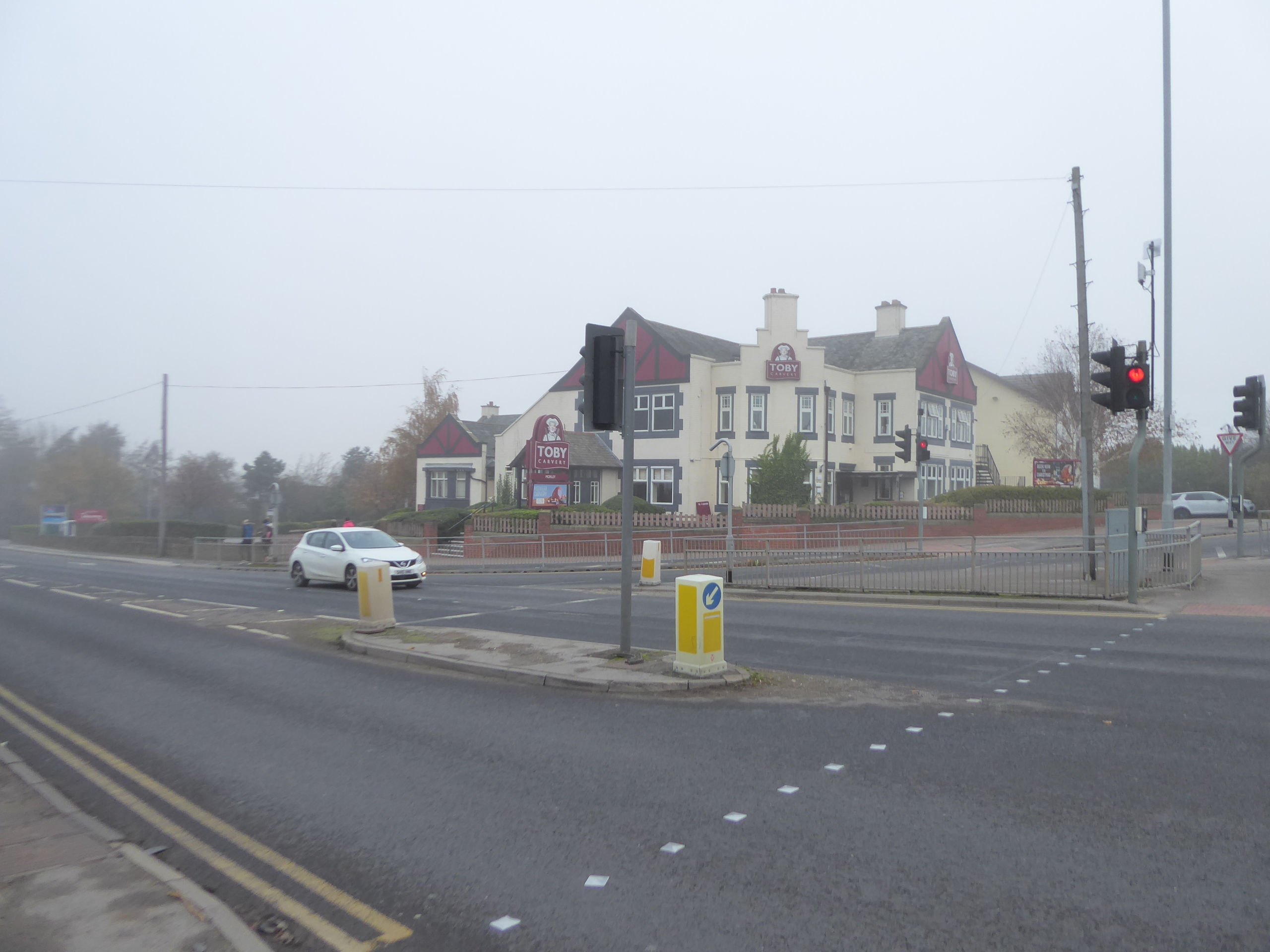
That's seven distinct valley crossings made on the northern side of the Calder along the way of our two-legged trip since leaving Mytholmroyd last weekend, (Luddenden, Hebble, Red Beck, Clifton Beck, Spen, Smithies Brook, and Howden Clough, if you're keeping tally), but we've still got another climb to complete, to meet the actual Calder -Aire watershed, on which my hometown sits, steeply rising up though the woodlands that claim the sides of Howden Clough Road, as we return to Leeds district and meet the high terraces on this lane, from which there is still no view to be had of the Calder catchment form here, as it's still buried in mist and fog. We meet the M62 again, returning to the north side of it where we'd started out at the beginning of the day, heading in towards Morley as we pass between the Shoulder of Mutton inn and the former Methodist chapel at Bruntcliffe, and ponder if that pub has much life left in it ahead of us meeting the A650 crossroads, which we cross by the Toby Carvery and the Travelodge as we settle back into the water-sheddings of the Aire valley as Bruntcliffe lane pulls us away from our last hill crest of the journey, which really ought to be all downhill from here. We do have a short detour to make, into the Leeds 27 industrial estate, not because the office and plants along Bruntcliffe Way hold any particular interest for me (though AAH Pharmaceuticals is name that always raises a smile), but because it's the last local spot where I haven't been to see the GNR's old Morley Top line, as it passed through on a now erased embankment, an absent feature that I didn't seek when walking locally in the Spring, and can now only confirm by having seen the space it once occupied therein. Back on the A643, we're onto the last stretch, past the more obvious old railway passage, the overgrown Quaker burial ground by the Highcliffe industrial estate, and the apartment complex on part of the old mill site, ahead of the final run down to Morley Hole, where despite the second lockdown being in force, I can still drop into Hillycroft Fisheries to buy my lunch in a way that's as socially distanced and hygienic as is possible, wrapping the day at 12.30pm and feeling grateful that my walking plans for the last four months all fell into place before the need for isolation in the Dark Season came along, regardless of my choice to do so anyway.
 |
Howden Clough Road leads out of the Calder Valley.
|
 |
The Bruntcliffe Toby Carvery on the Calder - Aire watershed.
|
 |
Really seeking out the lost railways, on the Leeds 27 Ind Est.
|
 |
Finally getting the season back home as we approach Morley Hole.
|
5,000 Miles Cumulative Total: 4731.4 miles
2020 Total: 464.9 miles
Up Country Total: 4268.4 miles
Solo Total: 4404.8 miles
5,000 in my 40s Total: 3325.2 miles
Next Up: One Last Lockdown Circuit, for Old Times' Sake?


No comments:
Post a Comment