15.6 miles, via Hill Top, Wilberlee, Pole Moor, Scammonden Dam, Withens End,
Rishworth Mills, Godley, Rishworth, Dyson Lane, Farrar Height, Manshead Moor,
Baitings Reservoir, Ryburn Reservoir, Stones Mills, Rishworth, Ripponden,
Hanging Stones, Triangle (station), and Watson Mill.
I'm now pretty certain that the Summer of 2020 is openly mocking me, not just by preventing a first family get-together of the year to celebrate Dad's birthday by locking down My Mum in Leicester for another few weeks, but also by seeming to know that I want to get my walking impetus on again, and thus dropping deeply unseasonable weather onto the days that I have selected to walk, whilst giving us three days of the conditions that you'd like to out in when I'm busy doing something else entirely with my time NIW, making the Summer feel far too much like the relentlessly damp one of 2007. So we travel out early on Saturday morning, with a plotted route in mind, but not certain if it will achievable due to the fact that we are projected to have rain in the air until 1pm and no significant improvement dus after that, riding out to alight in the Colne Valley at Slaithwaite station for the first time at 8.40am, with waterproofs already donned and a climb coming right after we've headed out from the platform by the old goods yard, not opposite the other, down to Crimble Bank and then uphill under the railway and hair-pinning left to join Hill Top Road and Royd Street through the terraced district that clings to this high side of the valley. I'd have hoped to get a view of Slaithwaite reservoir in its side valley cleft as we carry on up Longlands Road, but only its dam and heel are faintly visible beyond the run of suburban houses that run up the hillside, petering out as we rise higher, into open fields on the steeply rising road, with Merry Dale Clough opening out to the west of us as we see the first of many drizzles coming on as the road shifts us uphill to the hamlet of Wilberlee, where the Colne Valley Circular brought us last year, reeling rather remote for a suburb, despite being barely a hard mile out from the start line, and only part way up the climb out of the valley. Tiding Field Lane leads us on uphill sharply, before we reach a welcome level section below Moorside Edge and among the high farmsteads on the edge of moorland altitude, which we crash as we head above the gash of Barrett Clough, taking us over Crimea Lane and the route of the Kirklees Way, onto the high plateau and among the high points of the Colne Valley's north side, with Worts Hill to the west of us and the bulk of Wholestone Moor further off to the east, having gained over 200m of altitude as we pass behind the microwave masts on Pole Moor, the slender sentinels that can be seen from far and wide, which scrape the low clouds as they pass overhead.
 |
| Hill Top Road and Royd Street, Slaithwaite. |
 |
| Ascending Heys Lane to Wilberlee. |
 |
| High above the Colne Valley, below Moor Side Edge. |
 |
| The Pole Moor Masts. |
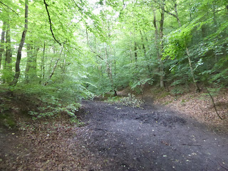
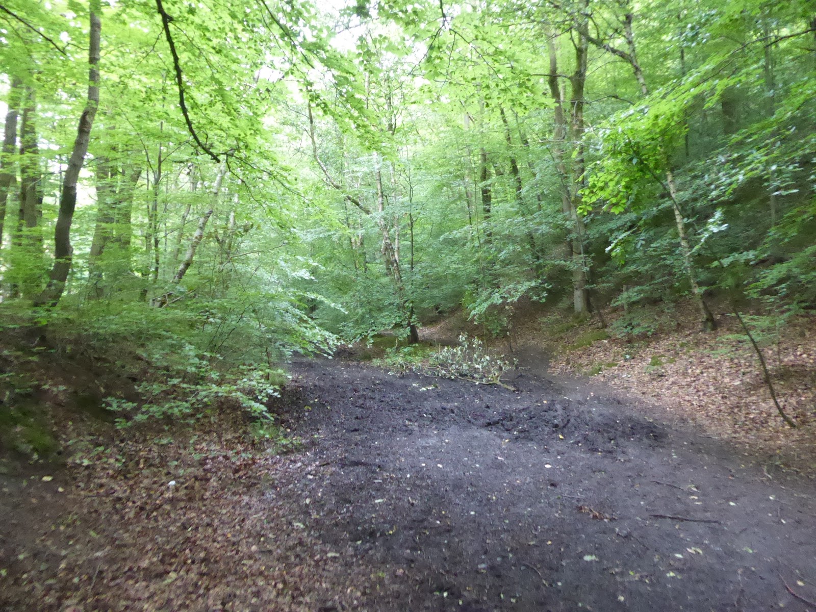
The rise to the ridge crossing comes next, via Pole Gate and its branch road, getting us out of the Colne Valley rapidly, and out from the shelter of the hillside, exposing us directly to the weather that blows in from the northwest, rendering the scattered hamlet of Pole Moor on the side of the A640 New Hey Road just that bit bleaker as we head down from the 350m high point on the ridge to head on down Hey Lane into the Blackburne Valley, heading down among the enclosed plots of Croft House Moss, with its trio of wind turbines, to aim under the M62 as it passes around the back of Crow Edge and Stainland Moor. Beyond the motorway, we turn onto the track that shadows it, among those abandoned lorry trailers that carry the most random of roadside advertising, as the path leads us onto the edge of Scammonden Dam once more, where the exercisers are thicker on the ground than they were on Wednesday, and we'll cross over below the carriageways, and above the hill climb routes for powerful cars, and for runners on the step flight up the dam face, adding to the perspectives that we gained up here only days earlier, and rising up to the old Scammonden Road to get our route on track among the enduring cottages and farmsteads at this obscure valley head. Rise to Saddleworth Road to complete our surprisingly brief passage over the Blackburne valley, joining the footpath that leads through the knot of gnarly beech trees and around the edge of the quarry site to emerge onto the rough moorland edge of Withens End, landing us above the Ryburn Valley, a little way to the south of Ringstone Edge and its reservoir, with our eyes drawn immediately across the reservoirs of the upper valley to the bulk of Great Manshead Hill which is shrouded in cloud as the rain continues to blow in, so onrushing dampness has to be contended with as we trace the rough path down to Withens End Lane, passing over the local catchwater drain before taking the most direct route downhill. Cock Pit Lane leads rough ly down to its eponymous farm, giving us views over to Moss Moor Edge and the farm in the middle of the M62 to the southwest, and directly across to the sharp end of Rishworth Moor ahead, as we are angled down some very rough going with Rishworth itself far below us the valley floor, landing on Hall Green Lane as it snakes downhill further, past Lower Hall Green farm and the Bank Bottom terrace before finally gaining us shelter from the weather as we pass around Rishworth Mill house and the coating of Beech trees atop the neighbouring Snow Hill.
 |
| Pole Moor hamlet on the A640 New Hey Road. |
 |
| Scammonden Reservoir, Dam and Bridge |
 |
| The Blackburne Valley, with Crow Edge and Wholestone Hill. |
 |
| On Withens End, high above the Ryburn Valley. |
 |
| Descending Hall Green Lane, below Ringstone moor. |
That's another mass of altitude shed on the way down, as we angle around the last couple of hairpins to land by the enduring Rishworth Mill, now an upscale retreat by the edge of Booth Dean Clough which we pass over before ascending on the far bank past cottages, factory and Heathfield school, to meet the A672 Oldham Road, which is crossed as we aim up the path to Godly Lane to meet Rishworth's parish church of St John, actually at a remove from the main body of the village in the hamlet of Godly, and looking like it has an early 20th century Arts & Crafts style, as it offers a bench for me to take elevenses. Move back to the lane and feel like the air is free of rain for the first time since setting out, passing under the power lines over the moors and up past the village school, while finding that the village heart is hard to locate as suburban estates bump up against rural outliers, which are suggestive of vintage around Upper Goat House, and the Mission chapel at the top of Shaw Lane, which we follow down its tree-lined passage behind the extensive grounds of Rishworth Grammar school, which has probably done as much as anything to forge the settlement hereabouts. Descend past its sports facilities as we drop back out onto Oldham Road, opposite the Slithero Mills site (which sounds like it's right out of Harry Potter), and pass down to the bridge over the actual river Ryburn, just upstream from the confluence with its minor branch, and having reached the bottom of our intended passage across the valley it's immediately time to start ascending again, up the sharp rise of Dyson Lane at a familiar Calderdale sort of pitch, finding suburban houses clinging to the hillside among the older cottages and terraces, never quite getting the downstream view that I feel ought to be available as we come up towards the A58 Rochdale Road. We get a puff on here as the climb then continues, away from the Butchers Arms inn, and up again with Castle Lane, rising us above the valley among the expensive suburban outliers, both contemporary and vintage, with the horizon we've traveled from appearing over the rooftops and then vanishing again as another wave of rain comes in from the west, meaning all clothing gaps need to be sealed off as we hit the top of the village at Nursery Lane, where we turn our backs on the houses with a usually prime view, and start our climb into the high fields via the grassy track of Spa Green Lane, pondering if our ongoing route towards the high moors will remain viable if this foul weather persists.
 |
| Rishworth Mills. |
 |
| St John's, Godly. |
 |
| Rishworth Grammar School. |
 |
| The terraces on Dyson Lane. |
 |
| Castle Lane, with the incoming weather. |
So upwards through the damp vegetation that's always welcome in such circumstances as we head up to Ripponden Old Lane, the pre-turnpike road that climbs over the crook of the valley, and offers little by way of shelter from the weather that has now greyed out all the horizons, and while my progress on over the rising fields around Farrar Heights seems pretty mental, I might not be the craziest people up here, as there are guys working out on the field of Stones Cricket Club, despite the weather, as we press on with the will wavering between the stone walls on the way up to Top o' The Hill farm. My destination on the edge of the moor remains obvious, beyond a couple of turns on the high lanes devoid of any traffic, with the way up the rough track of Flight House Lane directing us to moorland altitude, 300+m up, but once we get to the track that leads up onto Great Manshead's moor from Coal Gate lane, the will to continue on this route wavers as I'm looking into a window of traveling at a pretty consistent height of 380+m for another 3+ hours, and that looks like a no-go for me from this particular point of no return, so we break for lunch in the shelter of the wall and admire the fortitude of two passing runners who both assail the moorland track without a second thought. I haven't suffered a break in my desire to walk, though, despite the constant rain, and I have a circuit of the Ryburn's main features on my slate, and from here we ought to be able to do about 75% of it, as we quit the high route that was meant to take us to the previously unseen station at Walsden, and head down the lane back to the main body of the Ryburn valley, losing altitude as we come down to Blue Ball Road, to get sight of our target of Baitings Reservoir below, passing the old inn on the high road before slithering down another vegetation clad path to land by the A58 by the old New Inn, the one with the large sundial upon it. Our reservoir circuit thus starts here with our path directed by the one-way system put in place for safe social distancing by Yorkshire Water, setting us off out over the high edge of the concrete dam that has served Wakefield with drinking water since 1956, with its slightly s-shaped curvature and 50m high cascade being its most impressive features as we trace a path that featured on my opening New Year's Day stretch from the start of the year but makes it's first official appearance here, and only once we make the south bank do we touch a vintage route of mine, as in the preceding seasons, I've only made two passages over the whole of the Ryburn catchment, so this trip will add a lot of new terrain to my experience field.
 |
| Stones Cricket Club, high above Rishworth. |
 |
| As close to Great Manshead and the High Moors as I'm willing to travel today. |
 |
| Baitings dam and Reservoir, from Blue Ball Road. |
 |
| Baitings Dam and its runoff. |
The southern shore has lost most of the trees which used to shade it and thus views are improved, and as we grogress we get the rain easing off, to the point that sunshine and warmth almost break through, with Great Manshead revealing a crisp profile as we head upstream, briefly making me feel foolish for having quite my path, but I know the caprices of Calderdale, and as we make our way up to the road of Back O' The Height, and the way across the reservoir's heel via Baitings Bridge, the view from the watershed over the moors suggest these conditions aren't going to be lasting too longer as we land back on the north bank. Press for the finish line from here, still wildly distant as we trace the nicely built up permissive path eastwards, not getting as many waterside views as you might expect, with the 470m long dam eventually coming into sight in the final third, as we rise up to the New Inn again, with the bad weather coming on rapidly behind us, passing back through the car park through the crowd of visitors who haven't been deterred by the promise of more rain, and hitting the permissive path that will lead us down stream, slotted in between the field boundaries as we drop down below Baitings Dam. Press on, past Lower Beestonhurst farm on a path that I know is going to be sticky on its way down into the cleft of the woods above Ryburn reservoir, and it says something about today's conditions that the steep path down to the riverbank feels more fraught to day than it did in January, but the tree cover is welcome to shelter us as we pass down the side of the young Ryburn, to meet that odd spout that flows out from a culverted stream that looks like some sort of primitive hydro plant, before we rise along the boundaries of Beeston Hall farm and meet its eponymous rocks at the heel of the second these artificial lakes. Being much lower down, and partially shrouded by the remains of Hanson and Nab woods on its southern side, gives Ryburn reservoir a much more peaceful aspect, away from the wildness of the moors, and oddly devoid of foot traffic on this bank, so stillness holds as the rain quietens and we progress on to meet the intervening stream with the adjacent pipe bridge which really looks like the footpath ought to carry on over it, and then there's nary a soul to see along the whole remainder of the path on this north bank, I'd guess they might be venturing around the more exciting shore profile of the branch off to the south, the one which seems more inviting to those who don't know the challenges of the local paths so well.
 |
| Baitings Bridge and Great Manshead Hill. |
 |
| Baitings Reservoir and dam from the north shore. |
 |
| The descent toward the river and Ryburn reservoir. |
 |
| Ryburn Reservoir. |
Those are some miles that we won't be making official today as we land in the open field above the dam, built in 1930 as Wakefield sought its water need from much further afield, and describing a much more angular and ziggurat-ish stepped profile, which the path from the visitors car park descends below, barely visible through the shroud of trees as the sunshine teases us again, and I'll not take the extra steps down the valley side to get picture, instead staying high and observing how wide and still the Ryburn appears to be downstream, until it become apparent that it's a millpond that I'm looking at, plainly viewable once we've passed around a derelict shed and landed on the rising end of Bar Lane. The declining lane beyond settles into a wooded glade along the riverside, which was once surely the hotbed of industry in this quarter, which probably did as much as the school to fire the growth of Rishworth, not that the factories endure, as the site of Ryburndale paper mill has been replaced by a close with the river running through it, while the Ryburn cotton mill has also gone, though its terraces remain upstream, as do some of its auxillary buildings, whilst the millpond here has also become a feature for a group of cottages clustered around it. The growth of suburban Rishworth then looms over the bank of the valley, hanging tight above the terraces that endure by the Stones cotton mill site, of which the entrance complex endures, though most of its remainder seems to have been taken over by wild farming, as free-range chickens have the run of the roost in the kinks of the river bank as we come up to the edge of Oldham Road once again, meeting our inbound route and feeling that we could bail on the day here, with the 2pm bus almost imminent, but I gave myself a 7+ hour window for today, and it would be a shame to waste it. The most interesting feature of the Ryburn valley lies beyond, anyway, the disused branch line that terminates just downstream from here, north of the A672 and just over the bridge that crosses the lowest reach of Booth Dean, not that there is much to see of the former Rishworth station site, though the abutment of its footbridge endures and our route will take us around its site as the footpath clings to the riverbank, taking us up to the meeting of the Ryburn with its junior southern branch, as we press on northbound, in a quiet riverside idyll far below the embankmenting on which the railway terminated, traipsing on the undulating path as far as the Commercial mills site on the west bank.
 |
| Ryburn Dam. |
 |
| Ryburn cotton mill cottages. |
 |
| Stones cotton mill remnants. |
 |
| The Rishworth station footbridge abutment, over Booth Dean. |
We then rise with a path to meet the trackbed level, to start our explore of the last major West Yorkshire railway so far unseen, meeting the iron footbridge that is still in situ at the site of the station throat, despite having last seen trains in 1953, and the scale of the line to the north is pretty remarkable once we settle into the descending alignment that is thick with balsam, as the Lancashire & Yorkshire Railway had envisaged this branch as part of an alternative mainline route from Calderdale that burrowed under Blackstone Edge, a plan which never came to fruition, leaving a 4+mile stub completed in 1878, built to double track width throughout. There's still a drainage channel in place in the early going, and an impressive angled iron occupation bridge further along, steeply liking the linking the fields above below the fields on the high valley side, and the path slips up to the top of the cutting for the next stretch, showing up just how much engineering went into this ultimately futile attempt to cross the Pennines, and I'd have stuck to the track level if it hadn't been so overgrown, reminding me why railway walking ought to always be an early season excursion. Depart the alignment by the curved and stone-built Height Walk footbridge, with the path leading us down to the edge of Ripponden, which lies in the valley below around St Bart's church, while our interest looks up to the former bridge abutments over the steep Elland Road, to the station site which last saw passenger services in 1931 and was the goods terminus of the line until 1958, all lost under houses now, so we have to tangle with paths and lanes as we progress on, touching the Calderdale Way passage through the valley on the old bank road. Hanging Stones Lane will lead us on north, shadowing the railway line past the quarried out cliffs and the pair of houses that share a name with it, tangling with the trackbed by both of them, before settling in at a short detachment for quite a way as it lacks an accessible path here, passing above a pair of broken cattle creeps under the line, and rising above a deep cutting that the owners do not wish you to visit, before we drop down by Highlee Wood to find the gap in the wall to access the permissive Bridleway that lies beyond. This path, which passes the 31 mile marker and leads us under the Kebroyd bridge, ought to be one of the most popular in the locality, but it's devoid of life as we enter the rock cutting that reaches northwards, which is super dramatic in a low key way, whilst also providing going that would only be suited to foot traffic as we are kept dry by the canopy of foliage and approach another stone occupation bridge beyond a short stretch of lined cutting walls.
 |
| The Footbridge at Rishworth station throat. |
 |
| The angled iron occupation bridge. |
 |
| Elland Road bridge abutments, Ripponden. |
 |
| Hangingstones house, with the railway on the lawn. |
 |
| Kebroyd Bridge and the permissive bridleway. |
We are high above the passage of the river up here, passing over some vintage culverting as we enter the woodland of Rough Hey woods that seem to have engulfed the railway, so it's still shaded all the way as we run in toward the site of Triangle station, which sits beyond a double arched bridge and some railway vintage cottages on a high plinth, and wild faring seems to be the story here too as a sort of controlled chaos has taken over the plot ahead of the Stansfield Mill Lane Bridge. The line takes a sharp turn to the northeast, with the kink of the valley, with another deep rock cutting following, which was once bridged and partially lined, ahead of the 30 mile post (from L&YR HQ at Manchester Victoria, I'd assume) and it's sad to see so much engineering wasted, both historically and contemporarily as we carry on, under another pretty footbridge and over another culvert as we enter the closing stretch of the route. So it's stone bridge, culvert and iron bridge on the last leg, with sight of a llama farm on the fields above as we hit the end of the permissive route where it's blocked by a natural gas facility, though the access track to that can be followed as it slips off the trackbed and invisibly over the Ryburn, where the security gate is left open, as if use of the route is not officially permitted, but is basically tolerated by the owners as the local traffic joins the route from the Rochdale Road at the southern edge of Sowerby Bridge, over which the day's damp clouds still hang. We can slip from the A58 down to Watson's Bridge and up Watson Mill Lane among the factories to get a view down the side of the Aflex Hose plant, down the railway alignment from the Watson's Crossing halt site down to the south portal of Scar Head Tunnel, through which the railway entered the Ryburn valley from the main body of Calderdale, and we'll have to rise high over it via its eponymous road to land among the local mills and factories once again by Stirk bridge. So late footfalls are made along Water lane by the Ryburn riverside again, to Victoria bridge and Park Mill, taking the lane behind the vintage police station and on from Norland Road's bottom to Station Road, ascending past the coal drops and the Jubilee refreshment rooms to take a sneak into the yard of the Lucy Zodion plant to snare the mostly obscured north portal of Scar Head tunnel, and reaching the end of the day at Sowerby Bridge station the time that I had scheduled for it, 4pm on the nose, despite being many miles from where I'd intended to land in Calderdale, having redeemed the walking day when it could have been ignominiously abandoned, with no new aches and pains to report either.
 |
| Soft going is the order of the day. |
 |
| The double arched bridge, south of Triangle. |
 |
| The rock cutting, north of Triangle. |
 |
| The iron footbridge at the path's end, plus the gas facility. |
 |
| Scar Head tunnel, south portal, from Watson Mill Lane. |
 |
| Scar Head Tunnel, north portal, Sowerby Bridge station. |
5,000 Miles Cumulative Total: 4509.4 miles
2020 Total: 242.9 miles
Up Country Total: 4046.4 miles
Solo Total: 4185.8 miles
5,000 in my 40s Total: 3103.2 miles
Next Up: Colne to Calder again, by some fashion or other, weather permitting?
~~~
Pandemic Thoughts: Week 19
At (almost) the end of another ten day week off work, we again reflect on what's been going on in the world, a week for which we'd allowed ourselves to be hopeful of having a first family get together in nearly eight months, mostly for the occasion of marking what would have been Dad's 79th birthday, but that proved to be beyond us, with Leicester's local lockdown still being in place as we write this, ensuring we won't be able to travel down there, or for Mum to travel away, for a few weeks yet, and thus social plans get shifted to the end of August, despite all of us believing that taking an appropriate amount of care would have us all basically secure. So being NIW lands us spending another week locally, and illustrating the shifts of the pandemic situation in the UK once again, as I feel bold enough to venture beyond my regular local routine, and hit the city centre to do a bit of essential shopping, now that the mad rush of shoppers released from lockdown has passed, and I've only got three place that I need to visit to complete my list of clothing needs that I've been developing over the last four months, and I'm just interested so see how the major stores have organised themselves, while visiting early enough on a Tuesday morning to ensure that I'm out ahead of whatever multitude might be around later in the day. TK Maxx seems to have adapted well to the circumstances, as they offer hand cleansing to all who enter and leave the store, and counting the shoppers who enter and exit to a limit of 200 in their barn-like store, and as they've always been set out for browsing, social distancing is easily achieved by moving the clothing racks apart, and by not having so much stock on display (and I'd guess the quantities of remaindered gear that they sell are not as plentiful as they would be at other times), and I'll snag more socks from them as that always seems to be an ongoing need. The only cramped shop that I visit is Poundland, who have done gangbusters business over the last few months, apparently, and I only go there to get cheap lightbulbs and batteries, as needs must sometimes, while all my other purchasing comes from M&S, who've closed off some of their entrances and increased space on their floor too, but after a month they still seem to be having issues with getting all their stock displayed, especially as they'll be on the Summer - Autumn wardrobe transition soon enough, and there's barely a crowd there too, not getting in my way as I snag new walking trousers, shorts, trunks and a new shirt that I don't need before I head homeward at 11am, just as the released young folks start to descend on the town.
Otherwise, in the week of my Dad's birthday, I again start to adopt the mantle that he wore through his middle years and take a trip out for some trainspotting, because his legacy of rail enthusiasm needs to be maintained, and having used Live Rail Record for spotting exotic traction and services locally, Friday lunchtime offers the opportunity to spot four freight services passing through Mirfield on the Calder Valley Lines, and that's worth a venture on the train, even if it's far from essential travel, and it seems that I'm not the only person there with this purpose in mind, as there are four other (older) guys on the station too while I'm there. So in the 11.10am to 1pm window that we are there, we can spy the passage of possibly our most famous local freight service, the GBRf Liverpool - Drax Biomass 'Bin-liner's, with the empties heading up the valley and the loaded train thundering down it, as well as snagging the Preston - Lindsey Total oil empties hauled downhill by a pair of Colas Rail Class 56s making one heck of a noise, and the DB Cargo Wilton - Knowsley biomass empties returning for a resupply upstream, all worth travelling for when you can also factor in four TPE Nova services that also pass by at speed. Talking about this is more fun than regarding the latest piece of confusing and internally contradictory post-lockdown advice being sent out by HM Government, as people who have been working from home are now being encouraged to to return to their places of work because auxiliary and service businesses that have been reliant on them are not able to profit off an absent constituency, briefly summarisable as 'risk the health of the nation to buy a sandwich', a move that the chief medical officer is having none of, still advising to work from home for as long as is possible. It makes you realise just how ultimately incompatible the grinding gears of capitalism are incompatible with human well-being, and that people need to be fed into the mill to keep the money flowing, it's enough to make anyone harden their socialist outlook into an open contempt for how the system works, and even with this, you can at least regard the idiocy going on elsewhere in the world and feel hopeful that on'e own instinct for self preservation might protect you here in the near future, but I wouldn't be at all surprised if some wingnut somewhere in this world was opining and trying to propagate the idea that
'Human Life is Finite, but The Economy is Eternal'.


No comments:
Post a Comment