Odd House, Ashby Canal, Sutton Wharf, Ambion Wood, and Bosworth Battlefield.
 |
Long Distance Trail means Selfies!
#6 at St Nicholas's, Frolesworth.
|
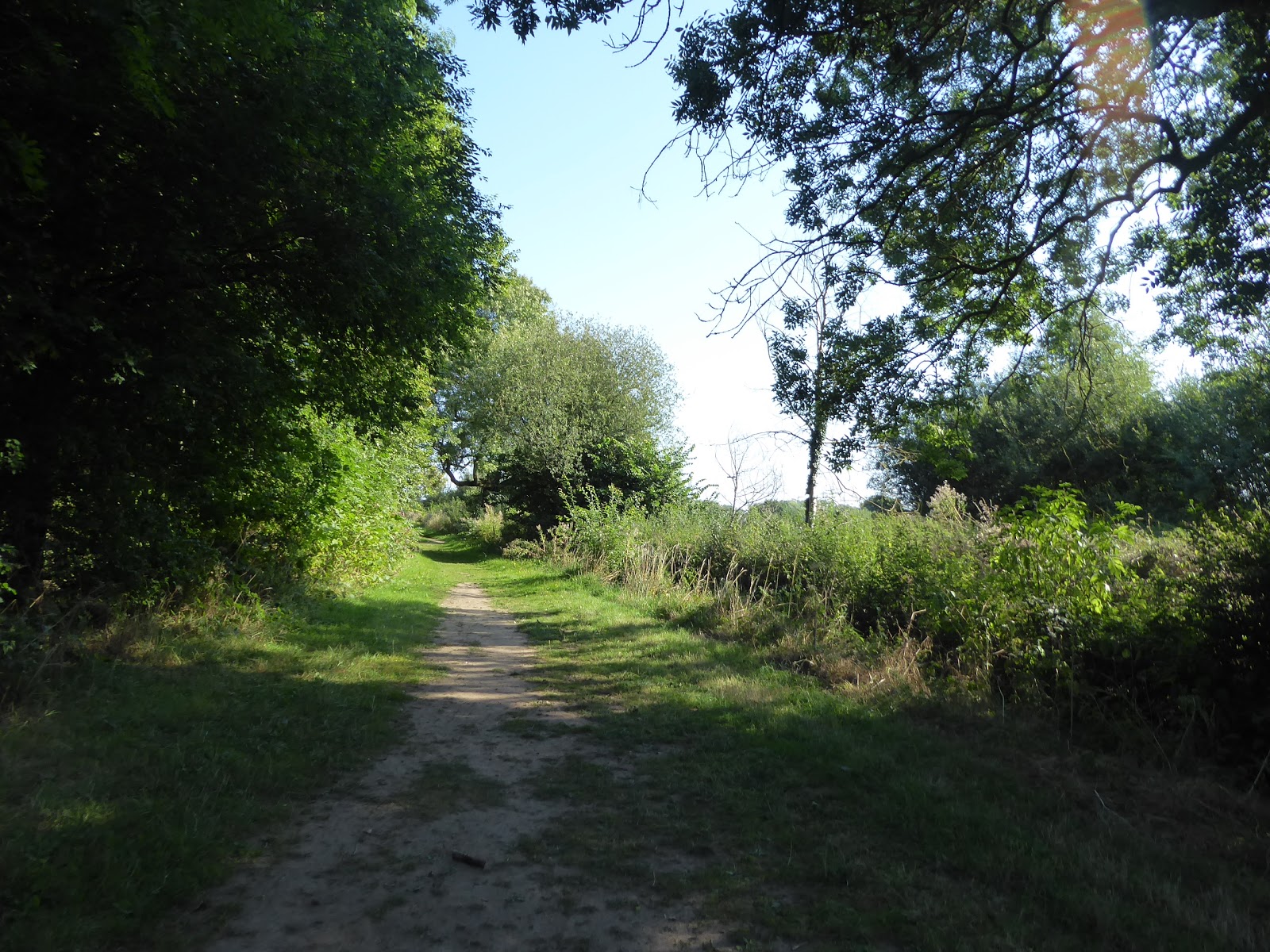
After my long weekend away in Wharfedale and a gratifyingly short week back in work, we can set our sights on the last holiday of the Summer, heading Down Country once more with August already receding into memory and all intentions set on getting the Leicestershire Round completed, with the two longest and most distant days still to go, trips that I had worried might prove to be logistically unfeasible due to the travel durations necessary to get to my start lines. We need not have worried though, as My Dad can be left to nap of a morning without great risk, and maximum flexibility can be gained from starting out as early as possible, not that I'm entirely sure that My Mum is entirely enamoured with having to get the Parental Taxi fired up for a departure from home at 7.15am, so that the trail might be joined again at St Nicholas's church in Frolesworth at 7.55am, which is easily the earliest I've started out, and the day's sunshine has already come on, for which I'm immensely grateful after last Sunday's damp debacle. Away on Main Street we go, past the gates of the Rectory to the corned by the now absent Royal Oak inn, taking a southerly track as we set course for the Heart of Roman England, down a grassy track that leads onto a field walk, seeing the village recede rapidly, but making sure to note the Dutch Barn at Manor Farm, a modern office building that looks exactly like an open barn stacked with straw bales, the sort of modern design that should be replicated in every rural redevelopment. Our path rises, gently, up towards Hill Farm, aside plots of corn and across the recently harvested wheat fields, before cresting by the equestrian grounds and then declining through open plots before shifting into rougher fields, where I'm greeted along the way by a farm worker and her enthusiastically yappy dogs, and I continue to enjoy the warm morning sun as we field walk to Frolesworth Lane and then hot foot it over to Claybrooke Mill, secluded away in its own little spinney. Trailing around the West Riding moorlands can make you unprepared for regularly rural Midlands landscapes, with its many stiles, ditches and plank bridges, and they will become the testing features of the day as we progress, across recently ploughed fields and enclosures full of docile cows, as we lead over to Claybrooke Magna, one of a Leicestershire pair which seems to have the majority of the modern suburban houses in it, apt to it's 'large' name, which our track only sees a corner of, on Bell Street.
 |
| The Dutch Barn, Frolesworth. |
 |
| Hill Farm |
 |
| Claybrooke Mill. |
 |
| Bell Street, Claybrooke Magna. |
We join a path that links Magna with its Parva neighbour to the south, down the edge of fields where the Swallows can be seen gathering to migrate with the end of Summer, and impressive trees can loom high over the path, the pair of Sweet Chestnuts being particularly impressive, as we are lead out to Main Road, to see that despite it's lesser stature, Claybrooke Parva is home to the bulky church of St Peter, and Claybrooke Hall, looking like a fixer-uppers dream, next to the suburban close that has claimed its grounds. It's also home to the village school, which will soon enough be back in business, which is where we pass off the road to head westwards towards High Cross, where we hit a long field boundary walk over to a converted barn that seems unduly isolated from other settlements, and the lead into open fields that undulate in a way that prevents you clearly seeing where you are heading, with only the yellow gateposts being useful indicators, unless you are good at spotting ponds and field corners without a vantage point. It's a bit of a haul, but you know that you have to keep running in closer to the A5 and once we've gotten sight of Claybrooke Grange and Victoria farm by High Cross Road we evidently right on track, as this will lead us up to the Heart of Roman Britain, where the Fosse Way and Watling Street crossed, and no major settlement ever developed, despite what we were taught in school about Roman Town planning. It's now home to a farm, with its famous inn lost below the widened A5, and the 1712 monument celebrating the reestablishment of Perpetual Peace in the wake of the War of the Spanish Succession, (which seems an impossibly quaint bit of reasoning at three centuries' remove), and from this high ridge we can look north to see the city of Leicester at a great distance away along with a lot of the rest of the county, and if we could look south, we'd find that it's Warwickshire that sits to the south of the former Watling Street. We are doing Leicestershire though, and we have a date with a mile and a half of the Fosse Way, one of the few local sections that isn't still in use, and a rough track lead us north, behind Victoria Farm with its camp site full of VW Type2 vans, dead straight and satisfyingly shady to let our minds wander through 2,000 years of history, wondering if any of the ancient engineering still endures beneath our feet. There's not a lot to see from the gradually declining track, with Sharnford Lodge farm being the only notable feature close by, which gets me pondering how when My Family used to travel to the West Country, they would always favour a drive down the Fosse Way, rather than the M69 and A46, despite that fact that the route south goes through literally nowhere until you get to Moreton In Marsh, in Gloucestershire, some 40+ miles distant.
 |
| St Peter's Claybrooke Parva. |
 |
| Field walking to High Cross. |
 |
| The 1712 Peace Monumnet, High Cross. |
 |
| The Fosse Way, a rare unused section. |
 |
| The Fosse Way again, with 2,000 years of history below our feet. |
Our Roman excursion ends as we meet the metalled section of the Fosse Way, as we split off the pass across the fields in front of Cottage farm to meet the perimeter track of the Fosse Meadows country park, which is part nature reserve and part forest preserve, and a popular one judging by the foot traffic around it at a little after 10am, with out path taking us between the bird-watching lake and the arboretums (arboreta?) of international trees before skirting the meadows to the east of the site, a fine place to stroll if we weren't in the midst of a 7 hour burn. 2+ hours into the day and we are about at the latitude that we started out from again, meeting the edge of Soar brook, one of the many streams that feed the namesake river to the north, and roll past the edge of Sharnford's cricket field, that looks like it has seen a ball bowled in many a summer and is probably too overgrown for most ball sports at the moment, following the brook as it leads into Sharnford, onto the old A46, downhill from the Sharnford Arms and St Helen's church. We will head in the opposite direction, along the B4114 Leicester Road past the Evergreen village hall and the pub now called The Bricklayers (a name that I'll immediately warm to), tracking on to the small green in front of Roadley House farm, among the suburban bungalows and semis that have grown about the place, and the amount of feature greenery that has grown over these farm buildings is surely something to admire before we get back to field walking. Care is taken to not disturb the horses in their paddock before we pass around the pack of the Brindley Truck services depot, and thence on tracking westwards along the field boundaries and espying the half moon in the sky still bold enough to be photographed, moving onto a track among maturing corn stalks that do their best to obscure any sight lines to the north while the modestly elevated Mickle Hill rises to the south. In this part of the county, pretty much any elevation is modest, revealed once we pass onto the edges of stubbly wheat fields, and then push on over those frustrating ridge and furrow fields that hammer the ankles and knees, passing though various hedges at all sorts of angles that show the weirdnesses of old Rights of Way, and almost playing a game of Seasons of Fruitfulness bingo as we go as the many bushes present us with the colours of Blackberries, Rose Hips, Hawthorn berries and the like. Land on the driveway to Mickle Hill farm, and this leads us up to the hamlet of Aston Flamville, most of which lies to the north of here, as all we get to see of it is the pair of old cottages by the road corner and the later additions built with a view to the southwest, one of which looks like its still trying to run a sideline in market gardening despite is ostensible upscale suburban status.
 |
| Fosse Meadows country park. |
 |
| Sharnford Cricket field (former). |
 |
| Roadley House farm, Sharnford. |
 |
| Mickle Hill. |
 |
| Lychgate Lane, Aston Flamville. |
Pressing on we head up Lychgate Lane as it swings around to pass over the motorway, and on a less busy day I might have paused to give a closer look to the Aston Alpacas establishment, but for now we'll rise over the M69, one of the trio of major routes that have been travelled many times in the past through this portion of the county that I nonetheless would profess to not know well, immediately dropping down onto a field boundary path just beyond the edge of the motorway perimeter to find more llama farming happening in this quarter. Settling back into field walking, some of the corners and passages get a bit confusing as we head towards Burbage, one of the Leicestershire villages that I was always convinced was in Derbyshire, and pauses can be made along the way to spot the birds of prey sailing around in the skies, and they're definitely not Kites in this part of the world, my best ornithological guess is that they're Buzzards, before we track our way towards our next call with civilisation as the spire of St Catherine's church leads us on. Many fields are crossed and stiles surmounted, along with each plot having its own herd of cattle in it, before we land on the suburban edge of Burbage, the easternmost reach of greater Hinckley, the only one of the Leicestershire towns that the Round path gets even slightly close to, and as we are half way through this day, it's time for lunch, despite it not even being midday yet, and the green among the houses of Salisbury Road provides the sort of place needed me to eat and water before getting the mileage ticker going again. Roll out onto Sapcote Road, and then depart into the countryside again, joining the path that leads to Burbage Wood and Common, another popular country park that seems to be a spot for the locals of greater Hinckley and Earl Shilton to come out and play, and field boundaries are traced to lead us to meet the wood first of all, that the path doesn't enter, instead skirting its western border and providing plenty of shade that's most welcome as the day has presented barely a cloud to see since we started out. The next immediate temptation would be to be drawn to the café at Wood House farm, sitting at a short remove from the trail, where an ice cream would be a most appealing prospect, but with 7+ miles still to go on the day we need to move on towards Burbage Common, and I'm glad that the guide book is particular with its directions as the knots of paths around here could get very confusing. At least things are clear enough once we meet the railway bridge, under the line from Leicester to Nuneaton, our frequently travelled Red Route to Birmingham and the North West back in the day, where I'd think to linger in the hope of spotting a passing train until I remember that it's a Sunday and traffic will be light, so entirely naturally, a westbound freight train thunders past, just once I've moved beyond having a useful sight line toward it.
 |
| The M69. |
 |
| Field Walking to Burbage. |
 |
| Salisbury Road, Burbage. |
 |
| Beside Burbage Wood. |
 |
| Under the Leicester to Nuneaton railway line. |
We now enter Burbage Common, the largest enduring plot of common lend in the county at over 200 acres extant, where you could still graze your horses or flock of sheep, if you so wished, and the folks are out in force for a lunchtime stroll around the woodland trails and around the wildflower meadow, and the guide book is again emphatic to direct you north along the bridleway towards Acorns Coffee shop and the play area to prevent you getting off course among the long grass, and even then the route east can feel a bit vague. Once you spot the way over the edge of Hinckley Golf Course, finding the way out it straightforward, only passing over one fairway before the enclosed path out to the B4668 Leicester Road, then entering someone's garden, dropping to a stream crossing and then rising over along field and spotting the various sports fields to the east, home to Hinckley United FC, unless I'm very much mistaken. Meet Barwell Lane by the pair of whitewashed cottages, and join their home lane to head north, passing under the A47 Hinckley bypass that has rendered it a long dead end, and while it feels like it ought to draw us on all the way up to Barwell, the route guide instead sends us onto a field walk uphill, towards the tower of the Parish Church atop its perch, with the suburban village scattered around it, alongside hedges thick with Elderberries and other autumnal fruit. Arrive behind St Mary's church and pass around it and the War Memorial, past the assisted living homes and down Church Lane to the main drag through this village that grew to townlet size with the shoe industry, and then grew suburbanly (?) to merge with Earl Shilton, which is the junior half of greater Hinckley, the way along High Street and Mill Street past the Red Lion having many terraces and no suggestion at all of any older settlement. That's the end of the eighth leg of the guide book, and our two-thirds marker on the day, as we enter the industrial estate on Moat Way to start the push on to the day's end, an unappealing stretch on a major Long Distance Trail to rival the passage past the distribution depot in Holmfield on the Calderdale Way, one which we happily leave behind with the trail now offering us almost three miles of unbroken countryside, as we strike on to the north west. Hit a long field path that takes us away from Barwell, where the high water tower on the horizon will linger for a long while as we progress, heading in the direction of Barwell House and Bosworth House farms, but not actually getting close to either of them as the path bisects the ridge and furrow field between them, where the local cattle sit at a far remove from me as we make our way over to the A447, that odd trunk route across West Leicestershire that runs north-south without seeming to actually go anywhere.
 |
| Burbage Common. |
 |
| Field Walking to Barwell Lane. |
 |
| The War Memorial and St Mary's church, Barwell. |
 |
| Moat Way Ind. Est. Barwell. |
 |
| Field Walking to the A447. |
Field walking resumes beyond, down the boundaries of plots filled with stubble, with the thick hedges and the land pitched at such an angle that we go no real contextual views in any direction, which gets odder as we meet the field crossing in front of Odd House farm, where nothing else at all forms the horizon aside from the remnants of the harvested wheat, making the nearing farm look like a painting with no apparent use of perspective. We can at least get views behind us as we rise onto another modestly sized hill, which presents us with a track to follow as we crest by the farm, and get another illustration of the changing of the agricultural seasons as we meet the famous Scottish farmer, Mr McSpreading, distributing manure over the fields, something I'm apt to try to keep away from, though that stench of pickled animal waste is pervasive. Just to add to the flavour of the air, we have to pass the manure pile that said farmer is using today, and that moment of fouled air wafting over me as I pass is one that won't get out of my nostrils in a hurry as we tack downhill again, meeting rough pasture and an intensely ploughed and harrowed that makes for very tough going as we pass over the loose and dry soil, eventually meeting a boundary that suggest a hind of villages beyond the Round route, Stoke Golding and Dadlington. The path suddenly shifts north, over the field to meet the plot by the stream that calls itself the River Tweed, rather ambitiously, which we follow and cross before passing though a large field full of sheep on the way over to Stapleton Lane, resuming the path by the side of a drainage ditch in a field full of fodder crops, Mangelwurzels, I believe, if their orange colour is anything to go by, surely planted in an attempt to make up extra animal feed in the wake of our Summer heatwave. Two fields beyond lies Poplars farm, only the second seen over the last couple of miles, and its driveway is met to pass over the Ashby Canal, which we then join the towpath of which as we slip under Bridge 33 to grab a place by the first bench seen since we left Barwell, and I can ponder if this is active canal or an inert one, a quandary soon solved as a narrowboat pushes south, confirming the former. I can now give a brief history lesson, as the Ashby Canal was opened in 1804 to link the Coventry Canal to the coal mines and iron furnaces around Ashby de la Zouch and Moira, (but never actually reached as its namesake destination), remaining profitable until as late as the 1890s before suffering leakages and subsidence that ultimately closed the top 9 miles of its length, but now endures as a long stub between Bedworth and Snarestone, offering 22 miles of lock-free boating for pleasure cruisers.
 |
| Odd House farm. |
 |
| Mr McSpreading, the Scottish Farmer. |
 |
| A Close Call with Stoke Golding & Dadlington. |
 |
| Field Walking through Mangelwurzels! |
 |
| Boating Action at Bridge 33, Ashby Canal. |
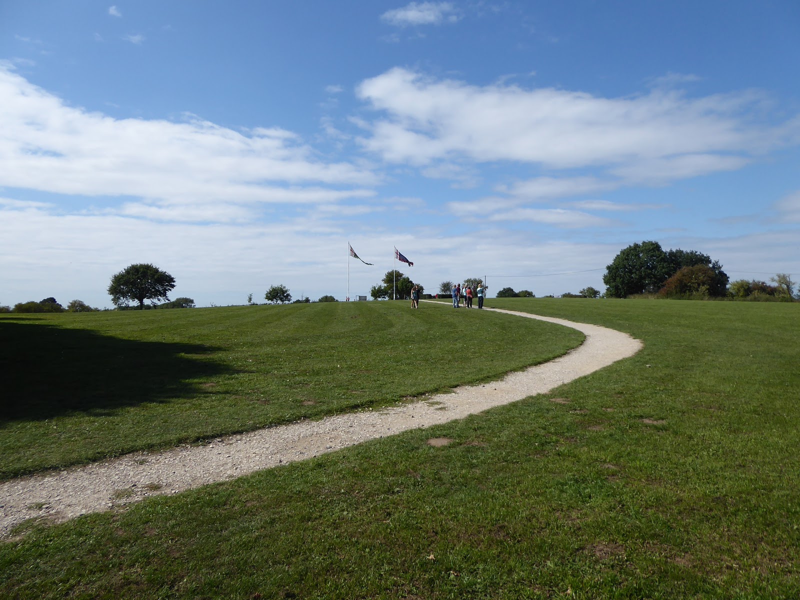
It's certainly still popular, judging by the number of boats moored south of Wharf Lanes bridge (one of which is obviously owned by aging Goths), and some of the registrations suggest travel from as far afield as Cheshire, and beyond the bridge we meet Sutton Wharf, the commercial centre and essential café of the canal that seems to have drawn many more people out for the waterside experience, which we pass once we've switched sides along the watercourse to meet the tourist throng pacing on to the north west. We trace the canal for a while along a hard path beside three fields before we slip into Ambion Wood, where a wide path tracks us north, giving us no doubt of the right direction of travel but giving pretty strong direction to not investigate this patch of ancient woodland any closer than we can see as we go by, passing though the welcome shade before we emerge on the path up to Ambion Hill, the acclaimed site of the Battle of Bosworth Field. The farm up here is now a visitor centre, another place that every child that has grown up in the county in the last 40 years must have visited, and atop the hill we have the standards of the combatants, Richard III and Henry Tudor, and the guides are still out to explaining the events of 22nd August 1485, the fall of the house of York and the ascent of Henry VII, despite the fact that the battle probably took place a couple of miles south west of here, according to more contemporary research. It was probably where KR3 pitched camp before the battle, which is recreated behind the visitor centre, but it all has a whole lot more hoopla attached to it than the very definitively correct battlefield as Towton, which I'll blather about to anyone, but not today as the last leg awaits, tracking uphill to the northeast, to get a notional view of the corner on the county that has been oft travelled across but never really known in my Leicestershire resident days. Meet Ambion Road and its footway, which leads us past a house displaying the Tudor standard, and follow it around the last half mile to the first settlement seen in over 5 miles, Sutton Cheney, passing the cottages farmstead and real Dutch barn at its northern end before diverting into the yard of St James's church, the so-called Battlefield Church with its stone body and squat brick church, home to the definitive memorial to Richard III before his remains were rediscovered in 2013. From there it's down the front path to meet our finish line for the day, at the Hercules Revived, a racehorse themed pub, it seems, where we finish at 2.55pm, surely the earliest I 'll ever finish after walking 17+ miles, landing only five minutes ahead of the Parental Taxi, which is great as that gives us time to go to our favourite garden centre, Woodlands, which is nearby, so Mum can go to the Lakeland store, I can visit Mountain Warehouse , and all three of us can enjoy an ice cream under the late Summer sunshine.
 |
| Sutton Wharf, Ashby Canal. |
 |
| Ambion Wood. |
 |
| Ambion Hill, Bosworth 'Battlefield'. |
 |
| Ambion Road. |
 |
| St James's Church, Sutton Cheney. |
5,000 Miles Cumulative Total: 3532.3 miles
2018 Total: 419.8 miles
Up Country Total: 3156.3 miles
Solo Total: 3246 miles
Miles in My 40s: 2126.1 miles
Next Up: And on the Seventh Day, the Leicestershire Round was completed...


No comments:
Post a Comment