16.5 miles, via Wharfemeadows Park, Farnley Park, Leathley, Stainburn Bank,
Napes Hill, Lindley Moor, Stainburn Forest, Little Alms Cliff, Sandwith Moor, Bland Hill,
Swinsty Dam, Timble, Low Hall, Askwith Moor, Askwith, and Burley stones.
There's no bonus round of walking for the last Sunday of my first Summer break because it's actually raining, putting a temporary brake on the 2018 heatwave for a short while at least, but the plan I'd hatched for it is carried forward to the next weekend, as after finally getting a copy of this year's Dalesbus timetable I'd discovered that the #821 Nidderdale Rambler could take me to Fewston or Blubberhouses and give me a window large enough to walk the circuit of the top half of the Washburn valley, a plan I've had on the slate for over two years now. So we aim for that as August comes around, setting out on the bus from Morley in what feels like good time, but it transpires that the journey plans that the WYMetro site gave me were damn lies as the necessary X84 isn't running and the scheme to ride the #821 dies before I can even board my second bus, and even though I could make the #874 to Upper Wharfedale, I only have the E297 map with me and thus am compelled to make a trek from Otley. Thus it's fortunate that I have the bones of a trail that I'd considered last year in my mind, travelling among the paths that were left unseen on my many treks across the Washburn area as I aimed to Harrogate and Nidderdale, and so when we arrive at Otley's bus stand at 10.10am, I set out with some idea of where I'm going to go, but with no idea at all of how far it might be or how long it might take, so for once we go onwards as close to trekking without a plan as we've ever really done. So northwards, after a fashion, via Crossgate and Boroughgate, past the empty market place and on to Clapgate, passing the Black Horse, the Stew and Oyster in the old Grammar School, and the solicitors office called Savage Crangel, then on between the spired pair of RC and URC establishments before making our crossing of the Wharfe via Otley Bridge. Tacking eastwards from here takes us into Wharfemeadows Park, and trying to trace paths not walked last year, which takes us along in front of the picturesque riverside terrace, around the back of the bowls club and former lido and then from Farnley Road side down to the riverbank to spot the redeveloped mill site and the fish elevating mechanism by the weir. The we can meet the dog and child exercisers who are using the riverside path that leads below the playing fields and out into the vast and recently harvested fields of Farnley Park, where the house hides well up the hillside, obscured by the rolls of the landscape and the fact that it's further away than you think, seeing the crowd thin down as we press east and downstream, watching the lump of Rombalds Moor recede and smelling air thick with the scent of Balsam as the vanishing clouds suggest we are in for another very warm day indeed.
 |
| Otley Market Place (sans market). |
 |
| Wharfemeadows Park, Otley. |
 |
| Farnley Park (with Farnley House hiding in plain sight). |
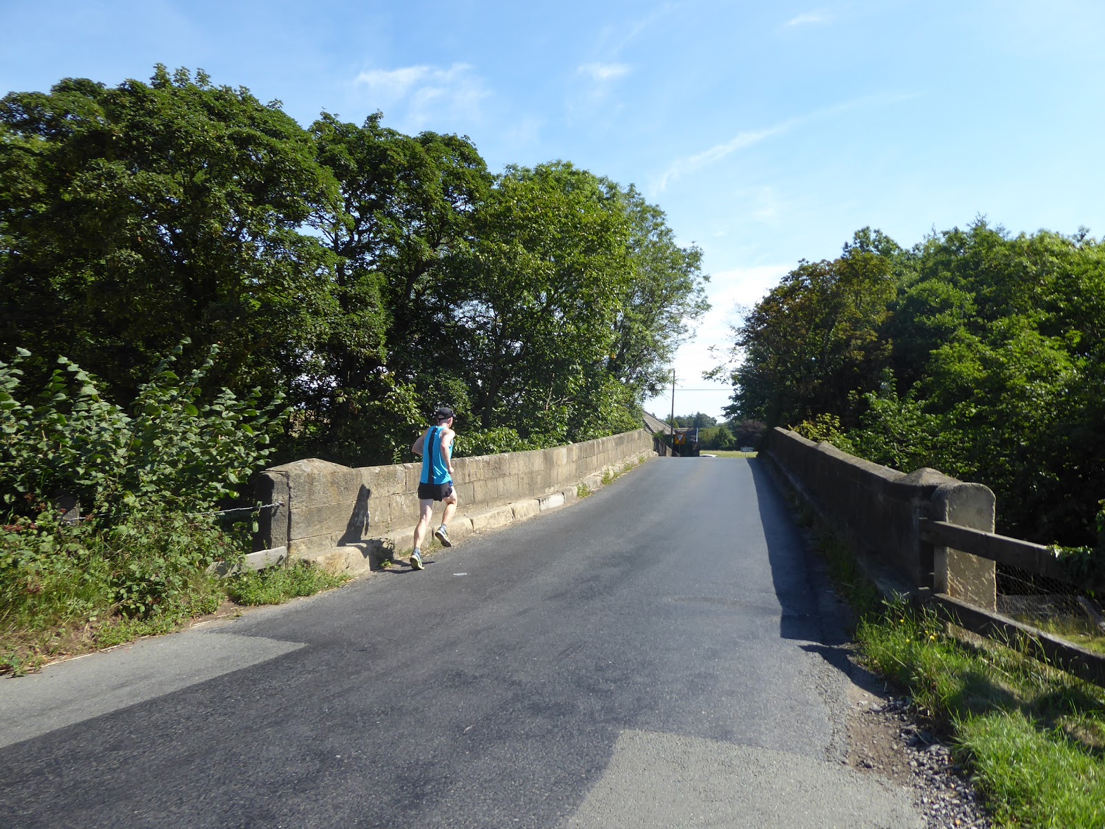
Quite a trek on by the river has passed, as have the casual walkers out of Otley, as we shift out of Farnley Park and into the fields of Hasling Hall farm, also raised up the hillside at a remove, and our path slips behind a fence to prevent us wandering further into the wheat fields, taking us to a field of pasture which has the path abandoning the riverside as we walk the slightly raised track among the few loose livestock who have chosen to not take in the shade below the largest tree in the field, and these sheep and cattle won't be disturbed for their rest as we progress. Meet Farnley Park road and crossing old routes will be a major theme for the day as we move with the hedged lane to cross over the River Washburn at Leathley Bridge, its lowest available transit point, passing the Lodge house and moving onto a northward trajectory as we join the B6161 as it twists its path northwards, along the riverside and onward with Leathley Hall and the rising fields of Barks Hill elevated beyond it in the east. Pass the few cottages around the farm and Manor house that compose the Low End of Leathley village and then arrive at the centre, where the Almshouses and Reading Rooms sit opposite St Oswalds church, where we take elevenses by the stocks and mounting block, while the sounds of the Sunday service waft out of the church, and boots are adjusted as I experiment with gel pads and new socks to ease the blistering troubles that have plagued this season. Despite having come this way two years back, the way along the Killinghall & Dudley Hill turnpike (which really does turn up in the most unexpected places across this quarter) seems rather unfamiliar as we pass the upper half of Leathley, stretched out along the road and sitting around Fishpool farm (up for sale if you've got a ton of cash to drop on it), which we pace through along the pavement as far as Leathley Mill before we set a new course and are let loose on the road surface, rising through a shady passage before we arrive by Leathley Grange, that distinctively yellow (and falsely vintage) house that's clearly visible from Pool Bank. We start our serious rise away from the river here, looking back to the Caley-Chevin ridge to the south of the Wharfe and also west past Leathley farm the see the shape of the Washburn valley's lower portion, clearly post-glacial and far too large for the river that passes through it, and we also get a reminder of how Sundays work on the remoter lanes of this county as we get our first bikers come past, all riding scooters as if they are some part of a delayed Mod revival, or a group of extras from 'Quadrophenia'.
 |
| Hasling Hall farm. |
 |
| Leathley Bridge. |
 |
| St Oswald's, Leathley. |
 |
| 'Fishpool', Leathley. |
 |
| Sunday Morning Scooters and their Scooters. |
Rise on, and the road gets steeper and harder to walk along with blind summits and hidden corners coming on among the hedges as we start to ascend Stainburn Bank, certainly not one of the most challenging road ascents but probably one of the most unwelcome, as well illustrated by its worst section where the road shift through ninety degree angles twice, with the very steepest section between them, a place where motorists have clearly been caught out and all wits have to be retained to make a safe passage among the Sunday drivers. Dodging from side to side and running(!) over the worst section gets us to the top, and to the edge of the wide plateau between the broad valley of Wharfedale and the elevated ridge of Stainburn Forest, meeting another biking crew on many Harley Davidsons as we go, and looking west past West End farm to see Almscliff Crag rising beyond Braythorn hamlet, and soon coming up on out previous passage on the B6161, where we trekked eastwards across the kinking lane below Hilltop farm. Depart the road as it takes its sharp turn off towards Killinghall, and we can carry on northwards on the bridleway that sets a pretty direct course off towards the top of the ridge between Wharfedale and Nidderdale, gaining us a grassy and rutted track that will test the durability of my feet as we skirt the moorland grasses of Napes Hill, startling the sheep that have taken up residence on the track and eventually meeting that bridleway to nowhere that I tried to walk last year. Decline a bit as the path continues, realising that we actually outside the catchment of Washburn and are at the headwaters of Stainburn beck, which is crossed as we venture onto the woodland contained expanse of Lindley Moor, which the bridleway continues across looking well built up with building rubble and accessed by heavy machinery that has been carving up the grasses to improve drainage, which rather spoils the remote and unspoiled aspect of this elevated plot. As we rise to the vicinity of Stainburn Forest and the Norwood Edge mast, it's worth looking back to get the elevated views back to see Cookridge Microwave tower beyond the Caley-Chevin ridge, and also to the very top of Sky Plaza peeking above the trees, the second highest building in Leeds looking far taller from its lofty eyrie, as well as Emley Moor mast rising from far further away, alongside its apparent and previously unseen slender companion(?). Then onto the track that leads us through the eastern edge of Stainburn Forest, where a lot of conifers have been felled and replanted since we came this way last year, marking our transition out of the vicinity of the Wharfe and getting the reveal over the valley of Oak Beck to Nidderdale and the North York Moors beyond, a whole range of views that have come to feel local in the last 12 months.
 |
| Stainburn Bank. |
 |
| The High Wharfedale plateau. |
 |
| The bridleway around Napes Hill. |
 |
| Lindley Moor. |
 |
| Stainburn Forest. |
Join Broad Dubb Lane, and curse the fact that there's no picnic area by the Stainburn Forest car park, but we do have a vantage point to approach at this high corner as the ride out reaches its summit at Little Alms Cliff, just that bit further from the road than you'd think but at 250m up offering us an opportunity to take lunch while watching the quartet of model aircraft enthusiasts who have brought their entire collection of planes and super-quick drones out for an afternoon of unrestrained buzzing. It's a lot of fun to watch as we also take in the fresh view to the south, brought about by much felling of trees that gives us much more of the 360 degree panorama that this rock outcrop deserves, and also take in the western view of the hills between the Wharfe and the Washburn, which have now ceased to feel like one of the most mysterious and impenetrable sections of the terrain in my locality and now feel happily familiar, the distant Wharfe-Nidd moors now holding that distinction. I could honestly bask out here for a while, but we still have a lot of ground to cover to get back to West Yorkshire, and so we return to the road and start on out westward portion of the day, setting off on a slow decline with the Wharfedale Moors forming our horizon, with Stainburn Forest a field or two to the south and the wide grassy expanses of Sandwith Moor stretching out to the north, as Broad Dubb Lane feels a lot like one of those roads at the top of the world, despite cresting at only 240+m elevation. For all its scenic value it seems to have little draw for the Sunday bikers and motorists, which means clear going for me along its long and relatively straight path, giving us regular views back to Little Alms Cliff as the road gently descends and the sights to nearby Radomes and Wind Turbines recede and we continue on in the shadow of the forest and the rising mast on Norwood edge, going on for more than a mile before we reach any sign of civilisation at all as we meet Gate House at the end of the driveway to Whistle House farm. Here attention can focus forwards as we start to descend in to the valley of the Washburn, as Fewston reservoir announces itself in the landscape below and the Askwith-Denton-Blubberhouses moorland rises to form the southwestern horizon, and we get buzzed by Red Kites as we go, a familiar enough sight for most of the days in this quarter. This brings us to the former farmstead cluster at Bland Hill, nowadays home to some of the remotest council houses in Harrogate Borough, and we join the B6451 Brame Lane to pass the former smithy and board school and to look down towards Swinsty Reservoir, getting sight of the dam long before we see the surface of the water, looking way lower than usual after six weeks of hot summer, and leaving this oddest of hamlets as we meet Smithson's Lane.
 |
| Little Alms Cliff. |
 |
| Sandwith Moor, looking towards the Washburn. |
 |
| Sandwith Moor, looking back to Little Alms Cliff. |
 |
| Gate House, and Whistle House. |
 |
| Blands Hill. |
The first steep descent of the day comes on quickly as we lose 50+m on the way down alongside the woods and plantations that surround Swinsty Reservoir, and trying to get a fix on my previous passages around here means I need my E297 map out, which makes one passing motorist think I'm lost, which I'm certainly not, just seeking out the route which we find as Pinfold Lane leads us along the foot of the slope and along the treeline to meet the reservoir perimeter, the place to find the more adventurous Sunday strollers. Pass the Valve house, and the cottage that has had its extension job finished since we came this way in 2016, and strike west across the dam to get our view across the silvery waters and down the valley and the over the extensive sections of the waterworks that lie below, my first transit of it in my official walking career, despite having come this way when the idea of walking for fun crystallised in my mind many years ago. It's definitely one of the best embankment dam crossings, giving some surprisingly good panoramic views around the valley despite our relative depth, especially as we pass the valve towers and runoff channel to look back east to Bland Hill and Norwood Edge, but that's all the reservoir walking that we'll get for this day when we'd planned for a lot of it, departing the circuit paths to rise west into Swinsty Moor plantation where we get a grand view of the dam before turning our back on the Washburn. The way west isn't as obvious as I'd like when in a strange wood, but we mostly follow the gab between the deciduous and evergreen trees as rise in the direction of Swinsty Hall, meeting rather too many felled trees across the path before we catch a view of the house's stables through the foliage and then find the track that leads us out into the fields, and the official route of the Harrogate Link path that we avoided walking last year. Push uphill away from the reservoir plantations through open pasture to get a view to the familiar sharp southward turn of the Washburn valley, and across back to Bland Hill again, illustrating well just how deep and narrow the post glacial channel of this river valley really is, meeting that one pasture that seems to have all the district's sheep in it before we meet the enclosed path that takes us to the lane below Timble village. Despite being off piste for this trail, we need to take a second look at the only village of note in the valley, sat on its lofty vantage point, with its cottages and farmsteads on South Lane having a grand view to the south, to the moors above and the stretch of the river below, all looking like a super desirable county retreat these days as we tour around to the Millennium Oak and back along North Lane to the Timble Inn and the Robinson Library, where a bench presents itself for our late lunch spot.
 |
| Descending to the Washburn on Smithson's Lane. |
 |
| Swinsty Dam from Pinfold Lane. |
 |
| Swinsty Dam, from Swinsty plantation. |
 |
| Ascending through all of the Washburn's sheep. |
 |
| The Timble Millennium Oak. |
Figure that it's going to be a two hour trip back to Wharfedale from here, and so start off the homeward leg by passing down the track from the pub back to South Lane and returning to the corner by High Field farm before meeting the track that will take us south, a narrow and enclosed track that descends steeply, wandering downhill towards Timble Beck, littered with loose rocks and dried holly leaves and altogether feeling like its significance in the distant past has not been carried into the present. It still offers sight lines down the valley and over to Sword Point that are pretty grand, as well as back to the village on its high perch before we need to ford the beck in its little glade, before the path actually rises beyond up the channel of Dick's Beck, which has you really glad that it's been dry for more than a month as that would be no fun at all if it were in spate. Rise into the fields as the path traces the boundary walls and fences as we elevate to get more views of the angle of the river valley, and head up with Askwith Moor on our horizon, meeting a distinct track once more as we ascend behind the buildings of Low Hall farm, which are pretty extensive, passing above Holt wood and over the fields of Low Snowden before we meet the 17th century farmhouse itself by Snowden Carr Road. A bolder day might have had us approaching the Snowden Crags on the steep northern edge of Askwith Moor's access land, but we'll be sticking to the lane for today, thankfully free of traffic as it only serves as the open driveway to all the local farms that cling to the high side of the Washburn, and we can meet our umpteenth passage over a 2016 trail as we pace south, looking back to the radomes of RAF Menwith Hill, and across to the sharp end of Sword Point with Norwood Edge beyond. Also forwards to the ruin of Dobpark Lodge, sat above the eponymous wood and having hidden from sight and my knowledge until today, of a similar style and vintage to Barden Tower and seemingly forgotten by history, but surely part of the Royal Forest of Knaresborough and a seat of the ancient Duchy of Lancaster, only visible at an extreme remove as we rise on, looking back to Swinsty Reservoir and down to Lindley Wood reservoir. The feeling comes on that we are on the closing stretch as we rise to meet the crest of the road and the passage over Askwith Moor Road, summitting the day at over 260m up, a most unwelcome final ascent across the moorland fringe that puts this surprisingly scenic trip around the Washburn behind us, and reveals the expanse of middle Wharfedale ahead of us, with Rombalds Moor backlit by the afternoon sun and Burley In Wharfedale sitting directly ahead of us, teasing us with the knowledge that we are going to end the day less than three miles distant from where we started the day in Otley.
 |
| The rough path to Low Hall. |
 |
| Sword Point and Norwood Edge. |
 |
| Low Hall farm. |
 |
| Dobpark Lodge and the looming Askwith Moor. |
 |
| Askwith Moor Road. |
Of course the long walk to the finish line isn't going to be a quick trip, especially as my brain is ready to go to the nearest convenient refreshment centre with an hour of the day still to go, walking down Moor Lane, which has more Sunday drivers on it than I'm really ready for, looking around the panorama from Otley Chevin around to Skipton Moor as we descend, and suffer that problem of completely losing touch with how far we have to travel as focus is far forward and not no the mile plus of landscape down to Askwith. Not that this is a landscape that offers much that is familiar despite the many passages made over the north side of the Wharfe, and attention is focussed in sighting Whin Castle farm as we track down among the plantations and fields, only barely glanced as it happens before we run into the local traffic piling up around the sharp corners over the narrow bridge on East Beck. The signage has offered us entry into Askwith from quite a distance out, and we've another farmstead cluster before we reach it's proper outer edge at Town Head, a way up Askwith Lane, which we descend fully to meet the multi tiered former chapel, the mundane village hall and the Primary school that seems large enough to house every child who lives on the North Yorkshire side of the river, before we land on the main street, just a step or twelve east of Manor Farm, and after one last watering break we strike east again, to pass over the gill of East Beck again. Into the Springbank portion of the village we head, and leave down Back Lane, where the cows have only recently gathered in the neighbouring farmyard for milking, and wander down to the Quaker cottage where we hit the path that will lead us down to the riverside, a familiar path from last year and altogether easier to walk when heading downhill, with the sound of the river drawing us on as we approach the weir and stepping stones on the Wharfe. It's good to find a crowd here, as using the river for leisure still seems to be an option for the locals here as at Bolton Abbey and Ilkley, and folks are still circulating in and out as we cross the stones and head on up Leather Bank, following a party with their dinghy as we pass the Greenholme farm development and the various Wharfeside houses, passing under the A65 bypass road to land in Burley on Main Street at the end of the long terraces. This is all terrain seen before from here to the railway station, though it's much hotter and brighter than on any of my previous visits, and judging by the folks out and about it does look like I'm going to be one of the few people in the county who wasn't attending Leeds Pride today, and I'll have to look rather drably dressed when the trains run me homewards from Burley, the trip ending at 4.50pm, a little late after a longer than intended trip, with me still hopeful that the planned Upper Washburn trek might come around in two weeks time.
 |
| Descending into Wharfedale via Moor Road. |
 |
| Town Head, Askwith. |
 |
| Askwith Village. |
 |
| Burley Stones (with dinghy!). |
 |
| Burley in Wharfedale Main Street. |
5,000 Miles Cumulative Total: 3476.4 miles
2018 Total: 363.9 miles
Up Country Total: 3117.6 miles
Solo Total: 3197.6 miles
Miles in My 40s: 2070.2 miles
Next Up: Visiting My Sister without a Walking Plan!


No comments:
Post a Comment